
Peaks
Park geography
A comprehensive breakdown of protected mountain landscapes, volcanic features, and elevation data.
Vesuvius National Park Geographic Profile: Mapped Boundaries and Natural Terrain Analysis
Examine the detailed physical characteristics of Vesuvius National Park, which spans 72.59 square kilometers within the Campania region of Italy. This structured profile includes elevation extremes reaching 1277 meters, mountain peak relationships, and forest landscape classifications mapped across the regional volcanic terrain.
Active volcano reserve protecting Mediterranean ecosystems on the slopes of Mount Vesuvius
Vesuvius National Park
Vesuvius National Park is an Italian national park established on June 5, 1995, centered on the active volcano Mount Vesuvius and the ancient crater of Monte Somma in the Campania region southeast of Naples. The park encompasses approximately 72.6 square kilometers across thirteen municipalities within the Province of Naples, making it one of Europe's few protected areas centered on an active continental volcano. The Somma-Vesuvius volcanic complex has a geological history spanning over 400,000 years, with the current volcanic structure featuring a massive outer cone (Monte Somma) that contains the younger, still-active Gran Cono of Vesuvius within its caldera. This unique volcanic landscape, combined with Mediterranean maquis and forest vegetation, supports remarkable biodiversity given the park's relatively small area, with 612 plant species and 227 animal species recorded within its boundaries.
- Location
- Italy
- Park type
- National park
- Established
- 1995
- Area
- 72.6 km²
- Highest point
- 1,277 m
Location overview
Administrative boundaries and regional alignment within Italy
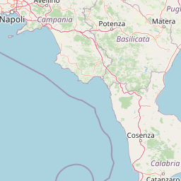
Geographic Location and Regional Setting of Vesuvius National Park
Vesuvius National Park is positioned entirely within the Campania region of Italy. Regional records confirm its contiguous land classification as a non-transboundary and interior protected area.
- Countries
- Italy
- Regions
- Campania
- Primary location
- Campania
- Geographic setting
- Inland
Boundary and coordinates
Mapped spatial geometry, area metrics, and coordinate spans
Vesuvius National Park Boundary Map and Geographic Extent
Interactive boundary geometry outlines the protected spatial perimeter for geographic reference. Accompanying metrics detail surface area measurements, coordinate limits, and regional spans.
- Boundary area
- 83 km²
- Boundary perimeter
- 48.8 km
- Northernmost point
- 40.872° N
- Southernmost point
- 40.7749° N
- Easternmost point
- 14.4997° E
- Westernmost point
- 14.3649° E
- Geographic centre
- 40.8218° N, 14.4342° E
- North–south span
- 10.8 km
- East–west span
- 11.4 km
Elevation and terrain
Mountain relief summary and recorded natural features
Vesuvius National Park Terrain and Elevation Profile
Elevation summary records a maximum height of 1277 meters across the mountain terrain. Recorded natural feature cards detail names, types, and spatial relationships within the landscape.
- Maximum elevation
- 1,277 m
- Highest point
- 1,277 m
Selected named natural features
Natural springs
Olivella alta
382 m
Peaks
Cognoli di Giacca
710.3 m
Peaks
Vesuvio
1,281 m
Peaks
Colle Umberto
886 m
Peaks
Cognoli di Ottaviano
1,112 m
Environmental setting
Interpreting volcanic relief, Mediterranean climate zones, and sparse forest cover
Vesuvius National Park Environmental Classifications and Physical Setting
Recorded mountain terrain, volcanic relief, and Mediterranean shrubland classifications provide complementary ways to read the physical setting of Vesuvius National Park. Linked categories connect stored environmental attributes directly to related atlas destinations across the region.
- Relief
- Mountain
- Climate
- Mediterranean
- Water
- Minor water
- Forest cover
- Sparse forest
- Seasonality
- Year-round
Landscape features
Mountains · Volcano · Forest · Woodland
Habitat types
Mediterranean forest · Shrubland
Park atlas
Compare the diverse protected landscapes and regional park geography around Vesuvius National Park.
Continue Your Discovery: Explore National Parks and Protected Areas Beyond Vesuvius National Park
Browse additional national parks and protected areas near Vesuvius National Park, extending your discovery across Italy's Campania region and its diverse landscapes. Compare varied conservation efforts and trace the geographic distribution of protected areas, revealing regional context for volcanic landscapes and Mediterranean ecosystems.
National parkItaly
59 km away#1 closest
Southeast

Cilento, Vallo di Diano and Alburni National Park: An Italian National Park's Geographic and Protected Landscape Identity
Mapped protected area boundaries and regional context.
Delve into the core geographic and protected-area characteristics of Cilento, Vallo di Diano and Alburni National Park. As a designated National Park in Italy, its mapped boundaries and landscape context are essential for atlas exploration. This entry provides the foundational geographic understanding needed to place this protected land within a broader map-based discovery framework, highlighting its significance as a natural landscape.
- Area
- 1,810.48 km²
- Established
- 1991
- IUCN
- II
- Relief
- Mountain
National parkBasilicata
100 km away#2 closest
East
Appennino Lucano - Val d'Agri - Lagonegrese National Park: Protected Mountain Landscape in Basilicata, Italy
Explore its geography, mapped terrain, and ecological role.
Gain insight into Appennino Lucano - Val d'Agri - Lagonegrese National Park, a significant protected mountain landscape in the heart of Basilicata. This detailed page focuses on the park's distinct geographic features, its role as a crucial ecological corridor connecting major southern Italian protected areas, and the mapped contours of its diverse terrain. Understand its place within the Lucano Apennine range and the broader natural atlas of Italy.
- Area
- 689.96 km²
- Established
- 2007
- IUCN
- II
- Relief
- Mountain
National parkItaly
About 110 km away#3 closest
Northwest
Abruzzo, Lazio and Molise National Park
Protected landscape in Italy's Apennines.
Explore the mapped boundaries and protected status of Abruzzo, Lazio and Molise National Park. This historic Italian national park offers a detailed look at Apennine mountain geography and landscape.
- Established
- 1923
- IUCN
- II
National parkAbruzzo
111 km away#4 closest
North
Maiella National Park: Abruzzo's Protected Landscape and Regional Geography
Explore mapped park boundaries and natural terrain.
Delve into the protected landscape of Maiella National Park, situated within the Abruzzo region of southern Italy. This page offers detailed atlas-level insights into its mapped boundaries, allowing for a clear understanding of its geographic setting. Discover how this national park contributes to the regional natural terrain and protected area context, providing a foundation for structured geographic exploration.
- Area
- 628.38 km²
- Established
- 1991
- IUCN
- II
- Relief
- Mountain
National parkItaly
115 km away#5 closest
Northwest
Circeo National Park: Protected Landscape of Italy's Lazio Coast
Explore mapped terrain and Mediterranean ecosystem boundaries.
Circeo National Park offers a distinct protected landscape anchored by the striking Monte Circeo limestone promontory and its associated coastal dunes and island environments. As one of Italy's earliest national parks, it preserves a vital mosaic of Mediterranean ecosystems, providing a unique subject for geographic study and atlas-based navigation of protected areas. Users can explore its mapped context and the interplay between karst geology, coastal terrain, and diverse natural habitats.
- IUCN
- II
National parkApulia
128 km away#6 closest
Northeast
Gargano National Park: Apulia's Protected Landscape and Regional Geographic Context
Mapped boundaries and natural terrain of a key Italian national park.
Delve into Gargano National Park, a designated national park situated in the Apulia region of Italy. This protected landscape offers valuable insights into the geography of the Gargano promontory. Through MoriAtlas, users can explore its mapped boundaries, understand its terrain, and connect it to the broader regional geography of southern Italy, providing a solid foundation for protected-area discovery.
- Area
- 1,181.44 km²
- Established
- 1991
- IUCN
- II
- Relief
- Mixed relief
National parkItaly
136 km away#7 closest
East
Alta Murgia National Park: National Park Exploration and Protected Landscape Context
Explore mapped terrain and regional geography.
Alta Murgia National Park is a designated national park offering unique opportunities for geographic discovery. Delve into its protected landscape, understand its mapped boundaries, and situate it within the broader Italian atlas. This entry provides essential context for exploring the park's terrain and regional significance.
- Area
- 677.39 km²
- Established
- 2004
- IUCN
- II
- Relief
- Mixed relief
Nature reserveAbruzzo
About 138 km away#8 closest
North
Riserva naturale regionale Marina di Vasto: Coastal Nature Reserve in Abruzzo, Italy
Mapping protected Adriatic dune and wetland ecosystems
This nature reserve protects a vital 3-kilometer strip of the Adriatic coastline in Abruzzo, acting as a rare sanctuary for specialized flora and fauna. By managing a delicate ecotone of shifting sand dunes and brackish wetland basins, the area maintains a high degree of ecological significance within the regional landscape. The geography provides an important look at integrated coastal conservation at the meeting point of urbanized hinterlands and the Adriatic sea.
- Area
- 0.57 km²
- Established
- 2007
- Relief
- Lowland
- Climate
- Mediterranean
MoriAtlas Explorer
Continue exploring Vesuvius National Park's volcanic geography and protected terrain
Deepen your atlas-based understanding of Vesuvius National Park by continuing to explore its specific mapped boundaries and the surrounding regional geography. MoriAtlas provides structured data to analyze the park's unique volcanic landscape, helping you navigate its terrain and understand its protected status within Campania. Expand your geographic discovery from this iconic natural site.
Browse next
Global natural geography
Explore related park routes
Explore MoriAtlas Global ParksBrowse All MoriAtlas ParksGlobal Park Map DiscoveryMoriAtlas: Browse All CountriesBrowse All MoriAtlas ContinentsNational Park Environment AtlasGrand Canyon National Park AtlasYellowstone National Park AtlasYosemite National Park Atlas and GeographySerengeti National Park AtlasGalápagos National Park Protected LandscapeBanff National Park Geography and AtlasKruger National Park Atlas EntryUluṟu-Kata Tjuṯa National Park AtlasExplore Uluru-Kata Tjuta National Park GeographyPlitvice Lakes National Park AtlasFiordland National Park Protected LandscapeGreat Smoky Mountains National Park AtlasAfghanistan National Parks and Protected AreasAlbania National Parks and Protected AreasAlgeria National Parks and Protected AreasAmerican Samoa National Parks and Protected AreasAndorra National Parks and Protected AreasAngola National Parks and Protected AreasAntarctica National Parks and Protected AreasAntigua and Barbuda Park List