
Rivers
Park geography
Structured landscape analysis including regional administrative data and natural features.
Detailed Geographic Profile and Mapped Boundaries of Warren National Park, Western Australia
Examine the geographic characteristics of Warren National Park located within Western Australia. This profile details the park boundary extents, total recorded area of twenty-nine square kilometers, and the physical presence of the Warren River alongside key identified natural viewpoints.
Related tags
karri forestold-growth foresttall treesWestern Australiariver ecosystems
Ancient karri forests of Western Australia's South West
Warren National Park
Warren National Park is a protected area in the South West region of Western Australia, situated approximately 287 kilometers south of Perth and 15 kilometers south of Pemberton. The park is renowned for its spectacular old-growth karri forests, which dominate the landscape and contain some of the tallest trees in Western Australia, with individual specimens reaching nearly 75 meters in height. Established in 1977, the park protects a significant tract of this iconic Australian forest ecosystem within the broader karri woodland belt that characterizes the region's temperate forests. The park's landscape is characterized by rolling terrain, the winding Warren River, and numerous smaller creeks and gullies that carve through the forest floor, creating a diverse and visually striking environment.
- Location
- Australia
- Park type
- National park
- Established
- 1977
- Area
- 29.8 km²
Location overview
Mapping the administrative placement within Western Australia
Warren National Park Protected Area Geography and Regional Context
Warren National Park lies in the state of Western Australia under the national jurisdiction of Australia. Standard records classify the reserve as a non-transboundary inland park without marine or coastal territory.
- Countries
- Australia
- Regions
- Western Australia
- Primary location
- Western Australia
- Geographic setting
- Inland
Boundary and coordinates
Interactive boundary geometry and derived spatial measurements
Warren National Park Boundary Map and Spatial Extent Explorer
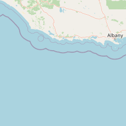
Mapped park outlines provide clear spatial context for the protected territory. Accompanying facts detail calculated area, coordinate limits, and geographic spans without claiming legal survey precision.
- Boundary area
- 29.9 km²
- Boundary perimeter
- 57 km
- Northernmost point
- 34.4674° S
- Southernmost point
- 34.5162° S
- Easternmost point
- 115.9898° E
- Westernmost point
- 115.8875° E
- Geographic centre
- 34.4946° S, 115.9407° E
- North–south span
- 5.4 km
- East–west span
- 9.4 km
Terrain and natural features
Explore recorded terrain classifications and internal geographical features
Warren National Park Terrain and Named Natural Features Guide
Recorded natural features within Warren National Park include the Warren River, Warren Lookout, Dave Evans Bicentennial Tree, Maiden Bush, and Heart Break Crossing. Linked feature cards provide names, types, measurements, and spatial relationships where recorded.
Selected named natural features
Viewpoints
Warren Lookout
Viewpoints
Dave Evans Bicentennial Tree
Viewpoints
Maiden Bush
Viewpoints
Heart Break Crossing
Environmental setting
Temperate broadleaf forest cover and river landscapes
Warren National Park Environmental Setting and Forest Classifications
Recorded landscape and habitat classifications provide complementary frameworks for reading physical terrain across Warren National Park. Structured environmental categories connect directly to related atlas destinations and mapped regional geographies.
- Water
- Minor water
- Forest cover
- Dense forest cover
Landscape features
Forest · Rivers
Habitat types
Temperate broadleaf forest
Park atlas
Browse the regional spread of protected karri forests and river ecosystems, tracing the geographic context of Western Australia's South West.
Uncover Nearby National Parks and Protected Areas, Expanding Beyond Warren National Park's Karri Forests
Browse additional national parks and protected areas near Warren National Park, revealing more of the unique karri forests and river ecosystems in Western Australia. Compare regional protected landscapes to understand the broader conservation efforts and distinct geographic features found across the South West Australian terrain.
National parkAustralia
Park boundaries overlap#1 closest
Southwest

Greater Hawke National Park: Mapped Boundaries of Old Growth Forest Landscape
Explore the protected forest and regional geography.
Greater Hawke National Park offers a significant atlas exploration opportunity for understanding Australia's protected forest ecosystems. This national park preserves critical old growth stands of karri and jarrah trees, showcasing the unique landscape of the Warren bioregion. Its Class A reserve status and adjacency to D'Entrecasteaux National Park highlight its importance as a conservation corridor within the South West of Western Australia. Users can examine the park's geographic setting and its protected-area identity.
- Area
- 140.04 km²
- Established
- 2004
- Climate
- Mediterranean
- Access
- Moderate access
National parkWestern Australia
0.6 km away#2 closest
Southeast
Brockman National Park: Western Australia National Park for Protected Landscape Discovery
Explore mapped boundaries and natural terrain.
Brockman National Park is a significant protected area within Western Australia, recognized as a national park. This detail page focuses on its role as a conserved landscape, offering insight into its natural geography and mapped extent. Engage with structured data to understand the park's context within the broader regional atlas of Western Australia's protected lands.
- Area
- 0.52 km²
- Established
- 1977
- IUCN
- II
- Relief
- Highland
National parkWestern Australia
2.9 km away#3 closest
Northeast
Gloucester National Park: National Park in Western Australia's Geographic Landscape
Explore mapped boundaries and protected land context.
Gloucester National Park stands as a significant protected area within the vast geographic expanse of Western Australia. This entry focuses on its identity as a national park, detailing its mapped landscape features and regional context. Understanding Gloucester National Park involves appreciating its specific geographic setting and its contribution to the atlas of protected natural areas in Australia, providing foundational data for landscape exploration.
- Area
- 8.78 km²
- Established
- 1993
- IUCN
- II
- Access
- Moderate access
National parkWestern Australia
4.1 km away#4 closest
Northwest
Greater Beedelup National Park: Western Australia's National Park Landscape
Discover Protected Areas and Regional Geography
Explore Greater Beedelup National Park, a key protected landscape within Western Australia. This national park offers a focus for understanding mapped natural features and the regional distribution of conservation areas. It serves as a vital point for atlas-based discovery, providing structured insights into the park's geographic setting and its identity as a protected natural area.
- Area
- 17.83 km²
- Established
- 1915
- IUCN
- II
- Relief
- Upland
National parkWestern Australia
5.3 km away#5 closest
Southeast
D'Entrecasteaux National Park: Discover Western Australia's Protected National Park Landscape
Mapping protected boundaries and regional natural terrain.
D'Entrecasteaux National Park stands as a significant protected natural area, offering a focused lens for geographic discovery within Western Australia. This park's identity as a National Park provides a concrete point for understanding mapped landscapes and regional conservation efforts. Explore its specific boundaries and terrain to build a comprehensive picture of its role within the broader atlas of Western Australia's natural heritage.
- Area
- 1,187.79 km²
- Established
- 1980
- IUCN
- II
- Visitors
- 168.5K annual
National parkAustralia
14 km away#6 closest
Southeast
Boorara-Gardner National Park: Mapped Old Growth Forest and Protected Landscape
Western Australia's protected area and regional geography.
Boorara-Gardner National Park is a vital national park in Western Australia, recognized for its stands of old-growth forest and its stunning spring wildflower displays. Delve into the park's specific geographic features, mapped terrain, and its identity as a key protected area within the South West region. Understand its place in the contiguous network of conservation lands through detailed atlas-style exploration.
- Area
- 110.08 km²
- Established
- 2004
- Relief
- Mixed relief
- Climate
- Mediterranean
National parkAustralia
18 km away#7 closest
Southeast
Jane National Park: Western Australia's Protected Old-Growth Forest Landscape
Mapped forest ecosystems in the South West bioregion.
Jane National Park represents a key protected landscape in the South West of Western Australia, recognized for its significant old-growth forest ecosystems. This Class A reserve preserves mature stands of karri and jarrah trees, offering a glimpse into the region's undisturbed natural heritage. Its landscape is characterized by dense, ancient forests dominating gentle terrain, making it an important site for understanding the conservation value of this bioregion and exploring its mapped natural context.
- Area
- 68.63 km²
- Established
- 2004
- IUCN
- II
- Scope
- Terrestrial
Marine protected areaWestern Australia
20 km away#8 closest
East
South-west Corner Marine Park: An Atlas of Deep-Sea Landscapes and Marine Protected Areas
Western Australia offshore marine and seabed geography
South-west Corner Marine Park represents one of the most ecologically diverse marine reserves in Australian Commonwealth waters. Stretching from the coast of Western Australia into the depths of the Southern Ocean, the park protects unique underwater terrain including extensive reef systems, submarine canyons, and isolated plateaus. This area serves as a primary migratory corridor for whales and provides a vital, mapped environment for threatened shark and seabird populations within the regional marine food web.
- Area
- 271,833 km²
- Established
- 2013
- Climate
- Temperate
- Access
- Remote access
MoriAtlas Explorer
Continue Exploring Warren National Park's Unique Geography and Forest Atlas
Deepen your understanding of Warren National Park by examining its specific geographic features, mapped protected boundaries, and regional landscape context within Western Australia. This national park offers a rich opportunity to study the characteristics of ancient karri forests and their unique riverine ecosystems through structured geographic data.
Browse next
Global natural geography
Explore related park routes
Explore MoriAtlas Global ParksBrowse All MoriAtlas ParksGlobal Park Map DiscoveryMoriAtlas: Browse All CountriesBrowse All MoriAtlas ContinentsNational Park Environment AtlasGrand Canyon National Park AtlasYellowstone National Park AtlasYosemite National Park Atlas and GeographySerengeti National Park AtlasGalápagos National Park Protected LandscapeBanff National Park Geography and AtlasKruger National Park Atlas EntryUluṟu-Kata Tjuṯa National Park AtlasExplore Uluru-Kata Tjuta National Park GeographyPlitvice Lakes National Park AtlasFiordland National Park Protected LandscapeGreat Smoky Mountains National Park AtlasAfghanistan National Parks and Protected AreasAlbania National Parks and Protected AreasAlgeria National Parks and Protected AreasAmerican Samoa National Parks and Protected AreasAndorra National Parks and Protected AreasAngola National Parks and Protected AreasAntarctica National Parks and Protected AreasAntigua and Barbuda Park List