

Streams
Park geography
A structured mapping of elevation ranges, wetland expanses, and boreal landscape geography
Wood Buffalo National Park Geographic Profile, Mapped Boundaries, and Environmental Features
This geographic profile tracks the complex landscape of Wood Buffalo National Park across Alberta and the Northwest Territories. The record documents the park boundary across 44,741 square kilometers, tracing terrain from the Caribou Mountains and Ninishith Hills to riparian networks along the Peace and Slave Rivers.
Related tags
Boreal ForestWorld Heritage SiteDark-Sky PreserveWetlandsDelta
Canada's vast northern wilderness protecting the world's largest wood bison herd and a UNESCO World Heritage delta
Wood Buffalo National Park
Wood Buffalo National Park is the largest national park in Canada and the second-largest national park in the world, spanning 44,741 square kilometers across northeastern Alberta and the southern Northwest Territories. Established in 1922 to protect the world's largest free-roaming herd of wood bison, this vast wilderness area is larger than Switzerland and encompasses a remarkable diversity of ecosystems, from boreal forest and grasslands to one of the world's largest freshwater deltas. The park is globally significant as the nesting site of the endangered whooping crane and was designated a UNESCO World Heritage Site in 1983 for the biological diversity of the Peace-Athabasca Delta and its wild bison population. In 2013, it became Canada's largest dark-sky preserve, protecting nocturnal ecology while offering visitors extraordinary views of the northern lights.
- Location
- Canada
- Park type
- National park
- Established
- 1922
- Area
- 44,741 km²
- Highest point
- 945 m
Location overview
Regional position across Alberta and the Northwest Territories
Wood Buffalo National Park Geographic Location and Regional Setting
Wood Buffalo National Park is situated in Canada, extending across Alberta and the Northwest Territories. The interior territory features a contiguous mainland footprint under dual regional jurisdictions.
- Countries
- Canada
- Regions
- Alberta, Northwest Territories
- Primary location
- Northwest Territories
- Geographic setting
- Inland
Boundary and coordinates
Vast park outline with geographic scale
Wood Buffalo National Park mapped boundary and 44,741 km² area
Wood Buffalo National Park pairs mapped geometry with a recorded 44,741 km² extent. Centre, coordinate limits, spans, and perimeter can communicate its scale where measured, while the outline remains contextual rather than a legal survey.
- Boundary area
- 45,550.4 km²
- Boundary perimeter
- 1,280 km
- Northernmost point
- 60.6909° N
- Southernmost point
- 58.0772° N
- Easternmost point
- 111.0357° W
- Westernmost point
- 115.6024° W
- Geographic centre
- 59.3565° N, 113.2581° W
- North–south span
- 291.2 km
- East–west span
- 259.5 km
Elevation and terrain
Mixed relief profiles and recorded internal hydrological formations
Wood Buffalo National Park Terrain, Elevation Range, and Named Natural Features
Recorded elevation metrics outline a mixed vertical range from one hundred eighty-three to nine hundred forty-five meters. Linked feature cards provide names, types, measurements, and spatial relationships for interior streams, lakes, and rivers.
- Minimum elevation
- 183 m
- Maximum elevation
- 945 m
- Highest point
- 945 m
Selected named natural features
Lakes
Sass Lake
Streams
Edra Creek
Streams
Murdock Creek
Streams
Vermilion River
Streams
Sanderson Creek
Environmental setting
Boreal climate, mixed relief, and major water systems across protected terrain
Wood Buffalo National Park Environmental Classifications and Physical Setting
Recorded landscape features, habitat types, and seasonal profiles serve as interpretive categories for the physical setting. Structured classifications connect directly to broader atlas records where available.
- Relief
- Mixed relief
- Climate
- Boreal
- Water
- Major water bodies
- Forest cover
- Mostly forested
- Seasonality
- Strongly seasonal
Landscape features
Mountains · Wetland · Rivers · Lakes · Karst · Forest · Grassland · Marsh · Bog
Habitat types
Boreal forest · Wetland · Riverine habitat · Lacustrine habitat · Karst habitat · Grassland · Peatland
Park atlas
Browse surrounding protected landscapes and compare regional park geography across Northern Canada.
Discover National Parks and Protected Areas Near Wood Buffalo National Park, Canada
Continue your atlas exploration by discovering additional national parks and protected areas located geographically near Wood Buffalo National Park, tracing Canada's vast boreal forests and wetland systems. Compare their unique landscapes, conservation priorities, and regional contexts to understand the broader spread of protected territories across northern Canadian wilderness.
Wildlife reserveAlberta
8.1 km away#1 closest
Southeast

Richardson Lake Migratory Bird Sanctuary: Protected Boreal Geography in Alberta
Mapping a vital waterfowl refuge and wetland complex
Richardson Lake Migratory Bird Sanctuary protects a crucial boreal wetland node along the southern margin of the Peace-Athabasca Delta. The area features a shallow lake environment, sedge meadows, and floodplains that provide essential breeding and staging habitat for diverse migratory waterfowl populations, offering a unique record of northern conservation and river management history.
- Area
- 107.98 km²
- Established
- 1949
- IUCN
- Ib
National parkNorthwest Territories
About 332 km away#2 closest
Northeast
Thaidene Nëné National Park Reserve: Northwest Territories National Park Atlas Overview
Mapped geography and protected landscape context.
Investigate Thaidene Nëné National Park Reserve, a key national park within the Northwest Territories. This detailed entry focuses on its protected area status, mapped geographic boundaries, and regional landscape context, crucial for understanding its role in the broader atlas of conservation lands.
- Area
- 14,070 km²
- Established
- 2019
- IUCN
- II
- Relief
- Highland
State or regional parkBritish Columbia
About 430 km away#3 closest
West
Maxhamish Lake Provincial Park and Protected Area: Mapping Northern British Columbia Wilderness
Boreal lake ecosystems and protected indigenous heritage lands
Spanning over 27,500 hectares, Maxhamish Lake Provincial Park and Protected Area is a remote boreal refuge characterized by its central lake and extensive coniferous forests. This park provides a critical habitat for moose, deer, and cold-water fish species while maintaining deep ties to the Fort Nelson First Nation and Acho Dene Koe. Its geography reveals a distinct northern basin, offering insight into the ecological character and protected landscape features of northeastern British Columbia.
- Area
- 275.16 km²
- IUCN
- II
- Water
- Major water bodies
- Season
- Seasonal
National parkNorthwest Territories
439 km away#4 closest
Northwest
Nahanni National Park Reserve National Park: Protected Landscape and Geographic Mapping
Explore the mapped terrain and protected area boundaries in Northwest Territories.
Navigate the protected landscape of Nahanni National Park Reserve, a designated national park within the Northwest Territories. This entry provides detailed insight into the park's mapped geographic boundaries and its role as a significant protected area. Understanding its place within the regional atlas allows for a deeper appreciation of its natural terrain and conservation significance, offering factual context for geographic exploration.
- Area
- 30,050 km²
- Established
- 1972
- IUCN
- II
- Visitors
- 1.1K annual
State or regional parkBritish Columbia
About 443 km away#5 closest
West
Jackpine Remnant Provincial Park: Protected Boreal Landscape and Regional Map Context
Conservation and terrain data for the Fort Nelson region
Jackpine Remnant Provincial Park provides a critical study in northern conservation geography. Located in the Fort Nelson area of British Columbia, this 148-hectare site protects a rare stand of jack pine trees. Its mapped boundaries and boreal forest terrain offer a focused look at small-scale protected landscapes and their significance within the broader regional ecosystem of the Canadian north.
- Area
- 1.48 km²
- Established
- 2001
- IUCN
- II
- Relief
- Lowland
Wildlife reserveAlberta
444 km away#6 closest
Southwest
Saskatoon Lake Migratory Bird Sanctuary: Protected Wetland Landscape in Alberta
Geographic overview of sanctuary boundaries and habitat zones
Examine the territorial footprint and environmental setting of Saskatoon Lake Migratory Bird Sanctuary. This site highlights the intersection of shallow aquatic basins and boreal parkland vegetation, providing a deep look into protected areas within the Grande Prairie region of Alberta.
- Area
- 11.5 km²
- Established
- 1948
- IUCN
- III
State or regional parkBritish Columbia
About 463 km away#7 closest
Southwest
Kiskatinaw Provincial Park: A Protected Landscape Along the Historic Alaska Highway
Geography and heritage in the Peace River region of British Columbia
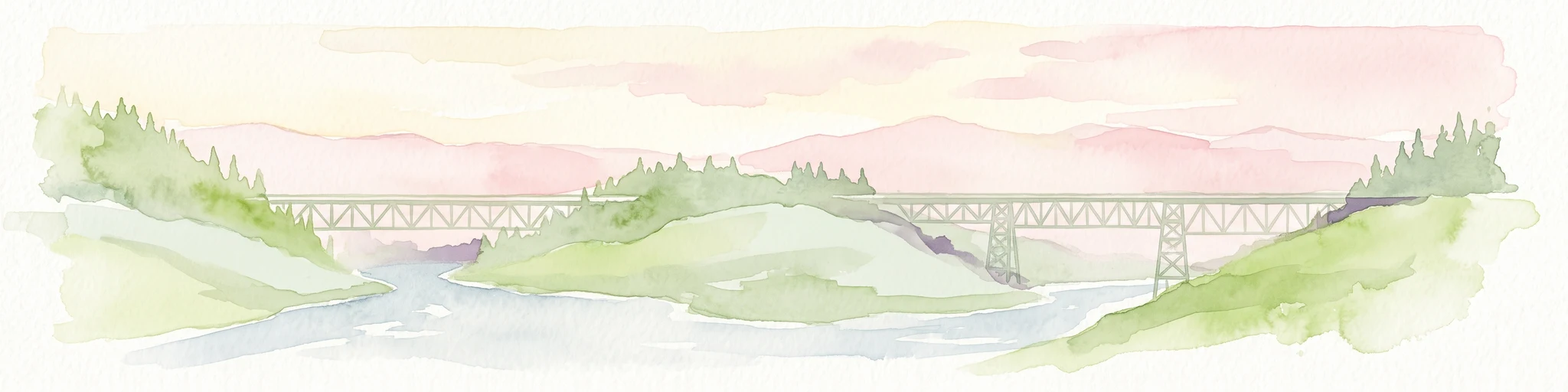
Kiskatinaw Provincial Park encompasses a distinctive horseshoe meander of the Kiskatinaw River, creating a deep gorge carved into the terrain of northeastern British Columbia. This protected area serves as a focal point for understanding both the river geomorphology of the Peace River Country and the engineering history of the original Alaska Highway, exemplified by the iconic 1942 wooden trestle bridge.
- Area
- 0.58 km²
- Established
- 1962
- IUCN
- II
- Relief
- Upland
National parkAlberta
486 km away#8 closest
South
Elk Island National Park: National Park Protected Landscape and Alberta Geography
Discover the mapped terrain and protected boundaries.
Elk Island National Park, a designated national park in Alberta, Canada, offers a distinct protected landscape for geographic exploration. This detail page focuses on its mapped boundaries, regional setting within Western Canada, and the specific natural terrain that constitutes its protected area. Users can gain a structured understanding of Elk Island National Park's role as a conserved natural entity, ideal for atlas-based discovery and geographic context.
- Area
- 194 km²
- Established
- 1913
- IUCN
- II
- Visitors
- 401.9K annual
MoriAtlas Explorer
Continue Exploring Wood Buffalo National Park's Geographic Identity
Dive deeper into the mapped boundaries and regional landscape of Wood Buffalo National Park. Understanding its protected-area status and geographic context within Northwest Territories provides valuable insight for atlas exploration. Discover how this national park fits into the wider natural geography, contributing to a structured understanding of protected lands.
Browse next
Global natural geography
Explore related park routes
Explore MoriAtlas Global ParksBrowse All MoriAtlas ParksGlobal Park Map DiscoveryMoriAtlas: Browse All CountriesBrowse All MoriAtlas ContinentsNational Park Environment AtlasGrand Canyon National Park AtlasYellowstone National Park AtlasYosemite National Park Atlas and GeographySerengeti National Park AtlasGalápagos National Park Protected LandscapeBanff National Park Geography and AtlasKruger National Park Atlas EntryUluṟu-Kata Tjuṯa National Park AtlasExplore Uluru-Kata Tjuta National Park GeographyPlitvice Lakes National Park AtlasFiordland National Park Protected LandscapeGreat Smoky Mountains National Park AtlasAfghanistan National Parks and Protected AreasAlbania National Parks and Protected AreasAlgeria National Parks and Protected AreasAmerican Samoa National Parks and Protected AreasAndorra National Parks and Protected AreasAngola National Parks and Protected AreasAntarctica National Parks and Protected AreasAntigua and Barbuda Park List