
Streams
Park geography
A detailed technical examination of landscape composition, mapped extent, and mountain geography.
Yarra Ranges National Park Geographic Profile: Boundaries, Elevation, and Terrain Features
Examine the physical structure of Yarra Ranges National Park through precise mapping data and environmental classifications. This profile details the 760 square kilometer extent, the 1245 meter high point, and regional mountain terrain including peaks like Mount Donna Buang and Lake Mountain.
Related tags
mountain ash foresttemperate rainforestwater catchmentGreat Dividing RangeVictoria
Victoria's mountain ash kingdom and critical water catchment for Melbourne
Yarra Ranges National Park
Yarra Ranges National Park is a expansive protected area in southeastern Victoria, Australia, situated roughly 107 kilometres northeast of Melbourne within the Great Dividing Range. Established in December 1995 and managed by Parks Victoria, the park encompasses 76,003 hectares of diverse mountainous terrain characterised by carbon-rich temperate rainforests and subalpine eucalypt-dominated forests. The park contains the headwaters of the Yarra, O'Shannassy and Taggerty Rivers, which collectively supply approximately 70 percent of Melbourne's drinking water, making the park a critical component of the city's water security infrastructure. This designation as a vital water catchment area has shaped much of the park's management approach, with 84 percent of the land falling within the Designated Water Supply Catchment Area where public access is restricted to protect water quality.
- Location
- Australia
- Park type
- National park
- Established
- 1995
- Area
- 760 km²
- Highest point
- 1,245 m
Location overview
National park location data and regional placement within Australia
Geographic Atlas Profile for Yarra Ranges National Park in Australia
Yarra Ranges National Park is situated within Australia as a dedicated inland protected area. Verified regional records outline the park's terrestrial positioning and sovereign status within the continent.
- Countries
- Australia
- Primary location
- Australia
- Geographic setting
- Inland
Boundary and coordinates
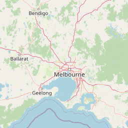
Interactive boundary geometry spanning 760 square kilometers
Yarra Ranges National Park Boundary Map and Spatial Extent
Mapped park outlines provide spatial context for exploring territorial limits and geographic spans. Accompanying measurements detail total area figures alongside coordinate bounds and center points.
- Boundary area
- 772.3 km²
- Boundary perimeter
- 425.6 km
- Northernmost point
- 37.4274° S
- Southernmost point
- 37.7925° S
- Easternmost point
- 146.1644° E
- Westernmost point
- 145.5215° E
- Geographic centre
- 37.6549° S, 145.8466° E
- North–south span
- 40.5 km
- East–west span
- 56.8 km
Elevation and terrain
Mapped mountain relief data and recorded internal natural features
Yarra Ranges National Park Elevation and Mountain Terrain Geography
Recorded elevation metrics outline the mountain terrain profile and highest summit point within Yarra Ranges National Park. Linked feature cards provide names, types, measurements, and spatial relationships for streams, rivers, and peaks.
- Highest point
- 1,245 m
Selected named natural features
Streams
Theodore Creek
Rivers
Acheron River
Waterfalls
Cora Lynn Falls
Streams
Keppel Hut Creek
Reservoirs
Upper Yarra Reservoir
Environmental setting
Temperate mountain relief, forest cover, and habitat classifications
Yarra Ranges National Park Environmental Classifications and Physical Setting
Recorded landscape features, climate zones, and forest classifications provide complementary ways to read the physical setting of Yarra Ranges National Park. Connected categories link directly to relevant atlas destinations across the protected area.
- Relief
- Mountain
- Climate
- Temperate
- Water
- Minor water
- Forest cover
- Mostly forested
- Seasonality
- Seasonal
Landscape features
Mountains · Forest · Valleys · Plateau
Habitat types
Temperate broadleaf forest · Montane forest
Park atlas
Discover surrounding protected landscapes and compare nearby mountain ash forests within the Great Dividing Range geography
Explore Other National Parks and Protected Areas Near Yarra Ranges National Park, Victoria
Extend your park discovery beyond Yarra Ranges National Park to explore nearby protected areas and national parks, revealing the regional spread of Victoria's unique mountain ash forests and crucial water catchments. Compare their varied mountainous terrain, distinct ecological features, and significant conservation importance within the Great Dividing Range.
National parkAustralia
3.9 km away#1 closest
Southeast

Baw Baw National Park: Subalpine Granite Landscapes and Protected Area Geography
Discover Victoria's southernmost alpine wilderness.
Baw Baw National Park offers a rare glimpse into Australia's subalpine environment, characterized by striking granite boulder formations and iconic snow gum forests. As a protected national park, it safeguards unique ecosystems and habitats, including those for critically endangered species. This atlas entry details the park's distinctive landscape, its mapped boundaries, and its geographic significance as the southern edge of mainland alpine terrain.
- Area
- 135.3 km²
- Established
- 1979
- IUCN
- II
- Relief
- Mountain
National parkAustralia
9.8 km away#2 closest
Northwest
Kinglake National Park: Protected Mountain Ash Forests and Geological Heritage
Explore the mapped landscape and regional geography of this Australian National Park.
Kinglake National Park is a significant protected natural area in Victoria, Australia, distinguished by its mountainous terrain dominated by eucalyptus forests, including towering mountain ash trees. The park's unique geology features sedimentary layers with marine fossils, offering a glimpse into its ancient submerged history. This National Park provides a rich environment for exploring diverse landscapes, understanding fire ecology, and appreciating the mapped boundaries of a resilient natural area.
- Area
- 232.1 km²
- Established
- 1928
- IUCN
- II
- Relief
- Upland
National parkAustralia
12 km away#3 closest
North
Lake Eildon National Park: Protected Landscape with Ancient Volcanic and Gold Mining Heritage
Explore mapped terrain and diverse eucalypt forests.
Lake Eildon National Park in Victoria's Central Highlands offers a unique protected landscape shaped by ancient volcanic activity and the region's gold rush era. This national park, centered around the large Lake Eildon reservoir, provides critical habitat within its diverse eucalypt forests. Discover its geological significance, historical mining sites, and mapped boundaries, offering a comprehensive view of its protected-area identity and regional geographic context.
- Area
- 277.5 km²
- Established
- 1997
- IUCN
- II
- Relief
- Mountain
National parkAustralia
15 km away#4 closest
West
Dandenong Ranges National Park: A Protected National Park Landscape
Explore its mapped terrain and regional geographic context.
Dandenong Ranges National Park represents a significant protected area near Melbourne, Australia, characterized by its steep, undulating ridges and deep gullies supporting tall, wet forests. As a national park, it safeguards a vital natural landscape, providing context for regional geography and offering insights into its terrain. This entry facilitates detailed exploration of the park's protected boundaries and its place within the Australian protected-area atlas.
- Area
- 35.4 km²
- Established
- 1987
- IUCN
- II
- Visitors
- 1M annual
National parkAustralia
33 km away#5 closest
Southwest
Churchill National Park: Remnant Woodland and Industrial Heritage in Victoria, Australia
Mapped protected area with notable bird diversity and historical quarry sites.
Churchill National Park offers a unique glimpse into Victoria's remnant woodland ecosystems and early twentieth-century industrial history. As a national park, it protects critical habitats for a variety of bird species and preserves the landscape features of historical quarrying operations, including the Scoresby Tramway ruins. The park's mapped geography and accessible walking tracks, like the Channel Track, provide opportunities for exploration and understanding its role as a protected natural and historical asset near Melbourne.
- Area
- 2.71 km²
- Established
- 1941
- IUCN
- II
- Relief
- Upland
National parkAustralia
39 km away#6 closest
Northeast
Alpine National Park: Victoria's Expansive National Park in the Great Dividing Range
Mapping significant alpine, subalpine, and mountain wilderness landscapes.
Alpine National Park represents Victoria's largest protected area, safeguarding critical alpine and subalpine environments across the Great Dividing Range. This national park encompasses vast mountainous terrain, including Victoria's highest peaks like Mount Bogong, and the expansive Bogong High Plains known for their unique grassland and woodland ecosystems. The park's protected landscape offers rich opportunities for geographic discovery and understanding its place within Australia's significant mountain wilderness regions.
- Area
- 6,474 km²
- Established
- 1989
- IUCN
- II
- Relief
- Mountain
Wildlife reserveVictoria
47 km away#7 closest
East
Avon Wilderness Park: Protected Mountain Landscapes and Geography in Victoria
A remote wilderness reserve in the Victorian Alps highlands.
Avon Wilderness Park spans forty thousand hectares of continuous, roadless mountain forest and sub-alpine woodland. Serving as a crucial link in the Australian Alps conservation network, the reserve is characterized by steep, dissected terrain and tall eucalyptus canopy, preserved in an entirely undeveloped state without internal roads or infrastructure.
- Area
- 395.58 km²
- Established
- 1987
- IUCN
- Ib
- Relief
- Mountain
National parkAustralia
63 km away#8 closest
Southwest
French Island National Park: Protected Island National Park with Coastal Wetland Habitats
Explore mapped boundaries and diverse terrain of this unique park.
French Island National Park preserves a vital island ecosystem in Victoria, Australia, featuring extensive mangrove forests, salt marshes, and open woodland. As one of Australia's most accessible island national parks, it offers a distinctive wilderness experience primarily reached by boat, showcasing coastal conservation and unique wetland habitats. The park's geography is defined by its low-lying terrain and tidal influences, creating a rich environment for mapped landscape exploration.
- Area
- 111 km²
- Established
- 1998
- IUCN
- II
- Relief
- Lowland
MoriAtlas Explorer
Continue Exploring Yarra Ranges National Park's Protected Mountain Ash Forest Geography
Delve deeper into the protected area identity of Yarra Ranges National Park. Understanding its unique mountain ash forests, diverse terrain, and critical role as a water catchment offers profound geographic context. Explore the mapped landscape and conservation significance of this extraordinary Australian natural asset, providing detailed insights beyond surface-level information.
Browse next
Global natural geography
Explore related park routes
Explore MoriAtlas Global ParksBrowse All MoriAtlas ParksGlobal Park Map DiscoveryMoriAtlas: Browse All CountriesBrowse All MoriAtlas ContinentsNational Park Environment AtlasGrand Canyon National Park AtlasYellowstone National Park AtlasYosemite National Park Atlas and GeographySerengeti National Park AtlasGalápagos National Park Protected LandscapeBanff National Park Geography and AtlasKruger National Park Atlas EntryUluṟu-Kata Tjuṯa National Park AtlasExplore Uluru-Kata Tjuta National Park GeographyPlitvice Lakes National Park AtlasFiordland National Park Protected LandscapeGreat Smoky Mountains National Park AtlasAfghanistan National Parks and Protected AreasAlbania National Parks and Protected AreasAlgeria National Parks and Protected AreasAmerican Samoa National Parks and Protected AreasAndorra National Parks and Protected AreasAngola National Parks and Protected AreasAntarctica National Parks and Protected AreasAntigua and Barbuda Park List