Why Kinglake National Park stands out
Kinglake National Park is best known for its towering mountain ash forests and the historical presence of Victoria's tallest tree, an Eucalyptus regnans specimen that reached 91.6 meters in height before the 2009 bushfires. The park's Masons Falls area represents a popular visitor destination combining waterfall scenery with native flora displays. The park's geological significance includes layered sedimentary formations preserving marine fossils from the era when the region was submerged beneath the sea. The park has also become emblematic of Victoria's fire-prone landscape, having been devastated by both the 2006 lightning-triggered fires and the catastrophic 2009 Black Saturday bushfires.
Kinglake National Park history and protected-area timeline
The history of Kinglake National Park reflects both European settlement patterns and the region's ongoing relationship with bushfire. Prior to European colonization, the land was home to Indigenous Australian communities whose connection to Country spans thousands of years. Following European settlement, the area was subjected to logging operations during the early twentieth century, and evidence of this period remains in the form of scarred trees and historical dumps.
The park was formally established on March 7, 1928, creating protected status for the mountainous terrain and its forests. This designation came after significant alteration of the landscape through logging, yet enough原生 vegetation remained to justify conservation protection. The subsequent decades saw the park managed as a protected area with growing recognition of its ecological and recreational values.
The twenty-first century brought major challenges to the park. In January 2006, lightning-sparked bushfire during a severe thunderstorm devastated parts of the park north of Kinglake township, advancing to within a few hundred meters of the town before being contained through the efforts of further thunderstorms and Country Fire Authority volunteers. The most catastrophic event came on Black Saturday in February 2009, when bushfires burned approximately 98 percent of the national park and destroyed much of the Kinglake township, claiming nearly 100 lives. As of 2010, rehabilitation work has continued with sections of the park gradually reopening to visitors. The park's history thus embodies both the beauty and the vulnerability of Victoria's forest landscapes.
Kinglake National Park landscape and geographic character
The landscape of Kinglake National Park is defined by its mountainous topography within Victoria's central highlands region. The terrain features steep valleys carved by ancient watercourses, with ridgelines offering panoramic views across the surrounding countryside. Elevation changes create diverse environmental conditions across relatively short distances, from valley floors to exposed ridge crests.
The park's underlying geology consists of layered sedimentary formations that document millions of years of geological history. These sedimentary layers contain fossil remains of marine organisms, providing evidence that the area was once covered by shallow seas. Over time, geological processes uplifted these marine sediments to form the present-day mountainous terrain. The combination of sedimentary rock and fertile soils supports the dense vegetation that characterizes much of the park.
Eucalyptus forest dominates the vegetation cover, with mountain ash among the most prominent species. Prior to the 2009 bushfires, the park contained some of Victoria's tallest trees, including the famed mountain ash that stood over 91 meters tall. The forest creates a characteristically Australian landscape of tall trunks, an understory of shrubs and ferns, and the distinctive eucalyptus scent. Following fire events, the landscape has shown the resilience of these fire-adapted ecosystems, with new growth emerging from both seed and lignotuber resprouting.
Kinglake National Park ecosystems, habitats, and plant life
The ecological character of Kinglake National Park reflects the forests and woodlands typical of Victoria's central highlands. The predominant vegetation community is dry sclerophyll forest dominated by eucalyptus species, particularly mountain ash and stringybark. These forests support a complex structure including a tall tree canopy, midstory of smaller trees and large shrubs, and a ground layer of grasses, ferns, and herbaceous plants. The diversity of microhabitats created by variations in aspect, elevation, and moisture supports varied plant assemblages across the park.
The park's geology contributes to its ecological character through the influence of sedimentary soils on nutrient availability and moisture retention. Marine fossil deposits within the sediments speak to the ancient origins of the landscape and the geological processes that created the present terrain. The valley formations create natural drainage patterns that influence vegetation distribution, with riparian zones supporting more moisture-loving species.
Fire represents a significant ecological factor in the park's dynamics. The eucalyptus forests have evolved with fire as a regular occurrence, with many species requiring fire for seed germination or possessing mechanisms for resprouting after burning. The 2009 Black Saturday fires, while devastating in the short term, have provided opportunities for ecological monitoring of post-fire recovery in these fire-adapted systems. The park's position within a larger landscape of remnant vegetation and other protected areas contributes to its value as habitat within a fragmented landscape.
Kinglake National Park wildlife and species highlights
Kinglake National Park supports a diversity of Australian native wildlife, with mammalian species including several marsupials that characterize Victorian forest environments. Wallabies, particularly wallaby species suited to forest understory, inhabit the denser vegetation areas. Kangaroos, predominantly eastern grey kangaroos, graze in more open areas and forest edges. Wombats, known for their burrowing behavior and sturdy build, establish dens in suitable soil conditions throughout the park.
Possums, including species adapted to arboreal life, utilize the forest canopy for shelter and feeding. The short-beaked echidna, one of Australia's monotremes, forages through leaf litter and soils across various parts of the park. These species represent the mammal community's composition, though exact species inventories vary across different habitat types within the protected area.
Birdlife is particularly diverse, with cockatoos among the most conspicuous. Sulphur-crested cockatoos, along with black and red-tailed cockatoo species, occur throughout the park. King parrots bring vibrant color to the forest canopy, while rosellas add to the avifauna diversity. The lyrebird, renowned for its extraordinary mimicking abilities, inhabits the denser understory areas. These bird species contribute significantly to the park's ecological character and provide notable wildlife viewing opportunities for visitors.
Kinglake National Park conservation status and protection priorities
Kinglake National Park holds significance within Victoria's protected area network both for its ecological values and its role in landscape-level conservation. The park is classified as IUCN Category II, reflecting its national park designation and primary conservation purpose. Its location within the central highlands creates connections with other protected areas and remnant vegetation, supporting wildlife movement across a landscape that has been significantly modified by agriculture and development.
The park's conservation challenges have become particularly evident through recent fire history. The 2009 Black Saturday bushfires, which burned approximately 98 percent of the park's area, represented a catastrophic event requiring long-term recovery planning. Conservation management has since focused on monitoring post-fire recovery, managing visitor access during rehabilitation, and maintaining habitat features that support wildlife recolonization. The presence of rare and sensitive species within the park adds to conservation prioritization, though detailed species status assessments would be found in formal management planning.
The historical presence of Victoria's tallest tree, an Eucalyptus regnans specimen, exemplifies the park's potential for supporting outstanding individual specimens within the forest ecosystem. While this particular tree was lost in the 2009 fires, the site's capacity to produce tall forest growth remains. Conservation values also extend to geological preservation, with the fossil-containing sedimentary formations representing scientific and educational values beyond typical biodiversity focus.
Kinglake National Park cultural meaning and human context
The cultural context of Kinglake National Park encompasses both Indigenous heritage and European settlement history. The Kinglake Ranges region has been home to Indigenous Australian communities for thousands of years, with Traditional Owners maintaining connection to Country through the present day. The landscape holds significance for these communities that extends beyond European categories of protected areas, though detailed documentation of specific cultural values would require consultation with appropriate Indigenous organizations.
European settlement brought logging to the area in the early twentieth century, fundamentally altering the forest composition and structure. Remnants of this logging period remain visible within the park, providing historical context for understanding the landscape's transformation. The township of Kinglake, situated adjacent to the national park, developed as a small settlement serving the regional community. The devastating 2009 bushfires that burned most of the park also destroyed much of the town, creating a shared experience of loss and recovery that continues to shape community identity.
Historical publications, including works such as "Living with Fire: A brief history of fires in the Kinglake Ranges" by the Kinglake Historical Society, document the region's relationship with fire. This documentation reflects both the practical challenges of living in fire-prone environments and the broader cultural understanding of landscape dynamics. The park thus exists within a cultural landscape where human community and natural environment have interacted over generations.
Top sights and standout views in Kinglake National Park
Kinglake National Park offers visitors access to Victoria's mountainous forest landscapes with facilities and attractions that make the area suitable for both day trips and longer stays. Masons Falls provides a focal point for visitor enjoyment, combining natural waterfall scenery with picnic facilities and opportunities to observe native flora. The network of walking tracks, including routes with wheelchair accessibility, enables exploration of various landscape features across the park.
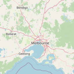
The park's historical significance adds depth to the visitor experience, from remnants of early logging through to the ongoing legacy of bushfire events. The post-fire recovery of the landscape demonstrates the resilience of Australian ecosystems and provides opportunities for understanding fire ecology. The park's proximity to Melbourne, approximately 50 kilometers, makes it one of the more accessible natural areas for residents of Victoria's capital seeking mountain forest experiences.
Wildlife viewing opportunities include encounters with cockatoos, king parrots, and lyrebirds, alongside marsupials such as wallabies and wombats. The forest environment, particularly the tall eucalyptus canopy, creates a distinctly Australian landscape character that distinguishes the park from lower-elevation or more modified environments in the surrounding region.
Best time to visit Kinglake National Park
The best time to visit Kinglake National Park depends on the experience visitors seek and awareness of seasonal conditions. Autumn and spring typically offer mild temperatures comfortable for walking and outdoor activities, with these seasons also providing opportunities to observe flora and wildlife in moderate conditions. These shoulder seasons often deliver more stable weather patterns compared to the extremes of summer and winter.
Summer months bring warmer conditions that can limit sustained physical activity while increasing fire danger ratings. Total fire bans may be declared during hot, dry periods, potentially affecting park access. Winter brings cooler temperatures and increased rainfall, which can make some tracks muddy or slippery while also adding to the atmosphere of the forest environment. Visitors should check current conditions and any park closures before traveling, particularly given the ongoing recovery from the 2009 bushfires and potential for visitor restrictions in rehabilitation areas.
The experience of the park varies significantly with seasons, from the fresh growth following winter rains to the drier conditions of late summer. Wildlife may be more observable during cooler parts of the day regardless of season. Visitors seeking to avoid peak periods may find weekdays less crowded than weekends, particularly during holiday periods.