
Mori Atlas logo
National parkZabaykalsky National Park

Understanding the complex terrain, rugged coastal geography, and protected land boundaries within the Buryatia region.

Zabaykalsky National Park: A Protected Mosaic of Mountain Taiga, Peninsulas, and Lake Baikal Shoreline

(Забайкальский национальный парк)

Zabaykalsky National Park serves as a vital protected landscape along the eastern edge of Lake Baikal, encompassing high-altitude mountain taiga, the Sviatoy Nos peninsula, and the Chivyrkuysky isthmus. This geography features a dramatic transition from the peaks of the Barguzin Range down to sheltered bays and island groups like the Ushkan Islands. The territory preserves essential habitats for endemic species and protects a diverse range of geological features, including thermal springs, karst lakes, and old-growth coniferous forests.

Lake BaikalBarguzin Rangemountain taiganational parkBuryatiapeninsula

Zabaykalsky National Park

National park

Park overview

Structured park overview, official facts, and landscape profile for Zabaykalsky National Park

Zabaykalsky National Park park facts, protected area profile, and essential visitor context

Review the core facts for Zabaykalsky National Park, including designation, size, terrain, visitor scale, habitats, and operating context in one park-focused overview.

About Zabaykalsky National Park

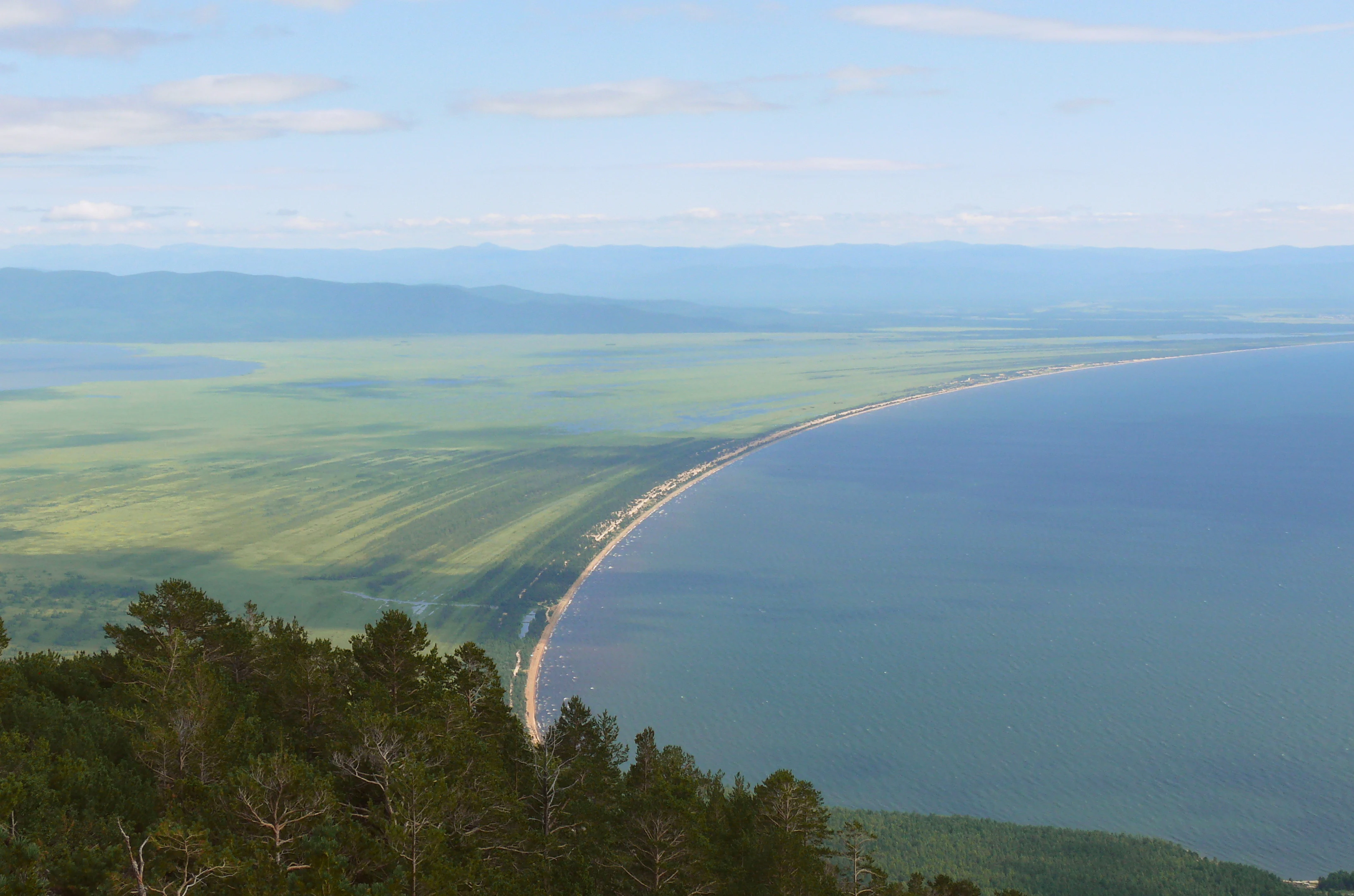
Zabaykalsky National Park stretches along the eastern shore of Lake Baikal in the Republic of Buryatia, occupying one of the most landscape-diverse sections of the entire lake. The park is anchored by three principal geographic units: the Barguzin Range in the west, which descends toward the lake through forested ridges and river valleys; the Sviatoy Nos peninsula, a long mountainous tongue of land projecting into Baikal; and the Chivyrkuysky isthmus, a lower strip of land connecting the peninsula to the mainland and separating the deep Barguzin Bay from the shallow, sheltered Chivyrkuysky Bay to the north.

Offshore, the Ushkan Islands rise from the waters of Baikal as the visible summits of the submerged Akademichesky Range, which divides the lake's northern and southern basins. These islands, together with the surrounding bays, isthmuses, and peninsulas, create a varied mosaic of mountain taiga, coastal meadows, sandy spits, wetlands, and rocky shoreline that defines the park's character. Roughly a quarter of the park's area lies within Lake Baikal itself, including the waters of the Barguzin and Chivyrkuysky bays.

The park's mission is twofold: to conserve the natural systems of the eastern Baikal coast and to provide for regulated public enjoyment of the area. It is considered one of the few Russian reserves that fully satisfies UNESCO criteria for the national park category. Its management is closely tied to that of the neighboring Barguzin Nature Reserve, and since 2011 both have been administered under a unified federal directorate, now known as Zapovednoye Podlemorye.

The combination of high mountains, peninsulas, bays, and offshore islands makes Zabaykalsky a key component of the broader Baikal ecological region. It protects transitional habitats where southern Siberian taiga meets Baikalian shoreline, where mountain steppes descend to the lake, and where freshwater seal populations still find undisturbed haul-out sites. For visitors and researchers alike, the park offers a representative cross-section of the natural and cultural richness of eastern Baikal.

Quick facts and research context for Zabaykalsky National Park

Zabaykalsky National Park lies in the Barguzin district of the Republic of Buryatia, bordering the eastern shore of Lake Baikal. It was established on 12 September 1986 and is classified as an IUCN Category II protected area, the national park category, and operates under the federal environmental authority of Russia. The park is noted as one of the few Russian protected areas considered to fully meet UNESCO criteria for the national park designation.

Its territory spans a rugged transition from the Barguzin Range in the west to the Baikal shoreline in the east, including the Sviatoy Nos peninsula, the Chivyrkuysky isthmus, and the Ushkan Islands. The park contains substantial tracts of mountain taiga, high-mountain tundra, steppe relicts, and shoreline wetlands, together with thermal springs and mineral-rich lakes. Zabaykalsky is distinct from but closely linked to the neighboring Barguzin Nature Reserve, and both are now managed under the same federal directorate.

Protection and recognition

Examine documented protection scope, administrative details, and recognition history

Zabaykalsky National Park Protection Status and Administrative Overview

Zabaykalsky National Park maintains a documented mixed protection scope alongside structured management records. Comprehensive administrative data details official status and international recognition benchmarks where available.

Protection details

Protection scope
Mixed
Transboundary protection
No
Park context

Deeper park guide and search-rich context for Zabaykalsky National Park

Zabaykalsky National Park history, landscape, wildlife, and travel context

Explore Zabaykalsky National Park through its history, landscape character, ecosystems, wildlife, conservation priorities, cultural context, and seasonal travel timing in a structured park guide built for atlas discovery and search intent.

Why Zabaykalsky National Park stands out

Zabaykalsky is best known for protecting the eastern shoreline of Lake Baikal across a remarkable mix of peninsulas, bays, and mountain taiga. Within its borders lie the Ushkan Islands, the single most important breeding and haul-out site for the Baikal seal, the world's only exclusively freshwater pinniped. The park also encompasses the Sviatoy Nos peninsula and the Barguzin Range front, creating a protected corridor that links lake, steppe, and high-mountain habitats within a single reserve. Beyond its seal population, the park is recognized for its plant communities, including old-growth pine, Siberian cedar, and Gmelin larch forests, together with unique stands of Siberian dwarf pine, mountain-steppe relicts, and more than 700 recorded vascular plant species. Its thermal springs, mineral lakes, karst features, and archaeological sites further distinguish it as a place where natural and cultural heritage intersect along Lake Baikal.
Zabaykalsky National Park history and protected-area timeline

Zabaykalsky National Park was established on 12 September 1986 as a state national park under the jurisdiction of the Russian Federation's Ministry of Natural Resources and Ecology. Its creation was motivated by the need to conserve the increasingly pressured ecosystems of Baikal's eastern shore while still allowing for regulated public use of the area, in keeping with international national park standards.

In 1989, the institute Rosgiproles developed the park's first organizational plan, the general scheme for the arrangement of the Zabaykalsky state natural national park, which laid out the functional zoning that still shapes its management today. The plan divided the territory into strict protection, special protection, recreation, visitor service, economic use, and educational tourism zones, balancing conservation with public access.

A major administrative change came in September 2011, when a federal order merged the management of Zabaykalsky National Park with that of the long-established Barguzin Nature Reserve, Russia's first nature reserve, founded in 1916 on the western side of the Barguzin Range. The two are now run jointly under the federal directorate Zapovednoye Podlemorye. Many small natural and historical monuments within what is now the park had already been recognized before 1986, and the national park designation formally brought them under unified protection.

Zabaykalsky National Park landscape and geographic character

The landscape of Zabaykalsky National Park is a dramatic east-Baikal mosaic of mountains, peninsulas, bays, and islands. The Barguzin Range forms a high western backdrop, gradually lowering from the peaks of the neighboring Barguzin Nature Reserve toward Barmashyovoye Lake, with its highest point inside the park reaching roughly 2,376 meters above sea level. From these elevations the terrain descends through taiga-covered ridges toward the lake shore.

Running parallel to the shore is the Sredinniy Range of the Sviatoy Nos peninsula, which rises to around 1,877 meters in its central section and slopes away both north and south. The peninsula is connected to the mainland by the low-lying Chivyrkuysky isthmus, a sandy strip built up by river sediments that physically separates the deep Barguzin Bay to the south from the shallower, intricately shaped Chivyrkuysky Bay to the north. Together, the peninsula and isthmus create a distinct micro-landscape system of coves, spits, wetlands, and sheltered waters.

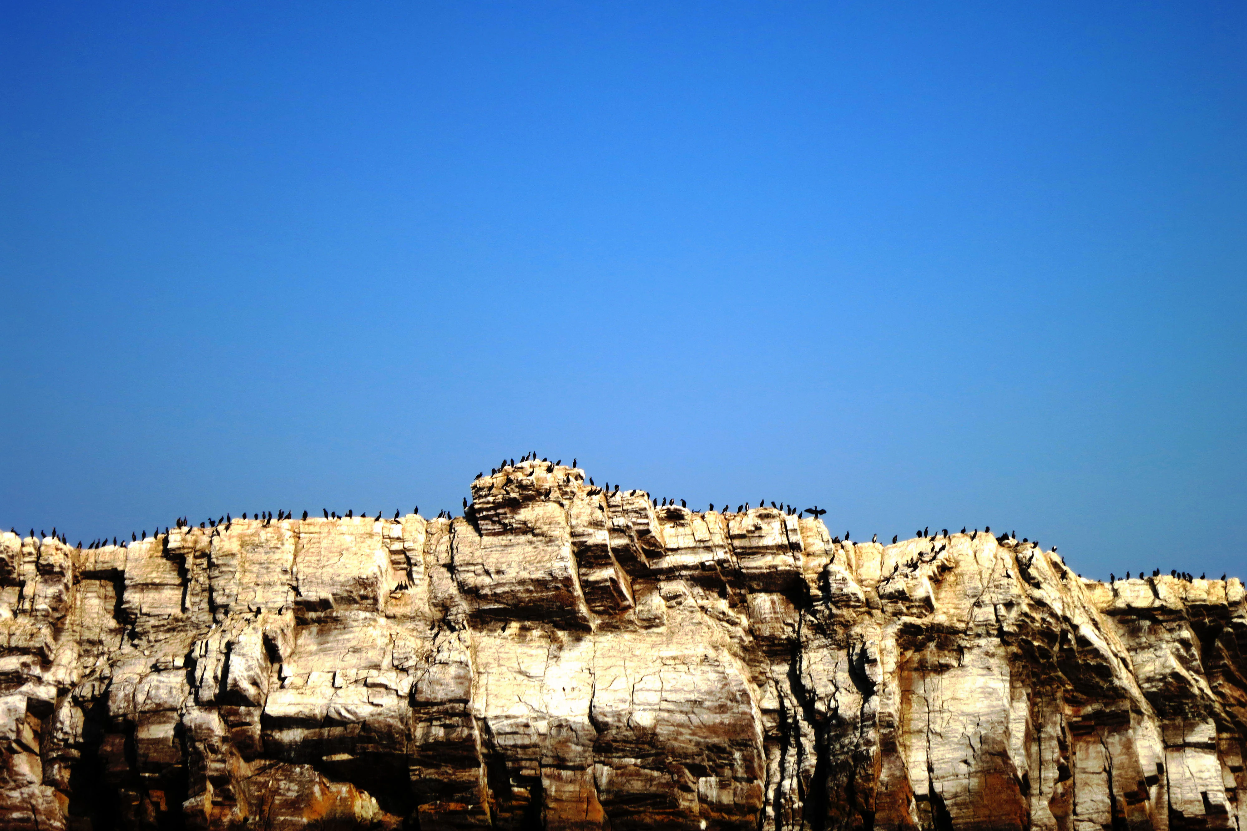
Offshore, the Ushkan Islands emerge as a compact group of islets that mark the surface expression of the underwater Akademichesky Range. Closer to the mainland, smaller rock-islands and boulders, including features like the Bely Kamen and the Baklaniy Islands, dot the bays. The park's slopes are notably steep: over half the territory has gradients of 26 degrees or more, making much of the park rugged and visually dramatic, while gentler coastal lowlands provide the contrast of sandy beaches, reed beds, and meadow flats along Baikal's edge.
Zabaykalsky National Park ecosystems, habitats, and plant life

The vegetation of Zabaykalsky reflects a strongly layered mountain-to-lake transition, characteristic of the southern taiga zone of Siberia. Coniferous species dominate the forests, with Scots pine the single most widespread tree, followed by Siberian dwarf pine on exposed slopes, Siberian cedar on richer soils, Gmelin larch in mixed stands, and Siberian fir in the moister coastal belt. Deciduous trees, including Erman's birch and broad-leaved birch, along with aspen, occupy smaller but ecologically meaningful areas.

Distinctive plant communities occur throughout the park. Relict steppe phytocoenoses persist in sheltered localities, while fragments of alpine dwarf-shrub vegetation survive on the Ushkan Islands and on the heights of Sviatoy Nos. Old-growth stands more than two centuries old of pine, cedar, larch, and fir are recognized as particularly valuable, alongside communities of Siberian dwarf pine and dwarf birch. Along the eastern shore of Baikal, the understory carries Siberian dwarf pine in places, creating a distinctive humid Baikalian forest type.

The flora includes around seven hundred vascular plant species, with nineteen endemics and nine species considered rare in the Baikal region. Notable taxa include Borodinia tilingii and Chosenia arbutifolia, the latter of particular interest as it approaches the western edge of its range here. Many of the park's plant species and communities are listed in the Red Data Book of the Russian Federation, reinforcing the area's botanical importance.
Zabaykalsky National Park wildlife and species highlights

Zabaykalsky supports a rich community of terrestrial vertebrates, with roughly three hundred recorded species across mammals, birds, reptiles, and amphibians. Common mid- and large-sized mammals include the mountain hare, red squirrel, muskrat, sable, ermine, brown bear, red deer, and moose, while carnivores and ungulates roam both the taiga slopes and the coastal lowlands. Across the territory, forty-nine vertebrate species are inscribed in the Red Data Books of either the Russian Federation or the Republic of Buryatia, highlighting the area's conservation significance.

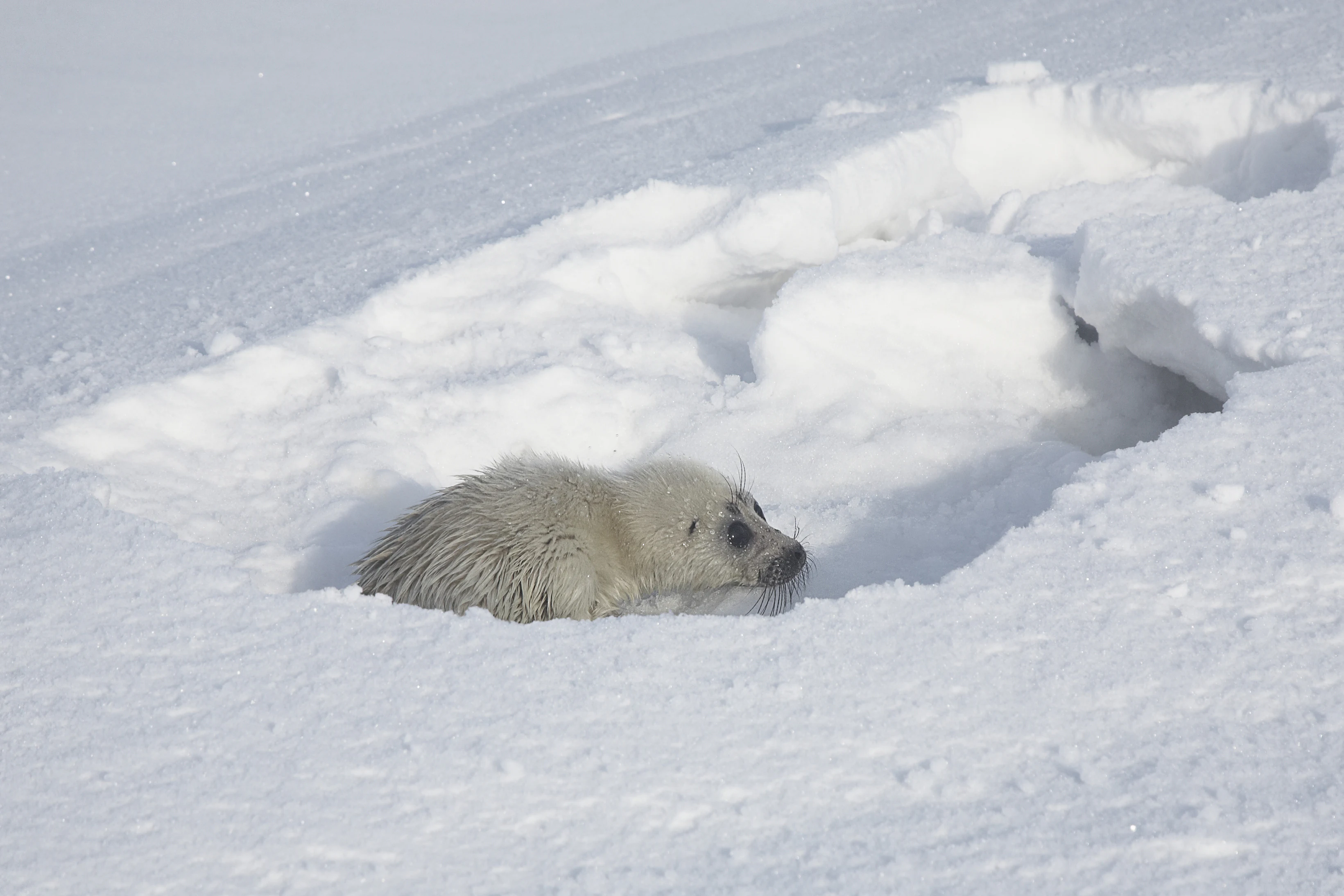
The most iconic wildlife feature of the park is the Baikal seal, the only pinniped that lives exclusively in fresh water. The Ushkan Islands within Zabaykalsky host the largest and most important haul-out and breeding site for this species on all of Lake Baikal, making the park a critical location for the seal's continued survival. Birdlife is also abundant around the bays, with herring gulls and other waterbirds breeding along the Chivyrkuysky shores, and grey herons frequenting the wetlands.

The park's lakes and rivers support a varied fish fauna. Omul, a signature Baikalian species, common whitefish, Siberian grayling, burbot, pike, perch, dace, ide, and common roach populate the rivers and bays. The Chivyrkuysky Bay is particularly important as one of the principal spawning grounds for the lake form of the common whitefish. Together, these aquatic and terrestrial faunas make the park a key area for understanding the broader biology of the Baikal basin.
Zabaykalsky National Park conservation status and protection priorities

Zabaykalsky National Park holds a distinctive position in Russian and international conservation. It is recognized as one of the few protected areas in Russia that fully satisfies the recommendations of UNESCO for the national park category, lending it academic and international weight beyond its domestic designation as an IUCN Category II protected area. Its purpose combines strict ecosystem protection with regulated recreation and public engagement, mirroring the dual mandate of national parks elsewhere in the world.

The park protects a critical ecological corridor along eastern Baikal, joining lands that would otherwise remain under fragmented or unregulated management. By including the Ushkan Islands, the Sviatoy Nos peninsula, and a substantial portion of the Barguzin Range's lakeside slopes, the park safeguards habitats essential to the survival of the Baikal seal, a globally unique freshwater pinniped, as well as dozens of rare and endemic plant and animal species.

Since 2011, the park has been managed jointly with the Barguzin Nature Reserve, Russia's first zapovednik, under a single federal directorate. This joint structure strengthens enforcement and scientific coordination across a continuous network of protected areas on both sides of the Barguzin Range. Functional zoning inside Zabaykalsky further sharpens its conservation value, with strict reserve, special protection, and educational tourism zones dedicated to maintaining ecological integrity alongside controlled visitor access.

Zabaykalsky National Park cultural meaning and human context

The territory of Zabaykalsky carries a long human history layered onto a remote Baikalian landscape. Within the park, archaeologists have documented neolithic settlements, slab burials from the second century BCE, and later nomadic graves from the fourteenth and fifteenth centuries, alongside traces of an ancient irrigation system and thirty-five settlements dating to the Bronze Age and early Iron Age. These remains reflect continuous human occupation and use of the eastern shore across many millennia.

Several monuments known as zasichki, historic boundary marks, are part of the park's history-cultural complex. Named sites such as Monakhovskaya, Nizhneizgolovskaya, Zimovyeinmysskaya, and Shimayskaya mark earlier episodes of regional administration and surveying, embedding the modern park within a wider heritage landscape of the Baikal region.

The Eastern Baikal coast has long supported communities of indigenous Buryat people and later Russian settlers, whose traditional land uses, including seasonal grazing, fishing, and small-scale harvesting, are part of the broader cultural fabric of the area. The coexistence of relict plant communities with these human traces gives Zabaykalsky a layered identity in which natural and cultural heritage are tightly interwoven.
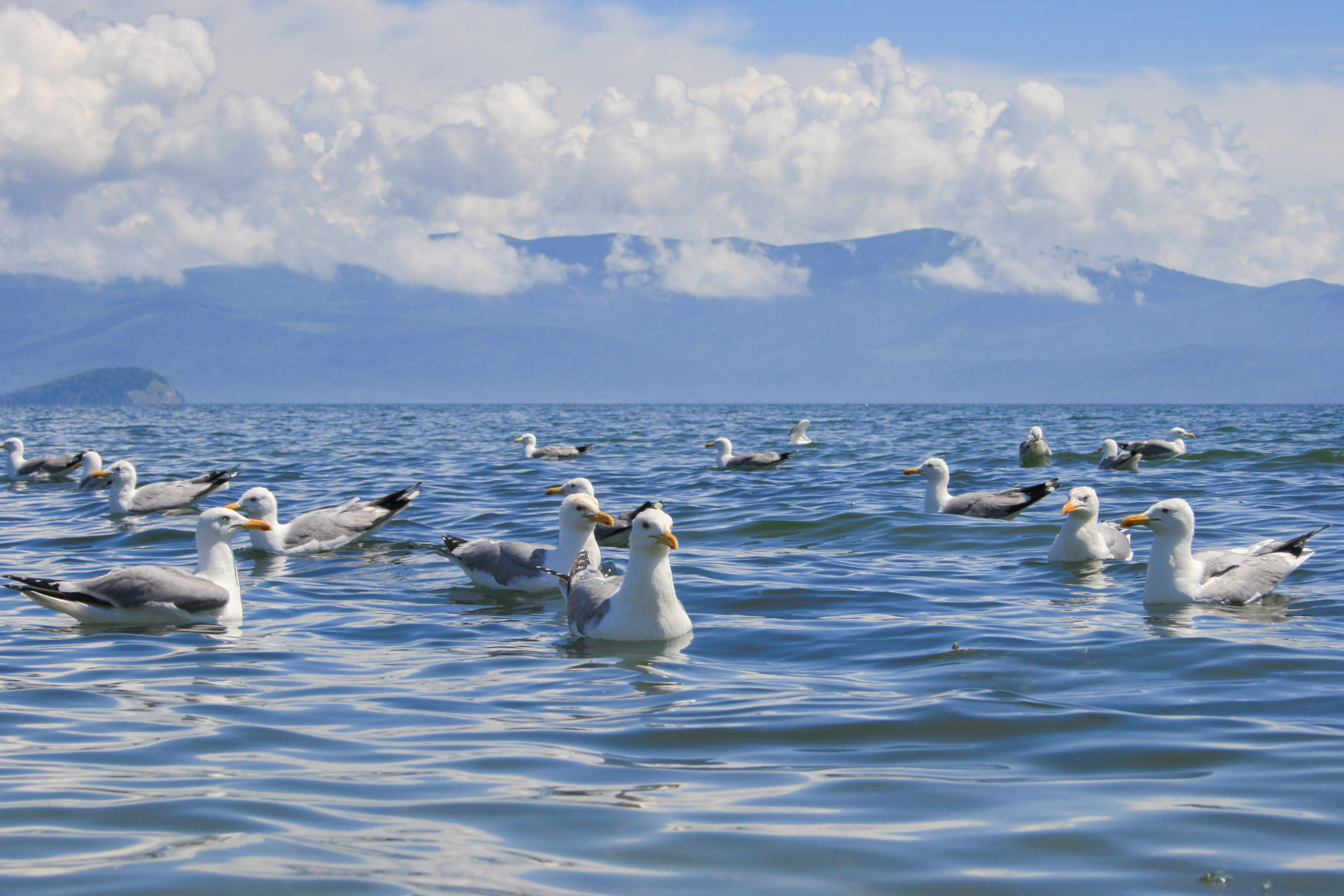
Top sights and standout views in Zabaykalsky National Park

Zabaykalsky's strongest distinguishing features cluster along its boundary with Lake Baikal. The Ushkan Islands, the most important haul-out for the Baikal seal, the Sviatoy Nos peninsula, a long mountain reaching out into the lake, and the Chivyrkuysky isthmus, separating two contrasting bays, together form the geographic heart of the park. Barguzin Bay, Chivyrkuysky Bay, and the offshore waters make up a sizable portion of the protected area and concentrate much of its biodiversity.

Ecologically, the park stands out for its old-growth mountain taiga of pine, cedar, larch, and fir, as well as for its unique dwarf-pine and relict steppe communities. Its thermal springs, including the Zmeiny, Nechayevsky, and Kuliny Bolota sources, mineral-rich Barmashyovoye Lake, and karst lake clusters add a distinctive geomorphological dimension. Cultural layers ranging from Bronze Age settlements to medieval nomadic burials complete the park's identity as both a natural and a heritage landscape of the Baikal region.
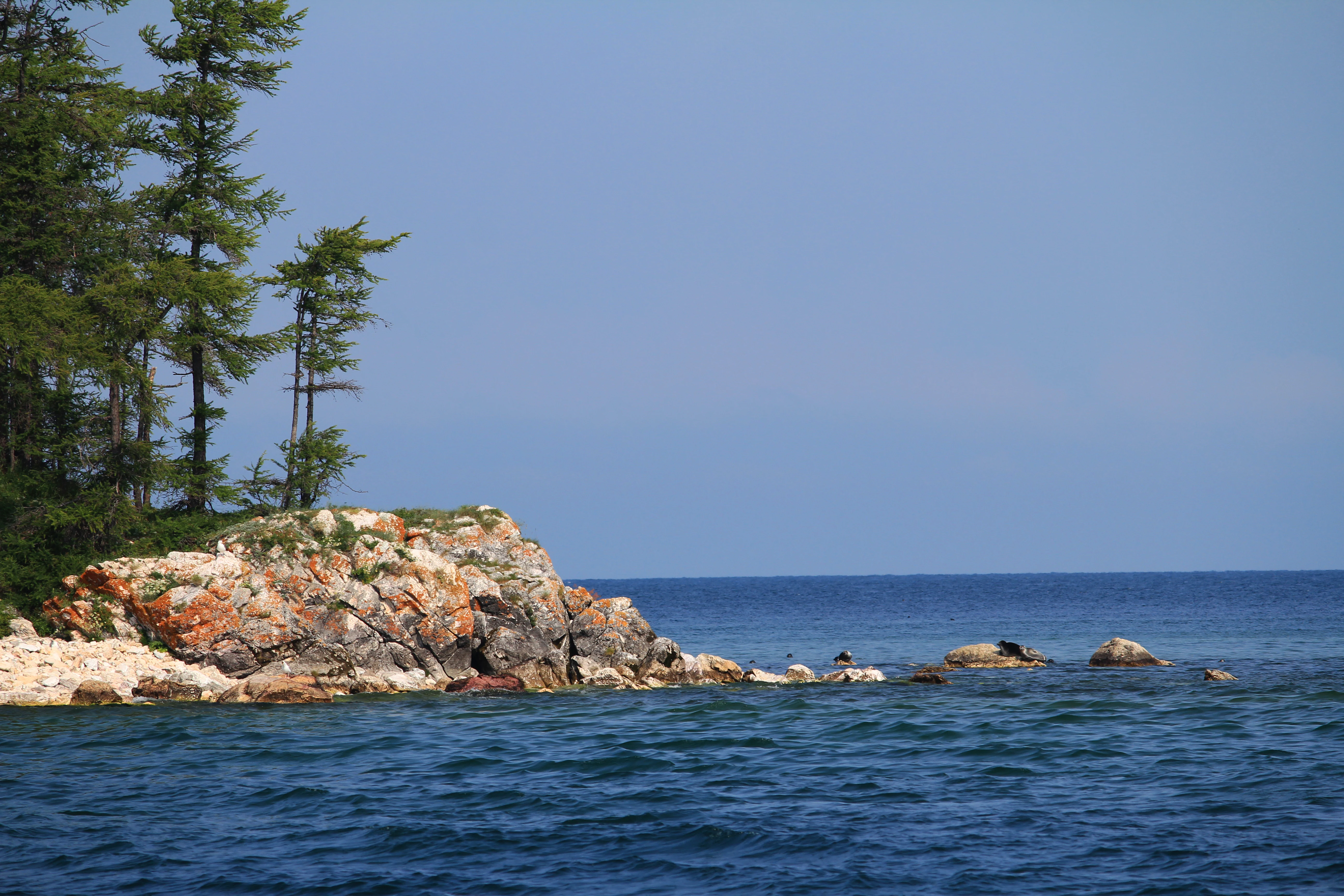
Best time to visit Zabaykalsky National Park

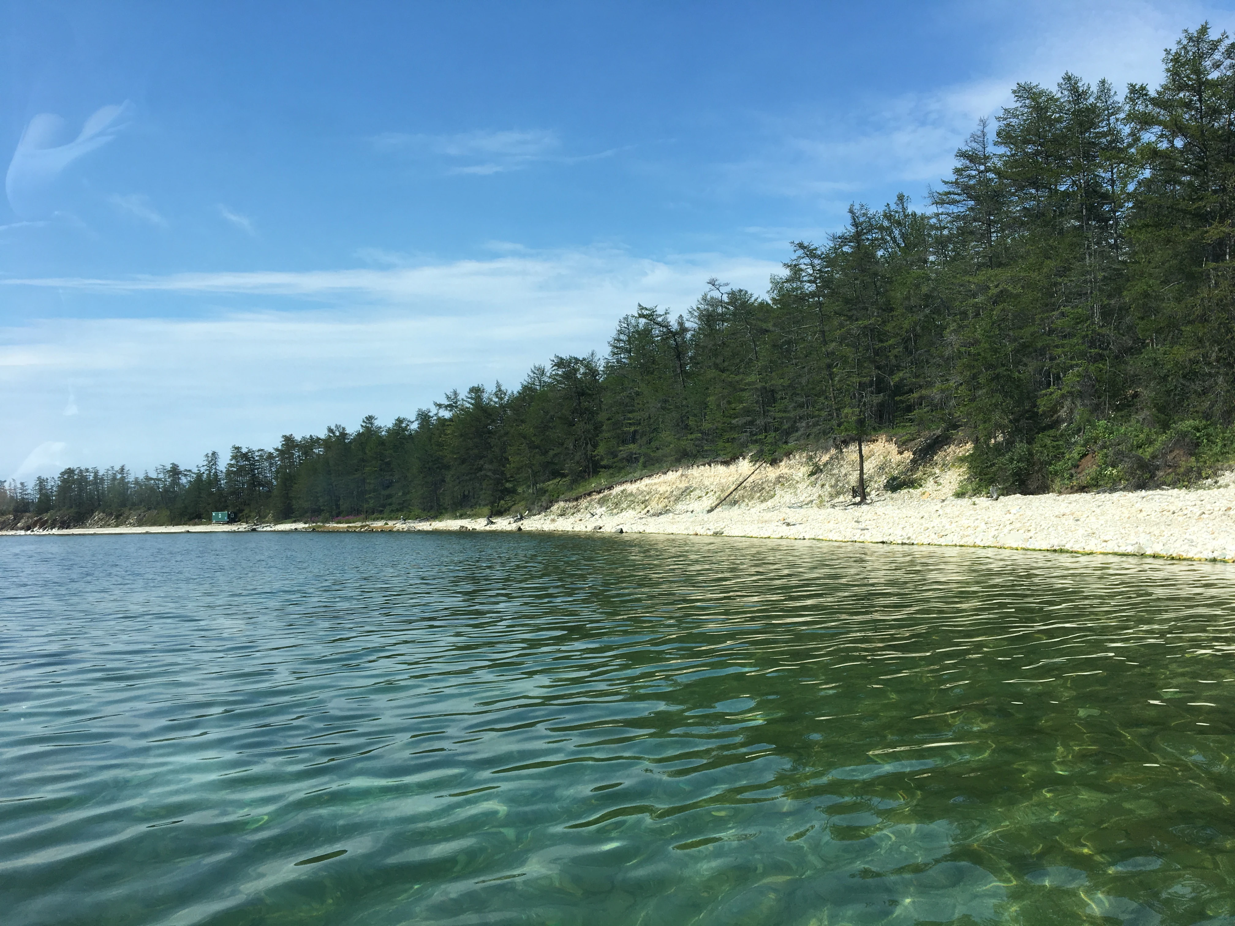
The park's strongly continental climate, moderated near the shore by the vast body of Lake Baikal, shapes the experience of visiting in distinct seasonal ways. Summers are short and warm, with Baikalian air keeping shoreline temperatures milder than the interior, making this the most comfortable period for hiking on the Sviatoy Nos peninsula, boating on the bays, and observing nesting waterbirds around the Chivyrkuysky wetlands. The lake itself rarely warms far beyond a cool, refreshing temperature in even the warmest weeks.

Winters are long and cold, with deep snow and prolonged ice cover across the bays, while autumn brings a brief transition with vivid taiga color and lower insect activity. Spring arrives later than in more southerly regions but is marked by the breakup of ice on Baikal and the gradual reawakening of the taiga. Each season offers a different character to the park, from the quiet, frozen silence of midwinter to the lively, bird-filled days of early summer along the eastern shore.
Monthly climate preview

Long-term temperature and precipitation patterns across representative coordinates

Zabaykalsky National Park Climate Normals and Monthly Weather Records

Zabaykalsky National Park exhibits a measured annual temperature and precipitation rhythm recorded across representative baseline coordinates between 1991 and 2020. Examining the complete twelve-month statistical profile clarifies long-term meteorological variations across the protected landscape.
Annual mean-2 °C
-24 °C20 °C
Jan-24°
Feb-20°
Mar-12°
Apr-1°
May
Jun16°
Jul20°
Aug17°
Sep
Oct-2°
Nov-14°
Dec-22°
Warmest month
July

19.6 °C

Coolest month
January

-23.9 °C

Wettest month
July

2.5 mm/day

Driest month
February

0.5 mm/day

Park location guide

Geography guide, regional context, and park location map for Zabaykalsky National Park

Zabaykalsky National Park park geography, regions, and map view in Russia

Understand where Zabaykalsky National Park sits in Russia through a broader geographic reading of the surrounding landscape, nearby location context, and its mapped position within the national park landscape.

How Zabaykalsky National Park fits into Russia

Russia is a transcontinental nation spanning eleven time zones, bordered by fourteen countries. It is the world's largest country by area, covering 17,098,246 km². Moscow is the capital and largest city, while Saint Petersburg is the second-largest and a major cultural centre.

Wider geography shaping Zabaykalsky National Park in Russia

Russia spans Eastern Europe and North Asia, covering 17,098,246 km². It shares land borders with fourteen countries, more than any other nation, and spans eleven time zones. The landscape includes vast plains, mountain ranges such as the Urals and Caucasus, and extensive coastlines along the Arctic Ocean, Pacific Ocean, Baltic Sea, Black Sea, and Caspian Sea.

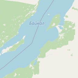
Map view of Zabaykalsky National Park

Use this park location map to pinpoint Zabaykalsky National Park in Russia, understand its exact geographic position, and read its mapped placement within the surrounding landscape more clearly.

Pigeon | © OpenStreetMap contributors

Location context for Zabaykalsky National Park

Buryatia
Park atlas

Compare regional protected landscapes, mountain ranges, and lake shore habitats.

Explore Other Parks Near Zabaykalsky National Park and Surrounding Protected Areas

Visitors exploring Zabaykalsky National Park can browse neighboring conservation units and protected natural areas across the surrounding region. Extending the geographic review allows comparison of diverse mountain taiga habitats, coastal peninsulas, and regional park networks.
Watercolor painting depicting a lake with mountain ranges, green hills, and scattered trees.
National parkBuryatia
About 0 km away#1 closest

Northeast

Zaybaykalsky National Park: Geographic Atlas of Lake Baikal Protected Terrain

Mapping the Svyatoy Nos peninsula and Barguzin mountain landscapes

Spanning over 269,000 hectares, Zaybaykalsky National Park protects a dramatic transition from the shores of Lake Baikal to high-altitude mountain complexes. This atlas resource details the park's steep topography, characterized by ancient taiga forests and geological features like the Academician Ridge and marble-limestone islands, offering a structured view of this significant Siberian protected area.

Area
2,690 km²
Established
1986
IUCN
II
Relief
Mountain
Watercolor illustration showing a lake, green vegetation, and mountains under a light sky
National parkIrkutsk Oblast
About 83 km away#2 closest

Southwest

Pribaikalsky National Park: Geographic Context and Protected Landscape Boundaries

Coastal mountain terrain and the freshwater ecosystems of Irkutsk Oblast.

Located in Russia, Pribaikalsky National Park represents a primary protected area within the Lake Baikal basin. The region features dramatic topographical transitions from the Primorsky Range to the inland expanse of Olkhon Island. This record provides a detailed look at the park's physical geography, including its forest cover, coastal cliffs, and the significant role of the Angara River outflow in shaping the surrounding Siberian terrain.

Area
4,173 km²
Established
1986
IUCN
II
Visitors
400K annual
National parkIrkutsk Oblast
About 230 km away#3 closest

Southwest

Pribaikalsky National Park: Atlas and Geographic Overview of Lake Baikal Shoreline

Protected taiga, rift valleys, and Olkhon Island topography

Pribaikalsky National Park serves as a critical protected landscape featuring 470 kilometers of western shoreline along Lake Baikal. Its geography is defined by the steep scarps of the Obruchev fault, the dense taiga of the Primorsky Range, and the unique steppe environments of Olkhon Island. This atlas entry provides essential context on the physical relief and regional characteristics of this landmark Siberian protected area.

Area
4,173 km²
Established
1986
IUCN
II
Visitors
400K annual
National parkZabaykalsky Krai
About 430 km away#4 closest

Southeast

Alkhanay National Park: Protected Mountain Terrain and Volcanic Landscapes of Zabaykalsky Krai

Mapping Siberia's forest-steppe transition and sacred mountain geography

Alkhanay National Park preserves an unusual assembly of Siberian mountain taiga, volcanic geology, and Buddhist heritage sites within the Zabaykalsky Krai region. The protected territory spans mid-elevation ranges and river valleys, offering deep insights into the intersection of ecological watershed protection and spiritual land preservation in the Russian Far East.

Area
1,382.34 km²
Established
1999
IUCN
II
Visitors
30K annual
Watercolor illustration depicting layered mountains, green hills, and forested areas with purple and pink tones
National parkZabaykalsky Krai
About 430 km away#5 closest

Southeast

Alkhanay National Park: A Study of Sacred Peaks and Daurian Forest Steppe Geography

Protected mountain landscapes in Russia's Zabaykalsky Krai

Alkhanay National Park preserves a unique transitional landscape where rugged mountain terrain meets the expansive Siberian steppe. Focused on the sacred Mount Alkhanai, the area features dramatic rock landforms, pine-covered canyons, and mineral springs. This protected zone provides a deep look into the geological and ecological history of the Mogotuyskogo Range and surrounding border regions.

Area
1,382 km²
Established
1999
IUCN
II
Relief
Mountain
Watercolor painting of a river winding through hills with trees and vegetation
National parkZabaykalsky Krai
About 446 km away#6 closest

South

Chikoy National Park: Protected National Park with Highland Landscape and River Basin Geography

Explore its protected boundaries and unique taiga-steppe transition in Zabaykalsky Krai.

Chikoy National Park, a protected area in Russia's Zabaykalsky Krai, showcases the rugged geography of the Khentei-Daur Highlands. As a national park, it preserves the upper Chikoy River basin and represents a significant ecological borderland, marking the transition from Siberian taiga to Mongolian steppe. This page facilitates a structured understanding of the park's mapped landscape, its prominent natural monument Bystrinsky Golets, and its role within the broader atlas of protected natural areas.

Area
6,665 km²
Established
2014
IUCN
II
Relief
Mountain
National parkBuryatia
About 529 km away#7 closest

West

Tunkinsky National Park National Park: Protected Landscape and Geographic Context in Buryatia

Discover mapped park boundaries and regional terrain.

Delve into Tunkinsky National Park, a significant protected national park situated in the Buryatia region of Russia. This detail page provides a geographic overview, highlighting the park's mapped boundaries and its place within the surrounding natural landscape. Understand its designation as a protected area, offering a focused entry point for atlas-based discovery of its specific terrain and regional importance.

Area
11,837 km²
IUCN
II
Relief
Mountain
Climate
Boreal
Wildlife reserveKhentii Province
About 535 km away#8 closest

South

Khan Khentii Strictly Protected Area: Geographic Overview and Protected Landscape Mapping

Eastern Mongolia wilderness and Khentii mountain terrain

Explore the expansive reaches of Khan Khentii Strictly Protected Area, a cornerstone of Mongolian conservation. This reserve shields intact taiga forests, river valley habitats, and the historic Burkhan Khaldun mountain from industrial activity, preserving one of the most significant mountain wilderness regions in the province of Khentii.

Area
12,270 km²
Established
1992
IUCN
Ib
Relief
Mountain

Common questions about visiting, size, designation, and location context for Zabaykalsky National Park

Zabaykalsky National Park FAQs for park facts, access, geography, and protected area context

Find quick answers about Zabaykalsky National Park, including protected-area facts, park geography, trail and visitor context, and how the park fits into its surrounding country and regional landscape.
MoriAtlas Explorer

Continue Your Protected Areas Search Across the Global Atlas

Deepen your exploration by continuing the structured search for national parks and protected areas worldwide. Utilize the comprehensive filtering capabilities to compare different conservation landscapes and refine your understanding of global park geography. Discover more about the distribution and characteristics of protected natural areas.

Global natural geography