
Mori Atlas logo
National parkZyuratkul National Park

Discover the mapped terrain of taiga forests, high-mountain lakes, and unique ecological transitions.

Zyuratkul National Park: A Geographic Atlas of Protected Mountain Landscapes in the Southern Urals

(National Park "Zyuratkul")

Zyuratkul National Park encompasses a distinctive protected territory in the Chelyabinsk Oblast, where the Southern Ural Mountains feature high-elevation lake environments and complex ecological interfaces. This park preserves a diverse mosaic of dark-coniferous taiga, mountain-tundra plateaus, and ancient rock formations that bridge the gap between forest-steppe and Siberian wilderness zones. Mapped boundaries reveal a landscape anchored by Lake Zyuratkul and framed by the prominent Nurgush and Zyuratkul mountain ridges.

mountainsSouthern Uralshigh-mountain laketaigaforest-steppe transitiondark coniferous forest

Zyuratkul National Park

National park

Park overview

Structured park overview, official facts, and landscape profile for Zyuratkul National Park

Zyuratkul National Park park facts, protected area profile, and essential visitor context

Review the core facts for Zyuratkul National Park, including designation, size, terrain, visitor scale, habitats, and operating context in one park-focused overview.

About Zyuratkul National Park

Zyuratkul National Park is a federally designated protected area in the Chelyabinsk Oblast of Russia, situated on the western macroslope of the Southern Ural Mountains. Established on 3 November 1993, the park covers approximately 88,249 hectares, extending about 49 km from north to south and 28 km from west to east. It is administered by a federal state institution under the Russian Ministry of Natural Resources and Ecology, and it carries IUCN Category II, the standard designation for national parks.

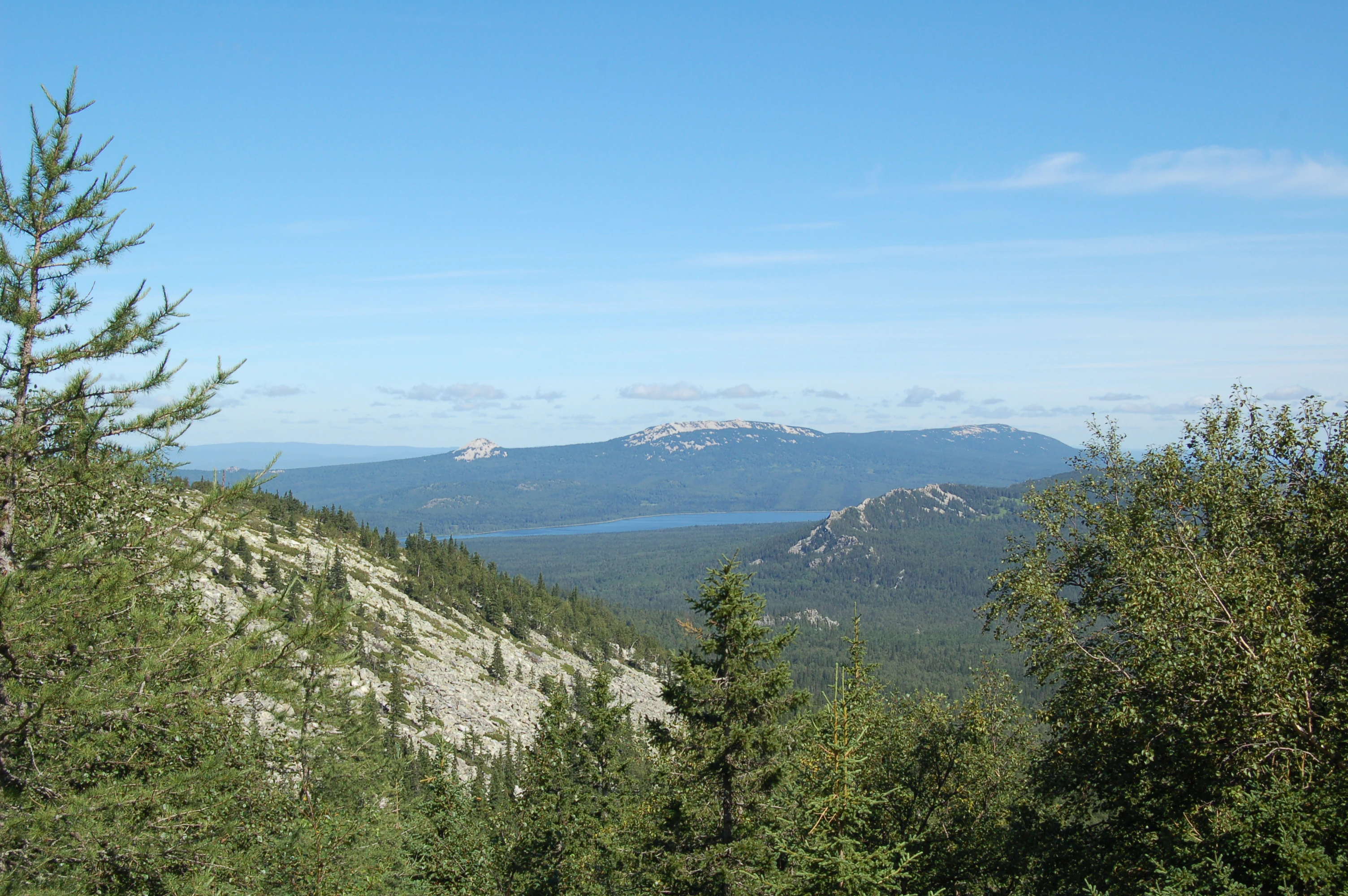
The park's central feature is Lake Zyuratkul, a reservoir-type lake at roughly 724 m above sea level that is often described as the only high-mountain lake on the western slope of the Southern Urals. Around this lake rise several mountain ridges, giving the landscape a classic high-altitude character for the region. The Zyuratkul range reaches about 1,175 m and stretches about 8 km along the lakeshore, while the Nurgush range climbs higher, reaching 1,406 m at its summit. Nurgush's crest carries a small mountain-tundra plateau covering roughly 9 square kilometers. Together with parallel ranges such as Urenga and Lukash, these ridges frame a varied terrain of crests, slopes, river valleys, cliffs, and alpine bogs.

Ecologically, the park sits at the junction of the taiga and forest-steppe zones, a position that drives its biological richness. Approximately ninety percent of the territory is covered by dark-coniferous taiga dominated by spruce and fir, with patches of birch forest, relict larch stands on the Urenga and Lukash ranges, and relict spruce stands on Nurgush and Lukash. The recorded flora includes 653 plant species, and 70 rare plant species from the park are listed in the Russian Red Data Book. These include lady's slipper orchids, the Ural anemone, and a range of other orchids and relicts of mixed biogeographic origin.

Wildlife in the park is correspondingly diverse: 214 vertebrate species have been recorded, including 40 mammal species, 145 bird species, 17 fish species, and smaller numbers of reptiles and amphibians. Large predators such as brown bears and wolves roam the forests alongside ungulates like moose, roe deer, and occasionally wild boar, while rare species such as the European mink, golden eagle, peregrine falcon, and Eurasian eagle-owl find refuge in the more remote ridges. Beyond its natural values, the park protects archaeological heritage: twelve Mesolithic and Neolithic campsites along the lakeshore have yielded stone tools, bronze points, and other artifacts, and in 2011 a large moose-shaped geoglyph was discovered on the surrounding land, attracting both research and public attention.

Today Zyuratkul is positioned as a conservation, scientific, and educational reserve, while also serving as a regulated tourism destination in the Urals. Its landscapes, biodiversity, and archaeological remains make it one of the most distinctive national parks on the western side of the Southern Ural Mountains.

Quick facts and research context for Zyuratkul National Park

Zyuratkul National Park lies in the Chelyabinsk Oblast of Russia, in the western part of the Southern Ural Mountains. It was created on 3 November 1993 and is administered by the Ministry of Natural Resources and Ecology of the Russian Federation through a federal state institution. The park covers about 88,249 hectares and is elongated along a north-south axis, with the small town of Satka as the nearest settlement.

Its territory sits at the transition between the taiga and forest-steppe zones, giving rise to a mixed flora with both Siberian and European elements. The park includes the high-mountain Lake Zyuratkul, several prominent mountain ridges, a 9 km diversion canal connected to a local hydroelectric station, and diverse natural monuments such as rocky cliffs, peat bogs, relict forests, and remnants of prehistoric habitation.

Protection and recognition

Examining terrestrial protection scope and documented designation frameworks

Zyuratkul National Park Protection Status and Conservation Records

Zyuratkul National Park maintains a documented terrestrial protection scope within its regional landscape. Official conservation records aggregate management parameters and designated area attributes for reliable reference.

Protection details

Protection scope
Terrestrial
Park context

Deeper park guide and search-rich context for Zyuratkul National Park

Zyuratkul National Park history, landscape, wildlife, and travel context

Explore Zyuratkul National Park through its history, landscape character, ecosystems, wildlife, conservation priorities, cultural context, and seasonal travel timing in a structured park guide built for atlas discovery and search intent.

Why Zyuratkul National Park stands out

Zyuratkul is best known for Lake Zyuratkul, the highest-elevation lake on the western slope of the Southern Urals, and for the surrounding ring of forested mountain ridges, including the Zyuratkul range and the Nurgush range, which rises to 1,406 m. The park is also recognized for the unusual meeting of taiga and forest-steppe ecosystems within a single protected territory, producing a rich mixture of Siberian and European species. A large moose-shaped geoglyph discovered near the lake in 2011 added an additional layer of public interest, though its age has been debated. Ancient Mesolithic and Neolithic campsite remains along the lakeshore further reinforce the park's identity as a landscape where high-mountain scenery, biodiversity, and deep human history overlap.
Zyuratkul National Park history and protected-area timeline

Zyuratkul National Park was formally established on 3 November 1993 by the Russian Federation, becoming one of the country's network of national parks created during the post-Soviet conservation reorganization. From its inception, the park was placed under the authority of what is now the Ministry of Natural Resources and Ecology of the Russian Federation, and its management was entrusted to a dedicated federal state institution known as National Park "Zyuratkul."

The park's founding mandate combined ecological protection, scientific research, and cultural heritage preservation. Its stated tasks included safeguarding reference and unique natural complexes, natural monuments, and objects of historical, cultural, and archaeological significance; promoting environmental education; developing scientific methods of nature protection compatible with recreational use; conducting ecological monitoring; and restoring disturbed natural and historical-cultural complexes while providing for regulated tourism and recreation.

Long before its designation, the area had been inhabited by humans in deep prehistory. Twelve prehistoric campsites along the shore of Lake Zyuratkul document occupation during the Mesolithic period, roughly 12,000 years ago, and the Neolithic period, between roughly 6,000 and 3,000 years ago. Excavations have produced stone axes, scrapers, chopping tools, bronze points, and remains of structures, many of which are now displayed at the Satka Local History Museum. In 2011, a large moose-shaped geoglyph measuring roughly 218 by 195 m was reported on the ground near the lake. Initial estimates suggested an age of about 8,000 years, though later analysis raised doubts and proposed that the figure may actually be a twenty-first-century training ski track. The debate around the geoglyph has itself become part of the park's modern history.

Zyuratkul National Park landscape and geographic character

The landscape of Zyuratkul National Park is built from the western slopes and ridges of the Southern Ural Mountains, an ancient range whose character here is moderate in elevation but strongly structured. The park's spine is a series of forested ridges surrounding the high-mountain Lake Zyuratkul at about 724 m above sea level. The Zyuratkul range itself runs for about 8 km near the lake and reaches roughly 1,175 m, while the Nurgush range forms a higher barrier to the north and east, culminating at 1,406 m. A small mountain-tundra plateau of about 9 square kilometers sits near the top of Nurgush, providing one of the park's most distinctive landform transitions.

Below the ridges, the terrain falls through slopes cloaked in dark-coniferous taiga, river valleys, and clearings. The drainage feeds rivers including the Kalagaza and Berezyak, and a 9 km diversion canal links Lake Zyuratkul to a hydroelectric station in the settlement of Magnitka, an unusual piece of hydraulic infrastructure within a protected landscape. Rock features are prominent throughout: the Zyuratkul Pillar cliffs, the "Grebeshok" rock remnant on the Berezyak River, and the Medvezhi cliffs on the Zyuratkul range add vertical drama to the otherwise soft, forest-covered ridges.

The park's location at the interface of the taiga and forest-steppe zones gives an additional landscape twist. On the Maly Moskal ridge, patches of relict forest-steppe vegetation survive at unusually high elevations of around 850 m, a reminder that ecological zones here do not follow the simple altitude gradient one might expect elsewhere in Russia.

Zyuratkul National Park ecosystems, habitats, and plant life

The ecological character of Zyuratkul National Park is defined by its position at the meeting of two major natural zones: the southern taiga and the forest-steppe. Roughly ninety percent of the park is covered by dark-coniferous taiga dominated by spruce and fir, with birch forests appearing locally and larch stands clinging to particular ridges as relicts of earlier climatic conditions.

The flora reflects this dual identity. Roughly 653 vascular plant species have been recorded here, drawing from both Siberian and European floras. Spruce-fir forests form the dominant matrix, while relict larch woodlands persist on the Urenga and Lukash ranges, and relict spruce stands survive on Nurgush and Lukash. On the Maly Moskal ridge, patches of forest-steppe vegetation appear at about 850 m above sea level, well above their usual elevation. Peat bogs occupy sheltered sections such as the Dolgy Elnik cape, while a curious "onion meadow" high in the upper reaches of the Malaya Satka River adds botanical variety. The lichen Lobaria pulmonaria, listed in the Russian Red Data Book, signals the quality of the old-growth forest air.

Rare plant communities include orchids such as the true lady's slipper and the large-flowered lady's slipper, the leafless helleborine, the early purple orchid, and the Ural anemone. Seventy rare plant species from the park are entered into the Russian Red Data Book, illustrating the conservation importance of the vegetation. Mixed forests, ridges, bogs, alpine plateaus, and rocky outcrops together create a mosaic of habitats unusual in the Urals.

Zyuratkul National Park wildlife and species highlights

The animal life of Zyuratkul reflects the same mixing of taiga and forest-steppe that shapes the park's flora. Roughly 214 vertebrate species have been recorded, of which mammals account for about 40, birds for 145, fish for 17, and smaller numbers of reptiles and amphibians for the remainder.

Among mammals, fourteen species of predator roam the forests, including brown bears, wolves, foxes, pine martens, and stoats, while ungulates are represented by moose, roe deer, and occasionally wild boar. Two lagomorph species complete the mammal picture. Fish in the park's waters include bream, perch, European grayling, burbot, and pike.

Rare species identified within the park and listed in the Russian Red Data Book include the European mink, the golden eagle, the peregrine falcon, the Eurasian eagle-owl, the European grayling, and two butterfly species: the clouded Apollo and the common Apollon. The presence of large raptors and a full guild of large carnivores suggests relatively intact wilderness conditions in the more remote parts of the park. Animal encounters are part of the cultural imagery of Zyuratkul as well, reinforced by the moose-shaped geoglyph near the lake and by small-scale tourism attractions like the maral deer farm and sled-dog center operating within the park.

Zyuratkul National Park conservation status and protection priorities

As a federally designated national park with IUCN Category II status, Zyuratkul sits in the strictest tier of Russian nature protection, with conservation as its principal mandate. Its stated tasks include the preservation of reference and unique natural complexes, conservation of natural monuments, ecological monitoring, and restoration of disturbed natural and historical-cultural complexes. The whole of its roughly 88,249 hectares is placed under park-level protection.

The ecological significance of Zyuratkul lies in the convergence of two biogeographic regions, the taiga and forest-steppe, within a single protected mountain territory. This convergence supports both Siberian and European species and has produced a flora of 653 plant species, 70 of which are included in the Russian Red Data Book. Notable among these are relict communities such as the larch stands on the Urenga and Lukash ranges, the relict spruce forests on Nurgush and Lukash, and the unusually elevated forest-steppe patches on the Maly Moskal ridge. Old-growth indicators such as Lobaria pulmonaria point to a relatively clean forest atmosphere.

Animal conservation is similarly significant: the park hosts 145 bird species, including red-listed raptors like the golden eagle, peregrine falcon, and Eurasian eagle-owl; rare mammals such as the European mink; and 17 fish species including the European grayling. The presence of 14 predator species and full representation of large ungulates suggests that the park maintains functional predator-prey dynamics. Beyond ecological protection, the park's conservation framework also covers archaeological heritage, including Mesolithic and Neolithic sites and the controversial moose-shaped geoglyph, making it a place where natural and cultural preservation are pursued together.

Zyuratkul National Park cultural meaning and human context

Zyuratkul's cultural significance is closely linked to long-term human presence around its high-mountain lake. Twelve prehistoric campsites along the lakeshore document occupation during the Mesolithic, roughly 12,000 years ago, and the Neolithic, between about 6,000 and 3,000 years ago. Stone axes, scrapers, bronze arrowheads, chopping tools, and traces of structures uncovered in these sites are now part of the collection displayed at the Satka Local History Museum, tying the park into the broader archaeological identity of the Southern Urals.

In 2011, the discovery of a huge moose-shaped geoglyph on the ground near Lake Zyuratkul reignited interest in the deeper cultural history of the area. The figure, roughly 218 by 195 m in size, was initially interpreted as possibly 8,000 years old, though later analysis contested this and suggested it could be a modern ski-training track. Whether ancient or modern, the geoglyph has become part of the cultural imagination associated with the park.

The present-day cultural landscape also includes working facilities such as the maral deer farm near the villages of Zyuratkul and Magnitsky, reflecting the continued human use of the protected territory under regulated conditions. Sites such as the hydroelectric station at Magnitka, fed by a 9 km canal from the lake, link the park's natural heritage to the region's industrial history.

Top sights and standout views in Zyuratkul National Park

Among Zyuratkul's most distinctive highlights is Lake Zyuratkul, the only high-mountain lake on the western slope of the Southern Urals, set at about 724 m and surrounded by a ring of forested ridges. The Zyuratkul and Nurgush ranges frame the lake, with Nurgush reaching 1,406 m and supporting a small mountain-tundra plateau near its summit.

Beyond the central lake and ridges, the park protects a rich diversity of natural monuments: the Zyuratkul Pillar cliffs, the Grebeshok rock remnant on the Berezyak River, the Medvezhi cliffs on the Zyuratkul range, relict larch and spruce forests, peat bogs, and an elevated patch of forest-steppe vegetation on the Maly Moskal ridge. Twelve Mesolithic and Neolithic campsites along the lakeshore and the debated moose-shaped geoglyph add an archaeological and cultural layer that few other Russian national parks combine at a single site.

Best time to visit Zyuratkul National Park

Zyuratkul's climate is moderately continental, with a cold snowy winter and a warm summer, and a growing season of roughly four and a half to five months. Annual precipitation is around 730 mm, much of it falling as snow, so winter produces a deeply snow-covered mountain landscape, while summer brings warm temperatures and the most accessible hiking conditions along the ecological trail to the Zyuratkul range and the shores of Lake Zyuratkul.

Summer and early autumn are generally the most rewarding periods for visiting the park's landscapes, alpine plateaus, and wildlife, as the ridges and Nurgush tundra become accessible without specialized winter equipment. Winter brings opportunities for snow-based recreation and the operation of the sled-dog center at the Ecopark, though visitors should expect cold conditions and snow at elevation. Spring and late autumn are transitional shoulder seasons, when snowmelt, early greening, or fall colors can be encountered but weather and conditions can change quickly in the mountains.
Monthly climate preview

Long term representative temperature and monthly precipitation averages

Zyuratkul National Park Climate Normals and Annual Weather Patterns

Zyuratkul National Park exhibits a measured annual cycle featuring deep subzero winter minimums alongside warm summer peaks and steady precipitation totals. Examining the full twelve month record clarifies long term temperature variations and monthly precipitation trends across the protected terrain.
Annual mean1 °C
-15 °C17 °C
Jan-15°
Feb-14°
Mar-7°
Apr
May10°
Jun15°
Jul17°
Aug15°
Sep
Oct
Nov-8°
Dec-13°
Warmest month
July

17.4 °C

Coolest month
January

-14.9 °C

Wettest month
July

3 mm/day

Driest month
February

0.9 mm/day

Park location guide

Geography guide, regional context, and park location map for Zyuratkul National Park

Zyuratkul National Park park geography, regions, and map view in Russia

Understand where Zyuratkul National Park sits in Russia through a broader geographic reading of the surrounding landscape, nearby location context, and its mapped position within the national park landscape.

How Zyuratkul National Park fits into Russia

Russia is a transcontinental nation spanning eleven time zones, bordered by fourteen countries. It is the world's largest country by area, covering 17,098,246 km². Moscow is the capital and largest city, while Saint Petersburg is the second-largest and a major cultural centre.

Wider geography shaping Zyuratkul National Park in Russia

Russia spans Eastern Europe and North Asia, covering 17,098,246 km². It shares land borders with fourteen countries, more than any other nation, and spans eleven time zones. The landscape includes vast plains, mountain ranges such as the Urals and Caucasus, and extensive coastlines along the Arctic Ocean, Pacific Ocean, Baltic Sea, Black Sea, and Caspian Sea.

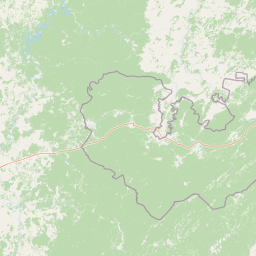
Map view of Zyuratkul National Park

Use this park location map to pinpoint Zyuratkul National Park in Russia, understand its exact geographic position, and read its mapped placement within the surrounding landscape more clearly.

Pigeon | © OpenStreetMap contributors

Location context for Zyuratkul National Park

Chelyabinsk Oblast
Park atlas

Compare regional mountain terrain and connected conservation areas across the Southern Urals

Explore Parks Near Zyuratkul National Park and Surrounding Protected Landscapes

Visitors exploring Zyuratkul National Park can compare adjacent protected areas and forested mountain reserves across the surrounding regional terrain. Extending the geographic review helps map broader ecological patterns and connected conservation landscapes throughout the southern mountain ranges.
Watercolor illustration depicting rolling hills, green forests, and distant mountains under a pale sky
National parkChelyabinsk Oblast
About 1.5 km away#1 closest

East

Zyuratkul National Park: Geography, Alpine Lakes, and Mountain Range Maps

Protected mountain wilderness in Chelyabinsk Oblast, Russia

Analyze the protected geography of Zyuratkul National Park, home to the highest point in Chelyabinsk Oblast and a distinctive alpine lake basin. Explore the park boundaries and the vertical transition from dense forest to the craggy summits of the Nurgush and Zyuratkul mountain ranges.

Area
882.49 km²
Established
1993
IUCN
II
Relief
Mountain
National parkChelyabinsk Oblast
About 34 km away#2 closest

Southwest

Zigalga National Park: Mapped Geography and Protected Areas of the Southern Urals

Mountain forest and tundra ecosystems in Chelyabinsk Oblast

Spanning the rugged ridges of the Southern Urals, Zigalga National Park protects a distinct mosaic of dark coniferous forests and alpine-like golets tundra. This protected area plays a crucial role in regional hydrology and biodiversity, encompassing the headwaters of the Yuryuzan and Kutkurka rivers across a diverse elevational landscape.

Area
456.616 km²
Established
2019
IUCN
II
Relief
Mountain
Watercolor illustration of a mountain range with purple peaks, green hills, a single tall pine tree, and pinkish foreground vegetation
National parkChelyabinsk Oblast
About 39 km away#3 closest

Southwest

Zigalga National Park: Geography, Alpine Terrain, and Protected Wilderness Areas

A vital ecological corridor within the Chelyabinsk Oblast of Russia

Zigalga National Park serves as a pristine natural sanctuary at the crossroads of Europe and Siberia. The territory features steep mountainous ridges, expansive peat bogs, and vertical floral zonation that defines the Southern Ural landscape. This protected area provides a stable environment for rare boreal plant species and remains largely untouched by development, offering a valuable record of subarctic ecosystem health.

Area
457 km²
Established
2019
IUCN
II
Relief
Mountain
Watercolor illustration of rolling hills, green forests, and distant mountains under a pale sky
National parkRussia
About 74 km away#4 closest

Northeast

Taganay National Park: Protected Landscape and Regional Geography Explorer

Explore mapped protected areas and natural landscapes.

Taganay National Park stands as a key protected area within Russia, offering unique geographic features and a distinct regional landscape identity. This entry serves as a gateway to understanding the park's role as a national park, providing context for its mapped boundaries and environmental setting. Utilize this resource for structured discovery of protected lands and their place within the broader atlas of natural geographies.

IUCN
II
Scope
Terrestrial
Wildlife reserveKostanay Region
About 234 km away#5 closest

Southeast

Mikhaylovsky Zakaznik: Geographic Overview of the Kostanay Region Wildlife Reserve

A protected forest steppe sanctuary in northern Kazakhstan.

Mikhaylovsky Zakaznik acts as an enduring zoological refuge within the Kostanay Region, protecting a rich tapestry of woodland and meadow steppe environments. This reserve supports native ungulates and game birds by maintaining a stable, low-profile landscape of birch and pine groves that function as critical corridors for biodiversity across the borderlands.

Area
768 km²
Established
1967
Relief
Upland
Access
Access unknown
National parkBashkortostan
About 254 km away#6 closest

Southwest

Bashkiriya National Park: Protected Karst Landscapes and Ural Mountain Geography

Southern Ural forest ecosystems and karst cave networks

Bashkiriya National Park protects over 900 square kilometers of mountainous terrain and river valleys in the Republic of Bashkortostan. The park serves as a prime example of the Southern Ural transition, featuring an intricate mix of karst sinkholes, surface streams, and mature broadleaf forests that support diverse temperate wildlife and avian communities.

Area
920 km²
Established
1986
IUCN
II
Visitors
30K annual
Watercolor painting showing a scenic landscape with mountains, a river, and trees
National parkBashkortostan
About 254 km away#7 closest

Southwest

Bashkiriya National Park: Mapping Karst Landscapes and Ural Forest Geography

Exploring protected terrain in the Bashkortostan region

Bashkiriya National Park anchors a critical conservation area along the southern Ural Mountains, characterized by its deep canyons, limestone grottoes, and vast subterranean cave networks. The park serves as a bridge for biodiversity at the continental edge, where river-carved valleys and dense taiga forests create a distinct, protected landscape for regional research and geographic study.

Area
920 km²
Established
1986
IUCN
II
Relief
Mixed relief
National parkUdmurtia
About 373 km away#8 closest

Northwest

Nechkinsky National Park: Protected Kama River Valley Geography and Landscape Atlas

Kama River valley protected areas and floodplain topography

Spanning the middle course of the Kama River and the Votkinsk Reservoir, Nechkinsky National Park protects a diverse mosaic of forest, wetland, and riverine habitats. The terrain features a sharp contrast between elevated forest slopes and flat alluvial floodplains, serving as a primary conservation landscape for the regional biodiversity of Udmurtia.

Area
207.52 km²
Established
1997
IUCN
II
Relief
Upland

Common questions about visiting, size, designation, and location context for Zyuratkul National Park

Zyuratkul National Park FAQs for park facts, access, geography, and protected area context

Find quick answers about Zyuratkul National Park, including protected-area facts, park geography, trail and visitor context, and how the park fits into its surrounding country and regional landscape.
MoriAtlas Explorer

Continue Your Protected Areas Search Across the Global Atlas

Deepen your exploration by continuing the structured search for national parks and protected areas worldwide. Utilize the comprehensive filtering capabilities to compare different conservation landscapes and refine your understanding of global park geography. Discover more about the distribution and characteristics of protected natural areas.

Global natural geography