Mori Atlas logo
National parkNechkinsky National Park

Mapping the ecological intersection of upland forested slopes, river cliffs, and expansive floodplain wetlands

Nechkinsky National Park: Protected Landscapes and Kama River Valley Geography in Udmurtia

(Natsionalny Park «Nechkinsky»)

Nechkinsky National Park represents a significant protected area within the middle Kama River valley of Udmurtia. The park showcases a distinct geomorphic contrast between the elevated, deeply dissected right bank and the low-lying, water-rich alluvial plains of the left bank. This protected region integrates coniferous and mixed forests with a complex mosaic of oxbow lakes, wetlands, and reservoir shorelines, providing a vital habitat structure for native flora and fauna across the Kama basin.

Kama River valleyVotkinsk Reservoirmixed coniferous forestsbroadleaf forestsfloodplain meadowsoxbow lakes

Nechkinsky National Park

National park

Park overview

Structured park overview, official facts, and landscape profile for Nechkinsky National Park

Nechkinsky National Park park facts, protected area profile, and essential visitor context

Review the core facts for Nechkinsky National Park, including designation, size, terrain, visitor scale, habitats, and operating context in one park-focused overview.

About Nechkinsky National Park

Nechkinsky National Park protects a representative section of the middle Kama River valley in the Udmurt Republic, focusing specifically on the natural complexes that have historically defined the ecology and culture of this region. Established in 1997 as a federal national park, it brings together forested uplands, river cliffs, reservoir shoreline, floodplain meadows, and a wide spectrum of wetland habitats within a single protected area of roughly 207 square kilometers.

The park's geography reflects the contrast that defines the middle Kama itself. The right bank is an elevated plain deeply dissected by small river valleys, ravines, and gullies, where slope erosion and landslides shape the terrain along the steep banks of the Kama and the Votkinsk Reservoir. The left bank and parts of the right bank are instead built from alluvial sediments, presenting a gentler floodplain landscape with flood meadows, over-bank terraces, and a network of dry or water-filled oxbows. This contrast produces a wide range of habitats within a relatively short distance.

Ecologically, the park lies in the subzone of mixed coniferous and broadleaf forests, with spruce, fir, birch, lime, oak, and pine communities forming the basis of the forest cover. Willow stands occupy the active floodplain, while alder and sedge communities develop in low-lying wet areas. A distinctive feature of the park is the diversity of mires, including raised, transitional, and lowland bogs, each supporting characteristic plant communities such as cranberry, bog rosemary, cottongrass, and sphagnum mosses. Aquatic vegetation ranges from shoreline sedges and reeds to floating-leaf communities of water lilies and yellow pond lilies in deeper water.

The protected territory plays a major role in conserving regional biodiversity, hosting a large majority of Udmurtia's species of vascular plants, fish, birds, and mammals. Rare species listed in the Red Data Book of the Russian Federation are documented across multiple groups, including fish, birds, orchids, and insects. The park also preserves a network of natural monuments of republican significance, including the mouth of the Siva River, several tracts such as Galevo and Sidorovy Gory, peat bogs, mineral springs, and Lake Zaboroye, alongside archaeological and historical sites that reflect long-standing human presence in the Kama valley.

Managed as a federal institution, the park supports ecological research, environmental education, and outdoor recreation. Its combination of ecological integrity, landscape diversity, and proximity to historic towns along the Kama gives Nechkinsky an important role both in the conservation of Udmurtia's natural heritage and in regional cultural identity.

Quick facts and research context for Nechkinsky National Park

Nechkinsky National Park is located in the Udmurt Republic in the middle reaches of the Kama River, along the coast of the Votkinsk Reservoir. It is classified as a national park under the IUCN Category II system and is managed by a dedicated federal institution. The park covers roughly 207 square kilometers of mixed forest, floodplain, river shoreline, and wetland. It was established by the Government of the Russian Federation on 16 October 1997, with conservation, ecological, cultural, and recreational purposes. The territory lies within the broader cultural landscape of Finno-Ugric peoples and is bordered by cities such as Izhevsk, Votkinsk, Sarapul, and Tchaikovsky.

Protection and recognition

Documented terrestrial protection scope, management framework, and international recognition details

Nechkinsky National Park Protection Status and Conservation Records

Nechkinsky National Park maintains a documented terrestrial protection scope and structured management framework within its conservation landscape. Official records compile verified protection status, designation history, and international recognition data without assuming external conservation outcomes.

Protection details

Protection scope
Terrestrial
Transboundary protection
No
Park context

Deeper park guide and search-rich context for Nechkinsky National Park

Nechkinsky National Park history, landscape, wildlife, and travel context

Explore Nechkinsky National Park through its history, landscape character, ecosystems, wildlife, conservation priorities, cultural context, and seasonal travel timing in a structured park guide built for atlas discovery and search intent.

Why Nechkinsky National Park stands out

Nechkinsky is best known for protecting the natural complexes of the middle Kama River basin, where uplifted forested right-bank terrain meets a lowland floodplain mosaic of meadows, oxbow lakes, swamps, and reservoirs. The park combines boreal and hemiboreal forest communities, diverse wetland types, and a remarkably high share of Udmurtia's flora and fauna concentrated in one relatively compact area. It is also recognized for its ecological richness: a substantial portion of Udmurtia's bird, fish, insect, and mammal species occur within the park, including rare species protected at the federal level. The coexistence of forest, river, and wetland habitats within an accessible central Russian setting makes the park a notable example of river-valley conservation.
Nechkinsky National Park history and protected-area timeline

Nechkinsky National Park was formally established by Resolution No. 1323 of the Government of the Russian Federation, signed on 16 October 1997. The founding decree specified that the purpose of the new national park was to preserve the unique natural complexes found in the basin of the Kama River, recognizing their significant ecological, cultural, and recreational value.

The park was created as a federal protected area, managed by a dedicated state institution responsible for its conservation, scientific, and educational work. From its inception, the park was conceived not only as a refuge for nature but also as a tool for protecting the cultural landscape of the Kama valley, which has been shaped over millennia by both natural processes and human activity.

Within its boundaries, the park inherited and continues to safeguard a network of natural monuments of republican significance, including tracts such as Galevo and Sidorovy Gory, peat mogs, mineral springs, and Lake Zaboroye. It also protects archaeological sites spanning multiple eras, from Stone Age and Neolithic settlements to Bronze Age villages and early Iron Age hillforts, reflecting the long history of human habitation along the Kama.

Over the following decades, Nechkinsky developed into one of the key protected areas of the Udmurt Republic, contributing to regional biodiversity inventories, conservation of Red Book species, and public engagement with the natural heritage of the Kama River basin.

Nechkinsky National Park landscape and geographic character

The landscape of Nechkinsky National Park is defined by its position along the middle course of the Kama River and the shoreline of the Votkinsk Reservoir. Two contrasting geomorphic sides give the park much of its scenic and ecological variety.

The right bank of the Kama rises as an elevated plain, deeply cut by valleys of small rivers, gullies, and ravines. This side of the park is shaped by active surface processes including sheet erosion, the action of temporary and permanent streams, and widespread landslides along the steep banks of the Kama and the reservoir. The combination of elevated terrain, deep dissection, and dynamic slopes produces dramatic valley scenery and a mosaic of forest, slope, and river-edge habitats.

The left bank, together with parts of the right bank near the mouth of the Siva River, consists of alluvial deposits and forms a much gentler floodplain landscape. Here the active floodplain of the Kama is uneven and ridged, dotted with numerous old river channels that have become dry depressions, oxbow lakes, and wetlands. Over-bank terraces add further topographic variation, while groundwater-fed lowlands support mires and wet meadows. This flat, water-rich side complements the steeper forested right bank, creating the hydrological and ecological diversity that defines the park.

Nechkinsky National Park ecosystems, habitats, and plant life

Nechkinsky lies in the subzone of mixed coniferous and broadleaf forests, and its vegetation reflects both zonal and floodplain influences. The most characteristic zonal forests are spruce stands, often accompanied by Siberian fir, lime, birch, and pine. Although pure spruce forests occur only in fragments, mixed communities with spruce as a backbone dominate substantial portions of the park. Broadleaf forests are represented primarily by oak-dominated associations, while small-leaved forests, mostly secondary in origin, cover areas altered by past land use, with the notable exception of black-alder communities in river floodplains.

A particularly important part of the park's natural character is its wetland system. All three major types of mires are present: raised, transitional, and lowland bogs. Raised bogs occur in low-lying parts of the terrain within pine forests and support typical bog plant communities, including cranberry, bog rosemary, Labrador tea, cottongrass, and various sphagnum mosses. Lowland bogs are associated with groundwater discharge, lake shores, and floating mats, harboring a different suite of species adapted to mineral-rich, waterlogged conditions. The park's aquatic vegetation is also diverse, with more than 60 species, ranging from reed and sedge communities near the shore to water lily and yellow pond lily communities in deeper water.

A striking feature of the park is the unusually high concentration of plant diversity: although Nechkinsky covers a relatively compact area, it hosts a substantial share of Udmurtia's natural flora, including species found nowhere else in the republic. The park also protects orchid species listed in the Red Data Book of the Russian Federation, such as the lady's slipper orchid and Calypso bulbosa, underscoring its importance for rare and sensitive habitats.

Nechkinsky National Park wildlife and species highlights

The wildlife of Nechkinsky National Park is exceptionally rich for its size, reflecting the diversity of forest, wetland, and aquatic habitats concentrated within the Kama valley. Inventories documented within the park record a major share of Udmurtia's animal species, including more than 190 bird species, 44 mammal species, 36 fish species, and over 900 invertebrate species in the terrestrial component alone.

Among invertebrates, beetles and butterflies form the core of the fauna, with forest-zone species dominating and a notable presence of forest-steppe elements that reflect the transitional character of the landscape. Fifteen insect species are recognized as rare or endangered within Udmurtia. The herpetofauna includes ten amphibian species and six reptile species, with common amphibians such as the lake frog inhabiting floodplain waters and forest-dependent species like the common newt, crested newt, and common toad occupying the wooded slopes above the flood zone. Snakes such as the grass snake and common adder are widespread across both forests and wet meadows.

The park's birdlife is particularly significant. Nearly 70 percent of the bird species known in Udmurtia have been recorded within Nechkinsky, including a large share of breeding species, migrants, and a number of important species with restricted local status. Wetland-dependent waterbirds are especially prominent, while the grouse family contributes notable forest species. The park supports several rare species listed in the Red Data Book of the Russian Federation, including the white-tailed eagle, osprey, black stork, great curlew, and eagle owl.

Mammals span a wide ecological spectrum. The forest theriofauna includes typical forest species such as the brown bear, Eurasian lynx, moose, red squirrel, and European beaver, alongside bat species such as the brown long-eared bat and northern bat, and small mammals such as hedgehogs and shrews. The presence of both European forest species and taiga elements such as the Siberian chipmunk and mountain hare reflects the transitional position of the park between broadleaf forest and taiga zones. A small number of steppe-related species, including the brown hare and the russet ground squirrel, also occur, adding to the ecological mosaic. Several fish species of conservation concern, including the sterlet, Volga zander, common taimen, and Russian spirlin, inhabit the waters of the Kama within the park's boundaries.

Nechkinsky National Park conservation status and protection priorities

Nechkinsky National Park plays a central role in the conservation of the natural complexes of the middle Kama basin. The park's establishment in 1997 was explicitly justified by the ecological, cultural, and recreational value of preserving these landscapes, and the protected area continues to function as a stronghold for biodiversity within the Udmurt Republic.

A defining aspect of the park's conservation significance is the concentration of regional biodiversity on a relatively compact territory. Nechkinsky protects over 70 percent of the natural flora of Udmurtia, including species found nowhere else in the republic, as well as the majority of the republic's bird, fish, and mammal species. This concentration supports both the persistence of common native wildlife and the survival of rare and threatened species.

A wide range of habitat types is maintained under protection: mixed and coniferous forests, river cliffs and slopes, active floodplain, oxbow lakes, all three major bog types, and diverse aquatic plant communities. Within these habitats, the park safeguards multiple Red Data Book species of the Russian Federation, including orchids, large raptors, wading birds, and rare freshwater fish.

Beyond its ecological role, Nechkinsky protects a network of natural monuments of republican significance, including the mouth of the Siva River, key tracts such as Galevo and Sidorovy Gory, distinctive peat bogs, mineral springs, and Lake Zaboroye. Together with archaeological and historical sites, these monuments underline the integrated ecological and cultural value of the protected area.

Nechkinsky National Park cultural meaning and human context

The territory of Nechkinsky National Park lies within a region historically shaped by Finno-Ugric peoples, and the broader cultural landscape of the Kama valley continues to influence the identity of the protected area. The park itself preserves archaeological traces of long-term human presence along the Kama, including Stone Age settlements such as the Rychinskaya site, Neolithic camps like the Povarenka site and Lake Zaboroye area, Bronze Age settlements such as the Makarovskoye site, and several hillforts of the early Iron Age dating to the Ust-Nechkinsky, Duvanak, and Makarovskoye sites.

In addition to its archaeological heritage, the park contains historical architectural monuments, including the 19th-century Kreshchenskaya-Bogoyavlenskaya church. The surrounding region is rich in cultural landmarks, with cities such as Izhevsk, Sarapul, Votkinsk, and Tchaikovsky forming a dense cultural ring around the protected area. This positioning gives Nechkinsky a role as a bridge between natural conservation and the broader cultural heritage of the Kama region.

Top sights and standout views in Nechkinsky National Park

Few protected areas in the middle Volga and Kama region combine such a wide range of habitats within a single territory as Nechkinsky. The park's defining strength lies in the contrast between its steep, forested right bank and its gentle, water-rich left-bank floodplain, producing sweeping transitions between upland forest, river cliffs, and wetland mosaics in a relatively short distance.

The park's ecological importance is amplified by the diversity and rarity of species supported within its boundaries. It concentrates a large majority of Udmurtia's flora and fauna, including multiple Red Data Book species of plants, birds, and fish. The presence of all major bog types, diverse aquatic vegetation, and forested slopes reaching the reservoir shore creates a habitat structure that supports both resident wildlife and migratory species.

Equally notable is the park's cultural backdrop. Nechkinsky lies within a Finno-Ugric cultural landscape, surrounded by cities rich in historical and architectural landmarks, and contains its own archaeological and architectural monuments that range from prehistoric settlements to 19th-century religious buildings. Together, these features position Nechkinsky as both an ecological stronghold and a cultural reference point along the Kama.

Best time to visit Nechkinsky National Park

The most rewarding seasons for visiting Nechkinsky National Park are late spring and summer, when the mixed forests, floodplain meadows, and wetlands along the Kama are fully alive and bird activity is at its peak. This period offers the best conditions for observing breeding birds, waders on reservoir and floodplain waters, and the full flowering display of forest and meadow plants. Summer also corresponds with the most accessible conditions for water-based and foot-based routes along the river and reservoir shoreline.

Late summer and early autumn bring different value, with mushroom-rich forests, ripening berries in the bog communities, and quieter visitor conditions. Late autumn shifts the landscape to a quieter, more austere atmosphere, while winter offers a snowy, forested setting attractive to those interested in tracking wildlife. Wildlife viewing and the character of the landscape vary across the year, but the warmer months are typically the most rewarding for exploring the full range of habitats the park protects.
Monthly climate preview

Long-term representative point measurements for monthly temperature and precipitation rhythm

Nechkinsky National Park Climate Normals and Annual Temperature Patterns

Representative coordinate records show average monthly temperatures ranging from deep winter lows to warm summer peaks alongside steady precipitation distribution. Examining the complete twelve-month climate profile reveals detailed monthly fluctuations and long-term meteorological normals across the terrain.
Annual mean2 °C
-15 °C19 °C
Jan-15°
Feb-14°
Mar-6°
Apr
May12°
Jun17°
Jul19°
Aug16°
Sep11°
Oct
Nov-7°
Dec-14°
Warmest month
July

18.9 °C

Coolest month
January

-15.2 °C

Wettest month
June

2.5 mm/day

Driest month
February

1.2 mm/day

Park location guide

Geography guide, regional context, and park location map for Nechkinsky National Park

Nechkinsky National Park park geography, regions, and map view in Russia

Understand where Nechkinsky National Park sits in Russia through a broader geographic reading of the surrounding landscape, nearby location context, and its mapped position within the national park landscape.

How Nechkinsky National Park fits into Russia

Russia is a transcontinental nation spanning eleven time zones, bordered by fourteen countries. It is the world's largest country by area, covering 17,098,246 km². Moscow is the capital and largest city, while Saint Petersburg is the second-largest and a major cultural centre.

Wider geography shaping Nechkinsky National Park in Russia

Russia spans Eastern Europe and North Asia, covering 17,098,246 km². It shares land borders with fourteen countries, more than any other nation, and spans eleven time zones. The landscape includes vast plains, mountain ranges such as the Urals and Caucasus, and extensive coastlines along the Arctic Ocean, Pacific Ocean, Baltic Sea, Black Sea, and Caspian Sea.

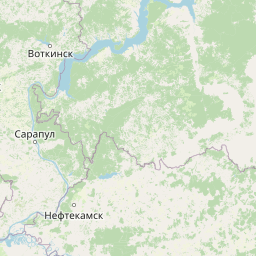
Map view of Nechkinsky National Park

Use this park location map to pinpoint Nechkinsky National Park in Russia, understand its exact geographic position, and read its mapped placement within the surrounding landscape more clearly.

Pigeon | © OpenStreetMap contributors

Location context for Nechkinsky National Park

Udmurtia
Park atlas

Compare surrounding regional terrain, river valleys, and forest ecosystems across nearby protected areas

Parks near Nechkinsky National Park and Related Protected Landscapes

Continue geographic discovery by comparing Nechkinsky National Park with adjacent river valley reserves and forested protected areas across the surrounding region. Analyzing these connected landscapes reveals broader ecological patterns and topographic variations within the middle Kama basin.
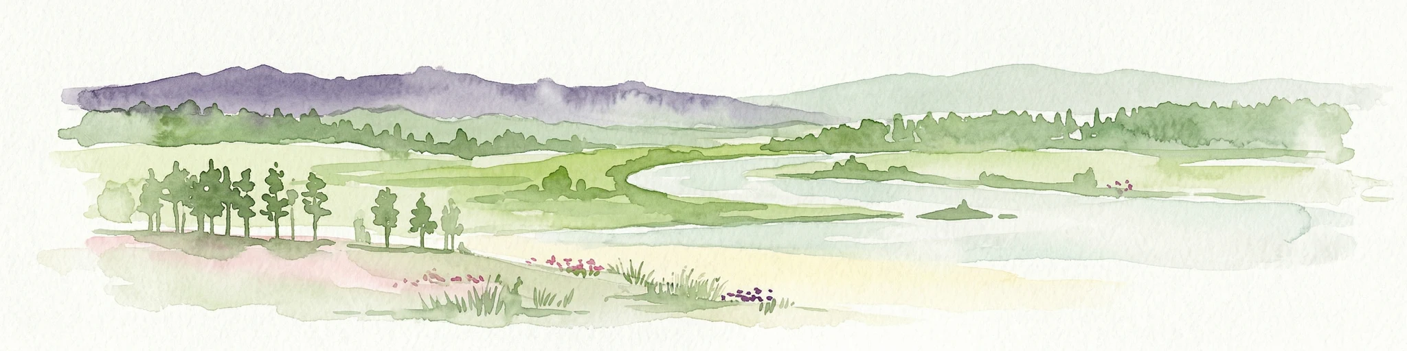
Watercolor illustration of a winding river through a valley with rolling hills and sparse vegetation under a soft sky
National parkUdmurt Republic
Mapped location lies within the park boundary#1 closest

Southwest

Nechkinsky National Park: Protected River Valleys and Wetlands in the Udmurt Republic of Russia

Geographic analysis of Kama River floodplains and forest-steppe terrain.

Nechkinsky National Park provides a critical study of river valley geography and protected ecosystems. Its unique terrain includes steep slopes; extensive floodplain terraces; and the coastal zones of the Votkinsk reservoir. This area serves as both a natural biological habitat for rare species and an important archaeological site preserving history from the Ananyino culture.

Area
208 km²
Established
1997
IUCN
II
Relief
Mixed relief
National parkTatarstan
About 114 km away#2 closest

Southwest

Nizhnyaya Kama National Park: Atlas of Tatarstan River Valley Landscapes

Examining protected forest and floodplain ecology

Nizhnyaya Kama National Park protects a significant portion of the lower Kama River valley, creating a sanctuary for diverse plant communities and wildlife. The landscape is marked by the interplay between aquatic habitats, expansive meadows, and dense upland forests, serving as a critical refuge within the industrial context of Tatarstan.

Area
266.01 km²
Established
1991
IUCN
II
Relief
Lowland
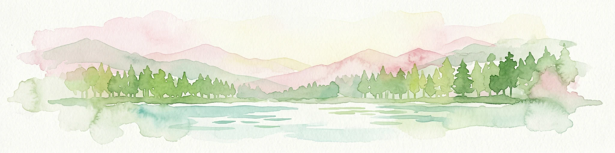
Watercolor illustration showing a river flowing through a valley with trees and distant mountains
National parkTatarstan
About 121 km away#3 closest

Southwest

Nizhnyaya Kama National Park: An Atlas of Protected Forests and Riverine Geography in Tatarstan

Examining boreal forest ecosystems along the Kama River corridor

Discover the geographic structure of Nizhnyaya Kama National Park, a protected region in Tatarstan featuring significant pine-dominated forests. This assessment details the park's isolated clusters, riverbank topography, and the ecological transition between elevated ravine systems and lowland wetlands within the Volga river basin.

Area
265.87 km²
Established
1991
IUCN
II
Relief
Lowland
National parkMari El
309 km away#4 closest

West

Mariy Chodra National Park: Regional Geography and Protected Forest Atlas

Mapped terrain, karst lake systems, and woodland corridors in Mari El

Deepen your understanding of Mariy Chodra National Park through its distinct geological and forest features. This overview examines the intersection of rolling upland blocks, sandy terrain, and the varied hydrology of the Ilet River drainage basin within the Volga region.

Area
366 km²
Established
1985
IUCN
II
Relief
Upland
Watercolor illustration showing a lake, forested hills, and mountains in the background
National parkRussia
About 329 km away#5 closest

West

Mariy Chodra National Park: Geographic and Protected Area Mapping for Russian Forests

Regional forest landscapes and protected Russian terrain

Mariy Chodra National Park is an essential protected natural area located in Russia, distinguished by its forest-dominated ecosystems. This entry provides detailed geographic context and boundary information for those studying the distribution of protected landscapes across the Russian Federation.

IUCN
II
Watercolor illustration of a mountain range with purple peaks, green hills, a single tall pine tree, and pinkish foreground vegetation
National parkChelyabinsk Oblast
About 372 km away#6 closest

Southeast

Zigalga National Park: Geography, Alpine Terrain, and Protected Wilderness Areas

A vital ecological corridor within the Chelyabinsk Oblast of Russia

Zigalga National Park serves as a pristine natural sanctuary at the crossroads of Europe and Siberia. The territory features steep mountainous ridges, expansive peat bogs, and vertical floral zonation that defines the Southern Ural landscape. This protected area provides a stable environment for rare boreal plant species and remains largely untouched by development, offering a valuable record of subarctic ecosystem health.

Area
457 km²
Established
2019
IUCN
II
Relief
Mountain
National parkChelyabinsk Oblast
About 373 km away#7 closest

Southeast

Zyuratkul National Park: Mapped Geography and Protected Landscapes of the Southern Urals

High-mountain lake terrain and diverse taiga forest ecosystems.

Zyuratkul National Park serves as a critical protected area in the Chelyabinsk Oblast, showcasing the meeting of Siberian and European ecosystems. The territory features a dramatic range of landforms including the high-mountain Lake Zyuratkul, alpine tundra on Nurgush ridge, and deep valleys containing ancient archaeological sites. This atlas entry provides a foundational view of the park's natural terrain, geographic features, and protected boundary structure.

Area
882.49 km²
Established
1993
IUCN
II
Relief
Mountain
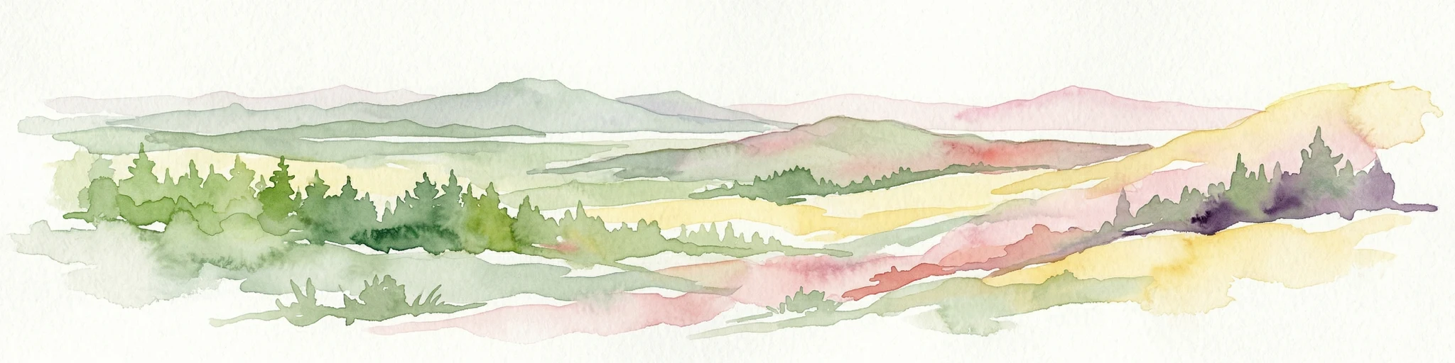
Watercolor illustration depicting rolling hills, green forests, and distant mountains under a pale sky
National parkChelyabinsk Oblast
About 374 km away#8 closest

Southeast

Zyuratkul National Park: Geography, Alpine Lakes, and Mountain Range Maps

Protected mountain wilderness in Chelyabinsk Oblast, Russia

Analyze the protected geography of Zyuratkul National Park, home to the highest point in Chelyabinsk Oblast and a distinctive alpine lake basin. Explore the park boundaries and the vertical transition from dense forest to the craggy summits of the Nurgush and Zyuratkul mountain ranges.

Area
882.49 km²
Established
1993
IUCN
II
Relief
Mountain

Common questions about visiting, size, designation, and location context for Nechkinsky National Park

Nechkinsky National Park FAQs for park facts, access, geography, and protected area context

Find quick answers about Nechkinsky National Park, including protected-area facts, park geography, trail and visitor context, and how the park fits into its surrounding country and regional landscape.
MoriAtlas Explorer

Continue Your Protected Areas Search Across the Global Atlas

Deepen your exploration by continuing the structured search for national parks and protected areas worldwide. Utilize the comprehensive filtering capabilities to compare different conservation landscapes and refine your understanding of global park geography. Discover more about the distribution and characteristics of protected natural areas.

Global natural geography
Nechkinsky National Park in Udmurtia: Protected River Valley Atlas