Mori Atlas logo
Countries

Explore the mapped boundaries and regional distribution of Montenegro's protected landscapes.

Montenegro National Parks and Protected Areas: A Geographic Atlas for Exploration

Montenegro, a unitary parliamentary republic in Southeast Europe, features a rich tapestry of protected natural areas and national parks. MoriAtlas provides a structured geographic lens through which to explore these conserved lands, offering insights into their distribution, mapped boundaries, and the regional terrain they encompass. Navigate Montenegro's diverse landscapes, from its Adriatic coastline to its mountainous interior, through a comprehensive atlas-style interface designed for geographic discovery.

Montenegro National Parks and Protected Areas: A Geographic Atlas for Exploration
Park system

National Parks in Montenegro: A Factual Protected Area Snapshot

Comparing geographic scale, establishment history, and habitat diversity across Dinaric landscapes

Map and compare regional conservation trends across the country by analyzing known records of protected areas, median park sizes, and establishment histories. Examining designation distributions, mountain habitats, and climate zones where data is available helps clarify the ecological diversity of Adriatic and Balkan terrains.

Designation distribution

National park3

Habitat distribution

Alpine meadow1
Montane forest1

Climate distribution

Alpine1
About

Explore the Mapped Geography and Protected Landscape Distribution of Montenegro

Montenegro National Parks and Protected Areas: A Geographic Atlas Overview

Montenegro serves as a vital geographic atlas entry point for understanding its national parks and protected areas. This country-level view offers a structured approach to discovering the mapped distribution of conservation landscapes across the Balkan Peninsula. Navigate Montenegro's diverse terrain through its significant protected areas, establishing a clear overview before delving into specific park details.

Montenegro is a unitary parliamentary republic in Southeast Europe on the Balkan Peninsula. With a population of approximately 623,000 and an area of 13,883 km², it borders five countries and has a coastline on the Adriatic Sea. The capital and largest city is Podgorica, while Cetinje serves as the old royal capital. The country declared independence in 2006 following the breakup of Serbia and Montenegro.

Largest city:Podgorica
Currency code:EUR
ISO code:ME
Parks count
3
Capital
Podgorica
Area
13,883 km²
Population
623,327 (2,025)

Coastal
Island
Mountainous
Landlocked
Park atlas3 parks

Explore the Mapped Geography and Conservation Landscapes of Montenegro's Natural Heritage

National Parks and Protected Areas in Montenegro: A Comprehensive Atlas View

Discover the significant national parks and protected areas that define Montenegro's diverse geography and conservation efforts. This atlas view provides a structured gateway to understanding the nation's natural reserves, allowing for detailed exploration of each protected landscape. Navigate through Montenegro's unique terrains and contribute to the growing repository of mapped natural sites.
Watercolor illustration showing mountains, a winding river, and forested areas
National park

Durmitor National Park: Dramatic Balkan Alpine Landscape & Protected Area

Explore its rugged terrain and glacial geography.

Durmitor National Park, a protected area in Montenegro, offers a spectacular alpine landscape defined by sharp limestone peaks, deep glacial valleys, and pristine mountain lakes. This national park preserves extensive old-growth forests and unique karst features, showcasing one of the Balkans' most significant wilderness areas. Its dramatic terrain and geological diversity make it a key destination for understanding regional protected lands and mountain geography.

IUCN
II
Relief
Mountain
Climate
Alpine
Scope
Terrestrial
Watercolor painting showing a mountain landscape with green forests, valleys, and distant hills
National park

Biogradska Gora National Park: Ancient Beech Forest and Protected Landscape Exploration

Discover Montenegro's oldest national park with mapped terrain and regional geography.

Biogradska Gora National Park represents a critical protected area in Montenegro, celebrated for its exceptionally well-preserved ancient beech forest. This national park features a heterogeneous terrain of rolling hills and river valleys that create a unique natural setting. The dense, old-growth canopy offers an immersive experience of a primeval forest ecosystem, providing significant value for understanding Balkan nature and protected forest dynamics. Explore the mapped boundaries and discover the distinct landscape character that defines this remarkable natural reserve.

IUCN
II
National park

Lovćen National Park: Protected National Park Landscape & Geographic Context

Mapped protected area with unique regional geography.

Dive into the detailed geography of Lovćen National Park, a designated national park in Montenegro. This protected landscape is mapped for structured exploration, revealing its specific natural terrain and its significance within the regional atlas. Understand the park's precise boundaries and its contribution to the diverse geographic tapestry of the area, providing context for further map-based discovery.

IUCN
II
Scope
Terrestrial
Water
No major water
Landscape and environment

Understand how Montenegro is shaped by terrain, ecosystems, and seasonal conditions

Montenegro geography, nature, climate, and landscape context for park-focused travel research

Explore the physical geography, natural setting, and climate patterns of Montenegro through a location-first overview built for travel research, national park discovery, and broader regional context. This section helps explain how landscapes, habitats, and environmental conditions shape what people search for, where they travel, and how they experience protected areas in Montenegro.

Montenegro geography and landscape

Montenegro is located on the Balkan Peninsula in Southeast Europe. It is bordered by Serbia to the northeast, Bosnia and Herzegovina to the northwest, Kosovo to the east, Albania to the southeast, and Croatia to the west. The country has a coastline along the Adriatic Sea to the southwest. The terrain is predominantly mountainous, with the Dinaric Alps running through the country.

Montenegro nature and environment

Montenegro features diverse natural landscapes including mountainous regions of the Dinaric Alps, coastal areas along the Adriatic Sea, and forested interior areas. The country contains several protected areas and national parks, with its varied elevation supporting different ecological zones.

Montenegro climate and seasonal conditions

Montenegro has a Mediterranean climate along the coast with hot, dry summers and mild winters, while the interior experiences continental climate with colder winters and warmer summers.

Explore this place

Related topics and popular queries

Ways to explore Montenegro

Useful phrases, related topics, and discovery prompts connected to Montenegro.
where is MontenegroMontenegro country factsMontenegro population and areaMontenegro geography and neighborsMontenegro capital cityMontenegro independence 2006Montenegro countryBalkan Peninsula nationSoutheast Europe countryMontenegro geographyMontenegro populationAdriatic Sea countryMontenegro economyMontenegro history
Park map

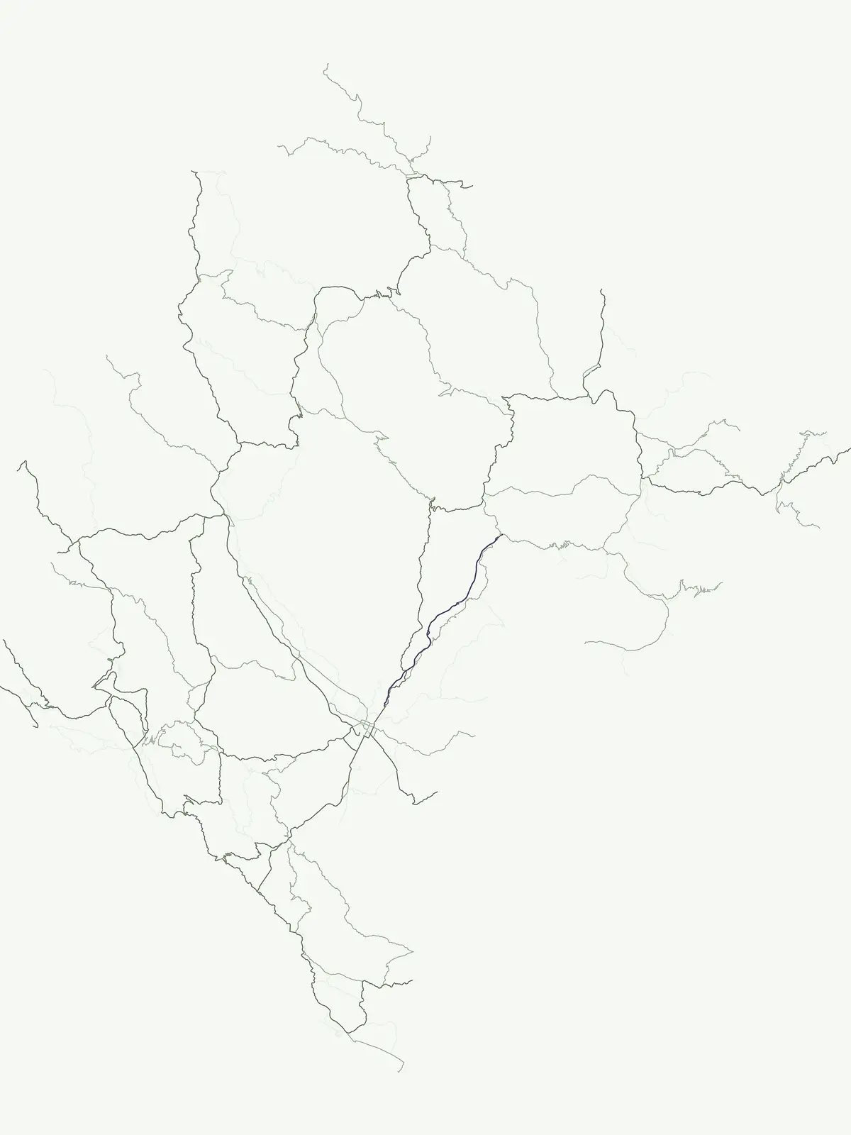
Visualize the distribution of Montenegro's national parks and protected landscapes across its Balkan Peninsula geography and Adriatic coast.

National Parks Map of Montenegro: Geographic Overview of Protected Areas

Preview the mapped locations of Montenegro's national parks and other significant protected areas, understanding their spatial arrangement within this Southeast European nation. This atlas view provides essential geographic context for exploring Montenegro's conservation landscapes and comparing park positions throughout the country.

Understanding the distribution, borders, and environmental management of Balkan protected areas.

Common Questions and Geographic Facts About National Parks in Montenegro

Reviewing common questions about Montenegro park geography provides essential context for navigating the dense network of mountain reserves across the Dinaric Alps. Clarifying these regional details helps trace the exact boundaries, protection statuses, and diverse forest zones that define these Balkan landscapes.
Other countries

Expand your atlas view, comparing protected landscapes and national park geographies across the Balkan Peninsula and wider European regions.

Explore National Parks and Protected Areas in Countries Adjacent to Montenegro and Across Southeast Europe

From Montenegro, browse adjacent country pages to explore a wider array of national parks and protected areas across the diverse Balkan Peninsula, comparing varied conservation landscapes. This country-level atlas provides structured geographic context and detailed park lists, enabling deeper exploration of regional protected area distribution and management.

Chile National Parks and Protected Areas: Geographic Atlas Explorer

Access a structured atlas view of Chile's national parks and protected natural areas. This geography-centric resource details the distribution and mapped boundaries of conservation landscapes, providing essential context for understanding the country's diverse terrain. Navigate through the protected areas to uncover their geographic significance and regional patterns within South America.

43 parks

Argentina National Parks and Protected Areas: A Comprehensive Geographic Atlas

Gain a structured overview of Argentina's national parks and protected areas. This atlas view details the geographic spread and placement of conservation landscapes throughout the country, offering a clear understanding of the nation's commitment to preserving its diverse natural environments. Facilitates exploration from a continental perspective down to individual park boundaries.

35 parks

Peru National Parks and Protected Areas: Browse the Geographic Atlas and Mapped Landscapes

Access a structured overview of Peru's national parks and protected areas, designed for geographic exploration and atlas-style discovery. Understand the distribution of conservation landscapes from the coast to the Amazon, examining their mapped boundaries and regional significance. This resource facilitates a deeper appreciation of Peru's natural terrain and its role in preserving biodiversity across diverse ecosystems.

15 parks

Bolivia National Parks and Protected Areas: Geographic Atlas and Landscape Explorer

Access a structured atlas to explore Bolivia's national parks and protected areas. Understand the geographic distribution and mapped boundaries of conservation landscapes, from the high Andes to the Gran Chaco and Amazonian plains. This resource details Bolivia's regional geography, providing essential context for its natural protected areas.

14 parks

Paraguay National Parks and Protected Areas: An Atlas for Geographic Discovery

Delve into the structured geography of Paraguay's protected areas and national parks. This atlas-style entry point offers a comprehensive overview of natural landscapes, allowing for detailed exploration of park boundaries and their distribution. Understand the unique regional context and mapped terrain across the country, providing a foundation for discovering Paraguay's conservation areas through geographic data.

4 parks

Uruguay National Parks and Protected Areas: Mapped Landscapes and Geographic Overview

Dive into the structured geography of Uruguay's protected areas. This atlas provides a unique lens to view national parks and natural reserves, highlighting their distribution and relationship to the surrounding landscape. Understand the geographic spread and context of conservation efforts across Uruguay, from coastal parks to inland natural reserves, all within a framework designed for deep exploration.

2 parks

Suriname National Parks and Protected Areas: Browse Geographic Atlas

Access a structured view of Suriname's national parks and protected areas, focusing on their geographic placement and landscape context. This atlas entry helps you understand the distribution of conservation lands within the country's vast rainforest territory, facilitating exploration of its unique natural terrain and protected regions.

2 parks

Protected area types

Continue Exploring Montenegro's Park Designation Geography and Landscape Context

Deepen your understanding of Montenegro's protected areas by continuing into the country's designation-specific routes. Each classification offers unique insights into regional geography, park boundaries, and the structured atlas of natural landscapes. Navigate through the specific categories represented in Montenegro to uncover more about its conservation strategy and the mapped terrain of its protected territories.

Montenegro Park Designations Overview
MoriAtlas Explorer

Continue Your Global Geographic Exploration with MoriAtlas Park Discovery

Dive deeper into the world's protected landscapes and national parks through MoriAtlas's structured atlas interface. Discover how continents and countries are organized, and how individual park geography fits into the broader map. Our platform is built for understanding the distribution and context of protected areas worldwide, facilitating your journey through global natural geography.

Global natural geography