Mori Atlas logo
Protected areaAi-Ais/Richtersveld Transfrontier Park

Mapping the unique arid terrain and cross-border conservation of this Southern African protected area.

Ai-Ais/Richtersveld Transfrontier Park: Protected Landscape and Geographic Context in Namibia

Ai-Ais/Richtersveld Transfrontier Park represents a crucial protected area bridging Namibia and South Africa, offering a unique perspective on arid conservation landscapes. Situated in Southern Africa, this transfrontier park showcases distinctive desert geography and vast protected boundaries that are vital for regional ecological continuity. Explore its mapped terrain to understand the geological formations and the expansive context of this cross-border conservation initiative.

transfrontier parkNamibiaSouth Africadesert conservationcross-border protected areaSouthern Africa

Ai-Ais/Richtersveld Transfrontier Park

Protected area

Park overview

Structured park overview, official facts, and landscape profile for Ai-Ais/Richtersveld Transfrontier Park

Ai-Ais/Richtersveld Transfrontier Park park facts, protected area profile, and essential visitor context

Review the core facts for Ai-Ais/Richtersveld Transfrontier Park, including designation, size, terrain, visitor scale, habitats, and operating context in one park-focused overview.
Protection and recognition

Mapping transboundary conservation borders and terrestrial status for global park research

Ai-Ais/Richtersveld Transfrontier Park Protected Area Status and Global Records

Researchers can evaluate the designated terrestrial protection status and international management frameworks established for Ai-Ais/Richtersveld Transfrontier Park. Cross-boundary geographic records provide critical context for understanding how shared terrestrial ecosystems are documented on a global scale.

Protection details

Protection scope
Terrestrial
Transboundary protection
Yes
Monthly climate preview

Long-term monthly temperature and precipitation patterns sampled from representative terrain coordinates

Ai-Ais/Richtersveld Transfrontier Park Climate Normals and Average Temperatures

Ai-Ais/Richtersveld Transfrontier Park experiences a measured annual climate rhythm ranging from cool winter minimums to prolonged summer heat alongside consistently low daily precipitation. Examining the complete monthly temperature and precipitation normals reveals detailed long-term variations across the coordinate sample.
Annual mean20 °C
15 °C25 °C
Jan24°
Feb25°
Mar24°
Apr21°
May18°
Jun15°
Jul15°
Aug15°
Sep18°
Oct20°
Nov22°
Dec23°
Warmest month
February

24.7 °C

Coolest month
July

14.6 °C

Wettest month
February

0.4 mm/day

Driest month
December

0.2 mm/day

Park location guide

Geography guide, regional context, and park location map for Ai-Ais/Richtersveld Transfrontier Park

Ai-Ais/Richtersveld Transfrontier Park park geography, regions, and map view in Namibia

Understand where Ai-Ais/Richtersveld Transfrontier Park sits in Namibia through a broader geographic reading of the surrounding landscape, nearby location context, and its mapped position within the national park landscape.

How Ai-Ais/Richtersveld Transfrontier Park fits into Namibia

Namibia is a sovereign country in Southern Africa that gained independence from South Africa in 1990. It is the driest country in sub-Saharan Africa, characterized by the Namib Desert along its coast. The population is approximately 3 million, with Windhoek as the capital and largest city. Namibia operates as a unitary semi-presidential republic with a multi-party system.

Wider geography shaping Ai-Ais/Richtersveld Transfrontier Park in Namibia

Namibia occupies 825,615 km2 in Southern Africa, making it the 34th largest country in the world. It is bordered by the Atlantic Ocean to the west, Angola and Zambia to the north, Botswana to the east, and South Africa to the south. The country features the Namib Desert along its coastal region, with varied terrain including savannas, mountains, and plateaus inland. A notable geographic feature is that Zimbabwe lies less than 200 metres away along the Zambezi river near Kazungula in the northeast.

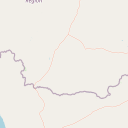
Map view of Ai-Ais/Richtersveld Transfrontier Park

Use this park location map to pinpoint Ai-Ais/Richtersveld Transfrontier Park in Namibia, understand its exact geographic position, and read its mapped placement within the surrounding landscape more clearly.

Pigeon | © OpenStreetMap contributors
Park atlas

Discover more transfrontier parks, desert conservation landscapes, and regional protected areas across Southern Africa.

Explore Related National Parks and Protected Areas Near Ai-Ais/Richtersveld Transfrontier Park

Continue your geographic exploration beyond Ai-Ais/Richtersveld Transfrontier Park by comparing other protected areas within the surrounding Southern African region. Browse mapped park geography to understand the regional spread of transfrontier conservation and desert landscapes, providing valuable context for similar park systems.
Wildlife reserveNamibia
Mapped park locations coincide#1 closest

ǀAi-ǀAis Hot Springs Game Park: A Namibian Wildlife Reserve Bridging Desert and Geothermal Landscapes

Explore mapped boundaries and regional park geography.

ǀAi-ǀAis Hot Springs Game Park represents a vital protected area within Namibia's arid southern reaches. This wildlife reserve is characterized by its namesake hot springs, which foster unique riparian ecosystems against a backdrop of rugged desert mountains and the impressive Fish River canyon. Its inclusion in a transfrontier conservation effort underscores its significance for regional landscape mapping and the preservation of stark desert beauty and geothermal features.

IUCN
II
Relief
Mixed relief
Climate
Arid
Access
Remote access
National parkNorthern Cape
Mapped location lies within the park boundary#2 closest

South

Richtersveld National Park: Geographic and Protected Area Map Context

Exploring arid volcanic landscapes in Northern Cape

Richtersveld National Park represents a vast, complex protected area defined by its rugged mountain ridges and arid desert ecology. Centered in South Africa's Northern Cape, the landscape is shaped by the Orange River and high-altitude volcanic formations. This profile offers detailed insight into the park's natural boundaries, endemic plant habitats, and its role as a living cultural landscape within the wider regional geography.

Area
1,624.45 km²
Established
1991
Relief
Mountain
Climate
Arid
National parkNamibia
About 179 km away#3 closest

Northwest

Namib-Naukluft National Park: Namibia's Iconic Desert Landscape and Protected Terrain

Explore its ancient dunes, Naukluft mountains, and coastal geography.

Namib-Naukluft National Park is a colossal protected area in Namibia, holding the distinction of being Africa's largest national park. This park is renowned for its iconic sand dunes, particularly at Sossusvlei, which are among the highest in the world and display dramatic colors due to iron oxidation. The landscape also features the rugged Naukluft Mountains and vital coastal fog zones, creating a diverse arid environment. Delve into the mapped geography and unique terrain of this ancient desert setting, understanding its protected landscape significance within Namibia's atlas.

Area
49,768 km²
Established
1907
IUCN
II
Relief
Mixed relief
National parkNorthern Cape
About 208 km away#4 closest

South

Namaqua National Park: Protected Landscape and Geographic Atlas Details

Explore Northern Cape's National Park mapped context.

Gain insight into Namaqua National Park, a protected national park situated in the expansive Northern Cape region of South Africa. This resource provides detailed geographic context, focusing on its mapped protected landscape and unique regional features. Understand its role as a distinct natural area for atlas-based exploration and geographic discovery within South Africa's diverse terrain.

Area
1,368.18 km²
Established
2001
Climate
Arid
Access
Moderate access
Nature reserveNamibia
About 219 km away#5 closest

North

Tirasberge Nature Reserve: Geography and Protected Landscapes of Southern Namibia

A compact wilderness spanning mountain massifs and desert frontiers.

The Tirasberge region serves as a vital protected area in southern Namibia, showcasing a diverse intersection of mountain ridges, red sand dunes, and arid savanna plains. This reserve provides a unique look into a stratified landscape where high elevation terrain meets the lower reaches of the Namib dune sea, creating a complex corridor for ecology and history. Understanding the reserve reveals how mountain-to-savanna transitions define the rugged character of this southern African conservation zone.

Area
1,250 km²
Established
1998
Relief
Mountain
Climate
Arid
National parkNamibia
About 246 km away#6 closest

Northwest

Tsau ǁKhaeb National Park: Namibia's Protected Area and Geographic Identity

Mapped natural landscape and park boundaries in Namibia.

Tsau ǁKhaeb National Park represents a vital protected area within Namibia, offering deep insights into the country's unique arid environments. This park detail page serves as an atlas entry focused on its mapped geography, highlighting its protected boundaries and its role within the broader landscape of Southern Africa. Explore the inherent geographic characteristics and conservation significance of this national park.

Marine protected areaNamibia
About 264 km away#7 closest

Northwest

Meob-Chamais Islands’ Marine Protected Area: Mapped Coastal and Marine Sanctuary

A protected Atlantic marine region in coastal Namibia

Spanning from Meob Bay to Chamais Bay, this expansive marine protected area preserves the vital intersection between Namibia's arid desert shoreline and the cold, productive waters of the Atlantic. The region comprises ten primary islands and numerous islets that provide essential breeding platforms for bank cormorants and African penguins. This site remains a foundational element of regional coastal conservation and marine geography.

Area
20,000 km²
Established
2009
IUCN
VI
Scope
Marine
National parkNorthern Cape
About 283 km away#8 closest

East

Augrabies Falls National Park: A South African National Park Defined by Granite Gorge and Semi-Desert Terrain

Explore the mapped natural landscape and protected boundaries.

Augrabies Falls National Park in South Africa's Northern Cape Province is a key protected area known for its thundering waterfall on the Orange River and the profound granite gorge carved over millennia. The park's semi-desert environment showcases the distinctive quiver trees and geological landmarks like Moon Rock, offering a unique landscape context. Understand its protected status and geographic significance within the arid Nama-Karoo biome through detailed mapping and landscape information.

Area
820 km²
Established
1966
IUCN
II
Relief
Upland

Common questions about visiting, size, designation, and location context for Ai-Ais/Richtersveld Transfrontier Park

Ai-Ais/Richtersveld Transfrontier Park FAQs for park facts, access, geography, and protected area context

Find quick answers about Ai-Ais/Richtersveld Transfrontier Park, including protected-area facts, park geography, trail and visitor context, and how the park fits into its surrounding country and regional landscape.
MoriAtlas Explorer

Continue Your Protected Areas Search Across the Global Atlas

Deepen your exploration by continuing the structured search for national parks and protected areas worldwide. Utilize the comprehensive filtering capabilities to compare different conservation landscapes and refine your understanding of global park geography. Discover more about the distribution and characteristics of protected natural areas.

Global natural geography