Mori Atlas logo
Wildlife reserveAl Saleel National Park

Discover the mapped boundaries and regional geography of this protected acacia woodland.

Al Saleel National Park: Oman's Vital Wildlife Reserve and Acacia Forest Landscape

Al Saleel National Park, a protected wildlife reserve in eastern Oman, safeguards a rare acacia forest ecosystem covering 220 square kilometers. This park is a critical refuge for endangered Arabian wildlife, including the Arabian gazelle and Omani wild cat, representing a significant conservation effort in a region where such habitats are scarce. Its unique terrain and landscape context highlight the ecological transition from desert to protected woodland, making it an important natural landmark within the Arabian Peninsula's geography.

acacia forestArabian wildlifeOman national parksprotected forestendemic speciesEastern Arabia

Al Saleel National Park

Wildlife reserve

Park overview

Structured park overview, official facts, and landscape profile for Al Saleel National Park

Al Saleel National Park park facts, protected area profile, and essential visitor context
Review the core facts for Al Saleel National Park, including designation, size, terrain, visitor scale, habitats, and operating context in one park-focused overview.

About Al Saleel National Park

Al Saleel National Park represents Oman's dedication to preserving its natural landscapes and the wildlife that depends on them. Located in the Sharqiyah region, the park encompasses approximately 220 square kilometers of predominantly acacia forest, a habitat type that is increasingly rare across the Arabian Peninsula. The park's protected status ensures the survival of species that might otherwise face extinction in the face of regional development pressures. Beyond its ecological significance, the park serves as an educational resource and a destination for those interested in experiencing Oman's natural heritage. The acacia trees that dominate the landscape create a shaded environment that supports a diverse community of organisms, from insects and birds to larger mammals. This forested habitat contrasts sharply with the desert environments that characterize much of Oman, making Al Saleel a distinctive element in the country's environmental portfolio.

Quick facts and research context for Al Saleel National Park

Al Saleel National Park is situated in the Sharqiyah Governorate of eastern Oman, approximately 22.363°N latitude and 59.197°E longitude. The protected area spans 220 square kilometers of predominantly acacia woodland, representing a distinctive forested habitat within the generally arid Arabian Peninsula landscape. The park is home to several rare and regionally significant species including the Arabian gazelle, the Omani wild cat locally known as Al Senmar, red fox, and the Egyptian eagle. This combination of forested habitat and specialized species makes Al Saleel a key conservation area within Oman's national park system.

Park context

Deeper park guide and search-rich context for Al Saleel National Park

Al Saleel National Park history, landscape, wildlife, and travel context
Explore Al Saleel National Park through its history, landscape character, ecosystems, wildlife, conservation priorities, cultural context, and seasonal travel timing in a structured park guide built for atlas discovery and search intent.

Why Al Saleel National Park stands out

Al Saleel National Park is best known for its distinctive acacia forest ecosystem, a rare habitat type within the Arabian Peninsula that supports remarkable biodiversity. The park provides crucial protection for the Arabian gazelle, a species that has faced significant population pressures across its range, as well as the elusive Omani wild cat, a subspecies of the wild cat that is endemic to this region. The acacia woodlands create a microhabitat that supports predator-prey relationships and ecological processes that have largely disappeared from surrounding areas due to agricultural expansion and development.

Al Saleel National Park history and protected-area timeline

The Wikipedia source provides limited detail on the establishment history of Al Saleel National Park. The park was designated as a protected area to preserve the unique acacia forest ecosystem and the wildlife populations it supports. Oman's approach to conservation has evolved significantly in recent decades, with the establishment of protected areas like Al Saleel reflecting a broader commitment to sustainable resource management and biodiversity preservation across the sultanate.

Al Saleel National Park landscape and geographic character

The landscape of Al Saleel National Park is defined by its acacia forest ecosystem, a rare and distinctive feature within the Arabian Peninsula's predominantly desert terrain. The acacia trees create a semi-forested environment that provides shade, habitat structure, and ecological function across the park's 220 square kilometer extent. This woodland landscape represents an ecological transition zone where desert conditions give way to more productive forested habitat, supported by local hydrological conditions that allow trees to persist. The terrain likely includes gentle slopes and wadi systems that channel seasonal rainfall through the forest, sustaining the acacia community and the wildlife that depends on it.

Al Saleel National Park ecosystems, habitats, and plant life

The nature of Al Saleel National Park centers on its acacia forest ecosystem, which represents one of the more productive habitat types in the Arabian region. Acacia trees provide the structural foundation for a complex ecological community, supporting insect populations, nesting birds, and foraging mammals. The forest creates a cooler microclimate than surrounding desert areas, reducing evaporation and allowing moisture to persist in the soil. This environmental gradient from desert to forest supports species with different ecological requirements and contributes to the park's overall biodiversity. The protected status of the area allows natural processes to continue with minimal human disturbance, maintaining ecological relationships that have evolved over millennia.

Al Saleel National Park wildlife and species highlights

Al Saleel National Park supports several notable wildlife species that depend on its acacia forest habitat. The Arabian gazelle represents one of the park's flagship species, a graceful antelope adapted to arid environments that finds refuge in the park's woodland. The Omani wild cat, locally called Al Senmar, is a subspecies of the wild cat that has made its home in this region, hunting among the acacia trees and utilizing the forest cover for shelter. Red foxes are present in the park, utilizing the diverse habitat for hunting and denning sites. The Egyptian eagle, a scavenger and bird of prey, soars above the forest canopy, utilizing thermals and searching for carrion. These species represent a functioning predator-prey community that depends on the integrity of the acacia forest ecosystem.

Al Saleel National Park conservation status and protection priorities

Al Saleel National Park serves an important conservation function by protecting one of the few remaining acacia forest habitats in Oman and the Arabian Peninsula. The park provides refuge for species that have experienced significant range contraction, including the Arabian gazelle and Omani wild cat. Protecting this forest ecosystem also preserves ecological processes including nutrient cycling, soil stabilization, and water regulation that benefit both wildlife and surrounding landscapes. The park's designation as a national park signals Oman's recognition that natural heritage preservation is essential to the country's long-term environmental health. Conservation efforts within the park likely focus on maintaining habitat integrity, monitoring wildlife populations, and managing human activities to minimize negative impacts.

Al Saleel National Park cultural meaning and human context

The Wikipedia source does not provide detailed information about human cultural connections to the Al Saleel landscape. The local name Al Senmar for the Omani wild cat suggests that local communities have historically recognized and interacted with the wildlife present in the area. The acacia forest may have provided resources such as fodder, firewood, and other materials for regional communities in traditional land use systems. The park's establishment represents a modern approach to land management that balances conservation with sustainable use, continuing a relationship between local communities and this distinctive landscape.

Top sights and standout views in Al Saleel National Park

Al Saleel National Park's primary highlight is its acacia forest ecosystem, a rare and ecologically significant habitat in the Arabian context. The park protects populations of endangered Arabian gazelles and the regionally endemic Omani wild cat, making it a critical area for wildlife conservation in Oman. The contrast between the park's wooded environment and surrounding desert landscapes creates a striking visual distinction that emphasizes the ecological importance of this protected area. Birdlife including Egyptian eagles adds another dimension to the park's biodiversity, with raptors utilizing the forest and airspace for hunting and nesting.
Park location guide

Geography guide, regional context, and park location map for Al Saleel National Park

Al Saleel National Park park geography, regions, and map view in Oman
Understand where Al Saleel National Park sits in Oman through a broader geographic reading of the surrounding landscape, nearby location context, and its mapped position within the national park landscape.

How Al Saleel National Park fits into Oman

Oman, officially the Sultanate of Oman, is a country in the southeastern Arabian Peninsula. It borders Saudi Arabia, the UAE, and Yemen, and has coastline along the Arabian Sea and Gulf of Oman. Ruled by the Al Bu Said dynasty since 1744, it is the oldest independent state in the Arab world and was historically a regional power controlling territory across the Persian Gulf to East Africa.

Wider geography shaping Al Saleel National Park in Oman

Oman occupies the southeastern Arabian Peninsula in West Asia. It shares land borders with Saudi Arabia, the UAE, and Yemen. The country has coastal access to the Arabian Sea to the southeast and the Gulf of Oman to the northeast. The Hajar Mountains run through the northern region, while the interior consists of desert plains and rocky plateaus. The Musandam Peninsula is an exclave separated from the rest of Oman by UAE territory.

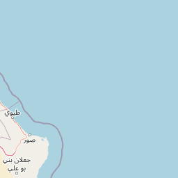
Map view of Al Saleel National Park

Use this park location map to pinpoint Al Saleel National Park in Oman, understand its exact geographic position, and read its mapped placement within the surrounding landscape more clearly.

Pigeon | © OpenStreetMap contributors
Park atlas

Explore the broader regional geography and compare unique protected landscapes adjacent to Al Saleel National Park.

Discover Nearby Protected Areas and National Parks around Al Saleel National Park in Oman
Browse other national parks and protected areas in Oman, expanding your discovery from Al Saleel National Park into nearby conservation landscapes and unique acacia forest ecosystems. Compare the regional geography and protected area spread across Eastern Arabia, revealing broader patterns of wildlife habitat and conservation value.
Nature reserveDubai

Dubai Desert Conservation Reserve: Nature Reserve, Mapped Geography, and Protected Landscape Context

Explore the natural terrain and conservation atlas of this UAE protected area.

This page details the Dubai Desert Conservation Reserve, a designated nature reserve situated within the geographic scope of Dubai, United Arab Emirates. Dive into its mapped boundaries, understand its role as a protected landscape, and gain insight into its unique natural terrain. MoriAtlas provides structured data to explore the park's place within regional geography and the broader atlas of protected areas.

Area
225 km²
Established
2003
Relief
Lowland
Climate
Arid
Nature reserveEmirate of Dubai

Al Wohoosh Desert Conservation Reserve Nature Reserve: Mapped Protected Landscape

Desert terrain and geographic context in the Emirate of Dubai.

Delve into the Al Wohoosh Desert Conservation Reserve, a key protected natural area situated in the Emirate of Dubai. This entry focuses on its mapped geography, showcasing the desert landscape and its protected boundaries. Gain structured insights into its role as a nature reserve and its contribution to understanding regional conservation landscapes and mapped terrain.

Area
15.06 km²
Established
2014
Relief
Lowland
Climate
Arid
Nature reserveDubai

Al Marmoom Desert Conservation Reserve: Nature Reserve and Desert Landscape in Dubai

Mapped Geography and Protected Area Context

Explore the Al Marmoom Desert Conservation Reserve, a designated nature reserve located near Dubai. This protected area is crucial for understanding the region's desert geography and landscape. MoriAtlas provides detailed mapping and geographic context, allowing for in-depth study of its protected boundaries and its significance within the UAE's conservation landscape.

Area
0.4 km²
Established
2018
Relief
Lowland
Climate
Arid
Nature reserveDubai

Ras Al Khor Nature Reserve: Explore Dubai's Key Protected Landscape and Geographic Features

Mapped natural reserve boundaries and regional context in Dubai.

Delve into Ras Al Khor, a protected nature reserve offering a unique perspective on Dubai's natural geography. This detail entry focuses on its status as a protected landscape, providing clear atlas-style information about its mapped extent and its role within the regional environmental context. Understand the geographic significance of Ras Al Khor as a key area for exploring conservation landscapes within the UAE.

Area
13 km²
Established
1998
Visitors
90K annual
Relief
Lowland
National parkBalochistan

Hingol National Park: Pakistan's Unique Protected Landscape and Geological Atlas

Discover dramatic rock formations and coastal geography.

Hingol National Park stands as a monumental protected landscape within Balochistan, Pakistan, offering an unparalleled atlas view of geological diversity. Renowned for its hoodoos like the Princess of Hope and the Balochistan Sphinx, the park also features active mud volcanoes and striking coastal semi-desert terrain. The confluence of the Hingol River with the Arabian Sea creates important wetland habitats. This national park provides a rich context for exploring unique natural formations and regional geography, making it a significant point of discovery within Pakistan's protected areas.

Area
6,100 km²
Established
1988
IUCN
II
Relief
Mixed relief
National parkGujarat

Marine National Park, Gulf of Kutch: A Protected Coastal Landscape in Gujarat, India

Explore its mapped boundaries and regional geography.

Marine National Park, Gulf of Kutch is a designated national park located in the Gujarat region of India. This page serves as an atlas-centric resource for understanding the park's protected landscape, its position within the broader geography of Western India, and its mapped natural features. Discover the distinct protected-area characteristics and regional context that define this important Indian national park.

Area
162.89 km²
Established
1982
IUCN
II
Relief
Lowland
National parkBalochistan

Hazarganji-Chiltan National Park: Balochistan's Mountain Protected Area & Landscape

Explore protected wildlife habitats and unique terrain in the Sulaiman Mountains.

Hazarganji-Chiltan National Park represents a significant protected landscape within Balochistan, Pakistan. Designated as a national park, it is fundamental to the conservation of the Chiltan ibex and Sulaiman Markhor, showcasing a unique arid mountain ecosystem. The park's terrain encompasses a transition from desert conditions to higher juniper forests, offering a detailed case study in regional geography and protected area management. Understanding Hazarganji-Chiltan National Park provides essential context for the mapped distribution of critical wildlife habitats in the Sulaiman Mountains range.

Area
155.55 km²
Established
1980
IUCN
II
Relief
Mountain
National parkBalochistan

Takatu National Park: Balochistan's Mountainous National Park and Protected Landscape

Explore the park's mapped terrain and Sulaiman markhor habitat.

Takatu National Park represents a significant protected landscape in the highlands of Balochistan, Pakistan. Established in 2025, this national park features the dramatic mountainous terrain dominated by Koh-i-Takatu, the region's third-highest peak. The park's boundaries encompass critical habitat for the endangered Sulaiman markhor, contributing to a vital conservation corridor. Its geography offers a distinctive semi-arid mountain character, distinct from other protected areas in Pakistan, making it a notable site for atlas-driven exploration and understanding of regional biodiversity.

Area
135.246 km²
Established
2025
IUCN
II
Relief
Mountain

Common questions about visiting, size, designation, and location context for Al Saleel National Park

Al Saleel National Park FAQs for park facts, access, geography, and protected area context
Find quick answers about Al Saleel National Park, including protected-area facts, park geography, trail and visitor context, and how the park fits into its surrounding country and regional landscape.
MoriAtlas Explorer

Continue Your Protected Areas Search Across the Global Atlas

Deepen your exploration by continuing the structured search for national parks and protected areas worldwide. Utilize the comprehensive filtering capabilities to compare different conservation landscapes and refine your understanding of global park geography. Discover more about the distribution and characteristics of protected natural areas.

Global natural geography