Mori Atlas logo
Marine protected areaBanco de Galicia

Understanding the bathymetric profile, cold-water coral reefs, and Atlantic marine terrain

Banco de Galicia Marine Protected Area: Mapping the Submerged Seamount and Deep-Sea Geography

Banco de Galicia functions as a distinct underwater seamount, or guyot, rising from abyssal plains in the northeastern Atlantic Ocean. Located approximately 200 kilometers from the Galician coast, this marine protected area reveals a complex volcanic landscape shaped by basaltic crust and carbonate-rich sediments. The submerged environment sustains unique cold-water coral communities, including Lophelia pertusa, alongside diverse deep-sea fish, shark, and ray species.

submarine seamountguyotdeep-sea ecosystemcold-water coral reefLophelia pertusaNatura 2000

Banco de Galicia

Marine protected area

Park overview

Structured park overview, official facts, and landscape profile for Banco de Galicia

Banco de Galicia park facts, protected area profile, and essential visitor context

Review the core facts for Banco de Galicia, including designation, size, terrain, visitor scale, habitats, and operating context in one park-focused overview.

About Banco de Galicia

Banco de Galicia is a prominent underwater mountain in the northeastern Atlantic Ocean, located west of Galicia in northwestern Spain. Positioned about 200 kilometers offshore from Cape Finisterre, it represents one of the most significant offshore bathymetric features in Iberian waters. Unlike a typical seamount, Banco de Galicia is classified as a guyot, meaning its summit has been planed off, possibly by ancient wave action or geological processes, leaving a relatively flat-topped structure that now lies far beneath the surface.

The bank's shallowest plateau spans roughly 6,200 square kilometers and sits between 650 and 1,500 meters deep, while an irregular eastern peak rises some 600 meters above the surrounding seafloor. To the north and northwest, the terrain slopes gradually down to the abyssal zone, reaching depths near 5,000 meters. A channel approximately 2,500 meters deep separates Banco de Galicia from the adjacent continental shelf, reinforcing its ecological isolation from shallower coastal ecosystems.

Geologically, the seamount is built from basaltic lavas originating from oceanic crust, overlain by thick layers of sediment that have accumulated over millions of years. Much of this sediment consists of the calcareous shells of foraminifera, microscopic marine organisms whose skeletal remains coat the slopes in fine carbonate ooze. This substrate, combined with strong deep-sea currents, provides the foundation for highly specialized benthic communities.

Ecologically, Banco de Galicia has become recognized as a hotspot of deep-sea biodiversity in the northeast Atlantic. Cold-water coral reefs, dominated by the branching species Lophelia pertusa, create three-dimensional habitat structures that shelter sponges, gorgonians, sea stars, and many other invertebrates. These reefs support a wide variety of fish, deep-sea crabs, and other organisms, marking the bank as an important ecological island in the open ocean. Conservation interest in the site has grown steadily, and Banco de Galicia is now formally recognized through the European Natura 2000 network.

Quick facts and research context for Banco de Galicia

Banco de Galicia is a guyot-style seamount in the northeastern Atlantic, about 200 km west of Cape Finisterre on the Galician coast of Spain. Its shallowest zones span roughly 6,200 square kilometers and lie between 650 and 1,500 meters below the surface, while surrounding abyssal areas plunge to about 5,000 meters. The structure is composed of basaltic oceanic crust capped by sediments derived largely from foraminifer shells.

The site is recognized as both a Special Area of Conservation (ZEC) and a Special Protection Area for Birds (ZEPA) under the European Natura 2000 framework, with cold-water coral reefs, deep-sea fish communities, and marine mammals among its most notable ecological assets.

Protection and recognition

Examine the recorded marine protection scope and international recognition context.

Banco de Galicia Protection Status and Marine Protected Area Designation

Marine protection parameters for Banco de Galicia outline the documented conservation scope and regulatory framework governing the area. Structured facts provide clear access to official designation records and international recognition details.

Protection details

Protection scope
Marine
Transboundary protection
No
Park context

Deeper park guide and search-rich context for Banco de Galicia

Banco de Galicia history, landscape, wildlife, and travel context

Explore Banco de Galicia through its history, landscape character, ecosystems, wildlife, conservation priorities, cultural context, and seasonal travel timing in a structured park guide built for atlas discovery and search intent.

Why Banco de Galicia stands out

Banco de Galicia is best known for its cold-water coral reefs built around Lophelia pertusa, which create habitat structures for a wide range of deep-sea organisms. The bank supports at least 86 fish species, including deep-dwelling sharks such as Dalatias licha and rays like Dipturus batis, alongside sponges, gorgonians, sea stars, and commercially important deep-sea crabs. The site is also recognized for the dramatic bathymetric shift from shallow guyot summits to surrounding abyssal plains, producing ecological communities that differ sharply from both the nearby continental shelf and the deep ocean floor.

Banco de Galicia history and protected-area timeline

Banco de Galicia remained poorly known for much of the modern era because it lies in relatively deep, open Atlantic waters far from the coast. Scientific information about the seamount and its ecosystems was sparse, and only a limited number of in situ biological investigations had been carried out before the early twenty-first century.

Public and scientific awareness of the bank changed dramatically following the 2002 sinking of the oil tanker Prestige off the Galician coast. The disaster prompted new interest in the surrounding marine environment and brought attention to the largely unexplored Banco de Galicia. In the aftermath, researchers began investigating the region more thoroughly, which in turn revealed the ecological importance of its coral communities and deep-sea fauna.

These investigations eventually led to formal conservation recognition. The site was proposed and accepted as a Site of Community Importance (LIC), and ultimately designated as both a Special Area of Conservation (ZEC) and a Special Protection Area for Birds (ZEPA). Environmental organizations, particularly WWF, urged Spanish authorities to implement the protections associated with the European Habitats Directive and to consider further designation within international frameworks such as the OSPAR convention.

Banco de Galicia landscape and geographic character

Banco de Galicia is defined by an extraordinary vertical profile beneath the ocean surface. Although invisible from shore, the seamount forms a dramatic underwater landscape, rising thousands of meters above the abyssal plains surrounding it. The shallowest portion of the bank, sometimes described as the summit plateau, spans about 6,200 square kilometers and lies between 650 and 1,500 meters below sea level.

To the east, the terrain rises irregularly into a peak about 600 meters tall, while to the north and northwest it slopes down gradually from depths around 1,000 meters to the abyssal zone. The bank is separated from the Galician continental shelf by a deep channel reaching roughly 2,500 meters, isolating the seamount's submarine topography from coastal influences.

The flanks of the seamount are steep in places, dropping abruptly to depths of up to 5,000 meters. Geologically, this landscape is composed of basaltic oceanic crust, smoothed and partially buried by carbonate-rich sediments derived from the accumulated shells of foraminifera. The result is an undulating submerged terrain shaped by both volcanic origin and long-term biological sedimentation.

Banco de Galicia ecosystems, habitats, and plant life

Banco de Galicia hosts a remarkable concentration of deep-sea ecosystems that differ significantly from both the nearby continental shelf and the abyssal plain. The combination of elevated topography, hard basaltic substrate, sediment-rich slopes, and strong currents creates conditions for diverse benthic communities dominated by filter-feeding organisms such as sponges, cold-water corals, gorgonians, and sea stars.

The bank's cold-water coral reefs, built primarily by Lophelia pertusa, are among its most ecologically important features. These corals form branching frameworks that provide habitat complexity in an otherwise relatively uniform deep-sea environment, enabling many other species to settle, feed, and shelter within the reef structure.

Soft sediments on the slopes are dominated by foraminiferal shell accumulations, which influence both the chemistry and texture of the seafloor. The result is a mosaic of habitats, from rocky and biogenic reef outcrops to muddy depositional zones, supporting very distinct ecological communities across relatively short distances.

Banco de Galicia wildlife and species highlights

The wildlife of Banco de Galicia is characterized by deep-sea specialists that thrive around the seamount's complex bathymetry. Approximately 86 fish species have been documented around the bank, including 11 species of elasmobranchs such as sharks and rays. Notable species include Dalatias licha, a deep-dwelling shark, and Dipturus batis, a skate that has been proposed as a threatened species under the OSPAR convention for the northwest Atlantic.

Other important teleost fish recorded in the area include Epigonus telescopus, Lepidion eques, Malacocephalus laevis, and Trachyscorpia cristulata. The benthic invertebrate community is equally diverse, with sponges, sea stars, and gorgonians abundant in filter-feeding zones, while predatory crustaceans roam the slopes. Among these, the deep-sea crab Chaceon affinis stands out for its commercial fishing interest.

Marine mammals such as cetaceans, sea turtles, and seabirds are also associated with the bank, taking advantage of the productivity and bathymetric complexity that the seamount creates in otherwise open ocean waters.

Banco de Galicia conservation status and protection priorities

Banco de Galicia is recognized as an ecologically valuable site in need of formal protection, though the regulatory framework surrounding the bank is still evolving. Following the research surge after the Prestige oil spill, the site was proposed as a Site of Community Importance (LIC) and later designated within the European Natura 2000 network as both a Special Area of Conservation (ZEC) and a Special Protection Area for Birds (ZEPA).

Despite this recognition, scientific information about the bank's ecosystems remains limited. Only a handful of in situ biological studies have been completed, and the anthropogenic impacts on the seamount, including potential effects from deep-sea fisheries targeting crustaceans and sharks with longlines, have not yet been fully evaluated.

Conservation organizations such as WWF have called on the Spanish government to exercise its authority in offshore conservation and to complete the necessary steps to align the site with the European Habitats Directive. Additional proposals have suggested designation as a Marine Protected Area under the OSPAR convention, which would help integrate the bank into broader international efforts to protect the northeast Atlantic marine environment.

Banco de Galicia cultural meaning and human context

Banco de Galicia derives its name from the Galician coast of northwestern Spain, the closest major land boundary to the submerged seamount. Although the feature itself lies far offshore in deep international-style Atlantic waters, it has become part of the regional identity tied to Galicia's strong maritime heritage. The Prestige oil tanker disaster of 2002, although a tragedy for the Galician coastline, became a turning point that brought public attention to the broader offshore ecosystems, including Banco de Galicia, and to the cultural importance of the region's sea.

Top sights and standout views in Banco de Galicia

Banco de Galicia stands out as one of the most ecologically distinctive offshore features in the northeastern Atlantic. Its cold-water coral reefs, dominated by Lophelia pertusa, create habitat structures in deep, cold waters that support a striking diversity of invertebrates and fish, including deep-dwelling sharks and rays.

The combination of dramatic bathymetry, basaltic geology, and foraminifer-rich sediments produces ecological communities markedly different from both the surrounding abyssal plains and the nearby continental shelf. Formal recognition within the Natura 2000 network has elevated the bank's profile as both a scientific reference site and a conservation priority for the Spanish Atlantic.

Best time to visit Banco de Galicia

Banco de Galicia lies entirely submerged in deep Atlantic waters and is not accessible as a conventional destination. Research visits and conservation surveys are typically conducted using research vessels and submersible platforms, with timing generally dictated by oceanographic conditions, weather windows, and the project's scientific goals rather than recreational seasons.

Monthly climate preview

Long term monthly averages for temperature and precipitation rhythm

Banco de Galicia Climate Normals and Annual Temperature Patterns

Representative coordinates record measured temperature variation and monthly precipitation totals across the protected area. Examining the complete twelve month profile provides deeper insight into long term climate rhythms.
Annual mean15 °C
12 °C19 °C
Jan13°
Feb12°
Mar13°
Apr13°
May14°
Jun16°
Jul18°
Aug19°
Sep19°
Oct17°
Nov15°
Dec14°
Warmest month
August

19.3 °C

Coolest month
February

12.5 °C

Wettest month
December

3.3 mm/day

Driest month
July

0.6 mm/day

Park location guide

Geography guide, regional context, and park location map for Banco de Galicia

Banco de Galicia park geography, regions, and map view in Spain

Understand where Banco de Galicia sits in Spain through a broader geographic reading of the surrounding landscape, nearby location context, and its mapped position within the national park landscape.

How Banco de Galicia fits into Spain

Spain, officially the Kingdom of Spain, is a unitary parliamentary constitutional monarchy located in Southern and Western Europe. The country occupies most of the Iberian Peninsula and includes territories in the Mediterranean and Atlantic. With a population of approximately 49.6 million and an area of 506,030 km², Spain is a major European economy and cultural force. Its capital is Madrid, and the country is known for its diverse landscapes ranging from mountainous regions to coastal areas.

Wider geography shaping Banco de Galicia in Spain

Spain occupies the Iberian Peninsula in Southern and Western Europe. Peninsular Spain is bordered to the north by France, Andorra, and the Bay of Biscay; to the east and south by the Mediterranean Sea and Gibraltar; and to the west by Portugal and the Atlantic Ocean. The territory includes the Canary Islands in the Atlantic Ocean, the Balearic Islands in the Mediterranean Sea, and the autonomous cities of Ceuta and Melilla in mainland Africa. Spain features diverse terrain including the Pyrenees in the northeast, the Sierra Nevada in the south, and the Meseta Central plateau.

Map view of Banco de Galicia

Use this park location map to pinpoint Banco de Galicia in Spain, understand its exact geographic position, and read its mapped placement within the surrounding landscape more clearly.

Pigeon | © OpenStreetMap contributors

Location context for Banco de Galicia

Galicia
Recorded earthquake history

Examine the Historical Seismic Records Associated with Banco de Galicia

Review the comprehensive catalogue of recorded earthquake activity associated with the Banco de Galicia seamount. This historical dataset facilitates geographic discovery and research, allowing for the analysis of seismic events in the region surrounding this ecologically significant underwater landscape.

Banco de Galicia Earthquake History

Catalogued events

9 events

Strongest magnitude

Magnitude 4.6

Most recent event

Jun 17, 2008

This history includes earthquakes recorded inside the park or within 50 km of its borders

Park atlas

Compare surrounding regional geography and connected marine protected landscapes

Explore Protected Areas and Other Marine Parks Near Banco de Galicia

Browse nearby marine reserves and deep-sea protected areas linked to the broader Atlantic basin. Comparing adjacent regional ecosystems provides deeper context into bathymetric diversity and offshore conservation networks.
Watercolor illustration of rolling green hills and distant purple mountains under a light sky
National parkGalicia
173 km away#1 closest

East

Atlantic Islands of Galicia National Park: Protected Archipelagos & Galician Coastline Geography

Explore mapped island ecosystems and protected marine areas.

Uncover the protected landscape of the Atlantic Islands of Galicia National Park, Spain's only national park in Pontevedra province. This atlas entry details the four distinct archipelagos, Cíes, Ons, Sálvora, and Cortegada, across the Rías Baixas. Discover the unique sea-land protected area, its rare bay laurel forests, significant seabird colonies, and the broader regional geography of Galicia.

Area
84.8 km²
Established
2002
IUCN
II
Visitors
472.3K annual
Biosphere reserveGalicia
211 km away#2 closest

East

Reserva de la biosfera de las Mariñas Coruñesas y Tierras del Mandeo: Regional Geography and Maps

A diverse protected area across Galicia, Spain

This biosphere reserve serves as a vital ecological refuge along the Cantabrian-Atlantic coast. The protected area features a unique mosaic of marine and terrestrial habitats, ranging from rocky coastal cliffs and sandy estuaries to dense Atlantic forest fragments and the mountainous interior of the Sierra de la Cova da Serpe.

Area
1,139.7 km²
Established
2013
Relief
Mixed relief
Climate
Temperate
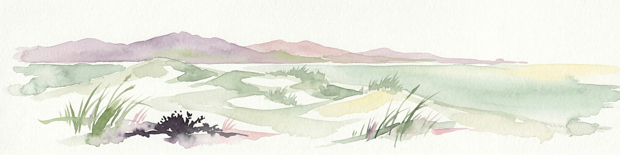
Watercolor painting of sandy dunes with patches of grass, distant mountains, and a body of water under a light sky
Protected landscapeEsposende
212 km away#3 closest

Southeast

Northern Littoral Natural Park Protected Landscape: Geographic Discovery and Atlas Context

Mapped protected areas and regional landscape discovery near Esposende.

Uncover the geographic identity of Northern Littoral Natural Park, a key protected landscape situated near Esposende. This MoriAtlas entry focuses on its mapped boundaries and regional significance, providing a factual basis for understanding its role within Portugal's network of protected areas. Explore the park's natural terrain and its context within the broader geography of the Norte region for comprehensive atlas-based discovery.

Area
87.62 km²
Established
1987
IUCN
V
Relief
Lowland
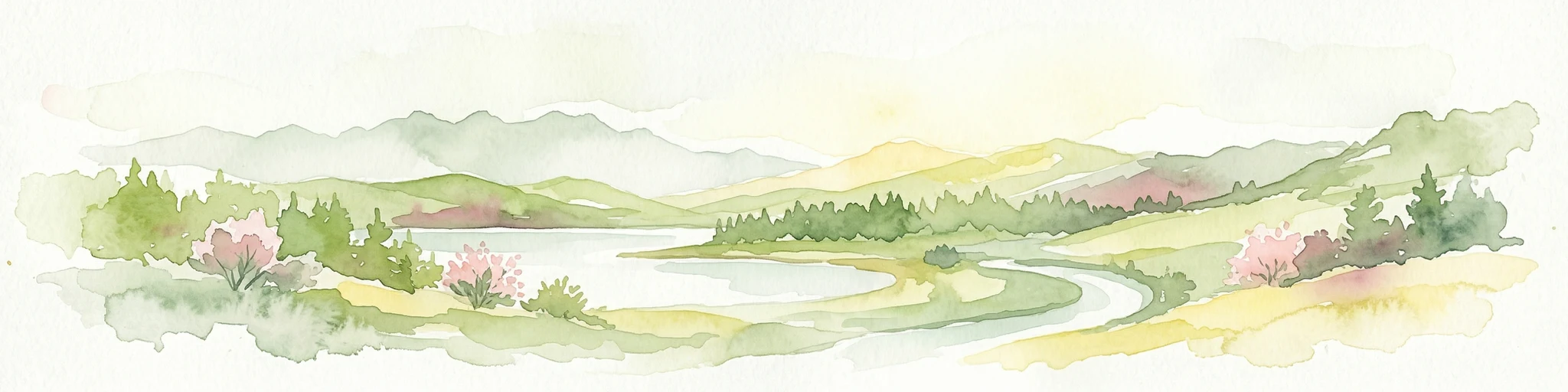
Watercolor illustration of a river winding through a valley with mountains, forests, and pink flowering trees.
National parkPortugal
235 km away#4 closest

Southeast

Peneda-Gerês National Park: A Distinct Protected Landscape in Northern Portugal

Granite peaks, glacial valleys, and cultural heritage mapped.

Peneda-Gerês National Park represents a cornerstone of protected landscapes in Portugal, celebrated for its rugged granite mountains and deep glacial valleys sculpted over millennia. This national park showcases a rare ecological transition zone with unique endemic species and features dramatic waterfalls and pristine river systems. The park's rich cultural tapestry, interwoven with its natural environment, offers a compelling subject for atlas-based geographic discovery and landscape exploration.

Area
695.93 km²
Established
1971
IUCN
II
Visitors
92.8K annual
Biosphere reserveGalicia
262 km away#5 closest

East

Reserva de la biosfera de las Tierras del Miño: Mapped Landscapes and Geographic Overview

Extensive riverine forests and wetland networks in northwestern Spain

Explore the expansive territory of Reserva de la biosfera de las Tierras del Miño, spanning a large portion of the Galician interior. This protected area features a mosaic of wetlands, riparian corridors, and mountainous terrain, offering a deep look into the ecological and cultural geography of the upper Miño river basin.

Area
3,636.69 km²
Established
2002
Relief
Lowland
Scope
Terrestrial
Biosphere reserveGalicia
269 km away#6 closest

East

Área de Allariz Biosphere Reserve: Mapping the Protected Landscapes of Inland Galicia

Exploring the river basins, granitic massifs, and ecological frontiers

The Área de Allariz biosphere reserve serves as a vital transition zone in northwestern Spain, characterized by its flat-floored tectonic basin, the River Limia, and varied highland terrain. This protected area offers an instructive look at the integration of traditional rural land management with large-scale ecological recovery and conservation across its core, buffer, and transition zones.

Area
214.82 km²
Established
2005
Relief
Mixed relief
Scope
Terrestrial
Watercolor landscape illustration featuring mountains, forests, fields, and trees
Protected areaPortugal
295 km away#7 closest

Southeast

Alvão Natural Park Protected Area: Atlas Exploration of Northern Portugal's Mountain Geography

Discover dramatic landscapes and mapped terrain.

Alvão Natural Park is a protected area in northern Portugal distinguished by its stark geological contrasts: upper granite plateaus and steep schist lowlands. This unique geography supports diverse ecosystems and features the impressive Fisgas de Ermelo waterfall. Explore the park's mapped boundaries and its role as a significant protected landscape within the region, offering rich context for any geographic exploration.

Area
72.03 km²
Established
1983
IUCN
V
Visitors
29.6K annual
Biosphere reserveLugo
326 km away#8 closest

East

Reserva de la Biosfera de Los Ancares Lucenses y Montes de Cervantes, Navia y Becerreá Protected Area Map

Mountainous terrain and river valley geography in Lugo, Spain

This protected area covers the dramatic Sierra de Ancares, featuring steep mountain slopes and deep river valleys that define the geography of Galicia. The reserve spans a significant vertical relief, providing essential habitats for brown bears and capercaillie while preserving traditional rural mountain land use systems and ancient forest ecosystems.

Area
536.64 km²
Established
2006
Relief
Mountain
Climate
Temperate

Common questions about visiting, size, designation, and location context for Banco de Galicia

Banco de Galicia FAQs for park facts, access, geography, and protected area context

Find quick answers about Banco de Galicia, including protected-area facts, park geography, trail and visitor context, and how the park fits into its surrounding country and regional landscape.
MoriAtlas Explorer

Continue Your Protected Areas Search Across the Global Atlas

Deepen your exploration by continuing the structured search for national parks and protected areas worldwide. Utilize the comprehensive filtering capabilities to compare different conservation landscapes and refine your understanding of global park geography. Discover more about the distribution and characteristics of protected natural areas.

Global natural geography