

Mori Atlas logo
National parkBandhavgarh National Park

Understand the mapped boundaries and regional context of this Indian national park.

Bandhavgarh National Park: Protected Landscape Geography and Map Exploration

(Bandhavgarh Tiger Reserve)

Bandhavgarh National Park stands as a significant protected landscape within India, offering rich opportunities for geographic discovery and atlas exploration. Situated within the Umaria district, this national park's mapped boundaries define its protected area status and provide essential context for understanding its place in the regional geography. Explore the terrain and landscape features that characterize this vital natural area through a detailed, map-centric lens.

Tiger ReserveDeciduous ForestCentral IndiaWildlife ConservationMadhya Pradesh ParksTiger Safari

Bandhavgarh National Park

National park

Park overview

Structured park overview, official facts, and landscape profile for Bandhavgarh National Park

Bandhavgarh National Park park facts, protected area profile, and essential visitor context
Review the core facts for Bandhavgarh National Park, including designation, size, terrain, visitor scale, habitats, and operating context in one park-focused overview.

About Bandhavgarh National Park

Bandhavgarh National Park represents one of India's most significant protected areas for tiger conservation and biodiversity preservation. Located in the Umaria district of Madhya Pradesh, the park forms the core of the larger Bandhavgarh Tiger Reserve, which encompasses 1,536 square kilometers including 716 square kilometers of core area and 820 square kilometers of buffer zone. The national park itself covers approximately 105 square kilometers of prime habitat. The park's landscape is characterized by undulating hills, steep cliffs, and valleys covered with dense vegetation. The predominantly moist deciduous forest ecosystem supports an extraordinary density of wildlife, with tigers being the flagship species. The park's three main tourism zones, Tala, Magdhi, and Khitauli, offer visitors different experiences of the landscape and wildlife. Tala zone is considered the most productive for tiger sightings, while Magdhi and Khitauli provide opportunities to explore varied terrain and encounter other species. The management falls under the Madhya Pradesh Forest Department, which conducts conservation activities, anti-poaching efforts, and habitat management programs.

Quick facts and research context for Bandhavgarh National Park

Bandhavgarh National Park lies in the Umaria district of Madhya Pradesh, approximately 170 kilometers from Jabalpur. The park is organized into three main tourism zones: Tala, Magdhi, and Khitauli, each offering distinct landscapes and wildlife viewing opportunities. The area features a mix of moist deciduous forests, sal woodland, and bamboo stands across hilly terrain. The park contains the ancient Bandhavgarh Fort, adding a historical dimension to the natural landscape. Visitor numbers reached around 176,000 in 2022, making it one of the more frequently visited tiger reserves in India.

Park context

Deeper park guide and search-rich context for Bandhavgarh National Park

Bandhavgarh National Park history, landscape, wildlife, and travel context
Explore Bandhavgarh National Park through its history, landscape character, ecosystems, wildlife, conservation priorities, cultural context, and seasonal travel timing in a structured park guide built for atlas discovery and search intent.

Why Bandhavgarh National Park stands out

Bandhavgarh is best known for its exceptional tiger population density, considered among the highest in any Indian national park. The park's abundance of forest and wild animals, particularly tigers, has made it a flagship destination for wildlife tourism and conservation in India. The rugged, hilly terrain with dense sal and bamboo forests creates ideal tiger habitat, supporting approximately 135 tigers according to the 2022 census. Beyond tigers, the park is noted for its diverse mammalian fauna including leopards, dhole, gaur, and several deer species. The presence of the ancient Bandhavgarh Fort within the park adds a unique historical and cultural layer to the wildlife experience.

Bandhavgarh National Park history and protected-area timeline

Bandhavgarh holds significant historical heritage as part of the princely state of Rewa, where it served as the royal hunting grounds for generations of rulers. The park derives its name from Bandhavgarh Fort, an ancient fortification whose name combines 'Bandhav' meaning brother and 'garh' meaning fort, referencing the mythological tradition that Lord Rama gave this fort to his brother Lakshmana. This cultural connection adds depth to the park's identity beyond its ecological significance. The area was designated as a national park in 1968, formalizing protection for its wildlife and forest resources. In 1993, it was officially declared a Tiger Reserve, recognizing its critical importance for tiger conservation. The establishment of the tiger reserve brought additional resources and management focus to protecting the tiger population and its habitat. In recent decades, conservation efforts have included species reintroduction programs, notably the gaur reintroduction project in 2012 that brought 50 animals from Kanha National Park to bolster the small existing population, which had been decimated by disease transmitted from cattle.

Bandhavgarh National Park landscape and geographic character

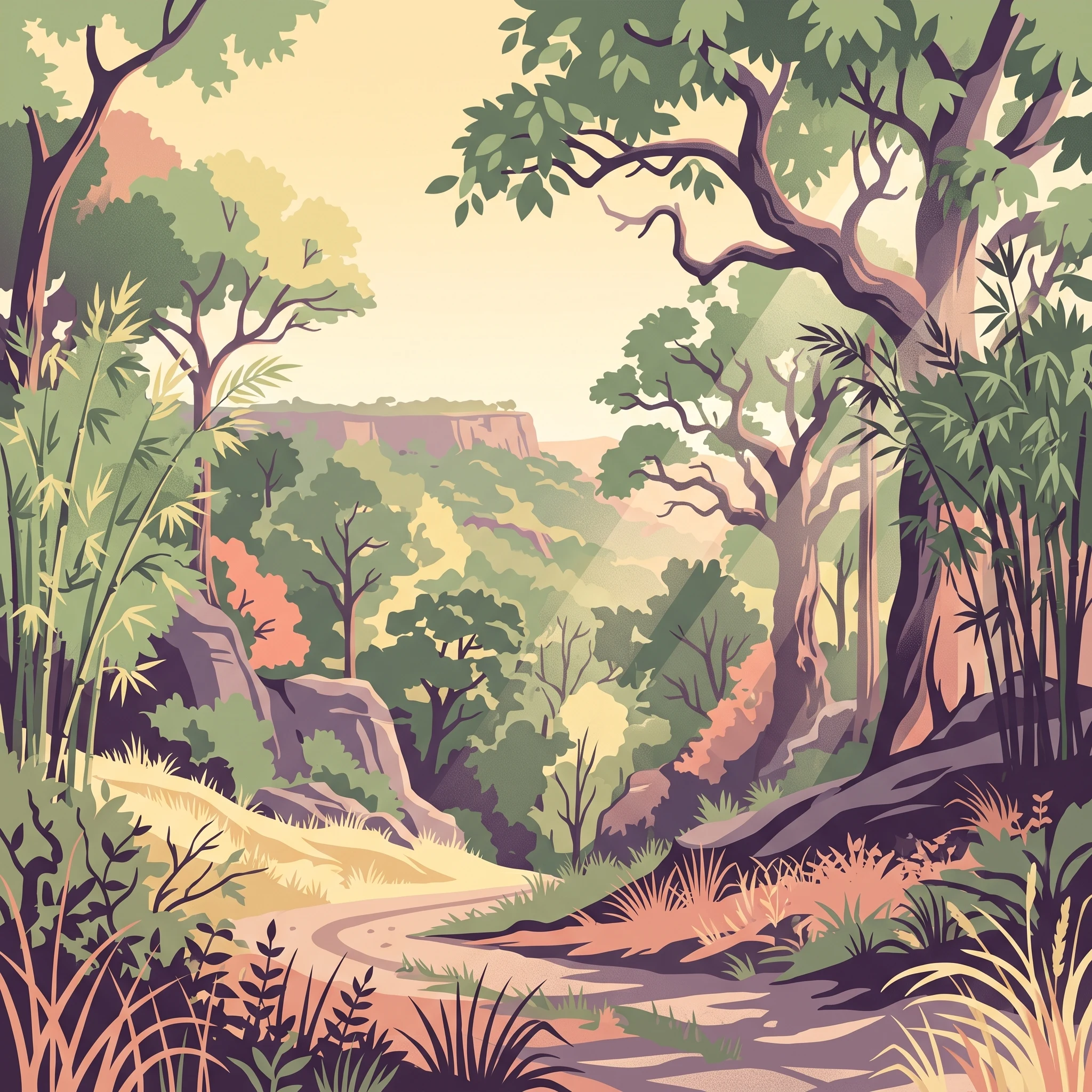
The landscape of Bandhavgarh National Park is defined by its rugged, hilly terrain with steep ridges and valleys creating a diverse topography. The area features predominantly moist deciduous forest cover, with sal trees forming the dominant canopy species across much of the park. Dense bamboo forests add to the vertical structure of the vegetation, creating ideal cover for wildlife. The terrain includes rocky outcrops, small streams, and natural waterholes that provide critical water sources for wildlife during the dry season. The park's elevation varies across its hilly sections, with the landscape transitioning from steep slopes to more gentle valleys. The presence of Bandhavgarh Fort atop one of the hills adds a historical landmark to the natural landscape. The three zones of the park, Tala, Magdhi, and Khitauli, each offer somewhat different landscape characteristics, with Tala being more undulating and forested, while other zones include more open grassland areas and different forest types.

Bandhavgarh National Park ecosystems, habitats, and plant life

The natural environment of Bandhavgarh consists of moist deciduous forest ecosystems that support exceptional biodiversity. The vegetation includes sal mixed forest, northern dry mixed deciduous forest, dry deciduous scrub, dry grassland, and west Gangetic moist mixed deciduous forest. The combination of sal trees and bamboo creates a distinctive forest character that provides ideal habitat for large mammals. The park's location in central India places it at the intersection of several ecological zones, contributing to its species diversity. The forest structure varies from dense, closed canopy areas to more open sections, creating varied habitat conditions. Water availability through streams and artificial waterholes supports wildlife throughout the year, particularly during the dry winter months when wildlife concentrates around remaining water sources. The park's protected status has allowed natural processes to continue relatively undisturbed, maintaining ecological functions and supporting viable populations of key species.

Bandhavgarh National Park wildlife and species highlights

Bandhavgarh supports an impressive array of wildlife, with tigers being the premier attraction. The 2022 tiger census recorded approximately 135 tigers in the park, representing one of the highest densities in India. Beyond tigers, the park is home to leopards, dhole (Indian wild dog), gaur (Indian bison), chital (spotted deer), sambar deer, nilgai, chinkara, four-horned antelope, wild boar, sloth bear, striped hyena, Indian wolf, golden jackal, and various smaller carnivores including jungle cat, Asiatic wildcat, fishing cat, and rusty-spotted cat. The gaur population was strengthened through a reintroduction program in 2012 that brought 50 animals from Kanha National Park, with the population growing to around 170 individuals by 2025. A notable development was the arrival of elephants from Chhattisgarh in 2018, marking the return of resident elephants to Madhya Pradesh after more than a century. The park also supports over 250 bird species, including red jungle fowl, Indian peafowl, various eagles, vultures, hornbills, and kingfishers.

Bandhavgarh National Park conservation status and protection priorities

Bandhavgarh's conservation significance is underscored by its designation as a Tiger Reserve, reflecting India's commitment to protecting the endangered tiger and its habitat. The park forms part of India's network of critical tiger habitats, known as tiger reserves, which are managed with special focus on tiger conservation and habitat protection. The Madhya Pradesh Forest Department oversees management activities including anti-poaching patrols, habitat management, and wildlife monitoring. The gaur reintroduction project demonstrates active conservation intervention, addressing population declines caused by disease. The return of elephants to the area represents a positive development in restoring ecological processes. Conservation challenges include managing human-wildlife conflict, addressing disease risks to wildlife populations, and maintaining habitat quality amid climate pressures. The park's tourism program is managed to balance visitor access with wildlife protection, with safari zones designed to minimize disturbance to sensitive species.

Bandhavgarh National Park cultural meaning and human context

Bandhavgarh carries cultural significance through its historical association with the princely state of Rewa and its royal hunting traditions. The Bandhavgarh Fort provides a tangible link to ancient history and mythology, with its name rooted in the epic Ramayana's narrative of brothers Rama and Lakshmana. The fort's presence within the park creates a unique blend of natural and cultural heritage. Local communities in the surrounding area have traditional connections to the landscape, though the park itself is managed as a protected area with restricted access. The cultural narrative of the fort adds an interpretive dimension to the wildlife experience, inviting visitors to appreciate both natural and historical heritage. This combination of ecological and cultural elements distinguishes Bandhavgarh from purely natural protected areas.

Top sights and standout views in Bandhavgarh National Park

Bandhavgarh offers exceptional tiger viewing opportunities in a scenic setting of hilly terrain and dense forests. The ancient Bandhavgarh Fort provides a unique historical landmark within the park boundaries. The park's three tourism zones allow visitors to experience varied landscapes and wildlife concentrations. The high density of tigers, combined with the park's manageable size, makes it one of the most reliable places in India for tiger sightings. The landscape of sal forests and bamboo thickets creates a quintessentially Indian forest atmosphere. Birdwatching opportunities are abundant, with over 250 species recorded. The recent presence of elephants adds another dimension to wildlife viewing. The park's accessibility from major cities in Madhya Pradesh makes it a viable destination for both dedicated wildlife enthusiasts and general tourists.

Best time to visit Bandhavgarh National Park

The optimal time to visit Bandhavgarh is during the winter months from October to March, when the weather is comfortable and wildlife is more easily spotted as vegetation thins and animals concentrate around water sources. The summer months from April to June offer excellent tiger sighting opportunities as animals become more active around diminishing waterholes, though temperatures can be quite high. The monsoon season from July to September brings heavy rainfall to the region, and the park is typically closed during this period to allow for natural regeneration and to minimize disturbance during breeding season. November and December are particularly popular months when visitor numbers increase, and advance booking of safari permits is recommended. The park's closed season generally runs from July to mid-October, though exact dates can vary annually based on monsoon conditions.
Park location guide

Geography guide, regional context, and park location map for Bandhavgarh National Park

Bandhavgarh National Park park geography, regions, and map view in India
Understand where Bandhavgarh National Park sits in India through a broader geographic reading of the surrounding landscape, nearby location context, and its mapped position within the national park landscape.

How Bandhavgarh National Park fits into India

India is a South Asian country bordered by the Indian Ocean, Arabian Sea, and Bay of Bengal. It shares land borders with Pakistan, China, Nepal, Bhutan, Bangladesh, and Myanmar. The country has a population of over 1.4 billion people and operates as a federal parliamentary republic with its capital in New Delhi.

Wider geography shaping Bandhavgarh National Park in India

India occupies the Indian subcontinent in South Asia, bordered by the Arabian Sea to the southwest, the Bay of Bengal to the southeast, and the Indian Ocean to the south. It shares land borders with Pakistan to the west, China, Nepal, and Bhutan to the north, and Bangladesh and Myanmar to the east. The territory also includes the Andaman and Nicobar Islands in the Indian Ocean.

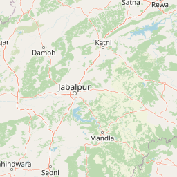
Map view of Bandhavgarh National Park

Use this park location map to pinpoint Bandhavgarh National Park in India, understand its exact geographic position, and read its mapped placement within the surrounding landscape more clearly.

Pigeon | © OpenStreetMap contributors

Location context for Bandhavgarh National Park

Madhya PradeshUmaria district
Park atlas

Explore Adjacent Wildlife Habitats and Compare Protected Landscapes Within Madhya Pradesh, Tracing Broader Conservation Geography

Discover Other National Parks and Protected Areas Near Bandhavgarh National Park in Central India
Explore a curated selection of national parks and other protected areas geographically near Bandhavgarh National Park, featuring diverse conservation landscapes across Central India. Trace the spread of unique ecosystems and wildlife corridors, enhancing your understanding of regional biodiversity and protected-area mapping beyond a single park.
National parkMadhya Pradesh

Ghughua Fossil Park National Park: Mapped Geography and Protected Area Context in Madhya Pradesh

Explore the mapped boundaries and regional landscape of Ghughua Fossil Park.

Ghughua Fossil Park stands as a designated national park within the expansive geography of Madhya Pradesh, India. This resource facilitates a detailed exploration of its protected landscape, offering insights into its geographic setting and the significance of its mapped boundaries. Understand the park's place within the regional atlas and its role as a key conservation territory.

Area
0.3 km²
Established
1983
IUCN
II
Access
Access unknown
National parkMadhya Pradesh

Sanjay National Park: Madhya Pradesh Protected Area with Hilly Terrain and Dry Deciduous Forests

Explore the mapped boundaries and landscape context of this national park.

Sanjay National Park, situated in Madhya Pradesh, India, is a substantial protected area recognized for its significant role in conservation. The park features a landscape dominated by hilly terrain and extensive dry deciduous forests, bisected by the Banas River. As a national park and tiger reserve, its mapped geography supports a rich ecosystem and is vital for understanding the protected lands of central India.

Area
1,674.55 km²
Established
1981
IUCN
II
Relief
Highland
National parkMadhya Pradesh

Panna National Park: National Park Atlas and Mapped Protected Landscape

Geographic context and protected boundaries in Madhya Pradesh.

Gain a structured understanding of Panna National Park as a protected national park entity. This detail page focuses on its specific geographic setting within Madhya Pradesh and its mapped landscape features. Explore the park's protected boundaries and regional natural context, ideal for atlas-based discovery and understanding its place in India's conservation geography.

Area
542.67 km²
Established
1981
IUCN
II
Visitors
22.6K annual
Wildlife reserveChhattisgarh

Guru Ghasidas - Tamor Pingla Tiger Reserve: Wildlife Reserve in Chhattisgarh's Mapped Landscapes

Explore protected area geography and regional context.

Guru Ghasidas - Tamor Pingla Tiger Reserve, identified as a wildlife reserve, offers detailed insight into its protected landscape and geographic positioning within Chhattisgarh. Users can explore its mapped boundaries and understand its contribution to the region's natural terrain. This resource focuses on the atlas-style discovery of protected areas, providing a clear picture of the reserve's environmental context and regional significance without delving into visitor logistics.

Area
2,829.38 km²
Established
2024
IUCN
II
Relief
Mixed relief
National parkMadhya Pradesh

Kanha National Park: A Madhya Pradesh Protected Landscape for Atlas Exploration

Mapped park boundaries and regional geographic context.

Kanha National Park serves as a vital protected area, offering critical insights into India's natural geography. This entry facilitates detailed atlas-style exploration of its mapped landscape and protected territory within Madhya Pradesh. Understand the park's geographic definition and its role within the broader context of India's conservation lands, providing a foundation for structured geographic discovery.

Area
940 km²
Established
1955
IUCN
II
Visitors
213.8K annual
National parkMadhya Pradesh

Pench National Park: Madhya Pradesh National Park Protected Landscape Overview

Mapped geographic context and protected area boundaries

Pench National Park is a designated national park situated in Madhya Pradesh, India, offering a distinct protected landscape for geographic study. This entry provides detailed insights into its mapped terrain, allowing for an atlas-style exploration of its protected boundaries and its significance within the regional geography. Understand the park's place in the landscape and its value for conservation-focused map exploration.

Area
292.85 km²
Established
1983
IUCN
II
Relief
Upland
National parkMaharashtra

Navegaon National Park: Maharashtra's Designated National Park for Atlas Exploration

Mapped protected area and regional landscape context.

Navegaon National Park is a designated national park offering rich opportunities for geographic discovery. Users can delve into its mapped boundaries and understand its protected landscape character within Maharashtra. This page provides structured data for exploring the park's role as a conservation area and its contribution to the natural geography of the region, ideal for atlas-based research.

Area
1,894.94 km²
Established
1975
IUCN
II
Visitors
50K annual
National parkJharkhand

Betla National Park: National Park Protected Area Exploration and Geographic Context in Jharkhand

Mapped boundaries of a significant protected landscape.

Betla National Park, situated in Jharkhand, India, is a key national park offering significant value for geographic and protected-area discovery. This resource facilitates exploration of its mapped boundaries, providing a clear understanding of its protected landscape and its relationship to the surrounding regional geography. Delve into the structured data to comprehend the park's atlas context and its role as a conserved natural area within India.

Area
226.32 km²
Established
1986
IUCN
II
Access
Moderate access

Common questions about visiting, size, designation, and location context for Bandhavgarh National Park

Bandhavgarh National Park FAQs for park facts, access, geography, and protected area context
Find quick answers about Bandhavgarh National Park, including protected-area facts, park geography, trail and visitor context, and how the park fits into its surrounding country and regional landscape.
MoriAtlas Explorer

Continue Your Protected Areas Search Across the Global Atlas

Deepen your exploration by continuing the structured search for national parks and protected areas worldwide. Utilize the comprehensive filtering capabilities to compare different conservation landscapes and refine your understanding of global park geography. Discover more about the distribution and characteristics of protected natural areas.

Global natural geography
Bandhavgarh National Park: India National Park Atlas & Map Details