Mori Atlas logo
National parkBanhine National Park

Mapping the protected area and regional context of Banhine National Park in Gaza Province

Banhine National Park: National Park Identity and Protected Landscape Geography

Banhine National Park stands as a key protected area within the expansive geography of Gaza Province, Mozambique. This page offers a detailed atlas-style view of the park, focusing on its specific boundaries, its role as a national park, and its place within the regional landscape. Understand the protected land's geographic context and its mapped representation, providing a foundation for exploring Mozambique's natural areas.

wetlandstransfrontier conservationsavannabirdwatchinglarge predatorsprotected area

Banhine National Park

National park

Park overview

Structured park overview, official facts, and landscape profile for Banhine National Park

Banhine National Park park facts, protected area profile, and essential visitor context
Review the core facts for Banhine National Park, including designation, size, terrain, visitor scale, habitats, and operating context in one park-focused overview.

About Banhine National Park

Banhine National Park represents one of Mozambique's most ecologically significant protected areas, characterized by its unique combination of extensive wetlands and semi-arid savanna environments. The park's location in northern Gaza Province places it at a critical ecological transition zone, where seasonal wetlands provide vital habitat and water resources that sustain wildlife populations across the broader landscape. Despite the challenging climatic conditions with annual rainfall averaging just 430 millimeters, the park's wetland system maintains year-round ecological function. The 2013 boundary revision acknowledged the reality of community resettlement within the park's borders, demonstrating the complex relationship between wildlife conservation and human habitation in this region. As part of the Great Limpopo Transfrontier Park initiative, Banhine contributes to one of Africa's most ambitious transboundary conservation efforts, creating ecological connectivity across national boundaries and supporting wildlife migration patterns that have been traditionally constrained by political borders.

Quick facts and research context for Banhine National Park

Banhine National Park covers 7,250 square kilometers in northern Gaza Province, making it one of Mozambique's larger protected areas. The park is administratively divided between Chicualacuala, Chigubo, and Mabalane districts. Its wetland system is fed by water flowing from the northwest near the Zimbabwe border, channeling through the wetlands before reaching the Changane River. The park is part of the Great Limpopo Transfrontier Conservation Area, which will ultimately connect protected lands from the Drakensberg Mountains to the Save River Estuary, spanning over 95,000 square kilometers across three countries.

Park context

Deeper park guide and search-rich context for Banhine National Park

Banhine National Park history, landscape, wildlife, and travel context
Explore Banhine National Park through its history, landscape character, ecosystems, wildlife, conservation priorities, cultural context, and seasonal travel timing in a structured park guide built for atlas discovery and search intent.

Why Banhine National Park stands out

Banhine National Park is distinguished by its extensive inland wetland system, a rare feature in Mozambique's generally dry southern landscape. The park contains over a thousand pans, some highly saline and others providing fresh drinking water. These wetlands support significant populations of wattled cranes, an endangered species, along with numerous migratory bird species. The park also serves as a crucial wildlife corridor connecting the broader Great Limpopo Transfrontier Park network, providing habitat for populations of ostrich, kudu, impala, reedbuck, and diverse predators including lions, leopards, and cheetahs.

Banhine National Park history and protected-area timeline

Banhine National Park was established on June 26, 1973, during a period when Mozambique was developing its post-independence conservation framework. The park was created to protect the significant wetland ecosystems and associated wildlife populations in this part of Gaza Province. Following decades of civil conflict during the 1980s and early 1990s, which severely impacted wildlife populations throughout Mozambique, the park underwent significant changes. In 2013, the official boundaries of the park were revised to better reflect ground realities, particularly acknowledging the presence of human communities that had resettled within the protected area. This adjustment recognized that effective conservation in this region must account for local human populations rather than attempting to exclude them entirely, and it facilitated more practical management approaches for maintaining the area as a wildlife haven.

Banhine National Park landscape and geographic character

The physical landscape of Banhine National Park is defined by a complex interplay between semi-arid savanna plains and extensive wetland systems. The terrain features numerous pans scattered across the terrain, varying dramatically in size from just a few square meters to hundreds of hectares. These pans differ in their chemical composition, with some containing highly saline water while others provide fresh, drinkable water. The wetland system receives water from the northwest, originating near the Zimbabwe border, where seasonal flows move through multiple channels into the wetland complexes before ultimately draining into the Changane River. The landscape supports a mosaic of habitats including seasonal floodplains, reed beds, open grasslands, and woodland areas that together create the park's distinctive ecological character.

Banhine National Park ecosystems, habitats, and plant life

The ecological character of Banhine National Park centers on its wetland ecosystems, which provide critical habitat within an otherwise dry regional landscape. Despite the relatively low annual rainfall, the park's wetland coverage exceeds one percent of its total area, a significant proportion for this climate zone. These wetlands support specialized aquatic organisms including 18 documented fish species, with the African lungfish and several killifish and barbel species demonstrating remarkable adaptations to the predictable dry periods that characterize the region. The wetland system's ecological importance extends beyond the park's boundaries, serving as an important water source that sustains the surrounding dry lands and supports wildlife populations throughout the broader landscape.

Banhine National Park wildlife and species highlights

Banhine National Park supports diverse wildlife populations despite the impacts of civil conflict in recent decades. The park was historically home to large herds of Cape buffalo, sable antelope, common tsessebe, hartebeest, Selous' zebra, and blue wildebeest, though many of these populations were severely depleted during the civil wars of the 1980s and early 1990s. The park remains critically important for endangered wattled cranes and serves as a crucial habitat for migratory bird species. An aerial survey conducted in October 2004 documented healthy populations of ostrich, kudu, impala, reedbuck, duiker, steenbok, porcupine, warthog, and oribi. The predator community includes leopards, lions, servals, spotted hyenas, and cheetahs, maintaining the ecological integrity of the park's food web.

Banhine National Park conservation status and protection priorities

Banhine National Park plays a vital role in Mozambique's conservation framework and contributes to the larger Great Limpopo Transfrontier Park initiative. The park forms part of a transfrontier conservation area linking protected areas across Mozambique, Zimbabwe, and South Africa, ultimately connecting the Drakensberg Mountains to the Save River Estuary. This network spans over 95,000 square kilometers and supports wildlife migration patterns that transcend national boundaries. The 2013 boundary revision reflects evolving approaches to conservation management in Mozambique, acknowledging that effective protection requires working with rather than against local communities. The wetland systems represent particularly important conservation targets given their rarity in the regional landscape and their role in supporting biodiversity throughout the semi-arid zone.

Banhine National Park cultural meaning and human context

Banhine National Park contains small human populations who practice subsistence agriculture, including slash-and-burn cultivation of maize, sorghum, cassava, and sugar cane. These communities have historically placed pressure on the park's wildlife through agricultural expansion and, during drought periods, through hunting and fishing activities. The government has implemented programs to encourage relocation outside the park by establishing permanent water sources outside the reserve and providing incentives for resettlement. The 2013 boundary adjustment formally recognized community presence within the park, reflecting a pragmatic approach to managing the intersection of human habitation and wildlife conservation in this region.

Top sights and standout views in Banhine National Park

Banhine National Park's defining features include its extensive inland wetland system unique to the semi-arid region, the network of over a thousand pans offering diverse water conditions, and its critical role within the Great Limpopo Transfrontier Park connecting three countries. The park provides essential habitat for endangered wattled cranes and supports significant populations of migratory birds. Its predator community including lions, leopards, and cheetahs maintains ecological balance. The park's location at the nexus of wetland and savanna environments creates a distinctive ecological character that supports biodiversity in a region where such wetland ecosystems are rare and ecologically vital.

Best time to visit Banhine National Park

The optimal time to visit Banhine National Park coincides with the dry season from May to October, when wildlife congregates around remaining water sources and visibility is improved. The wetland areas retain water throughout the year, offering reliable wildlife viewing even during the dry period. The wet season from November to April brings seasonal flooding that can affect access to some areas but also brings migratory bird arrivals and greener landscapes. Visitors interested in birdwatching, particularly for wattled cranes and other waterfowl, will find the wetland areas most productive during the drier months when water sources become more concentrated.

Park location guide

Geography guide, regional context, and park location map for Banhine National Park

Banhine National Park park geography, regions, and map view in Mozambique
Understand where Banhine National Park sits in Mozambique through a broader geographic reading of the surrounding landscape, nearby location context, and its mapped position within the national park landscape.

How Banhine National Park fits into Mozambique

Mozambique is a sovereign state in Southeast Africa spanning approximately 801,590 km² along the Indian Ocean. It borders Tanzania, Malawi, Zambia, Zimbabwe, Eswatini, and South Africa. The country gained independence in 1975 after Portuguese colonial rule and experienced a civil war from 1977 to 1992. Today it operates as a semi-presidential republic with a population of approximately 35 million people.

Wider geography shaping Banhine National Park in Mozambique

Mozambique occupies a coastal position along the Indian Ocean in southeastern Africa. The country shares borders with Tanzania to the north, Malawi and Zambia to the northwest, Zimbabwe to the west, and Eswatini and South Africa to the southwest. The terrain ranges from coastal plains to highlands in the west. The Mozambique Channel separates the country from Madagascar, Comoros, and Mayotte to the east.

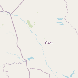
Map view of Banhine National Park

Use this park location map to pinpoint Banhine National Park in Mozambique, understand its exact geographic position, and read its mapped placement within the surrounding landscape more clearly.

Pigeon | © OpenStreetMap contributors

Location context for Banhine National Park

Gaza Province
Park atlas

Trace connected protected areas and the regional park geography of Mozambique, revealing broader conservation landscapes around its unique wetland systems.

Discover Other National Parks and Protected Areas Near Banhine National Park, Mozambique
Continue your exploration from Banhine National Park by browsing other national parks and protected areas situated within its surrounding regional geography and Mozambique's broader protected landscapes. Compare diverse park features, mapped terrain, and conservation efforts across the Great Limpopo Transfrontier Park network and adjacent natural zones, gaining deeper geographic insights.
National parkMozambique

Zinave National Park: A Mozambique National Park with Diverse Woodland and Savanna Landscapes

Explore its mapped terrain, riverine forests, and savanna ecosystems.

Zinave National Park in Mozambique is a significant protected area spanning 4,000 square kilometers. Its landscape comprises a rich variety of ecosystems, including miombo woodlands, mopane-dominated areas, acacia savannas, and distinct riverine forests along the Save River. This national park is strategically positioned within the Greater Limpopo Transfrontier Park, highlighting its importance for regional wildlife corridors and conservation geography. The terrain offers a unique insight into the transitional ecological zones of southern Africa, showcasing diverse natural habitats and mapping potential for its protected boundaries.

Area
4,000 km²
Established
1973
IUCN
II
Relief
Lowland
National parkMasvingo Province

Gonarezhou National Park: National Park Protected Landscape in Masvingo Province

Explore mapped boundaries and regional geography

Gonarezhou National Park represents a significant protected area within the geography of Masvingo Province, Zimbabwe. This page details its specific mapped boundaries and landscape context, offering a focused view for atlas-based exploration. Understand the park's natural terrain and its positioning within the regional protected lands for comprehensive geographic discovery.

Area
5,053 km²
Established
1975
IUCN
II
Relief
Mixed relief
National parkSouth Africa

Kruger National Park: South Africa's Iconic National Park for Geographic Discovery

Explore savanna landscapes and mapped protected area boundaries.

Kruger National Park serves as a paramount example of a protected landscape, offering a rich tapestry of savanna ecosystems and varied terrain across South Africa's Lowveld. This canonical entry details its vast geographic scope, approximately 19,623 square kilometres, and its status as the nation's first national park. Understand the park's environmental context, from the Lebombo Mountains to the Limpopo River, and its integral role within larger transfrontier conservation initiatives, providing critical insight for atlas-based geographic exploration.

Area
19,623 km²
Established
1926
IUCN
II
Visitors
1.7M annual
National parkManica Province

Chimanimani National Park: Map of Mozambique's Highest Mountain Landscape

Explore protected highland terrain and transfrontier conservation geography.

Chimanimani National Park stands as a vital protected area in Mozambique's Manica Province, celebrated for its rugged mountain landscape and the presence of Monte Binga, the country's highest point. As the Mozambican portion of the Chimanimani Transfrontier Park, it offers critical insights into cross-border conservation efforts and the preservation of unique montane ecosystems. Discover the park's geographic context, its elevation extremes, and the significance of its protected boundaries within the regional atlas.

Area
656 km²
Established
2020
IUCN
II
Relief
Mountain
Watercolor illustration of a savanna landscape with scattered trees and rock formations
National parkLimpopo

Mapungubwe National Park: National Park with Rich Iron Age Archaeology and Savanna Landscapes

Explore Limpopo's unique protected area at the three-nation border.

Mapungubwe National Park is a vital protected area in South Africa's Limpopo region, renowned for its dual significance as a major archaeological site and a diverse natural landscape. This national park protects a significant portion of savanna ecosystems, including unique riparian forests and mopane woodlands, surrounding the historic Mapungubwe Hill. As part of the Greater Mapungubwe Transfrontier Conservation Area, it plays a crucial role in regional conservation, offering a distinct geographic perspective at the confluence of South Africa, Botswana, and Zimbabwe, and serving as a focal point for atlas-based discovery of protected lands.

Area
280 km²
Established
1998
IUCN
II
Relief
Lowland
Protected areaSouth Africa

Greater Mapungubwe Transfrontier Conservation Area: A Transboundary Protected Landscape in South Africa

Mapped savanna ecosystems and rich cultural heritage at the Limpopo River confluence.

The Greater Mapungubwe Transfrontier Conservation Area, situated in South Africa, stands as a remarkable example of collaborative conservation across national borders. This protected area protects diverse savanna landscapes, particularly around the confluence of the Shashe and Limpopo Rivers, and holds immense cultural value as home to the Mapungubwe Cultural Landscape, a UNESCO World Heritage Site. By examining its mapped geography and protected area status, users gain insight into the ecological corridors vital for wildlife and the ancient archaeological heritage preserved within this significant transfrontier initiative.

Area
4,872 km²
Established
2009
IUCN
VI
Relief
Upland
National parkEswatini

Hlane Royal National Park: Eswatini's Vast Protected Savanna Woodland Landscape

Mapped geography and protected area context in northeastern Eswatini.

Delve into Hlane Royal National Park, Eswatini's most extensive protected territory, a prime example of lowland bushveld savanna. This national park is defined by its expansive woodland terrain, dotted with ancient trees and seasonal water pans, creating a dynamic landscape. It is an essential component for understanding the regional geography and the distribution of protected areas within Southern Africa, offering significant opportunities for landscape exploration.

Area
300 km²
IUCN
VI
Relief
Lowland
Climate
Subtropical
National parkMozambique

Gorongosa National Park: Mozambique National Park with Diverse Rift Valley Ecosystems

Mapped protected area, savanna, and montane rainforest landscapes.

Gorongosa National Park is a premier protected area situated in Mozambique's Great African Rift Valley. This vast national park showcases an extraordinary range of natural landscapes, including extensive floodplains, acacia savannas, and rare montane rainforests within dramatic limestone gorges. Its geographic diversity is matched by its compelling narrative of ecological restoration, making it a significant site for understanding protected land dynamics and regional geography.

Area
3,770 km²
Established
1960
IUCN
II
Relief
Mixed relief

Common questions about visiting, size, designation, and location context for Banhine National Park

Banhine National Park FAQs for park facts, access, geography, and protected area context
Find quick answers about Banhine National Park, including protected-area facts, park geography, trail and visitor context, and how the park fits into its surrounding country and regional landscape.
MoriAtlas Explorer

Continue Your Protected Areas Search Across the Global Atlas

Deepen your exploration by continuing the structured search for national parks and protected areas worldwide. Utilize the comprehensive filtering capabilities to compare different conservation landscapes and refine your understanding of global park geography. Discover more about the distribution and characteristics of protected natural areas.

Global natural geography