
Mori Atlas logo
Nature reserveMontague Island Nature Reserve

A detailed geographic look at the island terrain, coastal boundaries, and maritime habitat zones.

Barunguba Montague Island Nature Reserve: Mapping Coastal Protected Landscapes in New South Wales

Barunguba Montague Island Nature Reserve is a significant 81-hectare continental island situated in the Tasman Sea off the coast of New South Wales. This protected area features a diverse terrain of grassy slopes and rocky headlands, functioning as a critical habitat for seabirds and marine seals. The island serves as a prime example of an offshore protected landscape, showcasing a unique intersection of maritime geography, colonial lighthouse heritage, and longstanding cultural significance to the Walbunja clan of the Yuin people.

islandcontinental-islandseabirdslittle-penguinsshearwaterscrested-terns
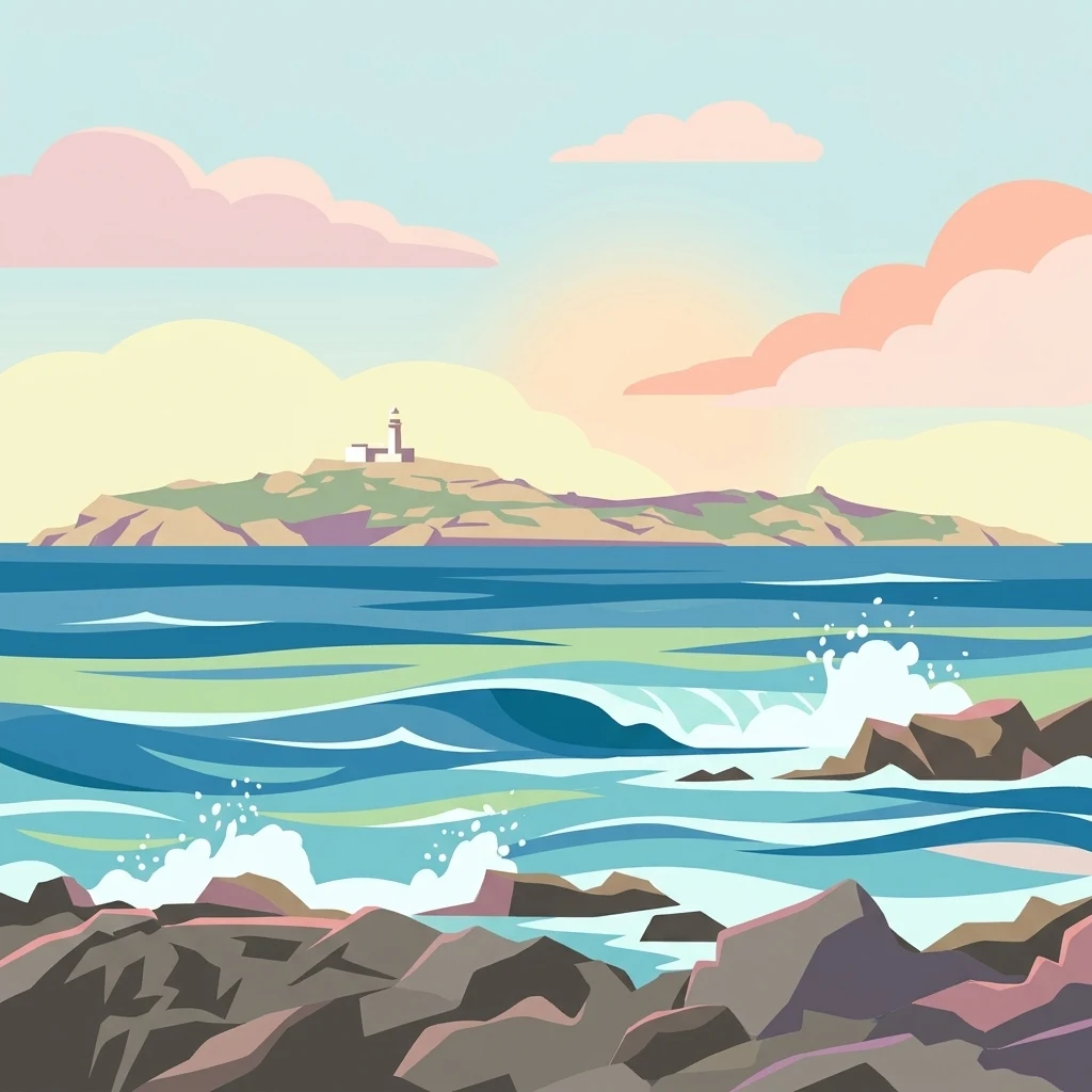
A flat-style digital illustration of a lighthouse on a distant island, set against a soft, pastel-colored sky, with rocky shorelines and ocean waves in the foreground.

Montague Island Nature Reserve

Nature reserve

Park overview

Structured park overview, official facts, and landscape profile for Barunguba / Montague Island Nature Reserve

Barunguba / Montague Island Nature Reserve park facts, protected area profile, and essential visitor context

Review the core facts for Barunguba / Montague Island Nature Reserve, including designation, size, terrain, visitor scale, habitats, and operating context in one park-focused overview.

About Barunguba / Montague Island Nature Reserve

Barunguba / Montague Island Nature Reserve protects a small but ecologically rich continental island sitting less than 10 kilometres from the NSW South Coast near Narooma. The island's isolation, mild oceanic climate and absence of introduced predators such as foxes and feral cats have created ideal conditions for dense seabird breeding colonies, most notably a population of roughly 12,000 little penguins that come ashore at dusk to a viewing platform near the jetty. The protected area is the second largest offshore island along the NSW coast after Lord Howe Island, an identity that shapes both its conservation role and its strong landscape character.

The reserve is classified by the National Trust as a Landscape Conservation Area because of its scenic, scientific and historical values and is entered on the IUCN's Category IV list as a habitat and species management area. Its 81-hectare footprint supports a mix of breeding seabirds, seasonal seal aggregations, and a programme of ecological restoration that targets invasive kikuyu grass originally introduced in the 19th century to feed lighthouse-keeper livestock. Restoration combines ground-based control with aerial spraying in more remote areas, followed by replanting with native species to rehabilitate habitat for shearwaters and penguins.

The reserve is also a place of layered human history. To the Walbunja people, part of the Yuin nation, the island is Barunguba, the eldest son of Gulaga (Mount Dromedary), and features in Aboriginal mythology as well as oral traditions about a 19th-century storm surge that drowned almost an entire clan's men and boys as they returned from collecting mutton bird eggs. From 30 November 2021 the island has been officially dual-named Barunguba and Montague Island, with Barunguba placed first on signage to reflect Dhurga language and traditions. The 1881 Montague Island Lighthouse, designed by James Barnet and automated in 1986, adds a colonial maritime layer to the island's identity and brings an additional heritage tourism dimension to the reserve.

Quick facts and research context for Barunguba / Montague Island Nature Reserve

Barunguba / Montague Island is located in the Tasman Sea off the South Coast of New South Wales, approximately 9 kilometres from the coastal town of Narooma. The reserve covers about 81 hectares, making it the second largest island off the NSW coast after Lord Howe Island, and is classified as IUCN Category IV, a habitat and species management area. The reserve was formally established in January 1990 and is governed by the NSW National Parks and Wildlife Service.

The island is recognised by the National Trust as a Landscape Conservation Area, while the Montague Island Light complex is entered on the Register of the National Estate for its architectural and historical significance. Public access is restricted to guided tours operated through NPWS partnerships, limiting visitor numbers and supporting both conservation and cultural protocols.

Park context

Deeper park guide and search-rich context for Barunguba / Montague Island Nature Reserve

Barunguba / Montague Island Nature Reserve history, landscape, wildlife, and travel context

Explore Barunguba / Montague Island Nature Reserve through its history, landscape character, ecosystems, wildlife, conservation priorities, cultural context, and seasonal travel timing in a structured park guide built for atlas discovery and search intent.

Why Barunguba / Montague Island Nature Reserve stands out

The reserve is especially known for its thriving little penguin colony, which has grown to roughly 12,000 birds following restoration of native habitat and the installation of penguin breeding boxes in the absence of foxes and feral cats. It is also well known for its populations of shearwaters, including the short-tailed shearwater (mutton bird), and for crested tern breeding activity. Beyond seabirds, the reserve is recognised for seasonal aggregations of Australian fur seals around the northern tip of the island, with New Zealand fur seals, subantarctic fur seals and Australian sea lions also recorded. The island's combination of seabird colonies, accessible marine wildlife viewing and a protected-access management model gives it a distinctive wildlife-focused profile among NSW offshore reserves.
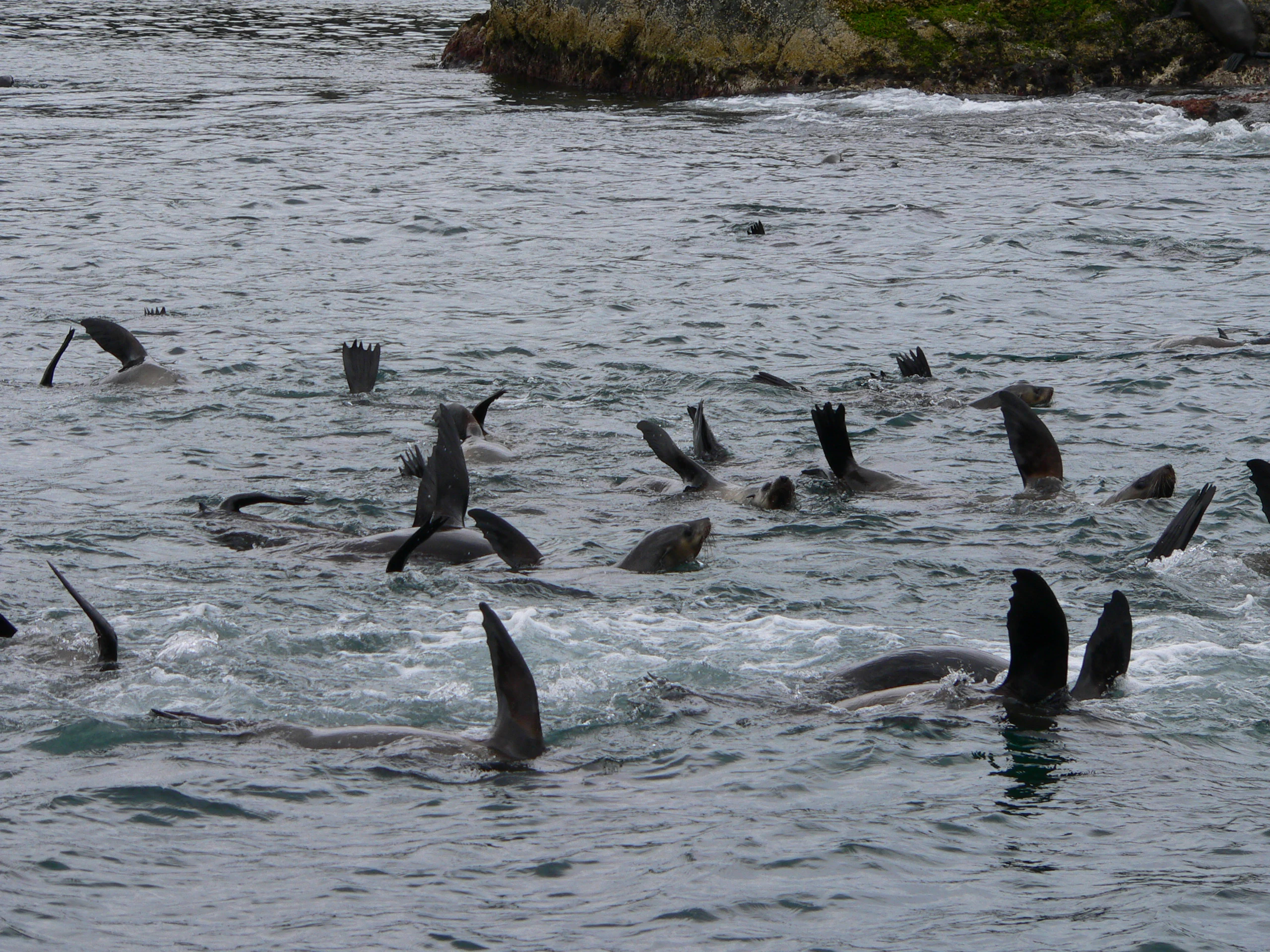
A group of seals swimming in the water with their flippers visible above the surface.
A colony of seals swimming in the waters off the coast of Montague Island Nature Reserve.

Barunguba / Montague Island Nature Reserve history and protected-area timeline

The island has long been central to the cultural and seasonal life of the Walbunja people of the Yuin nation. Known to them as Barunguba, it carried spiritual significance as the eldest son of Gulaga, Mount Dromedary, and featured in Aboriginal mythology alongside Najanuka, Little Dromedary Mountain, the younger son. Walbunja communities paddled to the island by canoe to collect mutton bird (short-tailed shearwater) eggs, and stories passed down within the community describe a tragic 19th-century storm surge that drowned nearly all the men and boys of an entire clan on their return to the mainland.

European contact began in 1770, when James Cook sighted the feature and named it Cape Dromedary, not yet recognising it as an island. It was later formally identified as an island and named by the master of the Second Fleet convict transport Surprize after George Montagu-Dunk, 2nd Earl of Halifax, giving it the English name Montague Island. In 1881 a lighthouse designed by colonial architect James Barnet was built on the island; the light was automated in 1986 and the station was de-staffed the following year, with the original Fresnel lens removed and later placed on display at the Narooma Lighthouse Museum.

The formal protection era began in January 1990 with the establishment of the Montague Island Nature Reserve under the NSW National Parks and Wildlife Service. A wave of restoration work followed, targeting kikuyu grass infestations and installing penguin breeding boxes to expand breeding habitat for little penguins. In November 2021, after a period of community consultation that began in mid-2021, the NSW Geographical Names Board officially assigned the dual names Montague Island and Barunguba to the island, with Gulaga and Najanuka / Little Dromedary Mountain dual-named at the same time, marking a major milestone in recognising Indigenous place names alongside colonial-era ones.

Barunguba / Montague Island Nature Reserve landscape and geographic character

Barunguba / Montague Island is a compact continental island of about 81 hectares rising from the Tasman Sea, with a coastal setting that gives it a narrow seasonal and diurnal temperature range typical of strongly oceanic environments. The reserve has a mild oceanic climate with warm summers, mild winters and moderate rainfall through the year, which supports a fairly lush cover of vegetation, including large areas of kikuyu grass on the southern part of the island that has had to be actively managed.

The island's terrain combines grassy slopes, rocky shoreline and exposed headlands, with the northern tip forming a prominent cape that hosts seasonal seal colonies offshore. The lighthouse stands on an elevated point of the island at about 52 metres above sea level, and its light sits roughly 80 metres above the sea, giving the island a recognisable silhouette when viewed from the coast at Narooma, about 9 kilometres to the northwest. From offshore vantage points the island reads as a green, low-relief landmass framed by the open ocean, with weathered cliffs and rock shelves around its perimeter that provide haul-out and nesting habitat for seabirds and seals.

Barunguba / Montague Island Nature Reserve ecosystems, habitats, and plant life

Ecologically, the reserve functions as a species management area focused on maintaining breeding seabird populations and the native vegetation that supports them. Kikuyu grass, introduced in the early 19th century to feed animals kept by lighthouse keepers and their families, has spread across much of the southern island and forms thick swards that can block shearwaters and penguins from reaching burrowing or nesting habitat. NPWS officers manage the grass by treating areas, burning them, and replanting with native species, complemented by aerial spraying in more remote northern and eastern sections where infestations overlap with shearwater breeding sites.

The milder, ocean-moderated climate and the absence of foxes and feral cats create unusually favourable breeding conditions for burrow-nesting seabirds. Native vegetation restoration, combined with predator-free conditions and changes in habitat structure, has supported a substantial recovery of the little penguin colony and a stable presence of several shearwater species. The reserve also provides roosting and haul-out space for marine mammals, particularly around the northern cape, adding a marine ecological dimension to what is otherwise a small island terrestrial system.

Barunguba / Montague Island Nature Reserve wildlife and species highlights

Wildlife is the main attraction of Montague Island Nature Reserve, and 49 species of fauna have been recorded on the island by the NSW National Parks and Wildlife Service. The dominant and most charismatic presence is the colony of little penguins (Eudyptula minor), now numbering around 12,000 individuals. With no foxes or feral cats, the penguins face few terrestrial predators, and their recovery has been supported by the restoration of native habitat and the provision of dedicated penguin breeding boxes. Chicks generally have better survival in good years, and visitors can watch the penguins come ashore at dusk from a viewing platform near the island jetty.

Shearwaters, locally known as mutton birds, are also significant breeders here. Four species have been recorded nesting on the island: Buller's shearwater (Puffinus bulleri), sooty shearwater (Puffinus griseus), wedge-tailed shearwater (Puffinus pacificus), and short-tailed shearwater (Puffinus tenuirostris). Crested terns (Sterna bergii), with their distinctive bright white body plumage and fully black heads, contribute to the seabird mix and add visual interest to the island's birdlife.

Marine mammals are an important part of the reserve's wildlife profile, although they are more difficult to observe. The northern tip of the island hosts a seasonal seal bachelor colony. Most of the seals are Australian fur seals (Arctocephalus pusillus doriferus), with smaller numbers of New Zealand fur seals (Arctocephalus forsteri), subantarctic fur seals (Arctocephalus tropicalis) and Australian sea lions (Neophoca cinerea) also recorded in surrounding waters. Because of remoteness, seal viewing is normally only possible from a boat, distinguishing this wildlife experience from the on-shore penguin encounters.

Barunguba / Montague Island Nature Reserve conservation status and protection priorities

Conservation management of the reserve centres on maintaining the island's unusually predator-free status, restoring native vegetation, and protecting breeding seabird habitat. The formal IUCN Category IV designation as a habitat and species management area reflects the reserve's purpose of conserving particular species and habitats rather than a broad landscape-scale ecosystem. The absence of foxes and feral cats, combined with the protected-access regime, has been critical for the recovery of the little penguin colony and for the persistence of shearwater breeding populations.

A major ongoing conservation focus is the management of kikuyu grass. Originally introduced as a forage plant for lighthouse-keeper animals in the early 19th century, it now covers large parts of the southern island and threatens seabird breeding habitat by blocking access to burrowing and nesting sites. NPWS uses a combination of targeted poisoning, controlled burning, replanting with native species and aerial spraying in the less accessible northern and eastern areas, often supported by volunteer involvement. The broader ecological importance of the island has also been recognised by the National Trust through its classification of the reserve as a Landscape Conservation Area for scenic, scientific and historical values.

Barunguba / Montague Island Nature Reserve cultural meaning and human context

The island is profoundly significant to the Walbunja people of the Yuin Aboriginal nation, who know it as Barunguba. In Yuin cosmology, Barunguba is the eldest son of Gulaga, the mother mountain (Mount Dromedary), while Najanuka, Little Dromedary Mountain, is the younger son who was not allowed to travel far from home. Gulaga is said to be able to see both her sons in the distance from the mainland. The island carries sacred sites and appears in Aboriginal mythology in ways that continue to shape local identity and cultural protocols around visitation.

Walbunja cultural memory also records the practical history of the island: paddling across by canoe to collect mutton bird eggs, and oral traditions about a 19th-century storm surge that drowned almost an entire clan of men and boys as they returned to the mainland. Community consultation beginning in mid-2021 led to the formal dual naming of the island as Barunguba and Montague Island on 30 November 2021, with Barunguba prioritised on signage to reflect the importance of the Dhurga language, history and traditions, and with Gulaga and Najanuka / Little Dromedary Mountain dual-named at the same time. In 2024 the Djaadjawan Dancers premiered a performance titled Baranguba: A Tale of Noorooma at the River of Art festival, telling the story of the storm surge through modern digital technology combined with traditional dance led by Walbunja elders.

Top sights and standout views in Barunguba / Montague Island Nature Reserve

Barunguba / Montague Island Nature Reserve combines Indigenous cultural depth, colonial maritime heritage and one of NSW's most accessible seabird viewing experiences in a single small island reserve. Highlights include a thriving colony of approximately 12,000 little penguins, breeding populations of four shearwater species, and seasonal aggregations of Australian fur seals and other seal species around the island's northern tip.

A protected-access regime keeps visitor numbers low and ties the on-island experience closely to NPWS-guided tours, while the official dual naming of the island as Barunguba and Montague Island reflects the long Walbunja cultural connection. The 1881 James Barnet lighthouse, listed on the Register of the National Estate, adds a tangible heritage layer, and the ongoing kikuyu grass restoration programme demonstrates an active, ongoing conservation effort rather than a static protected scene.

Best time to visit Barunguba / Montague Island Nature Reserve

Montague Island experiences a mild oceanic climate with warm summers and mild winters, moderate rainfall spread across the year, and temperatures strongly moderated by the ocean. There are about 83 clear days annually, and the seasonal temperature range is narrow, meaning conditions for visiting are workable across much of the year rather than concentrated in a single short window.

Visitors interested in little penguins should plan to be on the island at dusk, when the birds come ashore after feeding at sea, while viewing of the seasonal seal bachelor colony at the northern tip is only feasible from a boat and tends to be favoured during calmer sea conditions. Sea state, daylight length and weather windows along the South Coast will all play a major practical role in shaping an enjoyable visit, and guided tours operated through NPWS partnerships are subject to those conditions.

Monthly climate preview

Trace long-term monthly temperature averages and precipitation metrics for Montague Island Nature Reserve

Montague Island Nature Reserve Climate Normals and Annual Weather Patterns

Long-term NASA POWER climate data reveals the measured monthly temperature range and daily precipitation rhythm across representative coordinates in Montague Island Nature Reserve. Examining the full twelve-month profile provides deeper analytical context on thermal shifts and moisture patterns throughout the protected area.
Annual mean16 °C
10 °C21 °C
Jan21°
Feb20°
Mar19°
Apr16°
May13°
Jun11°
Jul10°
Aug11°
Sep13°
Oct15°
Nov17°
Dec19°
Warmest month
January

20.8 °C

Coolest month
July

10.2 °C

Wettest month
February

3.8 mm/day

Driest month
July

1.6 mm/day

Park location guide

Geography guide, regional context, and park location map for Barunguba / Montague Island Nature Reserve

Barunguba / Montague Island Nature Reserve park geography, regions, and map view in Australia

Understand where Barunguba / Montague Island Nature Reserve sits in Australia through a broader geographic reading of the surrounding landscape, nearby location context, and its mapped position within the national park landscape.

How Barunguba / Montague Island Nature Reserve fits into Australia

Australia is a constitutional monarchy and federal parliamentary democracy comprising six states and ten territories. With a population of nearly 28 million, it is one of the world's most urbanised countries, with most people concentrated on the eastern seaboard. The country has a high Human Development Index and is known for its cultural diversity, ancient Aboriginal heritage, and unique wildlife.

Wider geography shaping Barunguba / Montague Island Nature Reserve in Australia

Australia occupies the entire Australian continent, the island of Tasmania, and numerous smaller islands. It is the world's flattest and driest inhabited continent, featuring vast deserts in the interior (the Outback), tropical rainforests along the eastern coast, and a coastline bordering the Indian and Pacific Oceans.

Map view of Barunguba / Montague Island Nature Reserve

Use this park location map to pinpoint Barunguba / Montague Island Nature Reserve in Australia, understand its exact geographic position, and read its mapped placement within the surrounding landscape more clearly.

Pigeon | © OpenStreetMap contributors

Location context for Barunguba / Montague Island Nature Reserve

New South Wales

Explore protected coastal terrain, seabird habitats, and island topography

Montague Island Nature Reserve Photos and Landscape Scenery Visuals

Visual records capture the rugged offshore terrain, grassy headlands, and rocky marine margins defining Montague Island Nature Reserve. Examining field photography helps reveal the distinct ecological character and coastal geography of this protected sanctuary.

A group of seals swimming in the water with their flippers visible above the surface.

A distant view of a low-lying island across dark blue ocean waters, viewed from a rocky shoreline in the foreground.

Park atlas

Compare nearby coastal reserves, island habitats, and regional New South Wales landscapes.

Explore Other Parks Near Montague Island Nature Reserve and Surrounding Protected Areas

Browsing other parks near Montague Island Nature Reserve reveals connected marine ecosystems and protected coastal habitats across the surrounding region. Extending the geographic comparison helps trace broader patterns in regional conservation landscapes and wildlife reserves.
Watercolor painting showing green hills, valleys, and distant mountains
National parkNew South Wales
About 6.3 km away#1 closest

Northwest

Eurobodalla National Park: New South Wales Coastal Protected Landscape and Geographic Atlas

Explore its mapped protected boundaries and unique estuarine wetland habitats.

Eurobodalla National Park represents a critical segment of the New South Wales coastline, distinguished by its designation as a national park. The park's geography is characterized by a mosaic of coastal terrains, including sandy shores, river estuaries, and vegetated headlands, which collectively form essential protected landscapes. It is particularly recognized for its role in supporting migratory bird populations and serves as a key site for understanding coastal ecology and conservation efforts within Australia. Through its mapped protected areas, Eurobodalla National Park provides valuable insights into the regional geography and the distribution of vital natural habitats.

Area
29.13 km²
Established
1995
IUCN
II
Relief
Lowland
National parkNew South Wales
About 14 km away#2 closest

West

Gulaga National Park: Mapped Protected Area and Geographic Context in New South Wales

Explore New South Wales's significant national park boundaries.

Gulaga National Park stands as a key protected area within the diverse geography of New South Wales, Australia. This page offers focused insights into the park's mapped landscape, its protected-area designation as a national park, and its specific regional context. Utilize this information for detailed atlas-based exploration of Australia's natural heritage.

Area
46.73 km²
Established
2001
IUCN
II
Relief
Mountain
National parkNew South Wales
About 22 km away#3 closest

Southwest

Wallaga Lake National Park: National Park Geography and Mapped Boundaries

Discover its protected landscape within New South Wales.

Wallaga Lake National Park is cataloged as a national park within New South Wales, offering a distinct focus for atlas-based geographic discovery. Users can explore its specific location, mapped protected area, and the surrounding natural landscape context. This entry provides a foundational understanding of the park's geographic identity and its significance as part of Australia's protected lands.

Area
12.37 km²
Established
1972
IUCN
II
Climate
Temperate
National parkNew South Wales
About 22 km away#4 closest

West

Kooraban National Park: Protected Area Map and Landscape Geography in New South Wales

Explore critical marsupial habitat and transitional terrain.

Kooraban National Park in New South Wales is a protected national park recognized for its role in conserving vulnerable marsupial species and its distinctive transitional landscape. Spanning over 11,500 hectares, the park connects inland tableland environments with coastal ecosystems, defined by the Narira Creek valley and Tuross River system. Its geography supports four distinct vegetation communities, making it a vital area for endangered animal habitats and broader conservation efforts within southeastern Australia. This park provides essential context for understanding regional geography and protected-area networks.

Area
116.26 km²
Established
2001
IUCN
II
Relief
Mixed relief
Watercolor illustration showing a landscape with green trees, rolling hills, and a path
National parkNew South Wales
About 27 km away#5 closest

Southwest

Biamanga National Park: Protected National Park with Volcanic Landscape & Regional Geography

Discover mapped terrain and natural park boundaries.

Biamanga National Park is a significant protected area in New South Wales, Australia, notable for its volcanic mountain landscape dominated by Mumbulla Mountain. This national park provides valuable context for understanding regional geography, offering insights into its unique terrain, granite formations, and creek systems. Explore its protected boundaries and the ecological significance of this distinct natural landscape.

Area
137.49 km²
Established
1994
IUCN
II
Relief
Mountain
National parkNew South Wales
About 33 km away#6 closest

Northwest

Deua National Park: New South Wales National Park Exploration and Map Context

Discover protected landscape boundaries and regional geography.

Deua National Park offers a focused lens into Australia's protected areas, specifically within the state of New South Wales. This page provides detailed geographic context, enabling users to trace the park's boundaries and understand its position within the regional atlas. Explore the mapped terrain and the protected landscape identity that defines Deua National Park as a key component of conservation efforts in the area, ideal for a structured understanding of protected natural spaces.

Area
1,220 km²
Established
1979
IUCN
Ib
Relief
Mountain
National parkNew South Wales
About 35 km away#7 closest

Southwest

Mimosa Rocks National Park: Coastal Protected Area Atlas and Geographic Discovery

New South Wales National Park with Mapped Coastal Terrain

Mimosa Rocks National Park offers a compelling glimpse into Australia's protected coastal geography. This national park showcases a dynamic landscape where rocky outcrops and sweeping beaches define the Sapphire Coastline within New South Wales. Engage with its mapped boundaries and understand its role as a vital part of the regional protected area network, perfect for detailed atlas exploration and appreciating natural landscape context.

Area
57 km²
Established
1973
IUCN
II
Relief
Lowland
National parkNew South Wales
About 36 km away#8 closest

Southwest

Wadbilliga National Park: Exploring New South Wales' Rugged Protected Landscape

Discover its mapped terrain and diverse ecosystem geography.

Wadbilliga National Park in New South Wales is a prime example of a large, remote protected area characterized by its rugged natural terrain and diverse ecosystems. Spanning approximately 985 square kilometres, the park features dramatic geographic contrasts, from deep gorges carved by rivers like the Tuross to expansive plateaus and sheltered gullies supporting varied vegetation communities. Its designation as a national park underscores its importance for conservation and provides a unique opportunity for understanding the mapped landscape context of southeastern Australia.

Area
985.3 km²
Established
1979
IUCN
Ib
Relief
Mountain

Common questions about visiting, size, designation, and location context for Barunguba / Montague Island Nature Reserve

Barunguba / Montague Island Nature Reserve FAQs for park facts, access, geography, and protected area context

Find quick answers about Barunguba / Montague Island Nature Reserve, including protected-area facts, park geography, trail and visitor context, and how the park fits into its surrounding country and regional landscape.
MoriAtlas Explorer

Continue Your Protected Areas Search Across the Global Atlas

Deepen your exploration by continuing the structured search for national parks and protected areas worldwide. Utilize the comprehensive filtering capabilities to compare different conservation landscapes and refine your understanding of global park geography. Discover more about the distribution and characteristics of protected natural areas.

Global natural geography