Mori Atlas logo
National parkBashkiriya National Park

Tracing protected forest corridors and limestone formations across the Bashkortostan region

Bashkiriya National Park: A Comprehensive Geographic Atlas of Karst and Ural Landscapes

(National Park "Bashkiriya")

Bashkiriya National Park protects over 92,000 hectares of forested land within the southern Ural Mountains of Bashkortostan. This rugged terrain features deep river valleys carved by the Belaya and Nugush rivers, alongside significant karst limestone formations including the extensive Sumgan cave system and the Kuperlya natural bridge. As a vital ecological corridor, the park showcases an intersection between European and Asian ecosystems, preserving dense boreal taiga and broadleaf forest transition zones.

national parkkarst landscapecave systemsUral Mountainsboreal foresttaiga
Illustration of a river valley with rocky cliffs and forested hills under a pink and orange sky.

Bashkiriya National Park

National park

Park overview

Structured park overview, official facts, and landscape profile for Bashkiriya National Park

Bashkiriya National Park park facts, protected area profile, and essential visitor context

Review the core facts for Bashkiriya National Park, including designation, size, terrain, visitor scale, habitats, and operating context in one park-focused overview.

About Bashkiriya National Park

Bashkiriya National Park occupies a distinctive position at the southern terminus of the Ural Mountains, where the range transitions into the vast lowlands of European Russia. The park was established in 1986 to protect a contiguous forest landscape that had remained relatively undisturbed despite the broader industrialization of the Bashkortostan region. Its strategic location along the border between Europe and Asia, combined with the meeting point of several distinct biogeographical provinces—boreal taiga, broadleaf forests, and steppe—has produced an area of exceptional ecological complexity.

The park's terrain rises from flat agricultural land in the west toward medium-height karst uplands in the east. The Nugush River carves deep wooded valleys through the northern sector, while the Belaya River marks the southern boundary as it bends around the extremity of the Urals. The central region of the park remains relatively remote, featuring older-growth forest and the dead timber that supports diverse wildlife communities. This combination of protected forest, dramatic karst geology, and hydrological significance makes Bashkiriya a cornerstone of conservation in the southern Urals.

Beyond its ecological value, the park serves important recreational and cultural functions for the surrounding region. The Nugush Reservoir attracts local visitors during summer months, while the cave systems, river valleys, and forested trails offer opportunities for exploration by hikers, cavers, and horseback riders. The park provides a critical buffer function between populated industrial areas and the more strictly protected nature reserves to the east, demonstrating how conservation and human use can coexist within a managed landscape.

Quick facts and research context for Bashkiriya National Park

Bashkiriya National Park covers 92,000 hectares in southern Bashkortostan, Russia, at the transition zone between Europe and Asia. The park features karst topography with over 30 documented caves, including the Sumgan Cave—the largest in the Urals—along with the notable Kuperlya Natural Bridge formation. It sits between the Nugush River and Belaya River, with the Nugush Reservoir providing a popular recreation area. The park serves as an important buffer between industrial development to the west and the protected Shulgan-Tash sanctuary to the east. Established in 1986, it protects a forested landscape where taiga conifers mix with broadleaf species at the meeting point of multiple biogeographical provinces.

Protection and recognition

Documented terrestrial protection scope and conservation designation records

Bashkiriya National Park Protection Status and International Recognition

Comprehensive protected area records outline the established terrestrial status and management scope of Bashkiriya National Park. Structured data aggregates available designation history and official international recognition frameworks for regional analysis.

Protection details

Protection scope
Terrestrial
Transboundary protection
No
Park context

Deeper park guide and search-rich context for Bashkiriya National Park

Bashkiriya National Park history, landscape, wildlife, and travel context

Explore Bashkiriya National Park through its history, landscape character, ecosystems, wildlife, conservation priorities, cultural context, and seasonal travel timing in a structured park guide built for atlas discovery and search intent.

Why Bashkiriya National Park stands out

Bashkiriya National Park is especially known for its dramatic karst limestone landscape, which includes caves, natural bridges, and towering rock formations reaching heights of 150 meters along the river valleys. The park contains the Sumgan Cave, the largest cave system in the entire Ural mountain range, with passages extending over 10 kilometers. The Kuperlya Natural Bridge, a 20-meter-high karst arch, stands as one of the park's most distinctive geological features. The forest itself is notable for its ecological transition-zone character, where Siberian taiga species mingle with broadleaf trees at the geographic boundary between Europe and Asia. The Nugush Reservoir within the park also serves as a significant local recreation destination.
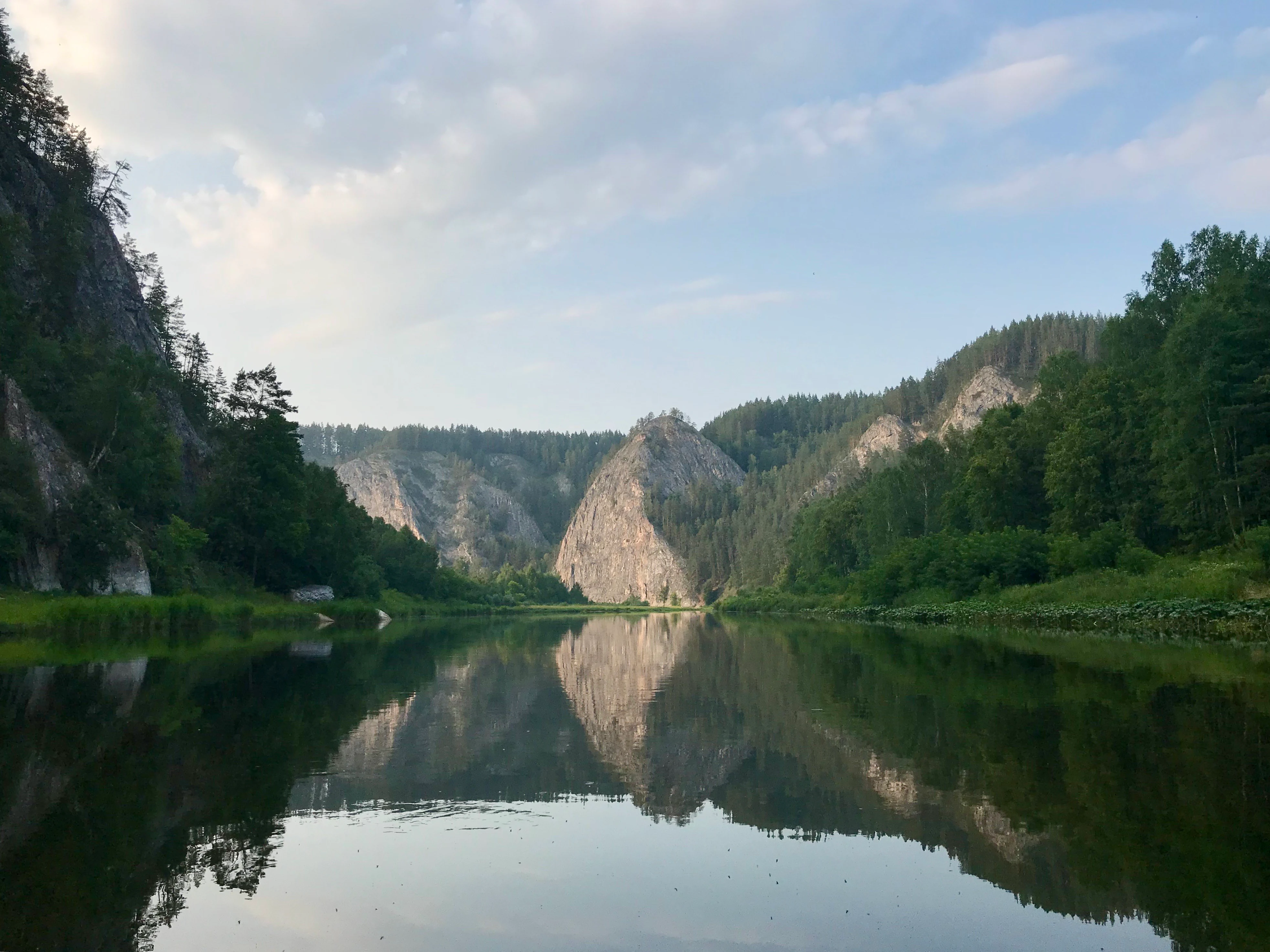
A wide river reflecting mountains and trees under a partly cloudy sky
Calm river reflecting mountain cliffs in Bashkiriya National Park

Bashkiriya National Park history and protected-area timeline

The Bashkiriya region has supported human habitation for thousands of years, with evidence of this long occupation preserved in the neighboring Shulgan-Tash reserve, where Paleolithic cave paintings have been dated to approximately 13,000-14,000 years ago through radio-chemical analysis. The indigenous Bashkir people, who remain the titular ethnic group of Bashkortostan, claim cultural descent from these ancient cave-dwelling communities. The region's historical economy included traditional wild beekeeping, a practice in which honey was harvested from tree hollows and artificial caverns—an industry potentially spanning 1,500 years and preserved today within the adjacent Altyn-Solok entomological reserve.

In the twentieth century, Bashkortostan became the most industrialized and densely populated republic within Russia. Despite this development, the upland areas encompassing Bashkiriya National Park and its associated reserves remained comparatively undisturbed by the broader waves of industrialization and population growth. This relative preservation increased both the ecological significance and the recreational importance of the area. The national park was formally established in 1986, formalizing protections for the forest landscape and its geological features. Today, the park balances its conservation mandate with growing recreational use, particularly around the Nugush Reservoir and through caving activities that explore the extensive underground passages characteristic of the karst terrain.

Bashkiriya National Park landscape and geographic character

The landscape of Bashkiriya National Park is defined by the interplay of forested uplands and dramatic karst topography. The terrain ascends from relatively flat agricultural land in the western portion of the park toward more rugged limestone uplands in the east. Deep river valleys, particularly those carved by the Nugush and Belaya rivers, cut through the landscape, with rocky canyon walls reaching heights of 150 meters. The Nugush River flows through wooded valleys flanked by limestone outcrops before widening into the Nugush Reservoir in the northwest—a 25-square-kilometer lake that serves as a focal point for recreational activity.

The most visually striking geological features are the various limestone formations that characterize the karst landscape. Rocky outcrops, caves, grottoes, and underground rivers create a complex subterranean environment. The Kuperlya Natural Bridge, standing 20 meters above the ground with a span of 10 meters, represents the remains of a former underground river and serves as one of the park's signature geological landmarks. The cave systems are particularly extensive, with 30 known caves containing a combined 8.2 kilometers of major passageways. The Sumgan Cave, located in an isolated area known as Kutuk-Sumgan, represents the largest cave system in the Urals, with passages reaching depths of 126 meters and total length up to 10 kilometers.
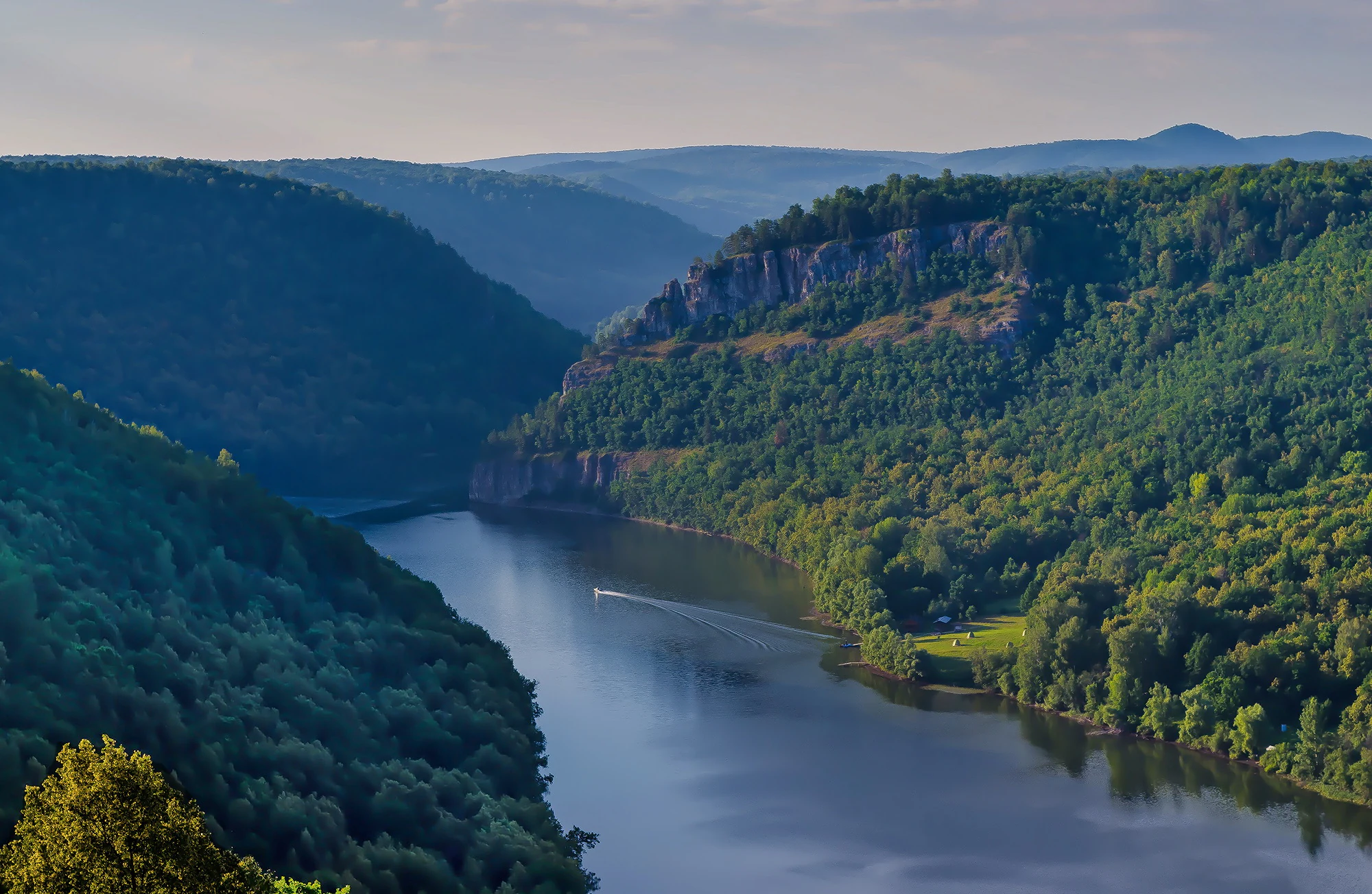
Wide river flowing through a lush green valley with forested hills on both sides and a prominent cliff face visible on the right hillside
Falcon Cliff above the Nugush River in Bashkiriya National Park

Bashkiriya National Park ecosystems, habitats, and plant life

Bashkiriya National Park occupies a remarkable position at the confluence of several biogeographical provinces, making it a center of botanical diversity within the southern Urals. The park's location at the meeting point of boreal conifer forests, broadleaf forests, and steppe ecosystems creates a mosaic of habitat types. Over 92 percent of the park is covered by forest, making it one of the more extensively wooded protected areas in the region. The taiga component features light-coniferous species including pine and larch, while broadleaf species such as linden, oak, elm, and maple occur in richer sites. Small-leaved trees including birch and aspen populate transitional areas.

The botanical diversity is substantial, with more than 800 flowering plant species recorded within the park boundaries. Of these, 117 species are listed as rare or vulnerable, reflecting the conservation significance of this transition-zone forest. Rocky outcrops and cliff faces create microhabitats for smaller flowering plants, while the limited non-forested areas include features such as Bear Meadow, which supports the distinctive lop-sided onion (Allium obliquum), a type of wild onion. The forest structure varies across the park, with the central regions characterized by older-growth stands and accumulated dead timber that supports broader biodiversity.
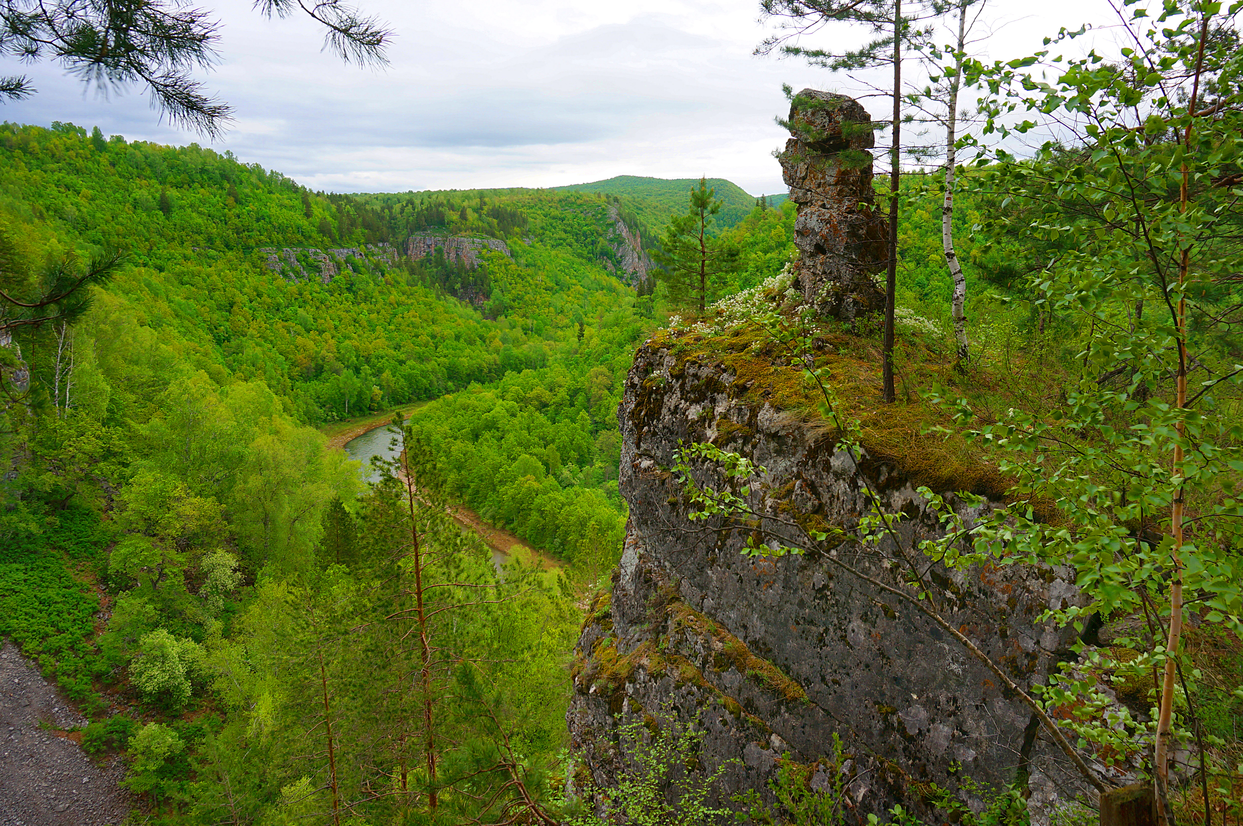
Rocky cliff with moss-covered outcrop overlooking a winding river through dense green forest
Stone Guardian rock formation overlooking the Kuperlya River in Bashkiriya National Park

Bashkiriya National Park wildlife and species highlights

The wildlife of Bashkiriya National Park reflects the park's position at the ecological crossroads between Europe and Asia, with many species at the extreme limits of their geographical ranges. The protected forest habitats support more than 60 species of mammals, including representative species such as brown bear, elk, wolf, lynx, and beaver. These larger mammals benefit from the extensive forest cover and the relative remoteness of the central park areas.

The avifauna includes approximately 150 bird species, with birds of prey representing particularly notable inhabitants. The vulnerable Eastern imperial eagle and the White-tailed eagle—both species of conservation concern—nest in the park's cliffs and forest margins. The White-tailed eagle is the largest eagle species in the region, with wingspans reaching up to 8 feet. The aquatic environments of the Nugush and Belaya rivers support 30 fish species, including the vulnerable Siberian salmon (Hucho taimen), a prized species of the headwaters. Additionally, 11 amphibian species have been recorded within the park, further contributing to the overall biodiversity of this transition-zone protected area.
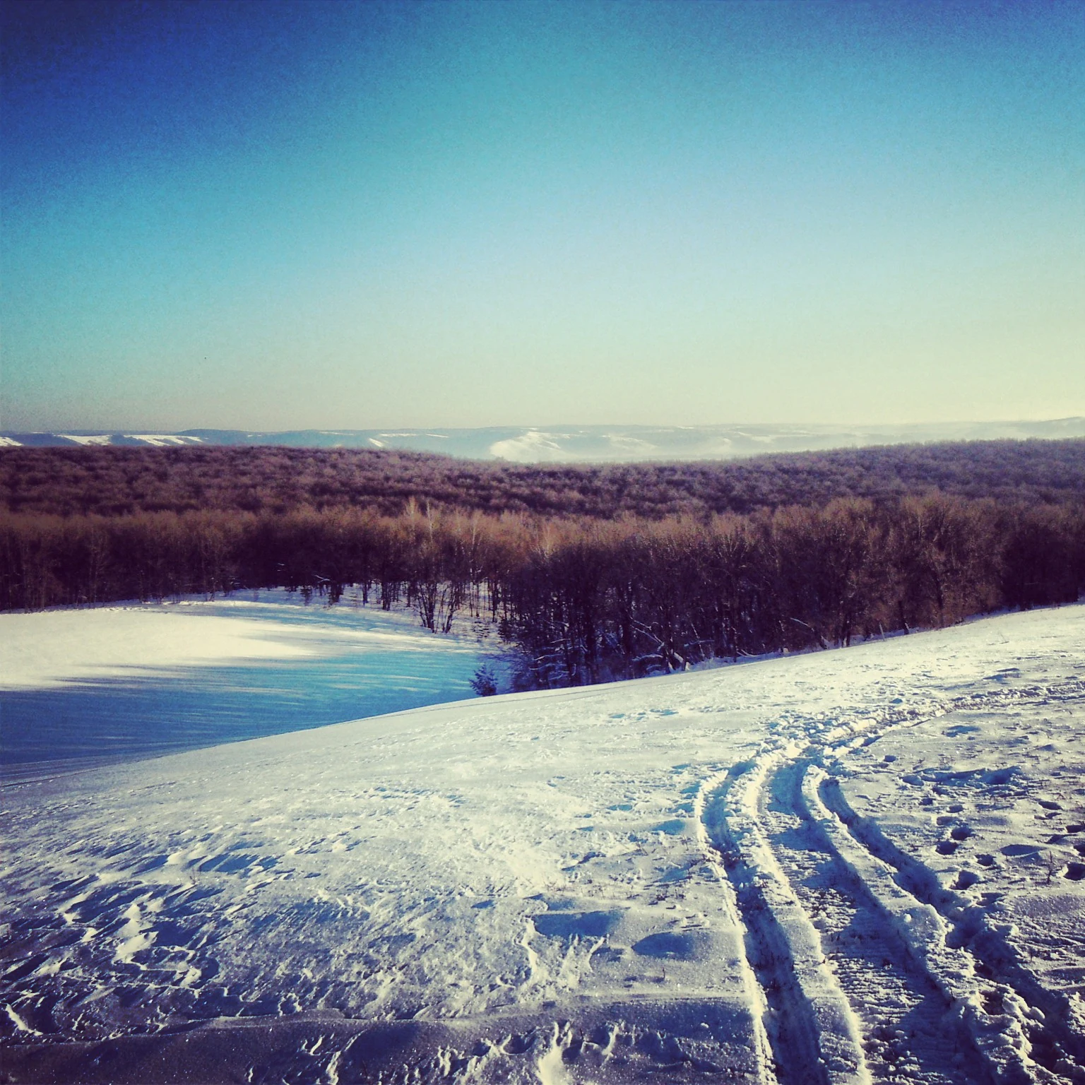
Snow-covered hills with tracks leading to a reservoir surrounded by forest under clear blue sky
Winter landscape near Nugush Reservoir within Bashkiriya National Park

Bashkiriya National Park conservation status and protection priorities

Bashkiriya National Park serves as a critical conservation node within the protected-area network of the southern Urals. The park functions as an essential buffer between the heavily industrialized and populated flatlands of western Bashkortostan and the more strictly protected mountain reserves to the east, including the Shulgan-Tash State Sanctuary. This buffer function is vital for maintaining ecological connectivity and allowing species to move between larger protected landscapes. The park's location at the Europe-Asia boundary adds further conservation significance, as it protects representative habitats of a transition zone that is limited in extent globally.

The protection of the forest cover is particularly important, given that over 92 percent of the park's area is forested. This makes Bashkiriya one of the largest contiguous forest protected areas in the southern Urals, providing sanctuary for species at range limits and preserving the ecological character of this biogeographical crossroads. The karst geological features and cave systems add another dimension to conservation value, protecting unique subterranean habitats and geological formations. The presence of vulnerable species including the Eastern imperial eagle, White-tailed eagle, and Siberian salmon further emphasizes the park's role in maintaining populations of species of conservation concern.

Bashkiriya National Park cultural meaning and human context

The Bashkiriya region carries deep cultural significance for the Bashkir people, the indigenous ethnic group of Bashkortostan. The Bashkirs claim descent from the ancient cultures that created the Paleolithic cave paintings found in the neighboring Shulgan-Tash reserve, dating back 13,000 to 14,000 years. This ancestral connection to the landscape gives the region cultural importance beyond its ecological value. Traditional land-use practices, particularly wild beekeeping, have shaped the relationship between local communities and the forest environment for potentially millennia. The Altyn-Solok entomological reserve protects this historic beekeeping tradition, which represents a unique form of interaction with the landscape that may extend back 1,500 years. The modern park continues to serve the recreational needs of surrounding communities, particularly through the Nugush Reservoir, maintaining the tradition of using these natural areas for leisure and gathering.

Top sights and standout views in Bashkiriya National Park

Bashkiriya National Park stands out for its combination of dramatic karst geology, extensive cave systems, and ecological transition-zone character at the Europe-Asia boundary. The Sumgan Cave represents the largest cave in the Urals, while the Kuperlya Natural Bridge provides a striking geological landmark. The forest covers over 92 percent of the park, protecting a diverse botanical community where Siberian taiga species mix with broadleaf trees. Wildlife includes notable species such as the Eastern imperial eagle and White-tailed eagle, as well as the endangered Siberian salmon in the river headwaters. The park also serves as a vital ecological buffer between industrialized lowlands and protected mountain reserves, maintaining connectivity across the regional conservation landscape.

Best time to visit Bashkiriya National Park

Bashkiriya National Park experiences a humid continental climate with warm summers and cold, snowy winters, characteristic of the southern Urals. Summer months offer the most accessible conditions for exploration, with the Nugush Reservoir providing a popular destination during the warm season. The forest trails, river valleys, and cave systems are most easily explored from late spring through early autumn. Winter visits provide opportunities to experience the park's snowy landscape and forest scenery, though access to some areas may be limited by snow and cold temperatures. The transition seasons of spring and autumn offer different character, with spring bringing blooming flora and autumn displaying the color change of broadleaf trees against the coniferous backdrop.

Monthly climate preview

Long-term representative point measurements tracking monthly averages across the protected terrain

Bashkiriya National Park Climate Normals, Annual Temperature and Precipitation Rhythm

Historical climate data for Bashkiriya National Park records measured monthly temperature variations alongside steady precipitation rates throughout the year. Reviewing the complete twelve-month record provides a detailed baseline of long-term temperature ranges and precipitation patterns.
Annual mean3 °C
-15 °C21 °C
Jan-15°
Feb-13°
Mar-7°
Apr
May12°
Jun18°
Jul21°
Aug19°
Sep12°
Oct
Nov-6°
Dec-13°
Warmest month
July

20.5 °C

Coolest month
January

-14.7 °C

Wettest month
October

1.8 mm/day

Driest month
February

1.4 mm/day

Park location guide

Geography guide, regional context, and park location map for Bashkiriya National Park

Bashkiriya National Park park geography, regions, and map view in Russia

Understand where Bashkiriya National Park sits in Russia through a broader geographic reading of the surrounding landscape, nearby location context, and its mapped position within the national park landscape.

How Bashkiriya National Park fits into Russia

Russia is a transcontinental nation spanning eleven time zones, bordered by fourteen countries. It is the world's largest country by area, covering 17,098,246 km². Moscow is the capital and largest city, while Saint Petersburg is the second-largest and a major cultural centre.

Wider geography shaping Bashkiriya National Park in Russia

Russia spans Eastern Europe and North Asia, covering 17,098,246 km². It shares land borders with fourteen countries, more than any other nation, and spans eleven time zones. The landscape includes vast plains, mountain ranges such as the Urals and Caucasus, and extensive coastlines along the Arctic Ocean, Pacific Ocean, Baltic Sea, Black Sea, and Caspian Sea.

Map view of Bashkiriya National Park

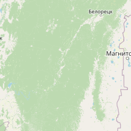
Use this park location map to pinpoint Bashkiriya National Park in Russia, understand its exact geographic position, and read its mapped placement within the surrounding landscape more clearly.

Pigeon | © OpenStreetMap contributors

Location context for Bashkiriya National Park

Bashkortostan

Visualizing karst limestone formations, deep river valleys, and boreal forest habitats

Bashkiriya National Park Photos and Landscape Scenery Exploration

Visual records capture the dramatic karst limestone formations, deep river valleys, and dense boreal forest habitats that define the protected landscape. Examining these field photographs reveals the rugged terrain and ecological transition zones characterizing the southern Ural mountain environment.

A wide river reflecting mountains and trees under a partly cloudy sky

Calming water reservoir with lush green forested hills and rocky cliffs under a clear blue sky

Wide river flowing through a lush green valley with forested hills on both sides and a prominent cliff face visible on the right hillside

Rocky cliff with moss-covered outcrop overlooking a winding river through dense green forest

Snow-covered hills with tracks leading to a reservoir surrounded by forest under clear blue sky

Park atlas

Compare surrounding regional geography and connected Ural mountain reserves

Other Parks Near Bashkiriya National Park and Protected Landscapes

Browse protected areas near Bashkiriya National Park to examine regional terrain, forest corridors, and geological diversity. Expanding the geographic comparison provides deeper context into neighboring conservation zones and broader ecoregions.
Watercolor painting of a lush green landscape featuring a flowing river, conifer trees, rolling hills, and a small waterfall on the right side.
National parkBashkortostan
About 0 km away#1 closest

East

Bashkiriya National Park: Protected Karst Landscapes and Ural Mountain Geography

Southern Ural forest ecosystems and karst cave networks

Bashkiriya National Park protects over 900 square kilometers of mountainous terrain and river valleys in the Republic of Bashkortostan. The park serves as a prime example of the Southern Ural transition, featuring an intricate mix of karst sinkholes, surface streams, and mature broadleaf forests that support diverse temperate wildlife and avian communities.

Area
920 km²
Established
1986
IUCN
II
Visitors
30K annual
Watercolor illustration of a mountain range with purple peaks, green hills, a single tall pine tree, and pinkish foreground vegetation
National parkChelyabinsk Oblast
About 215 km away#2 closest

Northeast

Zigalga National Park: Geography, Alpine Terrain, and Protected Wilderness Areas

A vital ecological corridor within the Chelyabinsk Oblast of Russia

Zigalga National Park serves as a pristine natural sanctuary at the crossroads of Europe and Siberia. The territory features steep mountainous ridges, expansive peat bogs, and vertical floral zonation that defines the Southern Ural landscape. This protected area provides a stable environment for rare boreal plant species and remains largely untouched by development, offering a valuable record of subarctic ecosystem health.

Area
457 km²
Established
2019
IUCN
II
Relief
Mountain
National parkChelyabinsk Oblast
About 220 km away#3 closest

Northeast

Zigalga National Park: Mapped Geography and Protected Areas of the Southern Urals

Mountain forest and tundra ecosystems in Chelyabinsk Oblast

Spanning the rugged ridges of the Southern Urals, Zigalga National Park protects a distinct mosaic of dark coniferous forests and alpine-like golets tundra. This protected area plays a crucial role in regional hydrology and biodiversity, encompassing the headwaters of the Yuryuzan and Kutkurka rivers across a diverse elevational landscape.

Area
456.616 km²
Established
2019
IUCN
II
Relief
Mountain
National parkChelyabinsk Oblast
About 254 km away#4 closest

Northeast

Zyuratkul National Park: Mapped Geography and Protected Landscapes of the Southern Urals

High-mountain lake terrain and diverse taiga forest ecosystems.

Zyuratkul National Park serves as a critical protected area in the Chelyabinsk Oblast, showcasing the meeting of Siberian and European ecosystems. The territory features a dramatic range of landforms including the high-mountain Lake Zyuratkul, alpine tundra on Nurgush ridge, and deep valleys containing ancient archaeological sites. This atlas entry provides a foundational view of the park's natural terrain, geographic features, and protected boundary structure.

Area
882.49 km²
Established
1993
IUCN
II
Relief
Mountain
Watercolor illustration depicting rolling hills, green forests, and distant mountains under a pale sky
National parkChelyabinsk Oblast
About 255 km away#5 closest

Northeast

Zyuratkul National Park: Geography, Alpine Lakes, and Mountain Range Maps

Protected mountain wilderness in Chelyabinsk Oblast, Russia

Analyze the protected geography of Zyuratkul National Park, home to the highest point in Chelyabinsk Oblast and a distinctive alpine lake basin. Explore the park boundaries and the vertical transition from dense forest to the craggy summits of the Nurgush and Zyuratkul mountain ranges.

Area
882.49 km²
Established
1993
IUCN
II
Relief
Mountain
National parkRussia
About 296 km away#6 closest

West

Buzuluksky Bor National Park: Mapping an Isolated Forest in the Russian Steppe

Examining the unique geomorphology and forest-steppe ecological boundaries.

Buzuluksky Bor National Park serves as an extraordinary natural laboratory in Russia, defined by its 106,000 hectares of pine forest set against a backdrop of open grasslands. This protected area features deep sandy substrates of marine origin, undulating dune landscapes, and the deeply incised Borovka River valley, providing a vital study site for forest-steppe dynamics and long-term conservation research.

Area
1,060 km²
Established
2007
IUCN
II
Relief
Lowland
A horizontal watercolor illustration depicting a line of evergreen trees along a shoreline with rolling hills in the background.
National parkSamara Oblast
About 296 km away#7 closest

West

Buzuluksky Bor National Park: A Mapped Analysis of Protected Pine Forest Landscapes

Regional Geography of the Samara and Orenburg Borderlands

Buzuluksky Bor National Park represents a significant conservation hub, safeguarding centuries-old pine stands within a pronounced riverine depression. This protected area offers deep insights into the transition between bore forest types and the broader steppe ecosystems of southeastern European Russia.

Area
1,067.88 km²
Established
2008
IUCN
II
Relief
Lowland
Watercolor illustration of rolling hills, green forests, and distant mountains under a pale sky
National parkRussia
About 326 km away#8 closest

Northeast

Taganay National Park: Protected Landscape and Regional Geography Explorer

Explore mapped protected areas and natural landscapes.

Taganay National Park stands as a key protected area within Russia, offering unique geographic features and a distinct regional landscape identity. This entry serves as a gateway to understanding the park's role as a national park, providing context for its mapped boundaries and environmental setting. Utilize this resource for structured discovery of protected lands and their place within the broader atlas of natural geographies.

IUCN
II
Scope
Terrestrial

Common questions about visiting, size, designation, and location context for Bashkiriya National Park

Bashkiriya National Park FAQs for park facts, access, geography, and protected area context

Find quick answers about Bashkiriya National Park, including protected-area facts, park geography, trail and visitor context, and how the park fits into its surrounding country and regional landscape.
MoriAtlas Explorer

Continue Your Protected Areas Search Across the Global Atlas

Deepen your exploration by continuing the structured search for national parks and protected areas worldwide. Utilize the comprehensive filtering capabilities to compare different conservation landscapes and refine your understanding of global park geography. Discover more about the distribution and characteristics of protected natural areas.

Global natural geography