
Mori Atlas logo
Wildlife reserveBhitarkanika Mangroves

Explore the deltaic plains and tidal waterways of this protected wetland in Odisha

Bhitarkanika Mangroves: A Detailed Geographic Overview of India's Coastal Wildlife Reserve

Bhitarkanika Mangroves sits within the deltaic plains where the Brahmani and Baitarani rivers meet the Bay of Bengal in Odisha. This vast wildlife reserve features a dense network of tidal creeks, estuarine channels, and mangrove islands that form a critical coastal habitat. The geography provides an essential look at salt-tolerant vegetation and dynamic riverine hydrology, serving as a landmark for protected ecosystems in Eastern India.

mangrove wetlandRamsar sitecoastal ecosystemBay of Bengalestuarine habitatsaltwater crocodile
A flat-style digital illustration depicting a mountain valley featuring a prominent waterfall, pine trees, and a setting sun.

Bhitarkanika Mangroves

Wildlife reserve

Park overview

Structured park overview, official facts, and landscape profile for Bhitarkanika Mangroves

Bhitarkanika Mangroves park facts, protected area profile, and essential visitor context

Review the core facts for Bhitarkanika Mangroves, including designation, size, terrain, visitor scale, habitats, and operating context in one park-focused overview.

About Bhitarkanika Mangroves

Bhitarkanika Mangroves is a large tidal wetland that defines the coastal landscape of northeastern Odisha, where the state's major river systems spill into the Bay of Bengal. The mangrove forests extend across the deltaic flats of the Brahmani and Baitarani rivers, forming a complex mosaic of tidal channels, mudflats, salt-tolerant woodlands, and estuarine islands.

The protected area encompassing the mangroves operates as a layered conservation landscape. The outermost tier is the Bhitarkanika Wildlife Sanctuary, declared in 1975 and covering a substantial area of the mangrove and surrounding habitat. Within it lies Bhitarkanika National Park, established in 1998 as the stricter core zone. To the east, the Gahirmatha Marine Wildlife Sanctuary extends protection along the coastal waters and beaches that front the mangrove system.

Quick facts and research context for Bhitarkanika Mangroves

Bhitarkanika Mangroves is a Ramsar-listed coastal wetland situated in Odisha, on India's eastern Bay of Bengal coast, within the combined delta of the Brahmani and Baitarani rivers. Covering approximately 650 square kilometers, it ranks among the most significant mangrove ecosystems in India and forms the ecological backdrop for both Bhitarkanika National Park and the surrounding Bhitarkanika Wildlife Sanctuary.

The mangrove system falls within the Indomalayan biogeographic realm and supports around 62 species of mangroves along with a diverse reptile, bird, and marine fauna. The area carries formal protection at multiple tiers, including national park status for the core zone, wildlife sanctuary and Ramsar Wetland designation, and protection of adjacent marine habitat through the Gahirmatha Marine Wildlife Sanctuary.

Protection and recognition

Documented conservation frameworks and official Ramsar wetland recognition

Bhitarkanika Mangroves Protection Status and International Recognition

Bhitarkanika Mangroves maintains a documented protection status alongside recorded international recognition sources. Official Ramsar wetland designation provides formal context for evaluating regional conservation frameworks.

International recognition

Protection details

Protection scope
Mixed
Transboundary protection
No
Core area
145 km²
Park context

Deeper park guide and search-rich context for Bhitarkanika Mangroves

Bhitarkanika Mangroves history, landscape, wildlife, and travel context

Explore Bhitarkanika Mangroves through its history, landscape character, ecosystems, wildlife, conservation priorities, cultural context, and seasonal travel timing in a structured park guide built for atlas discovery and search intent.

Why Bhitarkanika Mangroves stands out

Bhitarkanika is best known for being one of India's premier mangrove ecosystems and a critical stronghold for the saltwater crocodile, with healthy breeding populations inhabiting the tidal creeks, river channels, and mangrove islands. The wetland is equally celebrated for its role in the annual mass nesting of olive ridley sea turtles on nearby Gahirmatha Beach, one of the most important rookery sites for the species along the Indian coastline. The dense cover of true mangrove species, combined with the brackish tidal waters of the Brahmani-Baitarani delta, also makes Bhitarkanika a major hub for resident and migratory waterbirds. A large heronry within the sanctuary has historically supported tens of thousands of nesting herons and other colonial waterbirds, reinforcing the site's status as a key coastal biodiversity area in eastern India.
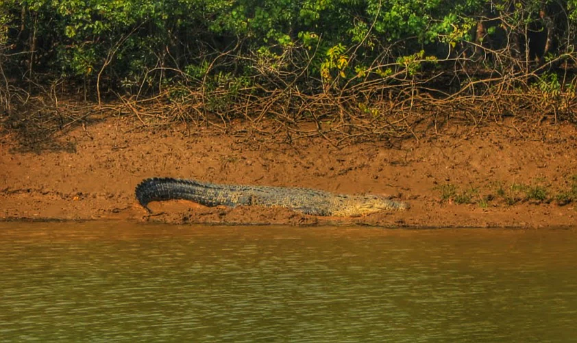
A large saltwater crocodile resting on a reddish mud bank along a river channel, with dense mangrove vegetation in the background.
A saltwater crocodile rests on the muddy bank of a mangrove forest channel in Bhitarkanika.

Bhitarkanika Mangroves landscape and geographic character

Bhitarkanika's landscape is shaped by the interaction of rivers, tides, and the Bay of Bengal. The terrain consists of low-lying deltaic flats crisscrossed by a dense network of tidal creeks, distributaries, and estuarine channels that branch off the Brahmani and Baitarani rivers. The elevation is uniformly low, with mangrove islands and mudflats rising gently above the tidal waters.

The visual character of the area is dominated by unbroken stretches of mangrove woodland, with tidal mudflats and sandflats exposed at low tide and salt-tolerant vegetation extending right to the water's edge. To the east, the mangrove landscape transitions into the open beach environment of Gahirmatha, where marine sands meet the Bay of Bengal, forming one of the most important sea turtle rookeries on the Indian coast.

The riverine influence of the Brahmani and Baitarani systems is central to the geomorphology of Bhitarkanika, delivering sediment and freshwater pulses that shape the mangrove islands and create a constantly evolving mosaic of channels, banks, and intertidal flats. This dynamic hydrology is what gives Bhitarkanika its distinctive layered scenery of forest, water, and tidal openness.
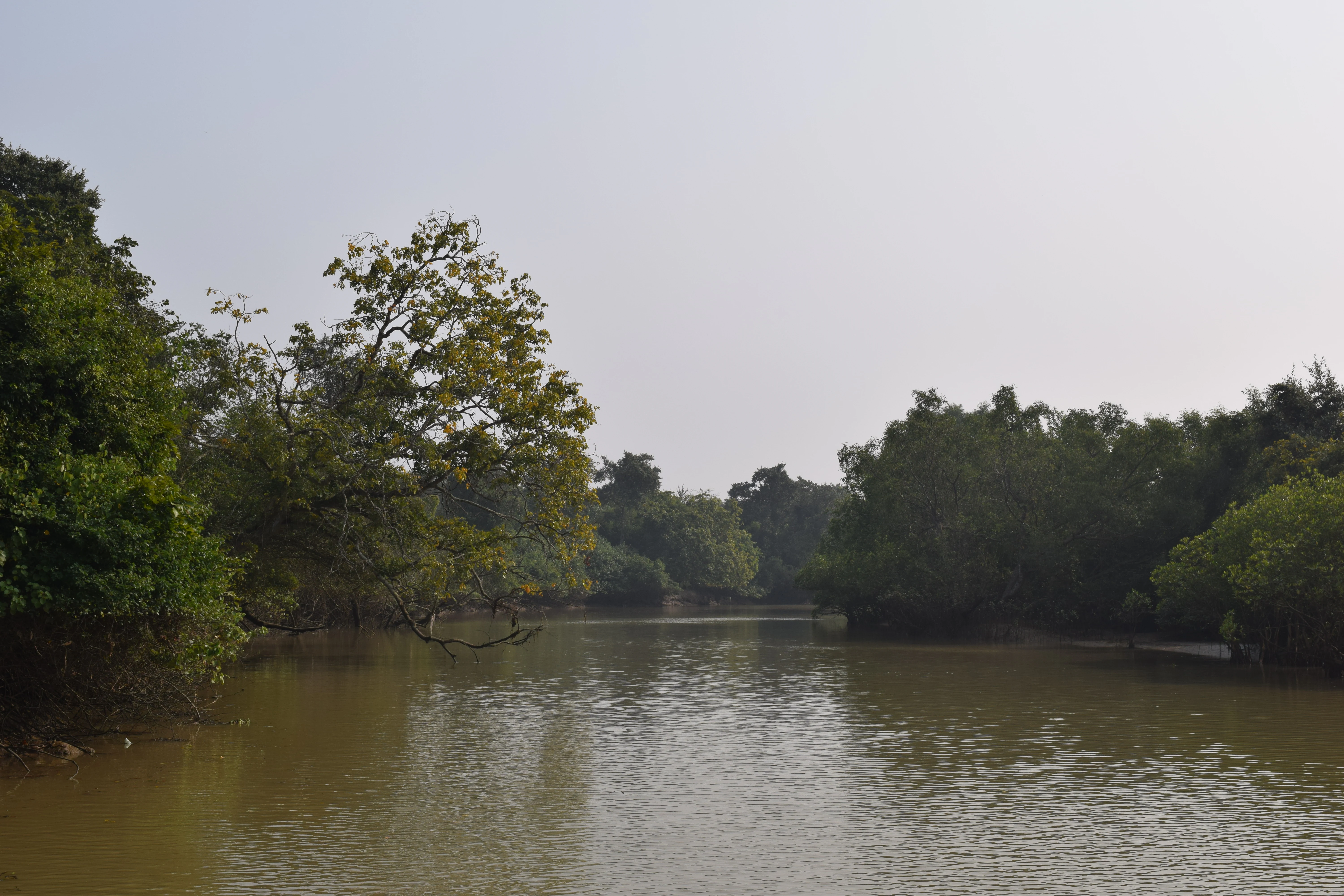
A calm, muddy waterway winds through a dense mangrove forest under a pale sky.
A view of the tranquil mangrove waterways within Bhitarkanika.

Bhitarkanika Mangroves ecosystems, habitats, and plant life

Bhitarkanika's ecological identity is fundamentally that of a mangrove ecosystem. The mangrove flora is unusually diverse for the Indian subcontinent, with around 62 mangrove species recorded in the system, spread across multiple tidal and elevation zones. Genera such as Avicennia, Bruguiera, Heritiera, and Rhizophora are among the notable components, each occupying characteristic niches between the subtidal fringe and the higher, less frequently inundated interior soils.

Beyond the mangroves themselves, the broader estuarine landscape of the Brahmani-Baitarani delta contributes further ecological complexity, with mudflats, saltpans, creeks, and remnant natural vegetation creating transitional habitats that link the mangrove forest with marine, freshwater, and terrestrial environments. This ecological gradient supports an unusually broad spectrum of estuarine and coastal species.

The ecosystem functions as a nursery and feeding ground for fisheries, a refuge for migratory waterbirds, and a structural stabilizer of the Odisha coastline. The combination of mangrove forest structure and dynamic tidal hydrology produces a coastal habitat system of considerable ecological significance within the Indomalayan biogeographic realm.

Bhitarkanika Mangroves wildlife and species highlights

The wildlife profile of Bhitarkanika is anchored by its populations of large reptiles and waterbirds. The saltwater crocodile is perhaps the area's most iconic resident, inhabiting the tidal creeks, river channels, and mangrove pools in numbers that make Bhitarkanika one of India's most important strongholds for the species.

Other reptiles documented in the mangroves include the king cobra, Indian python, and water monitor, reflecting the system's capacity to support diverse reptilian fauna across mangrove, estuarine, and forest-edge habitats. The olive ridley turtle is another cornerstone of Bhitarkanika's wildlife identity, arriving at the adjacent Gahirmatha Beach between January and March for nesting.

The birdlife of Bhitarkanika is extensive. Surveys between August 2004 and December 2006 recorded 263 bird species, comprising 147 resident and 99 migrant species. The wetland also hosts a major heronry, covering roughly four hectares, where more than 11,000 nests were counted in 2006, providing breeding habitat for multiple colonial waterbird species. The combination of resident and migratory species across mangrove, mudflat, riverine, and marine habitats makes Bhitarkanika a year-round hub for waterbird activity on the eastern Indian coast.

Bhitarkanika Mangroves conservation status and protection priorities

Bhitarkanika stands as one of the most heavily protected coastal wetland complexes in India, reflecting its long history of layered conservation designations. The foundational protection comes from the Bhitarkanika Wildlife Sanctuary, declared in 1975, and from the stricter Bhitarkanika National Park established in 1998 as the core zone.

A key marine conservation complement is the Gahirmatha Marine Wildlife Sanctuary, created in 1997, which extends protection across the sea turtle nesting beaches and adjacent waters of the Bay of Bengal. The ban on collecting and marketing turtles and their eggs, introduced in 1983, has been central to the recovery of the olive ridley nesting aggregation at Gahirmatha.

Internationally, Bhitarkanika's significance was formally recognized in 2002 when it was designated a Ramsar Wetland of International Importance, placing it within the global network of wetlands considered critical for conservation. The importance of Bhitarkanika extends beyond individual species, encompassing coastal stabilization, fisheries support, storm buffering, and the broader resilience of the Brahmani-Baitarani delta. Combined, these roles position Bhitarkanika as a conservation landmark for mangrove and estuarine ecosystems in South Asia.

Bhitarkanika Mangroves cultural meaning and human context

Bhitarkanika sits within a long-standing coastal cultural landscape of Odisha, surrounded by fishing and riverine communities whose livelihoods have historically been tied to the productivity of the Brahmani-Baitarani delta. The mangrove and associated mudflats have traditionally supported small-scale fisheries, crab collection, and other estuarine resource use.

The land tenure context of the area has also been significant: the mangroves were historically classified as zamindari forests until the land tenure reforms of 1952 transferred them to state forest control, a transition that shaped modern conservation governance in the region.

The cultural identity of the surrounding coast is closely tied to the rhythms of the Bay of Bengal and the Odisha coastal environment, with communities interacting with seasonal phenomena such as olive ridley turtle nesting. This interplay between human presence and seasonal natural events adds a social dimension to the wetland's significance, alongside its ecological and conservation roles.

Top sights and standout views in Bhitarkanika Mangroves

Bhitarkanika's strongest identity signals all converge on a coastal, mangrove-based ecological profile. Among its standout qualities are its status as one of India's largest mangrove wetlands, its layered protection through national park, wildlife sanctuary, marine sanctuary, and Ramsar site designations, and its globally recognized nesting beaches for the olive ridley sea turtle.

Equally notable is Bhitarkanika's role as a flagship habitat for the saltwater crocodile in India, and its exceptional bird diversity, anchored by a major heronry and a species list that includes more than 250 recorded resident and migrant birds. The ecosystem's role in coastal protection, fisheries support, and cyclone buffering reinforces its broader environmental significance along the Bay of Bengal coast.

Best time to visit Bhitarkanika Mangroves

Bhitarkanika's wetland and coastal landscapes change character throughout the year, shaped by tidal cycles, mangrove ecology, and seasonal wildlife events. The cooler, drier winter months are broadly associated with calmer conditions and active birdwatching, when migratory waterfowl augment the already rich resident birdlife across the mangroves, mudflats, and heronries.

The January to March period is particularly significant because of olive ridley turtle nesting at nearby Gahirmatha Beach, when large numbers of turtles come ashore to lay eggs. Travel and arrival planning during this period should remain mindful of conservation sensitivity around nesting beaches.

The summer monsoon brings heavy rainfall to coastal Odisha and influences water levels, salinity, and accessibility in the mangrove river systems, while the post-monsoon period sees the landscape refresh and stabilize. Throughout the year, the park's climate profile is typically warm and humid, consistent with its tropical coastal setting.
Monthly climate preview

Long-term representative measurements illustrating monthly temperature and precipitation cycles

Bhitarkanika Mangroves Climate Normals, Annual Temperature, and Precipitation Rhythm

Bhitarkanika Mangroves exhibits a measured annual temperature range from cooler winter minimums to higher summer maximums alongside distinct monthly precipitation variations. Examining the complete twelve-month climate profile reveals comprehensive long-term averages for temperature and rainfall distribution across the coordinate.
Annual mean27 °C
22 °C30 °C
Jan22°
Feb24°
Mar28°
Apr29°
May30°
Jun29°
Jul29°
Aug28°
Sep28°
Oct28°
Nov25°
Dec23°
Warmest month
May

29.9 °C

Coolest month
January

22 °C

Wettest month
July

11.7 mm/day

Driest month
December

0.3 mm/day

Park location guide

Geography guide, regional context, and park location map for Bhitarkanika Mangroves

Bhitarkanika Mangroves park geography, regions, and map view in India

Understand where Bhitarkanika Mangroves sits in India through a broader geographic reading of the surrounding landscape, nearby location context, and its mapped position within the national park landscape.

How Bhitarkanika Mangroves fits into India

India is a South Asian country bordered by the Indian Ocean, Arabian Sea, and Bay of Bengal. It shares land borders with Pakistan, China, Nepal, Bhutan, Bangladesh, and Myanmar. The country has a population of over 1.4 billion people and operates as a federal parliamentary republic with its capital in New Delhi.

Wider geography shaping Bhitarkanika Mangroves in India

India occupies the Indian subcontinent in South Asia, bordered by the Arabian Sea to the southwest, the Bay of Bengal to the southeast, and the Indian Ocean to the south. It shares land borders with Pakistan to the west, China, Nepal, and Bhutan to the north, and Bangladesh and Myanmar to the east. The territory also includes the Andaman and Nicobar Islands in the Indian Ocean.

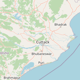
Map view of Bhitarkanika Mangroves

Use this park location map to pinpoint Bhitarkanika Mangroves in India, understand its exact geographic position, and read its mapped placement within the surrounding landscape more clearly.

Pigeon | © OpenStreetMap contributors

Location context for Bhitarkanika Mangroves

Odisha

Explore protected delta landscapes, winding estuarine channels, and coastal habitats.

Bhitarkanika Mangroves Photos and Scenery: Visualizing Tidal Forests

Visual documentation captures the intricate terrain of tidal creeks, mangrove forests, and deltaic mudflats across the protected wetland. Field photography reveals the distinct environmental character of riverine waterways and coastal ecosystems along the Bay of Bengal.

A large saltwater crocodile resting on a reddish mud bank along a river channel, with dense mangrove vegetation in the background.

A calm, muddy waterway winds through a dense mangrove forest under a pale sky.

Park atlas

Compare regional wildlife sanctuaries and coastal reserves across the surrounding delta

Parks Near Bhitarkanika Mangroves And Connected Protected Landscapes

Browsing parks near Bhitarkanika Mangroves reveals a wider network of tidal forests, estuarine wetlands, and protected coastal habitats along the Bay of Bengal. Expanding the geographic comparison helps trace regional conservation corridors and connected deltaic ecosystems across eastern India.
National parkKendrapara district
About 14 km away#1 closest

East

Bhitarkanika National Park: Protected National Park in Kendrapara District

Explore its mapped boundaries and regional landscape.

Bhitarkanika National Park, a designated national park in India's Kendrapara district, offers a unique opportunity for geographic discovery. This page details the park's protected area status, its specific landscape characteristics, and its position within the regional geography. Engage with structured data about its mapped boundaries and understand its environmental context for comprehensive atlas exploration.

Area
145 km²
Established
1998
IUCN
II
Relief
Lowland
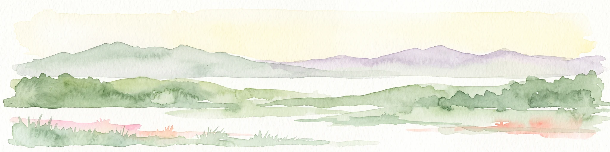
Watercolor illustration showing a landscape with trees, water, and mountains
National parkMayurbhanj district
About 107 km away#2 closest

Northwest

Simlipal National Park: National Park Protected Area in Mayurbhanj District

Mapped boundaries and regional geography of Simlipal National Park.

Simlipal National Park stands as a prominent national park, offering a rich protected area landscape within Mayurbhanj district, India. This entry provides detailed atlas-style information, focusing on the park's geographic footprint and mapped terrain. Explore the structured data that defines Simlipal National Park's identity as a protected natural landscape, ideal for understanding its place within regional geography and conservation efforts.

Area
2,750 km²
Established
1980
IUCN
II
Relief
Mountain
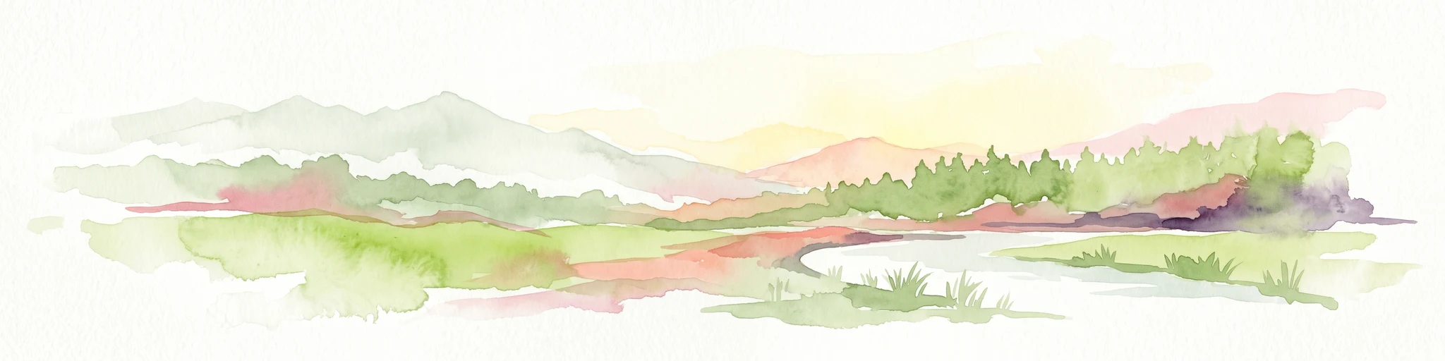
A horizontal watercolor painting showing a soft landscape with distant mountains, gentle green hills, and light water reflections.
Protected areaOdisha
About 197 km away#3 closest

Southwest

Chilika Lake Protected Area: Mapping the Estuarine Geography of the Odisha Coast

A study of lagoon hydrology, barrier beaches, and protected wetland terrain.

Chilika Lake provides a significant case study in estuarine geography, where tidal influence from the Bay of Bengal meets the runoff of the Eastern Ghats. This expansive protected area is characterized by seasonal water fluctuations, extensive island groups, and a vital barrier spit. The landscape remains a critical reference for understanding coastal wetland development and hydrological connectivity within the broader Indian geographic context.

Area
1,165 km²
Established
1981
Visitors
40K annual
Relief
Lowland
Watercolor painting showing mangrove trees, water channels, and hills in the background
National parkWest Bengal
About 212 km away#4 closest

Northeast

Sundarbans National Park: UNESCO World Heritage Mangrove National Park in West Bengal

Explore its tidal geography and mapped protected boundaries.

Sundarbans National Park is a vital protected area on the Ganges Delta, recognized globally as the world's largest mangrove forest and a UNESCO World Heritage Site. Located in West Bengal, this national park features a unique estuarine geography characterized by intricate tidal channels and distributaries that define its landscape. Its protected boundaries safeguard a complex ecosystem, offering rich opportunities for atlas-driven exploration of its distinctive natural terrain and coastal wetland significance.

Area
1,330.1 km²
Established
1984
IUCN
II
Relief
Lowland
A stylized digital illustration showing a valley with a waterfall cascading from a rocky cliff, green hills, pine trees, and a sunlit sky with clouds.
Protected areaWest Bengal
About 260 km away#5 closest

Northeast

East Kolkata Wetlands: A Comprehensive Geographic View of the Protected Area

Regional landscape, urban wetlands, and aquaculture mapping

Discover the physical layout of the East Kolkata Wetlands, a transformative protected area bordering Kolkata, West Bengal. This atlas entry provides a detailed look at the site's function as a massive, naturally integrated sewage-fed aquaculture and agricultural system, showcasing how water, land, and human labor interweave across the Ganges-Brahmaputra deltaic terrain.

Area
125 km²
Established
2002
Relief
Lowland
Climate
Subtropical
National parkPatuakhali District
About 357 km away#6 closest

East

Kuakata National Park: Protected Landscape Identity and Geographic Atlas

Mapped boundaries and regional context within Patuakhali District.

Kuakata National Park is a significant protected area designated as a national park, offering valuable insights into the geography of Patuakhali District. This park detail page provides a structured exploration of its mapped boundaries and protected landscape characteristics, serving as a vital entry point for understanding its place within the larger atlas of global natural sites. Focus on its specific geographic setting and conservation status for detailed discovery.

Area
16.13 km²
Established
2010
IUCN
II
Relief
Lowland
National parkJharkhand
About 444 km away#7 closest

Northwest

Betla National Park: National Park Protected Area Exploration and Geographic Context in Jharkhand

Mapped boundaries of a significant protected landscape.

Betla National Park, situated in Jharkhand, India, is a key national park offering significant value for geographic and protected-area discovery. This resource facilitates exploration of its mapped boundaries, providing a clear understanding of its protected landscape and its relationship to the surrounding regional geography. Delve into the structured data to comprehend the park's atlas context and its role as a conserved natural area within India.

Area
226.32 km²
Established
1986
IUCN
II
Access
Moderate access
National parkBangladesh
About 455 km away#8 closest

East

Nijhum Dweep National Park: A Protected Landscape in Bangladesh's Geographic Atlas

Explore the mapped boundaries and regional setting of this national park.

Nijhum Dweep National Park is a key protected area situated within the deltaic geography of Bangladesh. This detailed entry provides insight into its mapped landscape, natural terrain, and its significance as a national park. Understand its geographic context and explore its protected boundaries as part of a broader atlas of natural areas, offering a factual basis for understanding this unique South Asian landscape.

Area
163.52 km²
Established
2001
IUCN
IV
Relief
Lowland

Common questions about visiting, size, designation, and location context for Bhitarkanika Mangroves

Bhitarkanika Mangroves FAQs for park facts, access, geography, and protected area context

Find quick answers about Bhitarkanika Mangroves, including protected-area facts, park geography, trail and visitor context, and how the park fits into its surrounding country and regional landscape.
MoriAtlas Explorer

Continue Your Protected Areas Search Across the Global Atlas

Deepen your exploration by continuing the structured search for national parks and protected areas worldwide. Utilize the comprehensive filtering capabilities to compare different conservation landscapes and refine your understanding of global park geography. Discover more about the distribution and characteristics of protected natural areas.

Global natural geography