
Mori Atlas logo
National parkBikin National Park

Mapping the temperate ecosystems and Sikhote-Alin mountain terrain of this vast protected area

Bikin National Park: A Protected Wilderness of Old-Growth Forest in the Russian Far East

(National Park Bikin)

Bikin National Park encompasses over 1.16 million hectares of unbroken temperate rainforest within the Primorsky Krai region. This significant protected landscape, situated on the western slopes of the Sikhote-Alin mountain range, serves as a vital sanctuary for the endangered Amur tiger and maintains one of the largest tracts of old-growth mixed forest in the Northern Hemisphere. The Bikin River valley provides a complex hydrological network that defines the park geography, offering a rare window into undisturbed natural dynamics.

Old-growth forestAmur tiger habitatTemperate rainforestWorld Heritage siteRussian Far EastSikhote-Alin mountains
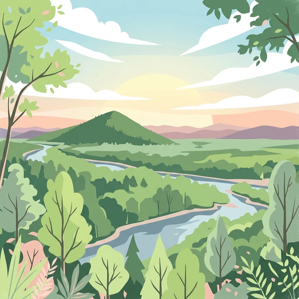
Illustration of a winding river flowing through a dense forest with a mountain in the background under a partly cloudy sky

Bikin National Park

National park

Park overview

Structured park overview, official facts, and landscape profile for Bikin National Park

Bikin National Park park facts, protected area profile, and essential visitor context

Review the core facts for Bikin National Park, including designation, size, terrain, visitor scale, habitats, and operating context in one park-focused overview.

About Bikin National Park

Bikin National Park occupies a remarkable position in the global conservation landscape as one of the last great wilderness areas in temperate Asia. The park's establishment in 2015 marked a significant milestone in Russian environmental protection, creating a sanctuary for the extensive old-growth forests that characterize the western Sikhote-Alin mountains. These forests, described as temperate rainforests, represent ecosystems that have persisted through centuries with minimal human intervention, providing intact habitat for species that have largely disappeared from other parts of the continent.

The park's location within the Ussuri broadleaf and mixed forests ecoregion places it at a critical biogeographic crossroads, where species from northern and southern Asia meet and interact. This positioning has resulted in extraordinary biodiversity, with the park supporting 51 mammal species and 194 bird species documented within its boundaries. The unbroken nature of the forest cover across such an extensive area creates wildlife corridors of continental significance, allowing large mammals to move freely across the landscape.

Management of the park balances strict conservation with recognition of the deep cultural connections between the land and its indigenous inhabitants. Approximately 600 people from the Udeghe and Nanai ethnic groups continue traditional practices of fishing, hunting, and pine nut gathering within the park boundaries. The zoning plan designates nearly 70% of the park's area for these traditional uses while concentrating more intensive conservation protection in core zones. This approach reflects a growing understanding that effective conservation in inhabited landscapes requires respecting and supporting the rights and practices of indigenous communities whose stewardship has often helped maintain ecosystem health.

Quick facts and research context for Bikin National Park

Bikin National Park covers 1,160,000 hectares in the Sikhote-Alin mountains of Primorsky Krai, making it one of the largest protected areas in the Russian Far East. The park was established in 2015 specifically to protect old-growth mixed forest and Amur tiger habitat. It forms part of the Bikin River Valley World Heritage Site since 2018. The park is managed by FGBU Bikin and maintains zoning that allows traditional indigenous land use across approximately 68% of its territory.

Protection and recognition

Documented terrestrial conservation scope and recognition history

Bikin National Park Protection Status and Designated Area Framework

Bikin National Park maintains a documented terrestrial protection status within its regional conservation framework. Official records compile available management scope and international recognition data for comprehensive territory analysis.

Protection details

Protection scope
Terrestrial
Park context

Deeper park guide and search-rich context for Bikin National Park

Bikin National Park history, landscape, wildlife, and travel context

Explore Bikin National Park through its history, landscape character, ecosystems, wildlife, conservation priorities, cultural context, and seasonal travel timing in a structured park guide built for atlas discovery and search intent.

Why Bikin National Park stands out

Bikin National Park is best known as the largest remaining tract of old-growth mixed forest in the Northern Hemisphere and as a critical stronghold for the endangered Amur tiger. The park's temperate rainforest environment supports one of the highest concentrations of biodiversity in Russia's forest ecosystems. Its designation as a World Heritage Site recognizes its outstanding natural value, while its population of 30-35 wild Amur tigers represents roughly 10% of the global population of this critically endangered big cat.
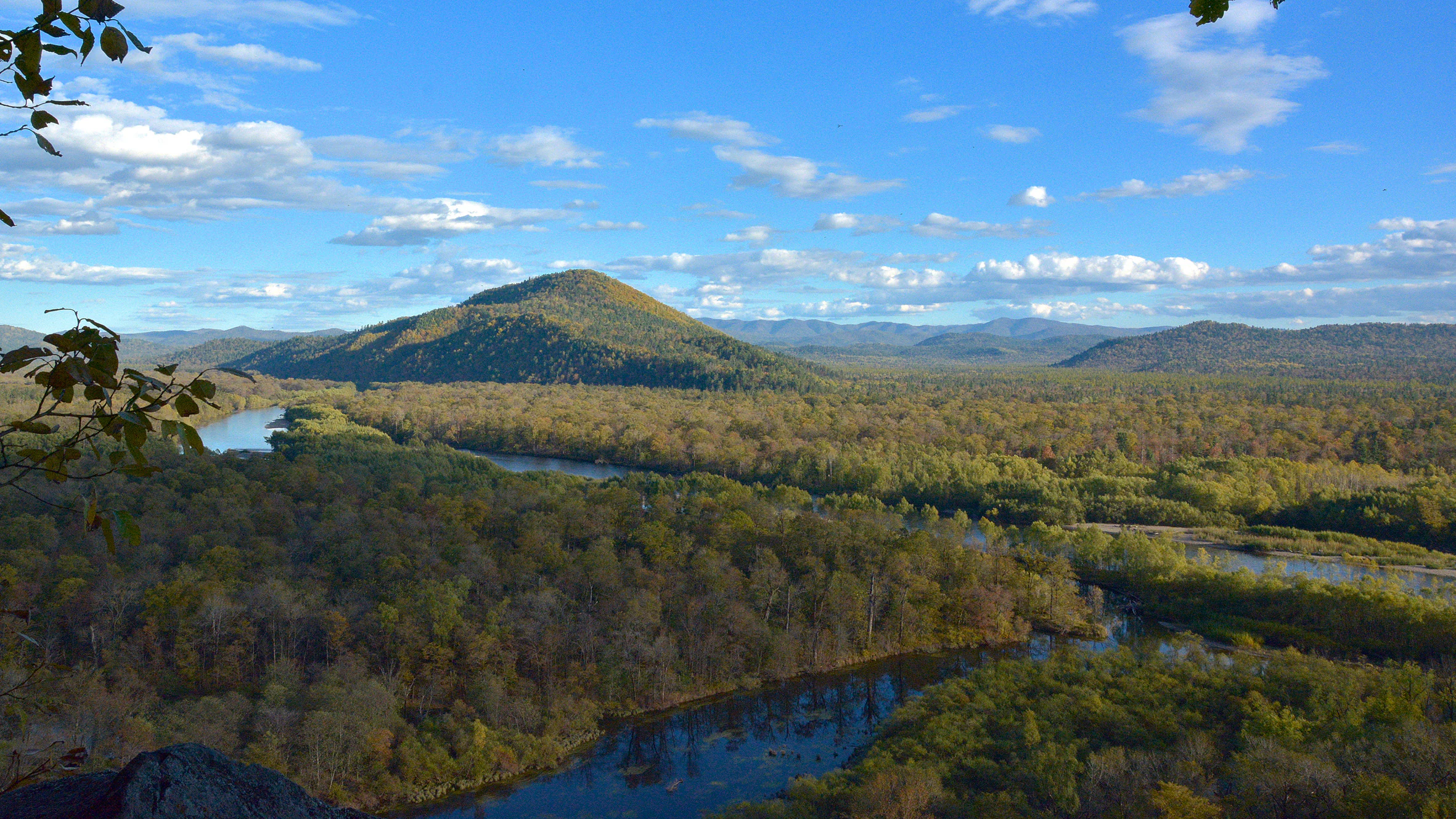
Wide aerial view of Bikin River valley surrounded by dense forests and rolling hills under a bright blue sky with scattered clouds
View of Bikin River valley from Klin Mountain viewpoint

Bikin National Park history and protected-area timeline

Bikin National Park was formally established on November 3, 2015, representing the culmination of years of conservation advocacy and scientific assessment. The creation of the park addressed a critical gap in the protected area network of the Russian Far East, providing formal protection for forests that had long been recognized for their exceptional ecological value but remained without formal national park status.

Prior to national park designation, the Bikin River valley had already gained international recognition. In 2001, the Central Sikhote-Alin region was inscribed on the UNESCO World Heritage List as one of the most significant forest wilderness areas in temperate Asia. Recognizing the ecological continuity between the Central Sikhote-Alin and the Bikin valley, Russian authorities pursued extension of the World Heritage property to include the park's territory. This extension was approved in 2018, and the property was renamed the Bikin River Valley World Heritage Site, expanding to encompass the full 1,160,469 hectares of the park.

The establishment of Bikin National Park also reflected evolving approaches to conservation in Russia that recognize the importance of indigenous involvement in protected area management. The park's zoning framework deliberately incorporates traditional land use rights, ensuring that the Udeghe and Nanai communities who have inhabited the region for generations can continue their forest-based practices while benefiting from the economic opportunities that controlled ecotourism and conservation provide.

Bikin National Park landscape and geographic character

Bikin National Park is characterized by a mountainous landscape dominated by the central Sikhote-Alin range, which forms a natural backbone separating the continental Amur River basin from the maritime regions of the Pacific coast. The terrain is rugged and heavily forested, with elevations ranging from approximately 200 meters in the river valleys to over 1,500 meters on some of the higher peaks. The terrain has been shaped by millions of years of geological processes, with the Sikhote-Alin representing a complex fold mountain system rich in mineral deposits and diverse rock formations.

The Bikin River itself is the defining hydrological feature of the park, flowing westward from its headwaters in the central mountains across the full width of the protected area. The river and its numerous tributaries have carved deep valleys through the mountainous terrain, creating diverse microhabitats from steep-sided gorges to broader floodplain meadows. These waterways ultimately flow into the Ussuri River and then the Amur River, connecting the park's ecosystems to the broader continental river system and eventually to the Sea of Okhotsk.

The forest landscape is overwhelmingly dominated by dense old-growth vegetation, with the nature of the forest changing with elevation and aspect. Lower slopes and valley bottoms support mixed conifer-deciduous forests, while higher elevations feature coniferous species adapted to the harsher mountain conditions. The forest canopy is typically multi-layered, with a diverse understory of shrubs, ferns, and herbaceous plants that thrives in the humid microclimate created by the dense overhead canopy.

Bikin National Park ecosystems, habitats, and plant life

The natural systems of Bikin National Park represent some of the most intact temperate forest ecosystems remaining on Earth. The park lies within the Ussuri broadleaf and mixed forests ecoregion, a region characterized by high species diversity resulting from its position at the meeting point of several floristic provinces. The climate is classified as humid continental with cool summer subtype, featuring dramatic seasonal temperature variations that have shaped the adaptive strategies of both flora and fauna.

The old-growth character of the forest is perhaps the park's most significant ecological attribute. Unlike the managed timber forests that dominate most of the Northern Hemisphere, the forests here have developed over centuries without significant timber extraction, maintaining the complex structural complexity that supports diverse ecological communities. Large dead trees, both standing and fallen, provide critical habitat for cavity-nesting birds, arboreal mammals, and a wealth of invertebrates essential for nutrient cycling.

The forest exhibits features of temperate rainforest, with high humidity supporting epiphytic plants including numerous moss and lichen species that carpet tree trunks and branches. This epiphytic diversity creates a three-dimensional habitat matrix that multiplies the effective habitat space available for wildlife. The forest floor supports abundant fern communities and a rich herb layer that provides foraging resources for numerous species.

Bikin National Park wildlife and species highlights

Bikin National Park supports an exceptional concentration of wildlife, with the documented presence of 51 mammal species and 194 bird species reflecting the ecological health of this intact forest ecosystem. The park's most famous resident is the Amur tiger, with an estimated 30-35 individuals maintaining territory within the Bikin River basin. This population represents approximately 10% of the global population of this endangered subspecies, making the park one of the most important tiger conservation areas in the world. The Amur tiger is adapted to the cold climate and forest environment of the Russian Far East, with a thicker coat and larger size than its tropical relatives.

Beyond tigers, the park supports a full suite of large carnivores and ungulates characteristic of intact boreal and temperate forest ecosystems. Moose, red deer, and roe deer provide prey base for the predator community, while wild boar root through the forest floor in search of roots and invertebrates. Both Ussuri brown bear and Ussuri black bear are present, with the brown bear being particularly common in the salmon-rich river valleys during spawning season. Smaller mammals include sable, mink, muskrat, and the small but ecologically important species that occupy the forest's understory and canopy layers.

The bird fauna is equally diverse, with species ranging from large raptors like the Steller's sea eagle to small songbirds that fill the forest with sound during the breeding season. The river systems provide habitat for waterfowl and fish-eating species, while the extensive forest cover supports populations of woodpeckers, owls, and thrushes that depend on the old-growth forest structure. The salmon runs that enter the Bikin River system provide a critical food resource for both mammals and birds, linking the terrestrial and aquatic food webs in ways characteristic of healthy wilderness ecosystems.

Bikin National Park conservation status and protection priorities

Bikin National Park represents one of the most important conservation designations in the Northern Hemisphere, protecting the largest remaining tract of old-growth mixed forest and a critical population of endangered Amur tigers. The park's inclusion in the World Heritage List in 2018 as the Bikin River Valley recognizes its outstanding universal value as a natural ecosystem of exceptional significance. This international recognition imposes obligations for conservation management that meet the highest global standards.

The conservation significance of the park extends beyond its own boundaries, as it forms part of a larger network of protected areas in the Sikhote-Alin region that together create an extensive wildlife corridor. This connectivity is essential for species like the Amur tiger that require large home ranges and must be able to move between different habitat patches to maintain genetic exchange. The protection of the Bikin corridor ensures that the tiger population here remains connected to individuals in adjacent areas, supporting long-term population viability.

The park's management approach represents an evolution in conservation thinking that recognizes the importance of indigenous communities in maintaining ecosystem health. By zoning nearly 70% of the park for traditional indigenous use while maintaining strict protection in core areas, the management framework acknowledges that the Udeghe and Nanai peoples have been partners in forest stewardship for generations. This approach aims to ensure that conservation outcomes are achieved while respecting the cultural rights and livelihoods of the communities who have called this landscape home.

Bikin National Park cultural meaning and human context

Bikin National Park is not only a wilderness sanctuary but also the ancestral homeland of the Udeghe and Nanai indigenous peoples, whose presence in the Bikin River valley predates written history. Approximately 600 people from these ethnic groups continue to maintain traditional lifestyles within the park boundaries, practicing fishing, hunting, and the gathering of pine nuts and other forest products. These activities are not merely historical practices preserved for cultural display but living traditions that shape both individual lives and community identity.

The Udeghe and Nanai peoples developed intimate knowledge of the forest environment over generations, understanding the patterns of animal movement, the cycles of fish runs, and the locations of productive plant gathering areas. This traditional ecological knowledge, accumulated over centuries of direct interaction with the landscape, represents a valuable complement to scientific understanding of ecosystem dynamics. The park's management framework explicitly incorporates this knowledge and ensures that traditional practices can continue within designated zones.

The cultural context of the park also includes the material heritage of these communities, including historical sites and traditional patterns of land use that have shaped the landscape over time. While the park's designation prohibits commercial resource extraction, the zoning plan carefully balances conservation objectives with recognition of indigenous rights to continue traditional activities that have sustained their communities for generations. This approach represents a departure from older conservation models that often treated human presence as inherently incompatible with wilderness protection.

Top sights and standout views in Bikin National Park

Bikin National Park stands as one of the last great wilderness areas in temperate Asia, protecting the largest contiguous old-growth forest in the Northern Hemisphere. The park's global significance is underscored by its role as sanctuary for approximately 10% of all wild Amur tigers, making it critical for the survival of this endangered big cat. Its World Heritage designation recognizes outstanding universal value, while its extensive area ensures that ecological processes can continue with minimal human interference. The park represents a rare example of large-scale forest protection that also maintains space for indigenous communities to continue traditional practices developed over generations.

Best time to visit Bikin National Park

Bikin National Park experiences a continental climate with dramatic seasonal variations that profoundly affect the visitor experience. Summer months bring warm conditions and the most accessible conditions for exploration, with long days and abundant wildlife activity in the forest. Autumn offers spectacular displays as the deciduous trees change color, while winter provides a dramatically different landscape of snow-covered forest and frozen waterways. Each season offers distinct advantages depending on visitor interests, though the remote location and limited infrastructure mean that access is typically restricted to the warmer months. Visitors interested in wildlife viewing should consider that winter tracking of tigers and other mammals can be more productive in some years, while summer provides better opportunities for river-based activities and bird observation.

Monthly climate preview

Long term representative measurements tracking the annual weather rhythm by month

Bikin National Park Climate Normals, Average Temperature and Precipitation

Bikin National Park records measured monthly temperature and precipitation normals derived from long term representative coordinate sampling. Reviewing the complete twelve month climate profile reveals full seasonal fluctuations across the protected terrain.
Annual mean0 °C
-22 °C18 °C
Jan-22°
Feb-18°
Mar-10°
Apr
May
Jun15°
Jul18°
Aug17°
Sep11°
Oct
Nov-9°
Dec-20°
Warmest month
July

18.5 °C

Coolest month
January

-21.7 °C

Wettest month
July

4.3 mm/day

Driest month
February

0.7 mm/day

Park location guide

Geography guide, regional context, and park location map for Bikin National Park

Bikin National Park park geography, regions, and map view in Russia

Understand where Bikin National Park sits in Russia through a broader geographic reading of the surrounding landscape, nearby location context, and its mapped position within the national park landscape.

How Bikin National Park fits into Russia

Russia is a transcontinental nation spanning eleven time zones, bordered by fourteen countries. It is the world's largest country by area, covering 17,098,246 km². Moscow is the capital and largest city, while Saint Petersburg is the second-largest and a major cultural centre.

Wider geography shaping Bikin National Park in Russia

Russia spans Eastern Europe and North Asia, covering 17,098,246 km². It shares land borders with fourteen countries, more than any other nation, and spans eleven time zones. The landscape includes vast plains, mountain ranges such as the Urals and Caucasus, and extensive coastlines along the Arctic Ocean, Pacific Ocean, Baltic Sea, Black Sea, and Caspian Sea.

Map view of Bikin National Park

Use this park location map to pinpoint Bikin National Park in Russia, understand its exact geographic position, and read its mapped placement within the surrounding landscape more clearly.

Pigeon | © OpenStreetMap contributors

Location context for Bikin National Park

Primorsky Krai
Recorded earthquake history

Review the Historical Earthquake Catalogue for Bikin National Park

Access a structured collection of recorded seismic activity documented near the boundaries of Bikin National Park. MoriAtlas provides these historical event logs to assist with geographical analysis of the Sikhote-Alin region and the surrounding landscape terrain.

Bikin National Park Earthquake History

Catalogued events

9 events

Strongest magnitude

Magnitude 5.5

Most recent event

May 11, 2025

This history includes earthquakes recorded inside the park or within 50 km of its borders

Visualizing old-growth forests, mountain terrain, and protected habitats in the Russian Far East

Bikin National Park Photos and Landscape Imagery

Examine professional photographs showcasing the dense old-growth canopy, rugged mountain terrain, and remote river valleys of Bikin National Park. Visual reference materials reveal the wild character of these protected ecosystems, providing clear insight into regional topography and conservation habitats.

Wide aerial view of Bikin River valley surrounded by dense forests and rolling hills under a bright blue sky with scattered clouds

Park atlas

Compare surrounding regional geography and connected wilderness landscapes

Explore Other Parks Near Bikin National Park and Protected Areas in the Region

Browsing nearby national parks and protected areas provides essential context for the old growth forests surrounding Bikin National Park. Analyzing adjacent terrain helps trace the wider ecological patterns of the Russian Far East mountain ecosystems.
A soft watercolor illustration showing a winding river through a forested valley with rolling hills in the background.
National parkPrimorsky Krai
Mapped location lies within the park boundary#1 closest

East

Bikin National Park: Protected Landscape Map and Regional Geography in Primorsky Krai

A vast wilderness corridor in the Sikhote-Alin mountain range

Bikin National Park is a prominent protected area in Primorsky Krai, encompassing the Bikin River valley and surrounding mountain ridges. This wilderness preserve is integral to the survival of the Amur tiger and features a distinct mix of coniferous and broadleaf forest ecosystems. The geography highlights a transition between boreal and temperate forest zones, maintained as a largely untouched natural landscape within the Russian Far East.

Area
11,604.7 km²
Established
2015
IUCN
II
Relief
Mountain
Watercolor painting of a landscape featuring green forests, distant mountains, and a body of water in the foreground
National parkPrimorsky Krai
About 74 km away#2 closest

Southwest

Udegeyskaya Legenda National Park: National Park with Mapped Protected Boundaries

Explore Protected Landscape Geography in Primorsky Krai

Gain an atlas-level understanding of Udegeyskaya Legenda National Park, a designated national park situated in Russia's Primorsky Krai. This resource provides insights into the park's geographic setting and the extent of its protected landscape. It is designed for users interested in the mapped features and regional context of protected natural areas, offering a clear view of the park's role within its geographic domain.

Area
1,037 km²
Established
2007
IUCN
II
Relief
Mountain
Watercolor painting of a river flowing through green hills with pink flowering trees and distant mountains under a light sky
National parkKhabarovsk Krai
About 241 km away#3 closest

North

Anyuysky National Park: Geographic and Protected Landscape Discovery in Khabarovsk Krai

Ecological corridors from the Amur River to the Sikhote-Alin mountains.

Anyuysky National Park represents a critical, remote expanse in the Russian Far East. Its boundaries protect a continuous gradient of habitats, linking the flat wetlands of the Amur River floodplain with the forested slopes of the Sikhote-Alin highlands. The park serves as a key area for habitat preservation and environmental mapping.

Area
4,294 km²
Established
1999
IUCN
II
Relief
Mixed relief
Watercolor illustration of a serene river landscape with birch trees in the foreground, forest in the midground, and soft-colored mountain ranges in the background.
National parkKhabarovsk Krai
About 241 km away#4 closest

North

Anyuysky National Park: Protected Sikhote-Alin Forests and River Valley Geography

An intact wilderness refuge in Khabarovsk Krai, Russia.

Anyuysky National Park stands as a primary reference for intact East Asian ecosystems. The park encompasses a dramatic landscape of forested ridges, riparian zones, and the signature Anyui Pillars. These sandstone rock formations overlook a valley that remains largely untouched by human activity, serving as a critical habitat within the greater Sikhote-Alin range. This geography offers a rare look at the transition from high-mountain terrain to the expansive Amur River basin.

Area
4,293 km²
Established
2007
IUCN
II
Relief
Mountain
National parkHokkaido
About 305 km away#5 closest

East

Rishiri-Rebun-Sarobetsu National Park: Volcanic Islands and Coastal Wetlands of Northern Hokkaido

Explore its mapped geography and unique subarctic alpine flora.

Rishiri-Rebun-Sarobetsu National Park in Hokkaido, Japan, offers a unique exploration of dramatic volcanic islands and vital coastal wetland ecosystems. This protected area showcases striking geological formations, from the conical peaks of Rishiri and Rebun islands to the vast peat bogs of the Sarobetsu Plain. Its subarctic environment supports a rich tapestry of alpine flora, providing a distinct case study in protected landscape geography and mapping for the region.

Area
241.66 km²
Established
1974
IUCN
II
Visitors
730K annual
National parkPrimorsky Krai
About 339 km away#6 closest

South

Zov Tigra National Park: Regional Geography and Sikhote-Alin Protected Landscape Analysis

A core conservation area in the southern Russian Far East.

Zov Tigra National Park encompasses an essential segment of the Sikhote-Alin mountain range, featuring deep river gorges and soaring ridges that reach the highest elevations in Primorsky Krai. This protected expanse integrates diverse forest types and serves as a key habitat link for rare species. Our atlas data details the terrain, elevation gradients, and river corridors that define this significant Russian conservation zone.

Area
834.9 km²
Established
2007
IUCN
II
Relief
Mountain
Watercolor painting of a valley landscape with a river, hills, trees, and a sky with sunrise colors
National parkPrimorsky Krai
About 339 km away#7 closest

South

Zov Tigra National Park: Geography and Protected Wilderness of the Sikhote-Alin Range

A rugged mountain landscape and critical conservation area in Primorsky Krai.

Zov Tigra National Park features a dramatic, forest-covered terrain within the southern Sikhote-Alin mountains. With peaks rising to 1,854 meters and deep river canyons, this protected area serves as a cornerstone for wildlife recovery and ecological monitoring in the region. Explore the topographical characteristics of this unique mountain habitat and its position in the broader Primorsky Krai geography.

Area
834 km²
Established
2007
IUCN
II
Relief
Mountain
Watercolor illustration of rolling green hills, scattered trees, and distant mountains under a pale sky.
National parkPrimorsky Krai
454 km away#8 closest

Southwest

Land of the Leopard National Park: Protected Area Map and Geographic Context in Primorsky Krai

Atlas exploration of Russia's critical Amur leopard habitat.

Investigate Land of the Leopard National Park, a nationally significant protected area situated in Primorsky Krai, Russia. This park is celebrated as the exclusive remaining sanctuary for the critically endangered Amur leopard, making it a focal point for global conservation efforts. Its varied landscape, characterized by forested slopes and mountainous terrain, serves as essential habitat not only for leopards but also for Siberian tigers. The park provides a rich geographic setting for understanding protected land distribution and regional ecosystems within the Russian Far East.

Area
2,799 km²
Established
2012
IUCN
II
Relief
Mixed relief

Common questions about visiting, size, designation, and location context for Bikin National Park

Bikin National Park FAQs for park facts, access, geography, and protected area context

Find quick answers about Bikin National Park, including protected-area facts, park geography, trail and visitor context, and how the park fits into its surrounding country and regional landscape.
MoriAtlas Explorer

Continue Your Protected Areas Search Across the Global Atlas

Deepen your exploration by continuing the structured search for national parks and protected areas worldwide. Utilize the comprehensive filtering capabilities to compare different conservation landscapes and refine your understanding of global park geography. Discover more about the distribution and characteristics of protected natural areas.

Global natural geography