
Mori Atlas logo
Nature reserveBinnendüne Waltersberge

Tracing the post-glacial sand deposits and habitat gradients in the Brandenburg region.

Binnendüne Waltersberge Nature Reserve: Inland Dune Geography and Protected Landscape Map

(Naturschutzgebiet Binnendüne Waltersberge)

Binnendüne Waltersberge stands as a distinct inland dune landscape within Brandenburg, rising above the Großer Storkower See as a remnant of glacial outwash. This nature reserve preserves a unique mosaic of open sand habitats, pine forest edges, and psammophilic flora. The site provides a critical study of extreme microclimates and post-glacial terrain, functioning as a vital protected area within the regional geography of the Oder-Spree district.

inland dunesandy grasslandheathlandNatura 2000 sitenature reserveBrandenburg
A stylized vector illustration of an inland forest clearing with a sandy path and tree stump in the foreground, surrounded by coniferous trees under a soft pink and blue sky.

Binnendüne Waltersberge

Nature reserve

Park overview

Structured park overview, official facts, and landscape profile for Binnendüne Waltersberge

Binnendüne Waltersberge park facts, protected area profile, and essential visitor context

Review the core facts for Binnendüne Waltersberge, including designation, size, terrain, visitor scale, habitats, and operating context in one park-focused overview.

About Binnendüne Waltersberge

Binnendüne Waltersberge is an inland sand dune complex on the eastern edge of the Naturpark Dahme-Heideseen, just outside the small town of Storkow (Mark) in Brandenburg. Its roughly 14-hectare core is one of the state's designated inland dune nature reserves, recognised for its open sand habitats, dry sandy grassland communities, and specialised flora and fauna that depend on nutrient-poor, sun-baked substrates.

Although the surface area is modest, the site captures an unusually complete slice of Brandenburg's post-glacial landscape story. Its sand originated from meltwater sediments of the Weichselian ice age, deposited in the wider glacial outwash plain of the Berlin Urstromtal. After the ice retreated, the dry, vegetation-poor surface allowed fine sand to be picked up and redeposited by wind, eventually forming large inland dune complexes. Waltersberge is one of the most prominent surviving examples in the eastern Brandenburg region.

Today, the reserve is managed as a striking juxtaposition of habitats. Bare, sun-exposed sand hosts silvergrass and sand thyme communities on the south-facing slopes; cooler, partially shaded areas retain mixed pine and oak stands with moss-rich ground layers; and the transition edges still carry traces of wet meadows and reed communities that once extended from the adjoining Hirschluch wetland. Protection, restoration, and public education efforts have been concentrated here since the early 2010s, when army volunteers, the Naturpark administration, NABU, and local school groups worked together to reopen and stabilise the open sand surfaces.

Quick facts and research context for Binnendüne Waltersberge

Binnendüne Waltersberge lies within the town limits of Storkow (Mark) in Brandenburg, in the Storkower Talsandfläche natural area of the East Brandenburg Heath and Lake District. Its core is a designated nature reserve of around 14 hectares, embedded within the larger Storkower Forst, and it is simultaneously listed as an FFH site (No. 3749-307) within the Natura 2000 network.

The dune lies just outside the formal boundaries of the Naturpark Dahme-Heideseen but is regularly treated as part of the park by its administration. The highest point, known as the Storkower Weinberg, reaches about 69 metres and rises roughly 32 metres above the adjacent lake. The site also forms part of stage 11 of the 66-Seen-Wanderweg regional hiking route.

Protection and recognition

Documented terrestrial protection scope and international recognition data

Binnendüne Waltersberge Protection Status and Natura 2000 Recognition

Binnendüne Waltersberge holds documented terrestrial protection status supported by official Natura 2000 recognition records. Structured atlas data aggregates these official designations and management frameworks for comparative ecological research.

International recognition

Protection details

Protection scope
Terrestrial
Transboundary protection
No
Park context

Deeper park guide and search-rich context for Binnendüne Waltersberge

Binnendüne Waltersberge history, landscape, wildlife, and travel context

Explore Binnendüne Waltersberge through its history, landscape character, ecosystems, wildlife, conservation priorities, cultural context, and seasonal travel timing in a structured park guide built for atlas discovery and search intent.

Why Binnendüne Waltersberge stands out

The site is best known as one of the most prominent inland dunes in Brandenburg, with a classic open sand habitat that supports psammophilic specialists like silvergrass, sand heather, and the ant lion, the latter serving as the reserve's unofficial mascot. The dramatic contrast between bare, sun-exposed sand, lichen-rich pine stands, and the cool lake edge makes it a textbook example of Brandenburg's post-glacial inland dune landscape.
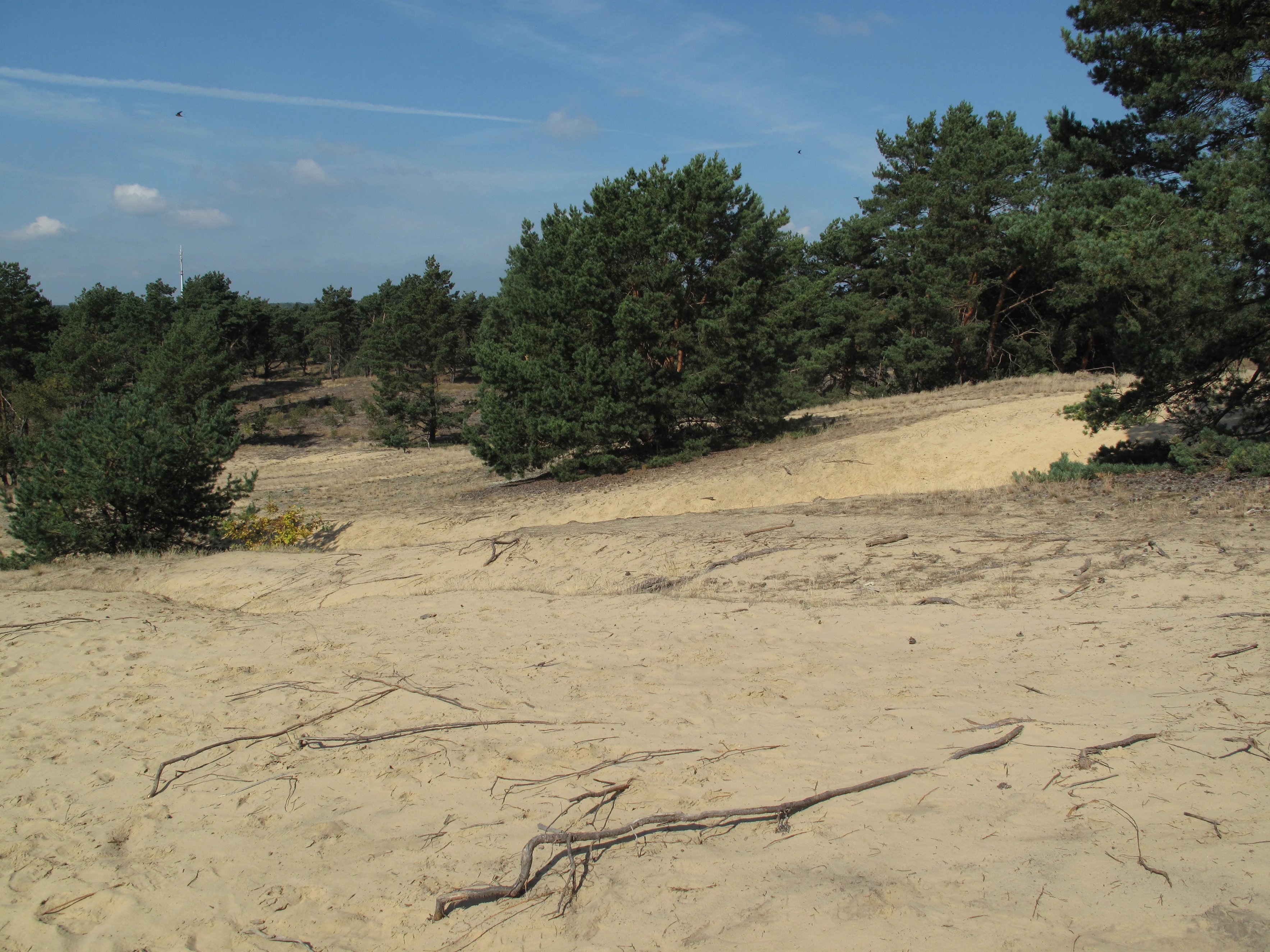
A wide view of an inland sand dune with sparse pine trees and scattered twigs on the sandy ground under a clear blue sky.
The inland dune landscape of Binnendüne Waltersberge in Brandenburg.

Binnendüne Waltersberge history and protected-area timeline

The Binnendüne Waltersberge has been shaped by centuries of human use, beginning with grazing of the dry grasslands by old regional sheep breeds. Written records from 1493 mention a winemaker at Storkow, and from 1518 onward the dune is explicitly documented as a vineyard (Weinberg). At its peak around 1735, the Storkower Weinberg covered around 26 Morgen (about 6.6 hectares), and even by 1750 an annual harvest of eight casks of wine was recorded, before Brandenburg's wine-growing tradition declined.

In the 1730s, waterways around Storkow were opened up to float building timber to Berlin, and from 1768 the Prussian administration under Frederick the Great ordered afforestation of the region's sandy 'Sandschellen' with pine and birch. The Waltersberge were gradually planted with Scots pine, and by 1801 a forestry district of around 5,400 Morgen (roughly 1,400 hectares) existed around the dune.

The most intensive transformation came with the Storkow Calcsandstone Works (Kalksandsteinwerk), active from 1906 to 1944 and built directly into the dune's sand source. Bucket-chain excavators removed approximately 75,000 cubic metres of sand per year in the early years, later estimated to at least 300,000 cubic metres overall, supplying white bricks used in many Berlin buildings, including sections of the Berlin U-Bahn. By the early 2000s, only about a quarter of the dune's surface remained open sand, prompting major restoration work in 2010 and 2011 to halt succession and recover the open habitats that are central to the dunes's conservation value.

Binnendüne Waltersberge landscape and geographic character

The Waltersberge rise as a wave-like inland dune north of the Großer Storkower See, with its highest point, the Storkower Weinberg, reaching roughly 69 metres above sea level, about 32 metres above the lake. The dune forms a sand-dominated ridge running through the Storkower Forst, dropping steeply to the Reichenwalder Straße on its lake-facing side and blending more gradually into the surrounding pine forest on the other slopes.

Geologically, the dune is part of the Storkower Talsandfläche at the western edge of the Storkower Platte, in the broader East Brandenburg Heath and Lake District natural area. Its sand is a glacial outwash relic of the Brandenburg stage of the Weichselian ice age. Compared with the wider, flatter Flugsandfelder of eastern and southern Brandenburg, the Waltersberge stand out as a more compact, dune-shaped accumulation.

The present-day landscape is a finely graduated mosaic. Sun-exposed south-facing slopes are open and bare, while cooler north-facing slopes and the ruderal edges carry mixed pine forest, lichens, and moss; remnants of wet meadows and reed beds persist toward the Hirschluch lowland to the northeast, connecting the dune to a wider pattern of lakes, moors, and sandy ridges typical of the region.
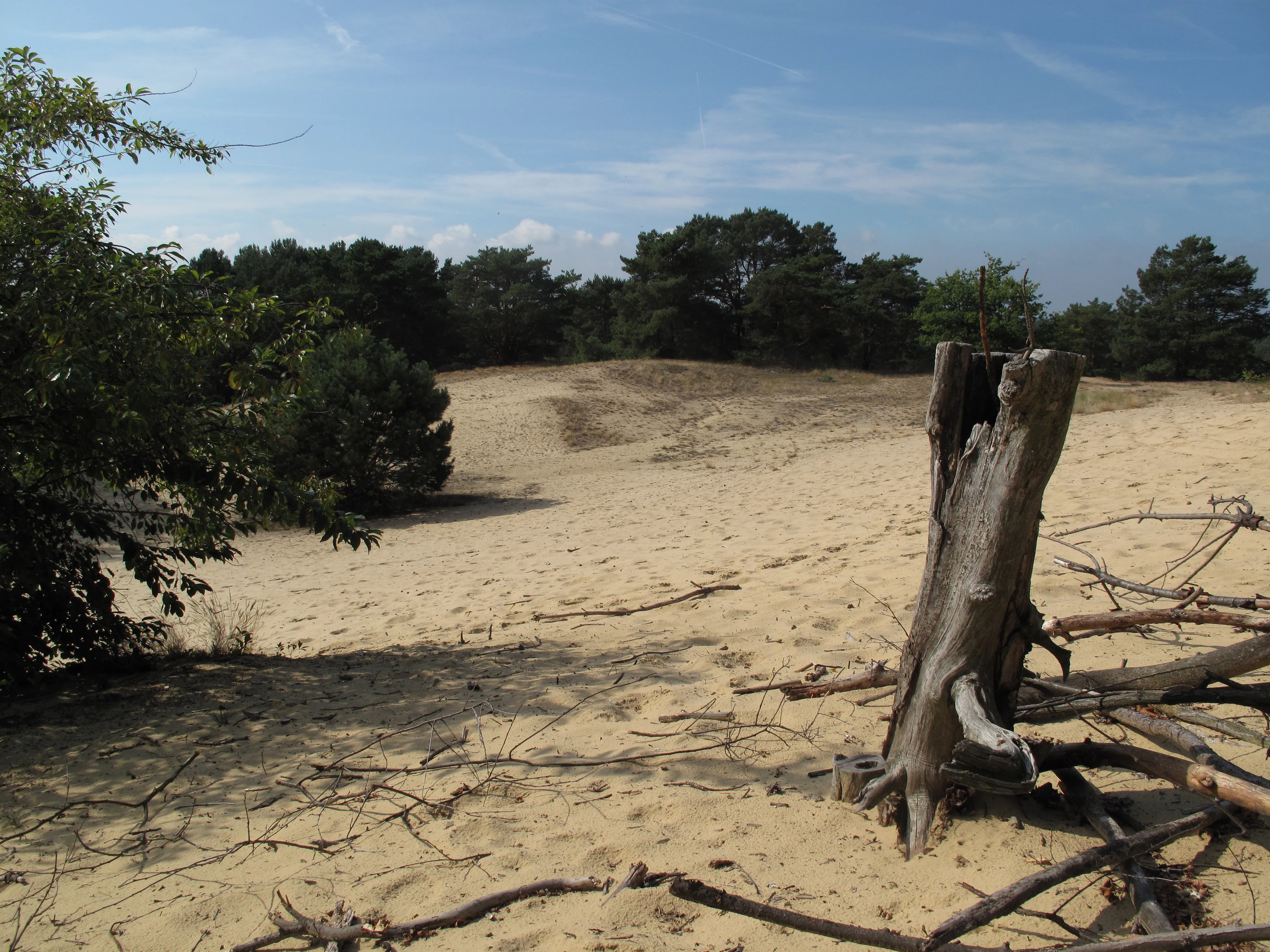
A sandy inland dune landscape with sparse vegetation and a weathered tree stump in the foreground, backed by a line of trees under a blue sky.
The inland sand dune landscape of Binnendüne Waltersberge.

Binnendüne Waltersberge ecosystems, habitats, and plant life

Ecologically, Binnendüne Waltersberge is defined by the contrast between very harsh, hot, dry sand surfaces and cooler forested edges. Surface sand temperatures can heat up to roughly 70 degrees Celsius during the day and drop sharply overnight, leaving only highly specialised plants and animals able to colonise the open areas. The site protects several habitat types listed under the EU Habitats Directive, including dry sand heaths with Calluna and Genista, open dune grasslands of Corynephorus and Agrostis, and subcontinental base-rich sandy grasslands.

Despite its compact size, the dune supports an unusually varied set of plant communities: silvergrass and bent-grass tussocks, sand sedge with metre-long creeping rhizomes, sand fescue and blue-green koeleria, heather with broom, and pioneer colonies such as mountain sandbell and heath pink. Wet and ruderal edges hold remnants of alder-birch swamp, reed communities, peat mosses, marsh iris, and the regionally threatened wild calla, once Germany's 'Flower of the Year'.
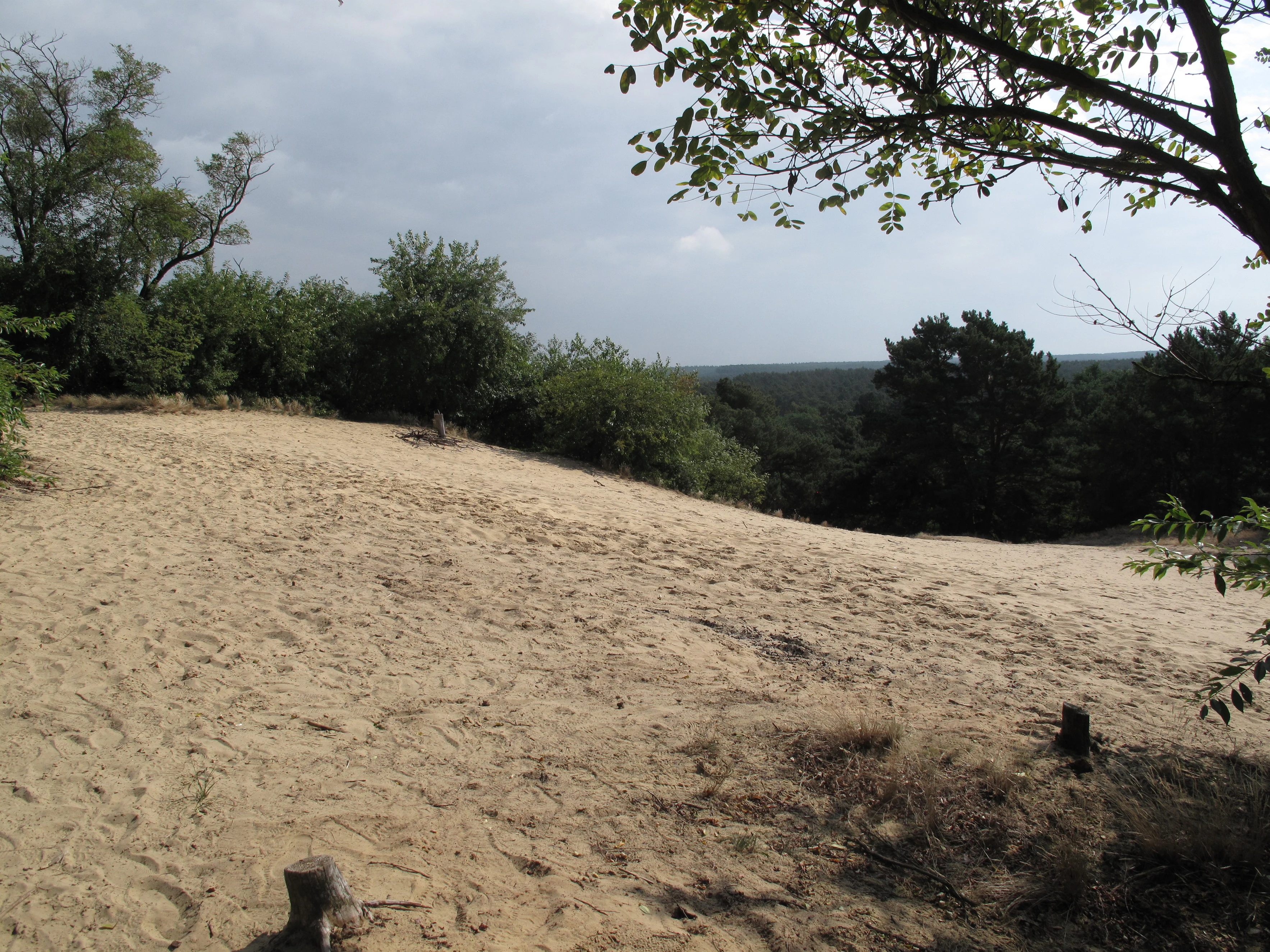
A wide, sandy inland dune at Binnendüne Waltersberge, framed by deciduous and coniferous trees under a cloudy sky.
The inland dune at Binnendüne Waltersberge in Brandenburg.

Binnendüne Waltersberge wildlife and species highlights

Mammals are not the focus of the dune, but the open sand fauna is rich and highly specialised. The ant lion, the larva of the antlion fly and Germany's 'Insect of the Year 2010', is famously the unofficial mascot of the Waltersberge, recognised under the German federal species protection order. Its characteristic conical sand traps dot the open areas and form microhabitats that protect it from extreme heat.

The site also supports other sand-loving, often legally protected invertebrates, including the Walker beetle (the symbolic species of Naturpark Dahme-Heideseen), the field tiger beetle, sand wasps that nest in the loose sand, and grasshoppers such as the wart-biter and the large green bush-cricket. Reptiles include sand lizards, which are strictly protected under the EU Habitats Directive, and slow-worms. Roughly twenty bird species were recorded in 2010, mostly in the surrounding mixed woodland, while former open-sand specialists like the woodlark and tawny pipit have been lost since 1983 and may return if open areas continue to expand.
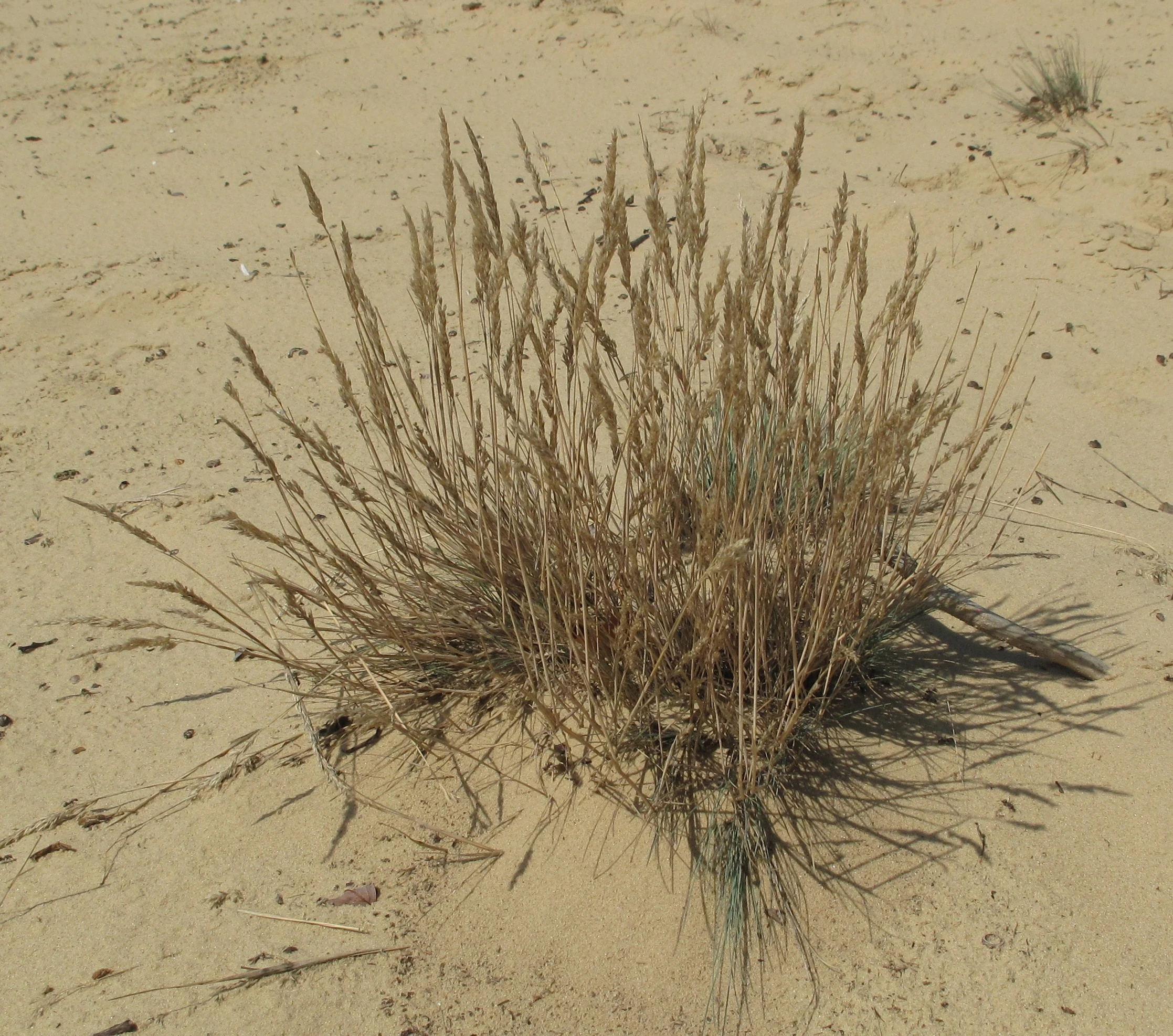
A close up of a single clump of dry, light-brown grass growing in a patch of open tan sand at the Binnendüne Waltersberge nature reserve.
A clump of grey hair-grass growing in the sandy soil of Binnendüne Waltersberge.

Binnendüne Waltersberge conservation status and protection priorities

Binnendüne Waltersberge is a formally protected nature reserve in Brandenburg and an FFH site within the Natura 2000 network (No. 3749-307), protecting characteristic inland dune habitat types of European importance. The Bundesamt für Naturschutz describes it as a largely shrub-free, open section of a larger inland dune complex with silvergrass and thrift swards, sheep's-fescue grasslands, thermophilic fringes, and lichen-rich pine forests.

Conservation concern grew sharply in the early 2000s, when only around a quarter of the area remained as open sand due to encroachment by pines, birches, black locust, aspen, and late-flowering cherry. Following a species survey in 2010, the Naturpark Dahme-Heideseen administration, the NABU regional branch, the Heinz Sielmann Foundation, the Brandenburg Naturwacht, the Bundesforst federal forest agency, and the town of Storkow coordinated thinning and clearing actions. These restored open sand areas and gave the reserve the conditions needed to host specialist species once again, including a chance of recovering lost open-sand bird species.

Binnendüne Waltersberge cultural meaning and human context

The Waltersberge have left a clear mark on local identity. The vineyard that once covered part of the dune is still echoed in the name Storkower Weinberg and in the 'Alter Weinberg' inn at the foot of the dune. The 2011 nature trail was formally named 'Martin-Graef-Weg' in honour of a Storkow farmer active in regional conservation from the post-war decades until 2007.

Sand from the dune also fed the industrial history of the region: the Storkow Kalksandsteinwerk, which operated from 1906 to 1944, supplied millions of white bricks to Berlin, including parts of the U-Bahn network, contributing to the famous expression that 'Berlin is built from the barge'. Today the dune forms part of stage 11 of the 66-Seen-Wanderweg regional hiking route and is featured in GEO Day of Biodiversity excursions and local nature education programmes.
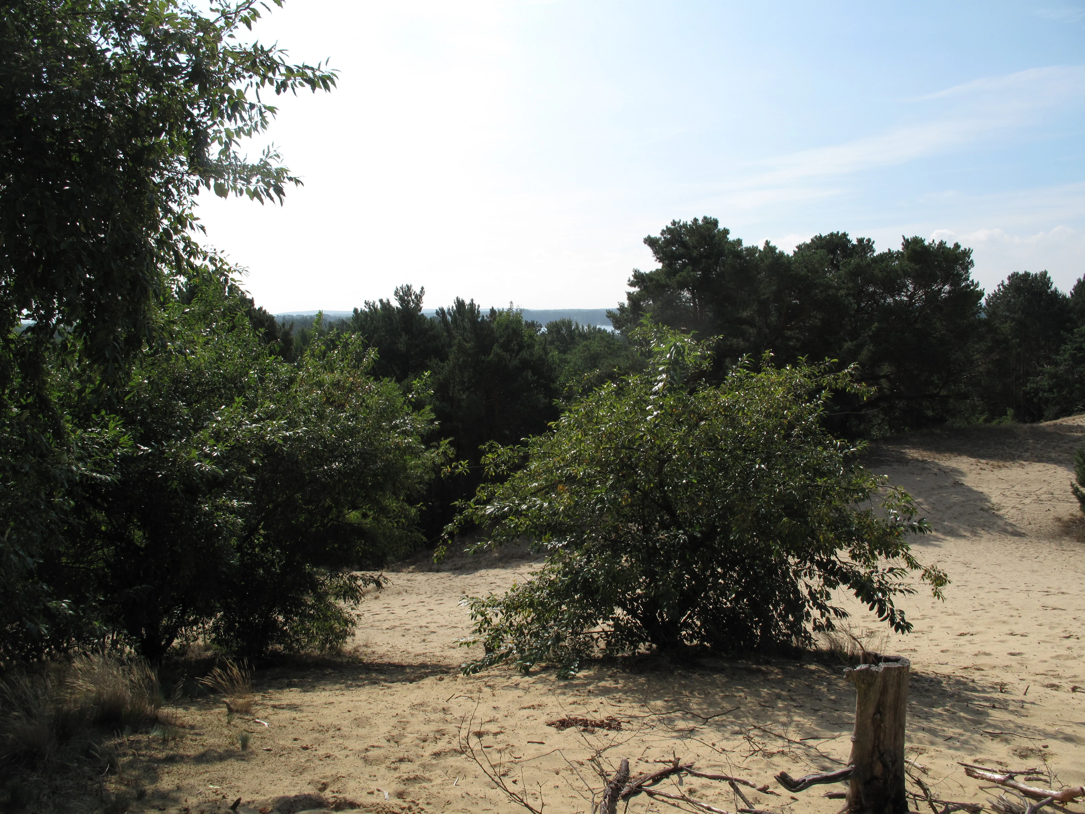
A view of open sandy terrain with scattered shrubs and trees at Binnendüne Waltersberge, Germany.
The inland dune landscape of Binnendüne Waltersberge.

Top sights and standout views in Binnendüne Waltersberge

Among the Waltersberge's strongest points of distinction are its openness as an inland dune in a region where most sandy uplands have been forested for centuries, and its striking habitat gradients within a very small footprint. The ant lion, a designated Insect of the Year in Germany, is a charismatic flagship species and an immediate visual signal of the dune's conservation work.

Equally distinctive is the close juxtaposition of bare sand, lichen-pine forest, and relict wet-edge communities, together with its cultural depth: a documented vineyard history going back to 1518, an industrial sand-extraction legacy that shaped Berlin's built fabric, and a recent restoration programme that combined Bundeswehr assistance, civic groups, and a regional naturpark to revive the open sand landscape.
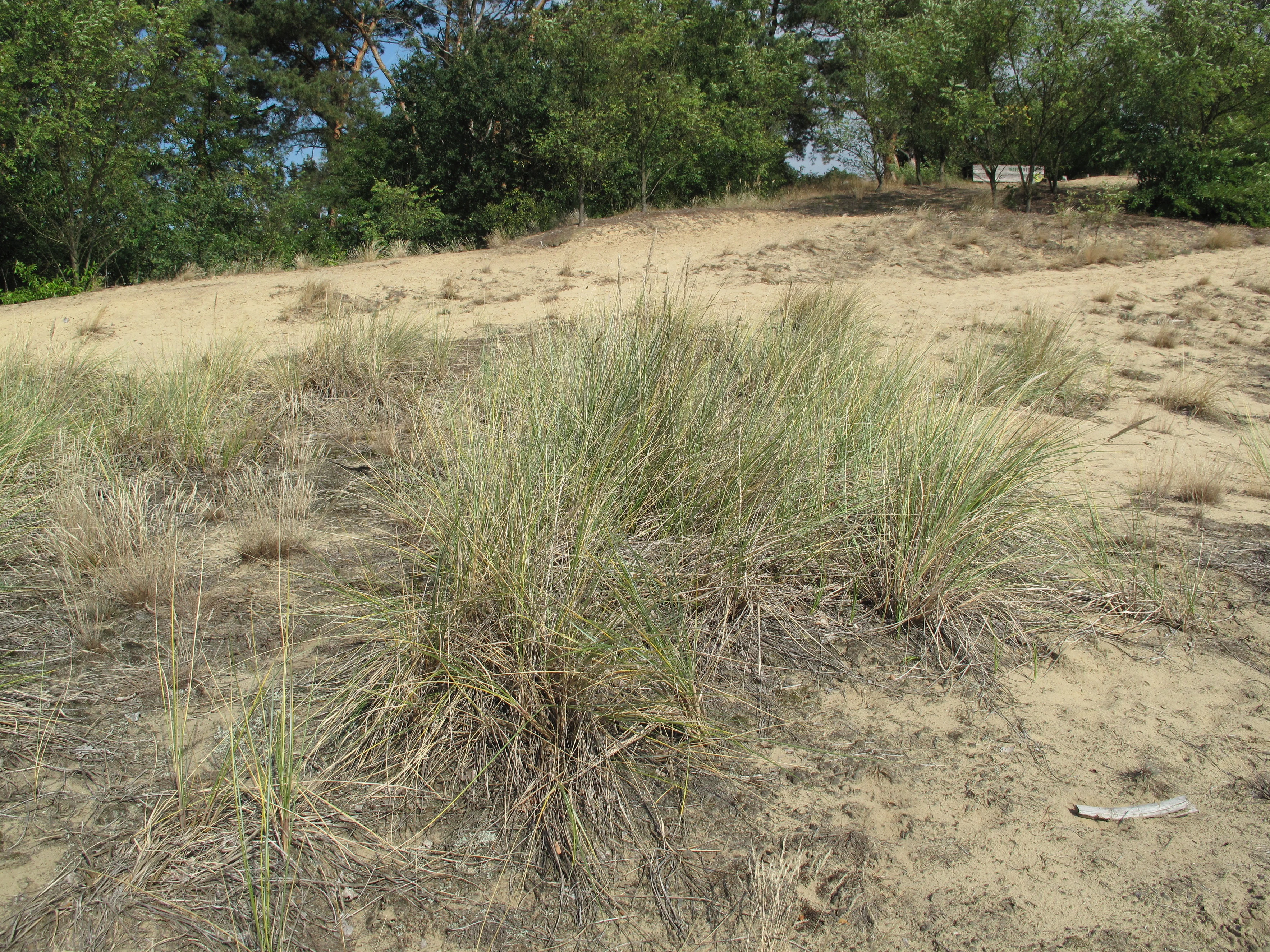
A wide view of an inland dune with sandy soil and clumps of dune grass in the foreground, with trees lining the top of the dune in the background.
Sparse vegetation growing on the sandy slopes of the Binnendüne Waltersberge inland dune.

Best time to visit Binnendüne Waltersberge

Late spring and early summer are the most rewarding seasons to experience the open sand habitats, when silvergrass tussocks dominate the foreground, sand heaths begin to flower, and ant lion traps are most easily observed in sun-warmed bare sand. Summer highlights the dune's extreme microclimate, with baking surfaces and active reptiles and insects on the south-facing slopes.

Autumn brings rich moss and lichen communities into focus and softens the surrounding mixed forest, while winter offers a quieter impression of the dune's underlying structure and the broader Storkower lake-and-forest landscape. The Martin-Graef-Weg nature trail and broader stage 11 of the 66-Seen-Wanderweg are usable across these seasons, with warmer months offering the most complete view of the plant communities that define the reserve.

Monthly climate preview

Long term monthly temperature ranges and precipitation averages across the protected terrain

Binnendune Waltersberge Climate Normals, Annual Temperature and Precipitation Patterns

Representative coordinates record mean monthly temperatures spanning sub-zero winter lows to warm summer highs alongside steady precipitation throughout the year. Reviewing the complete twelve-month record clarifies long-term thermal rhythms and moisture patterns across Binnendune Waltersberge.
Annual mean9 °C
-1 °C20 °C
Jan-1°
Feb
Mar
Apr
May14°
Jun18°
Jul20°
Aug20°
Sep15°
Oct
Nov
Dec
Warmest month
July

20.3 °C

Coolest month
January

-0.9 °C

Wettest month
July

2.4 mm/day

Driest month
April

1.1 mm/day

Park location guide

Geography guide, regional context, and park location map for Binnendüne Waltersberge

Binnendüne Waltersberge park geography, regions, and map view in Germany

Understand where Binnendüne Waltersberge sits in Germany through a broader geographic reading of the surrounding landscape, nearby location context, and its mapped position within the national park landscape.

How Binnendüne Waltersberge fits into Germany

Germany is a federal republic in Western and Central Europe with a population of over 83 million across sixteen constituent states. It is Europe's largest economy by nominal GDP and a major global exporter and importer. The capital is Berlin, and the country borders Denmark, Poland, Czech Republic, Austria, Switzerland, France, Luxembourg, Belgium, and the Netherlands.

Wider geography shaping Binnendüne Waltersberge in Germany

Germany is located in Western and Central Europe, spanning 357,022 km². It borders Denmark to the north, Poland and the Czech Republic to the east, Austria and Switzerland to the south, and France, Luxembourg, Belgium, and the Netherlands to the west. The country has coastlines on the Baltic Sea and North Sea to the north, with the Alps located in the southern region.

Map view of Binnendüne Waltersberge

Use this park location map to pinpoint Binnendüne Waltersberge in Germany, understand its exact geographic position, and read its mapped placement within the surrounding landscape more clearly.

Pigeon | © OpenStreetMap contributors

Location context for Binnendüne Waltersberge

Brandenburg

Visual exploration of glacial sand terrain, pine forests, and open dune habitats

Binnendüne Waltersberge Photos and Protected Landscape Scenery

Visual documentation captures the stark contrast between bare sun-exposed sand ridges and cooler pine-fringed forest edges across the reserve. Examining authentic landscape photography reveals the unique geomorphology and specialized microhabitats defining this protected inland dune ecosystem.

A wide view of an inland sand dune with sparse pine trees and scattered twigs on the sandy ground under a clear blue sky.

A gnarled, bleached dead tree structure sits on a sandy dune slope with tufts of dry grasses in the foreground and a blue sky in the background.

A sandy inland dune landscape with sparse vegetation and a weathered tree stump in the foreground, backed by a line of trees under a blue sky.

A wide, sandy inland dune at Binnendüne Waltersberge, framed by deciduous and coniferous trees under a cloudy sky.

A close up of a single clump of dry, light-brown grass growing in a patch of open tan sand at the Binnendüne Waltersberge nature reserve.

A sandy trail winds through light forest and inland dune vegetation under a blue sky.

A view of open sandy terrain with scattered shrubs and trees at Binnendüne Waltersberge, Germany.

A wide view of an inland dune with sandy soil and clumps of dune grass in the foreground, with trees lining the top of the dune in the background.

A close-up view of a sandy, textured inland dune slope with sparse grassy vegetation and pine needles at the Binnendüne Waltersberge nature reserve.

Park atlas

Compare nearby nature reserves and regional glacial landforms in Brandenburg

Parks Near Binnendüne Waltersberge and Surrounding Protected Landscapes

Visitors exploring Binnendüne Waltersberge can browse neighboring protected areas and regional conservation zones sharing similar post-glacial geography. Comparing adjacent habitats reveals the broader pattern of sandy ridges, pine forests, and wetland mosaics across the surrounding district.
Nature reserveBrandenburg
2.3 km away#1 closest

Southwest

Groß Schauener Seenkette Nature Reserve: Mapped Wetlands and Brandenburg Lake Geography

An undisturbed chain of shallow lakes and protected fen landscapes

This protected nature reserve in Brandenburg preserves a vital chain of six interconnected lakes. The geography is defined by extensive reedbeds, sedge stands, and rare inland saline meadows, providing a crucial habitat mosaic. Learn how these wetlands connect to the surrounding Dahme-Heideseen region through a network of terrain-focused conservation areas and historic trails.

Area
21.249 km²
Established
2000
Relief
Lowland
Climate
Temperate
Nature reserveBrandenburg
9.3 km away#2 closest

Northwest

Swatzke- und Skabyberge Nature Reserve and Protected Inland Dune Geography in Brandenburg

Mapping the sand heaths and forest ecosystems of northeastern Germany

Swatzke- und Skabyberge is a designated nature reserve in Brandenburg that preserves a rare inland dune complex. Originally shaped by long term military usage, this protected land now functions as a vital habitat for dry acid grasslands, lichen-rich pine forests, and wetland woodland fringes. It provides a unique study in how sand, fire, and moisture processes maintain biodiversity within the lowland German landscape.

Area
5.2 km²
Established
1999
IUCN
IV
Nature reserveBrandenburg
13 km away#3 closest

West

Dolgensee Nature Reserve: Mapped Protected Landscapes and Wetland Geography in Brandenburg, Germany

Protected lake basin, reedbeds, and inland dune grassland

Located in the Brandenburg state of Germany, Dolgensee Nature Reserve offers a rare mosaic of wetland and dry grassland habitats. The site centers on a nutrient-rich lake basin featuring extensive reedbeds and alder swamp, which transitions into open inland dune ecosystems. This protected area represents a significant example of natural lake basin preservation within the larger Dahme-Heideseen landscape, providing a crucial habitat for various waterbird and aquatic wildlife species.

Area
3.085 km²
Established
1995
IUCN
IV
Relief
Lowland
A soft watercolor painting of a wetland featuring grassy foregrounds, a winding stream, distant rolling hills, and a pale sky.
Protected areaBrandenburg
About 13 km away#4 closest

Southeast

Reichardtsluch Protected Area: A Wetland Geography Overview in Brandenburg, Germany

Glacial moraine terrain and seasonal amphibian habitats

Reichardtsluch acts as a vital, two-hectare wetland refuge within the Beeskower Platte region of Brandenburg. This protected landscape is defined by its dramatic seasonal hydrology, alternating between full inundation and dry spells. The site remains a core component of the broader Natura 2000 network, offering insight into postglacial drainage patterns and forest-fringed amphibian breeding ecology in eastern Germany.

Area
0.29 km²
Established
2003
Relief
Lowland
Climate
Temperate
A horizontal watercolor illustration depicting a soft, serene landscape with green trees, pink flowering trees, and gentle hills on a white background.
Nature reserveBrandenburg
13 km away#5 closest

West

Skabyer Torfgraben Nature Reserve: Geographic Mapping and Protected Area Overview

Wetland landscape corridors within Brandenburg, Germany

The Skabyer Torfgraben nature reserve provides a focused look at lowland stream ecosystems and rare through-flow peatland remnants. This protected area in the Dahme-Spreewald region serves as a crucial habitat mosaic, blending sandy birch-oak forests with sedge-dominated wet meadows. Examine its natural terrain and hydrological connections to the Dahme river within the context of German protected landscapes.

Area
3.049 km²
Established
1998
IUCN
IV
Relief
Lowland
Nature reserveBrandenburg
About 15 km away#6 closest

Southwest

Streganzsee-Dahme Nature Reserve: Mapping Brandenburg Protected River Landscapes and Dunes

An ecological mosaic in the Dahme-Spreewald river corridor

Streganzsee-Dahme represents an intact Brandenburg riverine corridor characterized by sharply varied topography. The reserve encompasses water bodies, floodplain forests, fens, and dry sandland heaths. Its protected boundaries connect various biotopes, offering an essential look at the region's diverse lowland ecology and the structured geography of the local conservation network.

Area
4.36 km²
Established
1999
IUCN
IV
Relief
Lowland
A horizontal watercolor illustration showing soft, pastel-colored rolling hills and a calm lake or pond in the foreground, surrounded by grassy banks.
Nature reserveBrandenburg
About 16 km away#7 closest

Northeast

Beerenbusch Nature Reserve: Geographic Profile and Protected Woodland Landscapes of Brandenburg

Mapping forest boundaries in the German lowlands

Located in the Oder-Spree district, Beerenbusch protects rare oak-hornbeam and alder swamp forest ecosystems. This profile details the reserve landscape, cultural landmarks like the Königskiefer, and its importance as a surviving woodland refuge within the Brandenburg forest belt.

Area
0.7 km²
Established
1967
IUCN
IV
Relief
Lowland
Nature reserveBrandenburg
16 km away#8 closest

Southwest

Katzenberge Nature Reserve: An Atlas of Glacial Moraine Woodlands in Brandenburg Germany

Protected oak forest habitats within the Dahme-Spreewald landscape

Katzenberge offers a focused look at the conservation of mature deciduous forest environments on sandy moraine soils. As a designated nature reserve within the Brandenburg region, the area serves as a primary reference point for studying habitat continuity and the unique glacial terrain that defines the south-eastern lowlands near the Dahme river.

Area
1.44 km²
Established
2004
IUCN
IV
Relief
Upland

Common questions about visiting, size, designation, and location context for Binnendüne Waltersberge

Binnendüne Waltersberge FAQs for park facts, access, geography, and protected area context

Find quick answers about Binnendüne Waltersberge, including protected-area facts, park geography, trail and visitor context, and how the park fits into its surrounding country and regional landscape.
MoriAtlas Explorer

Continue Your Protected Areas Search Across the Global Atlas

Deepen your exploration by continuing the structured search for national parks and protected areas worldwide. Utilize the comprehensive filtering capabilities to compare different conservation landscapes and refine your understanding of global park geography. Discover more about the distribution and characteristics of protected natural areas.

Global natural geography