

Mori Atlas logo
Nature reserveBlack Rock Conservation Park

Examining the outwash slopes, creek bed topography and native chenopod shrubland ecosystems

Black Rock Conservation Park: A Detailed Geographic Atlas of Protected South Australian Woodlands

Black Rock Conservation Park serves as an essential ecological reference point within the mid-north of South Australia. Located on the outwash plain of its namesake high point, the reserve preserves a compact yet significant mosaic of Casuarina woodlands and chenopod shrublands. Mapping these 119 hectares provides insight into the transition between rocky outcrops and the surrounding grazing landscapes, documenting a valuable habitat for diverse regional bird species.

conservation parkSouth Australiamid-north South Australialow woodlandCasuarina woodlandchenopod shrubland

Black Rock Conservation Park

Nature reserve

Park overview

Structured park overview, official facts, and landscape profile for Black Rock Conservation Park

Black Rock Conservation Park park facts, protected area profile, and essential visitor context

Review the core facts for Black Rock Conservation Park, including designation, size, terrain, visitor scale, habitats, and operating context in one park-focused overview.

About Black Rock Conservation Park

Black Rock Conservation Park is a modest but ecologically focused conservation park in the mid-north of South Australia, sitting in the locality of Erskine between the Flinders Ranges foothills and the broader pastoral country that characterises the region. Although it covers only 119 hectares, its position on the outwash plain surrounding Black Rock gives it a distinct combination of slope, soil, and vegetation patterns that reflect the wider landscape.

The park was proclaimed under the National Parks and Wildlife Act 1972 on 9 November 1972, making it one of many small conservation reserves established across South Australia during the early implementation of that legislation. It occupies part of section 76 in the cadastral unit of the Hundred of Erskine, on the south side of the Orroroo-Paratoo Road, and is managed by the state's Department for Environment and Water.

Its purpose is to protect vegetation representative of the local region, an objective that becomes more meaningful in an area where long-term grazing has altered much of the surrounding native vegetation. By setting aside a comparatively undisturbed patch, the park functions as a reference site for the regional flora, a habitat for resident and seasonal birdlife, and a small but enduring example of South Australia's conservation estate.

Quick facts and research context for Black Rock Conservation Park

Black Rock Conservation Park is a 119 hectare protected area in South Australia, located in the Hundred of Erskine near Orroroo in the state's mid-north. It was proclaimed on 9 November 1972 under the National Parks and Wildlife Act 1972 and is managed by the South Australian Department for Environment and Water.

It protects vegetation characteristic of the surrounding region, including Casuarina-dominated low woodland, scattered Eucalyptus, and a chenopod shrubland of bluebush, saltbush, and ruby saltbush, along with creek lines that provide nesting habitat for birds such as the red-backed kingfisher and rainbow bee-eater. The park is classified as an IUCN Category III protected area and was previously listed on the now-defunct Register of the National Estate.

Protection and recognition

Examine terrestrial protection scope, designation history, and formal recognition records.

Black Rock Conservation Park Protection Status and International Recognition

Black Rock Conservation Park maintains a documented terrestrial protection scope across its native landscape boundaries. Official records organize administrative status and international recognition criteria into structured conservation data.

Protection details

Protection scope
Terrestrial
Transboundary protection
No
Park context

Deeper park guide and search-rich context for Black Rock Conservation Park

Black Rock Conservation Park history, landscape, wildlife, and travel context

Explore Black Rock Conservation Park through its history, landscape character, ecosystems, wildlife, conservation priorities, cultural context, and seasonal travel timing in a structured park guide built for atlas discovery and search intent.

Why Black Rock Conservation Park stands out

Black Rock Conservation Park is most known for preserving a representative sample of mid-north South Australian vegetation on the outwash slopes around Black Rock, the highest point in the locality. Its woodland of Casuarina cristata and Myoporum platycarpum, with Eucalyptus socialis and chenopod shrubs including Maireana sedifolia and Atriplex species, is described as typical of the broader region and therefore ecologically instructive. The park is also notable among ornithologists for hosting a diverse avifauna in a relatively small area, and historically held the most westerly recorded occurrence of the black-backed wren, now considered a variant of the splendid wren.

Black Rock Conservation Park history and protected-area timeline

Black Rock Conservation Park was proclaimed on 9 November 1972 under the National Parks and Wildlife Act 1972, a piece of legislation that underpinned the modern expansion of South Australia's formal conservation reserve system. Its land, in section 76 of the Hundred of Erskine, was set aside on the south side of the Orroroo-Paratoo Road on the outwash plain associated with the locality's prominent Black Rock landform.

A 1980 statement of significance described the park as preserving vegetation typical of the region and noted the diversity of its birdlife, including the most westerly record of the black-backed wren, now treated as a variant of the splendid wren. The same 1980 description acknowledged that the park was in a disturbed natural condition owing to a long prior history of grazing.

By 2004, the park was being reported as containing good local examples of black oak and bluebush vegetation, along with creek beds that supported nesting red-backed kingfishers and rainbow bee-eaters. It was listed on the former Register of the National Estate, a non-statutory Australian heritage register that has since been discontinued.

Black Rock Conservation Park landscape and geographic character

The conservation park lies on the outwash from Black Rock, the highest point in the immediate vicinity, giving it gently sloping ground that extends downward from the rock itself across the broader plain. This topographic context means the reserve captures some of the transition between the rocky high point and the surrounding pastoral country, an arrangement that influences both soil conditions and vegetation.

Several creek beds cut through the park, featuring steep banks that add micro-topographic variety to an otherwise modestly undulating landscape. These creeks are an integral feature of the terrain, providing both structural diversity and the cooler, moister microhabitats that certain bird species use for nesting.

The surrounding region itself is part of the wider mid-north South Australian landscape, where low ranges, rocky outcrops, and broad grazing country alternate across long distances. Within that regional setting, the park serves as a tangible piece of the original landscape character.

Black Rock Conservation Park ecosystems, habitats, and plant life

Vegetation in Black Rock Conservation Park is dominated by a low woodland of Casuarina cristata together with Myoporum platycarpum, with Eucalyptus socialis contributing additional tree cover in places. This overstorey sits above an understorey characterised by chenopod shrubs typical of South Australia's semi-arid zone, including Atriplex species, Kochia sedifolia, and Enchylaena tomentosa.

A 2004 description of the park highlighted good local examples of black oak, identified botanically as Casuarina pauper, alongside bluebush, identified as Maireana sedifolia, indicating a coherent regional flora rather than an isolated assemblage. The presence of Casuarina species alongside Eucalyptus and a chenopod shrub layer reflects the typical structural complexity of vegetation adapted to the region's climate and soils.

The creek beds add an important additional dimension, supporting plant communities that differ from those on the surrounding slopes and providing shaded microhabitats in an otherwise open landscape. Although the area has a documented history of grazing, the vegetation within the reserve is recognised as representative and ecologically meaningful at a regional scale.

Black Rock Conservation Park wildlife and species highlights

Black Rock Conservation Park is described as having a diverse avifauna for a conservation reserve of its size, supporting a mix of woodland, shrubland, and creek-dwelling bird species. Its most notable ornithological record is the most westerly historical occurrence of the black-backed wren, a form now regarded as a variant of the splendid wren, giving the park real significance within Australian bird studies.

The steep banks along the park's creek beds provide nesting sites for red-backed kingfishers, which favour elevated earth banks for their burrows, and for rainbow bee-eaters, colonial nesters that excavate tunnels in similar substrates. Together with the broader mix of woodland and chenopod habitats, this supports a varied bird community across the reserve.

Black Rock Conservation Park conservation status and protection priorities

Black Rock Conservation Park contributes to South Australia's conservation estate by safeguarding vegetation that is described as typical of the broader region, serving as a reference site for regional flora in a landscape where long grazing history has altered much of the surrounding native cover. Even though its area is modest, its representation of Casuarina, Myoporum, Eucalyptus, and chenopod plant communities gives it disproportionate value for understanding and comparing regional vegetation.

The park is classified as an IUCN Category III protected area, recognising it as a natural monument or feature of significance despite its size. It was also listed on Australia's former Register of the National Estate, a recognition that, while not providing statutory protection, reflected its acknowledged heritage and conservation importance.

By preserving a patch of outwash vegetation alongside creek lines with relatively undisturbed banks, the park also contributes to local habitat continuity, supporting bird species that depend on intact creek-side substrates and providing a small refuge within a heavily grazed regional landscape.

Top sights and standout views in Black Rock Conservation Park

Among the park's strongest points of distinction are its position on the outwash around Black Rock, the locality's highest point, and its composition as a low woodland of Casuarina cristata and Myoporum platycarpum together with a chenopod understorey typical of the South Australian mid-north.

Equally important is its standing as a bird site, holding the most westerly historical record of the black-backed wren and offering nesting habitat along its steep creek banks for species such as the red-backed kingfisher and rainbow bee-eater. These features, combined with IUCN Category III recognition, give the park an outsized conservation footprint relative to its compact 119 hectare area.

Best time to visit Black Rock Conservation Park

Given the park's semi-arid regional setting, visits are likely to be most rewarding in the cooler and milder months of the South Australian year, when temperatures are more comfortable for outdoor activity and birdlife is generally active. Spring, when many Australian woodland and chenopod species flower and bird movement peaks, can be a particularly favourable window for observing both vegetation and avifauna.

Summer in the mid-north tends to bring higher temperatures and drier conditions that limit comfortable exploration, while heavy local rainfall can occasionally make the park's creek beds and surrounding roads less accessible. As with any small inland South Australian reserve, planning around cooler months and stable weather generally gives a more rewarding experience.
Monthly climate preview

Long-term representative temperature ranges and monthly precipitation rhythm for South Australia

Black Rock Conservation Park Climate Normals and Annual Weather Patterns

Black Rock Conservation Park displays measured long-term temperature swings alongside steady monthly precipitation patterns across a representative coordinate elevation. Examining the complete twelve-month statistical profile reveals deeper variations in average maximum and minimum temperatures.
Annual mean17 °C
8 °C25 °C
Jan25°
Feb25°
Mar21°
Apr17°
May12°
Jun
Jul
Aug
Sep13°
Oct16°
Nov20°
Dec23°
Warmest month
January

25.4 °C

Coolest month
July

8.1 °C

Wettest month
September

1 mm/day

Driest month
March

0.4 mm/day

Park location guide

Geography guide, regional context, and park location map for Black Rock Conservation Park

Black Rock Conservation Park park geography, regions, and map view in Australia

Understand where Black Rock Conservation Park sits in Australia through a broader geographic reading of the surrounding landscape, nearby location context, and its mapped position within the national park landscape.

How Black Rock Conservation Park fits into Australia

Australia is a constitutional monarchy and federal parliamentary democracy comprising six states and ten territories. With a population of nearly 28 million, it is one of the world's most urbanised countries, with most people concentrated on the eastern seaboard. The country has a high Human Development Index and is known for its cultural diversity, ancient Aboriginal heritage, and unique wildlife.

Wider geography shaping Black Rock Conservation Park in Australia

Australia occupies the entire Australian continent, the island of Tasmania, and numerous smaller islands. It is the world's flattest and driest inhabited continent, featuring vast deserts in the interior (the Outback), tropical rainforests along the eastern coast, and a coastline bordering the Indian and Pacific Oceans.

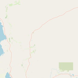
Map view of Black Rock Conservation Park

Use this park location map to pinpoint Black Rock Conservation Park in Australia, understand its exact geographic position, and read its mapped placement within the surrounding landscape more clearly.

Pigeon | © OpenStreetMap contributors

Location context for Black Rock Conservation Park

South Australia
Park atlas

Compare adjacent reserves and regional vegetation across the mid-north South Australia landscape

Exploring Parks Near Black Rock Conservation Park and Surrounding Protected Areas

Compare Black Rock Conservation Park with other protected areas located across the surrounding South Australian terrain. Continuing the geographic analysis helps trace regional woodland habitats and broader conservation patterns throughout the district.
National parkSouth Australia
About 59 km away#1 closest

West

Mount Remarkable National Park: Protected Landscape Atlas and South Australia Geography

Explore mapped boundaries and natural terrain.

Mount Remarkable National Park serves as a vital protected area within South Australia's unique geographic setting. This MoriAtlas entry details the park's mapped boundaries and surrounding natural terrain, providing structured insight into its landscape character and regional geographic importance. Understand the park as a key element of Australia's protected lands atlas.

Area
166.18 km²
Established
1972
IUCN
VI
Visitors
50K annual
National parkSouth Australia
About 75 km away#2 closest

Southwest

Wapma Thura, Southern Flinders Ranges National Park: South Australia's Protected Natural Landscape

Explore mapped boundaries and regional geography.

Wapma Thura, Southern Flinders Ranges National Park offers a distinct protected landscape within South Australia. This page serves as a portal for understanding its geographic setting, its role as a national park, and its place within the state's atlas of natural areas. Examine the mapped terrain and protected boundaries to grasp the park's unique geographic characteristics.

Established
2021
IUCN
II
Relief
Mountain
Scope
Terrestrial
Protected areaSouth Australia
About 86 km away#3 closest

South

Caroona Creek Conservation Park: Geographic Overview and Protected Landscape Analysis

Exploring the transitional terrain and gorge country of South Australia

Caroona Creek Conservation Park sits as a distinctive protected area between the Mid North and the Flinders Ranges. The reserve is defined by its dramatic northern Tourilie Gorge, varied calcrete ridgelines, and riparian habitat along the creek. This location serves as an essential example of the semi-arid environmental transition, offering a focused look at the intersection of rocky geological formations and alluvial drainage plains in South Australia.

Area
54.22 km²
Established
2010
IUCN
VI
Relief
Upland
Nature reserveSouth Australia
About 91 km away#4 closest

Northwest

The Dutchmans Stern Conservation Park: Landscape Mapping and Regional Geography

Explore the ridgeline terrain of the southern Flinders Ranges

Discover the geographic identity of The Dutchmans Stern Conservation Park, a 3,695-hectare nature reserve in South Australia. This protected area centers on an elongated mountain ridge that supports distinct eucalypt habitats, including river red gum gullies and blue gum woodlands. The park boundary encompasses a vital topographic mosaic that provides a natural sanctuary within the broader, long-grazed pastoral plains of the southern Flinders Ranges.

Area
36.95 km²
Established
1987
IUCN
VI
Relief
Mountain
Nature reserveSouth Australia
About 99 km away#5 closest

Northwest

Buckaringa Sanctuary: Geographic Atlas and Protected Landscape Overview

Nature reserve terrain in the southern Flinders Ranges

Buckaringa Sanctuary serves as a key case study in arid landscape conservation within South Australia. This entry examines the reserve's unique geological features, including the deeply incised gorges and rocky ridges that define the Flinders Ranges. Through a focus on mapped boundaries and regional ecology, the content provides a clear understanding of the sanctuary's position in the Australian landscape, highlighting its role as a protected refuge of sandstone formations and native scrubland.

Area
20 km²
Established
1990
Relief
Mountain
Climate
Arid
Natural monumentSouth Australia
About 112 km away#6 closest

Southwest

Clements Gap Conservation Park: A South Australian Natural Monument and Cultural Landscape

Mapping bushland corridors and historic heritage in the Mid North region.

Clements Gap Conservation Park occupies a 7.9 square kilometre footprint, offering a glimpse into the natural terrain of the Mid North region. The area functions as a protected monument that preserves native bushland alongside the built traces of a historic township, showcasing the layered human and environmental geography characteristic of the Spencer Gulf hinterland.

Area
7.9 km²
Established
1963
IUCN
III
Relief
Upland
National parkSouth Australia
About 128 km away#7 closest

Northwest

Lake Torrens National Park: Explore South Australia's Remarkable Inland Salt Lake Geography

A unique protected landscape of arid plains and expansive salt flats.

Lake Torrens National Park offers an unparalleled exploration of Australia's remote outback, centered around a vast, ancient salt lake basin. This national park in South Australia provides a canvas of stark, minimalist terrain, featuring shimmering saltpans, arid gibber plains, and rocky outcrops. Understand the park's unique geographic identity, its ecological significance as a temporary wetland habitat, and its dramatic visual appeal for landscape photography and geological interest. It is a key protected area showcasing the extreme environment of Australia's interior.

Area
5,676.68 km²
Established
1991
IUCN
VI
Relief
Lowland
National parkAustralia
About 141 km away#8 closest

North

Ikara-Flinders Ranges National Park: Mapped Boundaries and Regional Geography

Australia's protected landscape and national park terrain.

Investigate the geographic characteristics and protected-area identity of Ikara-Flinders Ranges National Park. This entry highlights its mapped boundaries and landscape context, offering a foundational understanding of this Australian national park for atlas-based discovery. Users can explore the natural terrain and regional setting that define Ikara-Flinders Ranges National Park.

Common questions about visiting, size, designation, and location context for Black Rock Conservation Park

Black Rock Conservation Park FAQs for park facts, access, geography, and protected area context

Find quick answers about Black Rock Conservation Park, including protected-area facts, park geography, trail and visitor context, and how the park fits into its surrounding country and regional landscape.
MoriAtlas Explorer

Continue Your Protected Areas Search Across the Global Atlas

Deepen your exploration by continuing the structured search for national parks and protected areas worldwide. Utilize the comprehensive filtering capabilities to compare different conservation landscapes and refine your understanding of global park geography. Discover more about the distribution and characteristics of protected natural areas.

Global natural geography