
Mori Atlas logo
Biosphere reserveBosawás Biosphere Reserve

Tracing the expansive rainforest terrain, river systems, and montane topography within the Cordillera Isabella range.

Bosawás Biosphere Reserve: Analyzing Geographic Boundaries and Tropical Forest Landscapes in Northern Nicaragua

Bosawás Biosphere Reserve represents a vast protected landscape encompassing tropical rainforest, the Cordillera Isabella range, and vital river headwaters in northern Nicaragua. This geographic analysis examines the reserve's territorial scale, its inclusion of the Saslaya massif, and the intersection of primary forest with indigenous lands. Understand the complex mapped terrain that defines this critical ecological zone within Jinotega Department.

tropical rainforestbiosphere reserveUNESCO protected areaCentral AmericaNicaraguaindigenous territory
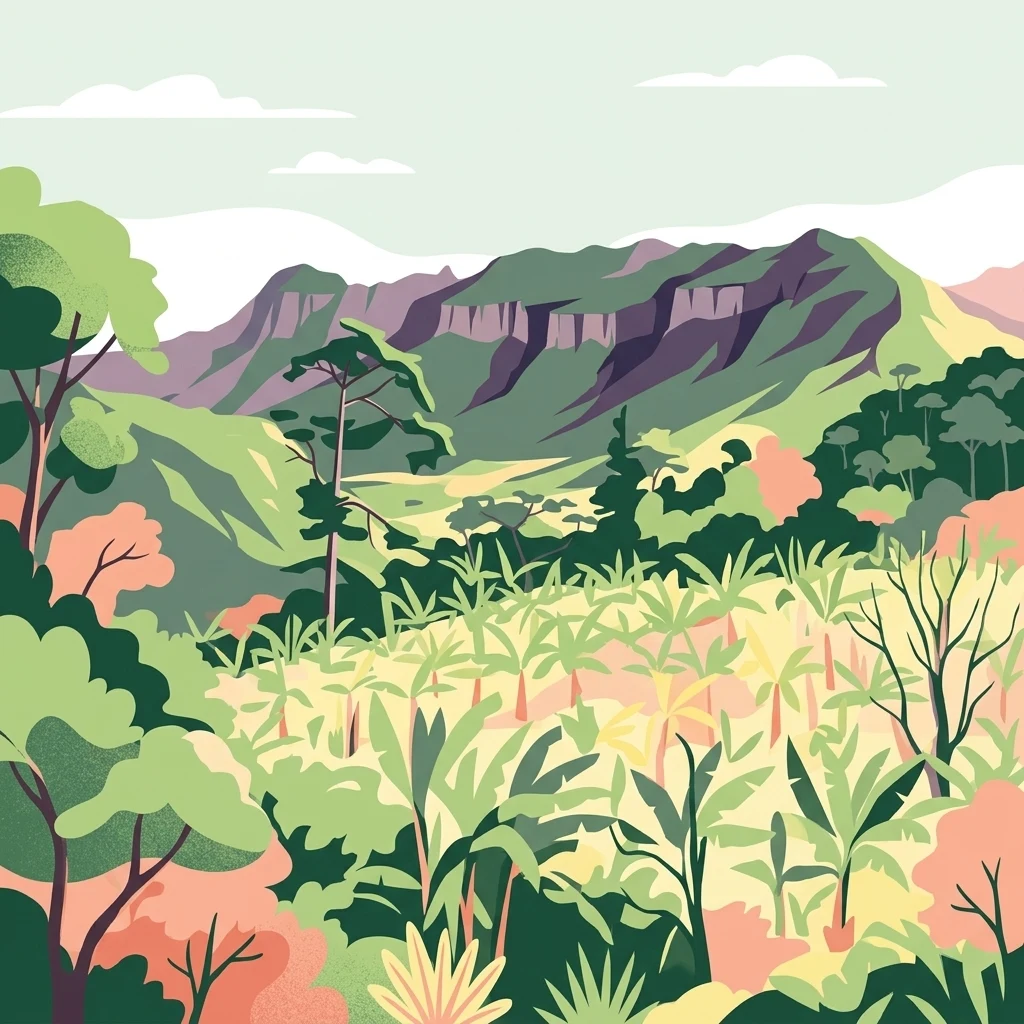
A colorful illustration showing a lush tropical rainforest valley with dense vegetation in the foreground and tall mountain ridges in the background under a pale sky.

Bosawás Biosphere Reserve

Biosphere reserve

Park overview

Structured park overview, official facts, and landscape profile for Bosawás Biosphere Reserve

Bosawás Biosphere Reserve park facts, protected area profile, and essential visitor context

Review the core facts for Bosawás Biosphere Reserve, including designation, size, terrain, visitor scale, habitats, and operating context in one park-focused overview.

About Bosawás Biosphere Reserve

Bosawás Biosphere Reserve occupies a vast swath of northern Nicaragua, stretching across the Jinotega Department and reaching the country's border with Honduras. Designated as a UNESCO biosphere reserve in 1997, it represents one of the most important tropical forest conservation areas in Central America and, by area, the second largest tropical rainforest in the Western Hemisphere after the Amazon.

The reserve is structured around a core nucleus surrounded by a buffer zone, together forming a landscape of roughly 20,000 square kilometers. The nucleus itself already accounts for around seven percent of Nicaragua's total land area. The terrain is dominated by the Cordillera Isabella, a mountain range whose peaks, including Mount Saslaya, reach high into the rainforest canopy. Major river systems such as the Coco, Bocay, and Waspuk carve through and around the reserve, and the Coco River forms the northern boundary with Honduras.

Ecologically, Bosawás is defined by continuous tropical rainforest, of which roughly half of the reserve's area is estimated to be forested. Because much of the interior remains poorly explored, true measures of its plant and animal diversity are still incomplete. What is known suggests extraordinary richness across vascular plants, invertebrates, and vertebrates, with particular significance for birds, large mammals, and endemic amphibians tied to the region's mountain forests.

The reserve is not purely an uninhabited wilderness. Approximately 130,000 people live within its broader boundaries, including some 35,000 Mayangna and Miskito inhabitants whose homelands overlap with the protected landscape. This human dimension shapes Bosawás as much as its forests do, making the reserve a place where conservation policy, indigenous territorial rights, and resource pressures converge in ways that continue to evolve.

Quick facts and research context for Bosawás Biosphere Reserve

Bosawás is located in the Jinotega region of northern Nicaragua and extends toward the Honduran border, which it follows along the Coco River. Its name combines three geographic landmarks: the Bocay River, Mount Saslaya, and the Waspuk River.

The reserve was designated a UNESCO biosphere reserve in 1997 and is classified as an IUCN Category IV protected area, focused on habitat and species management. BirdLife International has recognized it as an Important Bird Area, reflecting the exceptional avifaunal diversity found within its largely intact forest cover.

Protection and recognition

Documented terrestrial protection scope and official UNESCO Biosphere Reserve designation

Bosawás Biosphere Reserve Protection Status and International Recognition

Bosawás Biosphere Reserve holds documented terrestrial protection status and official UNESCO Biosphere Reserve recognition within its regional conservation framework. Official records compile international designation sources and management scope for structured geographic analysis.

International recognition

Protection details

Protection scope
Terrestrial
Designated year
1997
Core area
8,065.95 km²
Buffer area
8,500.63 km²
Park context

Deeper park guide and search-rich context for Bosawás Biosphere Reserve

Bosawás Biosphere Reserve history, landscape, wildlife, and travel context

Explore Bosawás Biosphere Reserve through its history, landscape character, ecosystems, wildlife, conservation priorities, cultural context, and seasonal travel timing in a structured park guide built for atlas discovery and search intent.

Why Bosawás Biosphere Reserve stands out

Bosawás is best known for being one of the largest continuous blocks of tropical rainforest remaining in the Western Hemisphere outside the Amazon basin. The reserve is renowned for its largely intact primary forest, its mountainous interior crossed by the Cordillera Isabella, and its exceptionally high but still incompletely documented biodiversity. The area is also known for its overlap with the territories of the Mayangna and Miskito peoples, and for the ongoing tensions between indigenous land rights, colonization pressure, and tropical forest conservation. The combination of ecological scale, biological richness, and unresolved human pressures has made Bosawás a globally significant, yet vulnerable, conservation landscape.
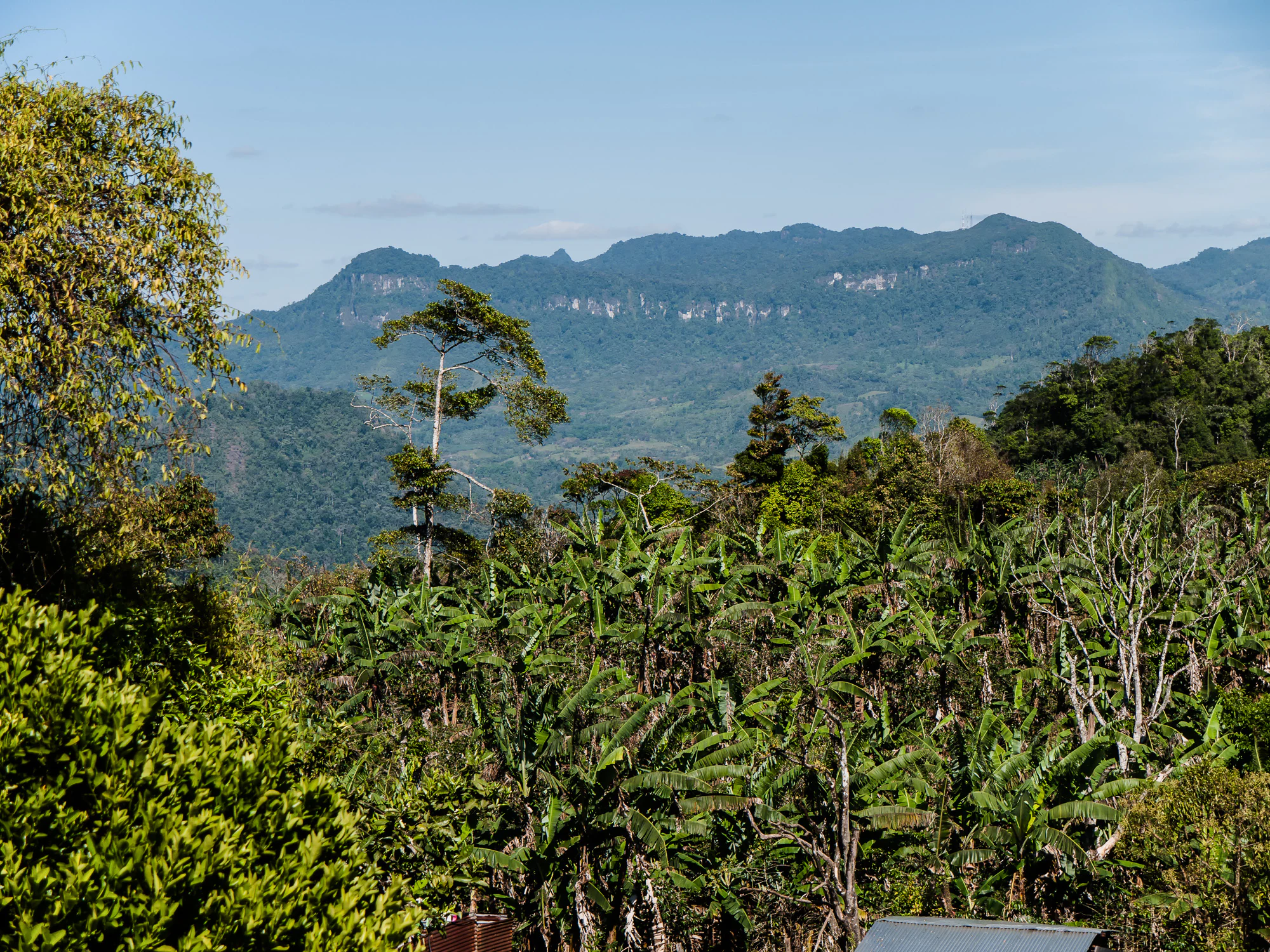
A wide view of a lush green landscape featuring tropical vegetation in the foreground and a series of forested mountain ridges in the distance under a clear blue sky.
A scenic view of the Penas Blancas region within the Bosawas Biosphere Reserve, showcasing the dense tropical landscape.

Bosawás Biosphere Reserve history and protected-area timeline

Bosawás developed out of the conflicts that emerged between the Sandinista government and the indigenous Miskito and Mayangna peoples of Nicaragua's Atlantic Coast. The armed confrontations of the 1980s gave way to a peace process in which the Nicaraguan government enacted the 1987 Autonomy Law of the Atlantic Coast (Law 28), formally recognizing indigenous and Afro-descendant territorial rights across the region.

In the early 1990s, the subsequent Chamorro government set aside three large reserves in the region, with Bosawás as the largest of these. The reserve was created without prior indigenous consultation and was initially regarded by Mayangna and Miskito communities as a violation of their constitutionally guaranteed territorial autonomy. Through negotiations and consultation in the late 1990s, indigenous territorial boundaries were demarcated, titles were granted to indigenous communities, and Bosawás came to be embraced as a shared framework of biosphere reserve, indigenous territory, and conservation zone.

UNESCO recognized this landscape in 1997 by designating Bosawás as a biosphere reserve, cementing its international conservation significance. Since then, the reserve has continued to grapple with ongoing tensions, including violent land conflicts between indigenous inhabitants and mestizo settlers, or colonos, pushing into the forest in search of land, timber, and gold. Notable incidents include attacks on Mayangna communities in 2020 and a massacre of nine indigenous people, alongside sexual assaults, in Sauni As in August 2021, illustrating that the history of Bosawás remains a live, contested process rather than a settled conservation outcome.

Bosawás Biosphere Reserve landscape and geographic character

The landscape of Bosawás is shaped by the meeting of tropical lowland forest with the highlands of the Cordillera Isabella in northern Nicaragua. While the reserve is dominated by dense rainforest, it is far from flat: ridges and mountain peaks rise through the canopy, with Mount Saslaya standing as a defining landmark both ecologically and etymologically, since part of the reserve's name is drawn from this massif.

Rivers are central to the geography of Bosawás. The Coco River runs along the northern edge of the reserve, forming the international boundary between Nicaragua and Honduras. The Bocay and Waspuk rivers, the other two geographic references embedded in the name Bosawás, traverse the landscape and have given their names to distinct settlement areas within the broader territory. Together, these river systems shape drainage, sediment, and forest patterns across a vast and largely unbroken forested region.

Although most of the reserve is depicted as continuous primary forest, satellite and field analyses indicate a patchwork of intact core, secondary growth, and disturbed zones, particularly near colonization fronts and along rivers used for transport. The inclusion of the full territory of Saslaya National Park within Bosawás underscores the mountain-and-forest character of the reserve, blending lowland tropical rainforest with elevated, often wetter, montane environments.

Bosawás Biosphere Reserve ecosystems, habitats, and plant life

Bosawás is a tropical rainforest ecosystem of exceptional scale and relative intactness. Its vegetation is dominated by broadleaf evergreen forest typical of the Central American lowlands, with transitions into montane forest along the higher elevations of the Cordillera Isabella. While no precise floristic inventory has been completed, vascular plant diversity is believed to run into the thousands of species across this landscape.

The reserve's biological richness extends far beyond plants. Entomological estimates suggest the presence of between 100,000 and 200,000 insect species, although the true figure is thought to be higher given how little of the terrain has been thoroughly surveyed. Vertebrate diversity is similarly significant, with amphibians, reptiles, mammals, and birds all represented in numbers consistent with a major Neotropical forest.

Despite ongoing disturbances in parts of the landscape, large tracts of primary forest remain. This continuity of habitat is itself a defining ecological feature of Bosawás, allowing wide-ranging species and ecological processes to persist across an unusually large area for a Central American protected landscape.

Bosawás Biosphere Reserve wildlife and species highlights

Bosawás supports some of the most important wildlife populations remaining in Central America. The reserve has been recognized by BirdLife International as an Important Bird Area, reflecting the presence of hundreds of the roughly 700 bird species recorded in Nicaragua. Among the most emblematic species are the resplendent quetzal and guacamayas, or macaws, alongside the harpy eagle (Harpia harpyja), the largest and most powerful eagle in the Americas and a powerful indicator of intact forest.

The mammalian fauna includes apex predators such as jaguars and pumas, which still inhabit the reserve in significant numbers where forest cover remains intact. Baird's tapir (Tapirus bairdii), one of the largest herbivores of Neotropical forests, is recorded as important prey for these big cats and is itself a species of conservation concern whose presence further signals the relatively undisturbed character of much of the reserve.

The reserve's amphibians are another important component of its wildlife profile. The Saslaya moss salamander (Nototriton saslaya), endemic to Mount Saslaya and found entirely within Bosawás, exemplifies the localized endemism that emerges from the reserve's mountainous terrain intersecting with its wet forest environments. While many species remain poorly documented, the existing records point to a wildlife assemblage of regional and continental significance.

Bosawás Biosphere Reserve conservation status and protection priorities

Bosawás is one of the most significant conservation areas in Central America, both because of its size and because of the biodiversity and ecological processes it preserves. As a UNESCO biosphere reserve and an IUCN Category IV protected area focused on habitat and species management, it is formally embedded in international conservation frameworks, while its recognition as an Important Bird Area underscores its avifaunal importance at a global scale.

The conservation significance of Bosawás rests heavily on the scale and continuity of its primary tropical forest. Continuous forest cover of this magnitude is rare in Central America and supports viable populations of wide-ranging species such as jaguars, harpy eagles, and tapirs that cannot persist in smaller, fragmented protected areas. The flagship status of these species has helped frame Bosawás as a regional stronghold for Neotropical biodiversity.

At the same time, conservation in Bosawás is shaped by powerful and ongoing pressures. Colonization by settlers seeking land, timber, and gold has led to deforestation along frontier zones, and violent conflicts over indigenous territory have escalated in recent years. The reserve is also a place where indigenous territorial rights and biosphere reserve governance must coexist, requiring conservation strategies that integrate local land tenure, community rights, and forest protection if the ecological integrity of the landscape is to be maintained over the long term.

Bosawás Biosphere Reserve cultural meaning and human context

Bosawás overlaps the ancestral homelands of two of Nicaragua's principal indigenous peoples of the Caribbean coast, the Mayangna and the Miskito. These communities have long inhabited the forests and rivers of northern Nicaragua, sustaining livelihoods based on subsistence farming, hunting, fishing, and the careful use of forest resources.

The region's modern political and cultural identity was significantly shaped by the 1987 Autonomy Law of the Atlantic Coast, which recognized the territorial rights of indigenous and Afro-descendant communities. The eventual demarcation and titling of indigenous territories within Bosawás in the late 1990s created a framework in which indigenous governance and biosphere reserve regulations coexist, producing an unusual and sometimes tense coexistence between customary law, community decision-making, and state-led conservation.

Cultural tension around land use has remained a defining feature of life in Bosawás. Disputes between indigenous communities and incoming mestizo settlers have repeatedly escalated into violence, framing the reserve as much as a contested cultural landscape as a protected natural one. The ongoing struggles over land, resource extraction, and indigenous autonomy continue to define the human story of Bosawás alongside its ecological identity.

Top sights and standout views in Bosawás Biosphere Reserve

Bosawás stands out for combining the sheer scale of a near-Amazonian tropical rainforest with the relatively intact ecological and cultural landscape of Central America. Its size, its largely unbroken canopy, and the presence of iconic species such as harpy eagles, jaguars, tapirs, and resplendent quetzals set it apart from most other protected areas in the region.

Equally distinctive is the overlapping of a UNESCO biosphere reserve with the territories of the Mayangna and Miskito peoples, making Bosawás a landmark case in the intersection of indigenous rights and conservation policy, and a focal point of ongoing debates over land, sovereignty, and the future of Central America's tropical forests.

Best time to visit Bosawás Biosphere Reserve

As a lowland tropical rainforest reserve dominated by year-round warm and humid conditions, Bosawás does not follow the dry and wet seasonality of higher or more temperate destinations in the same obvious way. However, patterns of rainfall and accessibility still influence when and how the forest can be experienced.

The drier months of the regional calendar typically offer better access along rivers and forest tracks, with reduced mud and lower water levels, while the wetter months bring higher water levels that can make travel more difficult but also intensify the forest's lushness and bird activity. Wildlife observation, including for harpy eagles and macaws, often benefits from periods when fruit availability peaks, although such patterns vary across the reserve's vast interior.

Monthly climate preview

Long term temperature and precipitation patterns across representative coordinates

Bosawás Biosphere Reserve Climate Normals and Monthly Weather Records

Representative coordinates within Bosawás Biosphere Reserve record measured long term temperature swings and shifting monthly precipitation rates from NASA climatology data. Examining the complete twelve month climate profile reveals detailed patterns across the entire annual cycle.
Annual mean25 °C
23 °C27 °C
Jan23°
Feb24°
Mar25°
Apr27°
May27°
Jun26°
Jul25°
Aug25°
Sep25°
Oct25°
Nov24°
Dec23°
Warmest month
April

27.2 °C

Coolest month
January

23.2 °C

Wettest month
October

5.3 mm/day

Driest month
March

0.7 mm/day

Park location guide

Geography guide, regional context, and park location map for Bosawás Biosphere Reserve

Bosawás Biosphere Reserve park geography, regions, and map view in Nicaragua

Understand where Bosawás Biosphere Reserve sits in Nicaragua through a broader geographic reading of the surrounding landscape, nearby location context, and its mapped position within the national park landscape.

How Bosawás Biosphere Reserve fits into Nicaragua

Nicaragua is a Central American country spanning 130,375 km² with a population of approximately 6.7 million. It borders Honduras, Costa Rica, the Caribbean Sea, and the Pacific Ocean. The official language is Spanish, and the currency is the Córdoba. Known for its agricultural productivity and cultural diversity, Nicaragua has a history dating back to indigenous civilizations before Spanish conquest in the 16th century.

Wider geography shaping Bosawás Biosphere Reserve in Nicaragua

Nicaragua occupies a strategic position in Central America, bordered by Honduras to the north, the Caribbean Sea to the east, Costa Rica to the south, and the Pacific Ocean to the west. The country also shares maritime borders with El Salvador and Colombia. The terrain includes coastal plains, volcanic highlands, and interior valleys. Lake Managua and Lake Nicaragua are major freshwater bodies.

Map view of Bosawás Biosphere Reserve

Use this park location map to pinpoint Bosawás Biosphere Reserve in Nicaragua, understand its exact geographic position, and read its mapped placement within the surrounding landscape more clearly.

Pigeon | © OpenStreetMap contributors

Location context for Bosawás Biosphere Reserve

Jinotega Department
Recorded earthquake history

Review the Historical Earthquake Catalogue for Bosawás Biosphere Reserve

Browse a detailed collection of recorded seismic events associated with the geographic coordinates of the Bosawás Biosphere Reserve. This MoriAtlas resource tracks historical event data, including magnitude and focal depth, to provide a clear view of seismic distribution across this protected landscape.

Bosawás Biosphere Reserve Earthquake History

Catalogued events

6 events

Strongest magnitude

Magnitude 4.9

Most recent event

Jul 8, 2009

This history includes earthquakes recorded inside the park or within 50 km of its borders

Explore photographic records of primary forest canopies, river basins, and highland terrain.

Bosawás Biosphere Reserve Photos and Landscapes: Visualizing the Protected Rainforest Environment

Visual documentation reveals the complex topography and dense tropical rainforest habitats that define the reserve. Examining these protected area views helps researchers understand regional geography, river networks, and conservation landscapes.

A wide view of a lush green landscape featuring tropical vegetation in the foreground and a series of forested mountain ridges in the distance under a clear blue sky.

Park atlas

Compare surrounding regional rainforest geography and connected conservation landscapes

Explore Protected Areas and Parks Near Bosawás Biosphere Reserve

Browse other national parks and protected areas near Bosawás Biosphere Reserve to examine broader regional forest corridors. This comparative view reveals how surrounding lowland rainforests and highland ranges connect across Central America.
National parkHonduras
0 km away#1 closest

Northwest

Patuca National Park National Park: Understanding its Mapped Protected Boundaries and Honduran Geography

Explore the protected landscape and regional setting of this Honduran park.

Patuca National Park is an important protected area within Honduras, offering a unique opportunity to study its geographic features and conservation significance. As a national park, it provides a critical anchor for understanding regional landscape patterns and mapped protected boundaries in Central America. This entity within the MoriAtlas helps users grasp the specific geographic context and natural terrain associated with Patuca National Park, facilitating detailed atlas-based exploration of its protected status and landscape character.

Area
3,755.84 km²
Established
1999
IUCN
II
Scope
Terrestrial
Biosphere reserveGracias a Dios Department
25 km away#2 closest

North

Río Plátano Biosphere Reserve: Protected Geography and Watershed Mapping in Honduras

A sprawling conservation landscape in Gracias a Dios Department

Río Plátano Biosphere Reserve protects one of the last major tracts of undisturbed tropical rainforest along the Central American Caribbean coast. This vast area spans diverse physiographies including brackish coastal lagoons, freshwater mangrove systems, and steep mountain ridges reaching over 1,300 meters. The geography is defined by the Río Plátano watershed, which serves as a vital corridor for endangered species and encompasses significant archaeological sites within its deep forest interior.

Area
5,250 km²
Established
1982
IUCN
II
Relief
Mixed relief
Nature reserveNicaragua
85 km away#3 closest

South

Cerro Pancasan Natural Reserve: Geographic Overview of a Nicaraguan Protected Forest Hill

Exploring mountain-slope terrain and regional watershed conservation

As a significant hill reserve in western Nicaragua, Cerro Pancasan Natural Reserve protects essential tropical forest cover against agricultural encroachment. This entry provides a detailed look at the reserve's topography, its role in maintaining regional stream flow, and its place within the country-wide SINAP network of protected land.

Scope
Terrestrial
National parkHonduras
About 90 km away#4 closest

Northwest

Sierra de Agalta National Park: National Park within Honduras's Protected Landscape Atlas

Explore mapped boundaries and natural terrain details.

Sierra de Agalta National Park is a protected national park in Honduras, offering valuable insight into the country's natural geography and conservation efforts. As a key entity within the broader atlas of protected lands, this park's mapped boundaries and surrounding terrain provide a foundation for understanding its ecological significance and regional context. Discover the geographic identity of Sierra de Agalta National Park and its contribution to Honduras's protected areas.

Area
207.85 km²
Established
1987
IUCN
II
Relief
Mountain
A watercolor painting showing a soft landscape with green hills, a tree line, and pinkish mudflats or shallow water in the foreground.
Wildlife reserveNorth Caribbean Coast Autonomous Region
136 km away#5 closest

East

Miskito Cays Wildlife Reserve: Geographic Atlas and Coastal Landscape Context

Protected marine terrain in the North Caribbean Coast Autonomous Region

The Miskito Cays Wildlife Reserve represents a complex, low-lying coastal environment featuring an intricate network of reefs, sand bars, and vegetated islets. This study of the archipelago provides an understanding of its protected status as a biological reserve and its role as an Important Bird Area. Examine the physical boundaries of this Caribbean wetland complex to see how the landscape connects to the broader Moskitia coastal corridor.

Area
27 km²
Established
1991
Relief
Lowland
Scope
Mixed
National parkColón Department
About 162 km away#6 closest

North

Capiro Calentura National Park: Honduran National Park Atlas and Protected Landscape

Discover mapped geography and protected area context in Colón Department.

Access detailed geographic information and mapped boundaries for Capiro Calentura National Park, a key protected area within Honduras' Colón Department. This entry offers an atlas-style perspective on the park's landscape and its regional setting, supporting structured discovery of national parks and conservation lands.

Area
80.82 km²
Established
1992
IUCN
II
Climate
Tropical
National parkFrancisco Morazán Department
About 166 km away#7 closest

West

La Tigra National Park: Mapped Protected Landscape in Francisco Morazán Department, Honduras

Explore its geography and protected area context.

La Tigra National Park serves as a key protected area within the Francisco Morazán Department, offering rich opportunities for geographic and landscape discovery. This national park's specific mapped boundaries and regional context are vital for understanding its role within Honduras's protected lands. Engage with its geography to appreciate the unique characteristics of this important natural landscape.

Area
238.21 km²
Established
1980
IUCN
II
Relief
Mountain
National parkLa Unión
About 171 km away#8 closest

Northwest

La Muralla National Park: Honduras National Park Geography and Mapped Boundaries

Explore the protected landscape and regional context.

La Muralla National Park represents a significant protected landscape within Honduras, offering valuable geographic data for atlas exploration. As a national park, its mapped boundaries and regional setting are key to understanding its conservation significance. This entry provides structured insight into the park's physical characteristics and its place within the broader Honduran geography, ideal for detailed landscape analysis.

Area
210.35 km²
Established
1993
IUCN
II
Scope
Terrestrial

Common questions about visiting, size, designation, and location context for Bosawás Biosphere Reserve

Bosawás Biosphere Reserve FAQs for park facts, access, geography, and protected area context

Find quick answers about Bosawás Biosphere Reserve, including protected-area facts, park geography, trail and visitor context, and how the park fits into its surrounding country and regional landscape.
MoriAtlas Explorer

Continue Your Protected Areas Search Across the Global Atlas

Deepen your exploration by continuing the structured search for national parks and protected areas worldwide. Utilize the comprehensive filtering capabilities to compare different conservation landscapes and refine your understanding of global park geography. Discover more about the distribution and characteristics of protected natural areas.

Global natural geography