
Mori Atlas logo
Protected areaBosque el Nixticuil

Tracing the boundaries and volcanic terrain of this vital urban forest within Jalisco.

Bosque el Nixticuil Protected Area: Geographic Atlas and Landscape Context in Zapopan, Mexico

Bosque el Nixticuil stands as a significant protected landscape on the northwestern edge of the Guadalajara Metropolitan Area. Spanning approximately 1,591 hectares of formally protected woodland, this site preserves an essential remnant of old-growth oak and pine forests. Its terrain is shaped by the volcanic geology of the Trans-Mexican Volcanic Belt, featuring a mix of rhyolitic domes, pyroclastic deposits, and rolling hills that form a critical part of the local Río Blanco watershed.

urban forestold-growth forestoak woodlandpine woodlandwatershed protectionprotected area
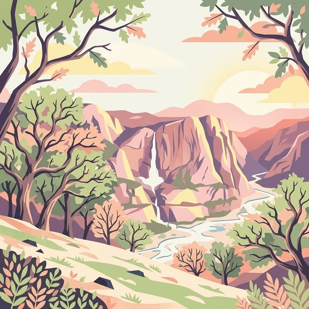
An illustrative style drawing of a sun-drenched canyon featuring a waterfall cascading down rocky cliffs into a winding river below, framed by trees in the foreground.

Bosque el Nixticuil

Protected area

Park overview

Structured park overview, official facts, and landscape profile for Bosque el Nixticuil

Bosque el Nixticuil park facts, protected area profile, and essential visitor context

Review the core facts for Bosque el Nixticuil, including designation, size, terrain, visitor scale, habitats, and operating context in one park-focused overview.

About Bosque el Nixticuil

Bosque el Nixticuil occupies a distinctive position among Mexico's protected natural areas: it is an old-growth oak-holm oak-pine woodland that survives directly alongside one of the country's largest and fastest-growing metropolitan regions. Located in the municipality of Zapopan, on the northwestern margin of the Guadalajara conurbation, the forest is a compact green island pressed against suburban development, industrial expansion, and infrastructure projects.

Geographically, the forest sits within the Trans-Mexican Volcanic Belt, near the edge of the Sierra Madre Occidental. Its northern and eastern portions are built on Pleistocene rhyolitic domes, while the Tesistán valley exposes airborne pyroclastic fall deposits dated to roughly 25,000 years old. This volcanic substrate has produced a varied topography of plains, shallow canyons, and low rolling hills, drained by the Río Blanco watershed, which the forest helps to regulate and protect.

Ecologically, Bosque el Nixticuil is more than a stand of trees. It shelters mammals such as coyote, gray fox, skunk, opossum, and rabbit, alongside a wide range of rodents, reptiles, amphibians, and insects. Ornithological surveys carried out by the University of Guadalajara have documented 107 bird species, including two considered rare, seven listed as threatened, and one under special protection. The plant community includes, in addition to its dominant oaks and pines, broader biodiversity in herbs and shrubs such as kidneywood, copal, mallow, mugwort, foxtail, willow, amate fig, and native acacias like tepame and huisache. The forest is one of only three known locations of Styrax jaliscana, a rare white-flowering member of the Styrax family.

The forest also delivers a broad set of ecosystem services to the surrounding population and to Greater Guadalajara as a whole. These include water conservation, soil protection, carbon sequestration, oxygen production, nutrient cycling, pollution decomposition, pest and disease regulation, biodiversity conservation, climate stabilization, and cultural and aesthetic value tied to its long history in the region.

Quick facts and research context for Bosque el Nixticuil

Bosque el Nixticuil is an old-growth forest in the municipality of Zapopan, Jalisco, northwest of the Guadalajara metropolitan area. Covering roughly 1,860 hectares total, with 1,591 hectares designated as a protected watershed area, it is the remnant of a once expansive 27,000-hectare woodland. The forest lies within the Trans-Mexican Volcanic Belt and forms part of the Río Blanco watershed, including the Cerro del Diente and the community of San Esteban. It was declared a Natural Protected Area by the Jalisco State Legislature on February 19, 2008, following years of community-led opposition to urban development projects within its boundaries.

Protection and recognition

Examine the recorded establishment timeline and conservation parameters for this protected area.

Bosque el Nixticuil Protection Status and Terrestrial Designation History

Historical records indicate terrestrial protection status established for Bosque el Nixticuil in 2008 without transboundary governance measures. Structured data compiles the official designation history alongside available international recognition parameters for analytical review.

Protection details

Protection scope
Terrestrial
Designated year
2008
Transboundary protection
No
Core area
15.91 km²
Park context

Deeper park guide and search-rich context for Bosque el Nixticuil

Bosque el Nixticuil history, landscape, wildlife, and travel context

Explore Bosque el Nixticuil through its history, landscape character, ecosystems, wildlife, conservation priorities, cultural context, and seasonal travel timing in a structured park guide built for atlas discovery and search intent.

Why Bosque el Nixticuil stands out

Bosque el Nixticuil is best known as one of the largest surviving old-growth oak and pine forests inside the urban footprint of Greater Guadalajara. It is recognized for hosting approximately 107 recorded bird species, including rare and threatened taxa, and for being one of only three known habitats of the white-flowering shrub Styrax jaliscana. The forest is also recognized as a focal point of grassroots urban conservation in Mexico. Community organizations such as the Comité Salvabosque Tigre II have fought for years to keep real estate, housing, and university-linked development projects from encroaching on the woodland, ultimately securing formal protected status for most of its remaining area.
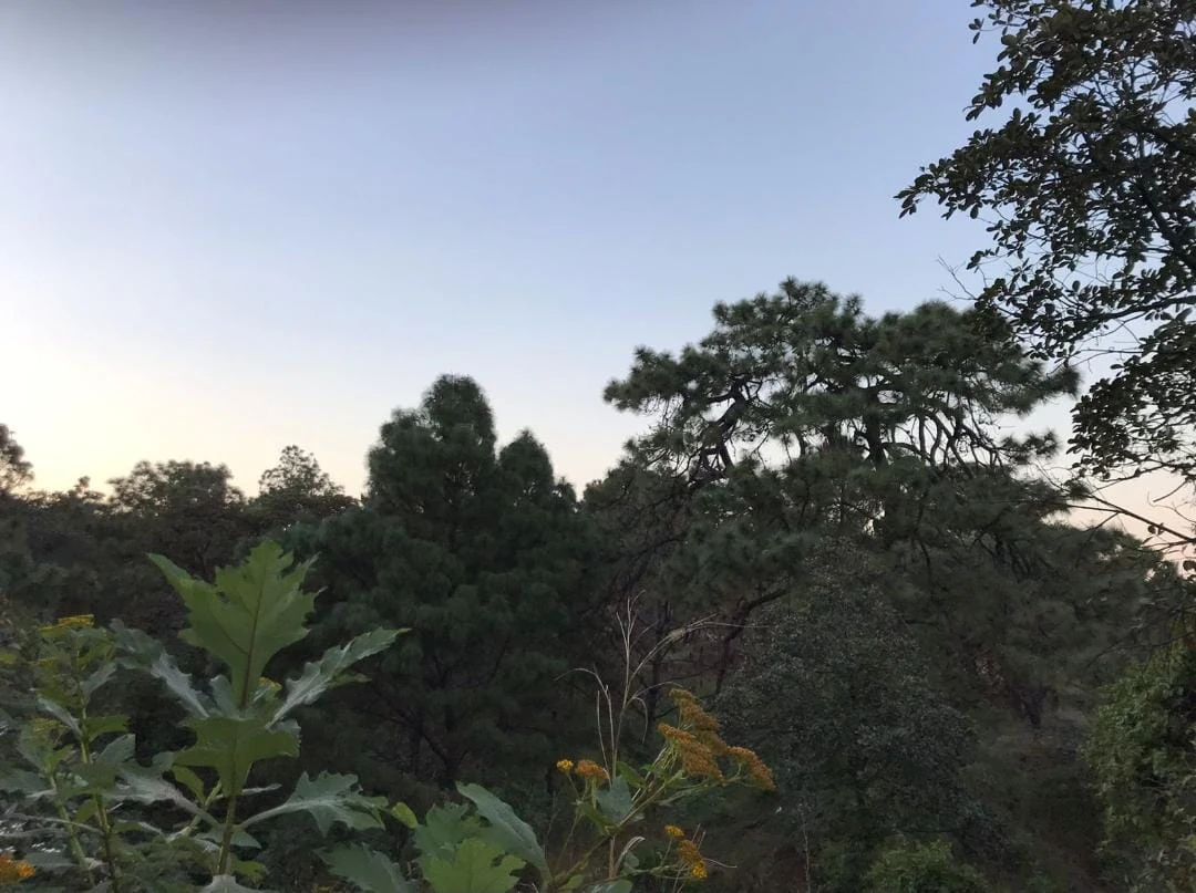
A view of pine and oak forest canopy under a soft evening sky with wildflowers in the foreground.
The forest canopy of Bosque el Nixticuil during dusk.

Bosque el Nixticuil history and protected-area timeline

The origins of Bosque el Nixticuil reach back well before its modern protected status. According to one local hypothesis, the woodland was originally indigenous territory associated with the village of Huautla and bordered lands connected to the Cópala people. After the Spanish conquest, these lands were incorporated into royal land grants, and indigenous communities long attempted to reclaim what had been ancestral territory. Throughout that long process, the Cerro del Nixticuil itself was preserved largely untouched, treated almost as a reserved treasure.

The surrounding area also carries colonial and industrial heritage. Three historically significant sites are associated with the forest today: the Templo de San Esteban, whose construction dates to 1580 and which is attributed to Fray Antonio de Segovia, built in a style reminiscent of the Basilica of Zapopan with thick adobe walls and interior paintings featuring indigenous motifs; the Hacienda La Escoba, located roughly five leagues from the Zapopan municipal seat and historically home to the first registered textile factory in Jalisco, operating from 1840; and the Hacienda Río Blanco, whose cotton factory harnessed water diverted from La Escoba through a channel and turbine system.

In modern times, the forest's history is largely a history of defense against urban encroachment. In 2004, the rainy season triggered a ground collapse in the nearby community of Nextipac that affected local residents. Zapopan's city government proposed relocating those households to a forested area adjacent to a development known as Tigre II, scheduled to begin construction in 2005. Residents of Tigre II, who wished to protect the forest, joined with many Nextipac residents opposed to forced relocation to block the project, halting construction and entering negotiations that the city government later unexpectedly resumed and expanded.

Renewed protests on May 18, 2005, succeeded in stopping work that had already led to the felling of more than 300 oak trees. Subsequent years saw additional proposals: a Zapopan municipal plan for public housing on five hectares of forest, a building complex planned by the Villa de los Niños Association, and a University Science and Technology Research Park advanced by the Autonomous University of Guadalajara (UAG). In June 2007, the Comité Salvabosque Tigre II filed a complaint with the Federal Prosecutor for Environmental Protection (PROFEPA) over alleged irregularities in permits, and later lodged a complaint with the Jalisco State Human Rights Commission (CEDHJ).

By the end of 2006, Zapopan proposed declaring the forest a Natural Protected Area. After further mobilization, the Jalisco State Legislature finally approved protected status for 1,591 hectares of Nixticuil on February 19, 2008, effectively freezing the contested municipal and private projects within its boundaries. The forest's modern identity is inseparable from this long civic struggle.

Bosque el Nixticuil landscape and geographic character

The forest sits within a transitional volcanic landscape where the Trans-Mexican Volcanic Belt approaches the edge of the Sierra Madre Occidental. Geologically, Nixticuil is built from extrusive igneous rocks; large parts of the territory expose tephras that can be grouped into three units: pnicitic tuffs, ignimbrite ash flow deposits, and pyroclastic cones. The northern and eastern portions of the area rest on rhyolitic domes formed during the early Pleistocene, while the Tesistán valley preserves air-fall tephras roughly 25,000 years old.

Across this substrate, the topography settles into a varied but rarely extreme pattern of plains, shallow canyons, and low rolling hills. The protected area encompasses not only the woodland itself but the Cerro del Diente and the community of San Esteban, all part of the broader Río Blanco watershed. The local promontory called El Nixticuil, which gives the forest its name, rises as a recognizable natural landmark within this basin.
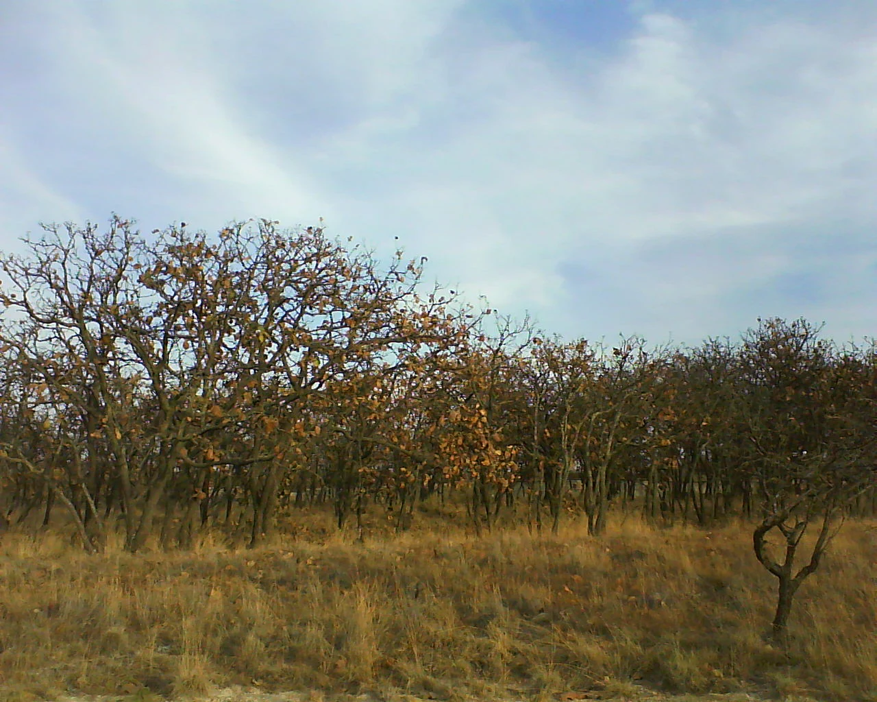
A grove of mature oak trees with sparse golden-brown foliage under a partially cloudy sky during the dry season.
Mature oak trees in Bosque el Nixticuil during the dry season.

Bosque el Nixticuil ecosystems, habitats, and plant life

Ecologically, Bosque el Nixticuil is a complex mosaic rather than a single uniform woodland. Its dominant canopy is composed of oak, holm oak (Quercus agrifolia), and planted pine, beneath which grows a notably biodiverse layer of shrubs, herbs, and smaller trees. Kidneywood, copal, mallow species, mugwort, foxtail, willow, amate fig, and the native acacias known locally as tepame and huisache all contribute to this understory.

The forest's value as habitat is amplified by its geographic context. As a vegetated island embedded in the metropolitan expansion of Guadalajara, it functions as both a refuge and a stepping stone for species that would otherwise have lost local habitat. The combination of plains, low hills, and shallow canyons, set on volcanic substrates with seasonal summer rainfall averaging around 917 mm annually, supports biomass and dry-matter production high enough to maintain a rich faunal community year-round.

The site also has a particular botanical claim to attention. It is one of only three known habitats worldwide for Styrax jaliscana, a white-flowering shrub of the Styrax family that is effectively endemic to this part of Jalisco, giving the forest a niche but genuine role in regional plant conservation.
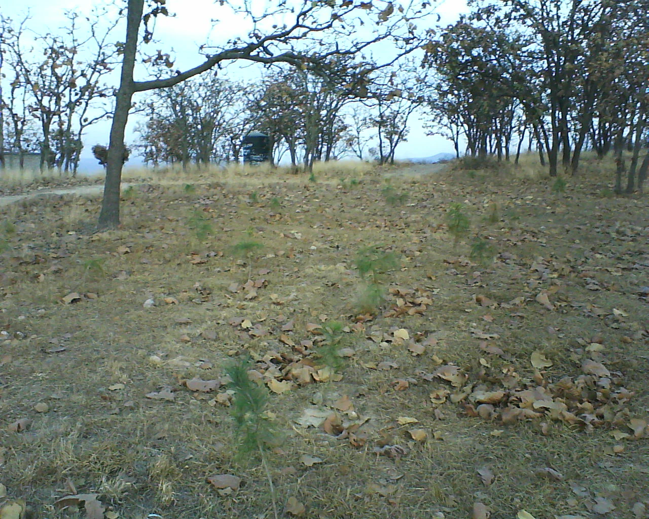
A wide view of an open forest floor with dry leaves on the ground, several small green saplings, and mature trees in the background under an overcast sky.
A reforested area within the Bosque el Nixticuil forest showing young saplings amidst established deciduous trees.

Bosque el Nixticuil wildlife and species highlights

The forest hosts a sizeable mammal community typical of central-western Mexico's oak and pine zones. Coyote, gray fox, skunk, opossum, and rabbit are all recorded, alongside multiple rodent species. Reptiles, amphibians, and arthropods occupy the warmer and moister microsites the woodland provides.

The birdlife is particularly noteworthy. Surveys by the University of Guadalajara have recorded 107 distinct avian species in the forest, including two considered rare, seven classified as threatened, and one under special protection. Among the species documented in the pine woodland are the red-tailed hawk, the Mexican gray squirrel, rock squirrels, the eastern cottontail, and the northern pygmy mouse, along with birds such as the russet-crowned motmot, acorn woodpecker, mourning dove, barn owl, and the black-throated blue warbler.

The oak woodland habitat supports its own assemblage, including opossums, least shrews, gray fox, and the clouded anole lizard, with red-tailed hawk, Cooper's hawk, sharp-shinned hawk, white-tailed hawk, and ladder-backed woodpecker among the raptors and woodpeckers recorded there. Tropical deciduous forest patches within the broader area add further variety, including the nine-banded armadillo, the Mexican spiny mouse, and birds such as the squirrel cuckoo, hooded oriole, white-winged dove, blue mockingbird, and black-headed grosbeak. Grassland openings support additional species including the common ground dove, mourning dove, vermilion flycatcher, and curve-billed thrasher.
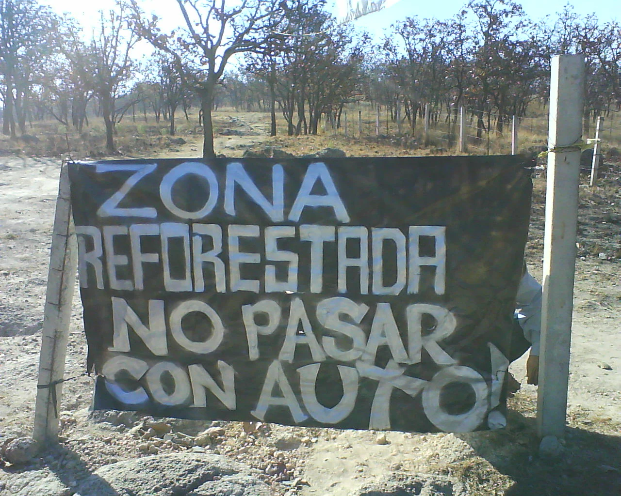
A horizontal black sign with white hand painted text that reads ZONA REFORESTADA NO PASAR CON AUTO! attached to two posts in a dry, open woodland area.
A hand painted sign in Bosque el Nixticuil indicating a reforested area with restricted vehicle access.

Bosque el Nixticuil conservation status and protection priorities

Bosque el Nixticuil is a textbook case of urban-edge conservation in Mexico, and one of the more dramatic examples of community-led protection of a remaining forest inside a major metropolitan area. The forest's ecological importance derives from its role in protecting the Río Blanco watershed; its formally designated status is specifically that of a municipal watershed protection area (Área Municipal de Protección Hidrológica).

Beyond watershed protection, the forest delivers a wide range of ecosystem services to surrounding neighborhoods and to Greater Guadalajara more broadly. These include water conservation and infiltration, soil stabilization against the kind of ground collapse seen in Nextipac after the 2004 rains, carbon sequestration, oxygen production, nutrient cycling, decomposition of pollutants, regulation of pests and disease, maintenance of biodiversity and genetic resources, and contributions to local climatic stability. Its cultural and aesthetic value is also recognized as part of its protected profile.

The forest's conservation has not been passive. After years of activism by neighbors and the Comité Salvabosque organization, the Jalisco State Legislature declared 1,591 hectares a Natural Protected Area on February 19, 2008. This designation halted a succession of urban, housing, and institutional development plans that had threatened the forest. Indigenous territorial history, colonial-era land tenure, and modern disputes over real estate pressure continue to inform the political ecology of the site.

Bosque el Nixticuil cultural meaning and human context

The forest carries a long human history layered onto its ecological value. Pre-conquest associations with the indigenous villages of Huautla and the neighboring Cópala people, followed by incorporation into Spanish royal land grants, mean that the woodland has long been a contested cultural space. Local communities have, at different times, treated the Cerro del Nixticuil itself as a kind of reserved treasure.

The surrounding landscape also preserves colonial and 19th-century industrial memory. The Templo de San Esteban, dating to 1580, has thick adobe walls and indigenous-influenced interior paintings that anchor the area's religious and artistic heritage. The Hacienda La Escoba site is associated with what is considered the first registered manufacturing industry in Jalisco, a textile mill that began operating in 1840. The Hacienda Río Blanco, downstream, extended that industrial story through cotton manufacturing powered by water diverted from La Escoba. Forest, haciendas, chapel, and modern suburb together form a single, layered cultural landscape on the edge of Guadalajara.

Top sights and standout views in Bosque el Nixticuil

Bosque el Nixticuil is notable for the unusual contrast it presents: a remnant old-growth oak and pine forest embedded directly in a major Mexican metropolitan area. Its roughly 1,860 hectares, of which 1,591 are formally protected, sustain 107 bird species documented by the University of Guadalajara and one of only three known populations of Styrax jaliscana.

The protected area also stands out as a successful, if hard-won, example of community-led urban conservation. Decades of activism by groups such as the Comité Salvabosque Tigre II turned a contested urban woodland into a legally protected watershed area, freezing multiple development projects and embedding the forest into both regional environmental policy and metropolitan civic life.

Best time to visit Bosque el Nixticuil

Nixticuil's climate is shaped by a definite rainy season that begins in June and tapers off by October, with July the wettest month and March the driest. Total annual rainfall is close to 917 mm, enough to support consistent biomass growth across the forest.

For visitors interested in the forest at its most visually lush, the wetter months of July through September tend to bring out the greenest conditions in the canopy and understory. Bird activity is generally easier to observe in the early morning hours of these warmer months. The late dry season, ending in May, offers more open ground visibility and cooler temperatures for walking, while exposing the seasonal character of oak-dominated woodland, which visibly shifts during the drought period documented in the forest's own research imagery.

Monthly climate preview

Long term temperature and precipitation records measured at representative park coordinates

Bosque el Nixticuil Climate Normals and Annual Weather Patterns

Representative coordinates record measured monthly temperature and precipitation rhythms across the protected area from nineteen ninety one to twenty twenty. Detailed climatology records provide complete month by month numerical comparisons for deeper analysis.
Annual mean19 °C
15 °C24 °C
Jan15°
Feb17°
Mar19°
Apr22°
May24°
Jun23°
Jul21°
Aug20°
Sep20°
Oct19°
Nov17°
Dec15°
Warmest month
May

23.7 °C

Coolest month
January

14.9 °C

Wettest month
July

6.3 mm/day

Driest month
April

0.1 mm/day

Park location guide

Geography guide, regional context, and park location map for Bosque el Nixticuil

Bosque el Nixticuil park geography, regions, and map view in Mexico

Understand where Bosque el Nixticuil sits in Mexico through a broader geographic reading of the surrounding landscape, nearby location context, and its mapped position within the national park landscape.

How Bosque el Nixticuil fits into Mexico

Mexico, officially the United Mexican States, is a country in North America spanning the Sierra Madre mountain ranges, coastal plains, and tropical regions. It borders the United States to the north, Guatemala and Belize to the southeast, and has coastlines along the Pacific Ocean, Gulf of Mexico, and Caribbean Sea. With a population exceeding 130 million, Mexico is home to one of the world's most significant concentrations of Indigenous languages alongside Spanish.

Wider geography shaping Bosque el Nixticuil in Mexico

Mexico occupies a land area of 1,972,550 km2, making it the thirteenth-largest country in the world. The terrain is highly diverse, featuring the Sierra Madre Occidental and Sierra Madre Oriental mountain ranges, the Mexican Plateau, coastal lowlands along the Pacific and Gulf/Caribbean margins, and the Yucatan Peninsula. The country spans multiple climate zones from desert in the north to tropical rainforest in the south.

Map view of Bosque el Nixticuil

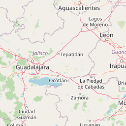
Use this park location map to pinpoint Bosque el Nixticuil in Mexico, understand its exact geographic position, and read its mapped placement within the surrounding landscape more clearly.

Pigeon | © OpenStreetMap contributors

Visualizing the old growth forest canopy, volcanic terrain, and protected habitats

Bosque el Nixticuil Photos and Landscape Scenery

Visual records reveal the rugged volcanic terrain, oak woodlands, and diverse habitats that define the protected landscape of Bosque el Nixticuil. Detailed photography helps researchers and observers examine the environmental character and topography of this metropolitan conservation area.

A view of pine and oak forest canopy under a soft evening sky with wildflowers in the foreground.

A wide view of a dry, open woodland with leafless or sparse-leaved deciduous trees and dried grass under a cloudy sky.

A grove of mature oak trees with sparse golden-brown foliage under a partially cloudy sky during the dry season.

A wide view of an open forest floor with dry leaves on the ground, several small green saplings, and mature trees in the background under an overcast sky.

A horizontal black sign with white hand painted text that reads ZONA REFORESTADA NO PASAR CON AUTO! attached to two posts in a dry, open woodland area.

Park atlas

Compare nearby volcanic terrain, watershed reserves, and forest ecosystems across Jalisco

Explore Other Parks Near Bosque el Nixticuil and Regional Protected Landscapes

Browse protected areas and natural reserves located near Bosque el Nixticuil to compare regional park geography across the surrounding volcanic landscape. Continuing into adjacent conservation zones provides deeper context on local watershed terrain and woodland habitats.
A horizontal watercolor painting depicting a soft-focus landscape with rolling green hills, patches of forest, and light golden hues representing meadows or dry terrain.
Biosphere reserveJalisco
About 14 km away#1 closest

Southwest

La Primavera Biosphere Reserve: Mapping Volcanic Landscapes and Protected Watersheds

Ecological geography and forest distribution in Jalisco, Mexico

Centering on the Sierra la Primavera volcanic complex, this biosphere reserve functions as an essential green corridor and water catchment zone. The terrain consists of a complex mosaic of vegetation types, including pine-oak forests and relict cloud forest patches across high-elevation ridges. Discover the structural role of these protected lands in moderating the climate and supporting biodiversity in the Guadalajara metropolitan region.

Area
305 km²
Established
2000
IUCN
VI
Relief
Mountain
A horizontal watercolor illustration depicting rolling green hills and distant muted mountain ranges.
Nature reserveJalisco
About 16 km away#2 closest

Southeast

Barranca de Oblatos: Protected Canyon Nature Reserve and Geographical Landmark in Jalisco

Urban-adjacent nature reserve and protected river corridor

Barranca de Oblatos is a striking geological feature and nature reserve that anchors the biodiversity of the Guadalajara metropolitan region. Featuring a deep canyon system carved by the Rio Grande de Santiago, this protected area holds a complex mosaic of tropical deciduous forests and historical landmarks within its dramatic vertical walls. Explore the landscape context and natural boundaries that define this essential western Mexican wilderness area.

Area
11.37 km²
Established
1997
Relief
Highland
Climate
Subtropical
Watercolor painting of a wide, calm lake surrounded by low, rolling hills and lush green vegetation under a soft, hazy sky.
Wildlife reserveJalisco
About 64 km away#3 closest

Southeast

Lake Chapala Wildlife Reserve: A Geographic Exploration of Mexico's Largest Freshwater Basin

Highland volcanic landscapes and protected wetland boundaries in Jalisco

Lake Chapala functions as the central hydrological anchor of the Lerma-Santiago watershed. Situated on a high volcanic plateau, this protected wildlife reserve spans a broad valley floor surrounded by dramatic sierras. Gain detailed perspective on its unique endemic fauna, including rare fish species and migratory waterbirds, while navigating the mapped geography of its shoreline, islands, and basin-wide ecological footprint.

Area
1,100 km²
Established
2009
Relief
Mixed relief
Climate
Temperate
A watercolor painting showing a stylized, soft-focus landscape with rolling green hills and tall grasses against a pale background.
Protected areaJalisco
About 74 km away#4 closest

South

Laguna de Sayula Protected Area: Exploring the Salt Lake Basins and Geography of Jalisco

Ramsar wetland habitat within the Neo-Volcanic Axis

Laguna de Sayula spans a shallow tectonic depression in central-western Mexico, defined by its endorheic lake system and saline margins. This protected area provides a critical flyway for migratory birds while preserving a unique landscape of volcanic mountains, tropical deciduous forest, and ancestral salt harvesting sites. Trace the boundaries and natural features of this significant wetland in the southern region of Jalisco.

Area
168 km²
Relief
Lowland
Climate
Subtropical
Access
Access unknown
Wildlife reserveJalisco
About 82 km away#5 closest

Southwest

Sierra de Quila: Protected Mountain Geography and Forested Wildlife Reserve in Western Jalisco

Mapped terrain, watershed boundaries, and high-altitude forest ecosystems

Sierra de Quila stands as a prominent protected mountain range in western Jalisco, offering a unique mosaic of pine, oak, and mesophilic cloud forests. This wildlife reserve serves as a essential natural anchor for regional biodiversity and watershed protection, with its rugged canyons and dramatic elevation changes providing a distinct geographical profile within the broader Mexican landscape.

Area
151.92 km²
Established
1982
Relief
Mountain
Climate
Temperate
State or regional parkJalisco
About 129 km away#6 closest

South

Bosque Mesófilo Nevado de Colima State Park: Atlas and Geographic Landscape Overview

Protected montane ecosystems of the Jalisco volcanic complex

Bosque Mesófilo Nevado de Colima State Park serves as a crucial protected area on the volcanic slopes of western Mexico. The territory captures an entire elevational gradient, shielding rare cloud forest stands from disturbance while providing a detailed study of volcanic topography, ranging from deep barrancas to high-altitude subalpine zacatonal grassland.

Area
72.14 km²
Established
2009
Relief
Mountain
Scope
Terrestrial
National parkJalisco
About 136 km away#7 closest

South

Volcán Nevado de Colima National Park: National Park Protected Landscape Exploration

Mapping the geographic context and protected boundaries.

Delve into the protected landscape identity of Volcán Nevado de Colima National Park, a designated national park in Jalisco, Mexico. This detailed view focuses on its geographic context, providing insights into mapped park boundaries and the natural terrain that defines this significant protected area for comprehensive atlas discovery.

Area
65.55 km²
Established
1936
IUCN
II
Relief
Mountain
Wildlife reserveColima
About 146 km away#8 closest

South

El Jabalí Flora and Fauna Protection Area: Volcanic Terrain and Forest Reserves in Colima

Mapping a diverse protected landscape in western Mexico

Located in the state of Colima, El Jabalí Flora and Fauna Protection Area presents a layered geography of volcanic slopes, pine-oak forests, and high-humidity cloud forest pockets. The area is defined by a series of permanent lagoons and streams that create a vital aquatic refuge. This entry provides a structured look at the physical boundaries and landscape characteristics of this essential Mexican wildlife sanctuary.

Area
51.79 km²
Established
2000
IUCN
VI
Relief
Mountain

Common questions about visiting, size, designation, and location context for Bosque el Nixticuil

Bosque el Nixticuil FAQs for park facts, access, geography, and protected area context

Find quick answers about Bosque el Nixticuil, including protected-area facts, park geography, trail and visitor context, and how the park fits into its surrounding country and regional landscape.
MoriAtlas Explorer

Continue Your Protected Areas Search Across the Global Atlas

Deepen your exploration by continuing the structured search for national parks and protected areas worldwide. Utilize the comprehensive filtering capabilities to compare different conservation landscapes and refine your understanding of global park geography. Discover more about the distribution and characteristics of protected natural areas.

Global natural geography