
Mori Atlas logo
National parkBoyne Valley National Park

Tracing the riverine ecology and Neolithic monument corridors of Ireland's youngest national park

Boyne Valley National Park: Mapped Geography and Protected Landscapes in County Meath, Ireland

(Páirc Náisiúnta Bhrú na Bóinne)

Boyne Valley National Park protects a vital stretch of the River Boyne in County Meath, integrating rich floodplain habitats with ancient archaeological landscapes. This atlas entry focuses on the park's low-lying riverine terrain, where riparian woodlands and wetlands support key migratory species. The boundary maps reveal a unique intersection of freshwater conservation and Neolithic passage tomb complexes, defining a landscape shaped by both natural hydrological processes and millennia of human history.

river valleyfloodplainfreshwater habitatsriparian woodlandneolithic monumentsmegalithic landscape
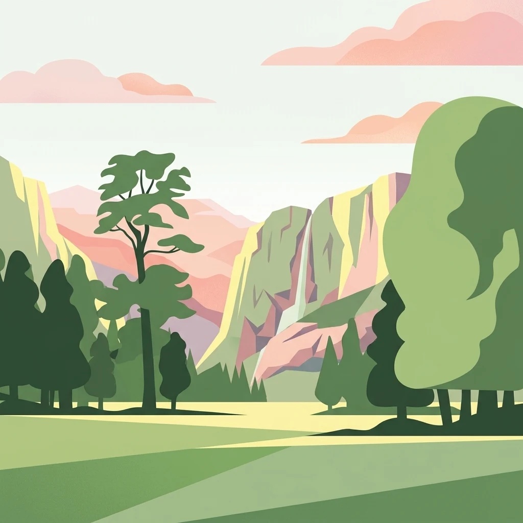
An illustration of a green meadow in the foreground with forest, steep cliffs, and a narrow waterfall in the background under a pale sky with soft pink clouds.

Boyne Valley National Park

National park

Park overview

Structured park overview, official facts, and landscape profile for Boyne Valley National Park

Boyne Valley National Park park facts, protected area profile, and essential visitor context

Review the core facts for Boyne Valley National Park, including designation, size, terrain, visitor scale, habitats, and operating context in one park-focused overview.

About Boyne Valley National Park

Boyne Valley National Park occupies a small but culturally and ecologically dense section of the Boyne river corridor in County Meath, in the east of Ireland. Only formally designated in 2023, the park represents a deliberate effort to consolidate protection around a landscape that has already earned international recognition for both its natural and archaeological value. Its compact footprint reflects the narrow, deeply historic stretch of the river that the founders chose as the nucleus of the new park, with the possibility of future expansion as additional lands are integrated.

The natural heart of the park is the Boyne itself and its surrounding floodplain. The river runs through ancient glacial and post-glacial terrain and supports a range of freshwater and riparian habitats that have been studied as important for migratory fish, semi-aquatic mammals, and wetland birdlife. Before the national park designation, these habitats had already been protected through the European Natura 2000 network as Special Areas of Conservation, a status that gave the area a foundation of ecological recognition. The national park now layers an additional ring of protection over the same terrain, with a unifying management vision for the valley.

What distinguishes Boyne Valley from Ireland's other national parks is the prominence of its prehistoric heritage. Within or directly adjacent to the park lie components of the Brú na Bóinne UNESCO World Heritage Site, including the great passage tombs of Newgrange, Knowth, and Dowth. These monuments, built more than five thousand years ago, place the park within a global continuum of megalithic landscape. The Irish government's decision to acquire the Dowth Hall estate and surrounding lands in 2023 provided the physical anchor for the new national park and connected the natural river corridor directly with one of the densest clusters of Neolithic monuments in Western Europe.

The park is also notable for its stage of development. At the time of its formal establishment, plans were in place to prepare a master plan to guide management and public engagement. Until such a framework was completed, the experience of the park as a visitor destination remained limited, even though the underlying sites of Brú na Bóinne have long drawn visitors from around the world. This transitional state gives Boyne Valley a particular character among Ireland's national parks: it is a landscape that has received the highest domestic protection status while still crystallizing its future role as a public natural and cultural site.

Quick facts and research context for Boyne Valley National Park

Boyne Valley National Park is located in County Meath in eastern Ireland, along the Boyne river floodplain. It was formally designated in 2023 as Ireland's eighth national park and, at roughly 2.23 square kilometers, remains the smallest in the country. The park includes territory already recognized as a Natura 2000 Special Area of Conservation for its freshwater and riparian wildlife.

The national park partially overlaps with the Brú na Bóinne UNESCO World Heritage Site, home to the Neolithic passage tombs of Newgrange, Knowth, and Dowth. The land around Dowth Hall was purchased by the Irish state in 2023 to serve as the nucleus of the new park.

Protection and recognition

Examine the documented protection status and conservation framework for Boyne Valley National Park.

Boyne Valley National Park Protection Status and Conservation Scope

Boyne Valley National Park holds a terrestrial protection scope within its designated conservation boundaries. Documented records outline the established protection status and management framework governing the natural landscape.

Protection details

Protection scope
Terrestrial
Transboundary protection
No
Park context

Deeper park guide and search-rich context for Boyne Valley National Park

Boyne Valley National Park history, landscape, wildlife, and travel context

Explore Boyne Valley National Park through its history, landscape character, ecosystems, wildlife, conservation priorities, cultural context, and seasonal travel timing in a structured park guide built for atlas discovery and search intent.

Why Boyne Valley National Park stands out

Boyne Valley National Park is best known for anchoring one of Europe's most important concentrations of Neolithic megalithic monuments within a protected natural landscape. The river valley around Newgrange, Knowth, and Dowth has been a focal point of prehistoric archaeology for centuries, and the national park designation formalizes a long-term protective framework around this cultural and natural setting. Equally distinctive is the park's ecological character as a Boyne floodplain protected area. The river corridor supports migratory fish such as Atlantic salmon and river lamprey, alongside riparian mammals including the Eurasian otter, and birds such as the kingfisher. The combination of prehistoric grandeur and functioning river valley wildlife is what sets Boyne Valley apart from Ireland's other national parks, which tend to center on upland, montane, or oceanic environments.
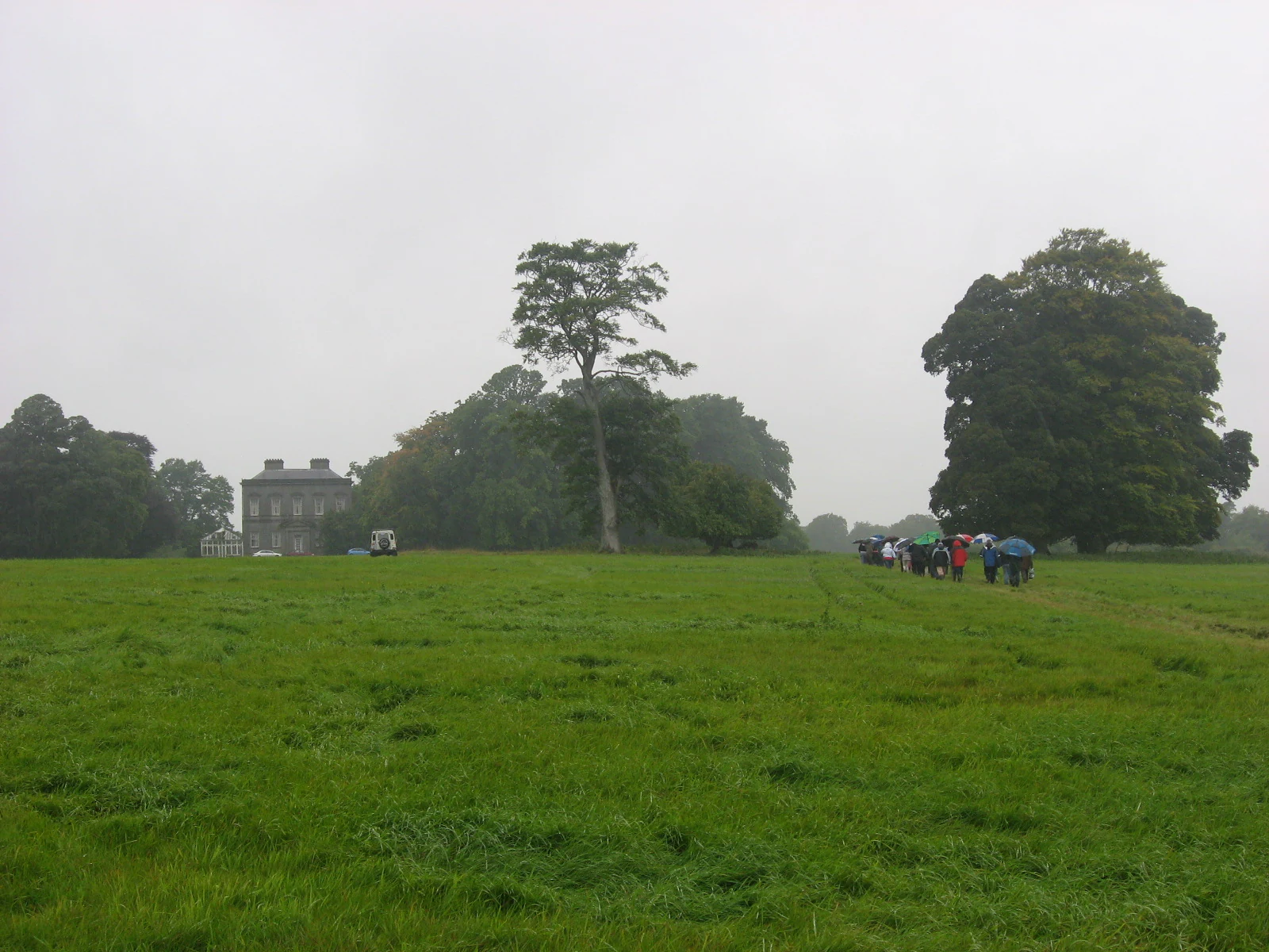
A green, grassy field under an overcast sky with large trees and a distant stone house. A small group of people with umbrellas is walking on the right side of the frame.
A group of visitors walking near the historic Dowth site in the Boyne Valley.

Boyne Valley National Park history and protected-area timeline

The history of Boyne Valley National Park as a formal protected area is very recent. The park was designated in 2023, making it Ireland's eighth national park and the first to be added to the country's network in several decades. Its creation reflects a long-standing recognition of the Boyne valley as a landscape of both ecological and archaeological significance, and a more recent policy decision to elevate that recognition into a unified national park designation.

A central moment in the park's establishment came in the same year, when the Irish state purchased the estate around Dowth Hall on the south side of the Boyne for roughly eleven million euros. This acquisition provided the foundational land base for the new national park and linked the protected area directly with one of the major monuments of the Brú na Bóinne complex.

Before the park was created, the surrounding lands had already been protected under European and Irish conservation frameworks. The Boyne and the adjoining Meath Blackwater had been designated as Special Areas of Conservation under the Natura 2000 network, recognizing their importance for freshwater species and riparian wildlife. The national park designation now extends these existing protections and consolidates them within a single, more prominent institutional structure.

In the months following its creation, the Irish government announced that a master plan for the new park would be developed, with a target completion by the end of 2025. Until that plan was adopted, public access to the park in its full national park capacity was to remain limited. This placed the park in a transitional period during which the formal protection status already applied, while the framework for guiding visitor use, conservation management, and future expansion was still being prepared.

Boyne Valley National Park landscape and geographic character

The landscape of Boyne Valley National Park is defined by the River Boyne and its associated floodplain in eastern Ireland. The terrain is low-lying and shaped by the long erosional and depositional work of the river, producing a gently undulating valley floor flanked by slightly higher ground on either side. This is an agricultural and historically settled landscape, and the national park sits within a working rural setting rather than a remote wilderness.

The river itself is the principal landscape feature. Where it flows through County Meath, it cuts a path through terrain that holds deep, waterlogged valley soils, with areas of wet meadow, marshy ground, and riparian woodland along the banks. This riverine corridor produces the characteristic Auenlandschaft, or floodplain landscape, that the park is noted for. The river's bends create sheltered pockets of habitat, while seasonal flooding continues to shape the lower terraces and banks.

Although the topography is relatively modest, the surrounding horizon is defined by the presence of three great Neolithic mounds, Newgrange, Knowth, and Dowth. These huge, rounded artificial hills rise above the natural lowlands and have reshaped the character of the visible landscape for thousands of years. The interplay between the horizontal sweep of the river valley and the dominant vertical mass of the passage tombs gives Boyne Valley a landscape signature found nowhere else in Ireland.

Boyne Valley National Park ecosystems, habitats, and plant life

Ecologically, Boyne Valley National Park centers on the freshwater and floodplain habitats of the River Boyne. The river and its immediate margins form a continuous corridor of aquatic and semi-aquatic environments, while the surrounding floodplain supports a shifting mosaic of wet grassland, reed-dominated edges, scrub, and riparian woodland. This combination gives the park a layered habitat structure despite its small overall size.

The habitats present in the park are typical of lowland Irish river valleys but are of disproportionate ecological value because of their connectivity and condition. The Boyne supports populations of migratory and resident fish in water of sufficient quality to sustain them, while the margins and tributaries provide cover and feeding areas for mammals and birds associated with freshwater edges. The Meath Blackwater, a tributary system associated with the same catchment, adds further ecological depth to the protected landscape.

Long before the national park designation, the ecological character of the area had been formally acknowledged through the Natura 2000 network, with the relevant stretches of the Boyne designated as Special Areas of Conservation. The national park now extends and consolidates this recognition, providing a single institutional framework for managing a recognized ecological network that includes both river and valley habitats.

Boyne Valley National Park wildlife and species highlights

Wildlife in Boyne Valley National Park reflects the ecological priorities of a protected Irish river valley. The Boyne's waters sustain populations of Atlantic salmon and river lamprey, both of which depend on clean, well-oxygenated gravel beds to complete their life cycles. Their continued presence in the river is a key indicator of habitat quality and is one of the main reasons the area's conservation status has been recognized at the European level.

Along the river margins, the Eurasian otter is among the most characteristic mammals of the park. Otters use the vegetated banks as hunting and resting sites, and their presence is tied closely to the quality of both the water and the riparian vegetation. The same river corridor also supports kingfishers, which depend on steep, soft riverbanks in which they can excavate nest burrows, along with other birdlife typical of mature lowland river systems.

The broader floodplain and surrounding farmland contribute additional wildlife value. Wet grassland and scrub support invertebrates, small mammals, and a range of common and specialist bird species associated with lowland Irish farmland. The interplay between a functioning river corridor and the surrounding agricultural and semi-natural habitats gives the park a relatively rich wildlife profile for its size, with species ranging from migratory fish to farmland birds all present within the same protected landscape.

Boyne Valley National Park conservation status and protection priorities

Boyne Valley National Park carries significant conservation value that extends well beyond its modest footprint. Its designation in 2023 placed it within Ireland's highest domestic category of protected landscape, while its underlying ecology had already been recognized at the European level through Natura 2000 Special Area of Conservation status for the Boyne and associated waters. This stacking of protection statuses gave the area one of the strongest conservation frameworks of any stretch of Irish lowland river.

The park's conservation profile is distinguished by its combination of freshwater, riparian, and cultural heritage values. Most national parks protect either broad natural ecosystems or cultural landscapes in isolation; Boyne Valley protects both within a single management unit. The river system is the natural anchor, while the surrounding lands include globally significant prehistoric monuments that themselves depend on careful land management to survive into the future.

At the time of its creation, the park's conservation framework was still being completed, with a master plan for guiding management and public use expected by the end of 2025. This transitional phase reflected both the recency of the designation and the desire to ensure that future development of the park would be coordinated around an explicit conservation and cultural strategy, rather than emerging piecemeal.

Boyne Valley National Park cultural meaning and human context

Boyne Valley National Park is inseparable from the long human history of the Boyne valley. The river and its surrounding lowlands have been inhabited and shaped by human activity for thousands of years, and the most visible expression of that history is the Brú na Bóinne complex of Neolithic monuments. Newgrange, Knowth, and Dowth are not isolated antiquities but a landscape-scale cultural phenomenon whose placement along the Boyne reflects deliberate choices made by prehistoric communities.

The lands around the park continued to be significant in later periods. The Dowth Hall estate, acquired by the Irish state as the nucleus of the national park, represents a more recent layer of landscape history, with its own architectural and estate heritage. The acquisition of Dowth Hall symbolized a willingness to absorb historic rural estates into the national park framework where they directly border the most important prehistoric monuments.

Across these layers, the Boyne has remained a continuous thread. In Irish mythology and historical tradition, the river carries deep symbolic weight, and the modern national park can be read as a formal continuation of long-standing Irish attachment to the Boyne valley as a place of cultural meaning. The Irish-language name of the park, Páirc Náisiúnta Bhrú na Bóinne, preserves this older identity directly within the park's official nomenclature.

Top sights and standout views in Boyne Valley National Park

Boyne Valley National Park's most distinctive highlight is the overlap between a protected river ecosystem and part of the Brú na Bóinne UNESCO World Heritage Site, giving the park a uniquely dual identity among Ireland's national parks.

Equally notable are the passage tomb landscapes of Newgrange, Knowth, and Dowth, which place the park alongside other great megalithic landscapes of prehistoric Europe, and the Boyne itself, which supports migratory fish, otters, kingfishers, and a continuous corridor of riparian habitat.

Best time to visit Boyne Valley National Park

As a recently established park still developing its public access framework, Boyne Valley National Park's visitor experience is tied more to the surrounding Brú na Bóinne sites than to the park's own internal facilities. Spring and summer typically bring longer daylight hours, more active birdlife along the river banks, and better conditions for outdoor movement along the Boyne corridor, while autumn offers softer light over the passage tomb landscapes and quieter rural surroundings.

Winter visits can have their own appeal, particularly for observing waterbirds and wintering raptors along the river and for experiencing the prehistoric monuments in atmospheric low light, though shorter days and wetter ground reduce the practicality of extended outdoor time. Visitors interested in Neolithic sites should also be aware that the most striking experience at Newgrange, the winter solstice alignment, occurs in late December, when dawn light enters the passage tomb chamber. Across all seasons, weather in eastern Ireland tends to be changeable, and conditions can shift quickly between bright intervals and rain.
Monthly climate preview

Long-term temperature ranges and precipitation patterns across representative coordinates

Boyne Valley National Park Climate Normals and Monthly Weather Records

Boyne Valley National Park records structured monthly temperature measurements alongside sustained precipitation averages derived from historical baseline data. Reviewing the complete twelve-month profile provides deep analytical clarity on long-term environmental rhythms at the representative coordinate.
Annual mean10 °C
6 °C15 °C
Jan
Feb
Mar
Apr
May11°
Jun13°
Jul15°
Aug15°
Sep13°
Oct11°
Nov
Dec
Warmest month
July

15.1 °C

Coolest month
February

5.7 °C

Wettest month
November

3.5 mm/day

Driest month
May

2.1 mm/day

Park location guide

Geography guide, regional context, and park location map for Boyne Valley National Park

Boyne Valley National Park park geography, regions, and map view in Ireland

Understand where Boyne Valley National Park sits in Ireland through a broader geographic reading of the surrounding landscape, nearby location context, and its mapped position within the national park landscape.

How Boyne Valley National Park fits into Ireland

Ireland is an island in the North Atlantic, geologically part of the British Isles. Politically, the island is split between the Republic of Ireland (a sovereign state and EU member) and Northern Ireland (part of the UK). The island has a population of approximately 7.2 million people and is known for its lush landscape, Celtic heritage, and literary culture.

Wider geography shaping Boyne Valley National Park in Ireland

Ireland is an island in the North Atlantic Ocean, separated from Great Britain to the east by the North Channel, Irish Sea, and St George's Channel. The island forms part of the British Isles archipelago. The terrain consists of low-lying mountains surrounding a central plain, with the highest point being Carrauntoohil at 1,041 metres. The coastline stretches approximately 7,527 kilometres with numerous inlets and bays.

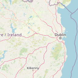
Map view of Boyne Valley National Park

Use this park location map to pinpoint Boyne Valley National Park in Ireland, understand its exact geographic position, and read its mapped placement within the surrounding landscape more clearly.

Pigeon | © OpenStreetMap contributors

Location context for Boyne Valley National Park

County Meath

Visual exploration of river valley terrain, ancient monuments, and riparian ecology

Boyne Valley National Park Photos: Landscape, Scenery, and Protected Habitats

Visual records capture the low-lying floodplain terrain, winding river channels, and riparian woodland habitats characteristic of Boyne Valley National Park. Detailed imagery illuminates the unique intersection of ancient megalithic monuments and protected wetland ecosystems across eastern Ireland.

A green, grassy field under an overcast sky with large trees and a distant stone house. A small group of people with umbrellas is walking on the right side of the frame.

Park atlas

Compare regional park geography and connected river valley landscapes in eastern Ireland

Explore Other Parks Near Boyne Valley National Park and Surrounding Protected Areas

Visitors exploring Boyne Valley National Park can continue browsing nearby protected areas and lowland wildlife reserves. Comparing regional river corridors and adjacent habitats reveals the broader ecological diversity of Ireland.
Watercolor illustration of a landscape with mountains, a lake, and trees
National parkCounty Wicklow
About 52 km away#1 closest

South

Wicklow Mountains National Park: Protected Landscape and Geographic Atlas Mapping

Explore County Wicklow's mapped natural terrain and park boundaries.

Understand the geographic scope and protected landscape identity of Wicklow Mountains National Park. This page offers detailed information on its mapped boundaries and its context within County Wicklow, providing a foundation for atlas-based discovery of Ireland's natural areas. Explore how this national park contributes to the region's mapped geography and conservation landscapes.

Area
205 km²
Established
1991
IUCN
II
Relief
Mountain
Watercolor painting of soft, rolling green hills and dunes with purple mountain peaks in the distance against a white background.
Nature reserveCounty Down
About 70 km away#2 closest

Northeast

Murlough Nature Reserve: Coastal Dune and Heathland Atlas of County Down

A historic protected peninsula along the shores of Dundrum Bay.

Located in County Down, Murlough Nature Reserve stands as the largest dune heathland in Ireland. This protected landscape encompasses a complex system of sand dunes and open heath, set against the backdrop of the Mourne Mountains. The reserve provides a unique vantage point for understanding coastal geomorphology, invertebrate-rich habitats, and the long-term interaction between shoreline dunes and upland mountainous geography.

Area
2.82 km²
Established
1967
Relief
Lowland
Climate
Temperate
Nature reserveCounty Fermanagh
About 84 km away#3 closest

Northwest

Crom Estate Nature Reserve and Upper Lough Erne Geographic Landscape Overview

Riparian forest and island geography in County Fermanagh

Deeply connected to the shores of Upper Lough Erne, Crom Estate is a sprawling nature reserve defined by its ancient riparian woodlands and intricate maze of bays and islands. The terrain preserves a distinct mix of old-growth forest, open grassland, and historic castle ruins, providing a valuable case study in the regional geography of County Fermanagh and the conservation of water-influenced ecosystems.

Area
5.5 km²
Established
1987
Relief
Lowland
Climate
Temperate
Nature reserveNorthern Ireland
About 87 km away#4 closest

North

Oxford Island National Nature Reserve: Protected Wetland Landscapes of Northern Ireland

Lakeshore habitats and woodland geography at Lough Neagh

Oxford Island is a prominent nature reserve where terrestrial woodland meets the expansive waters of Lough Neagh. The site showcases a transition of reed beds and meadows that serve as vital ecological assets within the regional geography of Northern Ireland, offering a dense, accessible look at lowland wetland environments.

Area
1.14 km²
Relief
Lowland
Climate
Temperate
Access
Easy access
Protected landscapeCounty Fermanagh
About 121 km away#5 closest

Northwest

Castle Archdale Protected Landscape in County Fermanagh: Geography and Map Overview

Lakeside woodland and historic terrain on Lower Lough Erne

Located on the shores of Lower Lough Erne, Castle Archdale represents a unique protected landscape in County Fermanagh. The area features a complex mosaic of sheltered inlets, mature woodland, and open parkland that characterises the Fermanagh lakelands. Beyond its physical terrain, the site is defined by its historical significance, from seventeenth century estate remnants to its role as a pivotal wartime flying boat base, providing a rich context for geographic and environmental exploration.

Relief
Lowland
Climate
Temperate
Access
Easy access
Scope
Terrestrial
Nature reserveNorthern Ireland
About 122 km away#6 closest

North

Lough Beg Nature Reserve: Mapping the Wetlands and Floodplains of Northern Ireland

An essential protected landscape within the Lough Neagh basin.

Lough Beg provides a distinct geographic study of freshwater ecosystems and alluvial landscapes. As a designated nature reserve, it forms a crucial link in the Lower Bann catchment, characterized by its shallow waters and seasonal pasture flooding. The area serves as a primary hub for migratory bird species, while the historic Church Island offers a unique convergence of early Christian heritage and natural wetland terrain.

Relief
Lowland
Climate
Temperate
Access
Easy access
Scope
Terrestrial
Nature reserveNorthern Ireland
About 124 km away#7 closest

North

Ballynahone Bog: Northern Ireland Lowland Raised Peatland and Wetland Geography

Intact active bog dome and protected wetland landscape

Examine the geography of Ballynahone Bog, one of the largest remaining lowland raised bogs in Northern Ireland. This protected landscape preserves an active peat-forming surface, intricate hummock and pool complexes, and marginal fen habitats, offering insight into the ecological history and hydrological patterns of the Lough Neagh lowland region.

Area
2.432 km²
Established
1995
Relief
Lowland
Climate
Temperate
Protected areaCounty Antrim
About 150 km away#8 closest

North

Slieveanorra Forest Protected Area: Geography, Maps, and Upland Landscape Context

A comprehensive look at the Antrim forest and glacial landscape.

Slieveanorra Forest serves as a prominent protected area within the County Antrim uplands. Featuring expansive conifer woodlands, the site includes rugged terrain, reservoir edges, and scenic summit views. Understand the geological and environmental composition of this working forest landscape through its mapped boundaries and regional context.

Relief
Upland
Water
Minor water

Common questions about visiting, size, designation, and location context for Boyne Valley National Park

Boyne Valley National Park FAQs for park facts, access, geography, and protected area context

Find quick answers about Boyne Valley National Park, including protected-area facts, park geography, trail and visitor context, and how the park fits into its surrounding country and regional landscape.
MoriAtlas Explorer

Continue Your Protected Areas Search Across the Global Atlas

Deepen your exploration by continuing the structured search for national parks and protected areas worldwide. Utilize the comprehensive filtering capabilities to compare different conservation landscapes and refine your understanding of global park geography. Discover more about the distribution and characteristics of protected natural areas.

Global natural geography