

Mori Atlas logo
Protected areaBudj Bim heritage areas

Explore the geographic distribution of stone channels, wetland mosaics, and dormant volcanic landscapes.

Budj Bim heritage areas: Mapping Ancient Volcanic Terrain and Indigenous Engineering in Victoria

(Budj Bim National Heritage Landscape (with Budj Bim Cultural Landscape as the UNESCO component))

Budj Bim heritage areas represent a uniquely engineered cultural landscape in south-western Victoria, formed by dormant volcanic activity more than 30,000 years ago. This protected region integrates the Budj Bim crater, the Kurtonitj wetlands, and the Tyrendarra lava flows into a connected network of ancient aquaculture systems. Our atlas details the spatial relationship between the basalt dam walls, manna gum woodlands, and the hydrological spine of Tae Rak; providing a comprehensive view of this enduring Gunditjmara country.

UNESCO World Heritage SiteIndigenous Protected AreaAboriginal heritagevolcanic landscapewetlandsaquaculture
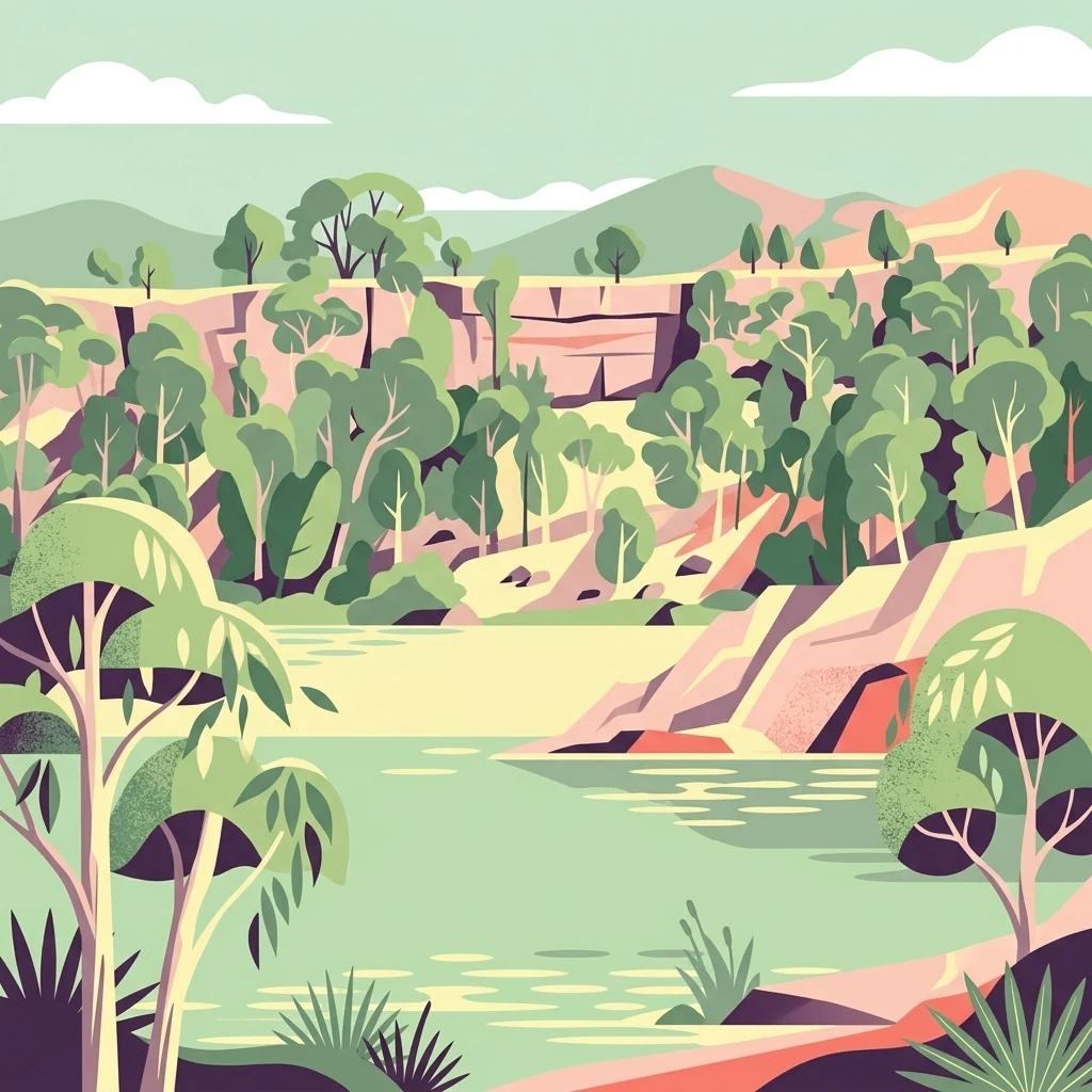
A flat-style digital illustration showing a serene landscape with a calm lake in the foreground, surrounded by rocky cliffs and native trees against a backdrop of rolling hills.

Budj Bim heritage areas

Protected area

Park overview

Structured park overview, official facts, and landscape profile for Budj Bim heritage areas

Budj Bim heritage areas park facts, protected area profile, and essential visitor context

Review the core facts for Budj Bim heritage areas, including designation, size, terrain, visitor scale, habitats, and operating context in one park-focused overview.

About Budj Bim heritage areas

The Budj Bim heritage areas form a continuous cultural and ecological landscape in south-western Victoria, linking the dormant volcano of Budj Bim, the wetlands of Lake Condah (Tae Rak), and the Darlot Creek corridor through a single volcanic lava flow. The area is defined by the eruption of Budj Bim more than 30,000 years ago, an event the Gunditjmara remember as the revealing of an ancestral creator-being and the origin point of their creation narratives.

What distinguishes the Budj Bim heritage areas from other Australian protected landscapes is the combination of ancient volcanic geology with sophisticated Indigenous land management. The Tyrendarra lava flow reshaped regional drainage patterns and created extensive wetlands, which the Gunditjmara then deliberately engineered over thousands of years. They constructed channels to divert water from Darlot Creek into adjacent low-lying areas, built stone walls and weirs across the lava flow to form a series of artificial ponds, and developed techniques for trapping, holding, and smoking kooyang (short-finned eels). This aquaculture infrastructure supported a transition from mobile foraging to settled occupation, with permanent stone-built dwellings established near the traps.

The heritage areas are administered through a layered system of national, state, and Aboriginal governance. The federal Environment Protection and Biodiversity Conservation Act 1999 provides the framework for their National Heritage listing, while Victoria's Aboriginal Heritage Act 2006 protects Gunditjmara cultural heritage across the land. Land management is carried out by Gunditj Mirring Traditional Owners Aboriginal Corporation and the Winda-Mara Aboriginal Corporation, supported by the Budj Bim Rangers, an Indigenous ranger team responsible for weed and pest control, revegetation, protection of cultural sites, and visitor infrastructure. The site is also recognised internationally under UNESCO cultural criteria iii and v, highlighting both its exceptional testimony to Gunditjmara cultural traditions and its outstanding example of long-term human interaction with the environment.

Quick facts and research context for Budj Bim heritage areas

The Budj Bim heritage areas are located in western Victoria, Australia, and were inscribed as a UNESCO World Heritage Site on 6 July 2019, following their addition to the National Heritage List on 20 July 2004. Their combined listed area covers around 9,935 hectares, and the broader National Heritage Landscape includes about 7,880 hectares around Mount Eccles, Lake Condah, and Tyrendarra.

The landscape is volcanic in origin, shaped by the eruption of Budj Bim (Mount Eccles) more than 30,000 years ago, with a connected network of lava flows linking the three Indigenous Protected Areas. Lake Condah, known as Tae Rak in the Gunditjmara language, is a shallow wetland basin approximately 4 kilometres long and 1 kilometre wide, and forms the central hydrological anchor of the cultural landscape. The site is owned and managed by the Gunditj Mirring Traditional Owners Aboriginal Corporation, with the Winda-Mara Aboriginal Corporation playing a key role in managing Tyrendarra IPA.

Protection and recognition

Terrestrial conservation scope, designation year, and official recognition records

Budj Bim Heritage Areas Protection Status and Designated History

Budj Bim heritage areas hold a documented terrestrial protection status established in 2004 within the protected area framework. Structured conservation records compile designation history, management scope, and verified international recognition details.

Protection details

Protection scope
Terrestrial
Designated year
2004
Transboundary protection
No
Park context

Deeper park guide and search-rich context for Budj Bim heritage areas

Budj Bim heritage areas history, landscape, wildlife, and travel context

Explore Budj Bim heritage areas through its history, landscape character, ecosystems, wildlife, conservation priorities, cultural context, and seasonal travel timing in a structured park guide built for atlas discovery and search intent.

Why Budj Bim heritage areas stands out

The Budj Bim heritage areas are best known for hosting one of the world's oldest known aquaculture systems, a network of stone weirs, channels, and dams constructed by the Gunditjmara people across the wetlands created by the Budj Bim lava flows. Carbon dating of channels in the area, including one trap system carbon dated to around 6,600 years old, with broader estimates reaching up to 8,000 years, places this engineered landscape among the most ancient examples of systematic food production anywhere on the planet. Equally significant is the site's deep cultural identity for the Gunditjmara. Budj Bim, the dormant volcano at the heart of the heritage areas, is regarded as a creator-being whose eruption forms the foundation of Gunditjmara creation narratives. This makes the heritage areas simultaneously a geological landmark, an archaeological treasure, and a living spiritual landscape where oral tradition, engineered wetlands, and ongoing Aboriginal land management continue to shape the country.
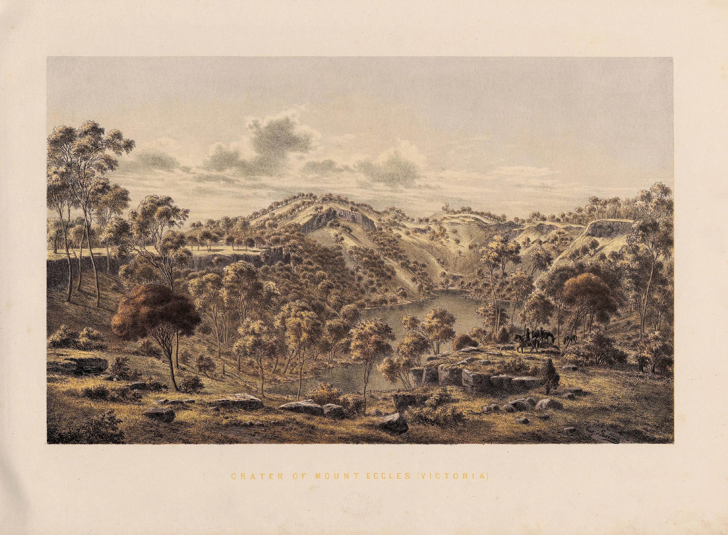
A 19th-century illustration showing the volcanic crater of Mount Eccles with a lake at the base, surrounded by trees and hilly terrain.
A historical lithograph depicting the crater and lake at Mount Eccles, now part of the Budj Bim heritage areas.

Budj Bim heritage areas history and protected-area timeline

The history of the Budj Bim heritage areas begins well before European contact with the eruption of Budj Bim, the geological event the Gunditjmara describe as the revealing of a creator-being. Oral traditions associated with this eruption are recognised as among the oldest in the world, supported by archaeological evidence from nearby Tower Hill where human artefacts have been found beneath volcanic ash.

European exploration of the engineered wetlands began in July 1841, when Chief Protector of Aborigines George Augustus Robinson encountered an extensive area of channels and embankments near Mount William and described it as resembling "the work of civilized man", but produced entirely by Aboriginal people for catching eels. Despite this early documentation, the scale and antiquity of the system was largely ignored until the 1970s, when archaeologist Peter Coutts of the Victoria Archaeological Survey conducted detailed surveys at Lake Condah (Tae Rak) and revealed hundreds of metres of excavated channels and basalt block walls estimated to weigh many hundreds of tonnes.

Further research in the 1990s and 2000s by Harry Lourandos, Heather Builth, and palynologist Peter Kershaw reconstructed the complexity of the aquaculture system through 3D mapping, demonstrating that the channels were built across lava flows to form artificial ponds at different stages of eel growth. This body of research, later popularised by Bruce Pascoe's Dark Emu (2014), reframed understanding of Aboriginal land use in the region.

European colonisation brought conflict and dispossession. From the late 1830s, the Eumeralla Wars saw the Gunditjmara displaced from much of their traditional country, and in 1867 the Lake Condah Mission was established a few kilometres from the lake on 2,000 acres along Darlot Creek. The mission operated under a series of protective and restrictive Acts, including the Half-Caste Act 1886, and closed at the end of 1918, though the church school continued until 1948. The mission church was demolished in the 1950s.

Recognition of the cultural significance of the site grew through the late 20th and early 21st centuries. The Aboriginal Land (Lake Condah and Framlingham Forest) Act 1987 returned the mission lands to the Kerrup-Jmara Elders Corporation on 1 January 1987. In March 2008, Lake Condah itself was returned to the Gunditjmara, and the area was subsequently vested to the Gunditj Mirring Traditional Owners Aboriginal Corporation. The Budj Bim National Heritage Landscape was added to Australia's National Heritage List on 20 July 2004, and the Budj Bim Cultural Landscape was inscribed as a UNESCO World Heritage Site on 6 July 2019, the first Australian site listed exclusively for its Aboriginal cultural values.

Budj Bim heritage areas landscape and geographic character

The Budj Bim heritage areas are defined by a continuous volcanic landscape that physically connects their three main components: the Budj Bim (northern) component, the Kurtonitj (central) component, and the Tyrendarra (southern) component. The unifying feature is the lava flow that radiates from the Budj Bim crater, which is the dormant volcano formerly known as Mount Eccles. This lava flow reshaped regional drainage patterns and created the conditions for the wetland systems the Gunditjmara later engineered.

At the heart of the landscape is Lake Condah, called Tae Rak in the Gunditjmara language, a shallow wetland basin roughly 4 kilometres long and 1 kilometre wide. It is bordered to the west by Darlot Creek (known as Kallara), and together the lake and creek form the central hydrological spine of the heritage areas. Around the lake, deep freshwater marshes and seasonally flooded shallow marshes create a mosaic of wetland habitats, while the surrounding country includes manna gum woodland that has been actively restored through revegetation programs.

The northern section is dominated by the Budj Bim crater itself and the associated features of Budj Bim National Park, including Lake Surprise, Tunnel Cave, the Crater Rim Walk, and the Lava Canal Walk, all of which reflect the underlying geology of the eruption. Stones State Faunal Reserve is integrated into this northern component, along with Aboriginal-owned lands including Muldoons and Allambie. The Tyrendarra component to the south covers approximately 248 hectares along Darlot Creek, with distinctive channel systems and basalt dam walls visible in the topography. Across all three areas, the rugged and uneven surface of the lava flow continues to define both the hydrology and the cultural engineering of the landscape.

Budj Bim heritage areas ecosystems, habitats, and plant life

The ecological character of the Budj Bim heritage areas is shaped by the intersection of volcanic geology and wetland hydrology, producing a mosaic of freshwater marshes, seasonally flooded shallow marshes, remnant and restored manna gum woodlands, and rocky lava flow country. These habitats support a wide range of native species adapted to wetland and woodland edge environments, while the ongoing management by the Budj Bim Rangers focuses on maintaining the ecological integrity of the original pre-1840s wetland system.

Vegetation management is a core component of the IPA programs. Tyrendarra IPA, in particular, has prioritised regrowth of manna gum woodland, replanting of thousands of trees and shrubs, and invasive species control. Restoration work at Kurtonitj and Lake Condah IPAs similarly emphasises reinstating native vegetation patterns and protecting cultural sites that depend on intact habitat condition. The 2006 bushfires destroyed large portions of newly planted vegetation around Tyrendarra, while the 2019-2020 bushfire season burnt more than 7,000 hectares around Lake Condah and within Budj Bim National Park, leaving a legacy of disturbance that continues to shape the ecological recovery process.

The wetlands themselves are the defining ecological feature, providing habitat for waterbirds, native fish, and the kooyang (short-finned eels) that drove the original Gunditjmara aquaculture system. Brolgas, great egrets, and powerful and barking owls are all recorded in the area, while seasonal flooding patterns continue to be important for the breeding cycles of these species. The interconnectedness of hydrology, native vegetation, and aquatic fauna makes the Budj Bim heritage areas a single integrated ecological system, not just a collection of separate reserves.

Budj Bim heritage areas wildlife and species highlights

Wildlife at the Budj Bim heritage areas is intimately tied to the wetland, woodland, and lava flow habitats that the Gunditjmara have managed for thousands of years. The most iconic species is kooyang, the short-finned eel, whose life cycle and seasonal movements underpin both the original aquaculture system and the ecological function of the wetlands. The engineered channels, weirs, and dams in the landscape were designed around catching kooyang at different stages of growth, and contemporary land management continues to maintain conditions suitable for the species.

Birds form a major part of the wildlife profile. Brolgas are present around the wetlands, and the area supports significant populations of great egrets, powerful owls, and barking owls within the Lake Condah IPA. These species depend on the combination of open water, fringing woodland, and intact hydrological cycles that the IPAs were established to protect.

Terrestrial wildlife includes the tiger quoll, a notable marsupial predator recorded in the Lake Condah IPA. However, the wildlife of the heritage areas is also shaped by intense pressure from introduced species. Feral pigs and fallow deer have caused widespread damage to vegetation and soil, particularly after the 2019-2020 bushfires, and in May 2021 more than 1,100 feral pigs and fallow deer were culled by helicopter as part of an integrated pest control project coordinated by the Victorian Department of Environment, Land, Water and Planning, Gunditj Mirring Traditional Owners Aboriginal Corporation, Parks Victoria, and the Winda-Mara Aboriginal Corporation.

Budj Bim heritage areas conservation status and protection priorities

The Budj Bim heritage areas represent a globally significant model of Indigenous-led conservation, with the entire cultural landscape Aboriginal-owned and/or managed. Three Indigenous Protected Areas, Tyrendarra, Kurtonitj, and Lake Condah, form the backbone of the conservation framework, certified under IUCN Category VI for sustainable use of natural ecosystems in the case of Tyrendarra. Management is carried out by the Budj Bim Rangers through the Winda-Mara Aboriginal Corporation and the Gunditj Mirring Traditional Owners Aboriginal Corporation, focused on protecting cultural heritage sites, managing revegetation, and eradicating weeds and feral animals.

At the federal level, the site is protected under the Environment Protection and Biodiversity Conservation Act 1999, which lists the Budj Bim National Heritage Landscape as requiring periodic reporting on its values. At the state level, all Gunditjmara cultural heritage across the land is protected under Victoria's Aboriginal Heritage Act 2006. UNESCO listing under cultural criteria iii and v recognises both the exceptional antiquity of the Gunditjmara aquaculture system and its outstanding representation of long-term human interaction with the environment.

The conservation challenges facing the area include recovery from major bushfires in 2006 and 2019-2020, ongoing pressure from feral pigs and fallow deer, and the need to manage the archaeological and ecological integrity of fragile wetland systems. The 2019-2020 fires paradoxically revealed previously hidden sections of the ancient aquaculture system, including the Muldoon trap complex, demonstrating how bushfire, revegetation, and cultural heritage management are deeply interconnected in this landscape.

Budj Bim heritage areas cultural meaning and human context

The Budj Bim heritage areas hold extraordinary cultural meaning for the Gunditjmara, the Aboriginal people of south-western Victoria. For them, the eruption of Budj Bim is not only a geological event but the moment a creator-being emerged from the landscape, anchoring their creation narratives and Dreaming trails. The dormant volcano, the lakes, the wetlands, and the engineered channels are all part of a single living cultural geography, where country, story, and practice are inseparable.

The Gunditjmara clans developed and maintained the aquaculture system as a collective enterprise. The Kerrup Gunditj (Kerrup-Jmara) clan, who lived around the shores of Lake Condah (Tae Rak), had specific custodial responsibility for the lake, and other clans contributed to the trapping, farming, and smoking of kooyang. The system supported permanent settlements, basalt-built houses, and a sophisticated smoking tradition using the hollows of manna gum trees, demonstrating that Aboriginal life in the region was highly sedentary and agriculturally informed long before European contact.

The European colonial period brought dispossession, conflict, and the establishment of the Lake Condah Mission in 1867, where displaced Gunditjmara were concentrated under successive Victorian protection policies. Mission buildings, including St Mary's Church, were constructed from local bluestone, and the mission was later recognised in the Bringing Them Home Report (1997) as an institution involved in the removal of Indigenous children. The return of Lake Condah in 2008 and the broader recognition of Gunditjmara ownership and management since 2019 mark a significant chapter in the cultural reclamation of this landscape, where Indigenous governance now drives conservation, heritage protection, and public engagement.

Top sights and standout views in Budj Bim heritage areas

The Budj Bim heritage areas stand out for combining volcanic geology, ancient Indigenous engineering, and ongoing Aboriginal custodianship into a single integrated cultural landscape. Highlights include the dormant crater of Budj Bim itself, the network of stone channels and weirs built across the Tyrendarra lava flow, and the wetland system of Lake Condah (Tae Rak), which has been actively managed for at least several thousand years.

Other defining features include the Kurtonitj wetlands, with deep freshwater marshes and ancient kooyang traps inscribed as part of the World Heritage Listing in 2019, and the Lake Condah Mission lands, returned to Gunditjmara ownership in the late 20th century. The heritage areas were the first Australian site inscribed on the UNESCO World Heritage List exclusively for Aboriginal cultural values, and they remain one of the most visible examples globally of long-term Indigenous land engineering continuing to operate under traditional governance.

Best time to visit Budj Bim heritage areas

The Budj Bim heritage areas sit in the temperate climate of south-western Victoria, where seasonal changes influence both the landscape atmosphere and the experience of visiting. Cooler months between late autumn and early spring tend to offer quieter, greener conditions, with the manna gum woodlands at Tyrendarra and Lake Condah most visibly lush, and water levels in the Darlot Creek and wetland areas at their highest following winter rains. Bird activity, including the presence of brolgas and wetland species, tends to be highest in this wetter part of the year.

Summer brings drier conditions and a higher risk of bushfire activity, as demonstrated by the 2006 and 2019-2020 fire seasons. Visitors should note that parts of the area can be temporarily closed following fire events, as happened after the 2019-2020 fires when walking tracks around Lake Surprise and Tunnel Cave in Budj Bim National Park were closed for safety and restoration work. Travelling outside the peak summer fire season generally offers more reliable access to the crater rim, the lava canal walk, the mission site, and the wetland boardwalks.
Monthly climate preview

Long-term representative measurements illustrating monthly temperature and precipitation cycles

Budj Bim Heritage Areas Climate Normals, Annual Temperature and Precipitation Rhythm

Representative coordinates document annual temperature shifts and monthly precipitation variations across the protected landscape. Detailed historical climate normals provide comprehensive monthly breakdowns for deeper geographical analysis.
Annual mean14 °C
9 °C19 °C
Jan19°
Feb19°
Mar17°
Apr14°
May12°
Jun10°
Jul
Aug
Sep11°
Oct13°
Nov15°
Dec17°
Warmest month
February

19 °C

Coolest month
July

8.9 °C

Wettest month
August

2.7 mm/day

Driest month
February

1 mm/day

Park location guide

Geography guide, regional context, and park location map for Budj Bim heritage areas

Budj Bim heritage areas park geography, regions, and map view in Australia

Understand where Budj Bim heritage areas sits in Australia through a broader geographic reading of the surrounding landscape, nearby location context, and its mapped position within the national park landscape.

How Budj Bim heritage areas fits into Australia

Australia is a constitutional monarchy and federal parliamentary democracy comprising six states and ten territories. With a population of nearly 28 million, it is one of the world's most urbanised countries, with most people concentrated on the eastern seaboard. The country has a high Human Development Index and is known for its cultural diversity, ancient Aboriginal heritage, and unique wildlife.

Wider geography shaping Budj Bim heritage areas in Australia

Australia occupies the entire Australian continent, the island of Tasmania, and numerous smaller islands. It is the world's flattest and driest inhabited continent, featuring vast deserts in the interior (the Outback), tropical rainforests along the eastern coast, and a coastline bordering the Indian and Pacific Oceans.

Map view of Budj Bim heritage areas

Use this park location map to pinpoint Budj Bim heritage areas in Australia, understand its exact geographic position, and read its mapped placement within the surrounding landscape more clearly.

Pigeon | © OpenStreetMap contributors

Location context for Budj Bim heritage areas

Victoria

Visual reference of ancient stone channels, freshwater wetlands, and volcanic terrain.

Budj Bim Heritage Areas Photos and Volcanic Landscape Scenery

Visual records illustrate the rugged lava flows, extensive freshwater marshes, and ancient stone aquaculture networks spanning the protected lands. Examining these environments reveals the unique interaction between volcanic geology and traditional land management across the region.

A 19th-century illustration showing the volcanic crater of Mount Eccles with a lake at the base, surrounded by trees and hilly terrain.

A calm, green crater lake bordered by a steep, rocky cliff topped with native Australian eucalyptus trees.

Park atlas

Compare surrounding volcanic landscapes, wetlands, and regional reserves

Explore Protected Areas and Parks Near Budj Bim Heritage Areas

Browsing other protected areas near Budj Bim heritage areas reveals connected volcanic terrain and wetland ecosystems across south-western Victoria. Comparing these regional reserves provides broader geographic context for ancient land management and basalt geology.
National parkAustralia
Mapped location lies within the park boundary#1 closest

West

Budj Bim National Park: Ancient Volcanic Landscapes and World Heritage Protected Area

Explore the unique geography of Budj Bim National Park's crater lakes and lava tubes.

Budj Bim National Park offers an exceptional exploration of volcanic geography and ancient human ingenuity. This protected area features a dramatic landscape dominated by volcanic cones, lava tubes, and the picturesque Lake Surprise crater lake. Its significance is amplified by the presence of sophisticated Aboriginal aquaculture systems, developed thousands of years ago by the Gunditjmara people, which have contributed to its UNESCO World Heritage status. Discover the mapped terrain and protected land context of this geologically and culturally rich Australian national park.

Area
54.7 km²
Established
1960
IUCN
II
Relief
Mixed relief
National parkAustralia
About 1.5 km away#2 closest

West

Mount Eccles National Park: Geographic Atlas of Volcanic Protected Landscapes

Explore mapped boundaries and regional park geography.

Delve into the structured geographic information for Mount Eccles National Park, a significant protected area in Victoria, Australia. This component of Budj Bim National Park showcases a distinct volcanic landscape and its surrounding terrain. Understand the park's mapped boundaries, regional setting, and its place within Australia's diverse protected land atlas, offering a clear view of its natural geography.

Protected areaVictoria
About 30 km away#3 closest

Southeast

Deen Maar Indigenous Protected Area: Mapped Geography and Coastal Landscape Profile

Gunditjmara country coastal terrain in south west Victoria.

Situated between the Eumeralla River and Bass Strait, Deen Maar Indigenous Protected Area features an unusual concentration of habitats within a small footprint. From calcareous limestone ridges to shallow lake systems and shifting dunes, the reserve serves as a crucial bird conservation area while maintaining deep ties to Gunditjmara cultural identity and management practices.

Area
4.53 km²
Established
1999
IUCN
VI
Relief
Lowland
National parkBarwon South West
About 33 km away#4 closest

West

Cobboboonee National Park: A Protected Landscape in Australia's Barwon South West Region

Explore its mapped geography and natural terrain.

Cobboboonee National Park represents an important protected area within the Barwon South West region of Australia. This destination offers users a deep dive into the park's specific geography, providing context on its mapped boundaries and the surrounding natural landscapes. It is designed for exploration of the park's protected-area identity and its place within the regional geography, offering structured data for landscape context.

Area
185.1 km²
Established
2008
IUCN
II
Climate
Temperate
National parkAustralia
About 43 km away#5 closest

West

Lower Glenelg National Park: Dramatic River Gorge and Limestone Cave Protected Landscape

Explore its mapped boundaries and unique geological features.

Lower Glenelg National Park in Victoria, Australia, is a national park celebrated for its visually stunning Glenelg River gorge. This protected area showcases millions of years of geological history etched into its limestone cliffs and features the accessible Princess Margaret Rose Cave. Understand the park's mapped landscape, its diverse terrain from riverine woodlands to coastal wetlands, and its significance within regional geographic exploration.

Area
273 km²
Established
1969
IUCN
II
Visitors
200K annual
National parkAustralia
About 44 km away#6 closest

Southwest

Mount Richmond National Park: Protected Area Atlas and Southwest Victoria Landscape

Explore mapped terrain and coastal woodland ecosystems.

Mount Richmond National Park is a vital protected area in Victoria's southwest, safeguarding coastal woodland and heath remnants on the region's volcanic plains. As a component of Victoria's national park system, it provides a geographically specific example of a protected landscape, contributing to the regional atlas of natural environments. Its landscape character is defined by eucalyptus woodlands and coastal influences, offering context for understanding conservation corridors and the mapped natural terrain of the southwestern Victorian coast. The park’s inclusion in long-distance walking routes also underscores its value for exploring protected natural areas.

Area
17.33 km²
Established
1960
IUCN
II
Relief
Mixed relief
National parkAustralia
About 52 km away#7 closest

Southwest

Discovery Bay Marine National Park: Victoria's Protected Coastal Marine Landscape

Mapped protected waters adjacent to Cape Bridgewater's unique geography.

Discover the geographic scope and protected landscape identity of Discovery Bay Marine National Park, an important marine national park located in Victoria, Australia, near Portland. This protected area safeguards a crucial stretch of the country's southern coastline, contributing to the ecological significance of the Southern Ocean marine region. Its position adjacent to the Discovery Bay Coastal Park highlights an integrated conservation approach, offering users a detailed view of its mapped marine boundaries and the distinctive geological context of the Cape Bridgewater area for atlas exploration.

Area
27.7 km²
Established
2002
IUCN
II
Climate
Temperate
National parkAustralia
About 62 km away#8 closest

Northeast

Grampians National Park National Park: Sandstone Ranges and Aboriginal Heritage Atlas

Explore its mapped protected landscape and regional geography.

Grampians National Park stands as a testament to Victoria's natural and cultural heritage, featuring striking sandstone mountain ranges and an exceptional concentration of Aboriginal rock art sites. This protected area offers a deep dive into the region's unique geology, from its ancient sedimentary rock formations to its dramatic cliff faces and peaks. Understanding the park's mapped boundaries and its place within the broader geography provides essential context for appreciating its protected landscape identity and its millennia-long human history.

Area
1,672.19 km²
Established
1984
IUCN
II
Relief
Mountain

Common questions about visiting, size, designation, and location context for Budj Bim heritage areas

Budj Bim heritage areas FAQs for park facts, access, geography, and protected area context

Find quick answers about Budj Bim heritage areas, including protected-area facts, park geography, trail and visitor context, and how the park fits into its surrounding country and regional landscape.
MoriAtlas Explorer

Continue Your Protected Areas Search Across the Global Atlas

Deepen your exploration by continuing the structured search for national parks and protected areas worldwide. Utilize the comprehensive filtering capabilities to compare different conservation landscapes and refine your understanding of global park geography. Discover more about the distribution and characteristics of protected natural areas.

Global natural geography