Mori Atlas logo
Protected areaCaddo National Grassland

Mapping the cross timbers and prairie mosaic of this significant northeastern Texas conservation area

Caddo National Grassland: An In-Depth Look at Texas Protected Area Geography and Landscapes

Caddo National Grassland serves as a critical example of soil restoration within the southern Great Plains of northeastern Texas. Comprising the non-contiguous Bois d'Arc Creek and Ladonia units, this protected area features a unique transitional mosaic of native grassland, scattered oak woodland, and bottomland habitat. The landscape, characterized by softly rolling terrain and creek-fed drainages, represents an important link in the regional federal land network managed for conservation and ecological recovery.

national grasslandsouthern great plainsprairie restorationcross timbersoak woodlandbottomland habitat

Caddo National Grassland

Protected area

Park overview

Structured park overview, official facts, and landscape profile for Caddo National Grassland

Caddo National Grassland park facts, protected area profile, and essential visitor context

Review the core facts for Caddo National Grassland, including designation, size, terrain, visitor scale, habitats, and operating context in one park-focused overview.

About Caddo National Grassland

Caddo National Grassland is a U.S. Forest Service national grassland sitting at the southern edge of the Great Plains, in the rolling country of Fannin County, Texas. Rather than a single contiguous block, the protected area exists in two pieces: the Bois d'Arc Creek Unit near Honey Grove and the Ladonia Unit near the town of Ladonia. This divided geography reflects the way the land was assembled during the 1930s, when the federal government purchased eroded agricultural properties with the goal of stabilizing soil and returning the surface to perennial cover.

Covering roughly 17,873 acres, Caddo is one of the smaller units in the National Grasslands system, but it occupies a distinctive ecological niche. The terrain transitions from open southern mixed-grass prairie into patches of oak savanna and cross timbers woodland, the latter being the traditional name for the mosaic of post oaks, blackjack oaks, and associated grasslands that historically fringed the prairie in this part of Texas. Bottomland habitat along Bois d'Arc Creek and other drainages adds another layer to the landscape, supporting denser hardwood growth and riparian vegetation.

Recreation is concentrated around Lake Davy Crockett, a 388-acre reservoir contained within the grassland. The lake and its two developed recreation areas serve as the primary visitor hubs, providing opportunities for shoreline activities and access to the surrounding prairie and woodland. Beyond these focal points, much of Caddo remains a quiet, working landscape of recovering grassland, scattered tree stands, and former cropland reverting to native cover.

Administratively, the grassland is bundled with the four national forests and one other national grassland that lie entirely within Texas. They are managed together from common offices in Lufkin, with local ranger district operations based in Decatur. This shared management framework underscores how small national grasslands like Caddo function as part of a broader mosaic of federal conservation lands across eastern and central Texas.

Quick facts and research context for Caddo National Grassland

Caddo National Grassland lies in Fannin County in northeastern Texas, near the small towns of Honey Grove and Ladonia. It is a U.S. Forest Service protected area of approximately 17,873 acres, split into two units: Bois d'Arc Creek and Ladonia.

Established through 1930s federal land purchases aimed at erosion control and soil restoration, the grassland now combines open prairie, scattered oak woodland, and bottomland habitat. It is co-managed with the other Texas national forests and grasslands from offices in Lufkin, and the local ranger district office is located in Decatur.

Protection and recognition

Documented protection scope and international recognition records for Caddo National Grassland

Caddo National Grassland Protection Status and Terrestrial Conservation Data

Caddo National Grassland maintains a documented terrestrial protection scope within its designated conservation boundaries. Structured facts detail the registered management framework and available international recognition metrics for the protected area.

Protection details

Protection scope
Terrestrial
Transboundary protection
No
Park context

Deeper park guide and search-rich context for Caddo National Grassland

Caddo National Grassland history, landscape, wildlife, and travel context

Explore Caddo National Grassland through its history, landscape character, ecosystems, wildlife, conservation priorities, cultural context, and seasonal travel timing in a structured park guide built for atlas discovery and search intent.

Why Caddo National Grassland stands out

Caddo National Grassland is best known as a soil-restoration success story in the southern Great Plains, where once eroded cropland was returned to a recovering mix of native grassland and oak woodland. Its divided landscape, shaped by the Bois d'Arc Creek and Ladonia units, captures the transition between true prairie and the cross timbers. It is also known for the recreation complex around Lake Davy Crockett, which provides visitor access through developed recreation areas within an otherwise predominantly natural and working grassland landscape.
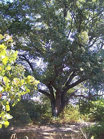
A towering, mature red oak tree with dense green foliage fills the frame; a small person stands at the base of the trunk for scale.
A large, mature red oak tree situated in the woodland of Caddo National Grassland.

Caddo National Grassland history and protected-area timeline

The land that now makes up Caddo National Grassland was purchased by the federal government in the 1930s, during a period when severe soil erosion across the Great Plains had made large areas of former farmland unsuitable for continued cropping. The primary purpose of these land acquisitions was land conservation and the restoration of damaged soils, a goal that shaped the early identity of the grassland and remains central to its management story.

Over the following decades, the purchased agricultural land was allowed to revert from cropland to perennial vegetation. Native grasses, forbs, and oak species gradually re-established themselves across the landscape, transforming heavily used farmland into a recovering mosaic of prairie and cross timbers woodland. This restoration trajectory is the defining element of Caddo's history.

The grassland is currently managed by the U.S. Forest Service in coordination with the other Texas national forests and grasslands. Shared administration from offices in Lufkin, with a local ranger district office in Decatur, reflects the modern institutional arrangement that emerged as the Texas units were grouped under common leadership.

Caddo National Grassland landscape and geographic character

Caddo National Grassland occupies gently rolling terrain in northeastern Texas, characteristic of the southern edge of the Great Plains. The land is neither flat prairie nor true hill country; instead, it offers a softly undulating surface shaped by small creeks and drainages, with subtle changes in elevation that influence where grassland gives way to woodland.

A defining visual feature is the cross timbers influence, where open grassland is interspersed with scattered post oak and blackjack oak, producing a lightly wooded savanna appearance in many areas. This mosaic distinguishes Caddo from the more uniformly treeless prairies further west and from the denser pineywoods forests of deep East Texas.

The Bois d'Arc Creek corridor cuts through the grassland, providing a ribbon of bottomland with heavier soils and richer vegetation. The 388-acre Lake Davy Crockett sits within this landscape, creating a clear water-centered focal point surrounded by prairie and oak woodland. The Ladonia Unit adds a second, somewhat different setting within the same county, contributing to the grassland's overall diversity of landform and vegetation pattern.

Caddo National Grassland ecosystems, habitats, and plant life

Ecologically, Caddo National Grassland sits in a transition zone where southern Great Plains prairie intergrades with the cross timbers, a band of oak-dominated woodland and savanna that traditionally marked the boundary between true prairie and the eastern forests. As a result, the grassland supports a blend of grassland and woodland habitats rather than a single uniform cover type.

Open areas are dominated by native and restored mixed grasses typical of the southern Plains, with forbs and shrubs contributing seasonal color and structural diversity. Across the landscape, post oak and blackjack oak appear in scattered groups, sometimes forming denser clusters that develop into recognizable cross timbers stands. Along Bois d'Arc Creek and around the impoundment of Lake Davy Crockett, the vegetation shifts toward bottomland hardwoods and riparian communities, adding moisture-loving trees and shrubs to the palette.

The recovered agricultural land itself represents a unique habitat condition: formerly cultivated soil now in the long process of returning to perennial native cover, threaded between established woodland and prairie patches. This continuously evolving vegetation mosaic gives Caddo its particular ecological character and distinguishes it from older, more stable grassland preserves.

Caddo National Grassland wildlife and species highlights

The mix of open grassland, scattered oak woodland, and bottomland habitat makes Caddo National Grassland attractive to a wide range of southern Plains wildlife. Grassland-dependent songbirds, game birds, and small mammals use the open and recovering prairie areas, while the oak patches and riparian corridors along Bois d'Arc Creek and Lake Davy Crockett provide nesting and foraging opportunities for woodland species.

White-tailed deer are common throughout the oak and bottomland areas, and the grassland supports typical small predators and mammals associated with the cross timbers region. Reptiles and amphibians find refuge in both the rocky, woody uplands and the wetter environments around the lake and creek systems.

Lake Davy Crockett and its surrounding shoreline add an aquatic and semi-aquatic dimension, attracting waterbirds and providing habitat for fish populations. This combination of terrestrial and aquatic habitat within a relatively compact area gives Caddo an unexpectedly rich wildlife profile for the southern Great Plains.

Caddo National Grassland conservation status and protection priorities

The conservation significance of Caddo National Grassland lies primarily in its origin as a soil-restoration project. The land was acquired in the 1930s to combat severe erosion associated with intensive agriculture in the southern Great Plains, and the subsequent conversion of degraded farmland back to perennial cover is itself a long-term conservation achievement.

Today, the grassland contributes to the protection of a transitional landscape between southern prairie and cross timbers woodland, a habitat type that has been heavily altered across Texas. By maintaining a recovering mix of grassland and oak habitats, along with bottomland communities along Bois d'Arc Creek, Caddo helps preserve ecological complexity that is increasingly uncommon in private working landscapes.

Management by the U.S. Forest Service, integrated with the other Texas national forests and the Lyndon B. Johnson National Grassland, places Caddo within a coordinated framework for conservation, prescribed fire, grazing, and habitat management typical of the southern Plains national grasslands.

Caddo National Grassland cultural meaning and human context

The name Caddo National Grassland reflects the broader regional heritage of northeast Texas, where the Caddo people historically occupied lands spanning parts of present-day Texas, Louisiana, Arkansas, and Oklahoma. While the grassland itself is named for this regional cultural geography, the land's more recent cultural history is defined by agricultural use, the 1930s Dust Bowl era land crisis, and the federal response that reshaped ownership of damaged farmland across the Great Plains.

The areas around Honey Grove and Ladonia carry the imprint of small-town rural Texas, with the grassland embedded within a working landscape of farms, ranches, and small communities. The recreation areas developed around Lake Davy Crockett and the broader National Grassland framework tie this local setting into a wider story of public land conservation in the United States.

Top sights and standout views in Caddo National Grassland

Caddo National Grassland stands out for its dual-unit layout, its cross timbers and prairie mosaic, and its 1930s origin as a soil-restoration purchase. The Lake Davy Crockett recreation area provides an accessible visitor focus within an otherwise quiet, recovering landscape.

Its integration with the other Texas national forests and grasslands, all managed under a common U.S. Forest Service framework, also makes Caddo an interesting example of how small, scattered federal lands are coordinated across an entire state.

Best time to visit Caddo National Grassland

Spring and fall generally offer the most pleasant conditions for visiting Caddo National Grassland, when temperatures are milder and the recovering prairie and oak woodland are most visually active. Spring brings green-up across the grasslands and wildflowers in the forb layer, while fall offers cooler weather and changing conditions in the oak stands.

Summer in northeast Texas is hot and can be humid, though the lake-based recreation areas remain attractive for water-related activities. Winter tends to be relatively mild compared with more northerly grasslands, with the bare branches of the oaks and open prairie offering good visibility for wildlife viewing and landscape appreciation.

Monthly climate preview

Examine long-term representative temperature and precipitation averages across the year

Caddo National Grassland Climate Normals and Annual Weather Patterns

Caddo National Grassland records measured monthly temperature and precipitation normals derived from long-term representative coordinates. Reviewing the complete twelve-month climatology profile provides detailed insight into historical environmental averages without relying on short-term forecasts.
Annual mean18 °C
6 °C29 °C
Jan
Feb
Mar13°
Apr17°
May22°
Jun26°
Jul29°
Aug29°
Sep25°
Oct19°
Nov12°
Dec
Warmest month
August

29.3 °C

Coolest month
January

5.5 °C

Wettest month
May

4.2 mm/day

Driest month
January

2.2 mm/day

Park location guide

Geography guide, regional context, and park location map for Caddo National Grassland

Caddo National Grassland park geography, regions, and map view in United States of America

Understand where Caddo National Grassland sits in United States of America through a broader geographic reading of the surrounding landscape, nearby location context, and its mapped position within the national park landscape.

How Caddo National Grassland fits into United States of America

The United States of America is a federal presidential republic and one of the world's largest countries by area and population. It consists of 50 states across a vast territory spanning multiple time zones, with its capital in Washington, D.C. and largest city in New York City. The nation has a diverse economy, influential political system, and significant cultural and military presence globally.

Wider geography shaping Caddo National Grassland in United States of America

The United States occupies a vast territory in North America, bordered by Canada to the north and Mexico to the south. The 48 contiguous states stretch from the Atlantic to the Pacific Ocean, while Alaska occupies the northwestern region and Hawaii is an archipelago in the Pacific. The country encompasses diverse terrain including the Rocky Mountains, Appalachian Mountains, Great Plains, and extensive river systems.

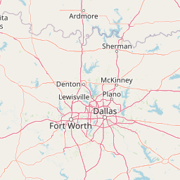
Map view of Caddo National Grassland

Use this park location map to pinpoint Caddo National Grassland in United States of America, understand its exact geographic position, and read its mapped placement within the surrounding landscape more clearly.

Pigeon | © OpenStreetMap contributors

Location context for Caddo National Grassland

Texas
Recorded earthquake history

Explore Recorded Seismic History and Earthquake Data for Caddo National Grassland

Gain insight into the historical seismic context of Caddo National Grassland through a curated list of documented earthquakes. This MoriAtlas dataset allows for the examination of historical event data, proximity, and magnitude trends surrounding these protected Texas lands.

Caddo National Grassland Earthquake History

Catalogued events

5 events

Strongest magnitude

Magnitude 3.4

Most recent event

Oct 12, 2013

This history includes earthquakes recorded inside the park or within 50 km of its borders

Visual exploration of recovering prairie and cross timbers woodland

Caddo National Grassland Photos: Scenery, Landscapes, and Habitats

Visual documentation of Caddo National Grassland reveals rolling terrain, open prairie segments, and scattered oak savanna woodlands across the southern Great Plains. Photographic views capture the distinctive protected-area environment, bottomland creek corridors, and water-centered landscapes of the region.

A towering, mature red oak tree with dense green foliage fills the frame; a small person stands at the base of the trunk for scale.

Park atlas

Compare surrounding southern Great Plains conservation landscapes and connected habitats.

Parks Near Caddo National Grassland and Regional Protected Areas

Browse nearby national parks and protected areas sharing the transitional terrain of northeastern Texas. Compare regional park geography and connected oak woodland habitats across the surrounding landscape.
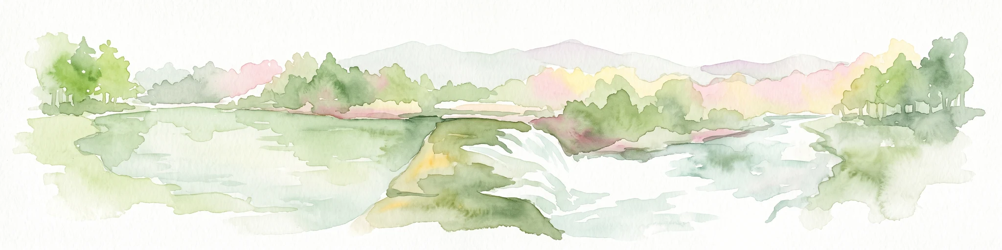
Watercolor painting of a forested landscape with soft rolling mountains in the background and vegetation in the foreground.
Protected landscapeArkansas
95 km away#1 closest

Northeast

Ouachita National Forest: Protected Landscape and Mountain Geography in Arkansas

Exploring the ancient ridges and river corridors of the Ouachita Mountains

Ouachita National Forest protects a unique geological system of east-west folded ridges and sandstone bluffs in the interior United States. This expansive region provides vital habitats for diverse hardwood communities and hosts extensive wilderness areas, offering a deep look into the natural history and terrain of the Ouachita Mountain range within Arkansas.

Area
7,221.44 km²
Established
1907
IUCN
VI
Relief
Mountain
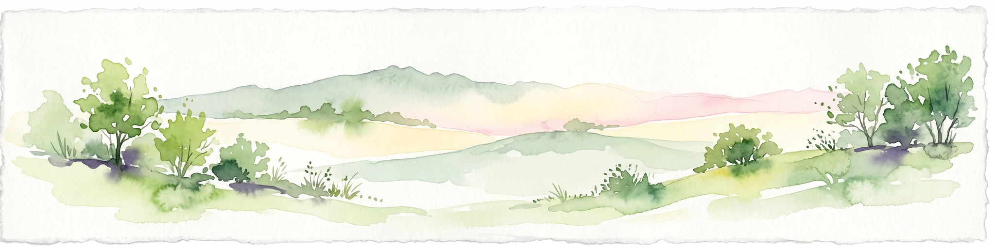
Watercolor painting of a flowing river with a small waterfall and forested banks against a soft, hilly background.
National parkOklahoma
About 108 km away#2 closest

Northwest

Chickasaw National Recreation Area: Geography and Protected Land Map Overview

Explore spring-fed creek corridors and reservoir landscapes in Oklahoma.

Understand the dual landscape of Chickasaw National Recreation Area, where narrow, spring-fed creek valleys contrast with the expansive shoreline of Lake of the Arbuckles. This record highlights the park's distinct transition from historic CCC-designed infrastructure to the surrounding prairie and forested hill terrain in Murray County.

Area
40.06 km²
Established
1902
Visitors
1.5M annual
Relief
Upland
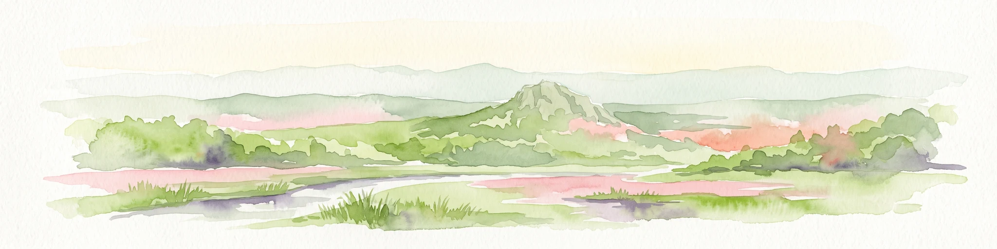
Watercolor painting of soft, rolling green hills and scattered trees against a pale, light-filled sky.
Protected landscapeWise County
130 km away#3 closest

West

Lyndon B. Johnson National Grassland: Atlas and Geographic Landscape Overview

Protected prairie and multiple-use terrain in Wise County

Examine the geographic layout and regional importance of Lyndon B. Johnson National Grassland, a federal protected area in northern Texas. The land offers a unique look at the convergence of open Great Plains prairie and the wooded Cross Timbers, serving as both a working ranching landscape and a preserved natural environment within easy reach of the Dallas-Fort Worth metropolitan area.

Area
82.19 km²
Relief
Lowland
Climate
Temperate
Access
Easy access
Protected areaOklahoma
About 146 km away#4 closest

Northeast

Winding Stair Mountain National Recreation Area: Oklahoma Protected Mountain Landscape

Mapped ridge systems and forested highland geography.

Spanning the prominent Winding Stair Mountains, this protected area serves as a key geographic pillar in southeastern Oklahoma. The landscape is characterized by its high-elevation ridgeline profile, pine-covered slopes, and stream-fed valleys, offering a distinct look at the wider Ouachita National Forest ecosystem and its mountainous terrain.

Area
107.02 km²
Established
1988
Relief
Mountain
Climate
Temperate
Protected landscapeArkansas
About 208 km away#5 closest

Northeast

Ozark, St. Francis National Forest: Geographic Overview of Arkansas Protected Wilderness Areas

Mapping rugged mountain slopes and Mississippi River floodplains.

This geographic profile of Ozark, St. Francis National Forest details the distinct ecological divide between the northern Ozark Mountain units and the eastern St. Francis ridge landscape. Use this data to trace the boundaries of old-growth pine stands, karst topography, and river-bottom habitats within one of Arkansas's most significant federal forest management systems.

Area
4,693.55 km²
Established
1908
Relief
Mountain
Climate
Temperate
National parkGarland County
267 km away#6 closest

East

Hot Springs National Park: National Park Protected Area and Geographic Context

Mapped boundaries and regional landscape of this US National Park.

Gain a structured understanding of Hot Springs National Park, focusing on its identity as a protected national park. Examine its mapped geography and regional landscape context within Garland County, providing essential details for atlas-based exploration. This entry details the park's protected area and its position in the broader geographic framework.

Area
22.5 km²
Established
1832
IUCN
II
Visitors
2.6M annual
A horizontal watercolor painting showing rolling green hills and a small stream in the foreground with faint mountain ridges in the distance.
Wildlife reserveArkansas
286 km away#7 closest

Northeast

Flatside Wilderness: Rugged Sandstone Ridges in the Ouachita Mountains

Arkansas wildlife reserve featuring mountain summits and mapped backcountry

Flatside Wilderness offers a deep look at the high-relief geography of the Ouachita Mountains. Featuring prominent sandstone summits and an 8.9-mile segment of the Ouachita National Recreation Trail, this protected landscape provides essential insight into the state's wilderness systems and regional forest ecosystems.

Area
38.47 km²
Established
1984
IUCN
Ib
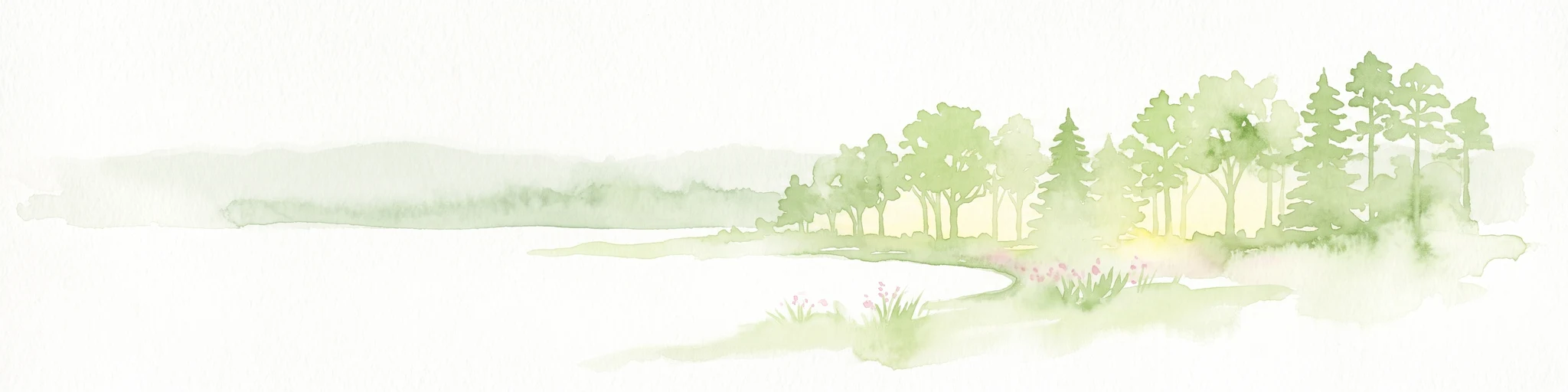
A pale, minimalist watercolor painting showing a soft green treeline and forest edge against a white background.
Protected landscapeTexas
297 km away#8 closest

South

Sam Houston National Forest: Mapping the Piney Woods Protected Landscape

Regional Geography of East Texas Protected Lands

Sam Houston National Forest is a 163,000-acre protected area in East Texas characterized by loblolly and shortleaf pine ridges. The geography features an intricate network of creeks, hardwood bottomlands, and designated wilderness areas like Little Lake Creek. Framed by Lake Conroe and Lake Livingston, the forest offers a complex look at Gulf Coastal Plains topography and long-standing Piney Woods ecological restoration efforts.

Area
659.82 km²
Established
1936
Relief
Lowland
Climate
Subtropical

Common questions about visiting, size, designation, and location context for Caddo National Grassland

Caddo National Grassland FAQs for park facts, access, geography, and protected area context

Find quick answers about Caddo National Grassland, including protected-area facts, park geography, trail and visitor context, and how the park fits into its surrounding country and regional landscape.
MoriAtlas Explorer

Continue Your Protected Areas Search Across the Global Atlas

Deepen your exploration by continuing the structured search for national parks and protected areas worldwide. Utilize the comprehensive filtering capabilities to compare different conservation landscapes and refine your understanding of global park geography. Discover more about the distribution and characteristics of protected natural areas.

Global natural geography