Mori Atlas logo
National parkCanaima National Park

Trace the mapped boundaries and natural terrain of this key national park in southeastern Venezuela.

Canaima National Park: Protected Landscape and Geographic Atlas of Bolívar State

(Parque Nacional Canaima)

Canaima National Park stands as a vital protected area within Venezuela's vast Bolívar State, a region known for its dramatic natural landscapes within the Guiana Highlands. This page offers an in-depth look at the park's geographic identity, allowing for detailed exploration of its mapped boundaries and regional context. Understand how Canaima National Park contributes to the protected land atlas of Venezuela, providing essential insights into its terrain and natural environment.

Table-top mountainsWorld Heritage SiteUNESCOTepuisAngel FallsHigh waterfall

Canaima National Park

National park

Park overview

Structured park overview, official facts, and landscape profile for Canaima National Park

Canaima National Park park facts, protected area profile, and essential visitor context

Review the core facts for Canaima National Park, including designation, size, terrain, visitor scale, habitats, and operating context in one park-focused overview.

About Canaima National Park

Canaima National Park represents one of the most spectacular and scientifically significant protected landscapes in South America. The park's defining feature is its extraordinary concentration of tepuis, ancient table-top mountains that rise like monolithic pillars from the surrounding rainforest. These geological formations, composed of Precambrian sandstone superimposed on ancient granite bases, range from 1.5 to 2 billion years in age, making them among the oldest formations on Earth. The tepuis occupy approximately 65% of the park's territory, creating a unique landscape of sheer vertical cliffs, cascading waterfalls, and isolated summit habitats that have evolved in near-complete isolation for millions of years. The park's hydrography is equally impressive, encompassing the entire watershed of the Caroní River's right bank and protecting two of the world's highest waterfalls, Angel Falls and Kukenán Falls, alongside numerous smaller cascades scattered throughout the terrain. Beyond its geological significance, Canaima holds immense ecological value as part of the Guayanan Highlands moist forests ecoregion. The isolated tepui summits function as ecological islands, hosting plant and animal species found nowhere else on Earth. The park's relative remoteness, with limited road access and transportation primarily via light aircraft or foot and canoe, has helped preserve its wilderness character despite growing tourism interest.

Quick facts and research context for Canaima National Park

Canaima National Park covers 30,000 square kilometers in southeastern Venezuela, making it the second largest protected area in the country and the sixth largest national park globally. The park occupies the Gran Sabana region in Bolívar State, bordering Brazil and Guyana. It was established in 1962 and became a UNESCO World Heritage Site in 1994. The park features approximately 65% of its territory dominated by tepuis, the ancient sandstone table-top mountains that are among the oldest geological formations on Earth at 1.5 to 2 billion years. Angel Falls, the world's highest waterfall at 979 meters, is located within the park on Auyantepui. The protected area encompasses the entire watershed of the right bank of the Caroní River.

Protection and recognition

Tracing the terrestrial management scope, 1994 designation history, and global conservation status.

Canaima National Park Protection Status and UNESCO World Heritage Recognition

Documented geographic records detail the terrestrial protection status and established boundaries of Canaima National Park. Analyzing the park's management history and 1994 UNESCO World Heritage designation provides essential context for global conservation mapping.

International recognition

Protection details

Protection scope
Terrestrial
Designated year
1994
Transboundary protection
No
Park context

Deeper park guide and search-rich context for Canaima National Park

Canaima National Park history, landscape, wildlife, and travel context

Explore Canaima National Park through its history, landscape character, ecosystems, wildlife, conservation priorities, cultural context, and seasonal travel timing in a structured park guide built for atlas discovery and search intent.

Why Canaima National Park stands out

Canaima National Park is most renowned for its extraordinary tepui landscape, a collection of ancient table-top mountains with vertical cliffs and flat summits that represent some of the oldest geological formations on the planet. The park protects Mount Roraima, the tallest and most accessible tepui, and Auyan-tepui, which hosts Angel Falls, the highest waterfall in the world. These tepuis support remarkable endemic biodiversity, including numerous carnivorous plant species adapted to the nutrient-poor summit environments. The combination of dramatic geological formations, spectacular waterfalls, and the cultural presence of the Pemon indigenous people creates a distinctive wilderness that is unlike any other protected area on Earth.

Canaima National Park history and protected-area timeline

Canaima National Park was formally established on June 12, 1962, marking Venezuela's commitment to preserving one of its most distinctive natural landscapes. Even before formal designation, the area's exceptional geological and cultural significance was recognized, and discussions about expanding protection began relatively early in the park's history. By 1990, the Amazonian Cooperation Treaty countries had recommended expanding Canaima southward to connect with Monte Roraima National Park in Brazil, proposing coordinated management of tourism, research, and conservation across the border. In 1994, UNESCO designated Canaima a World Heritage Site, recognizing its outstanding universal value based on natural criteria relating to geological processes, ecological significance, and biodiversity. The International Union for Conservation of Nature conducted a conservation assessment in 2017, identifying significant concerns regarding protection effectiveness and management, highlighting the ongoing challenges of managing such a vast and remote protected area.

Canaima National Park landscape and geographic character

The landscape of Canaima National Park is dominated entirely by the tepuis, which constitute one of the most unusual and visually dramatic geological formations found anywhere on Earth. These table-top mountains rise sharply from the surrounding terrain, their flat summits and vertical walls creating a landscape that resembles a lost world. Geologically, the tepuis represent remnants of a sedimentary sandstone cover that was superimposed approximately 1.5 to 2 billion years ago on an ancient base of igneous granite rocks that are nearly three billion years old. The sandstone surfaces have been eroded over millennia, creating the distinctive flat-topped profile that defines the tepui silhouette. Each tepui functions as an isolated ecosystem, with unique combinations of endemic species found only on that particular mountain. The park's hydrological features are equally spectacular, with the Caroní River watershed providing the hydraulic engine for numerous waterfalls. Angel Falls, dropping 979 meters from Auyan-tepui, is the highest uninterrupted waterfall in the world, while Kukenán Falls on the Kukenán-tepui ranks among the highest cataracts globally. Between these major falls, the park contains countless smaller waterfalls distributed across its diverse terrain.

Canaima National Park ecosystems, habitats, and plant life

The ecological systems within Canaima National Park are exceptionally diverse and highly specialized, particularly on the isolated tepui summits where endemic species have evolved in complete isolation. The park lies within the Guayanan Highlands moist forests ecoregion, with vegetation patterns that vary dramatically from the rainforest-covered lowlands to the specialized summit habitats. The Gran Sabana region contains over 300 botanical species that are endemic to the area, many restricted to the unique conditions found on the tepui surfaces. Among the most fascinating of these are the carnivorous plants, which have evolved to compensate for the nutrient-poor nature of the summit soils by capturing insects and other small organisms. The genus Heliamphora, comprising South American pitcher plants, represents one of the most notable groups, along with Brocchinia, a type of bromeliad that has adopted carnivorous habits. Several species of sundews (Drosera), corkscrew plants (Genlisea), and bladderworts (Utricularia) also occur in the park's higher elevations. Plant genera endemic to the region include Achnopogon, Adenanthe, Chimantaea, Mallophyton, Quelchia, and Tepuia, representing a botanical heritage found nowhere else on the planet.

Canaima National Park wildlife and species highlights

Canaima National Park supports a rich and varied fauna distributed throughout its diverse habitats according to altitude and vegetation type. The lowland rainforests and savanna areas shelter impressive megafauna, including the giant armadillo, giant otter, giant anteater, cougar, and jaguar. Primates are well represented, with species such as Linnaeus's two-toed sloth, white-faced saki, and brown-backed bearded saki occurring throughout the forested areas. The park's smaller mammals include the endemic Roraima mouse and Tyleria mouse opossum, both restricted to the highland environments. Birdlife is particularly notable, with the park designated as an Important Bird and Biodiversity Area by BirdLife International. The harpy eagle represents perhaps the most impressive avian resident, while macaws, parrots, toucans, and hummingbirds add color and sound to the forest canopy. Reptiles include the green iguana and the South American bushmaster, one of the largest venomous snakes in the Americas. Amphibians are well represented, with the yellow-banded poison dart frog being among the more distinctive species. The park also supports populations of green acouchi and bush dog, two relatively uncommon South American mammals.

Canaima National Park conservation status and protection priorities

Canaima National Park's designation as a UNESCO World Heritage Site in 1994 reflects its outstanding universal value from a conservation perspective. The park protects one of Earth's most significant geological archives, with tepui formations representing some of the oldest continental surfaces and providing irreplaceable windows into planetary evolution. The endemic biodiversity, particularly the specialized species restricted to individual tepui summits, represents an irreplaceable genetic heritage that cannot be found anywhere else on the planet. The carnivorous plant communities alone constitute a unique ecological phenomenon of global significance. However, conservation assessments by the International Union for Conservation of Nature in 2017 identified significant concerns regarding protection effectiveness and management capacity, underscoring the challenges of maintaining adequate conservation in such a vast and remote wilderness area. The 2017 assessment categorized Canaima as an area of significant concern, highlighting issues that include ineffective protection and management that require ongoing attention and resources.

Canaima National Park cultural meaning and human context

Canaima National Park is home to the Pemon people, an indigenous group belonging to the Carib linguistic family who have inhabited the Gran Sabana region for generations. The Pemon maintain an intimate and spiritual relationship with the tepuis, which they consider to be the dwelling place of the Mawari spirits, entities central to their traditional cosmology. This cultural connection to the landscape predates the establishment of the protected area and continues to shape how the region is understood and managed. Archaeological evidence indicates that human presence in the area extends much further back in time, with pictographic rock art sites estimated to be 4 to 7 thousand years old discovered within the park, representing cultures that long predated the arrival of the Pemon. Several indigenous communities remain within and adjacent to the park, including villages such as Kavac, Kamarata, San Francisco de Yuruaní, Paraitepui, and Wonkén, where traditional practices and contemporary life continue to intersect with the protected area framework.

Top sights and standout views in Canaima National Park

The tepuis of Canaima represent the park's most extraordinary feature, with Mount Roraima being the tallest and most accessible, while Auyan-tepui hosts Angel Falls, the world's highest waterfall. The park encompasses the entire Gran Sabana region, a landscape of savanna and forest that surrounds the dramatic table-top mountains. Over 300 endemic plant species occur within the park, including numerous carnivorous plants found nowhere else on Earth. The Pemon indigenous communities maintain living cultural traditions connected to the tepuis. Ancient rock art sites estimated at 4,000 to 7,000 years old provide evidence of even older human presence. The park protects the Caroní River watershed, one of Venezuela's major river systems. Several tepuis remain essentially unexplored, with their summit ecosystems yielding new species discoveries.

Best time to visit Canaima National Park

Canaima National Park can be visited year-round, though the dry season from December through April generally offers more predictable weather conditions for trekking and sightseeing. During the wet season from May through November, rainfall is more frequent and can affect visibility for waterfall views and make some trails more challenging. The park's highland environments experience cooler temperatures compared to the lowlands, with summit areas often shrouded in mist regardless of season. Visitors should note that access to the park's more remote tepui summits requires either organized treks or flights, and the wet season may affect some flight operations. The crowd levels at major sites like Angel Falls and Mount Roraima tend to be lower during the wet season, offering a different but equally valid experience of the park's dramatic landscapes.
Monthly climate preview

Long term weather by month averages and precipitation profiles in Bolívar State

Canaima National Park Climate Normals and Average Monthly Temperatures

Representative climatology data at an elevation of 875 meters shows stable monthly temperatures between 21 and 24 degrees Celsius with a distinct wet period during mid-year months. Analyzing the complete seasonal cycle provides deeper monthly precipitation averages, maximum temperature spreads, and historical trends for the Canaima wilderness.
Annual mean22 °C
22 °C23 °C
Jan22°
Feb22°
Mar23°
Apr23°
May23°
Jun22°
Jul22°
Aug22°
Sep23°
Oct23°
Nov23°
Dec22°
Warmest month
April

23.5 °C

Coolest month
January

21.5 °C

Wettest month
June

12.3 mm/day

Driest month
February

1.8 mm/day

Park location guide

Geography guide, regional context, and park location map for Canaima National Park

Canaima National Park park geography, regions, and map view in Venezuela

Understand where Canaima National Park sits in Venezuela through a broader geographic reading of the surrounding landscape, nearby location context, and its mapped position within the national park landscape.

How Canaima National Park fits into Venezuela

Venezuela is a country in northern South America with coastline along the Caribbean Sea and Atlantic Ocean. It borders Colombia, Brazil, Guyana, and Trinidad and Tobago. The country has an area of approximately 916,445 km² and a population of about 31.8 million. Caracas is the capital and largest city. Venezuela consists of 23 states and the Capital District.

Wider geography shaping Canaima National Park in Venezuela

Venezuela is located on the northern coast of South America. The continental territory is bordered by the Caribbean Sea and Atlantic Ocean to the north, Colombia to the west, Brazil to the south, and Guyana to the east. Trinidad and Tobago lies to the northeast. The country includes various islands and islets in the Caribbean Sea known as the Federal Dependencies.

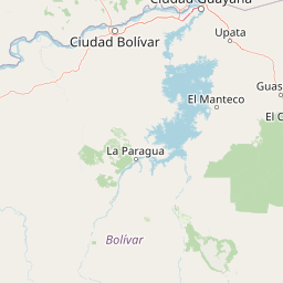
Map view of Canaima National Park

Use this park location map to pinpoint Canaima National Park in Venezuela, understand its exact geographic position, and read its mapped placement within the surrounding landscape more clearly.

Pigeon | © OpenStreetMap contributors

Location context for Canaima National Park

Bolívar State
Natural feature types

Continue Exploring Natural Features in Canaima National Park

Examine the full array of named landforms and water bodies across the Canaima National Park region. MoriAtlas provides a structured view of the tepuis and waterfall systems that constitute this complex wilderness for those interested in detailed geographic research.
Recorded earthquake history

Investigate the Historical Earthquake Record for Canaima National Park

Examine the archive of recorded seismic events associated with the territory of Canaima National Park. This catalogue provides valuable historical data on past earthquake epicentres and magnitude occurrences to support deeper geographic understanding of the region.

Canaima National Park Earthquake History

Catalogued events

1 event

Strongest magnitude

Magnitude 4.5

Most recent event

Jan 7, 2024

This history includes earthquakes recorded inside the park or within 50 km of its borders

Park atlas

Trace the regional spread of Venezuela's conservation landscapes and unique geological features surrounding Canaima

Compare Related Protected Areas, National Parks, and Landscapes Near Canaima National Park

Browse national parks and protected areas geographically adjacent to Canaima National Park, revealing diverse landscapes from the Gran Sabana to neighboring territories. Compare these protected areas for essential context on regional ecology, shared geological formations, and conservation efforts across the Guayana Highlands.
Nature reserveEstado Bolívar
Park boundaries overlap#1 closest

Northeast

Reserva forestal de Imataca: Geographic Overview of a Major Venezuelan Nature Reserve

Mapping the Sierra de Imataca and regional forest ecosystems

Reserva forestal de Imataca serves as a key conservation zone, characterized by the Sierra de Imataca and a dense network of major rivers. This large-scale protected area provides an essential look at the tropical wilderness and upland forest terrain found within Estado Bolivar, mapping out a significant slice of the Venezuelan Guayana region.

Area
38,219 km²
Established
1961
Relief
Mountain
Climate
Tropical
National parkPotaro-Siparuni
116 km away#2 closest

East

Kaieteur National Park: Iconic South American Waterfall and Protected Forest Landscape

Discover the unique geography and mapped boundaries of this Guiana Shield natural wonder.

Kaieteur National Park is a significant protected area in Guyana, celebrated globally for Kaieteur Falls, the world's largest single-drop waterfall by volume. This national park preserves over 242 square miles of untouched tropical rainforest, offering critical habitat for endemic species and a profound example of the Guiana Shield's ancient geological formations and diverse ecosystems. Its location deep within the Potaro-Siparuni Region underscores its role as a vital bastion of wilderness and a landmark in South American protected landscapes.

Area
630 km²
Established
1929
IUCN
II
Relief
Mixed relief
National parkBolívar
165 km away#3 closest

Southwest

Parque nacional Jaua-Sarisariñama: Protected Tepui Landscapes in Bolívar

Mapping the sandstone mesas and remote wilderness of the Venezuelan Guiana Shield.

Parque nacional Jaua-Sarisariñama stands as one of the most secluded protected areas in Venezuela, defined by its massive tepuis and dramatic vertical sinkholes. This geography encompasses critical headwaters and ancient Precambrian rock formations that rise abruptly from surrounding lowland forests, providing a stable habitat for isolated species across the Guiana Shield.

Area
3,300 km²
Established
1978
IUCN
II
Relief
Highland
National parkAmazonas
240 km away#4 closest

Southwest

Parima Tapirapecó National Park: Venezuela's Largest Protected Area within the Guayanan Highlands

Explore its vast geographic extent and critical Orinoco River basin landscape.

Parima Tapirapecó National Park is an expansive protected territory in Venezuela's Amazonas region, holding the title of the country's largest national park and ranking among the world's most significant protected lands. Its geography is defined by the ancient Guayanan Highlands, protecting the vital headwaters of the Orinoco River and a mosaic of tropical forests and savannas. This park offers deep insights into landscape preservation on a grand scale, crucial for understanding regional geography and protected area distribution.

Area
38,290 km²
Established
1991
IUCN
II
Scope
Terrestrial
National parkVenezuela
About 252 km away#5 closest

Northwest

Caura National Park: Venezuela's Largest Protected Area in the Guianan Highlands

Mapped boundaries of an immense tropical rainforest basin.

Caura National Park represents Venezuela's most extensive protected territory, established in 2017 to encompass the vast Caura River basin. This national park preserves a critical tropical rainforest ecosystem within the Guianan Highlands, contributing significantly to the Orinoco River's watershed. Its creation is the result of long-standing conservation efforts aimed at protecting millions of hectares of biodiverse landscape, offering a unique opportunity for understanding the geographic scope and ecological importance of large-scale protected areas.

Area
75,340 km²
Established
2017
IUCN
II
Climate
Tropical
National parkAmazonas
285 km away#6 closest

Southwest

Parque nacional Duida-Marahuaca: Geographic Overview of Protected Tepui Landscapes in Venezuela

Mapping the highland ecosystems and river systems of Amazonas

Parque nacional Duida-Marahuaca protects a vast expanse of remote wilderness, anchored by the prominent Cerro Duida, Cerro Huachamacari, and Cerro Marahuaca. This site offers deep insights into the park's sandstone topography and hydrological connectivity within the broader Guayana Shield, providing a clear geographic understanding of these isolated table-top mesas and their surrounding forest habitats.

Area
2,100 km²
Established
1978
IUCN
II
Relief
Mountain
National parkDelta Amacuro
299 km away#7 closest

North

Parque nacional Mariusa: A Detailed Geographic Study of Orinoco Delta Wetlands

Mapped tidal channels and protected wetland geography

Located in Delta Amacuro, Parque nacional Mariusa represents a key protected area where the Orinoco River meets the Atlantic. Its geography is defined by a dynamic system of caños, seasonally flooded rainforests, and mangrove forests that support high ecological complexity. This atlas entry provides an overview of the park boundaries and the physical terrain that shapes this critical Venezuelan protected landscape.

Area
3,310 km²
Established
1991
IUCN
II
Water
Water-dominated
Protected areaBarima-Waini
About 324 km away#8 closest

Northeast

Shell Beach: Coastal Protected Area Geography and Barima-Waini Map Context

Atlantic shoreline nesting habitats and regional ecological boundaries.

Spanning 120 kilometers of Guyana's northern coast, Shell Beach represents a significant protected area dedicated to marine conservation. Its geography features a continuous chain of sandy beaches, offshore foraging waters, and adjacent coastal forest ecosystems, all managed through a community-based model within the Barima-Waini Region.

Area
31.77 km²
Established
2011
IUCN
VI
Relief
Lowland

Common questions about visiting, size, designation, and location context for Canaima National Park

Canaima National Park FAQs for park facts, access, geography, and protected area context

Find quick answers about Canaima National Park, including protected-area facts, park geography, trail and visitor context, and how the park fits into its surrounding country and regional landscape.
MoriAtlas Explorer

Continue Your Protected Areas Search Across the Global Atlas

Deepen your exploration by continuing the structured search for national parks and protected areas worldwide. Utilize the comprehensive filtering capabilities to compare different conservation landscapes and refine your understanding of global park geography. Discover more about the distribution and characteristics of protected natural areas.

Global natural geography