Mori Atlas logo
National parkAguaro-Guariquito National Park

Discover the mapped boundaries and regional setting of this Venezuelan National Park.

Aguaro-Guariquito National Park: Protected Landscape and Geographic Context

(Parque Nacional Aguaro-Guariquito)

Aguaro-Guariquito National Park represents a key protected natural area within Venezuela's Guárico region. This page provides an atlas-driven perspective, detailing the park's geographic scope and its identity as a designated national park. Understand the park's position within the broader landscape and its mapped protected boundaries, offering a foundation for detailed geographic exploration.

national parkwetland ecosystemtropical savannaLlanosOrinoco basinprotected area

Aguaro-Guariquito National Park

National park

Park overview

Structured park overview, official facts, and landscape profile for Aguaro-Guariquito National Park

Aguaro-Guariquito National Park park facts, protected area profile, and essential visitor context
Review the core facts for Aguaro-Guariquito National Park, including designation, size, terrain, visitor scale, habitats, and operating context in one park-focused overview.

About Aguaro-Guariquito National Park

Aguaro-Guariquito National Park represents one of Venezuela's most significant conservation achievements, protecting a substantial portion of the nation's iconic Llanos ecosystem. The Llanos, meaning "the plains" in Spanish, is a vast region of tropical grasslands that spans much of central Venezuela and extends into Colombia, forming one of the largest and most biodiverse savanna ecosystems in South America. This protected area preserves the natural dynamics of this landscape, where the annual flooding cycle of the Orinoco River system drives ecological processes that sustain remarkable biodiversity.

The park's establishment in 1974 reflected growing recognition of the need to protect the Llanos from increasing pressures of agricultural expansion and development. At nearly 586,000 hectares, the protected area encompasses a representative sample of the region's diverse habitats, from seasonally flooded savannas to riparian corridors and forest islands. The Venezuelan government, under President Rafael Caldera, identified the preservation of this natural formation as imperative for maintaining ecological integrity and ensuring that future generations could experience the Llanos in its original condition.

The park's location in Guárico state places it at the heart of the Orinoco basin, where the interplay between the river system and the flat terrain creates a landscape of exceptional ecological significance. The seasonal dynamics, with wet and dry periods dramatically altering the appearance and accessibility of the terrain, support a range of ecological adaptations among wildlife and shape the traditional land use patterns of the region. This natural rhythm continues to define the character of the park and the surrounding landscape.

Quick facts and research context for Aguaro-Guariquito National Park

Aguaro-Guariquito National Park covers 5,857 square kilometers in Guárico state, Venezuela, making it one of the country's largest protected areas. The park was established on March 7, 1974, by decree under President Rafael Caldera, encompassing the floodplain landscapes south of the Guárico River in the municipalities of Francisco de Miranda and Jose Rondon. The climate is tropical with two pronounced seasons: a dry summer from November to March followed by a rainy winter from April to October, when seasonal flooding transforms the savanna into an extensive wetland system.

Park context

Deeper park guide and search-rich context for Aguaro-Guariquito National Park

Aguaro-Guariquito National Park history, landscape, wildlife, and travel context
Explore Aguaro-Guariquito National Park through its history, landscape character, ecosystems, wildlife, conservation priorities, cultural context, and seasonal travel timing in a structured park guide built for atlas discovery and search intent.

Why Aguaro-Guariquito National Park stands out

Aguaro-Guariquito National Park is best known for its preservation of the Venezuelan Llanos, one of South America's most extensive tropical grassland ecosystems. The park protects critical habitat for the Amazon river dolphin, a flagship species that inhabits the park's rivers and seasonal waterways. As an Important Bird Area, it supports populations of distinctive Neotropical birds including the rufous-vented chachalaca and the yellow-knobbed curassow, both characteristic species of the Llanos region. The park's seasonal flooding cycle creates a dynamic landscape where vast savannas transform into temporary wetlands, supporting a unique ecological character that distinguishes it from other Venezuelan protected areas.

Aguaro-Guariquito National Park history and protected-area timeline

Aguaro-Guariquito National Park was established on March 7, 1974, through a decree issued by the Venezuelan government during the administration of President Rafael Caldera. The creation of the park reflected a growing environmental awareness in Venezuela during the 1970s, a period when the country began expanding its national park system to protect representative samples of its diverse ecosystems. The Llanos, despite its ecological significance and cultural importance to Venezuela, had received limited formal protection until this time.

The park was established on land located south of the Guárico River in what was then the municipalities of Las Mercedes del Llano and Miranda in Guárico state. The initial protected area encompassed approximately 569,000 hectares, later expanded to the current extent of 585,750 hectares. The establishment decree recognized the imperative need to protect this natural formation under the national park regime, acknowledging that the Llanos represented a unique and valuable ecosystem that required preservation for present and future generations.

The selection of this area for protection came at a time when the Llanos faced increasing pressures from agricultural expansion, particularly cattle ranching, which had begun transforming large areas of native savanna into pastureland. By creating the national park, the Venezuelan government sought to ensure that the ecological character and natural processes of this representative Llanos landscape would be maintained intact. The park remains an important element in Venezuela's protected area network, serving as a refuge for species and ecosystems typical of the Orinoco basin floodplain.

Aguaro-Guariquito National Park landscape and geographic character

The landscape of Aguaro-Guariquito National Park is defined by the flat, expansive terrain characteristic of the Llanos basin. The terrain is predominantly flat with minimal elevation variation, typical of an ancient lake bed that has been filled with sediments from the Orinoco River system over millions of years. This flat topography creates a landscape where the seasonal flooding pattern becomes the dominant force shaping both the physical environment and the ecological character of the park.

The park encompasses a mosaic of habitats that shift dramatically with the seasons. During the rainy season from April to October, vast areas of savanna become submerged as water from the Orinoco and its tributaries spreads across the plain, creating seasonal marshes, temporary lakes, and flooded grasslands. These wetland areas provide critical habitat for aquatic species and migratory waterbirds. During the dry season, the waters recede to reveal fertile savanna grasslands dotted with isolated forest patches known as "morichales" or "galeras," which are typically found along drainage channels and in slightly elevated areas.

The vegetation patterns reflect this hydrological cycle, with grasses dominating the open savanna while gallery forests line the watercourses. Scattered throughout the landscape are remnant forest islands that provide refuge for forest-dwelling species and add structural diversity to the otherwise open terrain. The park's waterways, including the Guárico River and its seasonal tributaries, serve as linear corridors connecting the various habitats and providing movement routes for aquatic species including the Amazon river dolphin.

Aguaro-Guariquito National Park ecosystems, habitats, and plant life

The nature of Aguaro-Guariquito reflects the dynamic ecology of the Llanos floodplain, where seasonal flooding creates a richly productive ecosystem supporting diverse plant and animal communities. The park's ecosystems range from open grasslands to seasonal wetlands, riparian forests, and isolated forest islands, each supporting different ecological communities. The annual flood pulse is the fundamental ecological process driving productivity and shaping the distribution of wildlife throughout the protected area.

The floodplain environment supports high primary productivity during the wet season, when nutrient-rich sediments are deposited across the landscape and grasses grow rapidly in the saturated soils. This seasonal abundance supports populations of herbivores and their predators, while the flooded areas provide breeding and feeding habitat for fish, amphibians, and waterbirds. The forest islands and gallery forests along watercourses serve as refugia for forest species during the wet season and as critical dry-season habitat when the open savannas become inhospitable.

The park's ecological significance is recognized through its designation as an Important Bird Area, reflecting the presence of significant bird populations and species of conservation concern. The ecosystem supports characteristic Llanos species adapted to the seasonal dynamics of the floodplain, creating a distinctive Neotropical savanna environment that differs substantially from the rainforests of the Amazon basin to the south or the Andean ecosystems to the west.

Aguaro-Guariquito National Park wildlife and species highlights

Aguaro-Guariquito National Park supports notable wildlife populations, with the Amazon river dolphin standing as the most emblematic species present in the protected area. The freshwater dolphin Inia geoffrensis inhabits the park's rivers and seasonal waterways, utilizing the flooded forest areas during the wet season to feed and move through the landscape. These dolphins are well adapted to the dynamic hydrological conditions of the Llanos, where they navigate between permanent water bodies and seasonal flood channels.

The park's avifauna is particularly significant, with the area designated as an Important Bird Area recognizing its value for bird conservation. Resident bird species include the rufous-vented chachalaca Ortalis ruficauda, a large gamebird that inhabits forest edges and gallery forests throughout the Llanos. The yellow-knobbed curassow Crax daubentoni, another distinctive ground-dwelling bird, is also found in the park's forest habitats. These species represent the characteristic avifauna of the Venezuelan Llanos, where open savannas and forest patches create diverse bird communities.

The seasonal wetlands and savannas support a range of other wildlife including capybara, various deer species, and caiman, while the waterways contain diverse fish populations. The dynamic nature of the ecosystem, with its pronounced wet and dry seasons, creates conditions that support both aquatic and terrestrial species in different parts of their annual cycle, making the park an important refugium for wildlife in the Venezuelan Llanos.

Aguaro-Guariquito National Park conservation status and protection priorities

Aguaro-Guariquito National Park represents Venezuela's commitment to preserving the ecological integrity of its Llanos ecosystem, one of the nation's most distinctive and biologically significant biomes. As a protected area of nearly 586,000 hectares, the park preserves a substantial sample of the Orinoco floodplain, maintaining the natural processes and species communities that characterize this vast grassland ecosystem. The national park designation provides legal protection against industrial development, mining, and other activities that could compromise the ecological integrity of the area.

The park's conservation value is enhanced by its role as habitat for the Amazon river dolphin, a species that faces population pressures throughout its range in South American river systems. Protection of the waterways within the park ensures that these dolphins have access to relatively undisturbed habitat where they can carry out their seasonal movements and reproductive activities. Similarly, the Important Bird Area designation recognizes the park's significance for maintaining populations of bird species that depend on the Llanos ecosystem for their survival.

Beyond species-specific conservation, the park preserves the broader ecological processes that sustain the Llanos ecosystem, including the seasonal flood pulse that drives productivity and creates the habitat heterogeneity upon which biodiversity depends. Maintaining these natural processes is increasingly important as climate change and land use changes in the surrounding landscape alter the hydrological patterns upon which the ecosystem depends.

Aguaro-Guariquito National Park cultural meaning and human context

Aguaro-Guariquito National Park lies within the traditional territory of the Venezuelan Llanos, a region with a distinctive cultural heritage shaped by the rhythms of the floodplain environment. The Llanos has been inhabited for centuries by communities whose lives and livelihoods have been closely tied to the seasonal dynamics of the landscape. The seasonal flooding that shapes the park's ecology has historically influenced settlement patterns, agricultural practices, and the cultural identity of the region's inhabitants.

The region's cultural history includes the traditions of the indigenous peoples who inhabited the Llanos before European colonization, as well as the more recent heritage of Venezuelan cowboys known as "llaneros" whose semi-nomadic cattle ranching traditions defined the region's cultural landscape. While the park itself is a protected area, the surrounding landscape continues to reflect this cultural heritage, with traditional land use practices interacting with the natural dynamics of the floodplain. Understanding this human dimension adds context to the park's conservation significance and its place within the broader landscape of the Venezuelan Llanos.

Top sights and standout views in Aguaro-Guariquito National Park

Aguaro-Guariquito National Park stands as one of Venezuela's largest and most ecologically significant protected areas, preserving the essence of the Llanos floodplain ecosystem. The park's vast expanse of seasonal wetlands, savannas, and forest islands represents a near-intact example of one of South America's great grassland ecosystems. Visitors and researchers encounter a landscape where the annual flooding cycle creates dramatic transformations, with submerged grasslands during the rainy season giving way to expansive dry-season savannas.

The presence of the Amazon river dolphin in the park's waterways provides a remarkable wildlife viewing opportunity, as these intelligent marine mammals navigate the river channels and flooded areas. The park's status as an Important Bird Area ensures that birdwatchers can observe characteristic Llanos species including the rufous-vented chachalaca and yellow-knobbed curassow. The combination of large mammals, aquatic species, and diverse birdlife makes the park a destination for ecological exploration and nature-based tourism in Venezuela.

Best time to visit Aguaro-Guariquito National Park

The best time to visit Aguaro-Guariquito National Park depends on what visitors hope to experience, as the two distinct seasons offer different perspectives on the park's ecology. The dry season from November to March offers easier access to the savanna areas as water levels recede, making wildlife easier to spot in the more open landscape. This period also coincides with the dry summer when the grasses turn golden and the overall character of the landscape contrasts sharply with the wet season appearance.

The rainy season from April to October transforms the park into an extensive wetland system, with flooded grasslands creating excellent conditions for observing aquatic birds and the seasonal movements of wildlife. This is also when the waterways are most accessible for river-based activities and when the Amazon river dolphins are most active in the flooded forest areas. Visitors interested in experiencing the full ecological dynamism of the Llanos may find the transition periods at the start and end of each season particularly rewarding, as these times showcase the dramatic changes that characterize this floodplain ecosystem.

Park location guide

Geography guide, regional context, and park location map for Aguaro-Guariquito National Park

Aguaro-Guariquito National Park park geography, regions, and map view in Venezuela
Understand where Aguaro-Guariquito National Park sits in Venezuela through a broader geographic reading of the surrounding landscape, nearby location context, and its mapped position within the national park landscape.

How Aguaro-Guariquito National Park fits into Venezuela

Venezuela is a country in northern South America with coastline along the Caribbean Sea and Atlantic Ocean. It borders Colombia, Brazil, Guyana, and Trinidad and Tobago. The country has an area of approximately 916,445 km² and a population of about 31.8 million. Caracas is the capital and largest city. Venezuela consists of 23 states and the Capital District.

Wider geography shaping Aguaro-Guariquito National Park in Venezuela

Venezuela is located on the northern coast of South America. The continental territory is bordered by the Caribbean Sea and Atlantic Ocean to the north, Colombia to the west, Brazil to the south, and Guyana to the east. Trinidad and Tobago lies to the northeast. The country includes various islands and islets in the Caribbean Sea known as the Federal Dependencies.

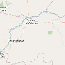
Map view of Aguaro-Guariquito National Park

Use this park location map to pinpoint Aguaro-Guariquito National Park in Venezuela, understand its exact geographic position, and read its mapped placement within the surrounding landscape more clearly.

Pigeon | © OpenStreetMap contributors

Location context for Aguaro-Guariquito National Park

Guárico
Park atlas

Explore the Llanos Protected Landscapes and Orinoco Basin Geography Adjacent to Aguaro-Guariquito

Discover Nearby Protected Areas and National Parks Around Aguaro-Guariquito National Park
Explore other national parks and protected areas near Aguaro-Guariquito National Park, discovering more of Venezuela's iconic Llanos ecosystem, tropical savannas, and Orinoco basin wetlands. Compare their geographic features, trace the regional spread of similar conservation landscapes, and deepen your atlas-based understanding of South American protected lands.
National parkMiranda

Guatopo National Park: Venezuela's National Park Mapped Landscape Context

Discover Guatopo National Park's protected area geography.

Guatopo National Park represents a key protected natural landscape in Venezuela's Miranda region. This entry offers detailed geographic context, focusing on the park's mapped boundaries and its status as a national park. It is designed for users seeking structured information about protected areas, enabling a deeper understanding of natural landscapes and their regional distribution within an atlas framework. Explore the park's distinct protected-area identity and its place in the national geography.

Area
1,224.64 km²
Established
1958
IUCN
II
Relief
Mixed relief
National parkVenezuela

Caura National Park: Venezuela's Largest Protected Area in the Guianan Highlands

Mapped boundaries of an immense tropical rainforest basin.

Caura National Park represents Venezuela's most extensive protected territory, established in 2017 to encompass the vast Caura River basin. This national park preserves a critical tropical rainforest ecosystem within the Guianan Highlands, contributing significantly to the Orinoco River's watershed. Its creation is the result of long-standing conservation efforts aimed at protecting millions of hectares of biodiverse landscape, offering a unique opportunity for understanding the geographic scope and ecological importance of large-scale protected areas.

Area
75,340 km²
Established
2017
IUCN
II
Climate
Tropical
National parkVenezuela

Macarao National Park: Venezuela's National Park with Mapped Boundaries and Regional Atlas Context

Explore its protected landscape and geographic setting within South America.

Delve into Macarao National Park, a significant national park situated in Venezuela. This page offers an atlas-centric view of the park, detailing its mapped boundaries and highlighting its importance within the regional geography of northern South America. Understand how Macarao National Park contributes to the country's network of protected landscapes and provides foundational geographic context for explorers and researchers.

Area
150 km²
Established
1973
IUCN
II
Relief
Mountain
Watercolor painting of a lagoon surrounded by green vegetation and mountains in the background
National parkMiranda State

Laguna de Tacarigua National Park: Protected Area and Miranda State Geography

Mapped natural landscape and park boundaries in Venezuela.

Laguna de Tacarigua National Park is a designated national park offering critical protected landscape features within Miranda State. This park provides essential context for understanding Venezuela's protected areas, with a focus on its mapped boundaries and regional geographic setting. Dive into the atlas-style details to comprehend its place in the natural landscape.

Area
391 km²
Established
1974
IUCN
II
Relief
Lowland
Watercolor painting showing a winding river flowing through a landscape with rolling hills in the background
National parkVenezuela

El Ávila National Park: Venezuela's Premier Coastal Mountain National Park Exploration

Discover diverse terrain, mapped boundaries, and unique geographic context.

El Ávila National Park offers an exceptional gateway into Venezuela's mountainous protected landscapes. This national park features a dramatic rise from the Caribbean coast into varied terrain, including unique cloud forest and alpine zones. Its mapped geography showcases steep slopes, deep ravines, and remarkable elevation changes, providing a significant atlas-style study of coastal mountain environments. Exploring El Ávila National Park reveals a vital natural barrier and a rich ecosystem supporting diverse flora and fauna, making it a key destination for understanding regional protected areas.

Area
819 km²
Established
1958
IUCN
II
Relief
Mountain
Watercolor painting depicting mountains, a lake, and green vegetation
National parkVenezuela

Henri Pittier National Park: Venezuela's Oldest National Park, Coastal Range Geography

Explore protected landscapes, cloud forests, and birdwatching geography.

Henri Pittier National Park is Venezuela's foundational protected area, established in 1937 and spanning over 107,800 hectares within the Venezuelan Coastal Range. This national park is renowned for its exceptional biodiversity, particularly its over 500 bird species and its distinctive cloud forest ecosystems, which include the iconic Gyranthera caribensis tree. The park's geography extends from rugged mountain terrain to coastal bays and beaches, with the Paso de Portachuelo serving as a significant migratory bird corridor. Its mapped boundaries enclose a rich mosaic of natural landscapes vital for understanding regional conservation and protected area geography in northern South America.

Area
1,078 km²
Established
1937
IUCN
II
Relief
Mountain
National parkCarabobo

San Esteban National Park: Discover Carabobo's Protected Caribbean Forest Landscape

Mapped protected area and natural terrain in Venezuela.

San Esteban National Park represents a significant protected area within Venezuela's Carabobo region, offering a unique exploration of Caribbean forest ecosystems and historical cultural sites. Covering approximately 445 square kilometers, the park's terrain spans coastal areas to mountainous interiors, presenting a diverse natural landscape shaped by its position in the coastal mountain ranges. This national park is notable for its archaeological petroglyphs, colonial roads, and fortifications, providing a rich cultural heritage context alongside its natural ecosystems. Its status as a protected national park makes it a key destination for understanding the intersection of natural conservation and historical geography in Venezuela.

Area
445 km²
Established
1987
IUCN
II
Relief
Mixed relief
National parkVenezuela

Yurubí National Park: A National Park in Venezuela for Protected Landscape Exploration

Explore mapped boundaries and regional geography.

Yurubí National Park represents a distinct protected area within Venezuela, offering valuable data for geographic exploration and atlas-based understanding. This national park's identity is defined by its mapped boundaries and its role in the regional landscape context of northern South America. Delve into its protected territory to gain insights into Venezuela's natural geography and conservation landscapes.

Area
236.7 km²
Established
1960
IUCN
II
Relief
Mountain

Common questions about visiting, size, designation, and location context for Aguaro-Guariquito National Park

Aguaro-Guariquito National Park FAQs for park facts, access, geography, and protected area context
Find quick answers about Aguaro-Guariquito National Park, including protected-area facts, park geography, trail and visitor context, and how the park fits into its surrounding country and regional landscape.
MoriAtlas Explorer

Continue Your Protected Areas Search Across the Global Atlas

Deepen your exploration by continuing the structured search for national parks and protected areas worldwide. Utilize the comprehensive filtering capabilities to compare different conservation landscapes and refine your understanding of global park geography. Discover more about the distribution and characteristics of protected natural areas.

Global natural geography