Mori Atlas logo
National parkCape Le Grand National Park

Discover the mapped boundaries and regional natural landscape of this Western Australian national park.

Cape Le Grand National Park: National Park Protected Landscape and Geographic Context in Western Australia

Cape Le Grand National Park stands as a significant protected natural area within the vast geography of Western Australia. As a designated national park, its mapped boundaries define a unique landscape, offering a specific point of discovery for understanding regional protected lands. This atlas-centric view helps situate Cape Le Grand National Park within the broader context of Western Australia's diverse natural terrain and conservation efforts, highlighting its role in the state's geographic identity.

Granite landscapesCoastal national parksWestern AustraliaBeach destinationsHeathland ecosystemsRelict species

Cape Le Grand National Park

National park

Park overview

Structured park overview, official facts, and landscape profile for Cape Le Grand National Park

Cape Le Grand National Park park facts, protected area profile, and essential visitor context
Review the core facts for Cape Le Grand National Park, including designation, size, terrain, visitor scale, habitats, and operating context in one park-focused overview.

About Cape Le Grand National Park

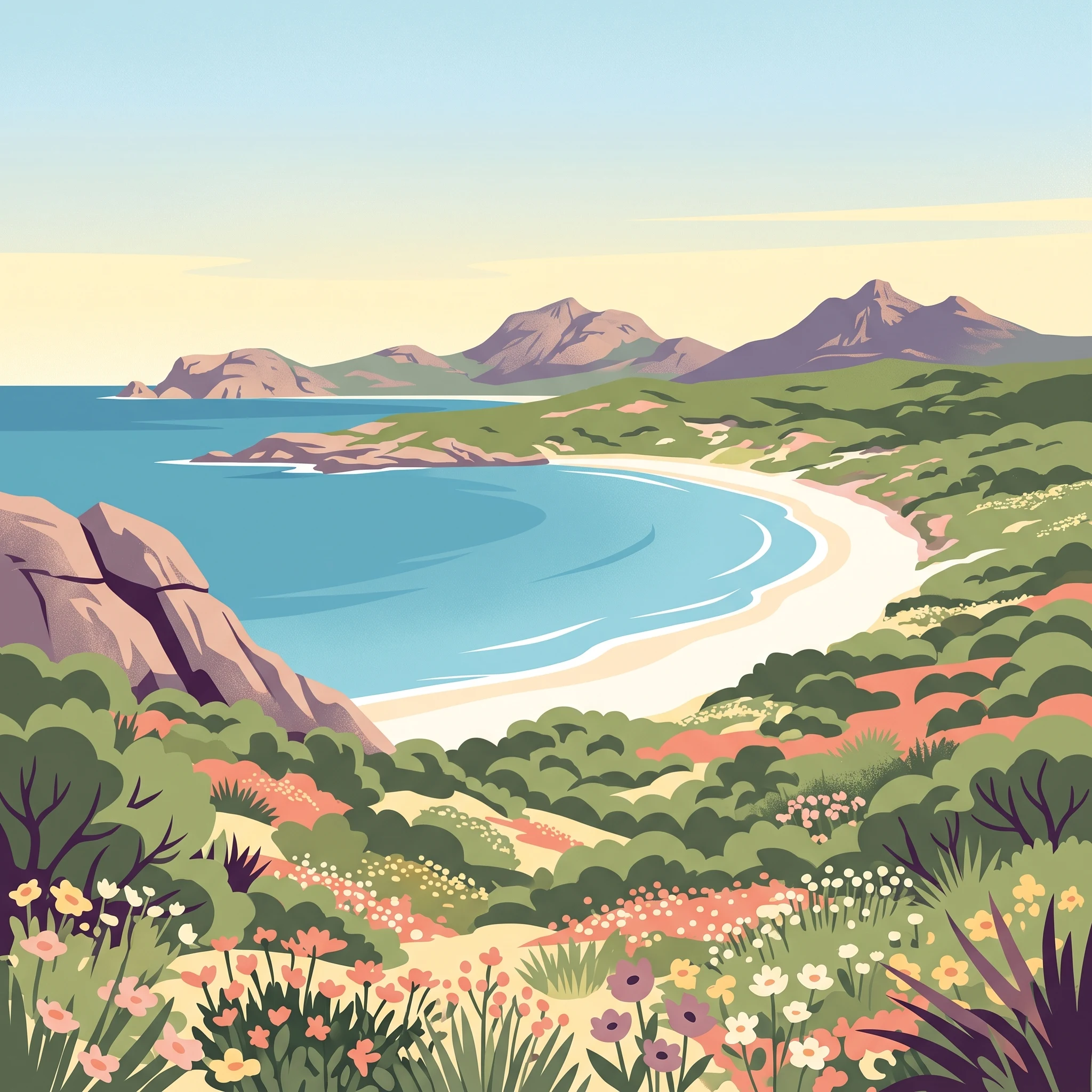
Cape Le Grand National Park represents one of Western Australia's most distinctive protected areas, where coastal drama meets deep geological time. Located along the state's far southern coast, the park stretches from the granite headlands of the cape itself across to the inland heathlands and freshwater systems that characterize the interior. The landscape tells a story of extraordinary stability: while much of Australia's coastline has been reshaped by sea level changes and tectonic activity over the past 200 million years, this area has remained continuously above the ocean, providing a stable platform for evolution and the persistence of ancient species lineages. The granite peaks that dominate the southwestern section of the park, including Mount Le Grand, Frenchman Peak, and Mississippi Hill, are composed of ancient metamorphic and igneous rocks that have been exposed by erosion over geological epochs. These peaks provide not only visual landmark status but also shelter and habitat diversity for the park's fauna. The coastline is characterized by contrasts: the dramatic rocky shores give way to sweeping white sand beaches such as Lucky Bay and Rossiter Bay, where visitors experience the turquoise waters of the Southern Ocean. The park lies adjacent to the Recherche Archipelago, a chain of islands and surrounding waters protected as a nature reserve, creating a broader coastal conservation context that extends protection into the marine environment.

Quick facts and research context for Cape Le Grand National Park

Cape Le Grand National Park covers 318 square kilometres along the southern coast of Western Australia. The park was formally established in 1966 and is managed by the state's Department of Parks and Wildlife. The park's name derives from an officer aboard L'Espérance, the French exploration vessel that charted this coast in 1792 under Bruni d'Entrecasteaux. The landscape is dominated by ancient granite formations, with Mount Le Grand reaching 345 metres above sea level and Frenchman Peak at 262 metres. The park's interior consists largely of heath-covered sandplain interspersed with freshwater swamps and pools. The coastal waters and islands south of the park fall within the Recherche Archipelago Nature Reserve, extending the protected area into the marine environment.

Park context

Deeper park guide and search-rich context for Cape Le Grand National Park

Cape Le Grand National Park history, landscape, wildlife, and travel context
Explore Cape Le Grand National Park through its history, landscape character, ecosystems, wildlife, conservation priorities, cultural context, and seasonal travel timing in a structured park guide built for atlas discovery and search intent.

Why Cape Le Grand National Park stands out

Cape Le Grand is best known for its exceptional combination of coastal scenery and geological significance. The park's white sand beaches, particularly Lucky Bay, rank among the most picturesque along the southern Australian coast, set against the backdrop of weathered granite headlands. However, it is the park's biological significance that sets it apart: the ancient, stable landscape has served as a refugium for relict species dating back millions of years. This includes legless lizards with clear Gondwanan evolutionary origins, endemic frog species, and ancient blind snakes. The dense banksia woodlands that cover the sandplains support a specialized fauna including honey possums, bandicoots, and western grey kangaroos, while the spring wildflower display adds seasonal colour to the heathlands.

Cape Le Grand National Park history and protected-area timeline

The establishment of Cape Le Grand National Park in 1966 reflected a growing recognition of the region's natural and scenic significance during the mid-twentieth century. Prior to formal protection, the area had been used for pastoral purposes and informal recreation, but increasing understanding of the region's geological and ecological importance spurred its designation as a national park. The name Le Grand itself carries historical weight, derived from an officer aboard L'Espérance, the French corvette that explored this coastline in 1792 during Bruni d'Entrecasteaux's expedition to search for the missing explorer La Pérouse. The French naming legacy persists in the landscape, with Frenchman Peak bearing testimony to the European charting of this coast over two centuries ago. Mississippi Hill, meanwhile, remembers the American whaling vessel that once operated in these waters. The park's management under the Department of Parks and Wildlife has evolved to balance visitor enjoyment with conservation imperatives, with two permanent rangers residing within the park to oversee both visitor facilities and resource management.

Cape Le Grand National Park landscape and geographic character

The physical character of Cape Le Grand National Park is defined by the interplay between ancient crystalline bedrock and the softer sands and heaths that mantle the terrain. The southwestern portion of the park is dominated by a chain of granite and gneiss peaks that rise abruptly from the surrounding plain, with Mount Le Grand reaching 345 metres as the highest point, followed by Frenchman Peak at 262 metres and Mississippi Hill at 180 metres. These granite outcrops create a distinctive skyline and provide sheltered microhabitats for specialized flora and fauna. Between the peaks, the landscape transitions into heath-covered sandplain that covers the vast majority of the park's interior. This sandplain, composed of deep sandy soils over the ancient bedrock, supports the dense banksia woodlands that are a defining visual element of the park. Interspersed through this heathland are numerous swamps and freshwater pools that provide critical habitat and water sources, especially during the dry summer months. The coastline presents a striking contrast: the坚硬的花岗岩悬崖让位于受保护的白色沙滩,如幸运湾、罗斯特湾和 Hellfire Bay,这些海滩是公园最受欢迎的游客目的地。

Cape Le Grand National Park ecosystems, habitats, and plant life

The ecological character of Cape Le Grand National Park is defined by its ancient, stable landscape and the suite of specialized species that have evolved or persisted here over millions of years. The park sits within a broader context of southwestern Australian biodiversity, one of the world's Mediterranean-climate biodiversity hotspots. The dominant vegetation on the sandplains consists of dense thickets of banksias, particularly Banksia speciosa and Banksia pulchella, which create a structurally complex habitat that supports diverse fauna. These banksia woodlands form what is locally called 'sclerophyllous' heath, adapted to the nutrient-poor sandy soils and seasonal drought. The wetlands and freshwater pools scattered through the park add ecological diversity, providing breeding habitat for frogs and waterbird species and serving as dry-season refuges for larger animals. The park's flora includes numerous species of Melaleuca, Grevillea, sheoak, and the spectacular Christmas tree (Nuytsia floribunda), while grass trees (Xanthorrhoea) add distinctive silhouettes to the heathland. The spring wildflower season, lasting from August through October, sees the heathland transformed by blooms including the blue china orchid (Cyanicula gemmata),Diuris corymbosa, Hakea laurina, and numerous other species.

Cape Le Grand National Park wildlife and species highlights

The fauna of Cape Le Grand National Park reflects both the park's Gondwanan heritage and the specialized adaptations required for life in the southwestern Australian heathlands. Among the park's most distinctive residents are several species of legless lizards that represent ancient lineages with clear evolutionary connections to the ancient supercontinent of Gondwana. The common scaly-foot (Pygopus lepidopodus), Delma fraseri, Delma australis, and Aprasia striolata are all found within the park, representing relict species that have persisted here while their relatives elsewhere have diversified or gone extinct. The ancient blind snake Ramphotyphlops australis adds another element of geological antiquity to the reptile fauna. Mammals commonly encountered include bandicoots, the tiny pygmy honey possum (one of Australia's smallest marsupials), ring-tailed possums, quenda, and the familiar western grey kangaroo that grazes the open areas. The park also supports a diversity of frogs, including endemic species such as the quacking frog (Crinia georgiana), the banjo frog (Limnodynastes dorsalis), and the humming frog (Neobatrachus pelobatoides). This combination of ancient relict species and more recent arrivals creates a fauna assemblage of considerable scientific and conservation interest.

Cape Le Grand National Park conservation status and protection priorities

Cape Le Grand National Park serves as a critical conservation unit within the broader network of southwestern Australian protected areas. The park's significance derives not from single flagship species but from the preservation of an entire ancient landscape and its suite of relict species, many of which are found nowhere else on Earth. The 200-million-year period of continuous terrestrial existence, combined with the absence of glaciation, has allowed this area to function as a evolutionary refugium, preserving species lineages that have disappeared from other parts of Australia. The banksia sandplains represent a distinct habitat type that has been significantly reduced by agricultural clearing across its former range, making the protected examples within the park increasingly valuable. The park also connects to broader conservation outcomes through its adjacency to the Recherche Archipelago Nature Reserve, creating a coastal and marine protection complex that spans from terrestrial heathlands through to island and oceanic ecosystems.

Cape Le Grand National Park cultural meaning and human context

While Cape Le Grand National Park is fundamentally defined by its natural values, the landscape carries evidence of Indigenous Australian occupation and use over thousands of years, though the Wikipedia source does not provide specific detail on this aspect. The post-European history of the area dates from the late eighteenth century when French explorer Bruni d'Entrecasteaux charted this coast in 1792, naming features including Cape Le Grand after officers aboard his vessels. The subsequent pastoral use of the region preceded the establishment of formal protection in 1966. The locality of Cape Le Grand shares almost identical boundaries with the national park, with only a small number of roads in the western portion falling within the locality but outside the park's official boundary.

Top sights and standout views in Cape Le Grand National Park

The granite peaks of Mount Le Grand and Frenchman Peak provide the park's most distinctive landmarks, offering panoramic views across the coast and heathland from their summits. Lucky Bay stands as the park's flagship beach destination, where white sand meets the clear blue waters of the Southern Ocean in a setting that ranks among Western Australia's most scenic coastal spots. The spring wildflower season transforms the heathland between August and October, with banksias, orchids, and numerous other species creating a kaleidoscope of colour across the sandplains. The park's population of Gondwanan relict species, including the legless lizards and ancient blind snakes, represents a living museum of evolutionary history. The Recherche Archipelago, visible from the park's southern beaches and accessible by boat, extends the adventure into island exploration within a protected marine environment.

Best time to visit Cape Le Grand National Park

The optimal time to experience Cape Le Grand National Park aligns with the southern Australian spring, from September through November, when wildflower blooms reach their peak across the heathland and weather conditions are generally mild and pleasant. The summer months of December through February bring warmer temperatures and more visitors, with the beaches providing popular relief from inland heat, though the park can become crowded during school holiday periods. Autumn and early winter offer quieter conditions and the opportunity to experience the park's landscapes in more solitude, though rainfall increases and some facilities may see reduced services. The park can be visited year-round, but those seeking the iconic wildflower display and comfortable hiking conditions should plan for the spring season, while those prioritising beach activities and swimming should consider the warmer summer months when water temperatures are highest.
Park location guide

Geography guide, regional context, and park location map for Cape Le Grand National Park

Cape Le Grand National Park park geography, regions, and map view in Australia
Understand where Cape Le Grand National Park sits in Australia through a broader geographic reading of the surrounding landscape, nearby location context, and its mapped position within the national park landscape.

How Cape Le Grand National Park fits into Australia

Australia is a constitutional monarchy and federal parliamentary democracy comprising six states and ten territories. With a population of nearly 28 million, it is one of the world's most urbanised countries, with most people concentrated on the eastern seaboard. The country has a high Human Development Index and is known for its cultural diversity, ancient Aboriginal heritage, and unique wildlife.

Wider geography shaping Cape Le Grand National Park in Australia

Australia occupies the entire Australian continent, the island of Tasmania, and numerous smaller islands. It is the world's flattest and driest inhabited continent, featuring vast deserts in the interior (the Outback), tropical rainforests along the eastern coast, and a coastline bordering the Indian and Pacific Oceans.

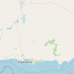
Map view of Cape Le Grand National Park

Use this park location map to pinpoint Cape Le Grand National Park in Australia, understand its exact geographic position, and read its mapped placement within the surrounding landscape more clearly.

Pigeon | © OpenStreetMap contributors

Location context for Cape Le Grand National Park

Western Australia
Park atlas

Trace the protected landscapes of Western Australia, comparing regional park geography and conservation zones near Cape Le Grand National Park.

Explore Coastal National Parks and Protected Areas Near Cape Le Grand National Park
After exploring Cape Le Grand National Park's ancient coastal geology and unique relict species, discover other national parks and protected areas across Western Australia and its surrounding regions. Use this geographic overview to compare diverse landscapes, from further granite headlands to expansive heathlands, enhancing your atlas-style understanding of protected conservation areas.
National parkWestern Australia

Stokes National Park National Park: Mapped Boundaries and Regional Geography

Western Australia's protected landscape identity.

Stokes National Park represents a significant protected entity within the expansive geography of Western Australia. This detailed page provides users with essential mapping information, focusing on the park's designated boundaries and its role within the broader atlas of Australian conservation landscapes. Explore the specific geographic context that defines this national park and understand its natural landscape features.

Area
97.26 km²
Established
1976
IUCN
II
Relief
Lowland
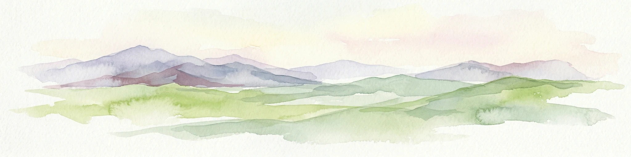
Watercolor painting of green rolling hills and purple mountains under a pastel sky
National parkWestern Australia

Cape Arid National Park: A National Park Atlas Entry for Western Australia's Coast

Explore its mapped terrain and protected landscape identity.

Cape Arid National Park, located in Western Australia, is a substantial protected area notable for its striking coastal geography. This national park features a dramatic intersection of the Southern Ocean coastline with ancient granite landforms and low hills, creating a diverse mapped terrain. Its significance extends to being a key habitat for numerous bird species, making it a critical component of the regional protected-area network and a valuable point of study within the broader geographic atlas.

Area
2,794.46 km²
Established
1969
IUCN
II
Relief
Mixed relief
National parkWestern Australia

Peak Charles National Park: A National Park in Western Australia's Mapped Landscape

Discover its protected area status and geographic setting.

Peak Charles National Park is a vital component of Western Australia's protected natural areas. This dedicated page provides an atlas-centric view, focusing on the park's geographic scope, its mapped boundaries, and the surrounding regional landscape context. It serves as an essential resource for understanding the park's protected land identity and its contribution to the broader geography of Western Australia.

Area
399.59 km²
Established
1979
IUCN
II
Relief
Mountain
National parkWestern Australia

Frank Hann National Park: Explore Its Protected Area Geography and Mapped Boundaries

Western Australia's protected national park landscape.

Frank Hann National Park is a designated national park providing crucial insight into Western Australia's protected natural landscapes. This entry focuses on its precise geographic scope and mapped boundaries, allowing for detailed atlas-based exploration. Understand the park's identity as a protected area and its position within the broader regional geography of this large Australian state, ideal for focused landscape discovery.

Area
675.5 km²
Established
1970
IUCN
II
Relief
Lowland
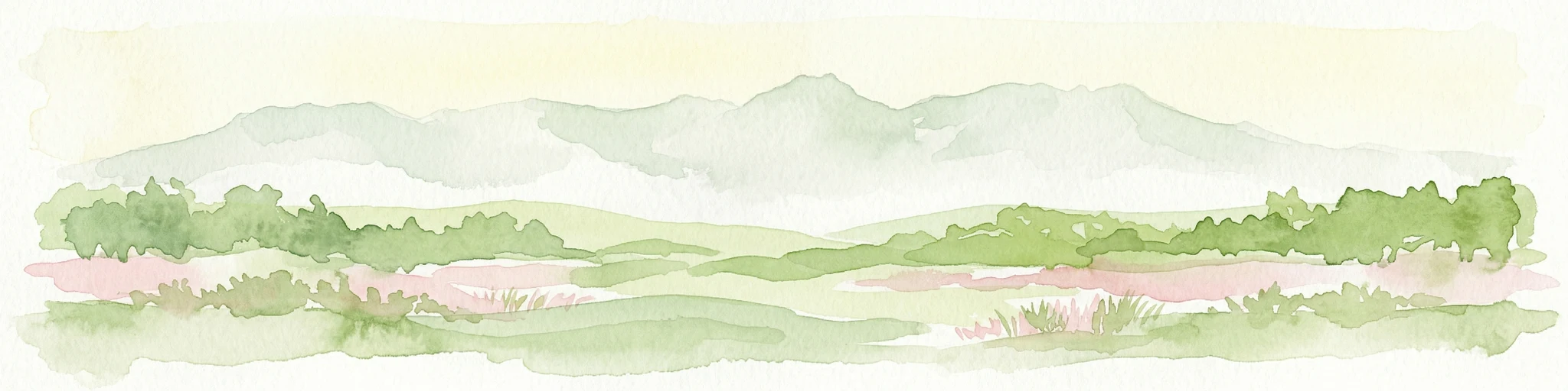
Watercolor illustration showing mountains in the background, green vegetation, and pink meadows
National parkWestern Australia

Fitzgerald River National Park: A Western Australian Protected Landscape of Global Botanical Importance

Discover its mapped terrain, endemic flora, and UNESCO Biosphere Reserve status.

Fitzgerald River National Park stands as a protected landscape of immense ecological value in Western Australia. This national park is celebrated for its extraordinary botanical diversity, featuring more endemic plant species than any other conservation reserve in Australia. Its varied terrain, from rugged mountain ranges to coastal cliffs, provides a rich tapestry of natural habitats. As a designated UNESCO Biosphere Reserve, it offers a unique opportunity to explore mapped geographic features and understand the critical role of protected areas in conserving rare flora and distinct Mediterranean ecosystems.

Area
2,972.11 km²
Established
1973
IUCN
II
Visitors
40K annual
National parkGoldfields-Esperance

Goldfields Woodlands National Park: Explore Protected Area Geography and Mapped Boundaries

Discover the mapped landscape context of this national park.

Delve into Goldfields Woodlands National Park, a key protected area within the Goldfields-Esperance region. This resource provides detailed atlas-style information, focusing on the park's mapped geography, its protected status, and its role within the broader regional landscape. Understand its specific topographic features and its place in the natural atlas.

Area
646.28 km²
Established
2000
Climate
Arid
Scope
Terrestrial
National parkWestern Australia

Boorabbin National Park: Exploring Western Australia's National Park Landscape and Boundaries

Mapped protected area context within Western Australia's geography.

Boorabbin National Park represents a distinct protected landscape within the expansive geography of Western Australia. This entry provides focused insight into the park's identity as a national park, highlighting its specific mapped boundaries and its contribution to the regional atlas of protected areas. Understanding Boorabbin National Park's geographic setting allows for a deeper appreciation of Western Australia's natural terrain and conservation efforts.

Area
281.53 km²
Established
1977
IUCN
II
Relief
Upland
National parkWestern Australia

Hassell National Park National Park: Mapped Protected Landscape in Western Australia

Explore the geographic identity and park boundaries of Hassell National Park.

Hassell National Park offers a focused view of protected natural landscapes within Western Australia. This atlas entry details the park's specific geographic scope and its designation as a national park, providing essential context for understanding its mapped features and regional landscape. Explore how Hassell National Park contributes to the protected area geography of the state.

Area
12.65 km²
Established
1971
IUCN
II
Scope
Mixed

Common questions about visiting, size, designation, and location context for Cape Le Grand National Park

Cape Le Grand National Park FAQs for park facts, access, geography, and protected area context
Find quick answers about Cape Le Grand National Park, including protected-area facts, park geography, trail and visitor context, and how the park fits into its surrounding country and regional landscape.
MoriAtlas Explorer

Continue Your Protected Areas Search Across the Global Atlas

Deepen your exploration by continuing the structured search for national parks and protected areas worldwide. Utilize the comprehensive filtering capabilities to compare different conservation landscapes and refine your understanding of global park geography. Discover more about the distribution and characteristics of protected natural areas.

Global natural geography