Mori Atlas logo
Park earthquake history

Review recorded seismic events, epicentre distances, and magnitude data for this coastal region

Historical Earthquake Records Associated with Cape Rodney-Okakari Point Marine Reserve

Access a structured catalogue of documented earthquakes occurring in the vicinity of Cape Rodney-Okakari Point Marine Reserve. This record provides geographical data for seismic events identified by their proximity to the protected marine waters of the North Island. Each entry includes chronological event details, magnitude measurements, and depth data to support better understanding of the local seismic record, reflecting historical activity independent of current landscape safety or hazard status.

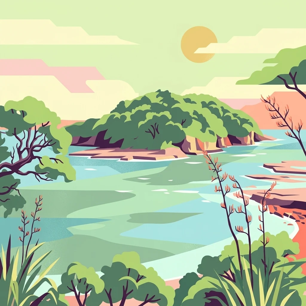
Stylized digital illustration of a coastal bay with an island, lush vegetation, and rocky shorelines under a pale sun.

New Zealand's first marine reserve, protecting a rich tapestry of coastal marine life near Leigh on the North Island.

Cape Rodney-Okakari Point Marine Reserve

Cape Rodney-Okakari Point Marine Reserve is a protected marine area on the North Island of New Zealand, covering 547 hectares along the coastline between Cape Rodney and Okakari Point, and extending roughly 800 metres offshore. Created in 1975, it was the first marine reserve established in New Zealand and remains one of the country's most visited marine protected areas. The reserve encompasses a striking variety of coastal environments, including rocky headlands, white sand surf beaches, sheltered mudflats, mangrove forests, and offshore waters around the small island of Te Hāwere-a-Maki, also known as Goat Island. The reserve is widely recognised for the abundance and diversity of marine life found within its boundaries, a transformation that has occurred since fishing and the removal of marine life were prohibited. Before protection, decades of over-harvesting had left the seafloor dominated by sea urchins, sometimes called kina barrens, with depleted populations of predatory species such as rock lobster and snapper. After more than three decades of recovery, the reserve today supports thriving fish populations, kelp forests, sponge gardens, and a wide range of intertidal invertebrates, drawing snorkellers, divers, kayakers, and marine scientists from across the country. Beyond its ecological importance, the reserve carries strong cultural significance. Te Hāwere-a-Maki is central to the identity and whakapapa of Ngāti Manuhiri, the local iwi, and the area has been important to Māori for centuries before it became a focus of European settlement, scientific research, and public recreation.

Location
New Zealand
Park type
Marine protected area
Established
1975
Area
5.5 km²
Cape Rodney-Okakari Point Marine Reserve Atlas

Review Cape Rodney-Okakari Point Marine Reserve event details and distances

Earthquake records near Cape Rodney-Okakari Point Marine Reserve

Cape Rodney-Okakari Point Marine Reserve’s earthquake association comes from reported epicentre geography and calculated distance, which does not prove that each event occurred within its protected waters. Every result preserves the event time, magnitude, depth, reported locality, reserve separation, and source link for historical study without asserting reef effects, causation, present danger, or future conditions.

Sort by
Magnitude
Location

This page describes catalogued earthquakes associated with the park by epicentre location and distance. It does not establish causation, assess current danger, or predict future earthquakes.

No earthquake records match the current filters

Park atlas

Continue beyond Cape Rodney-Okakari Point Marine Reserve earthquake records

Other parks after Cape Rodney-Okakari Point Marine Reserve

Cape Rodney-Okakari Point Marine Reserve's earthquake catalogue closes before discovery broadens from its New Zealand rocky shore, kelp forest, and protected marine setting to other destinations. The following pages do not imply shared marine-reserve status, habitat, proximity, geology, seismic observations, hazards, risk, recreation, or comparable documentation.
Regional parkAuckland Region
10 km away#1 closest

Northwest

Te Ārai Regional Park: Mapping Coastal Dune Systems and Protected Geography in Auckland

A protected coastal landscape featuring expansive dune systems and northern headlands.

Te Ārai Regional Park sits as a major protected coastal area on the northern edge of the Auckland Region. Its primary defining feature is an expansive system of sand dunes that anchor a diverse coastal environment. Extending southward toward Poutawa Stream and bordered by the Mangawhai Forest, the park represents a critical geography for endangered species breeding and provides a distinct topographic profile along the North Island coast.

Established
2008
Relief
Lowland
Climate
Subtropical
Access
Easy access
A soft watercolor illustration showing the low-lying shape of Motuora Island surrounded by calm water, with a distant hilly coastline in the background.
Nature reserveNorth Island
About 25 km away#2 closest

South

Motuora Nature Reserve: Protected Coastal Island Geography and Restoration Map

Predator-free ecological sanctuary in the Hauraki Gulf

Motuora occupies a key position in the Hauraki Gulf, offering a well-mapped look at coastal island restoration in New Zealand. This protected area features a regenerated forest interior and cliff-edged terrain, serving as an important mainland-island site for avian conservation, including kiwi and petrel colonies.

Area
0.8 km²
Established
1965
Relief
Lowland
Climate
Subtropical
Regional parkAuckland Region
28 km away#3 closest

South

Te Muri Regional Park: Mapped Coastal Peninsula and Estuarine Geography in Auckland

Protected native forest and tidal estuary landscapes

Te Muri Regional Park presents a unique peninsular landscape situated between the Puhoi River and Te Muri O Tarariki Stream in Auckland. This protected area showcases a complex interface between native coastal forest and tidal ecosystems, offering clear mapped boundaries that connect to the wider Hauraki Gulf coastal belt. Explore the topographical transition from sea level estuaries to rolling hill country.

Area
4.44 km²
Established
2010
Relief
Upland
Scope
Terrestrial
Regional parkAuckland Region
29 km away#4 closest

South

Wenderholm Regional Park: Coastal Forest and Estuary Geography in the Auckland Region

Mapped protected landscapes of a coastal New Zealand peninsula

Situated on a narrow peninsula north of Auckland, Wenderholm Regional Park offers a compact study in diverse coastal terrain. The park encompasses the forested Maungatauhoro headland, the tidal Puhoi sandspit, and riverine boundaries that create a distinct protected environment. Since its 1965 founding, the area has become a haven for native bird restoration and coastal vegetation, providing a unique vantage point across the Hauraki Gulf.

Area
1.35 km²
Established
1965
Relief
Mixed relief
Climate
Temperate
A watercolor illustration of a soft green hilly landscape with distant peaks against a white background.
Nature reserveNew Zealand
About 36 km away#5 closest

North

Hen and Chicken Islands Nature Reserve: Mapped Geography and Protected Island Terrain

Archipelago sanctuary and volcanic landscape offshore of New Zealand

Explore the geographic structure of the Hen and Chicken Islands, an uninhabited nature reserve that serves as a vital predator-free sanctuary. The archipelago displays varied volcanic terrain, from the dramatic central ridge of Hen Island to the rugged rocky reefs of the Marotiri islets, offering a clear window into the ecological conservation landscapes of the Northland region.

Area
8.44 km²
Established
1908
Relief
Highland
Climate
Subtropical
Regional parkAuckland Region
51 km away#6 closest

Southwest

Te Rau Pūriri Regional Park: Geography and Protected Land Overview for Auckland Region

Coastal harbour landscape and native forest recovery zones

Te Rau Pūriri Regional Park occupies a strategic position on the South Kaipara Head, serving as a protected corridor between agricultural land and the expansive Kaipara Harbour. The park serves as an atlas-worthy example of ecological transition, featuring sandy bays, eucalyptus stands, and native pūriri forests that provide habitat stability within the wider Auckland coastal geography.

Area
2.49 km²
Established
2006
Relief
Lowland
Climate
Temperate
A horizontal watercolor painting of a coastal island landscape with rolling green hills, pale distant mountains, and coastal greenery.
Wildlife reserveAuckland
About 60 km away#7 closest

South

Motuihe Island Wildlife Reserve: Protected Landscapes and Hauraki Gulf Geography

Ecological restoration and coastal island history near Auckland

Motuihe Island represents a significant case study in island conservation, featuring intensive native forest regeneration and successful wildlife reintroduction. The mapped landscape details an elongated island geography defined by coastal beaches, sandstone terrain, and rich archaeological layers, serving as a prominent protected reserve for the Auckland region.

Area
1.79 km²
Relief
Lowland
Climate
Subtropical
Access
Moderate access
A watercolor painting showing soft green hills rising above a light blue body of water, with a small patch of reddish-brown land visible in the foreground.
Protected areaAuckland Region
About 63 km away#8 closest

East

Rakitu Island Protected Area: Volcanic Geography and Coastal Landscapes in the Hauraki Gulf

A protected offshore sanctuary near Great Barrier Island

Rakitu Island is an uninhabited 253-hectare protected area that represents a distinct volcanic landscape off the northeast coast of New Zealand. Formed from eroded rhyolite domes, the island features high coastal cliffs and a central valley that now supports native forest regrowth. This predator-free sanctuary offers an essential map perspective on small-scale island conservation and rugged maritime terrain.

Area
2.5 km²
Established
1994
Relief
Upland
Scope
Terrestrial
MoriAtlas Explorer

Continue Exploring Cape Rodney-Okakari Point Marine Reserve Geography

Access deeper insights into the marine protected area boundaries and coastal features of Cape Rodney-Okakari Point Marine Reserve through the MoriAtlas collection. Examine the unique interplay between rocky shorelines and offshore habitats that define this pioneering site in the New Zealand marine landscape.