Why Capiro Calentura National Park stands out
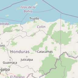
Capiro Calentura National Park is known primarily for its protection of tropical forest ecosystems in Honduras's northern Caribbean coastal region. The park preserves significant tracts of moist tropical forest within the Colón Department, an area recognized for its biodiversity and ecological importance within Central America. Its location near the historic port city of Trujillo gives it added regional significance as both a natural and cultural landmark in Honduras's Caribbean zone.
Capiro Calentura National Park history and protected-area timeline
Capiro Calentura National Park was established in 1992 through official governmental action designating the area as a protected national park. This designation came during a period when Honduras was expanding its protected areas network to include representative examples of the country's major ecological zones. The creation of the park reflected growing recognition of the need to conserve tropical forest ecosystems in the Caribbean lowland regions, which had faced increasing pressure from agricultural expansion and logging. The park's name, Capiro Calentura, appears to derive from local geographic terminology, though the precise linguistic origins of these terms are not extensively documented in available sources. The selection of the area for national park status acknowledged both its ecological values and its landscape significance within the Colón Department.
Capiro Calentura National Park landscape and geographic character
The landscape of Capiro Calentura National Park is characterized by tropical forest terrain typical of Honduras's Caribbean lowland regions. The park sits at relatively low elevations, consistent with its coastal proximity in the Colón Department. The terrain supports dense vegetation cover dominated by tropical tree species, with the forest canopy creating a layered landscape of remarkable green density. The area's proximity to the Caribbean Sea influences its overall character, with moisture-laden air from the ocean contributing to the lush, humid conditions that sustain the forest ecosystem. The broader region around Trujillo features a mix of coastal lowlands and rolling terrain, with the park's interior areas representing the more heavily forested portions of this landscape.
Capiro Calentura National Park ecosystems, habitats, and plant life
The nature of Capiro Calentura National Park centers on its tropical forest ecosystems, which represent a significant portion of Honduras's remaining lowland forest cover. The park occupies a position within the Mesoamerican biodiversity hotspot, a region recognized globally for its extraordinary species richness and endemism. The tropical moist forest conditions support diverse plant communities, with multiple canopy layers creating complex habitat structures. The moisture regime, influenced by the nearby Caribbean Sea, sustains vegetation types that require high humidity and consistent rainfall patterns. These forest ecosystems provide critical habitat for numerous species and contribute to broader ecological processes across the Central American isthmus.
Capiro Calentura National Park wildlife and species highlights
While specific wildlife details are not extensively documented in available sources, the park's tropical forest environment supports diverse animal communities typical of Honduras's Caribbean lowlands. The broader Colón Department region is known to harbor numerous bird species, mammals, and reptiles associated with tropical forest habitats. The park's protected status provides refuge for wildlife in a region where habitat loss has reduced forest cover in surrounding areas. The Mesoamerican region as a whole is recognized for its exceptional bird diversity, and similar protected areas in comparable habitats often support significant avian populations.
Capiro Calentura National Park conservation status and protection priorities
Capiro Calentura National Park functions as an IUCN Category II protected area, reflecting its primary designation as a national park with conservation as a core objective. The park protects significant tropical forest ecosystems in a region that has experienced considerable land-use change in recent decades. Conservation of this area helps maintain ecological connectivity within the broader Caribbean lowland landscape of Honduras. The park contributes to national efforts to preserve representative samples of the country's diverse ecosystem types, with particular emphasis on the moist tropical forests characteristic of the Caribbean coastal region.
Capiro Calentura National Park cultural meaning and human context
The park is situated near Trujillo, one of Honduras's oldest colonial settlements and a city with significant historical importance in Central America. The broader Caribbean coast of Honduras has a complex cultural history involving indigenous peoples, Spanish colonization, and later development patterns. The region around Trujillo was among the first areas explored by European arrivals to Central America, giving the surrounding landscape historical resonance beyond its ecological values. While the park itself does not contain major documented archaeological sites, its location within this historically significant region connects it to broader narratives of Honduran cultural heritage.
Top sights and standout views in Capiro Calentura National Park
Capiro Calentura National Park offers visitors access to intact tropical forest environments in Honduras's Caribbean coastal region. The park provides opportunities to experience the natural landscapes that characterize the Colón Department, with forest-covered terrain and the tropical atmosphere typical of this part of Central America. The proximity to Trujillo allows visitors to combine exploration of the park with appreciation of the region's colonial heritage, creating a destination that offers both natural and cultural experiences. The park represents one of the designated protected areas through which Honduras maintains its commitment to tropical forest conservation.
Best time to visit Capiro Calentura National Park
The park can be visited throughout the year, though visitors should anticipate the tropical climate conditions characteristic of Honduras's Caribbean coast. The region experiences consistently warm temperatures and high humidity regardless of season. The wettest period typically occurs during the latter portion of the year, while the dry season often brings somewhat reduced rainfall but maintains the humid conditions typical of tropical environments. Visitors interested in wildlife observation may find the drier months offer slightly better conditions for spotting animals in more open areas, though tropical forest environments maintain their biodiversity appeal year-round.