Mori Atlas logo
National parkCarrasco National Park

Discover the geographic context and protected area boundaries of this Bolivian national park.

Carrasco National Park: Mapped Protected Landscape and Regional Geography in Cochabamba

Carrasco National Park stands as a significant protected area within Bolivia, located in the Cochabamba Department. This page provides detailed geographic context, helping you understand the park's mapped boundaries and its role as a national park. Explore its unique landscape identity and discover its place within the broader regional geography, offering an atlas-style perspective on this vital conservation area.

National ParkYungas EcoregionCloud ForestMountain LandscapeBiodiversity HotspotProtected Area

Carrasco National Park

National park

Park overview

Structured park overview, official facts, and landscape profile for Carrasco National Park

Carrasco National Park park facts, protected area profile, and essential visitor context
Review the core facts for Carrasco National Park, including designation, size, terrain, visitor scale, habitats, and operating context in one park-focused overview.

About Carrasco National Park

Carrasco National Park occupies a pivotal position in Bolivia's protected area network, safeguarding one of the nation's most ecologically valuable and biologically diverse landscapes. The park is situated in the eastern portion of Cochabamba Department, extending across the provinces of Carrasco, Tiraque, and Chapare, in a region where the Andes Mountains transition into the Amazon basin. This geographic position creates a complex mosaic of habitats, from cloud forest-covered ridges to humid foothill forests in the lower elevations. The park's terrain is dominated by mountainous topography, with deep river valleys cutting through the landscape and numerous waterfalls marking where tributaries descend from the highland slopes. More than 5,000 plant species have been recorded within the park's boundaries, a figure that reflects the exceptional botanical richness of the Yungas ecoregion. The park was established as a strict protected area, with human settlement prohibited throughout its extent, allowing the ecosystem to function with minimal human interference. This protection has preserved not only the forest cover but also the ecological processes that sustain the region's remarkable diversity of flora and fauna.

Quick facts and research context for Carrasco National Park

Carrasco National Park covers 622,600 hectares in eastern Bolivia, making it one of the country's largest protected areas. The park lies within the Bolivian Yungas ecoregion, a biodiversity hotspot spanning the eastern slopes of the Andes. It was officially established on October 11, 1991, and is managed by Bolivia's National Service of Protected Areas. The park spans three provinces: Carrasco, Tiraque, and Chapare, encompassing elevations from the Andean foothills down into the Amazon transition zone. More than 5,000 plant species have been documented within the park, placing it among Bolivia's most botanically rich regions.

Park context

Deeper park guide and search-rich context for Carrasco National Park

Carrasco National Park history, landscape, wildlife, and travel context
Explore Carrasco National Park through its history, landscape character, ecosystems, wildlife, conservation priorities, cultural context, and seasonal travel timing in a structured park guide built for atlas discovery and search intent.

Why Carrasco National Park stands out

Carrasco National Park is best known for its exceptional biodiversity within the Bolivian Yungas, a globally significant ecoregion that serves as a critical transition zone between Andean cloud forests and Amazonian lowlands. The park protects extensive old-growth forests with towering trees, epiphytes, and a remarkable concentration of endemic species. Its dramatic mountainous landscape, characterized by steep canyons carved by rushing rivers and numerous waterfalls, creates one of the most visually striking protected areas in Bolivia. The park's strict protection status has preserved populations of endangered wildlife and plant species that depend on the intact forest ecosystem.

Carrasco National Park history and protected-area timeline

Carrasco National Park was established on October 11, 1991, when the Bolivian government designated this expansive mountain forest area as a national park under the national protected areas system. The creation of the park reflected Bolivia's growing commitment to conserving its exceptional biodiversity during the late 20th century, as scientists and conservationists recognized the global significance of the Yungas ecoregion. The park was placed under the administration of SERNAP (Servicio Nacional de Áreas Protegidas), the national body responsible for managing Bolivia's protected areas. The establishment of Carrasco as a strict protection zone, prohibiting settlement within its boundaries, represented a deliberate choice to prioritize ecological integrity over human use, recognizing that the region's biodiversity required the maintenance of intact, functioning ecosystems.

Carrasco National Park landscape and geographic character

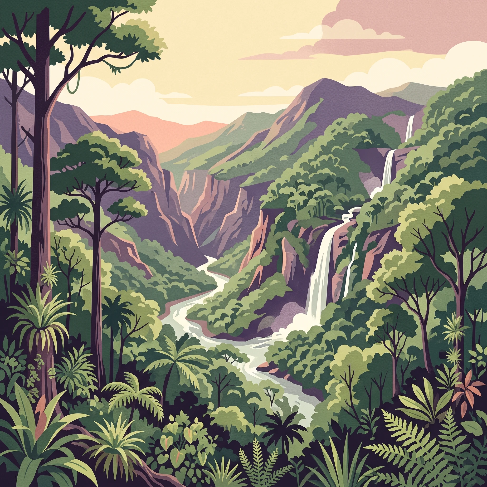
The landscape of Carrasco National Park is characterized by dramatic mountainous terrain that forms part of the eastern Andean foothills descending toward the Amazon basin. The park encompasses a complex topography of steep ridges, broad valleys, and deep canyons carved over millennia by rivers flowing from the highlands. Numerous streams and rivers cascade down the slopes, creating waterfalls that are among the park's most distinctive visual features. The terrain ranges from gentle valley floors where rivers have deposited sediments to steep canyon walls where the forest clings to rocky outcrops. The forest cover is continuous and dense, with the vegetation responding to the moisture patterns created by the interaction of moist Amazonian air masses with the mountain barriers. The elevation range within the park supports different forest types, from cloud forest at higher elevations to more humid subtropical forests in the lower foothills.

Carrasco National Park ecosystems, habitats, and plant life

Carrasco National Park protects one of Bolivia's most ecologically significant regions, the Bolivian Yungas, which forms part of a biodiversity hotspot extending along the eastern slopes of the Andes. The park's exceptional plant species richness, with more than 5,000 species documented, reflects the complex environmental gradients created by the transition between Andean and Amazonian ecosystems. The Yungas region receives moisture-laden winds from the Amazon, which condenses as cloud forest on the mountain slopes, supporting lush vegetation characterized by abundant epiphytes, ferns, and understory plants. The park's forests contain numerous tree species, some reaching impressive heights, creating a multi-layered canopy structure. This vegetation supports the diverse animal life that depends on the intact forest ecosystem, from large mammals to countless bird and invertebrate species.

Carrasco National Park wildlife and species highlights

The wildlife of Carrasco National Park is intimately tied to the health of the Yungas forest ecosystem, which provides habitat for a remarkable diversity of animal species. The dense forest harbors numerous mammal species that depend on the continuous canopy and the resources provided by the old-growth trees. Birdlife is particularly diverse, as the Yungas region serves as a critical area for both resident tropical species and migratory birds moving between the Andes and the Amazon. The park's rivers and streams support aquatic ecosystems that include fish species adapted to the fast-flowing mountain waters. The protection of this extensive forest area is particularly important for species that require large, unfragmented habitats to maintain viable populations, as the park's strict protection status helps ensure the continuity of these ecological processes.

Carrasco National Park conservation status and protection priorities

Carrasco National Park represents a cornerstone of Bolivia's conservation strategy for the Yungas ecoregion, one of the most biodiverse regions in South America. The park's strict protection status, which prohibits human settlement within its boundaries, reflects a management approach that prioritizes ecosystem integrity and biodiversity preservation over other uses. The protection of this extensive mountain forest area helps maintain ecological processes that are essential for regional biodiversity, including watershed function, nutrient cycling, and species migration corridors. The park's biodiversity, with more than 5,000 plant species recorded, positions it among Bolivia's most important areas for botanical conservation. The Yungas ecoregion faces pressures from agricultural expansion and deforestation in many areas, making protected areas like Carrasco critical for maintaining forest cover and the ecological services these ecosystems provide.

Carrasco National Park cultural meaning and human context

Carrasco National Park is located in a region historically inhabited by indigenous communities whose traditional territories overlapped with the forest environments now protected within the park. The Yungas region has been home to various Quechua-speaking communities who have maintained connections to the land and its resources over generations. While the park's strict protection status prohibits settlement within its boundaries today, the broader region retains cultural traditions tied to the mountainous forest environment. The park's name honors the historical presence of these communities and the regional identity associated with the Yungas landscape.

Top sights and standout views in Carrasco National Park

Carrasco National Park stands out as one of Bolivia's largest and most ecologically significant protected areas, safeguarding an extensive portion of the Bolivian Yungas in a mountainous landscape of exceptional beauty. The park's more than 5,000 recorded plant species make it one of the most botanically diverse areas in Bolivia. Its landscape of rivers, waterfalls, valleys, and deep canyons creates dramatic scenery that distinguishes it from other protected areas. The strict protection status ensures the preservation of intact forest ecosystems in a region where such habitats are increasingly fragmented. The park protects critical habitat within a globally recognized biodiversity hotspot, making it important for both national and international conservation priorities.

Best time to visit Carrasco National Park

The optimal time to visit Carrasco National Park generally falls during the dry season from May to October, when rainfall is reduced and trails are more accessible for exploration. During this period, the park's landscape remains lush from the preceding rainy season while offering more favorable conditions for wildlife observation and photography. The Yungas region experiences year-round high humidity, and the cloud forest environment maintains its characteristic misty atmosphere regardless of the season. Visitors interested in experiencing the park's waterfalls may find the early wet season (November to April) particularly dramatic as water flow increases, though trail conditions can be more challenging during this period.
Park location guide

Geography guide, regional context, and park location map for Carrasco National Park

Carrasco National Park park geography, regions, and map view in Bolivia
Understand where Carrasco National Park sits in Bolivia through a broader geographic reading of the surrounding landscape, nearby location context, and its mapped position within the national park landscape.

How Carrasco National Park fits into Bolivia

Bolivia, officially the Plurinational State of Bolivia, is a landlocked country in central South America. It features diverse geography including the Andean mountain range, Amazonian plains, Gran Chaco, and the Pantanal wetland. The country has a population of approximately 11.4 million and is administratively divided into nine departments, with La Paz as the seat of government and Sucre as the constitutional capital.

Wider geography shaping Carrasco National Park in Bolivia

Bolivia is located in central South America, bordered by Brazil to the north and east, Paraguay to the southeast, Argentina to the south, Chile to the southwest, and Peru to the west. The country is divided between a western Andean region and tropical lowlands to the east and north. It includes the Amazonian plain, Gran Chaco, temperate valleys, the high-altitude Altiplano plateau, and part of the Pantanal wetland along its eastern border.

Map view of Carrasco National Park

Use this park location map to pinpoint Carrasco National Park in Bolivia, understand its exact geographic position, and read its mapped placement within the surrounding landscape more clearly.

Pigeon | © OpenStreetMap contributors

Location context for Carrasco National Park

Cochabamba Department
Park atlas

Trace the regional spread of protected areas, comparing similar mountain and Yungas ecoregion landscapes in Bolivia.

Discover Other National Parks and Protected Areas Near Carrasco National Park, Bolivia
Browse national parks and protected areas geographically connected to Carrasco National Park, exploring the dramatic mountain terrain and rich biodiversity of Bolivia's Yungas ecoregion. Comparing these adjacent protected landscapes offers a crucial atlas perspective on regional conservation efforts and diverse ecosystems across the Andean foothills.
National parkPotosí Department

Torotoro National Park: Paleontology and Karst Landscape Exploration in Bolivia

Discover prehistoric footprints within dramatic Andean canyon geography.

Torotoro National Park in the Potosí Department is a protected area distinguished by its rich paleontological significance and unique semi-arid mountain terrain. Featuring dramatic canyon systems plunging hundreds of meters deep, the park showcases thousands of Cretaceous dinosaur footprints alongside its complex karst topography, complete with caves and sinkholes, offering a profound glimpse into both ancient life and sculpted natural geography.

Area
165 km²
Established
1989
IUCN
II
Relief
Mountain
National parkSanta Cruz Department

Amboró National Park: Its Protected Area Identity and Geographic Context

Mapped boundaries and regional landscape details.

Amboró National Park is a designated national park situated within the Santa Cruz Department, Bolivia. This entry provides detailed insights into its protected landscape, focusing on its geographical significance and mapped boundaries. Users can explore how Amboró National Park fits into the broader regional geography, enhancing their understanding of conservation areas and mapped natural terrains for atlas-based research and discovery. Its specific location and protected status are crucial for understanding its ecological and geographic role.

Area
4,425 km²
Established
1984
IUCN
II
Relief
Mountain
Watercolor illustration showing a mountain range with green fields, a river, and soft pastel colors
National parkCochabamba Department

Tunari National Park: Protected Landscape Atlas and Geographic Context

Mapped boundaries within Cochabamba Department's geography.

Tunari National Park represents a vital protected landscape within the Cochabamba Department of Bolivia. This page offers an atlas-centric exploration of the park's geographic boundaries, its relationship to the surrounding regional terrain, and its significance as a national park. Delve into the mapped context of Tunari National Park to understand its protected area status and its contribution to Bolivia's diverse geography.

Area
3,090 km²
Established
1992
IUCN
II
Relief
Mountain
National parkBolivia

Isiboro Sécure National Park and Indigenous Territory: Bolivian Protected National Park Atlas

Mapped protected boundaries and regional landscape context.

Investigate Isiboro Sécure National Park and Indigenous Territory as a key protected national park within Bolivia's expansive geography. This resource offers detailed views of its mapped natural landscape and its regional significance as a protected area. Understand the park's geographic attributes and its contribution to the country's conservation atlas through structured map-based exploration.

Area
13,721.8 km²
Established
1965
IUCN
II
Relief
Mixed relief
National parkChuquisaca Department

Iñao National Park and Integrated Management Natural Area: Bolivia National Park and Protected Landscape

Explore the Serranía del Iñao's geography and conservation role.

Iñao National Park and Integrated Management Natural Area is a protected territory located within Chuquisaca Department, Bolivia, centered on the prominent Serranía del Iñao mountain range. This page offers detailed geographic context and an atlas perspective on the park's landscape, its role as a national park, and its contribution to regional conservation efforts in the Andean foothills.

Area
2,630.9 km²
Established
2004
IUCN
II
Scope
Terrestrial
National parkLa Paz Department

Cotapata National Park and Integrated Management Natural Area: A Protected Landscape in La Paz Department, Bolivia

Explore its mapped boundaries and regional geographic context.

Delve into the protected landscape identity of Cotapata National Park and Integrated Management Natural Area, situated within the La Paz Department of Bolivia. This entry provides essential geographic context, focusing on its mapped protected area status and its contribution to the regional landscape, ideal for atlas-based exploration and understanding Bolivia's conservation network.

Area
600 km²
Established
1993
IUCN
II
Scope
Terrestrial
National parkBolivia

Sajama National Park National Park: Bolivia's Mapped Protected Landscape for Geographic Exploration

Discover regional geography and mapped protected area context.

Sajama National Park represents a crucial protected area within the geography of Bolivia. This MoriAtlas entry focuses on its identity as a national park, detailing its mapped boundaries and its contribution to the regional atlas of protected lands. Understand the park's landscape context and its significance for geographic discovery within South America's diverse terrains.

Area
1,002 km²
Established
1939
IUCN
II
Relief
Mountain
National parkBolivia

Kaa-Iya del Gran Chaco National Park and Integrated Management Natural Area: Bolivia's National Park and Protected Landscape

Explore the mapped geography and regional natural landscape.

Kaa-Iya del Gran Chaco National Park and Integrated Management Natural Area stands as a crucial component of Bolivia's protected lands, offering a distinct entry point for exploring its natural geography. This page details the park's status as a national park and integrated management natural area, providing context for its mapped boundaries and its role within the country's diverse landscapes. Engage with structured information designed to illuminate the park's geographic setting and its significance for atlas-style exploration and understanding of Bolivia's protected areas.

Area
34,411.1 km²
Established
1995
Relief
Upland
Climate
Subtropical

Common questions about visiting, size, designation, and location context for Carrasco National Park

Carrasco National Park FAQs for park facts, access, geography, and protected area context
Find quick answers about Carrasco National Park, including protected-area facts, park geography, trail and visitor context, and how the park fits into its surrounding country and regional landscape.
MoriAtlas Explorer

Continue Your Protected Areas Search Across the Global Atlas

Deepen your exploration by continuing the structured search for national parks and protected areas worldwide. Utilize the comprehensive filtering capabilities to compare different conservation landscapes and refine your understanding of global park geography. Discover more about the distribution and characteristics of protected natural areas.

Global natural geography