
Mori Atlas logo
Wildlife reserveChandratal Wildlife Sanctuary

A crescent-shaped alpine ecosystem set within the rugged glacial terrain of Himachal Pradesh

Chandratal Wildlife Sanctuary: Mapping the High Altitude Geography of the Western Himalayas

Chandratal Wildlife Sanctuary protects a dramatic cold-arid landscape dominated by the iconic crescent-shaped Chandra Taal lake. Resting on the Samudra Tapu plateau at over 4,000 metres, this protected area features a striking glacial cirque, loose scree slopes, and seasonal alpine meadows. Use this geographic atlas to trace the sanctuary boundaries, understand its high-altitude ecosystem, and analyze the terrain of this remote Himalayan wilderness.

high-altitude lakealpine meadowsWestern HimalayaRamsar wetlandcold-arid ecosystemcrescent lake
A minimalist flat illustration showing a calm lake reflecting rugged mountains under a clear blue sky, with a small waterfall flowing into the lake and coniferous trees in the foreground.

Chandratal Wildlife Sanctuary

Wildlife reserve

Park overview

Structured park overview, official facts, and landscape profile for Chandratal Wildlife Sanctuary

Chandratal Wildlife Sanctuary park facts, protected area profile, and essential visitor context

Review the core facts for Chandratal Wildlife Sanctuary, including designation, size, terrain, visitor scale, habitats, and operating context in one park-focused overview.

About Chandratal Wildlife Sanctuary

Chandratal Wildlife Sanctuary occupies a striking niche in the Western Himalaya, encompassing the upper Chandra valley in the Lahul and Spiti district of Himachal Pradesh. The sanctuary takes its name from Chandra Taal, a high-altitude lake whose crescent outline gives the waterbody its poetic meaning, 'moon lake.' The lake is perched on the Samudra Tapu plateau, overlooking the Chandra River, one of the source streams of the much larger Chenab River system. At roughly 4,300 metres, the sanctuary exists in a cold, arid, and oxygen-thin environment where life has adapted to extreme conditions.

The terrain within the sanctuary is defined by contrasts. Scree-covered mountains rise sharply on one side of the lake, while a glacially carved cirque encloses it on the other. Vast alpine meadows extend around the waterbody, briefly carpeted each spring and early summer with hundreds of wildflower varieties. These meadows once supported extensive seasonal grazing by shepherd communities bringing large flocks from Kullu and Kangra, and that grazing history has left visible pressure on the grassland ecosystem.

Wildlife within the sanctuary is sparse but high in character. Cold-adapted mammals such as the Himalayan ibex, blue sheep (bharal), and red fox move across the rugged slopes, while predators including the elusive snow leopard roam the wider range. Birdlife is equally distinctive: golden eagles, kestrels, snow cocks, choughs, and chukors inhabit the cliffs and meadows, and migratory species such as the ruddy shelduck arrive at the lake during the warmer months. Together, these species represent a community finely tuned to the sanctuary's harsh climate, intense solar radiation, and thin air.

The sanctuary's significance extends beyond its scenic beauty. In 2005, the lake was formally designated as the Chandertal Wetland under the Ramsar Convention, placing it among an elite group of internationally recognized wetlands and underscoring the ecological value of protecting such a fragile high-altitude freshwater ecosystem. Despite its remoteness, the area has become a favorite destination for trekkers and campers crossing Kunzum Pass, and increasing tourism has introduced new pressures on a landscape once described as a pristine hidden paradise.

Quick facts and research context for Chandratal Wildlife Sanctuary

Chandratal Wildlife Sanctuary lies in the Lahaul Valley of Himachal Pradesh, deep in the Western Himalaya, and surrounds the high-altitude Chandra Taal lake at roughly 4,300 metres elevation. The lake has a surface area of about 0.49 square kilometres and sits on the Samudra Tapu plateau overlooking the Chandra River, a headwater of the Chenab. The lake was designated a Ramsar site under the name Chandertal Wetland on 8 November 2005, making it one of two high-altitude Ramsar wetlands in India. The sanctuary protects cold-arid alpine meadows, seasonal wildflower displays, and habitat for species such as snow leopard, Himalayan ibex, blue sheep, red fox, golden eagle, and ruddy shelduck. Access is seasonal, typically possible from late May to early October, with the lake frozen during winter months from December through March.

Protection and recognition

Documented terrestrial protection scope and official recognition details

Chandratal Wildlife Sanctuary Protection Status and Conservation Records

Chandratal Wildlife Sanctuary holds a recorded terrestrial protection scope within its designated natural habitat boundaries. Documented records compile available administration details and statutory conservation frameworks for this protected area.

Protection details

Protection scope
Terrestrial
Park context

Deeper park guide and search-rich context for Chandratal Wildlife Sanctuary

Chandratal Wildlife Sanctuary history, landscape, wildlife, and travel context

Explore Chandratal Wildlife Sanctuary through its history, landscape character, ecosystems, wildlife, conservation priorities, cultural context, and seasonal travel timing in a structured park guide built for atlas discovery and search intent.

Why Chandratal Wildlife Sanctuary stands out

Chandratal Wildlife Sanctuary is best known for protecting the dramatically crescent-shaped Chandra Taal, often called the 'moon lake,' which rests in a glacial cirque at over 4,000 metres elevation. The sanctuary is also recognized as a Ramsar wetland of international importance, highlighting its value as one of India's rare high-altitude lake ecosystems. Its other defining feature is the contrast between harsh, austere mountain surroundings and the brief but vivid burst of alpine life that appears each summer. Meadows explode with wildflowers, migratory birds such as the ruddy shelduck arrive on the water, and cold-adapted mammals like the Himalayan ibex and blue sheep range across the slopes, all within a landscape shaped by scree, cirque, and high plateau.
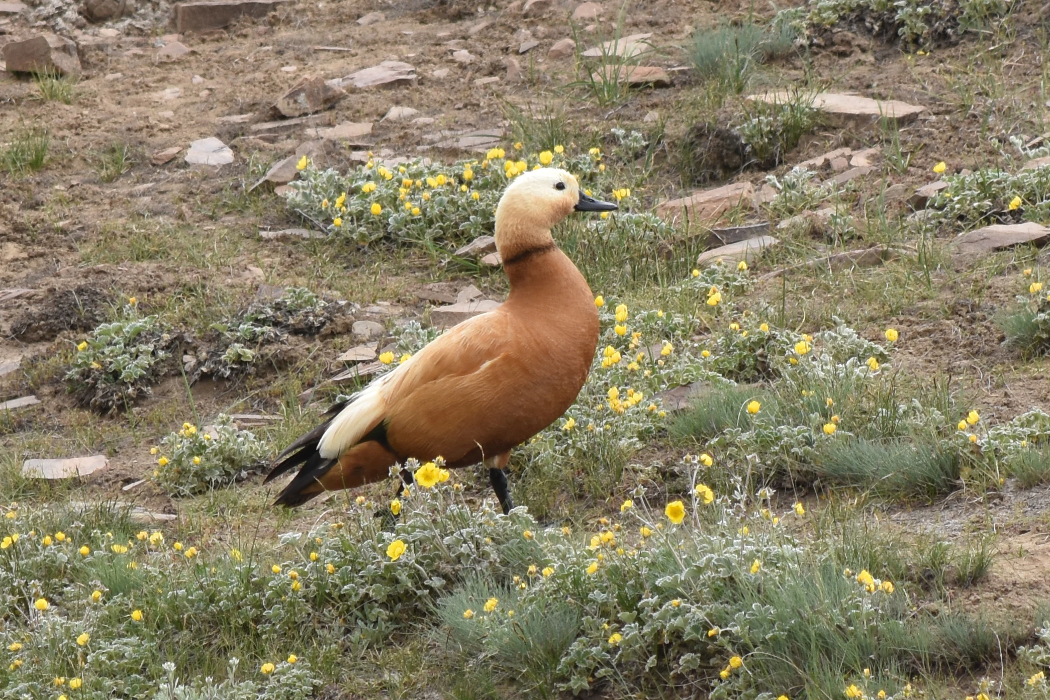
A Ruddy Shelduck with orange feathers and a light head standing on a rocky hillside covered with small yellow wildflowers.
A Ruddy Shelduck standing among alpine wildflowers in the high altitude meadows of Chandratal Wildlife Sanctuary.

Chandratal Wildlife Sanctuary history and protected-area timeline

The recorded history of Chandratal Wildlife Sanctuary is closely tied to the lake it protects and the wider patterns of pastoral land use in the Western Himalaya. In 1871, Harcourt, the Assistant Commissioner of Kullu, reported that a plain of good grass extended to the north of Chandra Taal, where shepherds brought large herds for seasonal grazing from the Kullu and Kangra districts. That historical grazing economy shaped the meadows around the lake for generations, though it also led over time to significant degradation of the grasslands.

Formal recognition of the area's ecological importance came much later. On 8 November 2005, the lake was officially designated as the Chandertal Wetland under the Ramsar Convention, becoming one of just two high-altitude wetlands in India to receive this international recognition. This designation established the framework for its modern protected status and helped frame the surrounding landscape as a sanctuary worthy of conservation attention.

In the decades since, the area has also acquired a growing reputation among trekkers and high-altitude tourists traveling the Manali-Kunzum-Spiti route. The rise of visitors has brought both economic interest and concern about the pressures that tourism can place on such a fragile, high-altitude environment.

Chandratal Wildlife Sanctuary landscape and geographic character

The landscape of Chandratal Wildlife Sanctuary is a textbook expression of high Himalayan geomorphology. The central feature is Chandra Taal itself, an elongated crescent lake stretching about 1.76 kilometres long and 0.41 kilometres wide, occupying a shallow basin at approximately 4,250 to 4,300 metres elevation. The lake's surface sits on the Samudra Tapu plateau, a high bench overlooking the deeply incised valley of the Chandra River below.

The surrounding terrain combines contrasting forms. On one side, steep mountains of loose scree rise above the lake, their barren flanks reflecting the cold-arid climate that limits soil and vegetation. On the other side, a glacially carved cirque wraps around the water in a sweeping arc, giving the lake its distinctive crescent shape and its evocative name. These landforms together create the visual drama that defines the sanctuary.

Around the lake, broad alpine meadows spread out across flatter ground. In late spring and summer, these meadows briefly transform into colorful wildflower carpets, a striking contrast to the otherwise austere, rocky, and snow-affected landscape that dominates much of the sanctuary's higher elevations. The combination of high plateau, cirque, scree, meadow, and a turquoise alpine lake makes the sanctuary one of the most visually distinctive protected areas in the Western Himalaya.
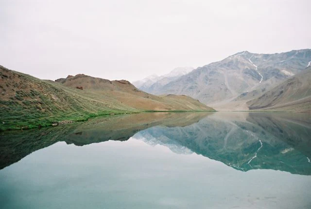
A wide, calm, turquoise high-altitude lake reflecting surrounding barren, rocky mountain slopes under an overcast sky.
The serene, turquoise waters of Chandra Taal lake reflecting the surrounding Himalayan landscape.

Chandratal Wildlife Sanctuary ecosystems, habitats, and plant life

Chandratal Wildlife Sanctuary protects a compact but ecologically rich slice of cold-arid Himalayan ecosystems. The dominant habitats are alpine meadows, scree slopes, rocky cirque walls, and the high-altitude freshwater lake itself, all existing under conditions of intense solar radiation, low oxygen, and long, severe winters.

Vegetation in the sanctuary is most visible and expressive during the short growing season. Vast meadows surrounding the lake bloom with hundreds of wildflower varieties in spring and early summer, creating brief but vivid floral displays above 4,000 metres. Beyond the meadows, plant life thins into hardy alpine species adapted to thin soils, frost, and drought, gradually giving way to bare rock and scree at higher elevations. Historical grazing pressure from large flocks brought in from the Kullu and Kangra districts has visibly degraded parts of the grassland, changing both composition and structure over time.

The lake ecosystem itself is a unique freshwater habitat at this elevation. Its waters support migratory waterbirds during the warmer months and reflect the seasonal cycle of freezing and thawing that defines the sanctuary's annual rhythm. The Ramsar designation of the lake acknowledges the broader wetland functions it performs, from supporting aquatic and semi-aquatic life to sustaining the bird populations that depend on high-altitude waterbodies during the breeding season.
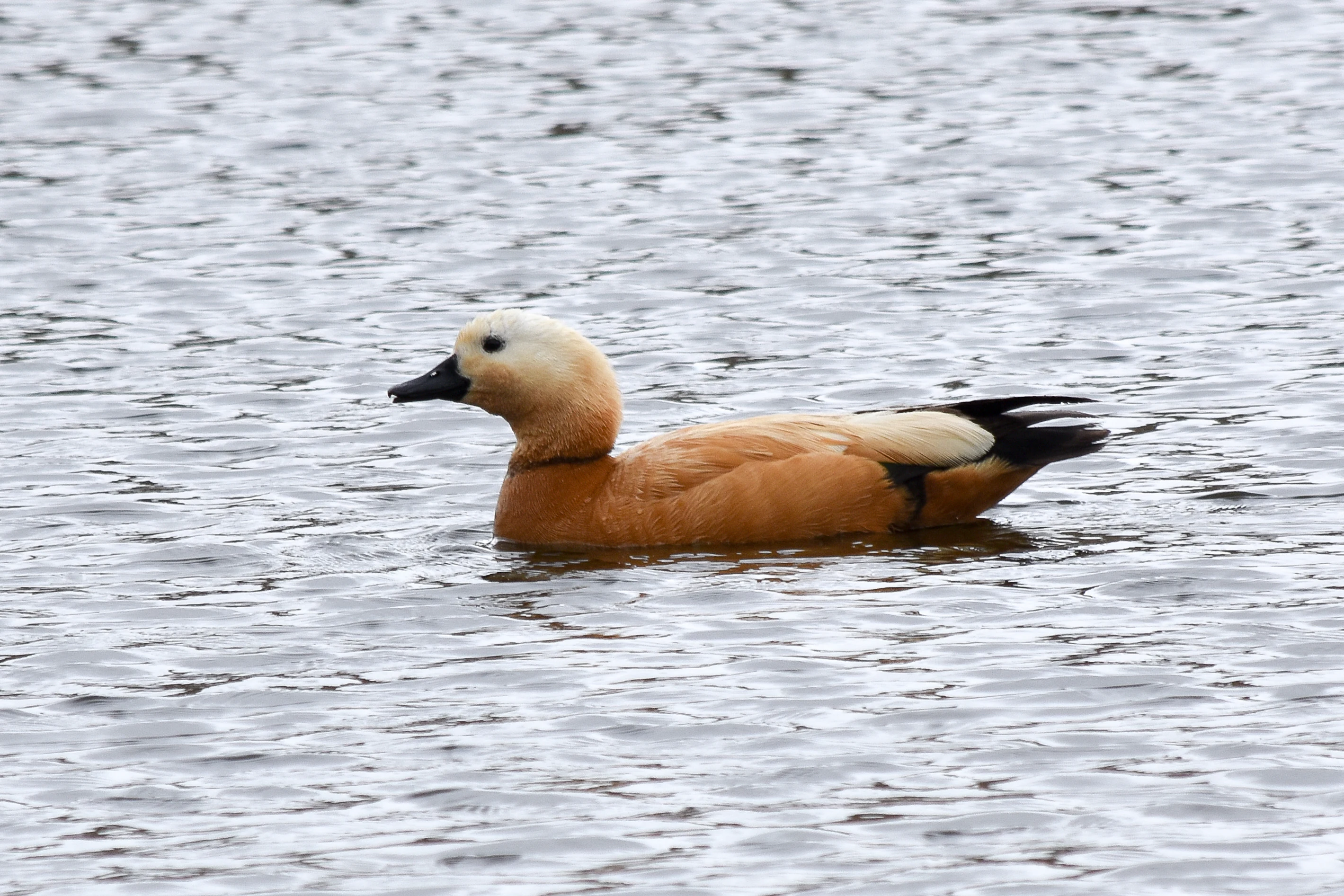
A side profile of a single ruddy shelduck with brownish-orange plumage and a pale head, swimming in calm water.
A ruddy shelduck swimming in the waters of Chandra Taal.

Chandratal Wildlife Sanctuary wildlife and species highlights

Wildlife in Chandratal Wildlife Sanctuary is shaped by elevation, cold, aridity, and the brevity of the productive season. The animal community is small in number but adapted to extremes, with species that have evolved physical and behavioral traits to cope with intense solar radiation, low oxygen levels, and long winters.

Among large mammals, the sanctuary supports populations of Himalayan ibex and blue sheep (bharal), both well-suited to navigating the steep scree and rocky cliffs around the lake. The red fox is also present, taking advantage of the open alpine terrain. The snow leopard, while rarely seen, is part of the wider predator community that uses the sanctuary and its surroundings as part of a much larger high-altitude range.

Birdlife is a defining feature of the sanctuary. Resident species such as the snow cock, chukor, black ring stilt, kestrel, golden eagle, and chough occupy cliffs, meadows, and open slopes year-round, while migratory visitors arrive with the warmer months. The ruddy shelduck, a particularly striking seasonal visitor, has become closely associated with the lake during summer, often seen swimming and feeding along its margins amid blooming wildflowers. Together, these species form a community that captures the wild, isolated character of one of India's highest protected ecosystems.
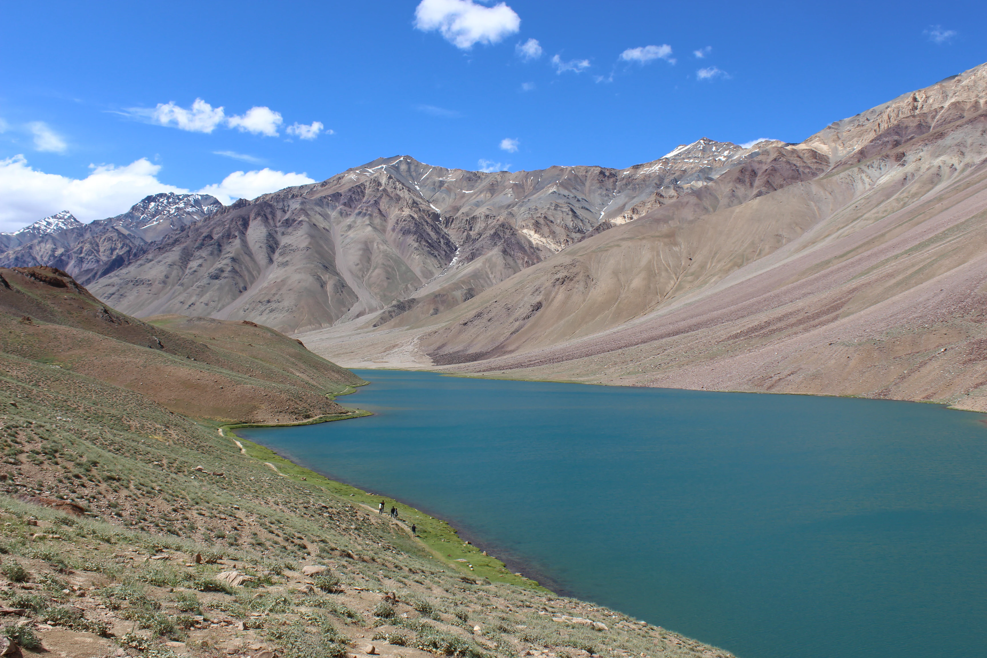
A wide landscape photograph of a turquoise lake nestled within a deep valley, surrounded by barren, brown Himalayan mountain slopes under a clear blue sky.
A view of the high-altitude Chandra Taal lake surrounded by the rugged peaks of the Himalayas.

Chandratal Wildlife Sanctuary conservation status and protection priorities

Chandratal Wildlife Sanctuary is ecologically significant as a refuge for cold-arid Himalayan biodiversity at very high elevation, where few protected areas of comparable altitude exist. The sanctuary's core conservation value centers on its combination of alpine meadow, scree, cirque, and lake habitat, which together sustain specialized wildlife and one of India's rare high-altitude freshwater wetlands.

The lake's designation in 2005 as the Chandertal Wetland under the Ramsar Convention, numbered 1569, was the defining conservation milestone for the area. This recognition places the sanctuary among an internationally protected network of wetlands and frames the lake not just as a scenic feature but as a functioning ecosystem with value for migratory birds, aquatic life, and broader ecological processes.

The sanctuary also faces ongoing conservation pressures. Historical overgrazing by large transhumant flocks has degraded the meadows around the lake, while the recent growth of tourism along the Manali-Kunzum-Spiti corridor brings new stresses in the form of foot traffic, camping, and increased human presence in a fragile environment. Conservation interest in the sanctuary therefore extends beyond protection of charismatic wildlife to active concern for the long-term health of its meadows, water quality, and wilderness character.

Chandratal Wildlife Sanctuary cultural meaning and human context

Chandratal Wildlife Sanctuary sits within a landscape shaped by long-standing Himalayan pastoral traditions. For generations, shepherds from the Kullu and Kangra districts brought large herds to the grasslands north of Chandra Taal for seasonal grazing, a use pattern documented as early as 1871 by the Assistant Commissioner of Kullu. This pastoral heritage is woven into the cultural geography of the Lahaul valley, even as it has contributed to ecological strain on the meadows.

The sanctuary lies in a region where Lahaul and Spiti cultures meet the broader Himalayan transhumance lifestyle, with Kunzum Pass traditionally marking the seasonal exchange of movement between valleys. Modern trekkers and travelers now follow routes once used by shepherds and traders, giving the sanctuary a layered cultural identity rooted in both ancient land use and contemporary adventure travel.
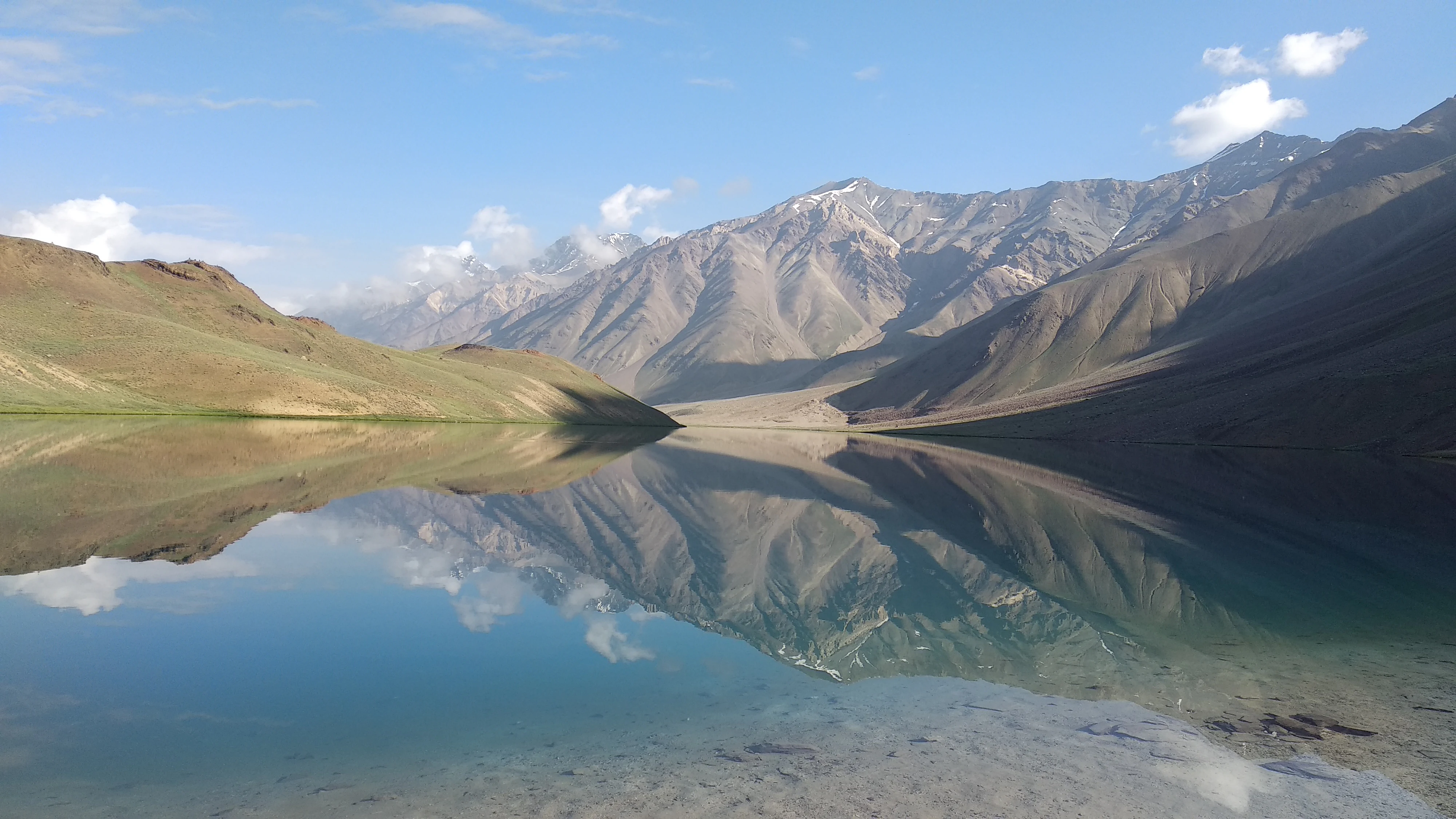
A wide, eye-level shot of a calm lake in the mountains, with a perfect reflection of the surrounding rocky slopes and sky on the water surface.
A calm, reflective view of Chandra Taal lake surrounded by the rugged peaks of the Himalayas.

Top sights and standout views in Chandratal Wildlife Sanctuary

Among Chandratal Wildlife Sanctuary's standout qualities is the crescent-shaped Chandra Taal, a strikingly beautiful high-altitude lake that has earned the name 'moon lake' for its outline. The lake is one of only two high-altitude Ramsar sites in India, giving the sanctuary an internationally recognized conservation profile.

Equally distinctive are the seasonal floral blooms that blanket the alpine meadows in summer and the cold-adapted wildlife, from Himalayan ibex and blue sheep on the slopes to ruddy shelduck on the water, all framed by a backdrop of scree mountains and a glacially carved cirque. The combination of harsh terrain, vivid brief summers, and rare wildlife encounters makes the sanctuary a powerful expression of high Himalayan wilderness.
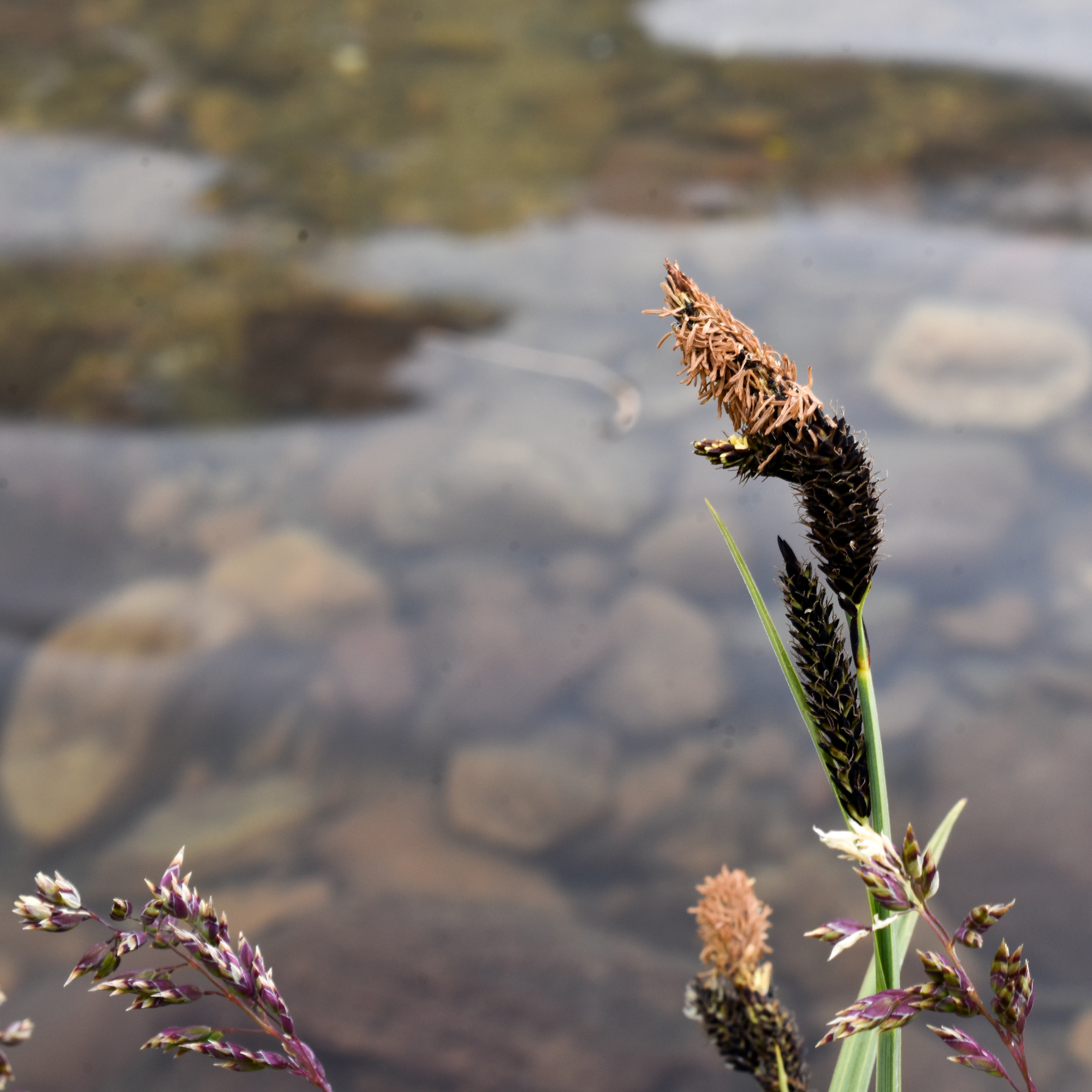
Close-up of dark-tipped alpine grass seed heads and delicate purple wildflower clusters against a soft-focus background of shallow, rocky lake water.
Alpine grasses and wildflowers growing at the edge of the high-altitude Chandra Taal lake.

Best time to visit Chandratal Wildlife Sanctuary

The practical season for visiting Chandratal Wildlife Sanctuary runs from late May through early October, when the access roads from Batal and Kunzum Pass are typically open and the lake is free of ice. During this window, the meadows around the lake are at their most expressive, with wildflowers in bloom and migratory birds such as the ruddy shelduck present on the water.

In contrast, the lake and much of the sanctuary are frozen from December through March, when deep cold and snow cover make the area inaccessible to most visitors and dramatically alter the landscape into a quiet, icy wilderness. Travelers seeking the sanctuary's iconic summer color, wildlife viewing opportunities, and trekking conditions will find the warmer months far more rewarding, while those drawn to extreme high-altitude winter scenery should be prepared for very limited access and harsh conditions.
Monthly climate preview

Long-term representative point measurements tracking monthly temperature and precipitation variation

Chandratal Wildlife Sanctuary Climate Normals and Annual Temperature Rhythm

Representative coordinate records show wide annual temperature swings alongside distinct monthly precipitation patterns across the high-elevation terrain of Chandratal Wildlife Sanctuary. Detailed twelve-month climate normals provide complete historical context for studying long-term meteorological trends across the protected landscape.
Annual mean-7 °C
-18 °C4 °C
Jan-18°
Feb-17°
Mar-14°
Apr-8°
May-3°
Jun
Jul
Aug
Sep
Oct-7°
Nov-12°
Dec-16°
Warmest month
July

4.1 °C

Coolest month
January

-18.3 °C

Wettest month
August

5.3 mm/day

Driest month
October

0.3 mm/day

Park location guide

Geography guide, regional context, and park location map for Chandratal Wildlife Sanctuary

Chandratal Wildlife Sanctuary park geography, regions, and map view in India

Understand where Chandratal Wildlife Sanctuary sits in India through a broader geographic reading of the surrounding landscape, nearby location context, and its mapped position within the national park landscape.

How Chandratal Wildlife Sanctuary fits into India

India is a South Asian country bordered by the Indian Ocean, Arabian Sea, and Bay of Bengal. It shares land borders with Pakistan, China, Nepal, Bhutan, Bangladesh, and Myanmar. The country has a population of over 1.4 billion people and operates as a federal parliamentary republic with its capital in New Delhi.

Wider geography shaping Chandratal Wildlife Sanctuary in India

India occupies the Indian subcontinent in South Asia, bordered by the Arabian Sea to the southwest, the Bay of Bengal to the southeast, and the Indian Ocean to the south. It shares land borders with Pakistan to the west, China, Nepal, and Bhutan to the north, and Bangladesh and Myanmar to the east. The territory also includes the Andaman and Nicobar Islands in the Indian Ocean.

Map view of Chandratal Wildlife Sanctuary

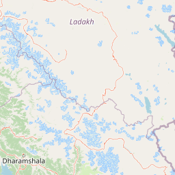
Use this park location map to pinpoint Chandratal Wildlife Sanctuary in India, understand its exact geographic position, and read its mapped placement within the surrounding landscape more clearly.

Pigeon | © OpenStreetMap contributors

Location context for Chandratal Wildlife Sanctuary

Himachal Pradesh

Visualizing the protected terrain, glacial cirques, and alpine lake scenery of the Western Himalaya

Chandratal Wildlife Sanctuary Photos and High Altitude Landscapes

Visual documentation reveals the stark topography and fragile ecosystems defining Chandratal Wildlife Sanctuary across high altitude terrain. Detailed imagery highlights the crescent shaped lake, alpine meadows, and surrounding scree slopes that characterize this protected region.

A Ruddy Shelduck with orange feathers and a light head standing on a rocky hillside covered with small yellow wildflowers.

A close up view of a purple cluster of flowers with silver green, textured leaves in a high altitude meadow.

A wide, calm, turquoise high-altitude lake reflecting surrounding barren, rocky mountain slopes under an overcast sky.

A side profile of a single ruddy shelduck with brownish-orange plumage and a pale head, swimming in calm water.

A wide landscape photograph of a turquoise lake nestled within a deep valley, surrounded by barren, brown Himalayan mountain slopes under a clear blue sky.

A clear, calm high-altitude lake reflects the surrounding barren mountains and a snow-capped peak under a bright blue sky.

A wide, eye-level shot of a calm lake in the mountains, with a perfect reflection of the surrounding rocky slopes and sky on the water surface.

Close-up of dark-tipped alpine grass seed heads and delicate purple wildflower clusters against a soft-focus background of shallow, rocky lake water.

A bright, turquoise mountain lake with sunlight reflecting on the water, framed by snow-capped peaks and barren brown hills under a clear blue sky.

A dirt path leads through green alpine meadows toward a crescent-shaped mountain lake surrounded by rugged, rocky Himalayan peaks.

A wide view of the crescent shaped Chandra Taal lake reflecting the blue sky and white clouds, with arid, grassy hills sloping down to the water edge.

A wide angle view of a blue alpine lake set in a valley, with snow-capped mountain peaks rising in the background under a blue sky with white clouds.

A wide view of a turquoise lake edged by a rocky shoreline, with a large herd of white sheep grazing near the water; high, barren, dark mountains rise in the background under a clear sky.

Three metal signs standing on a gravel ground with a rocky, arid mountain slope in the background. The leftmost sign is a yellow board labeled Chander Taal Sanctuary with conservation text.

Park atlas

Compare adjacent high-altitude alpine reserves and connected mountain wilderness terrains

Parks Near Chandratal Wildlife Sanctuary and Surrounding Western Himalaya Protected Areas

Browse protected areas near Chandratal Wildlife Sanctuary to examine shared high-altitude ecosystems and rugged mountain geomorphology across the surrounding region. Extending the geographic review beyond Chandra Taal provides deeper context on Western Himalayan conservation landscapes and cold-arid terrains.
National parkIndia
About 33 km away#1 closest

Southwest

Inderkilla National Park: Detailed Protected Landscape and Geographic Atlas Entry

Mapping the natural terrain and protected boundaries across India.

Delve into the protected landscape of Inderkilla National Park, a designated national park located in India. This entry provides essential geographic context, focusing on the park's mapped boundaries and its role within the country's protected areas atlas. Understand the specific natural terrain and regional landscape character that defines Inderkilla National Park for detailed geographic exploration.

Area
46.1 km²
Established
2010
Relief
Mountain
Climate
Alpine
Watercolor illustration showing mountains, a tree, and a landscape with green and pink tones
National parkHimachal Pradesh
About 54 km away#2 closest

South

Khirganga National Park: Himachal Pradesh National Park Geographic Atlas

Mapped protected area and regional landscape context.

Investigate Khirganga National Park, a designated national park situated within the vast mountain geography of Himachal Pradesh. This atlas-focused entry provides critical details on the park's protected landscape identity, its mapped boundaries, and its significance within the broader regional context of northern India's Western Himalayas. Understand the park's geographic position for detailed landscape exploration.

Area
710 km²
Established
2010
IUCN
II
Relief
Mountain
National parkHimachal Pradesh
About 58 km away#3 closest

Southeast

Pin Valley National Park: Remote Himalayan Cold Desert National Park in Himachal Pradesh

Explore its dramatic terrain and unique protected landscape in Spiti Valley.

Pin Valley National Park is a significant protected area covering roughly 675 square kilometers of the cold desert region in Himachal Pradesh, India. Established as a national park, it showcases a remote and rugged Himalayan landscape, characterized by its stark beauty, sparse vegetation, and extreme temperatures typical of high-altitude deserts. The park's geography spans dramatic mountain terrain, steep cliffs, and deep valleys, forming a vital habitat for endangered species and contributing to the unique ecological profile of the Cold Desert Biosphere Reserve.

Area
675 km²
Established
1987
IUCN
II
Relief
Mountain
National parkHimachal Pradesh
About 59 km away#4 closest

South

Great Himalayan National Park: Protected Landscape and Mapped Geography

Explore this national park's dramatic elevation and rich biodiversity.

Great Himalayan National Park is a vital protected area within India's Himachal Pradesh, celebrated for its exceptional biodiversity and dramatic mountain geography. This national park encompasses a remarkable range of elevations, creating distinct ecological zones from lower forest elevations to high alpine meadows and glacial zones. Its significance as a mapped protected landscape makes it essential for understanding regional natural heritage and conservation efforts within the Himalayas.

Area
1,171 km²
Established
1984
IUCN
II
Relief
Mountain
Protected landscapeLadakh
About 80 km away#5 closest

Northeast

Tso Moriri Protected Landscape: Ladakh Geography and Trans Himalayan Lake Atlas

High altitude wetland and cold desert plateau study

Trace the boundaries and ecological features of Tso Moriri, a major Ramsar site set within the high altitude cold desert of the Ladakh region. The landscape encompasses glacial streams, vast marshy deltas, and open steppe terrain that supports diverse wildlife and traditional pastoral land use.

Area
120 km²
Established
2002
Relief
Mountain
Climate
Arid
Protected areaLadakh
About 91 km away#6 closest

North

Tso Kar Protected Area: Geographic Overview of Ladakh's High-Altitude Salt Lake

Mapping wetland margins, steppe ecology, and Himalayan basin terrain

Tso Kar is a distinct high-altitude salt lake system on the Rupshu Plateau. This protected area features a striking contrast between mineral-rich salt flats, freshwater lagoons, and surrounding alpine peaks. As a vital wetland, it supports diverse migratory bird populations and nomadic cultural landscapes, making it a key study of environmental complexity within the Indian Himalayas.

Area
22 km²
Established
2020
Relief
Highland
Climate
Alpine
A watercolor painting showing soft rolling hills and green pine trees against a light sky.
Protected areaHimachal Pradesh
About 153 km away#7 closest

West

Pong Dam Lake Protected Area: Geography, Mapped Terrain, and Himachal Pradesh Wetlands

A vast reservoir bordering the Dhauladhar range

Pong Dam Lake is a sprawling reservoir in Himachal Pradesh that serves as a vital protected area for waterfowl and regional ecosystems. Its geography combines high-altitude dam engineering with the natural relief of the Siwalik foothills, offering a distinct landscape of seasonally shifting shorelines, forested ridges, and deep-water habitats that anchor the local environment.

Area
240 km²
Established
1975
Visitors
5K annual
Relief
Upland
National parkUttarkashi District
About 165 km away#8 closest

Southeast

Govind Pashu Vihar National Park: Exploring India's Uttarkashi District Protected Landscape

Mapped protected area boundaries and regional geographic context.

Investigate Govind Pashu Vihar National Park, a key protected area in Uttarkashi District, India. This resource provides essential information on its designation as a national park, focusing on its geographic spread, mapped landscape features, and its placement within the regional atlas for comprehensive discovery. Understand the distinctiveness of this protected land's terrain and its role in conservation geography.

Area
958 km²
Established
1955
IUCN
II
Relief
Mountain

Common questions about visiting, size, designation, and location context for Chandratal Wildlife Sanctuary

Chandratal Wildlife Sanctuary FAQs for park facts, access, geography, and protected area context

Find quick answers about Chandratal Wildlife Sanctuary, including protected-area facts, park geography, trail and visitor context, and how the park fits into its surrounding country and regional landscape.
MoriAtlas Explorer

Continue Your Protected Areas Search Across the Global Atlas

Deepen your exploration by continuing the structured search for national parks and protected areas worldwide. Utilize the comprehensive filtering capabilities to compare different conservation landscapes and refine your understanding of global park geography. Discover more about the distribution and characteristics of protected natural areas.

Global natural geography