
Mori Atlas logo
Nature reserveChanivaz – Delta de l’Aubonne

A preserved landscape mosaic featuring alluvial floodplains, mature oak woodland, and historic lakeshore terrain in Vaud.

Chanivaz – Delta de l’Aubonne: Exploring the Terraced Geography of a Swiss Glacial Delta

Chanivaz – Delta de l’Aubonne offers a rare window into the geological history of the Lake Geneva basin through its distinct four-level terrace sequence. This protected nature reserve encompasses a complex mosaic of riparian floodplain forests, extensive reedbeds, and marshland habitats shaped by the receding Rhone glacier. The area stands as an essential geotope where natural river meandering meets a layered cultural landscape spanning Roman history to modern pilgrimage routes.

Lake Geneva shorelineRiver deltaFloodplain forestReedbedAmphibian habitatGlacial geotope
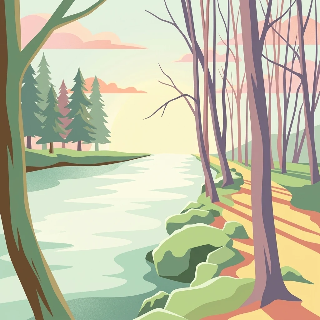
A stylized digital illustration showing a calm river flowing through a forest with a path along the bank leading toward a distant shoreline at sunset.

Chanivaz – Delta de l’Aubonne

Nature reserve

Park overview

Structured park overview, official facts, and landscape profile for Chanivaz, Delta de l'Aubonne

Chanivaz, Delta de l'Aubonne park facts, protected area profile, and essential visitor context

Review the core facts for Chanivaz, Delta de l'Aubonne, including designation, size, terrain, visitor scale, habitats, and operating context in one park-focused overview.

About Chanivaz, Delta de l'Aubonne

Chanivaz – Delta de l'Aubonne is a compact but exceptionally varied protected landscape on the north shore of Lake Geneva, in the western Swiss Mittelland. The site comprises the mouth of the River Aubonne, the forested alluvial fan that the river has built since the end of the last ice age, and an open plain around the small hamlet of Chanivaz in the municipalities of Buchillon and Allaman. Although the lake's northern shore has been heavily built up, this stretch is one of the few that remains largely intact and under public protection rather than fragmented into private estates.

Geologically, the area is a textbook example of a glacial river delta. After the Würm glaciation, the Aubonne cut through the moraine terraces left by the Rhone glacier and progressively deposited sediments into the lake basin, creating a roughly three-square-kilometer alluvial fan whose terraces are still clearly visible at about 3, 10, 25, and 35 meters above the present lake surface. This unusually well developed sequence of terraces is what gives the site its national interest as a geotope and underlies its inclusion in the federal BLN inventory.

Ecologically, the area is equally rich. The Aubonne is one of the few Lake Geneva tributaries whose lower course has not been straightened, so it can meander naturally through its floodplain. The resulting habitats include softwood floodplain forest along the river, dense reed marshes at the lake edge (notably the Les Batiaux area), wet meadows, oak woodland, dry pine stands on the higher terraces, gravel and boulders along the open shore, and cultivated vineyards and farmland. This mosaic supports breeding birds, migratory waterfowl, amphibians, dragonflies and other insects, and fish that still ascend the river from the lake.

The cultural layer is significant as well. A Roman settlement lay on the plain between Lausanne and Nyon, and the area later became a medieval parish center. The name Chanivaz derives from the Franco-Provençal word for oak, reflecting the long presence of oak woodland. The route that once formed the lakeside road between Geneva and Lausanne still passes through the area, and a stage of the Swiss Camino de Santiago crosses the delta from Buchillon. The Swiss federal BLN inventory explicitly recognizes the protection of these archaeological and historic features as part of the site's purpose.

Quick facts and research context for Chanivaz, Delta de l'Aubonne

Chanivaz – Delta de l'Aubonne is a federal BLN (IFP) landscape of national importance, listed under object number 1210 since 1996, located on the northern shore of Lake Geneva in the district of Morges, canton of Vaud. The protected area covers the mouth of the River Aubonne, its floodplain forest, and the plain around the hamlet of Chanivaz in the municipalities of Buchillon, Allaman, Aubonne, and Etoy. The site is also part of the Swiss inventory of floodplains of national importance and the federal register of nationally important amphibian spawning areas; the cantonal nature reserve Embouchure de l'Aubonne was created in 2003.

The Aubonne is one of the few Lake Geneva tributaries whose lower course remains uncanalized, allowing the river to migrate freely across its delta. Since the last ice age the river has built an alluvial fan of roughly three square kilometers, much of it visible in a sequence of four terraces between 3 and about 35 meters above the present lake level. The landscape contains old oaks, willows, ashes and black alders, reedbeds including the Les Batiaux marsh, gravelly shoreline, vineyards of Allaman, and historically significant sites such as the Roman settlement, the Fontanettes estate, and the Chanivaz hamlet.

Protection and recognition

Examining the terrestrial conservation framework and 1996 establishment data

Chanivaz – Delta de l’Aubonne Protection Status and Designation History

Chanivaz – Delta de l’Aubonne maintains a documented terrestrial protection status established in 1996 for regional conservation oversight. Official records outline the formal designation history and management scope without additional international recognition sources.

Protection details

Protection scope
Terrestrial
Designated year
1996
Transboundary protection
No
Park context

Deeper park guide and search-rich context for Chanivaz, Delta de l'Aubonne

Chanivaz, Delta de l'Aubonne history, landscape, wildlife, and travel context

Explore Chanivaz, Delta de l'Aubonne through its history, landscape character, ecosystems, wildlife, conservation priorities, cultural context, and seasonal travel timing in a structured park guide built for atlas discovery and search intent.

Why Chanivaz, Delta de l'Aubonne stands out

Chanivaz, Delta de l'Aubonne is best known for being one of the rare glacial morphologic geotopes on the Swiss shore of Lake Geneva, where the River Aubonne has built a clearly terraced alluvial fan at the edge of the lake basin. The site's four distinct elevation steps, formed during the retreat of the Würm-era Rhone glacier, give the delta more layered terraces than other Lake Geneva river mouths and form the geological core of its national landscape designation. Equally distinctive is its ecological character, combining a freely meandering river, an intact floodplain forest, one of the last large reedbelt areas of the lake (Les Batiaux), and a mosaic of marshland, meadows, and oak woodland. These habitats support rare amphibians such as the European tree frog, migratory and breeding birds including marsh harrier, bluethroat, common kingfisher, and black tern, and fish like the threatened lake trout that still use the Aubonne as a spawning stream.
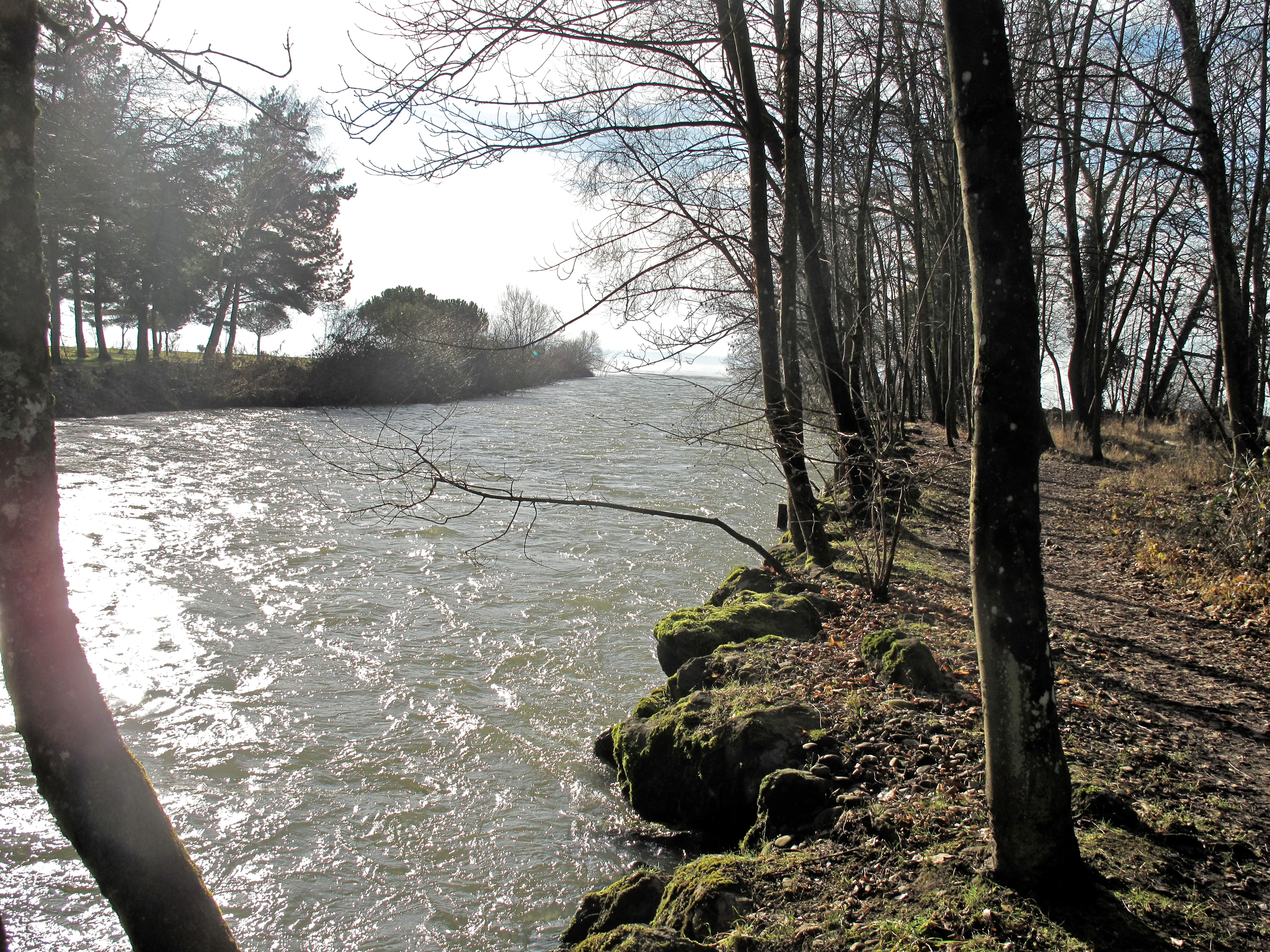
A view of the Aubonne River flowing past a tree-lined bank with mossy rocks, leading towards the horizon of Lake Geneva.
The Aubonne River flowing toward Lake Geneva within the nature reserve.

Chanivaz, Delta de l'Aubonne history and protected-area timeline

The area's recorded history stretches back to Roman times. A substantial archaeological site was discovered in the 19th century on the plain east of the Aubonne river, between the Roman towns of Lousanna (Lausanne) and Colonia Iulia Equestris (Nyon). The settlement, whose ancient name is not preserved, lay directly on the lakeshore and is believed to have been damaged or destroyed by the Tauredunum tsunami of 563 AD, which flooded the Lake Geneva shoreline with waves several meters high, as recorded by the bishops Gregory of Tours and Marius of Avenches.

In the Middle Ages, the locality became the center of a parish; the parish church is documented in 1228 in the Lausanne chartulary of the Burgerbibliothek Bern under the name Chanliva. Chanliva, later Chanivaz, is a Franco-Provençal form meaning 'oak' or 'oak grove,' and the silent final -z typical of the regional dialect explains why it is not pronounced. The neighboring estate of Les Fontanettes ('the springs,' likely referring to groundwater seeps near the lake) has a long and continuous history as well, and both the Chanivaz farmstead and Fontanettes remain living parts of the cultural landscape around which the BLN zone is organized.

During the Ancien Régime, the area belonged to the Seigneurie d'Allaman, a patrimonial lordship administered from the Château d'Allaman and held under the city and republic of Bern through its Amt Morges. A historic lakeside road between Geneva and Lausanne once passed directly through the protected area; since 1431 the main road (today's Swiss Route 1) has bypassed the delta, crossing the Aubonne farther upstream at Claveleire. The railway line Geneva–Lausanne–Bern and, later, the A1 motorway both cross the valley on large viaducts farther upstream, beyond the delta geotope itself.

In the 20th century, the area gradually came under residential pressure from the expanding lakeside development around Buchillon. By the 1970s, a major real-estate project envisioned a large housing development for several hundred or even a thousand residents directly in the Chanivaz plain. After the municipality of Buchillon had already approved the investment, the Swiss Federal Council imposed a building ban in 1980, turning the case into a landmark of Swiss landscape protection. Despite this protection, recreation on the lake, agricultural intensification, groundwater pumping for regional water supply, and gravel extraction continue to influence the site's condition.

Chanivaz, Delta de l'Aubonne landscape and geographic character

The landscape of Chanivaz – Delta de l'Aubonne is shaped by the interaction between the River Aubonne and Lake Geneva, producing one of the clearest and most layered delta systems on the Swiss side of the lake. Over the roughly three square kilometers of alluvial fan that the Aubonne has built since the end of the Würm glaciation, the terrain rises from the lakeshore in a sequence of four distinct terraces at about 3, 10, 25, and 35 meters above the present lake surface of 372 meters. These terraces are unusually well preserved compared to other Lake Geneva deltas, because the Aubonne cut through older moraines deposited by the Rhone glacier and the older terraces remain as flat plateaus that have not been fully reworked.

The lowest terrace forms the actual river mouth and lower floodplain, extending inland as far as the railway viaduct at Aubonne. Above it, the 10-meter terrace carries the wet meadows and pastures around the Pècherie west of the river and the historic estates of Chanivaz and Fontanettes to the east. The 25-meter terrace forms the broad plateau of Grands-Bois and Buchillon, while the 35-meter terrace forms the elevated ground at Allaman, crowned by the Château d'Allaman. Beneath the lake surface, Aubonne sediments extend several more square kilometers into the lake basin.

Visually, the protected area is a patchwork of contrasting textures: a freely meandering river that has not been channelized, dense softwood floodplain forest with willows, ashes and alders, mature oak stands that have given the locality its name, open meadows, vineyards on the Allaman slopes, and large reedbeds along the lake. The shoreline itself is asymmetric; west of the river mouth it is a coarse gravel and boulder beach, while east of the Aubonne mouth a broad belt of reeds, including the Les Batiaux marsh, dominates. Older maps even show a plot east of the river mouth named Au Marais ('in the marsh'), reflecting the long-standing presence of these wet habitats.

Chanivaz, Delta de l'Aubonne ecosystems, habitats, and plant life

The ecological identity of Chanivaz – Delta de l'Aubonne rests on the unusually close coexistence, within a small area, of aquatic, wetland, forest, meadow and dry-ground habitats. The combination of an active, freely meandering river, a large and largely intact floodplain forest, several hectares of lake-shore reedbed, wet meadows, and a mosaic of oak woodland and dry pine stands on the terraces has earned the landscape its national-level designations for floodplains, amphibian spawning, and landscape quality.

The forest structure is particularly important. Along the river, classic softwood floodplain species such as willow, ash, and especially black alder dominate, while on the higher and drier terraces, mixed oak woodland and pine forest take over. Old oaks are still present in the area, and the jay, which caches acorns to support forest regeneration, is closely associated with this oak-dominated character. At the lakeshore, small populations of the increasingly rare European sea-grass (Strandling) survive in patches of shore rush vegetation, while orchids bloom in some of the open meadows.

The wetland habitats around the river mouth and the Les Batiaux reedbed are central to the site's biodiversity. They form habitats for amphibians, including the European tree frog, which is still relatively widespread in the Aubonne valley and is rare elsewhere in Switzerland, and the yellow-bellied toad along the gravelly shore. The reedbeds and adjacent lake shallows are important for waterbirds, with breeding and migratory species ranging from reed-bed specialists to fish-eaters, while the gravel lakeshore is one of the few remaining natural nesting grounds for sand martins. Insect diversity is also notable, including threatened species such as the mallow skipper, a butterfly at risk of extinction in Switzerland.

Chanivaz, Delta de l'Aubonne wildlife and species highlights

Wildlife is one of the strongest reasons the area has been protected. The Lutry-Les Batiaux reedbed marsh, although situated beyond the strict BLN core, is acknowledged as one of the last large remaining reed areas of Lake Geneva and serves both as a habitat for breeding birds and as a resting place for migratory species. Among species documented here are ferruginous duck, great cormorant, bluethroat, Eurasian nuthatch, marsh harrier, common redshank, common gull, black tern, Eurasian hoopoe, common kingfisher, water rail, common tern, barn swallow, red kite, chiffchaff, grey wagtail, great crested grebe, and marsh tit.

In the broader protected mosaic, woodland birds play a major role. Woodpeckers such as the middle spotted woodpecker and the green woodpecker inhabit the oak and mixed forest along the Aubonne, while the Eurasian jay, closely linked to the area's old oaks, supports natural forest regeneration through its acorn caches. Songbirds, including the common nightingale, are also characteristic of the site.

Aquatic fauna is similarly diverse. The Aubonne is one of the few remaining spawning rivers for the lake trout, a species considered highly threatened in Lake Geneva; brown trout and bullhead also live in the river. Reptiles and amphibians are widespread in the warm, structurally varied shoreline, where the gravelly beach west of the river mouth is officially listed as a nationally important amphibian spawning site, and the yellow-bellied toad still occurs. The European tree frog remains relatively common in the Aubonne valley, making the area an important stronghold for this species in Switzerland.

Chanivaz, Delta de l'Aubonne conservation status and protection priorities

Chanivaz – Delta de l'Aubonne is protected at multiple levels, which is what gives it its unusually strong conservation profile. Since 1996 it has been part of the federal Inventory of Landscapes and Natural Monuments of National Importance (BLN or French IFP), listed as object 1210. Its delta is also registered in the federal inventory of floodplains of national importance, and the lakeshore strip is included in the inventory of nationally important amphibian spawning areas under a 2001 federal ordinance. In addition, the canton of Vaud has classified part of the river-mouth landscape as the cantonal nature reserve Embouchure de l'Aubonne in 2003, and the Allaman vineyards and the Les Batiaux reed area are registered in the cantonal inventory of natural monuments and sites.

The site's conservation importance lies in the combination of geological and ecological values that are otherwise difficult to preserve together. The four-level terrace sequence is a textbook example of glacial-river interaction and is rare in such clarity along Lake Geneva. Ecologically, the freely meandering river, the softwood floodplain, and the reedbed mosaic represent a small-scale but unusually complete example of a natural northern-shore lakeside ecosystem, with breeding, wintering, and migratory species concentrated in close proximity. The protection of archaeological and historic features, from the Roman settlement to the medieval site and the pilgrimage route, is also written into the BLN designation as an explicit objective.

Despite this layered protection, the area faces ongoing pressures. Recreational boat traffic around the Allaman marina built in the 1980s affects fauna in the reedbed. Agriculture in the Chanivaz estate and the use of plant-protection products in the surrounding vineyards can influence the protected habitats, and groundwater pumping for regional water supply, from a designated protection zone at Chanivaz and Chaney, operates within the delta's gravel aquifer. The 1980 federal building ban, following the canceled large-scale real-estate project, is a key reason this stretch of the Lake Geneva shore remained largely unbuilt, and the site remains a benchmark case in Swiss landscape-protection law.

Chanivaz, Delta de l'Aubonne cultural meaning and human context

The cultural landscape of Chanivaz – Delta de l'Aubonne is built around the small hamlets and estates of Chanivaz and Les Fontanettes, at the heart of the protected area. The Chanivaz farmstead, rebuilt around 1900, remains the center of a working agricultural estate focused on potato and onion cultivation, while the Fontanettes estate has stayed in private hands for a long time and extends, with its historic park, all the way down to the lakeshore. Both are listed within the BLN objectives for protecting historic structures.

The Swiss section of the Way of St. James enters the area from Buchillon and crosses the Aubonne delta; pilgrims can walk partly along an unbuilt path under the forest canopy from Buchillon into the protected zone. Tangible traces of older cultures exist as well. Although the Roman settlement's ancient name is lost, the archaeological remains underline the location's long role as a stopping point on the lakeside route between the Roman towns of Lausanne and Nyon. The medieval parish of Chanivaz, the seigneurial castle of Allaman, and the legendary 563 Tauredunum tsunami, which reportedly reached the settlement, are important context for how deeply human history is interwoven with the lake and river landscape.

Top sights and standout views in Chanivaz, Delta de l'Aubonne

Chanivaz – Delta de l'Aubonne stands out for the unusually clear four-level terrace sequence of its alluvial fan, a textbook glacial delta landscape that is rare among Lake Geneva river mouths. It also hosts one of the few remaining stretches of the northern Lake Geneva shore where a river still flows freely into the lake through an intact floodplain, and where the large Les Batiaux reedbed still functions as a breeding and stopover site for waterbirds.

Other distinctive features include the continued presence of the European tree frog in the Aubonne valley, the use of the river by the threatened lake trout as a spawning stream, and the close proximity of Roman ruins, a medieval parish center, and a modern Camino de Santiago route within a single federal landscape protection zone.

Best time to visit Chanivaz, Delta de l'Aubonne

Spring and early summer are particularly rewarding, when water levels in the Aubonne are higher, the floodplain forest is in fresh leaf, and migratory and breeding waterbirds are most active in the reedbeds and shallow waters of the Les Batiaux marsh and along the lake edge. Meadow habitats, including the orchid-rich grassland near Chanivaz, are at their most visible in late spring.

Late summer and early autumn tend to be quieter, with lower water in the Aubonne, which exposes larger areas of the gravel riverbed and shoreline, and makes the layered structure of the delta easier to read on the ground. Winters, although mild along the lake, are generally less colorful, though the open landscape and reduced vegetation can make the terrace sequence and the Roman-historic sites easier to appreciate.


Monthly climate preview

Representative long-term climate normals and monthly weather patterns across the protected terrain

Annual Temperature and Precipitation Normals for Chanivaz – Delta de l’Aubonne

Representative coordinate measurements trace the measured annual temperature and precipitation rhythm across Chanivaz – Delta de l’Aubonne from 1991 to 2020. Examining the complete twelve-month climatology profile reveals deeper multi-year normals and monthly fluctuations at a single sampled elevation.
Annual mean9 °C
-1 °C18 °C
Jan-1°
Feb
Mar
Apr
May12°
Jun16°
Jul18°
Aug18°
Sep14°
Oct10°
Nov
Dec
Warmest month
July

18.5 °C

Coolest month
January

-0.6 °C

Wettest month
May

3.7 mm/day

Driest month
March

2.7 mm/day

Park location guide

Geography guide, regional context, and park location map for Chanivaz, Delta de l'Aubonne

Chanivaz, Delta de l'Aubonne park geography, regions, and map view in Switzerland

Understand where Chanivaz, Delta de l'Aubonne sits in Switzerland through a broader geographic reading of the surrounding landscape, nearby location context, and its mapped position within the national park landscape.

How Chanivaz, Delta de l'Aubonne fits into Switzerland

Switzerland is a landlocked federal republic in Central Europe comprising 26 cantons, with Bern as the federal city and Zurich as the largest city. The country features the Swiss Alps, Swiss Plateau, and Jura Mountains, with German, French, Italian, and Romansh as official languages. It is noted for its political neutrality, direct democracy traditions, and strong economy.

Wider geography shaping Chanivaz, Delta de l'Aubonne in Switzerland

Switzerland is located in Central Europe at the intersection of Western and Southern Europe. It is bordered by Germany to the north, France to the west, Austria and Liechtenstein to the east, and Italy to the south. The country is geographically divided among the Swiss Alps (covering most of the territory), the Swiss Plateau (where most of the population resides), and the Jura Mountains. Switzerland is landlocked.

Map view of Chanivaz, Delta de l'Aubonne

Use this park location map to pinpoint Chanivaz, Delta de l'Aubonne in Switzerland, understand its exact geographic position, and read its mapped placement within the surrounding landscape more clearly.

Pigeon | © OpenStreetMap contributors

Location context for Chanivaz, Delta de l'Aubonne

Vaud

Visualizing glacial terraces, riparian habitats, and lake shorelines

Chanivaz – Delta de l’Aubonne Landscape Photography and Scenery Views

Visual documentation captures the layered glacial terraces, meandering river channels, and intact floodplain forests defining Chanivaz – Delta de l'Aubonne. Examining these protected habitats provides clear insight into the geomorphic and ecological character of the Lake Geneva shoreline.

A view of the Aubonne River flowing past a tree-lined bank with mossy rocks, leading towards the horizon of Lake Geneva.

Park atlas

Compare surrounding lake shore habitats, glacial geotopes, and regional conservation landscapes

Explore Protected Areas Near Chanivaz – Delta de l’Aubonne and Regional Reserves

Browse nearby protected natural areas and river delta reserves that share similar ecological traits with Chanivaz – Delta de l’Aubonne. Comparing adjacent regional landscapes reveals broader patterns in Swiss watershed geography and lakeside conservation.
Wildlife reserveBourgogne-Franche-Comté
About 21 km away#1 closest

Northwest

Tourbières et lacs de la montagne jurassienne: Mapping High-Altitude Wetlands and Glacial Landscapes

A vast protected wildlife reserve in the Bourgogne-Franche-Comté region

Covering more than 12,000 hectares, this wildlife reserve forms a crucial conservation benchmark for peatland and glacial lake systems in the Jura Massif. The landscape encompasses deep combes, broad plateaus, and clear-water basins like Lac de Saint-Point, providing a vital habitat mosaic for diverse flora and fauna across the French highlands.

Area
121.56 km²
Established
2021
Relief
Mountain
Climate
Temperate
A horizontal watercolor painting depicting a soft, layered landscape with distant hills, gentle slopes, and clusters of evergreen trees in shades of green and purple.
Nature reserveBourgogne-Franche-Comté
About 42 km away#2 closest

West

Réserve naturelle régionale des tourbières du bief du Nanchez: Protected Jura Mountain Peatlands

Mapping bog systems and wet grassland geography in Eastern France

Located in the Jura department, this regional nature reserve preserves forty-nine hectares of vital peatland, including diverse mire communities and forested slopes. The site provides a critical look at montane landscape restoration, documenting significant bog flora and complex hydrological patterns along the Combe du Nanchez valley floor.

Area
0.488 km²
Established
2021
IUCN
IV
Relief
Upland
A watercolor landscape painting showing green hills, trees, and marshy river banks.
Nature reserveGeneva
About 42 km away#3 closest

Southwest

Naturschutzgebiet Moulin de Vert: Protected Wetland and Forest Geography in Geneva

Detailed nature reserve map and regional landscape context

The Naturschutzgebiet Moulin de Vert nature reserve protects a mosaic of riverside woodland, meadows, and managed pond systems along the Rhône in the Canton of Geneva. Spanning approximately 132 hectares, this conservation area is recognized for supporting extensive biodiversity, from nesting peregrine falcons to diverse amphibian populations. Access this detailed geographic perspective to visualize the park boundaries, internal terrain features, and its ecological connection to the broader Swiss river landscape.

Area
1.32 km²
Established
2001
IUCN
IV
A horizontal watercolor painting showing a soft, misty landscape with coniferous trees, grassy wetlands, and rolling hills in the background, executed in a muted color palette.
Nature reserveBourgogne-Franche-Comté
About 42 km away#4 closest

Northwest

Réserve naturelle régionale de la Seigne des Barbouillons Protected Landscape Atlas

Geography and wetland boundaries in the Jura plateau of France

The Réserve naturelle régionale de la Seigne des Barbouillons protects a characteristic raised bog ecosystem in the Mignovillard commune. This compact area serves as a vital reference point for understanding the distribution of sphagnum mires and specialized butterfly habitats across the Jura plateau, illustrating the contrast between protected peatlands and their surrounding agricultural environment.

Area
0.346 km²
Established
2014
IUCN
IV
Relief
Upland
A watercolor illustration of a landscape with green forest, wetland grasses, and pale mountains in the background, set against a clean white background.
Nature reserveBourgogne-Franche-Comté
About 46 km away#5 closest

North

Réserve naturelle régionale des tourbières de Frasne-Bouverans Protected Landscape Atlas

Peatland mosaic geography in the Drugeon valley of Bourgogne-Franche-Comté

Trace the boundaries and ecological features of this significant regional nature reserve. Spanning the Forbonnet massif and the wider Drugeon basin, the area features a dense concentration of raised bogs, woodlands, and mire habitats defined by complex glacial geology.

Area
2.926 km²
Established
1986
IUCN
IV
Visitors
17.5K annual
A soft, light watercolor painting of a winding river flowing through a gentle, rolling landscape with trees and distant hills against a pale, warm sky.
Nature reserveAuvergne-Rhône-Alpes
About 56 km away#6 closest

Southwest

Réserve naturelle régionale de la galerie du Pont-des-Pierres Regional Nature Reserve

Protected gorge landscapes and underground habitats in France

An essential record of the Réserve naturelle régionale de la galerie du Pont-des-Pierres, detailing its critical role in safeguarding cliff and underground habitats within the Valserine gorges. This protected land in the Ain department represents a vital ecological intersection of geological features and specialized faunal refuges.

Area
0.093 km²
Established
2009
IUCN
IV
Relief
Mountain
Nature reserveAuvergne-Rhône-Alpes
About 59 km away#7 closest

West

Réserve naturelle régionale du récif fossile de Marchon - Christian Gourrat Geological Site

A protected Jurassic fossil reef in the Auvergne-Rhône-Alpes region

Located in the Ain department, this small nature reserve is scientifically renowned for its Kimmeridgian reef outcrop. The site protects a fossilized coral and rudist assemblage within the forêt de Marchon, offering a quiet, forested setting for studying France's ancient marine geological history.

Area
0.001 km²
Established
2015
IUCN
IV
Scope
Terrestrial
A pale, minimalist watercolor painting depicting rolling hills and mountains in shades of soft green, purple, and yellow against a white background.
Natural monumentNeuchâtel
About 61 km away#8 closest

Northeast

Creux du Van et Gorges de l’Areuse Natural Monument and Regional Protected Landscape

Geological exploration of the Folded Jura and Areuse river valley

Spanning the Cantons of Neuchâtel and Vaud, this protected area unites the dramatic rock bowl of the Creux du Van with the narrow, cascading passages of the Gorges de l’Areuse. The site provides a comprehensive view of Jura mountain landforms, highlighting millions of years of river erosion, glacial activity, and karst weathering in a singular, well-defined geographic corridor.

Area
21.21 km²
Established
1876
Relief
Mountain
Climate
Temperate

Common questions about visiting, size, designation, and location context for Chanivaz, Delta de l'Aubonne

Chanivaz, Delta de l'Aubonne FAQs for park facts, access, geography, and protected area context

Find quick answers about Chanivaz, Delta de l'Aubonne, including protected-area facts, park geography, trail and visitor context, and how the park fits into its surrounding country and regional landscape.
MoriAtlas Explorer

Continue Your Protected Areas Search Across the Global Atlas

Deepen your exploration by continuing the structured search for national parks and protected areas worldwide. Utilize the comprehensive filtering capabilities to compare different conservation landscapes and refine your understanding of global park geography. Discover more about the distribution and characteristics of protected natural areas.

Global natural geography