

Mori Atlas logo
Nature reserveCharles Darwin Reserve

A critical conservation landscape preserving transitional eucalypt woodlands and arid zone mallee habitats.

Charles Darwin Reserve: Mapping the Protected Woodlands and Heath Landscapes of Western Australia

Charles Darwin Reserve encompasses 686 square kilometres of the Western Australian Wheatbelt, representing one of the largest consolidated blocks of native vegetation remaining in the region. The reserve acts as a vital transition point between the South West Botanical Province and the Eremean Province, protecting a semi-arid mosaic of old-growth salmon gum woodlands and sand-plain heath. These unfragmented habitats provide essential nesting resources in veteran hollow-bearing trees, supporting diverse bird and mammal populations across a gently undulating terrain.

nature reservewheatbeltwoodlandsand-plainheathmallee

Charles Darwin Reserve

Nature reserve

Park overview

Structured park overview, official facts, and landscape profile for Charles Darwin Reserve

Charles Darwin Reserve park facts, protected area profile, and essential visitor context

Review the core facts for Charles Darwin Reserve, including designation, size, terrain, visitor scale, habitats, and operating context in one park-focused overview.

About Charles Darwin Reserve

Charles Darwin Reserve is a privately protected nature reserve in the north-eastern Wheatbelt of Western Australia, situated in a landscape that has lost the majority of its native vegetation to broad-scale agriculture. Purchased by Bush Heritage Australia in 2003 and partly funded by Chris Darwin, great-great-grandson of the English naturalist, the reserve was renamed in honour of Charles Darwin's legacy of natural-history observation and scientific curiosity.

The property occupies about 686 square kilometres of former pastoral country, originally run as Whitewells Station. Its location is ecologically significant: it lies largely within the South West Botanical Province but crosses into the Eremean Province along its northern margins. This positions the reserve on a botanical transition between the more temperate, higher-rainfall southwest and Australia's arid interior, giving it a distinctive blend of southwestern and arid-zone plant communities.

The reserve protects extensive stands of York gum and salmon gum woodland, sand-plain heath, and patches of mallee vegetation. Old-growth trees within these woodlands retain hollows that are critical nesting and shelter resources for many birds and mammals in a region where mature trees have become increasingly rare. The site's semi-arid Mediterranean climate, with most rainfall arriving in winter, shapes a vegetation pattern adapted to seasonal drought and periodic fire, and reinforces the reserve's character as an inland southwestern Australian woodland landscape rather than a wet sclerophyll forest system.

Recognition of the reserve's value extends beyond Australia. The reserve and the adjacent Mount Gibson Sanctuary together form the Mount Gibson and Charles Darwin Important Bird Area, a 2,335 square kilometre site identified by BirdLife International for supporting significant populations of malleefowl and western corellas, as well as other species whose ranges are restricted to arid or mallee biomes. This international recognition reflects the reserve's standing as one of the more important refuges for mallee- and arid-zone birdlife within the southwestern region.

Quick facts and research context for Charles Darwin Reserve

Charles Darwin Reserve lies in north-eastern Wheatbelt, Western Australia, roughly 90 kilometres from Wubin and about 355 kilometres north of Perth. It spans around 686 square kilometres and straddles the boundary between the South West Botanical Province and the Eremean Province.

The reserve is owned and managed by Bush Heritage Australia, which purchased and renamed the former Whitewells Station pastoral lease in 2003 with partial funding from Chris Darwin, great-great-grandson of Charles Darwin. It carries a semi-arid Mediterranean climate with predominantly winter rainfall averaging roughly 282 millimetres per year.

Its habitat mosaic includes York gum and salmon gum woodlands, sand-plain heath, and patches of mallee vegetation, supporting old-growth trees with hollows valued by many species. The reserve and neighbouring Mount Gibson Sanctuary together form a BirdLife International Important Bird Area recognised primarily for malleefowl and western corellas, in addition to other arid- and mallee-restricted species.

Protection and recognition

Documented terrestrial protection metrics and conservation governance records

Charles Darwin Reserve Protection Status and International Recognition Data

Charles Darwin Reserve maintains a documented terrestrial protection status encompassing official management scope and administrative records. International recognition details remain unassigned within the recorded governance database.

Protection details

Protection scope
Terrestrial
Transboundary protection
No
Park context

Deeper park guide and search-rich context for Charles Darwin Reserve

Charles Darwin Reserve history, landscape, wildlife, and travel context

Explore Charles Darwin Reserve through its history, landscape character, ecosystems, wildlife, conservation priorities, cultural context, and seasonal travel timing in a structured park guide built for atlas discovery and search intent.

Why Charles Darwin Reserve stands out

Charles Darwin Reserve is best known for protecting a large, intact mosaic of old-growth eucalypt woodland and sand-plain heath in a landscape where such habitats have largely been cleared for farming. Its old hollow-bearing York gum and salmon gum trees provide nesting and shelter resources that are increasingly scarce across the Wheatbelt. Equally important is the reserve's role in conservation of the malleefowl, a ground-dwelling bird that depends on large tracts of intact mallee and woodland habitat and which has declined sharply across much of southern Australia. The reserve's recognition as part of a BirdLife International Important Bird Area underlines the broader importance of the site for arid- and mallee-restricted birdlife, while its sheer size offers some of the most unfragmented habitat left in the region.

Charles Darwin Reserve history and protected-area timeline

Before its acquisition as a conservation reserve, the land that is now Charles Darwin Reserve operated as Whitewells Station, a pastoral lease used for grazing in the Western Australian Wheatbelt. Like much of the surrounding region, it sat within a landscape that had been progressively altered by agricultural use since European settlement, although portions of native woodland and heath survived intact.

In 2003, the property was purchased by Bush Heritage Australia, a non-profit organisation dedicated to acquiring and managing land for the long-term protection of Australia's native species and habitats. The acquisition was partly supported by a donation from Chris Darwin, great-great-grandson of Charles Darwin, the 19th-century English naturalist whose observations helped lay the foundations of evolutionary biology. Following the purchase, the property was renamed Charles Darwin Reserve in his honour.

Since then, Bush Heritage Australia has managed the reserve as a conservation asset, removing it from the pastoral lease system and allowing ecological processes to be restored. Its integration, for conservation planning purposes, with the neighbouring Mount Gibson Sanctuary and its formal recognition as part of the Mount Gibson and Charles Darwin Important Bird Area mark the reserve's transition from a working pastoral property into a regionally and internationally significant biodiversity refuge.

Charles Darwin Reserve landscape and geographic character

Charles Darwin Reserve sits on the undulating plains of the north-eastern Wheatbelt, where ancient weathering has produced broad sand-plains interspersed with rises of heavier soils. The terrain is generally low and gently rolling rather than mountainous, with the visual character defined by extensive woodland canopy broken by patches of low heath, areas of bare or sparsely vegetated sand-plain, and transitional edges where one vegetation type meets another.

The climate sets the rhythmic backdrop for this landscape. With winter-dominated rainfall averaging around 282 millimetres a year and a semi-arid Mediterranean pattern of cool, wet winters and hot, dry summers, plant communities are adapted to long seasonal droughts punctuated by relatively short, dependable wet periods. This seasonal pulse strongly influences growth, flowering, and seed production, and contributes to the often open, parkland-like character of the woodland in which individual tree canopies stand clear of a diverse understorey.

Sand-plain areas feature low shrubs, herbs, and ground covers adapted to nutrient-poor soils, while the heavier-soil rises support more substantial York gum and salmon gum woodland with mature trees of significant age. Among the most distinctive of these are old-growth salmon gums, whose smooth, salmon-coloured trunks and gnarled forms give the woodland a sculptural quality. Hollows and dead limbs in these veteran trees contribute to the physical complexity of the landscape, providing niches for cavity-nesting birds, mammals, and reptiles across an otherwise relatively simple topography.

Charles Darwin Reserve ecosystems, habitats, and plant life

The reserve's ecological identity lies in the juxtaposition of two botanical provinces. Most of the reserve falls within the South West Botanical Province, characterised by eucalypt woodlands and heath communities typical of southwestern Australia, while its northern sections extend into the Eremean Province, where vegetation transitions toward the drier, more arid-adapted communities of the Australian interior. This overlap creates a zone of mixed floral influence with elements drawn from both regions.

York gum and salmon gum woodlands form the backbone of the reserve's vegetation. York gum is associated with heavier red and brown soils and often occurs as a medium-sized tree with a spreading canopy, while salmon gum typically grows on lighter soils and valley sites, producing striking stands of smooth-barked mature trees. Together, these woodlands are layered over an understorey of shrubs, grasses, and smaller eucalypts, including mallee species whose multi-stemmed habit signals drier, more exposed conditions.

Sand-plain heath contributes a contrasting habitat. These plains support low, often diverse shrublands with species representing numerous southwestern Australian plant families, including wattles, myrtles, and pea-flowered shrubs. In spring, following good winter rains, sand-plain heath communities are well known for spectacular flowering displays. The combination of woodland, heath, and sand-plain gives the reserve a habitat mosaic in which different plant communities meet and intergrade, supporting ecological processes and species combinations that are difficult to replicate in smaller or more uniform reserves.

Charles Darwin Reserve wildlife and species highlights

The reserve's wildlife is closely tied to the structure of its old-growth woodlands and the integrity of its sand-plain heath. Mature trees with hollows and fallen timber provide shelter, nesting sites, and foraging substrates for a wide range of birds and mammals, while the open ground between trees supports ground-foraging and ground-nesting species that depend on large, continuous blocks of habitat.

Birds are among the reserve's most studied and ecologically important fauna groups. The malleefowl, a large ground-dwelling bird of the mallee and arid woodlands, is a particular focus of conservation interest because of its dependence on extensive stands of intact vegetation and leaf-litter for mound-building and foraging. Other notable birds include Australian bustards, which stride across open plains and lightly wooded country; Major Mitchell's cockatoos, recognised by their pink-and-white plumage and yellow crests; peregrine falcons, using woodland edges and open airspace for hunting; crested bellbirds, whose far-carrying calls ring through the shrublands; and the Wheatbelt form of the white-browed babbler, a social, ground-feeding passerine.

Mammals recorded on the reserve include short-beaked echidnas, which forage among leaf-litter and sandy soils for ants and termites; euros, the hill-adapted wallaroos that shelter in rocky or sheltered sites and graze on surrounding vegetation; and red kangaroos, the largest of Australia's macropods, which move across open woodland and plains. The presence of these medium- to large-sized mammals in relatively intact numbers reflects the reserve's role as a refuge in a landscape where smaller remnants often cannot sustain viable populations of such species.

Charles Darwin Reserve conservation status and protection priorities

Charles Darwin Reserve is one of the most significant privately protected areas in the Western Australian Wheatbelt, a region where clearing for agriculture has left native vegetation highly fragmented. By incorporating several hundred thousand hectares of contiguous habitat under a single conservation management regime, the reserve helps preserve ecological processes and species populations that cannot survive in scattered remnants.

The reserve's conservation profile is strongly shaped by BirdLife International. Together with the neighbouring Mount Gibson Sanctuary, Charles Darwin Reserve forms a substantial portion of the 2,335 square kilometre Mount Gibson and Charles Darwin Important Bird Area. This designation reflects the site's importance for malleefowl and western corellas, as well as for additional species restricted to arid or mallee biomes. The reserve's recognition under this international framework highlights its contribution not just to local conservation but to broader efforts to safeguard bird diversity across Australia's arid and semi-arid zones.

Management by Bush Heritage Australia focuses on maintaining the reserve's ecological values through active threat abatement and ongoing monitoring. Priorities include managing pressures from introduced species such as goats and foxes, reducing the impact of inappropriate fire regimes, maintaining the integrity of old-growth vegetation, and monitoring key indicator species like malleefowl. The reserve also functions as a reference site for researchers and conservation managers interested in understanding how large blocks of Wheatbelt woodland and sand-plain habitat recover and persist when returned to dedicated conservation management.

Charles Darwin Reserve cultural meaning and human context

The cultural context of Charles Darwin Reserve is layered. The land carries a long history of Indigenous connection and use prior to European settlement, embedded in a wider southwestern Australian landscape of deep Aboriginal ecological knowledge, language, and seasonal movement. While specific traditional associations of the Whitewells Station area are not detailed in the available source material, the reserve sits within Country whose broader cultural heritage is significant and ongoing.

More recently, the reserve's identity has been shaped by two modern threads. The first is its pastoral history as Whitewells Station, a working property within the Western Australian wool and wheat economy that defined much of the Wheatbelt's settlement era. The second is its renaming following Bush Heritage Australia's 2003 purchase, when a donation from Chris Darwin, great-great-grandson of Charles Darwin, helped convert former pastoral land into a conservation asset named in honour of the famous naturalist whose work helped transform humanity's understanding of life on Earth. Together, these layers give the reserve a character that bridges regional agricultural heritage, modern private conservation philanthropy, and the international cultural legacy of Charles Darwin's scientific contributions.

Top sights and standout views in Charles Darwin Reserve

• A 686 square kilometre private nature reserve representing one of the largest consolidated blocks of relatively intact habitat remaining in the Western Australian Wheatbelt.

• Old-growth York gum and salmon gum woodlands with hollow-bearing mature trees that support a wide range of woodland-dependent wildlife.

• Sand-plain heath and mallee shrublands that contribute a striking habitat mosaic drawn from both the South West Botanical Province and the Eremean Province.

• Together with Mount Gibson Sanctuary, the reserve forms a BirdLife International Important Bird Area recognised especially for malleefowl and western corellas, alongside other arid- and mallee-restricted bird species.

Best time to visit Charles Darwin Reserve

Like much of inland southwestern Australia, Charles Darwin Reserve has a Mediterranean climate in which the cooler, wetter winter and spring months typically offer the most comfortable conditions for outdoor activity. Winter, from roughly June through August, brings the bulk of the annual rainfall and cooler daytime temperatures, softening the landscape and supporting green growth across woodlands and heath.

Spring, from roughly September through November, is often considered the most rewarding season for natural-history viewing. Following good winter rains, sand-plain heath communities can flower prolifically, and the wildlife of the reserve, including birds such as malleefowl and Major Mitchell's cockatoos, may be more active as temperatures warm but remain moderate. By contrast, summer brings heat, dryness, and a heightened risk of bushfire, which can make conditions less comfortable and access more restricted. Autumn generally sees a gradual drying of the landscape, with warm days and cool nights preceding the next winter rainfall cycle.
Monthly climate preview

Long term temperature and monthly precipitation patterns across representative terrain

Charles Darwin Reserve Climate Normals and Measured Weather by Month

Charles Darwin Reserve exhibits a recorded annual temperature rhythm, ranging from cooler winter minimums to prolonged summer maximums alongside measured monthly precipitation. Reviewing twelve month climate normals provides deeper context for long term meteorological patterns recorded across representative coordinates.
Annual mean20 °C
12 °C29 °C
Jan29°
Feb29°
Mar26°
Apr21°
May16°
Jun13°
Jul12°
Aug13°
Sep15°
Oct19°
Nov23°
Dec27°
Warmest month
January

29.2 °C

Coolest month
July

11.7 °C

Wettest month
July

1.4 mm/day

Driest month
October

0.4 mm/day

Park location guide

Geography guide, regional context, and park location map for Charles Darwin Reserve

Charles Darwin Reserve park geography, regions, and map view in Australia

Understand where Charles Darwin Reserve sits in Australia through a broader geographic reading of the surrounding landscape, nearby location context, and its mapped position within the national park landscape.

How Charles Darwin Reserve fits into Australia

Australia is a constitutional monarchy and federal parliamentary democracy comprising six states and ten territories. With a population of nearly 28 million, it is one of the world's most urbanised countries, with most people concentrated on the eastern seaboard. The country has a high Human Development Index and is known for its cultural diversity, ancient Aboriginal heritage, and unique wildlife.

Wider geography shaping Charles Darwin Reserve in Australia

Australia occupies the entire Australian continent, the island of Tasmania, and numerous smaller islands. It is the world's flattest and driest inhabited continent, featuring vast deserts in the interior (the Outback), tropical rainforests along the eastern coast, and a coastline bordering the Indian and Pacific Oceans.

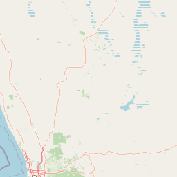
Map view of Charles Darwin Reserve

Use this park location map to pinpoint Charles Darwin Reserve in Australia, understand its exact geographic position, and read its mapped placement within the surrounding landscape more clearly.

Pigeon | © OpenStreetMap contributors

Location context for Charles Darwin Reserve

Western Australia
Park atlas

Compare regional protected areas and surrounding wildlife habitats in the Wheatbelt

Other Parks Near Charles Darwin Reserve and Connected Protected Landscapes

Browsing nearby national parks and regional protected areas helps trace broader conservation corridors across the surrounding semi-arid landscape. Comparing adjacent reserves reveals how native eucalypt woodlands and sand-plain heath extend beyond single property boundaries.
Nature reserveWestern Australia
About 25 km away#1 closest

Southeast

Mount Gibson Sanctuary Nature Reserve: Western Australia Protected Landscape Atlas

Regional geography and ecological transition zones

Located north-east of Perth, Mount Gibson Sanctuary serves as a vital nature reserve representing the complex boundary between the Wheatbelt and Australia's arid rangelands. The property features a mosaic of rocky ranges, claypans, floodplains, and sandplains that support significant bird and mammal populations within a carefully managed conservation framework.

Area
1,305 km²
Established
2001
Relief
Upland
Climate
Arid
National parkMid West
About 46 km away#2 closest

North

Mungada Ridge National Park: National Park Geography and Protected Landscape Details

Mapped boundaries and regional landscape context.

Delve into the protected landscape identity of Mungada Ridge National Park, a significant national park located in Australia's Mid West. This resource provides detailed information on its geographic positioning, mapped boundaries, and the natural terrain it encompasses, contributing to a structured understanding of protected areas within the region and the broader national atlas.

Area
10.31 km²
Established
2022
Relief
Upland
Climate
Arid
National parkWestern Australia
About 113 km away#3 closest

Southwest

Watheroo National Park National Park: Mapping Protected Landscapes in Western Australia

Explore regional geography and mapped park boundaries.

Watheroo National Park represents a key protected landscape within the vast state of Western Australia. This detail page offers focused insight into the park's specific geographic character, its mapped boundaries, and its role within the regional atlas of protected areas. Understand the natural terrain and landscape context that defines this Australian national park.

Area
444.81 km²
Established
1969
IUCN
II
Relief
Upland
National parkWestern Australia
About 133 km away#4 closest

West

Alexander Morrison National Park: Discover Its Protected Landscape and Regional Geography

Mapped protected area boundaries and landscape context in Western Australia.

Alexander Morrison National Park represents a core protected natural landscape within Western Australia. As a national park, its identity is deeply tied to its mapped geographic extent and its role in the regional atlas. This destination provides a focused lens on a specific protected area, enabling users to understand its unique landscape features and its contribution to the conservation estate of Western Australia. Delve into its protected status and geographic orientation within Australia's largest state.

Area
85 km²
Established
1970
IUCN
II
Relief
Upland
National parkWestern Australia
About 137 km away#5 closest

West

Tathra National Park: Protected Landscape Identity and Mapped Geographic Boundaries

Western Australia national park exploration and regional context.

Delve into the protected landscape of Tathra National Park, a significant entity within Western Australia's network of natural areas. This detail provides a structured overview of its geographic position, mapped outlines, and ecological context, serving as a vital entry point for understanding Australia's diverse protected lands and regional geography.

Area
43.22 km²
Established
1970
IUCN
II
Relief
Upland
National parkWestern Australia
About 167 km away#6 closest

Southwest

Badgingarra National Park: Mapped Boundaries and Protected Landscape Exploration

Explore its national park designation and regional geography.

Delve into the protected landscape identity of Badgingarra National Park, a designated national park situated in Western Australia. This entry provides detailed atlas-level information, focusing on the park's geographic scope, mapped boundaries, and its significance as a protected natural area. Understand its terrain and regional context for a deeper appreciation of Western Australia's conservation landscapes.

Area
131.08 km²
Established
1973
IUCN
II
Relief
Mixed relief
National parkWestern Australia
About 174 km away#7 closest

West

Lesueur National Park: Detailed National Park Atlas and Geographic Context

Explore the mapped protected landscape in Western Australia.

Lesueur National Park is a key protected area within the expansive geography of Western Australia. This resource provides detailed information on its national park status, mapped boundaries, and its significance within the regional atlas. Engage with the specific landscape identity of this protected territory and understand its role in the broader geographic context of Australia.

Area
272.35 km²
Established
1992
IUCN
II
Relief
Upland
National parkWestern Australia
About 191 km away#8 closest

West

Drovers Cave National Park: Protected National Park Landscape in Western Australia

Discover the mapped geography and natural context of this park.

Drovers Cave National Park stands as a key protected area within the expansive Western Australian region. This national park offers a focused lens through which to explore its specific geographic identity and landscape characteristics. As a designated national park, it is mapped within the larger atlas of Australia's protected lands, providing users with structured insights into its regional setting and natural terrain.

Area
26.81 km²
Established
1972
IUCN
II
Relief
Lowland

Common questions about visiting, size, designation, and location context for Charles Darwin Reserve

Charles Darwin Reserve FAQs for park facts, access, geography, and protected area context

Find quick answers about Charles Darwin Reserve, including protected-area facts, park geography, trail and visitor context, and how the park fits into its surrounding country and regional landscape.
MoriAtlas Explorer

Continue Your Protected Areas Search Across the Global Atlas

Deepen your exploration by continuing the structured search for national parks and protected areas worldwide. Utilize the comprehensive filtering capabilities to compare different conservation landscapes and refine your understanding of global park geography. Discover more about the distribution and characteristics of protected natural areas.

Global natural geography