

Mori Atlas logo
Protected landscapeCiénegas del Lerma

A detailed look at the highland marsh systems, riparian forests, and riverine geography.

Ciénegas del Lerma: Mapping the Protected Wetland Landscapes of the Central Mexican Highlands

(Área de Protección de Flora y Fauna Ciénegas del Lerma)

Ciénegas del Lerma represents a crucial remnant of the historic wetland systems once spanning the Toluca Valley plateau. This protected landscape preserves a mosaic of open-water lakes, floating marshes, and riparian woodlands that function as essential flood regulators. Our data maps the intersection of this aquatic geography with the surrounding volcanic terrain of the Trans-Mexican Volcanic Belt, highlighting its role as a refuge for endemic aquatic life and migratory bird species.

wetlandhighland basinfreshwater lakesmigratory birdsRamsar siteaquatic vegetation

Ciénegas del Lerma

Protected landscape

Park overview

Structured park overview, official facts, and landscape profile for Ciénegas del Lerma

Ciénegas del Lerma park facts, protected area profile, and essential visitor context

Review the core facts for Ciénegas del Lerma, including designation, size, terrain, visitor scale, habitats, and operating context in one park-focused overview.

About Ciénegas del Lerma

Ciénegas del Lerma is a highland wetland protected area in central Mexico, located in the State of Mexico within the upper drainage of the Lerma River and the broad Toluca Valley basin. Federally designated as an Área de Protección de Flora y Fauna in 2002, the reserve encompasses three principal water bodies, the Laguna de Almoloya, the Laguna de Lerma, and the Laguna de San Bartolo, together with their surrounding marshes, channels, and riparian zones.

The protected area sits within the Trans-Mexican Volcanic Belt, specifically in the Lagos y Volcanes de Anáhuac subprovince, giving it a volcanic geological substrate and soils dominated by alluvial and lacustrine types. Its landscape combines open lake surfaces more than five meters deep, swamps with both floating and emergent hydrophytes, and gallery forests along the streams that link the lakes. These varied aquatic and semi-aquatic habitats are what remain of a once vast marshland landscape that covered the surrounding plateau before the modern era of drainage and land conversion.

Ciénegas del Lerma functions simultaneously as a natural protected area, a working rural landscape, and a cultural anchor for the communities of the Toluca Valley. The reserve continues to support traditional activities such as small-scale fishing for native species, livestock grazing on surrounding lands, harvesting of aquatic plants, and limited seasonal hunting of migratory waterfowl. At the same time, its protected status is intended to safeguard the hydrological regulation, water-quality improvement, and biodiversity refugium functions that the wetland performs within a heavily modified regional landscape.

The broader importance of Ciénegas del Lerma derives from its position as one of the few representative remnants of the original wetland ecosystems of the Central Mexican Plateau. Where surrounding wetlands have been drained, polluted, or built over, this reserve still preserves a functional mosaic of open water, marshland, and riparian forest that continues to shelter species with very restricted national distributions and to provide essential services for the densely populated Toluca Valley that surrounds it.

Quick facts and research context for Ciénegas del Lerma

Ciénegas del Lerma is a federal Flora and Fauna Protection Area in the State of Mexico, situated in the upper Lerma River basin near the city of Toluca within the Trans-Mexican Volcanic Belt's Lagos y Volcanes de Anáhuac subprovince. The protected territory is divided into three polygons corresponding to the lakes of Almoloya, Lerma, and San Bartolo, and was formally inscribed as a Ramsar site in 2004, two years after its designation as a natural protected area.

The reserve protects temperate wetland habitats, including open-water bodies more than five meters deep, marshes with rooted aquatic vegetation, and streamside woodlands that together sustain more than 425 documented species of plants and animals. Among these are endemic and threatened taxa such as the Lerma axolotl and the Mexican duck, reflecting the site's role as a refugium in a region where most original wetlands have already been drained or modified.

Protection and recognition

Documented terrestrial protection history, designation year, and international Ramsar recognition

Ciénegas del Lerma Protection Status and International Recognition Facts

Ciénegas del Lerma maintains documented terrestrial protection status established in 2002 alongside official Ramsar wetland recognition. Structured records outline the designation history and management scope associated with the protected area.

International recognition

Protection details

Protection scope
Terrestrial
Designated year
2002
Transboundary protection
No
Park context

Deeper park guide and search-rich context for Ciénegas del Lerma

Ciénegas del Lerma history, landscape, wildlife, and travel context

Explore Ciénegas del Lerma through its history, landscape character, ecosystems, wildlife, conservation priorities, cultural context, and seasonal travel timing in a structured park guide built for atlas discovery and search intent.

Why Ciénegas del Lerma stands out

Ciénegas del Lerma is best known for being the last extensive surviving remnant of the great wetland system that once covered the central Mexican highlands along the upper Lerma River. The reserve is recognized both nationally and internationally for its combination of open-water lakes, floating marshes, and riparian forest that sustain a remarkably diverse community of aquatic plants, fish, amphibians, reptiles, and birds. It is especially valued as a wintering and stopover habitat for migratory waterfowl and as a refuge for several species that are endemic to Mexico or threatened with extinction, including the Lerma axolotl. The site also illustrates how a highland wetland system can continue to coexist with intensive human use, supporting traditional fishing, water-plant harvesting, and grazing within a flood-regulating, biodiversity-rich landscape.

Ciénegas del Lerma history and protected-area timeline

The wetland system now protected as Ciénegas del Lerma was, at the end of the nineteenth century, part of an enormous continuous marshland landscape that covered roughly 27,000 hectares across the upper Lerma basin. Over the course of the twentieth century, agricultural expansion, urban growth, industrial development in the Toluca Valley, and large-scale drainage projects drastically reduced and fragmented this original extent, leaving the three lakes and their associated marshes as the principal surviving fragments.

By the mid-twentieth century, additional areas had been lost, including roughly 10,746 hectares that became permanently inundated through mismanagement and excessive hydrological pressure by 1940. These historical losses framed Ciénegas del Lerma as a rare and increasingly valuable ecological refuge in a landscape that had otherwise lost most of its original wetland character.

In response to this pattern of degradation, the Mexican federal government issued a decree on 27 November 2002 establishing the area as an Área de Protección de Flora y Fauna, recognizing it as an ecological unit that still preserved several interacting ecosystems and a notable biodiversity component. Two years later, on 2 February 2004, Ciénegas del Lerma was designated a Ramsar Wetland of International Importance, placing it on the global register of wetlands considered significant for conservation and embedding it within the international framework of wetland protection.

Subsequent regulatory instruments have shaped how activities inside and around the reserve are managed. Federal norms on endangered native flora and fauna, on water resource availability, on scientific collection, on controlled use of fire, and on training and certification of nature guides all apply to the reserve, formalizing a layered conservation regime that overlays the working agricultural and fishing landscape still present around the lakes.

Ciénegas del Lerma landscape and geographic character

Ciénegas del Lerma occupies a highland basin position on the central Mexican plateau, with the three protected lakes set within a flat to gently rolling valley floor framed by the surrounding volcanic terrain of the Trans-Mexican Volcanic Belt. The protected area lies within the Lagos y Volcanes de Anáhuac physiographic subprovince, where lakes, swamps, and stream channels interwoven with ranching and farmland define the local topography.

The soils of the area reflect its geological and hydrological history, dominated by alluvial deposits along the watercourses and by three lacustrine soil regions associated with the historical lake beds. The principal soil types are humic histosols, gleysolic humic variants, pellic vertisols, gleyic phaeozems, and mollic andosols, together producing the moisture-retaining substrates that sustain the wetland vegetation.

The hydrology of the reserve is organized around the upper Lerma River and its tributaries, with various drainage channels, irrigation ditches, and smaller streams crossing and encircling the polygons. The three lakes themselves differ in depth and character, with deeper open-water areas exceeding five meters alongside shallower zones dominated by floating plants, emergent vegetation, and deep-rooted aquatic species. This combination of open water, marshland, riparian woodland, and agricultural countryside gives the protected area a strongly mosaic-like landscape in which water defines the spatial structure.

Ciénegas del Lerma ecosystems, habitats, and plant life

Ecologically, Ciénegas del Lerma is defined by the juxtaposition of open-water lake habitats with floating and emergent aquatic vegetation, extensive marshland communities, and riparian woodlands on the lake margins. The three protected lagoons, Almoloya, Lerma, and San Bartolo, each support distinct submergent and floating plant communities, but together they form a contiguous wetland complex that functions as a single ecological unit.

The vegetation of the reserve is composed of aquatic and subaquatic species as well as moisture-tolerant terrestrial plants. Across the three lakes, records include 226 species of angiosperms, two species of pteridophytes, and at least one algal species, a flora that includes Mexico-endemic taxa such as Cyperus semiochraceus, Sisyrinchium tolucense, Glyceria mexicana, Pennisetum crinitum, Nymphaea gracilis, and Lemna trisulca, as well as culturally important plants whose tubers, leaves, or roots are still harvested by local communities.

At the regional scale, Ciénegas del Lerma acts as a refugium for wetland-dependent ecological processes in a landscape that has otherwise been heavily converted to agriculture and urban land uses. The reserve retains functional examples of native aquatic plant communities, supporting water purification, sediment retention, flood regulation, and recharge of the underlying aquifer, and it provides essential habitat continuity for native fishes, amphibians, reptiles, and birds in an otherwise fragmented highland landscape.

Ciénegas del Lerma wildlife and species highlights

The protected area harbors more than 425 documented species of plants and animals, including 31 taxa classified under some category of risk and a number of exotic or introduced species. Mammals recorded within the reserve include the eastern cottontail, the long-tailed weasel, small shrews, pocket gophers, several bat species, western harvest mice, deer mice, Mexican voles, and hispid cotton rats, together representing a characteristic small-to-medium mammal community of central Mexican wetlands and their margins.

Birds are the most diverse vertebrate group, with around 118 species recorded, and the reserve is notable for its role as a wintering area for migratory waterfowl and other aquatic birds attracted by the temperate conditions and the relatively mild microclimate generated by the open water. Protected and threatened species in the area include the least grebe, American bittern, Mexican duck, Swainson's hawk, white-tailed hawk, swallow-tailed kite, peregrine falcon, yellow rail, king rail, Virginia rail, great horned owl, song sparrow, Savannah sparrow, and the endemic black-polled yellowthroat.

Reptiles of the reserve include the southern garter snake, the Mexican black-bellied water snake, the Mexican bull snake, the Trans-Mexican rattlesnake, the mesquite lizard, the mountain horned lizard, and the Mexican alligator lizard, occupying a range of aquatic, marsh, and upland habitats around the lakes. The amphibian fauna is small but ecologically significant, featuring salamanders such as the granular salamander and the critically important Lerma axolotl, together with tree frogs such as the ridged tree frog and the Moctezuma frog, several of which are classified as species at risk.

Native freshwater fishes have historically formed part of the cultural and economic identity of the wetland, and the reserve continues to sustain populations of native species alongside introduced carp, goldfish, and grass carp. The combination of endemic and threatened amphibians, restricted-range reptiles, a substantial migratory bird community, and a mix of native and introduced fishes gives Ciénegas del Lerma a distinctive and nationally important wildlife profile shaped by its position at the intersection of highland basin and major migratory flyway.

Ciénegas del Lerma conservation status and protection priorities

Ciénegas del Lerma is recognized as a conservation priority because it represents one of the last intact functioning wetland complexes of the Central Mexican highlands, an ecosystem type that has been almost entirely lost elsewhere in the region through drainage, urban expansion, and pollution. Federally designated as a Flora and Fauna Protection Area in 2002 and inscribed as a Ramsar site in 2004, the reserve carries both national and international legal recognition of its ecological value.

The conservation significance of the area rests on several reinforcing factors. It is a refugium for endemic species such as the Lerma axolotl, it anchors a migratory bird network across central Mexico, and it continues to provide regulating ecosystem services including flood control, water-quality maintenance, and aquifer recharge for the densely populated Toluca Valley. These functions tie the protection of the wetland directly to the hydrological and climatic stability of one of Mexico's most important highland basins.

At the same time, conservation here is inseparable from active management of human pressures. Over-extraction of groundwater to supply the Toluca Valley and Mexico City, urban and industrial land-use change, untreated wastewater discharges crossing the polygons via drainage channels during rain events, and shifts in agricultural practices all affect the lakes. The site's conservation regime therefore combines federal protection status, Ramsar obligations, and a set of national norms controlling endangered species protection, water availability accounting, scientific collection, controlled use of fire, and guide certification, in an effort to keep traditional livelihoods compatible with the long-term functioning of the wetland.

Ciénegas del Lerma cultural meaning and human context

Ciénegas del Lerma is woven into the cultural and economic life of the communities of the upper Lerma basin, where the lakes have long supported subsistence and small-scale commercial activities. Rainfed agriculture for household consumption and limited sale, extensive grazing of cattle, sheep, and horses, harvesting of aquatic plants such as water potato, watercress, soft-stem bulrush, and round and palm bulrush, and small-scale fishing for native species such as the tiro, amarillo, and tambulla fish coexist within and around the protected area.

Hunting of migratory waterfowl, particularly ducks and teal, has historically been part of the seasonal rhythm of the wetlands, alongside aquaculture practices using both native species and introduced Asian carp and crayfish. These activities give the reserve a strong cultural dimension, embedding it within a still-living rural wetland tradition rather than separating it from the surrounding working landscape.

The wetland also carries a broader symbolic and ecological significance, as the surviving fragment of the great marshland that once characterized the Toluca Valley and the central Mexican plateau. Its recognition as a Ramsar site and its continuous presence in the regional identity of Toluca and the surrounding municipalities underline its role not only as a natural protected area but also as a cultural landscape shared by farmers, fishers, hunters, and urban residents who depend, directly or indirectly, on the environmental services the wetland provides.

Top sights and standout views in Ciénegas del Lerma

Ciénegas del Lerma stands out as the principal surviving wetland of the upper Lerma basin and one of the last extensive highland marshes of central Mexico, with three named lake polygons each preserving distinct aquatic plant communities. Its combination of Ramsar status, flora and fauna protection designation, and ongoing traditional rural use makes it a notable example of layered conservation governance applied in a working landscape.

The reserve's particular strengths include its importance for migratory aquatic birds, its refuge role for the Lerma axolotl and other threatened amphibians, its mosaic of open water, floating marsh, and riparian woodland habitats, and its continuing role as a flood-regulating and water-quality-supporting element of the Toluca Valley landscape.

Best time to visit Ciénegas del Lerma

The climate of the Toluca Valley around Ciénegas del Lerma is temperate subhumid with summer rains, so the wetland's character shifts seasonally between a drier cool season and a warmer, water-rich rainy season. Winter, particularly December and January, brings frosts and the lowest temperatures of the year, but it is also the period when many migratory waterfowl are present at the lakes, making it the most rewarding season for observing wintering birdlife on the open water.

Spring and early summer, especially April and May, are the warmest and driest months, with the highest temperatures and the lowest atmospheric humidity, conditions in which water levels tend to be lower and aquatic vegetation is most visible. The rainy season that follows recharges the lakes and surrounding marshes and brings the wetland to its fullest hydrological expression, with the highest abundance of aquatic plants and the most active breeding conditions for resident wildlife.
Monthly climate preview

Long-term representative point measurements tracking monthly averages at 2067 meters

Ciénegas del Lerma Climate Normals, Annual Temperature and Precipitation Rhythm

Representative coordinate records show measured variations in mean temperature and daily precipitation across twelve distinct monthly intervals. Examining the complete twelve-month climate profile reveals long-term thermal and moisture patterns across the protected landscape.
Annual mean17 °C
14 °C21 °C
Jan14°
Feb16°
Mar18°
Apr20°
May21°
Jun19°
Jul18°
Aug18°
Sep17°
Oct17°
Nov16°
Dec15°
Warmest month
May

20.8 °C

Coolest month
January

14.4 °C

Wettest month
August

5.8 mm/day

Driest month
December

0.2 mm/day

Park location guide

Geography guide, regional context, and park location map for Ciénegas del Lerma

Ciénegas del Lerma park geography, regions, and map view in Mexico

Understand where Ciénegas del Lerma sits in Mexico through a broader geographic reading of the surrounding landscape, nearby location context, and its mapped position within the national park landscape.

How Ciénegas del Lerma fits into Mexico

Mexico, officially the United Mexican States, is a country in North America spanning the Sierra Madre mountain ranges, coastal plains, and tropical regions. It borders the United States to the north, Guatemala and Belize to the southeast, and has coastlines along the Pacific Ocean, Gulf of Mexico, and Caribbean Sea. With a population exceeding 130 million, Mexico is home to one of the world's most significant concentrations of Indigenous languages alongside Spanish.

Wider geography shaping Ciénegas del Lerma in Mexico

Mexico occupies a land area of 1,972,550 km2, making it the thirteenth-largest country in the world. The terrain is highly diverse, featuring the Sierra Madre Occidental and Sierra Madre Oriental mountain ranges, the Mexican Plateau, coastal lowlands along the Pacific and Gulf/Caribbean margins, and the Yucatan Peninsula. The country spans multiple climate zones from desert in the north to tropical rainforest in the south.

Map view of Ciénegas del Lerma

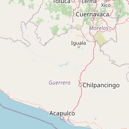
Use this park location map to pinpoint Ciénegas del Lerma in Mexico, understand its exact geographic position, and read its mapped placement within the surrounding landscape more clearly.

Pigeon | © OpenStreetMap contributors

Location context for Ciénegas del Lerma

Estado de México
Park atlas

Compare regional wetlands, highland reserves, and connected conservation areas

Explore Parks Near Ciénegas del Lerma and Surrounding Protected Landscapes

Continue exploring regional geography by comparing Ciénegas del Lerma with other protected areas across the central Mexican plateau. Examining nearby natural reserves reveals broader watershed patterns and shared highland wetland characteristics.
National parkMexico
About 17 km away#1 closest

Northeast

La Marquesa National Park: Atlas of Protected Highland Forests in Mexico's Sierra de las Cruces

Explore its mapped boundaries and regional geographic context.

La Marquesa National Park represents a critical protected natural zone in Mexico's central highlands, specifically within the Sierra de las Cruces mountain range. Its landscape is defined by rugged volcanic terrain, featuring steep slopes and deep ravines densely covered by pine and oak woodlands. Designated as an early national park, it plays a crucial role in watershed protection for the surrounding region, preserving unique highland forest ecosystems and their associated biodiversity. This park offers a tangible example of protected landscape within Mexico's atlas, highlighting its ecological significance and geographic positioning.

IUCN
II
National parkState of Mexico
About 23 km away#2 closest

Southeast

Lagunas de Zempoala National Park: Protected Landscape and Geographic Atlas Entry

Explore mapped boundaries and natural terrain context.

Lagunas de Zempoala National Park is a dedicated protected area within the State of Mexico, serving as a vital point for understanding national park geography and landscape mapping. This entry provides foundational atlas data on its protected boundaries and its specific natural terrain. It is designed for users seeking structured information on the park's geographic scope and its importance as a mapped natural landscape for regional context.

Area
47.9 km²
Established
1936
IUCN
II
Relief
Mountain
National parkMexico City
About 23 km away#3 closest

Northeast

Desierto de los Leones National Park: Protected National Park and its Geographic Setting

Explore mapped boundaries and regional landscape context near Mexico City.

Delve into the specifics of Desierto de los Leones National Park, a designated national park recognized for its protected landscape. This MoriAtlas entry focuses on its geographic presence within the Mexico City region, providing clear insights into its mapped boundaries and the surrounding natural terrain. Understand the park's importance as a conservation area and its contribution to the regional geography through dedicated atlas data.

Area
18.67 km²
Established
1917
IUCN
II
Visitors
205K annual
National parkMexico
About 26 km away#4 closest

East

Cumbres del Ajusco National Park: Exploring Mexico's National Park Protected Landscape

Discover mapped boundaries and regional geography.

Cumbres del Ajusco National Park is an important national park offering rich opportunities for geographic exploration. This detailed profile focuses on its identity as a protected landscape within Mexico, providing essential context for map-based discovery. Understand the park's specific location, its mapped territory, and its role within the nation's network of conservation areas, facilitating a structured atlas view.

Area
9.2 km²
Established
1936
IUCN
II
Relief
Mountain
National parkMexico State
About 30 km away#5 closest

Southwest

Nevado de Toluca National Park: Protected Landscape Atlas and Geographic Context

Explore mapped boundaries and regional terrain within Mexico State.

Nevado de Toluca National Park serves as a key protected landscape for understanding the natural geography of Mexico State. This destination facilitates detailed exploration of its mapped territory, protected area identity, and the surrounding regional context. Discover how this national park fits into the larger geographic atlas through its distinct terrain and documented boundaries, offering a factual foundation for landscape research.

Area
510 km²
Established
1936
IUCN
VI
Relief
Mountain
A watercolor illustration showing a misty mountain peak in the background and a grassy meadow with a winding path in the foreground.
Wildlife reserveEstado de México
About 30 km away#6 closest

Southwest

Área de protección de flora y fauna Nevado de Toluca: Geography and Protected Landscapes

High-altitude volcanic massif and hydrological protected area

Situated in the State of Mexico, this wildlife reserve preserves the dramatic volcanic slopes of the Nevado de Toluca. The protected area features significant elevation gradients, crater lakes, and transition forests that anchor the regional watershed and provide a habitat for a wide array of plant and animal species.

Area
467.84 km²
Established
1936
IUCN
II
Relief
Mountain
National parkMexico
About 34 km away#7 closest

East

Fuentes Brotantes de Tlalpan National Park: National Park Geographic Atlas and Terrain Exploration

Explore protected land boundaries and mapped natural landscapes.

Delve into the geographic specifics of Fuentes Brotantes de Tlalpan National Park, a protected national park situated within Mexico. This detailed view highlights the park's mapped terrain and its significance as a distinct natural landscape. Understand its role in the country's protected area network and its contribution to the broader atlas of natural geography.

Area
0.08 km²
Established
1936
IUCN
II
Relief
Upland
National parkMexico State
About 39 km away#8 closest

Northeast

Los Remedios National Park: Protected Landscape and Historical Geography of Mexico State

Mapped terrain and cultural heritage within this unique national park.

Delve into the protected landscape of Los Remedios National Park, a national park situated in Mexico State. This page provides detailed geographic context, focusing on its volcanic terrain, mapped boundaries, and the convergence of pre-Hispanic and colonial heritage. Understand its role as a protected area within the western Valley of Mexico and explore the mapped elements that define its cultural and natural identity.

Area
4 km²
Established
1938
IUCN
II
Relief
Mountain

Common questions about visiting, size, designation, and location context for Ciénegas del Lerma

Ciénegas del Lerma FAQs for park facts, access, geography, and protected area context

Find quick answers about Ciénegas del Lerma, including protected-area facts, park geography, trail and visitor context, and how the park fits into its surrounding country and regional landscape.
MoriAtlas Explorer

Continue Your Protected Areas Search Across the Global Atlas

Deepen your exploration by continuing the structured search for national parks and protected areas worldwide. Utilize the comprehensive filtering capabilities to compare different conservation landscapes and refine your understanding of global park geography. Discover more about the distribution and characteristics of protected natural areas.

Global natural geography