

Mori Atlas logo
National parkCollier Range National Park

Discover the mapped boundaries and regional terrain of this national park in Western Australia.

Collier Range National Park: Protected Landscape and Geographic Context in Western Australia

Collier Range National Park represents a distinct protected landscape within the vast geography of Western Australia. As a national park, its mapped boundaries delineate an area crucial for understanding regional conservation efforts and natural terrain context. This page serves as a focused entry point for exploring the specific geographic identity and atlas significance of Collier Range National Park, providing essential context for broader landscape discovery.

National ParkWestern AustraliaPilbaraArid LandscapeMountain TerrainCliff Formations

Collier Range National Park

National park

Park overview

Structured park overview, official facts, and landscape profile for Collier Range National Park

Collier Range National Park park facts, protected area profile, and essential visitor context
Review the core facts for Collier Range National Park, including designation, size, terrain, visitor scale, habitats, and operating context in one park-focused overview.

About Collier Range National Park

Collier Range National Park occupies a significant position within the protected area network of Western Australia's Pilbara region, a vast and historically remote landscape known for its ancient geological formations, extreme temperatures, and distinctive arid-adapted ecosystems. The park was established in 1978 as part of a broader initiative to protect representative examples of the Pilbara's natural landscapes and biodiversity. The Collier Range itself presents a mountainous character that rises abruptly from the surrounding terrain, offering a landscape of considerable visual and ecological distinction within a region more typically characterized by gently undulating plains and occasional isolated hills. The park's establishment reflected growing recognition that the Pilbara's biodiversity, while adapted to harsh conditions, faced pressures from pastoral development, feral animals, and other human activities that necessitated formal protection of key habitats and species. Management responsibility rests with the Western Australian Department of Parks and Wildlife, though the park's remote location and limited resources have resulted in relatively minimal active management intervention compared to more accessible protected areas.

Quick facts and research context for Collier Range National Park

Collier Range National Park occupies a substantial tract of the central Pilbara in Western Australia, covering 2,351.62 square kilometres. The park was formally established in 1978 and is managed under IUCN Category II as a national park. The terrain is characterized by ranges that transition from low hills to impressive high ridges with numerous cliff formations. Vegetation across the park is typical of arid Pilbara environments, dominated by spinifex grassland and mulga woodland, with eucalypts following creek lines through the terrain. The northeastern plains support dense mulga scrub with mulla mulla understorey, while the western sections feature spinifex and sand dunes. The park is notable for supporting populations of the threatened Pilbara Pebble-Mound Mouse, as well as greater bilby, mulgara, and other critical weight range mammals within the protective mulga habitat.

Park context

Deeper park guide and search-rich context for Collier Range National Park

Collier Range National Park history, landscape, wildlife, and travel context
Explore Collier Range National Park through its history, landscape character, ecosystems, wildlife, conservation priorities, cultural context, and seasonal travel timing in a structured park guide built for atlas discovery and search intent.

Why Collier Range National Park stands out

Collier Range National Park is best known for its dramatic ridgeline and cliff formations that create a mountainous character unusual in the generally flat Pilbara landscape. The park protects significant populations of the Pilbara Pebble-Mound Mouse, a small mammal whose distinctive pebble-mound nesting behaviour makes it a particular focus for conservation attention. The mulga woodland habitats within the park serve as critical refuges for several threatened mammal species including the greater bilby and mulgara, both of which have suffered extensive range contractions across northern Australia. The contrast between the rugged, cliff-lined ranges and the spinifex-dominated plains creates a visually distinctive landscape that distinguishes this park from other Pilbara protected areas.

Collier Range National Park history and protected-area timeline

Collier Range National Park was established in 1978 through formal declaration under Western Australian legislation, creating protected status for the Collier Range area within the broader Pilbara region. The establishment of the park occurred during a period of increased environmental awareness in Australia during the 1970s, when numerous national parks and reserves were declared to protect representative natural areas across different terrestrial ecosystems. The decision to protect the Collier Range reflected recognition of the area's distinctive landforms and the ecological value of its vegetation communities and wildlife populations. Prior to formal protection, the land had been subject to limited pastoral use, typical of the extensive cattle and sheep grazing that characterizes much of the Pilbara's rangelands. The park's creation also responded to growing scientific understanding of the biodiversity significance of Pilbara environments, including the discovery and documentation of species such as the Pilbara Pebble-Mound Mouse whose conservation needs were only beginning to be understood. Since establishment, the park has remained under the management of the Western Australian parks and wildlife authority, though its remote location has limited the frequency and intensity of management activities.

Collier Range National Park landscape and geographic character

The landscape of Collier Range National Park is defined by the prominent ridge and cliff systems that give the area its name and create one of the more mountainous environments within the Pilbara region. The ranges within the park vary from low hills to high ridges, with numerous cliff formations adding dramatic vertical relief to the terrain. These ancient landscapes have been shaped by millions of years of geological processes, with the underlying rock formations contributing to the distinctive red and orange hues that characterize much of the Pilbara's scenery. Between the ridge systems, the terrain gives way to plains that support different vegetation communities, with the northeastern areas featuring dense mulga scrub while the western portions transition into more open spinifex grassland with scattered sand dunes. The park's creeklines, though infrequently flowing in this arid environment, are lined with eucalypts that provide green vegetation corridors through the otherwise sparse landscape. The combination of cliff-lined ridges, rolling plains, and the subtle greening of creek environments creates a landscape of considerable visual diversity within the broader context of arid Australian terrain.

Collier Range National Park ecosystems, habitats, and plant life

The nature of Collier Range National Park reflects the distinctive ecological character of the Pilbara, one of Australia's most environmentally significant arid regions. The park's vegetation communities are adapted to low rainfall, extreme temperatures, and nutrient-poor soils, resulting in a landscape where vegetation is distributed according to subtle variations in moisture availability and soil type. Spinifex, a tough tussock-forming grass, dominates large areas of the park, particularly in the western sections where it occurs alongside developing sand dunes. Mulga, a distinctive Acacia species adapted to arid conditions, forms extensive woodland and scrubland across the northeastern plains and throughout the range areas. These vegetation communities provide critical habitat for the park's characteristic wildlife, supporting both common species and several that are of significant conservation concern. The eucalypts that follow the creek lines represent important moisture-retaining environments that support additional species and provide refuge during periods of drought. The overall ecological character reflects millions of years of evolution in an arid landscape, producing species and communities uniquely adapted to the challenges of the Pilbara environment.

Collier Range National Park wildlife and species highlights

Collier Range National Park is notable for supporting several threatened mammal species that have declined dramatically across much of their former Australian range. The park is particularly important as a habitat for the Pilbara Pebble-Mound Mouse, a small native rodent distinguished by its behaviour of constructing mounds of small pebbles around its nesting burrows. This species is listed as threatened and is known from relatively few locations, with the Collier Range area representing one of its strongholds alongside Millstream-Chichester National Park and Karlamilyi National Park. The mulga woodland and scrub habitats within the park provide crucial refuge for critical weight range mammals, a group of small to medium-sized marsupials and rodents that have suffered severe declines across northern Australia. Greater bilby populations persist within the park's mulga habitats, representing one of the few remaining strongholds for this iconic but increasingly rare species. The mulgara, a small carnivorous marsupial, similarly depends on the protective cover provided by dense mulga vegetation. These species collectively represent a significant conservation asset for the park, justifying its role within the Pilbara's protected area network despite the challenges posed by introduced animals and limited management resources.

Collier Range National Park conservation status and protection priorities

The conservation significance of Collier Range National Park derives from its role in protecting both distinctive Pilbara landscapes and populations of threatened arid-land wildlife. The park provides protected habitat for several mammal species of conservation concern, including the Pilbara Pebble-Mound Mouse, greater bilby, and mulgara, all of which have experienced significant range contractions across their former distributions. However, the park faces considerable conservation challenges that reflect the broader pressures affecting Pilbara environments. Feral donkeys cause damage to vegetation and soil through trampling and browsing, while wandering cattle from neighbouring pastoral properties intrude into the park and compete with native wildlife for resources. Wild dog populations necessitate active management through baiting programs. Despite its protected status, the park suffers from limited management attention due to its remote location, with Department of Parks and Wildlife staff visiting only occasionally from Karratha. No fire management program is currently in place, which may affect vegetation dynamics and habitat condition over time. These challenges highlight the gap between formal protection status and effective on-ground conservation that affects many remote Australian protected areas.

Collier Range National Park cultural meaning and human context

The cultural context of Collier Range National Park is less extensively documented in available sources than its ecological values, though the Pilbara region more broadly has deep cultural significance for Indigenous Australian communities. The land upon which the park sits has been part of Traditional Owners' Country for thousands of years, though specific details of Indigenous heritage and connection to the Collier Range area are not extensively recorded in the available source material. The Pilbara region contains numerous significant Indigenous sites and continues to be managed in partnership with Aboriginal organisations and Traditional Owners where appropriate. The pastoral history of the Pilbara, which preceded the park's establishment, has left a legacy of modified landscapes and introduced species that current conservation management must address. The establishment of the park in 1978 represented a recognition that the natural values of the Collier Range warranted protection independent of pastoral and mining uses that dominate much of the broader region.

Top sights and standout views in Collier Range National Park

Collier Range National Park offers a distinctive Pilbara experience defined by its dramatic ridgeline and cliff terrain that creates a mountainous backdrop rare in this predominantly flat region. The park's significance as a refuge for threatened wildlife, particularly the Pilbara Pebble-Mound Mouse, greater bilby, and mulgara, positions it as an important conservation area within the broader network of Pilbara protected areas. The contrast between the rugged range terrain with its cliff formations and the surrounding spinifex and mulga plains creates a visually compelling landscape. Visitors seeking to experience the remote and rugged character of the Australian outback will find the Collier Range offers a wilderness experience largely unchanged from that encountered by early explorers and pastoralists entering the region. The park represents one of the more accessible mountain environments within the Pilbara, offering a different perspective on this vast and ancient landscape.

Best time to visit Collier Range National Park

The optimal time to visit Collier Range National Park would be during the cooler months of the Australian winter, typically between May and September, when daytime temperatures are more moderate and comfortable for outdoor exploration. The Pilbara experiences extremely hot conditions during summer months, with temperatures frequently exceeding 40 degrees Celsius, making outdoor activity hazardous and uncomfortable. Winter visits allow for more extended exploration of the park's landscape while reducing heat stress. However, visitors should be aware that the park receives very limited management attention and infrastructure development, necessitating self-sufficiency and careful preparation. The remote nature of the area means that visitors should carry adequate supplies of water, food, and fuel, and advise others of their travel plans. The park's wildlife viewing opportunities may be enhanced during cooler periods when animals are more active during daylight hours.
Park location guide

Geography guide, regional context, and park location map for Collier Range National Park

Collier Range National Park park geography, regions, and map view in Australia
Understand where Collier Range National Park sits in Australia through a broader geographic reading of the surrounding landscape, nearby location context, and its mapped position within the national park landscape.

How Collier Range National Park fits into Australia

Australia is a constitutional monarchy and federal parliamentary democracy comprising six states and ten territories. With a population of nearly 28 million, it is one of the world's most urbanised countries, with most people concentrated on the eastern seaboard. The country has a high Human Development Index and is known for its cultural diversity, ancient Aboriginal heritage, and unique wildlife.

Wider geography shaping Collier Range National Park in Australia

Australia occupies the entire Australian continent, the island of Tasmania, and numerous smaller islands. It is the world's flattest and driest inhabited continent, featuring vast deserts in the interior (the Outback), tropical rainforests along the eastern coast, and a coastline bordering the Indian and Pacific Oceans.

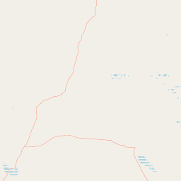
Map view of Collier Range National Park

Use this park location map to pinpoint Collier Range National Park in Australia, understand its exact geographic position, and read its mapped placement within the surrounding landscape more clearly.

Pigeon | © OpenStreetMap contributors

Location context for Collier Range National Park

Western Australia
Park atlas

Compare the diverse arid landscapes and rugged mountain terrains that define Western Australia's Pilbara conservation network.

Explore Related National Parks and Protected Areas Near Collier Range National Park
Trace the regional spread of national parks and protected areas adjacent to Collier Range National Park, encompassing similar rugged mountain terrains and arid landscapes across Western Australia's Pilbara region. Compare these distinct conservation units to gain a comprehensive geographic understanding of the interconnected protected landscapes and their unique ecological character.
National parkWestern Australia

Mount Augustus National Park: Western Australia National Park & Protected Landscape

Explore its mapped terrain and regional geographic context.

Mount Augustus National Park represents a significant protected area within the diverse geography of Western Australia. This page serves as a portal to understanding its specific protected landscape characteristics and its contribution to the state's mapped natural areas. Users can explore the park's geographic identity, its defined boundaries, and its role within a broader atlas of protected lands, providing essential context for regional landscape discovery.

Area
91.68 km²
Established
1989
IUCN
III
Relief
Mountain
National parkWestern Australia

Karijini National Park: Explore the Protected Landscape and Geographic Context in Western Australia

Mapped natural terrain and regional geography for this Australian national park.

Karijini National Park is a designated national park in Western Australia, offering a distinct protected landscape for geographic exploration. This detailed entry provides context on its specific location within the state, its mapped boundaries, and the surrounding natural terrain. It serves as a foundational element for understanding the park's role within the larger atlas of protected areas and natural geography across Australia.

Area
6,274.22 km²
Established
1969
IUCN
II
Visitors
166K annual
National parkGoldfields-Esperance

Matuwa Kurrara Kurrara National Park: A National Park in Goldfields-Esperance

Explore its protected landscape and regional geographic context.

Matuwa Kurrara Kurrara National Park is a designated national park offering a unique lens into Australia's protected lands. Situated within the Goldfields-Esperance region, this park's mapped geography and protected boundaries provide essential context for understanding its natural landscape. Engage with the park's identity as a key protected area, uncovering its contribution to the regional geography and atlas exploration.

Area
6,093 km²
Established
2023
Relief
Lowland
Climate
Arid
National parkWestern Australia

Lakeside National Park: Protected Landscape in Western Australia's Murchison Bioregion

Explore its semi-arid terrain and mapped park boundaries.

Lakeside National Park is an 8,490-hectare national park located in Western Australia's Mid West region, declared in 2021. Situated within the Murchison bioregion, it encompasses characteristic semi-arid landscapes, including Mulga woodland and open plains. This protected area serves as a key site for understanding the geological heritage and ecological communities of inland Western Australia, offering a specific point for mapped landscape exploration.

Area
84.9 km²
Established
2021
IUCN
II
Climate
Arid
National parkWestern Australia

Karlamilyi National Park: A Premier Protected Desert Landscape in Western Australia

Explore mapped terrain, river systems, and dune fields across this vast national park.

Karlamilyi National Park is the largest national park in Western Australia, covering a significant portion of the Pilbara's desert wilderness. This protected area showcases an entire sequence of desert landforms, including vast sand dune fields, rugged tablelands, and the complete Rudall River catchment system. As a place of profound cultural importance and a prime example of intact desert landscape processes, Karlamilyi National Park offers unique insights into Australia's natural and geographic heritage within a mapped context.

Area
12,837.1 km²
Established
1977
IUCN
II
Relief
Lowland
National parkGascoyne

Kennedy Range National Park: Explore Its Dramatic Sandstone Plateau and Canyon Geography

Discover the protected landscapes of Gascoyne's arid terrain.

Kennedy Range National Park is a protected area defined by its striking geological formations, including a vast sandstone plateau and deeply incised canyons that create a dramatic mesa landscape. Situated in the Gascoyne region, this national park serves as a significant example of Australia's inland semi-arid environments, offering rich context for mapped terrain exploration. Understand the park's protected boundaries, its unique arid-zone ecosystems, and the visual contrast it presents within the regional geography, providing valuable insights for atlas-driven discovery.

Area
1,416.6 km²
Established
1993
IUCN
II
Relief
Highland
National parkWestern Australia

Millstream Chichester National Park: A Mapped Protected Landscape in Western Australia

Explore its geographic spread and natural terrain features.

Millstream Chichester National Park is a designated national park within the vast geographic expanse of Western Australia. This entry provides detailed atlas-level information focused on its protected boundaries and distinct landscape characteristics. Understand the park's role within the regional geography and its significance as a mapped natural area for discovery and exploration.

Area
2,381.67 km²
Established
1970
IUCN
II
Relief
Mixed relief
National parkGascoyne

Pimbee National Park: Australian National Park with Gascoyne Regional Geography

Mapped protected boundaries and natural landscape context.

Pimbee National Park represents a key protected area within Australia's vast Gascoyne region. This national park provides a specific geographic focus, allowing for detailed exploration of its mapped boundaries and the surrounding natural landscape. Understanding Pimbee National Park's place within the regional geography of Western Australia is crucial for a comprehensive atlas-driven discovery of the continent's protected lands and their unique terrain.

Established
2023
Climate
Arid
Scope
Terrestrial

Common questions about visiting, size, designation, and location context for Collier Range National Park

Collier Range National Park FAQs for park facts, access, geography, and protected area context
Find quick answers about Collier Range National Park, including protected-area facts, park geography, trail and visitor context, and how the park fits into its surrounding country and regional landscape.
MoriAtlas Explorer

Continue Your Protected Areas Search Across the Global Atlas

Deepen your exploration by continuing the structured search for national parks and protected areas worldwide. Utilize the comprehensive filtering capabilities to compare different conservation landscapes and refine your understanding of global park geography. Discover more about the distribution and characteristics of protected natural areas.

Global natural geography