
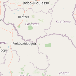
Lakes
Park geography
A structured examination of park terrain, river systems, and upland geography in Ivory Coast
Detailed Geographic Profile, Mapped Boundaries, and Natural Landscapes of Comoé National Park
Examine the expansive 11,491.5 square kilometer boundary of Comoé National Park through structured map data. This geographic profile details the upland relief and diverse habitat types, including tropical forest, grassland, and wetland systems. Gain context on major water features and specific peaks that define the protected landscape.

West Africa's largest protected natural reserve, anchored by the Comoé River and sweeping Sudanian savanna.
Comoé National Park
Comoé National Park is the largest protected natural area in West Africa, set in the northeast of Côte d'Ivoire within the Bounkani region around the town of Bouna. Designated as a national park in 1968 and recognized as a UNESCO World Heritage Site and biosphere reserve in 1983, it protects a vast swath of the West Sudanian savanna ecoregion, traversed by the Comoé River and bordered to the west by the Black Volta, which marks the frontier with Burkina Faso. The park's combination of riverine forests, broad savanna plains, and seasonal floodplains supports an unusually rich mosaic of West African wildlife, including elephants, hippos, three species of crocodiles, and a remarkable density of antelope and primate species. Its sheer size and ecological diversity have made it one of the most important strongholds for biodiversity conservation in the region, even as it has faced serious pressures from poaching, livestock grazing, and management gaps that once placed its World Heritage status in peril.
- Location
- Ivory Coast
- Park type
- National park
- Established
- 1968
- Area
- 11,491.5 km²
Location overview
National park administrative records and country location data
Comoé National Park Location and Geographic Setting in Ivory Coast
Comoé National Park is officially situated within the national borders of Ivory Coast. Administrative records confirm its sovereign country membership within the protected area database.
- Countries
- Ivory Coast
- Primary location
- Ivory Coast
- Geographic setting
- Inland
Boundary and coordinates
Comoé’s mapped outline encompasses a recorded 11,491.5 km²
Comoé National Park mapped boundary and 11,491.5 km² area
Comoé National Park's stored boundary geometry conveys the shape and scale of its extensive 11,491.5 km² protected area. The database reports that size as a combined total, without a land or marine breakdown and without a perimeter measurement.
- Boundary area
- 11,530.3 km²
- Boundary perimeter
- 513.8 km
- Northernmost point
- 9.6159° N
- Southernmost point
- 8.5048° N
- Easternmost point
- 3.1155° W
- Westernmost point
- 4.4419° W
- Geographic centre
- 9.1171° N, 3.7244° W
- North–south span
- 122.9 km
- East–west span
- 145.8 km
Terrain and natural features
Upland terrain classifications and recorded natural features across the protected landscape
Comoé National Park Terrain Geography and Named Natural Features
Stored upland relief classifications define the landscape alongside recorded streams, lakes, peaks, and ridges located within the protected area boundaries. Individual feature records supply verified names, classification types, and spatial relationships for structural atlas navigation.
Selected named natural features
Streams
Hanha
Streams
Lougbélo
Streams
Pidi
Streams
Kolosson
Streams
Hahiu
Environmental setting
Tropical habitat types, upland relief, and seasonal water systems
Comoé National Park Environmental Classifications and Physical Geography
Recorded landscape features, habitat types, and climate classifications provide interpretive frameworks for the physical setting. Connected categories link directly to relevant atlas destinations across the region.
- Relief
- Upland
- Climate
- Tropical
- Water
- Major water bodies
- Forest cover
- Partial forest
- Seasonality
- Seasonal
Landscape features
Forest · Grassland · Wetland · Rivers
Habitat types
Tropical forest · Grassland · Wetland · Riverine habitat
Park atlas
Compare regional park geography, savanna habitats, and adjacent protected landscapes
Other Parks Like Comoé National Park and Protected Areas in the Surrounding Region
Browse national parks and protected areas sharing the West Sudanian savanna ecoregion with Comoé National Park. Expand regional geographic comparison and trace connected conservation landscapes across the surrounding terrain.
National parkIvory Coast
Park boundaries overlap#1 closest
Northwest

Comoé National Park: Geographic and Environmental Overview of the Ivory Coast Reserve
Mapping the transitions of West Africa's largest protected savanna ecosystem.
Comoé National Park serves as an ecological crossroads in north-eastern Ivory Coast, protecting 11,500 square kilometers of diverse terrain. The park hosts an extraordinary gradient of habitats, from dense gallery forests hugging the 230 kilometer stretch of the Comoé River to open, dry Sudanian savannas. Its geological foundation, featuring dramatic granite inselbergs and wide plains, supports a highly complex network of life, making it a cornerstone for understanding West African regional conservation and landscape ecology.
- Area
- 11,500 km²
- Established
- 1983
- IUCN
- II
- Relief
- Lowland
Wildlife reserveUpper West Region
About 66 km away#2 closest
Northeast

Wechiau Community Hippo Sanctuary: Protected River Landscapes and Savanna Wildlife Reserve
Upper West Region, Ghana: Riverine ecology and community-managed boundaries
Wechiau Community Hippo Sanctuary encompasses a protected stretch of the Black Volta, providing essential habitat for hippopotamuses in northwestern Ghana. This wildlife reserve features a diverse landscape of riverine forests, sandbanks, and savanna trails. The sanctuary demonstrates how local traditional governance maintains critical natural terrain while fostering an integrated cultural and ecological landscape.
- Established
- 1999
- Relief
- Lowland
- Scope
- Terrestrial
- Water
- Major water bodies
National parkSavannah Region
90 km away#3 closest
East
Mole National Park: A Premier Protected Landscape in Ghana's Savannah Region
Explore mapped boundaries and Guinea savannah ecosystems.
Mole National Park represents a significant protected landscape within Ghana's Savannah Region, serving as the country's largest national park and a crucial conservation area for West African wildlife. The park's geography is defined by extensive Guinea savannah, characterized by grasslands with scattered woodlands and a prominent escarpment along its southern edge. Its vast expanse offers a unique opportunity to study mapped park boundaries and understand the ecosystem's role in regional conservation efforts. Discover the unique landscape context and protected area identity of this major West African wildlife refuge.
- Area
- 4,840 km²
- Established
- 1958
- IUCN
- II
- Visitors
- 17.8K annual
National parkGhana
About 100 km away#4 closest
Southeast
Bui National Park: Protected Savanna Landscape and Black Volta River Geography in Ghana
Explore the mapped boundaries and unique ecosystems of this national park.
Bui National Park, a protected national park in Ghana, offers a rich geographic discovery of savanna ecosystems bisected by the Black Volta River. Its vast mapped area provides a unique setting for understanding riparian corridors, woodland savanna, and mountainous terrain. The park is critically important for its significant hippopotamus population and its designation as an Important Bird Area, showcasing its ecological value. Exploration of Bui National Park provides insight into Ghana's protected landscapes and their strategic position within West African geography, serving as a key entity for any natural atlas.
- Area
- 1,820 km²
- Established
- 1971
- IUCN
- II
- Relief
- Mixed relief
Protected areaCascades
About 131 km away#5 closest
Northwest

Lac de Tengréla Protected Area: Mapping Wetland Landscapes in the Cascades Region
Freshwater geography and regional catchment in southwestern Burkina Faso
Located near Banfora, Lac de Tengréla functions as a protected Ramsar wetland within the Comoé River system. This freshwater lake provides essential ecological value, with its elongated basin and outflow connectivity offering a distinct window into the hydrology and natural terrain of southwestern Burkina Faso.
- Area
- 5.8 km²
- Established
- 2009
- Scope
- Terrestrial
- Water
- Water-dominated
Wildlife reserveUpper West Region
About 171 km away#6 closest
Northeast
Gbele Resource Centre Wildlife Reserve: A Regional Atlas of Protected Savanna Landscapes
Mapped geography and protected woodland in Ghana
Gbele Resource Centre represents one of the most substantial protected savanna landscapes in northwestern Ghana, spanning over 500 square kilometres of Sudano-Sahelian woodland. The terrain is defined by the seasonal Kulpawn River and a distinct composition of African baobab and sycamore fig trees, which together anchor an important ecological corridor. This reserve provides a vital opportunity to map and understand the conservation geography and avian diversity that distinguish the Upper West Region from other parts of the country.
- Area
- 565 km²
- Relief
- Lowland
- Scope
- Terrestrial
- Water
- Minor water
Protected areaBurkina Faso
About 175 km away#7 closest
North
Forêt classée de Kou: Protected Gallery Forest and Riverine Geography in Burkina Faso
A compact biodiversity refuge near Bobo-Dioulasso
Forêt classée de Kou stands as a vital example of Guinean-type forest preservation in Burkina Faso. This protected area features a complex mosaic of dense gallery woodland along the Kou and Guinguette rivers, transitioning into arborescent savanna. With its layered canopy, riverine corridors, and documented avian richness, it serves as a critical geographic marker of humid woodland in the broader Sudano-Sahelian terrain.
- Area
- 1.15 km²
- Established
- 1951
- Climate
- Tropical
- Access
- Easy access
Wildlife reserveBono East Region
About 192 km away#8 closest
Southeast
Boabeng-Fiema Monkey Sanctuary: Geographic Boundaries and Wildlife Reserve Context
Community-protected forest landscapes in Ghana
Boabeng-Fiema Monkey Sanctuary represents a rare community-based wildlife reserve located in central Ghana. Spanning 4.4 square kilometers between the villages of Boabeng and Fiema, the forest provides essential habitat for primate populations protected by generations of cultural tradition. This detail page offers geographic context, map exploration of the forest reserve, and insight into the unique intersection of woodland ecosystems and community-enforced conservation in the Bono East Region.
- Area
- 4.4 km²
- Established
- 1970
- Relief
- Lowland
- Climate
- Tropical
MoriAtlas Explorer
Explore the Geographic Boundaries and Protected Terrain of Comoé National Park
Deepen your understanding of Comoé National Park through our detailed geographic data and map-focused analysis. MoriAtlas presents the structural landscape, riverine corridors, and savanna distribution that define this premier Ivory Coast protected area, facilitating a clearer view of its role in regional conservation.
Browse next
Global natural geography
Explore related park routes
Explore MoriAtlas Global ParksBrowse All MoriAtlas ParksGlobal Park Map DiscoveryMoriAtlas: Browse All CountriesBrowse All MoriAtlas ContinentsNational Park Environment AtlasGrand Canyon National Park AtlasYellowstone National Park AtlasYosemite National Park Atlas and GeographySerengeti National Park AtlasGalápagos National Park Protected LandscapeBanff National Park Geography and AtlasKruger National Park Atlas EntryUluṟu-Kata Tjuṯa National Park AtlasExplore Uluru-Kata Tjuta National Park GeographyPlitvice Lakes National Park AtlasFiordland National Park Protected LandscapeGreat Smoky Mountains National Park AtlasAfghanistan National Parks and Protected AreasAlbania National Parks and Protected AreasAlgeria National Parks and Protected AreasAmerican Samoa National Parks and Protected AreasAndorra National Parks and Protected AreasAngola National Parks and Protected AreasAntarctica National Parks and Protected AreasAntigua and Barbuda Park List