Why Conception Island National Park stands out
Conception Island National Park is best known for its extensive mangrove ecosystems and its role as a premier nesting site for green sea turtles in the Bahamas. The island's protected status has helped preserve one of the region's most important coastal wetland complexes, where mangrove communities dominate the shoreline and provide critical habitat for marine life. The park also serves as a significant stopover and nesting area for numerous seabird species and migratory birds, making it an important location for avian conservation in the Caribbean.
Conception Island National Park history and protected-area timeline
Conception Island National Park was established in 1964, making it one of the earliest national parks in the Bahamas. The creation of the park reflected a growing awareness in the mid-20th century of the need to protect the Bahamas' unique coastal and island ecosystems. The Bahamas National Trust, founded to manage the nation's protected areas, assumed administrative responsibility for the park. Beyond its ecological significance, the island has historical cultural interest due to a theory proposed by Washington Irving that identified Conception Island as one of Christopher Columbus' landfall sites during his 1492 voyage. However, this early attribution was not supported by subsequent historians, who identified other islands in the Bahamas as more likely candidates for Columbus' first landfall. This historical note, while unverified, adds a layer of cultural context to the island's identity.
Conception Island National Park landscape and geographic character
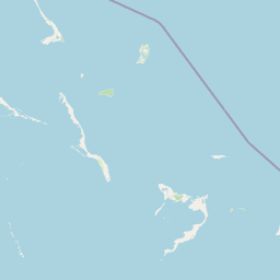
The landscape of Conception Island National Park is defined by its low-lying coastal geography and extensive mangrove systems. The island's terrain is nearly flat, reaching only 20 meters at its highest point, which is characteristic of the limestone-based islands that make up the Bahamian archipelago. Along the island's margins, dense mangrove communities dominate, creating a distinctive coastal ecosystem where tidal waters flow through root systems that support diverse marine life. The interior of the island features typical strand vegetation adapted to the salty, windswept environment of a small Caribbean island. The surrounding waters, while not technically part of the land-based park designation, are integral to the island's ecological function, with mangrove ecosystems extending into the shallow marine environment. The overall visual character is one of low green vegetation rising only slightly above sea level, surrounded by the turquoise waters of the Bahamas.
Conception Island National Park ecosystems, habitats, and plant life
The nature of Conception Island National Park centers on its mangrove-dominated coastal ecosystem, which represents one of the most ecologically important habitat types in the Caribbean region. Mangroves serve as critical nurseries for fish and crustaceans, stabilize coastlines, and filter water, making them among the most productive ecosystems in tropical marine environments. The strand vegetation inland includes species adapted to coastal conditions, including salt tolerance and wind resistance. The island's position within the Bahamas places it within a broader network of marine ecosystems that support significant biodiversity. The relatively undisturbed nature of the island, protected since 1964, has allowed these ecosystems to persist with less human disturbance than many other Caribbean coastlines have experienced.
Conception Island National Park wildlife and species highlights
The wildlife of Conception Island National Park is most notable for the island's significance as a nesting site for green sea turtles, which rank among the most important marine reptiles in the Caribbean. Green sea turtles return to the island's beaches to lay their eggs, making Conception Island one of the most important nesting sites in the Bahamas for this species. The surrounding waters provide foraging habitat for juvenile and adult turtles. Beyond marine reptiles, the island supports substantial seabird populations and serves as a critical stopover for migratory birds traveling through the Caribbean. The mangrove habitats support fish, crustaceans, and other marine species that rely on these productive coastal ecosystems. The combination of marine, coastal, and terrestrial habitats creates a relatively complete ecological system within the small island boundary.
Conception Island National Park conservation status and protection priorities
Conception Island National Park holds significant conservation importance within the Bahamas and the broader Caribbean region. The protection of the island's mangrove ecosystems preserves habitat that is critical for marine species at multiple life stages, from spawning grounds to juvenile nurseries. The park's status as a major green sea turtle nesting site gives it particular conservation significance, as sea turtle populations throughout the Caribbean face pressures from habitat loss, egg predation, and human interaction. The long-established protected status, dating to 1964, has provided decades of continuous protection that has allowed these ecological values to persist. The Bahamas National Trust's management of the park ensures that conservation priorities remain central to the site's stewardship, maintaining the protected area's ecological integrity.
Conception Island National Park cultural meaning and human context
While the ecological values of Conception Island are the primary basis for its protected status, the island also carries a degree of historical cultural interest related to early exploration of the Americas. The writer Washington Irving proposed that Conception Island was one of the sites where Christopher Columbus landed during his 1492 voyage, a theory that would have given the island a place in the foundational narrative of European contact with the Americas. However, this attribution was not accepted by subsequent historical scholarship, which has identified other islands in the Bahamas as more plausible candidates for Columbus' first landfall. This historical note, while unverified, adds a layer of cultural context to the island without altering the primary conservation rationale for its protected status.
Top sights and standout views in Conception Island National Park
Conception Island National Park stands out as one of the Bahamas' most important protected areas for coastal and marine conservation. The park's extensive mangrove habitats represent critical ecosystems that support marine food webs and provide nursery habitat for commercially and ecologically important species. The island's status as a major green sea turtle nesting site distinguishes it within the Bahamas, as few other islands provide such important nesting grounds for this endangered marine reptile. The park's age, established in 1964, makes it one of the more mature protected areas in the Bahamas, with decades of continuous conservation stewardship. The combination of terrestrial, coastal, and marine habitats within a single protected designation creates a relatively comprehensive conservation unit that preserves ecological processes across multiple environments.
Best time to visit Conception Island National Park
The best time to visit Conception Island National Park aligns with the broader patterns of Bahamian weather and the ecological cycles of the island's key species. The dry season from late autumn through spring offers generally more stable weather conditions for island visits. Green sea turtle nesting occurs during warmer months, and visitors traveling during peak summer may witness nesting activity if conditions permit. Migratory bird passage through the Bahamas occurs during spring and autumn, providing opportunities to observe transient species using the island as a stopover. The flat, low-lying nature of the island means that visitors should be aware of hurricane season risks during the summer and autumn months, when tropical weather can affect travel plans.