

Mori Atlas logo
Wildlife reserveDefence Island Wildlife Sanctuary

Understanding the island boundaries, coastal terrain, and forest environments of this Andaman archipelago reserve

Defence Island Wildlife Sanctuary: A Comprehensive Geographic Overview of Protected Tropical Island Landscapes

Defence Island Wildlife Sanctuary stands as a protected tropical landscape situated within the Andaman archipelago, encompassing a significant expanse of coastal and interior forest environments. Located north of Port Blair in the Bay of Bengal, this uninhabited reserve maintains an essential role in the ecological network of the Andaman and Nicobar Islands. Its low-lying terrain and elongated coastline provide a clear window into the regional geography that defines these protected island habitats.

wildlife sanctuaryAndaman Islandsuninhabited islandtropical islandBay of Bengalisland reserve

Defence Island Wildlife Sanctuary

Wildlife reserve

Park overview

Structured park overview, official facts, and landscape profile for Defence Island Wildlife Sanctuary

Defence Island Wildlife Sanctuary park facts, protected area profile, and essential visitor context

Review the core facts for Defence Island Wildlife Sanctuary, including designation, size, terrain, visitor scale, habitats, and operating context in one park-focused overview.

About Defence Island Wildlife Sanctuary

Defence Island Wildlife Sanctuary is a designated island reserve located in the Andaman group of islands, part of India's union territory of Andaman and Nicobar Islands. The sanctuary occupies a single uninhabited island within the Bay of Bengal, situated north of Port Blair and within the broader Defence Group of islands near the Jirkatang sound.

The island's physical profile is typical of smaller Andaman landforms: a low-lying, elongated tropical island with a coastline of roughly 14 kilometres, supporting interior forest cover alongside littoral and coastal habitat zones. Its uninhabited status reinforces its character as a dedicated conservation area, free from permanent human settlement and focused instead on habitat and species protection.

Administered as part of South Andaman district and Ferrargunj Tehsil, the sanctuary fits into the wider protected-area framework of the Andaman and Nicobar Islands. Though modest in scale, it plays a meaningful role within the archipelago's network of island reserves that collectively sustain the tropical island ecosystems of the Bay of Bengal.

Quick facts and research context for Defence Island Wildlife Sanctuary

Defence Island Wildlife Sanctuary is an uninhabited protected island within the Andaman Islands, part of India's Andaman and Nicobar union territory. The island falls under the South Andaman district and Ferrargunj Tehsil, and lies roughly 33.5 kilometres north of Port Blair.

It is a low-lying tropical island in the Bay of Bengal, with a land area of about 5 square kilometres, an elongated shape measuring roughly 5.4 kilometres long and 1.4 kilometres wide, and a coastline of around 14 kilometres. As a designated wildlife sanctuary, it functions as a habitat protection reserve within the wider Andaman archipelago.

Park context

Deeper park guide and search-rich context for Defence Island Wildlife Sanctuary

Defence Island Wildlife Sanctuary history, landscape, wildlife, and travel context

Explore Defence Island Wildlife Sanctuary through its history, landscape character, ecosystems, wildlife, conservation priorities, cultural context, and seasonal travel timing in a structured park guide built for atlas discovery and search intent.

Why Defence Island Wildlife Sanctuary stands out

Defence Island Wildlife Sanctuary is known primarily as an uninhabited island reserve within the Andaman archipelago, recognized for its role in protecting tropical island habitat in the Bay of Bengal. Its compact size and protected status make it a representative example of the small island sanctuaries that contribute to biodiversity preservation across the Andaman and Nicobar Islands.

Defence Island Wildlife Sanctuary history and protected-area timeline

The historical development of Defence Island Wildlife Sanctuary is largely tied to the broader establishment of protected areas across the Andaman and Nicobar Islands under Indian administration. The island itself, situated within the Defence Group of islands near Jirkatang, has been managed as part of the union territory's conservation framework rather than as a populated settlement.

Its designation as a wildlife sanctuary reflects the regional priority placed on protecting uninhabited tropical islands as habitat reserves. Beyond this administrative protection status, detailed historical milestones for the sanctuary are not extensively documented in available sources.

Defence Island Wildlife Sanctuary landscape and geographic character

Defence Island is a small, low-lying tropical island with an elongated shape stretching about 5.4 kilometres in length and around 1.4 kilometres in width. The island reaches its high point close to sea level, with the highest recorded elevation effectively at 0 metres, reinforcing its character as a flat coastal landform within the Andaman archipelago.

Its roughly 14 kilometres of coastline frame the island's perimeter, shaped by the waters of the Bay of Bengal. The interior combines coastal and littoral habitats typical of smaller Andaman islands, with vegetation cover transitioning from shoreline fringe communities into denser tropical interior growth. The surrounding sea and the nearby Jirkatang sound contribute to the broader marine and coastal setting that defines the island's physical character.

Defence Island Wildlife Sanctuary ecosystems, habitats, and plant life

As an island wildlife sanctuary in the Andamans, Defence Island represents the tropical island ecology characteristic of the archipelago. Its habitats span coastal and littoral zones along the Bay of Bengal shoreline as well as interior forest environments further inland, supporting the typical vegetation patterns associated with small uninhabited Andaman islands.

The protected status of the island helps maintain habitat continuity in a region where small island ecosystems are ecologically significant. The combination of shoreline, interior forest, and surrounding marine influence gives the sanctuary a layered ecological profile even at its compact scale, integrating terrestrial and coastal habitat types within a single reserve.

Defence Island Wildlife Sanctuary wildlife and species highlights

The wildlife profile of Defence Island Wildlife Sanctuary aligns with that of other protected uninhabited islands in the Andaman archipelago, where tropical forests, coastal vegetation, and surrounding waters sustain island biodiversity. While detailed species inventories for this specific sanctuary are limited in available sources, the island's protected status indicates its role in safeguarding fauna typical of the region's small island habitats.

Defence Island Wildlife Sanctuary conservation status and protection priorities

Defence Island Wildlife Sanctuary's significance lies in its designation as a protected uninhabited island within a heavily island-dominated union territory. By maintaining its status free from permanent human settlement and by being formally recognized as a wildlife sanctuary, the island contributes to the broader conservation network of the Andaman and Nicobar Islands.

Its protection supports habitat continuity for native island flora and fauna and complements the regional strategy of preserving ecologically representative islands across the Bay of Bengal. The sanctuary therefore holds value as part of a larger archipelago-wide conservation framework rather than as a standalone large-scale reserve.

Defence Island Wildlife Sanctuary cultural meaning and human context

The Defence Group of islands, of which Defence Island is a part, holds a place within the geography of the Andaman archipelago near the Jirkatang sound. Detailed indigenous or local community cultural associations specific to this particular island sanctuary are not extensively documented in available sources.

Top sights and standout views in Defence Island Wildlife Sanctuary

Defence Island Wildlife Sanctuary stands out as an uninhabited tropical island reserve within the Andaman group, offering protection to a representative slice of the archipelago's island habitat. Its elongated coastline, modest scale, and location north of Port Blair make it a notable component of the South Andaman district's protected-area framework.

The sanctuary's defining qualities are its untouched natural state, its position within the Bay of Bengal, and its role in sustaining the broader network of island conservation that defines the Andaman and Nicobar union territory.

Best time to visit Defence Island Wildlife Sanctuary

Detailed seasonal guidance specific to Defence Island Wildlife Sanctuary is not extensively documented. In the broader Andaman context, conditions favourable to tropical island landscapes and coastal habitat viewing typically align with the region's drier months, while monsoon periods bring heavier rainfall and rougher sea conditions.
Monthly climate preview

Long-term representative monthly temperature and precipitation data patterns

Defence Island Wildlife Sanctuary Climate Normals and Annual Temperature Rhythm

Representative baseline coordinates record consistent warm monthly temperatures alongside distinct shifts between dry periods and heavier precipitation regimes. Analyzing the complete twelve-month sequence reveals detailed long-term averages across the protected area.
Annual mean28 °C
27 °C29 °C
Jan27°
Feb27°
Mar28°
Apr29°
May29°
Jun28°
Jul28°
Aug28°
Sep28°
Oct28°
Nov28°
Dec27°
Warmest month
April

29.2 °C

Coolest month
January

26.7 °C

Wettest month
September

13.2 mm/day

Driest month
February

0.4 mm/day

Park location guide

Geography guide, regional context, and park location map for Defence Island Wildlife Sanctuary

Defence Island Wildlife Sanctuary park geography, regions, and map view in India

Understand where Defence Island Wildlife Sanctuary sits in India through a broader geographic reading of the surrounding landscape, nearby location context, and its mapped position within the national park landscape.

How Defence Island Wildlife Sanctuary fits into India

India is a South Asian country bordered by the Indian Ocean, Arabian Sea, and Bay of Bengal. It shares land borders with Pakistan, China, Nepal, Bhutan, Bangladesh, and Myanmar. The country has a population of over 1.4 billion people and operates as a federal parliamentary republic with its capital in New Delhi.

Wider geography shaping Defence Island Wildlife Sanctuary in India

India occupies the Indian subcontinent in South Asia, bordered by the Arabian Sea to the southwest, the Bay of Bengal to the southeast, and the Indian Ocean to the south. It shares land borders with Pakistan to the west, China, Nepal, and Bhutan to the north, and Bangladesh and Myanmar to the east. The territory also includes the Andaman and Nicobar Islands in the Indian Ocean.

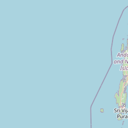
Map view of Defence Island Wildlife Sanctuary

Use this park location map to pinpoint Defence Island Wildlife Sanctuary in India, understand its exact geographic position, and read its mapped placement within the surrounding landscape more clearly.

Pigeon | © OpenStreetMap contributors

Location context for Defence Island Wildlife Sanctuary

Andaman and Nicobar Islands
Park atlas

Discover related island reserves and coastal habitats across the Andaman archipelago

Explore Parks Near Defence Island Wildlife Sanctuary and Surrounding Protected Areas

Browsing other protected areas near Defence Island Wildlife Sanctuary reveals connected tropical island habitats and coastal landscapes throughout the surrounding region. Comparing these regional reserves provides deeper geographic context for island conservation networks in the Bay of Bengal.
National parkAndaman and Nicobar Islands
About 20 km away#1 closest

Southeast

Mount Harriet National Park: National Park Mapping and Protected Landscape Identity

Explore its endemic biodiversity and mountain forest terrain.

Mount Harriet National Park provides a deep dive into a unique protected landscape, offering detailed insights into its geography, terrain, and ecological significance within the Andaman and Nicobar Islands. As a national park, it showcases a remarkable combination of mountainous forest ecosystems and coastal environments, serving as a vital habitat for numerous endemic species. Understanding its mapped boundaries and regional geographic context reveals why this protected area is a key point of interest for atlas-based natural landscape exploration.

Area
46.62 km²
Established
1979
IUCN
II
Relief
Mountain
Marine protected areaIndia
About 20 km away#2 closest

South

Rani Jhansi Marine National Park: An Indian Marine Protected Area for Geographic Discovery

Explore mapped marine boundaries and regional landscape context.

Rani Jhansi Marine National Park stands as a crucial marine protected area within India, offering a unique focus on aquatic ecosystems and coastal geography. This dedicated space allows for detailed exploration of its specific marine protected boundaries and its significance within the broader landscape of India's natural heritage. Delve into the mapped geography and protected areas of this vital conservation zone for a deeper understanding of its environmental role.

Area
256 km²
Established
1996
IUCN
II
Climate
Tropical
National parkIndia
About 46 km away#3 closest

South

Mahatma Gandhi Marine National Park: India National Park Protected Landscape and Geography

Explore mapped boundaries and regional geographic context.

Gain a detailed understanding of Mahatma Gandhi Marine National Park, a designated national park in India. This entry focuses on its protected area status, the mapped extent of its natural landscape, and its significance within India's diverse geography. Discover the park's spatial context and contribution to the nation's protected lands through an atlas-focused lens, providing essential geographic details for informed exploration.

Area
281.5 km²
Established
1983
IUCN
II
Relief
Lowland
National parkAndaman and Nicobar Islands
About 55 km away#4 closest

Northeast

South Button Island National Park: Mapped Boundaries and Regional Protected Landscape

Key National Park in the Andaman and Nicobar Islands

South Button Island National Park is a protected natural area offering critical insight into the geography of the Andaman and Nicobar Islands. This detailed view focuses on its mapped boundaries and its significance as a national park within this Indian archipelago. Understanding its position within the regional geography provides essential context for exploring protected lands and natural landscapes across the Andaman and Nicobar Islands.

Area
5 km²
Relief
Lowland
Climate
Tropical
Access
Moderate access
National parkAndaman and Nicobar
About 59 km away#5 closest

Northeast

Middle Button Island National Park: National Park within Andaman and Nicobar's Geography

Explore protected landscape context and mapped park boundaries.

Middle Button Island National Park represents a significant protected natural landscape, offering users a focused entry point for geographic discovery. As a designated national park, it contributes distinct mapped boundaries and terrain characteristics to the Andaman and Nicobar region's atlas data. Understanding its specific identity helps contextualize the broader protected-area network and regional geography. This page details the park's role as a conserved territory, vital for those seeking structured landscape and geography information.

Area
64 km²
Established
1979
Relief
Lowland
Climate
Tropical
National parkAndaman and Nicobar Islands
About 65 km away#6 closest

Northeast

North Button Island National Park: Protected Landscape and Mapped Geographic Identity

Explore the mapped boundaries and regional natural terrain.

Gain a clear understanding of North Button Island National Park as a distinct protected landscape within the Andaman and Nicobar Islands region. This entry offers detailed geographic context, focusing on the park's mapped boundaries and its role within the archipelago's natural terrain. It serves as a foundational element for understanding this Indian National Park's place in a broader atlas of conservation areas.

Area
114 km²
Established
1979
Wildlife reserveAndaman and Nicobar Islands
About 65 km away#7 closest

North

Flat Island Wildlife Sanctuary: Protected Island Geography in the Andaman and Nicobar Islands

Coastal wildlife reserve and isolated island terrain

Flat Island Wildlife Sanctuary stands as a distinct, low lying protected area within the Andaman and Nicobar Islands. Its compact oval shape and shoreline focused landscape provide a clear example of the archipelago's small scale, uninhabited marine reserves. This protected island serves as a vital geographic marker for those mapping the diverse coastal habitats found across the Bay of Bengal.

Area
2.48 km²
Relief
Lowland
Climate
Tropical
Access
Remote access
Wildlife reserveAndaman and Nicobar Islands
About 93 km away#8 closest

Northeast

Cuthbert Bay Wildlife Sanctuary: Coastal Habitat and Sea Turtle Nesting Ground

Eastern Middle Andaman protected coastal geography

Cuthbert Bay Wildlife Sanctuary covers 5.8 square kilometres of critical coastal terrain along the eastern Middle Andaman coastline. Renowned for its concentration of sea turtle nesting beaches, the reserve supports diverse coastal ecosystems ranging from open sand to inland forest patches. It serves as a compact but vital ecological anchor within the broader landscape of the Andaman and Nicobar Islands.

Area
5.8 km²
Established
1997
IUCN
IV
Scope
Terrestrial

Common questions about visiting, size, designation, and location context for Defence Island Wildlife Sanctuary

Defence Island Wildlife Sanctuary FAQs for park facts, access, geography, and protected area context

Find quick answers about Defence Island Wildlife Sanctuary, including protected-area facts, park geography, trail and visitor context, and how the park fits into its surrounding country and regional landscape.
MoriAtlas Explorer

Continue Your Protected Areas Search Across the Global Atlas

Deepen your exploration by continuing the structured search for national parks and protected areas worldwide. Utilize the comprehensive filtering capabilities to compare different conservation landscapes and refine your understanding of global park geography. Discover more about the distribution and characteristics of protected natural areas.

Global natural geography