Mori Atlas logo
National parkDeux Mamelles National Park

Mapping the U-shaped mountain terrain and vital cloud forest ecosystem of Haiti's Tiburon Peninsula.

Deux Mamelles National Park: Haiti's Protected Cloud Forest Landscape and Geography

(Parc National Naturel de Deux Mamelles)

Deux Mamelles National Park represents a crucial protected landscape within Haiti, safeguarding the prominent U-shaped Morne Deux Mamelles mountain. This national park, established in 2015, protects one of the Caribbean's last significant tracts of intact cloud forest above 1,000 meters. Its rugged limestone terrain and high elevation create a unique highland environment that offers vital watershed protection and refuge for endemic species. Discover the geographic context of this remote park and its importance as a conservation area on the Tiburon Peninsula.

Cloud ForestMountain Protected AreaLimestone TerrainCaribbean ConservationNew National ParkWatershed Protection

Deux Mamelles National Park

National park

Park overview

Structured park overview, official facts, and landscape profile for Deux Mamelles National Park

Deux Mamelles National Park park facts, protected area profile, and essential visitor context

Review the core facts for Deux Mamelles National Park, including designation, size, terrain, visitor scale, habitats, and operating context in one park-focused overview.

About Deux Mamelles National Park

Deux Mamelles National Park represents one of Haiti\u2019s newest and most ecologically significant protected areas, created to preserve a rare mountain cloud forest ecosystem in a country where deforestation has eliminated most old-growth forest cover. Located on the Tiburon Peninsula in the southwestern portion of the country, the park encompasses the mountainous terrain surrounding Morne Deux Mamelles, a prominent U-shaped peak that rises dramatically from the surrounding landscape. The park\u2019s establishment in 2015 followed preliminary scientific surveys that revealed the area\u2019s exceptional biodiversity value, particularly the presence of intact cloud forest at higher elevations. The limestone substrate supporting this forest creates a unique ecological setting, with highly dissected rock formations providing diverse microhabitats for specialized species. Haiti\u2019s protected area network remains limited, and Deux Mamelles represents a critical addition for preserving the country\u2019s remaining forest biodiversity and watershed function.

Quick facts and research context for Deux Mamelles National Park

Deux Mamelles National Park is located on the Tiburon Peninsula in southwestern Haiti, just west of a line connecting Les Anglais to the south and J\u00e9r\u00e9mie to the north. The park was officially established on September 23, 2015 and covers 2,265 hectares. Its central feature, Morne Deux Mamelles, rises to 1,276 meters and is the highest mountain at the western end of the Tiburon Peninsula. The park protects significant cloud forest ecosystem on limestone substrate, with primary forest remaining only above 1,000 meters elevation. Access is extremely difficult due to the absence of roads, and the park was first scientifically explored via helicopter in 2011.

Protection and recognition

Tracking the terrestrial protection status and formal designation history of the regional landscape

Deux Mamelles National Park Protection Status and Conservation Designation

National park profiles provide verified data on the terrestrial protection status and official designation history established for Deux Mamelles National Park. Documenting the official 2015 establishment timeline helps researchers map conservation boundaries and analyze regional environmental management efforts.

Protection details

Protection scope
Terrestrial
Designated year
2015
Park context

Deeper park guide and search-rich context for Deux Mamelles National Park

Deux Mamelles National Park history, landscape, wildlife, and travel context

Explore Deux Mamelles National Park through its history, landscape character, ecosystems, wildlife, conservation priorities, cultural context, and seasonal travel timing in a structured park guide built for atlas discovery and search intent.

Why Deux Mamelles National Park stands out

Deux Mamelles National Park is best known for protecting one of Haiti\u2019s last significant tracts of cloud forest, a critically endangered ecosystem type in the Caribbean. The park\u2019s U-shaped mountain, Morne Deux Mamelles, harbors primary forest growing on dissected limestone rock at elevations exceeding 1,000 meters. This highland forest provides critical watershed protection and habitat for species found nowhere else, making it a biodiversity hotspot of national and regional importance. The park\u2019s inaccessibility has paradoxically served as a natural conservation buffer, preserving ecological integrity that more reachable Haitian forests have lost.

Deux Mamelles National Park history and protected-area timeline

Deux Mamelles National Park was officially established on September 23, 2015, making it one of Haiti\u2019s most recently designated national parks. The park\u2019s creation was directly prompted by a 2011 exploratory visit conducted by founders of the Haiti National Trust, who accessed the remote area by helicopter due to the absence of any road infrastructure reaching the mountain. During this initial survey, the team collected biological data that revealed the area\u2019s remarkable biodiversity and the critical conservation value of its remaining cloud forest. The findings from this expedition provided the scientific foundation for advocating formal protected area status. Prior to this survey, the Morne Deux Mamelles area had received limited scientific attention despite its ecological significance, and its remote character had largely preserved it from the extensive deforestation that has affected other Haitian forests.

Deux Mamelles National Park landscape and geographic character

The landscape of Deux Mamelles National Park is dominated by the U-shaped mountain formation of Morne Deux Mamelles, which rises to 1,276 meters and stands as the highest peak at the western end of Haiti\u2019s Tiburon Peninsula. The terrain features highly dissected limestone rock, creating a rugged and complex topography with numerous ridges, valleys, and cliff faces. The mountain\u2019s elevation and positioning within the Tiburon Peninsula create a distinct highland environment where cloud-forming conditions are frequent. The limestone substrate weathers into distinctive karst-like features, with exposed rock outcrops and steep slopes characterizing much of the park\u2019s terrain. Below the cloud forest zone, the landscape transitions through lowerelevation vegetation zones before meeting the more degraded agricultural and pastoral lands that surround the protected area.

Deux Mamelles National Park ecosystems, habitats, and plant life

The nature of Deux Mamelles National Park centers on its cloud forest ecosystem, one of the most threatened forest types in the Caribbean and among the rarest in Haiti. The primary forest that remains intact above 1,000 meters elevation represents a critical refuge for biodiversity in a country where most original forest has been cleared. The cloud forest develops on the highly dissected limestone substrate, where frequent mist and moisture create conditions for epiphytic vegetation, specialized plant communities, and unique ecological interactions. This ecosystem type serves critical watershed functions, capturing moisture from clouds and releasing it as streams that feed lower-elevation watersheds. The combination of high rainfall, persistent cloud cover, and limestone geology produces a distinctive ecological community with species adapted to these specific conditions.

Deux Mamelles National Park wildlife and species highlights

While the source material does not provide detailed species lists, the cloud forest ecosystem of Deux Mamelles National Park almost certainly supports significant biodiversity, including numerous bird species, amphibians, insects, and other fauna adapted to highland forest conditions. Cloud forests throughout the Caribbean are known to harbor endemic species, and the isolated nature of Morne Deux Mamelles increases the likelihood of unique species presence. The forest provides critical habitat for migratory bird species that use Caribbean flyways, while resident birds depend on the intact forest for nesting and feeding. Amphibians, particularly sensitive to environmental changes, find sanctuary in the moist cloud forest conditions. The 2011 biological survey conducted by the Haiti National Trust likely documented specific wildlife observations that formed the basis for the park\u2019s establishment, though detailed species records are not available in this source.

Deux Mamelles National Park conservation status and protection priorities

Deux Mamelles National Park represents a critical conservation asset for Haiti, protecting one of the nation\u2019s last remaining intact cloud forest ecosystems. The park\u2019s establishment addresses a significant gap in Haiti\u2019s protected area network, which historically has underrepresented highland forest environments. The cloud forest ecosystem provides essential watershed protection, regulating water flow and preventing erosion on the steep limestone terrain. The park\u2019s relative inaccessibility has paradoxically served conservation goals by limiting human impact and forest clearing that has devastated other Haitian forests. Conservation challenges include the need for ongoing protection enforcement, research to document biodiversity, and community engagement to ensure sustainable relationships between local populations and the protected area.

Deux Mamelles National Park cultural meaning and human context

The cultural context of Deux Mamelles National Park is closely tied to the rural communities of the Tiburon Peninsula, where agriculture and small-scale land use have historically shaped the landscape surrounding the protected area. The park\u2019s name, Deux Mamelles, refers to the twin peaks or ridges of the U-shaped mountain, reflecting local geographic knowledge and naming conventions. The area\u2019s remote character has preserved both ecological integrity and traditional land-use patterns, though the surrounding lands have experienced forest loss typical of rural Haitian development. The park\u2019s recent establishment in 2015 represents a modern conservation approach applied to a landscape with deep historical roots in agricultural and pastoral use.

Top sights and standout views in Deux Mamelles National Park

The standout features of Deux Mamelles National Park include its status as a recent addition to Haiti\u2019s protected area network, preserving one of the country\u2019s last significant cloud forest ecosystems. The park protects Morne Deux Mamelles, the highest mountain at the western end of the Tiburon Peninsula, rising to 1,276 meters with intact primary forest above 1,000 meters. Its remote, roadless character has naturally preserved ecological values that more accessible areas have lost. The limestone-based cloud forest represents a distinctive habitat type within the Caribbean, providing watershed benefits and biodiversity refuge in a region where forest conservation remains urgently needed.

Best time to visit Deux Mamelles National Park

Visiting Deux Mamelles National Park presents significant challenges due to the absence of road access, making the park extremely difficult to reach through conventional means. The 2011 scientific expedition accessed the area by helicopter, and no infrastructure exists for regular visitor access. For those able to arrange specialized access, the dry season typically offers more favorable conditions for outdoor activity in Haiti, though cloud forest environments are inherently moist year-round. The park\u2019s remote character means that visit planning requires substantial logistical advance preparation and dependence on local knowledge and permission.
Monthly climate preview

Long-term representative temperature and precipitation averages across the year

Deux Mamelles National Park Climate Normals and Monthly Weather Records

Deux Mamelles National Park exhibits steady monthly temperature ranges alongside measured precipitation variations recorded across twelve distinct periods. Examining the complete twelve-month climatology dataset reveals deeper statistical patterns for temperature and rainfall across the protected terrain.
Annual mean27 °C
26 °C29 °C
Jan26°
Feb26°
Mar26°
Apr27°
May28°
Jun28°
Jul28°
Aug29°
Sep28°
Oct28°
Nov27°
Dec26°
Warmest month
August

28.5 °C

Coolest month
January

25.6 °C

Wettest month
October

3.5 mm/day

Driest month
March

0.8 mm/day

Park location guide

Geography guide, regional context, and park location map for Deux Mamelles National Park

Deux Mamelles National Park park geography, regions, and map view in Haiti

Understand where Deux Mamelles National Park sits in Haiti through a broader geographic reading of the surrounding landscape, nearby location context, and its mapped position within the national park landscape.

How Deux Mamelles National Park fits into Haiti

Haiti is a Caribbean country occupying the western third of Hispaniola Island in the Caribbean Sea. It gained independence from France in 1804 following the Haitian Revolution, becoming the first sovereign state established by a slave revolt and the second independent nation in the Americas. The country is known for its complex political history, economic challenges, and cultural significance in the Caribbean.

Wider geography shaping Deux Mamelles National Park in Haiti

Haiti occupies the western third of Hispaniola Island in the Caribbean, sharing the island with the Dominican Republic. The country is positioned in the Caribbean Sea, east of Cuba and south of the Bahamas. Haiti's terrain is predominantly mountainous, with valleys and coastal plains. The country borders the Caribbean Sea on its western, southern, and southwestern coasts.

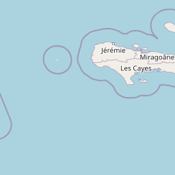
Map view of Deux Mamelles National Park

Use this park location map to pinpoint Deux Mamelles National Park in Haiti, understand its exact geographic position, and read its mapped placement within the surrounding landscape more clearly.

Pigeon | © OpenStreetMap contributors

Location context for Deux Mamelles National Park

Sud-Ouest Department
Park atlas

Trace the surrounding Tiburon Peninsula and wider regional conservation landscapes to compare connected protected areas.

Explore Other National Parks and Protected Areas Near Deux Mamelles National Park in Haiti

Continue your exploration of Haiti's natural heritage by discovering other national parks and protected areas located near Deux Mamelles National Park within the Tiburon Peninsula and broader Caribbean region. This geographic view allows for comprehensive comparison of diverse protected landscapes, offering insight into regional conservation efforts and distinct environmental features.
National parkSud
About 10 km away#1 closest

Southwest

Grand Bois National Park National Park: Protected Mountain Landscape in Sud, Haiti

Discover Haiti's vital primary rainforest and endemic species refuge.

Grand Bois National Park is a critical conservation area in Haiti's Sud region, established to protect the rare primary rainforest ecosystem found on the isolated Morne Grand Bois peak. This national park safeguards approximately 3.7 square kilometers of mountainous terrain above 900 meters, featuring a unique cloud forest environment. It is a vital refuge for endemic species, including rediscovered amphibians and rare flora, making it a significant site for Caribbean biodiversity and landscape conservation. The park's importance lies in preserving one of Haiti's last intact forest ecosystems.

Area
3.7 km²
Established
2015
IUCN
II
Relief
Mountain
National parkSud
About 10 km away#2 closest

Southwest

Parc national du Grand Bois: Geographic Profile and Protected Forest Boundaries

High-elevation montane terrain within the Sud department of Haiti

Parc national du Grand Bois protects an ecologically significant remnant of primary tropical and cloud forest on the isolated Morne Grand Bois peak. The park's steep, basin-like geography creates a unique refuge for endemic biodiversity and critical watershed protection in the Sud region, showcasing a distinct topographic boundary that contrasts sharply with the surrounding deforested slopes of the Tiburon Peninsula.

Area
3.702 km²
Established
2015
IUCN
II
Watercolor painting of a mountainous landscape with green valleys and distant peaks.
National parkHaiti
About 16 km away#3 closest

East

Grande Colline National Park: Remote Haitian Mountain Protected Landscape

Unique cloud forest, giant tree ferns, and rugged terrain in Haiti.

Grande Colline National Park safeguards crucial montane cloud forest ecosystems in Haiti's Massif de la Hotte. Characterized by its five named peaks and steep ridges, this protected area preserves a landscape of towering tree ferns and intact hardwood forests above 1,800 meters. Its establishment highlights scientific exploration and the ongoing need for conservation in one of the Caribbean's most biodiverse regions, offering a unique glimpse into isolated montane geography.

Area
15.1 km²
Established
2014
IUCN
II
Relief
Mountain
National parkSud
About 16 km away#4 closest

East

Parc national naturel de Grande Colline: Mountain Geography and Protected Area Atlas

A remote, high-altitude primary forest reserve in the Massif de la Hotte

Trace the boundaries of Parc national naturel de Grande Colline, an inaccessible mountain sanctuary characterized by deep ravines, cloud forests, and permanent rivers. As a central biodiversity site within Haiti, the terrain spans five major summits and protects key headwaters for the southern coastline. This atlas entry provides an overview of the park's geographic significance and primary forest habitat.

Area
15.1 km²
Established
2014
IUCN
II
Relief
Mountain
Protected areaHaiti
About 24 km away#5 closest

East

Massif de la Hotte Protected Area: Geography, Mapped Ridges, and Haitian Mountain Terrain

Exploring the ecological architecture of the Tiburon Peninsula.

Massif de la Hotte serves as a pivotal mountainous protected area in southwestern Haiti, known for its dense cloud forest coverage and steep, rugged topography. This overview provides insight into the massif’s formation, its role as a regional biodiversity anchor, and its vertical landscape that rises sharply from the surrounding coastal lowlands.

Relief
Mountain
Scope
Terrestrial
Water
Minor water
Forest
Mostly forested
National parkHaiti
About 25 km away#6 closest

East

Pic Macaya National Park: Haiti's Protected Cloud Forest and Mountain Geography

Explore critical endemic species within Haiti's mountainous protected areas.

Pic Macaya National Park stands as a significant natural sanctuary in Haiti, preserving the island's final remnants of virgin cloud forest within the challenging terrain of the Massif de la Hotte. This protected area is defined by its high-altitude volcanic and karstic landscape, including Pic Macaya, the second-highest peak in Haiti. The park is a crucial stronghold for biodiversity, harboring numerous species endemic to Hispaniola, making it an essential site for conservation and a focal point for understanding regional natural landscapes.

Area
80 km²
Established
1984
IUCN
II
Relief
Mountain
National parkSud
About 26 km away#7 closest

Southeast

Parc national de Macaya: Mountain Geography and Protected Area Map of Southern Haiti

Cloud forest summits and hydrological landscapes in Sud

This protected area represents one of the most significant biodiversity reserves in the Caribbean. By safeguarding high-elevation cloud forests and steep mountain terrain within the Sud region, the park sustains rare endemic flora and vital watersheds that define the southern Haitian landscape.

Area
20 km²
Established
1983
IUCN
II
Natural monumentFinland
About 27 km away#8 closest

Southeast

Grotte Marie-Jeanne Natural Monument: Exploring the Geography of Haiti's Longest Cave System

A complex karst labyrinth of limestone galleries and cultural heritage

Grotte Marie-Jeanne represents a premier karst landscape feature in southern Haiti, offering a deep look into a subterranean network of over 50 distinct chambers. This natural monument reveals a multi-tiered geological structure characterized by diverse speleothems and historical inscriptions. The site serves as a vital anchor for understanding the regional karst topography, combining natural formation processes with long-standing human cultural presence within its limestone walls.

Relief
Upland
Climate
Tropical
Access
Access unknown
Scope
Terrestrial

Common questions about visiting, size, designation, and location context for Deux Mamelles National Park

Deux Mamelles National Park FAQs for park facts, access, geography, and protected area context

Find quick answers about Deux Mamelles National Park, including protected-area facts, park geography, trail and visitor context, and how the park fits into its surrounding country and regional landscape.
MoriAtlas Explorer

Continue Your Protected Areas Search Across the Global Atlas

Deepen your exploration by continuing the structured search for national parks and protected areas worldwide. Utilize the comprehensive filtering capabilities to compare different conservation landscapes and refine your understanding of global park geography. Discover more about the distribution and characteristics of protected natural areas.

Global natural geography