
Mori Atlas logo
Nature reserveDubravos rezervatinė apyrubė

Examine the mapped boundaries, mature pine ecosystems, and wetland dynamics in the Kaunas district.

Dubravos rezervatinė apyrubė: A Detailed Geographic Atlas of Protected Forest Landscapes

Dubravos rezervatinė apyrubė is a strictly protected nature reserve in central Lithuania that serves as a vital reference site for undisturbed forest and bog dynamics. Spanning approximately 120 hectares, the area features exceptionally tall coniferous stands and a distinct raised bog. This territory provides a unique opportunity to study natural ecological processes, including deadwood accumulation and long term forest development within the Kaunas district municipality.

strict nature reserveIUCN Category Iaconiferous forestpine forestraised bogpeatland
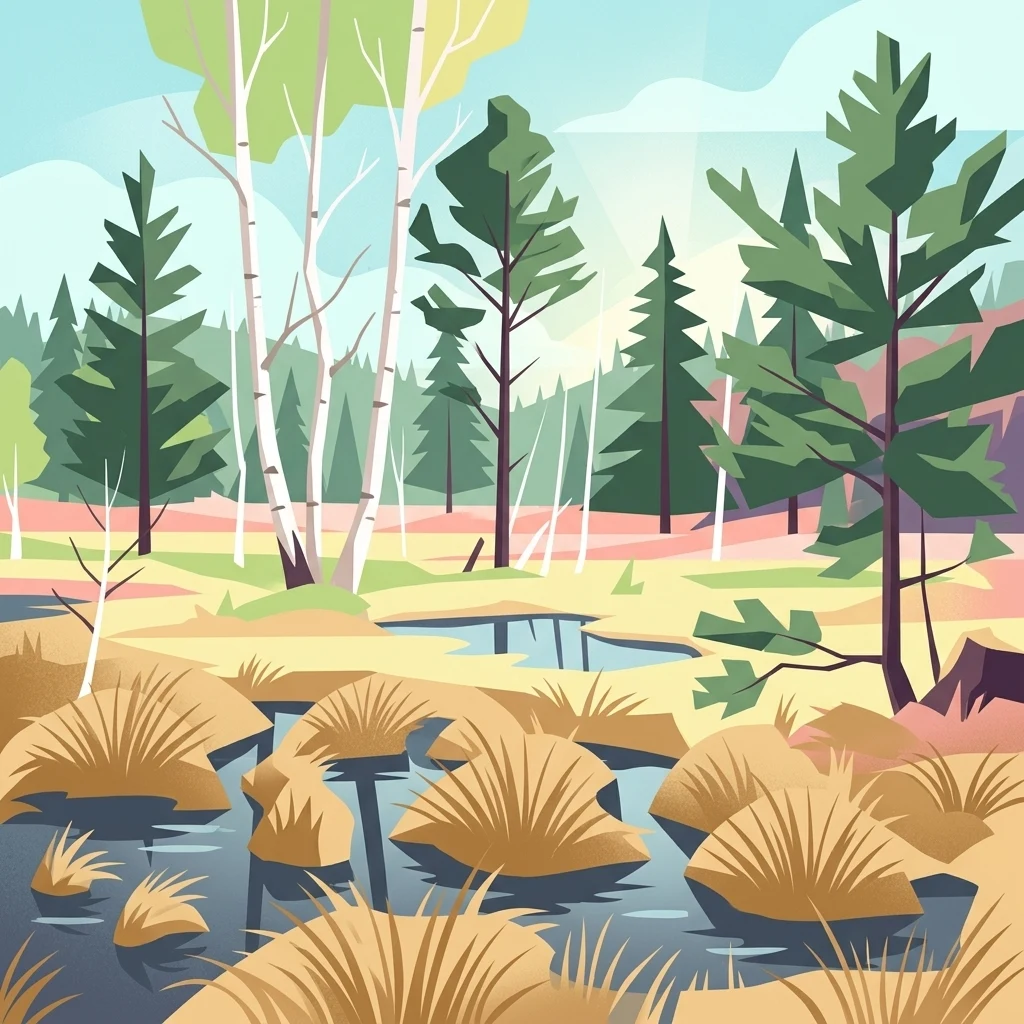
Digital illustration of a marshy landscape featuring tall, slender birch trees and evergreen conifers, with pools of water and clusters of tall grass in the foreground.

Dubravos rezervatinė apyrubė

Nature reserve

Park overview

Structured park overview, official facts, and landscape profile for Dubravos Reserve (Dubrava Strict Nature Reserve)

Dubravos Reserve (Dubrava Strict Nature Reserve) park facts, protected area profile, and essential visitor context

Review the core facts for Dubravos Reserve (Dubrava Strict Nature Reserve), including designation, size, terrain, visitor scale, habitats, and operating context in one park-focused overview.

About Dubravos Reserve (Dubrava Strict Nature Reserve)

Dubravos rezervatinė apyrubė is one of Lithuania's small, strictly protected nature reserves, set within the larger Dubrava Forest in the Kaunas district. The reserve's purpose is to maintain a natural reference area where forest development and bog dynamics can proceed without direct human interference. By concentrating on the Vaišvydava forest district's compartments 51, 52, 68, and 69, the reserve captures a representative sample of the region's rare forest habitats, productive coniferous stands, and ecologically valuable plant communities.

The reserve's defining landscape combines a relatively compact pine-forested core with a natural raised bog that occupies about a quarter of its area. The pine stands are unusually tall and well-structured, with individual trees exceeding 33 meters and the tallest pine recorded at 38 meters, indicating long growth periods and favorable conditions for conifer development. This mature forest structure is a key reason the area was protected.

The reserve also illustrates the practical challenges of strict nature protection. Because the forest has been left largely untouched for decades, deadwood, wind-snapped trees, and windthrown stems have accumulated. These natural disturbances have at times fostered outbreaks of bark beetles and fungal pathogens. During the mid-1990s, such outbreaks affected roughly a third of the surrounding pine stands in the broader Dubrava Forest, highlighting how strict reserves interact ecologically with the wider managed landscape.

Modern management of the reserve is intentionally light. It is overseen by the Lithuanian State Service for Protected Areas, and the reserve itself does not have its own dedicated directorate, which is consistent with the concept of a "rezervatinė apyrubė," a small-scale reserve focused primarily on conservation rather than active public use. A short interpretive trail, established in 2005, allows visitors to experience representative sections of the forest and bog without compromising the reserve's protected status.

Quick facts and research context for Dubravos Reserve (Dubrava Strict Nature Reserve)

Dubravos rezervatinė apyrubė is a strict nature reserve, classified under the highest protection category (IUCN Category Ia), in the Kaunas district of central Lithuania. The total area is approximately 1.2 square kilometers (120 hectares), spread across four forest compartments of the Dubrava Forest. The reserve was formally established in 1994, although protective regime on the site has been in place since 1968.

Approximately one quarter of the territory is occupied by a natural raised bog, while the surrounding landscape is dominated by mature pine stands. Some pines exceed 33 meters in height, and the tallest recorded pine in the reserve reaches 38 meters. The reserve is managed by the State Service for Protected Areas (Valstybinė saugomų teritorijų tarnyba) without a dedicated directorate, as is typical of small Lithuanian strict reserves. A 1.9-kilometer interpretive trail crosses the reserve.

Protection and recognition

Examining documented protection scope and international recognition records

Dubravos rezervatinė apyrubė Protection Status and Conservation Framework

Dubravos rezervatinė apyrubė maintains a terrestrial protection scope within its designated conservation framework. Structured records outline the official status and administrative history associated with this protected natural area.

Protection details

Protection scope
Terrestrial
Transboundary protection
No
Park context

Deeper park guide and search-rich context for Dubravos Reserve (Dubrava Strict Nature Reserve)

Dubravos Reserve (Dubrava Strict Nature Reserve) history, landscape, wildlife, and travel context

Explore Dubravos Reserve (Dubrava Strict Nature Reserve) through its history, landscape character, ecosystems, wildlife, conservation priorities, cultural context, and seasonal travel timing in a structured park guide built for atlas discovery and search intent.

Why Dubravos Reserve (Dubrava Strict Nature Reserve) stands out

The reserve is best known for its tall, undisturbed pine forest and its intact raised bog within the broader Dubrava Forest landscape. The presence of century-scale, untouched coniferous stands gives it significance as a reference site for natural forest dynamics in Lithuania, with the tallest pines reaching nearly 38 meters. Equally notable is the raised bog that occupies roughly a quarter of the reserve, representing a rare, relatively unmodified wetland habitat that contributes to the area's mixed forest-and-bog character. Beyond its biological features, the reserve is recognized for the long unbroken period during which its forest has been left to natural processes, allowing accumulation of deadwood, windthrown trees, and storm-felled stems, all of which shape the structural complexity of the woodland. This combination of mature pine forest, bog, and long-term ecological non-intervention defines the reserve's identity.
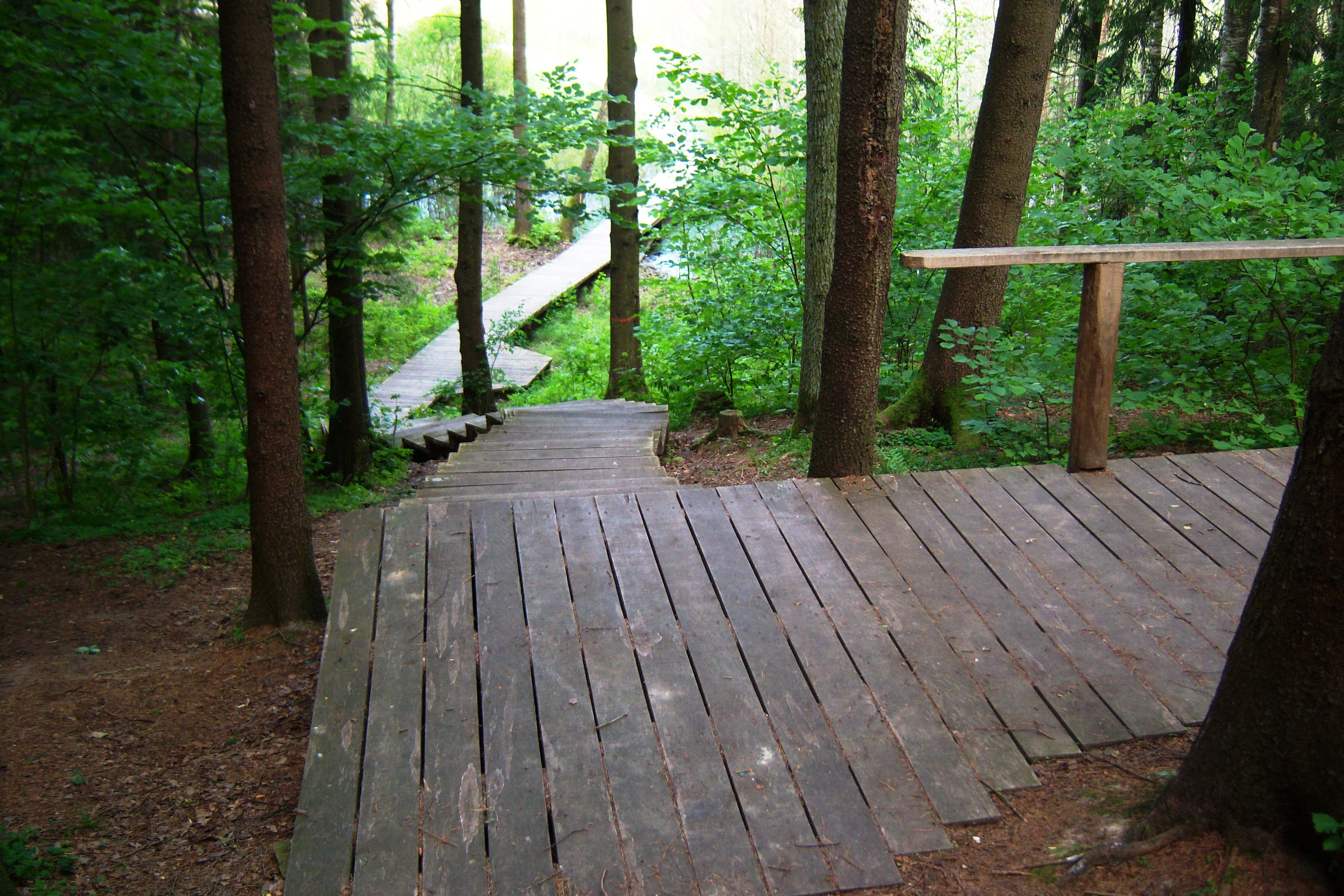
A wooden boardwalk trail descends into a dense green forest, with a wooden handrail on the right side.
A wooden boardwalk and staircase winding through the forest at Dubravos rezervatinė apyrubė.

Dubravos Reserve (Dubrava Strict Nature Reserve) history and protected-area timeline

The land that now forms Dubravos rezervatinė apyrubė has been under protective regime since 1968, when maintenance of a conservation-oriented management approach began in what was then part of the Dubrava Forest forestry system. This initial protection allowed the forest to develop without harvesting, planting, or other intensive silvicultural interventions.

In 1994, the area was formally designated as a rezervatinė apyrubė, a category of small, strictly protected Lithuanian reserve. This formal step consolidated roughly twenty-five years of de facto protection into an official statutory framework, aligning the site with Lithuania's growing system of strict nature reserves. At the time of establishment, the site covered the four designated forest compartments within the Vaišvydava forest district, and its newly defined purpose was to preserve rare forest habitats, productive conifer stands, and other valuable plant communities.

The mid-1990s proved to be a critical period for the reserve and adjacent forest. Accumulated deadwood and undisturbed tree mortality created conditions favorable for bark beetles and fungal pathogens. Between 1993 and 1997, outbreaks of trunk pests in the broader Dubrava Forest led to the loss of approximately one-third of the surrounding pine stands, drawing attention to how strict reserves can both shape, and be shaped by, regional forest health dynamics.

In 2005, a 1.9-kilometer interpretive trail was constructed through the reserve, providing controlled public access to representative sections of the bog and forest. This trail reflected a broader shift toward allowing limited, low-impact visitor experiences in Lithuania's strictly protected areas, without converting the reserve itself into an intensively managed public site. The reserve has continued under the administration of the State Service for Protected Areas.

Dubravos Reserve (Dubrava Strict Nature Reserve) landscape and geographic character

The landscape of Dubravos rezervatinė apyrubė is defined by two closely interwoven natural features: an extensive matrix of mature coniferous forest, and a substantial raised bog occupying roughly one quarter of the protected area. Together they create a transition zone typical of Lithuanian lowland forest-wetland complexes, where dry pine woodland gradually yields to open, peat-forming wetland.

The forest portion of the reserve is dominated by pine, much of it exceptionally tall and structurally mature. Individual pines grow above 33 meters, and the tallest measured pine in the reserve reaches 38 meters. Such heights indicate long stand continuity and favorable growing conditions on sandy, well-drained soils. The canopy is relatively dense, but natural disturbances have created openings where windthrown trees, snapped stems, and slowly decomposing deadwood accumulate along the forest floor.

The raised bog provides the reserve's most distinctive open landscape. As a typical aukštapelkė, its surface is dominated by Sphagnum communities and is shaped largely by water balance, peat accumulation, and microtopographic variation rather than active hydrological management. The bog contrasts with the surrounding forest in color, texture, and openness, and forms a quiet, almost treeless core within the reserve.

The overall terrain of the reserve is flat to gently undulating, characteristic of the lowland forest belt of central Lithuania. There are no dramatic topographic features, but the contrast between closed-canopy pine woodland and open bog vegetation gives the small territory a strong sense of internal variation, which is reflected in the interpretive trail that threads through both environments.
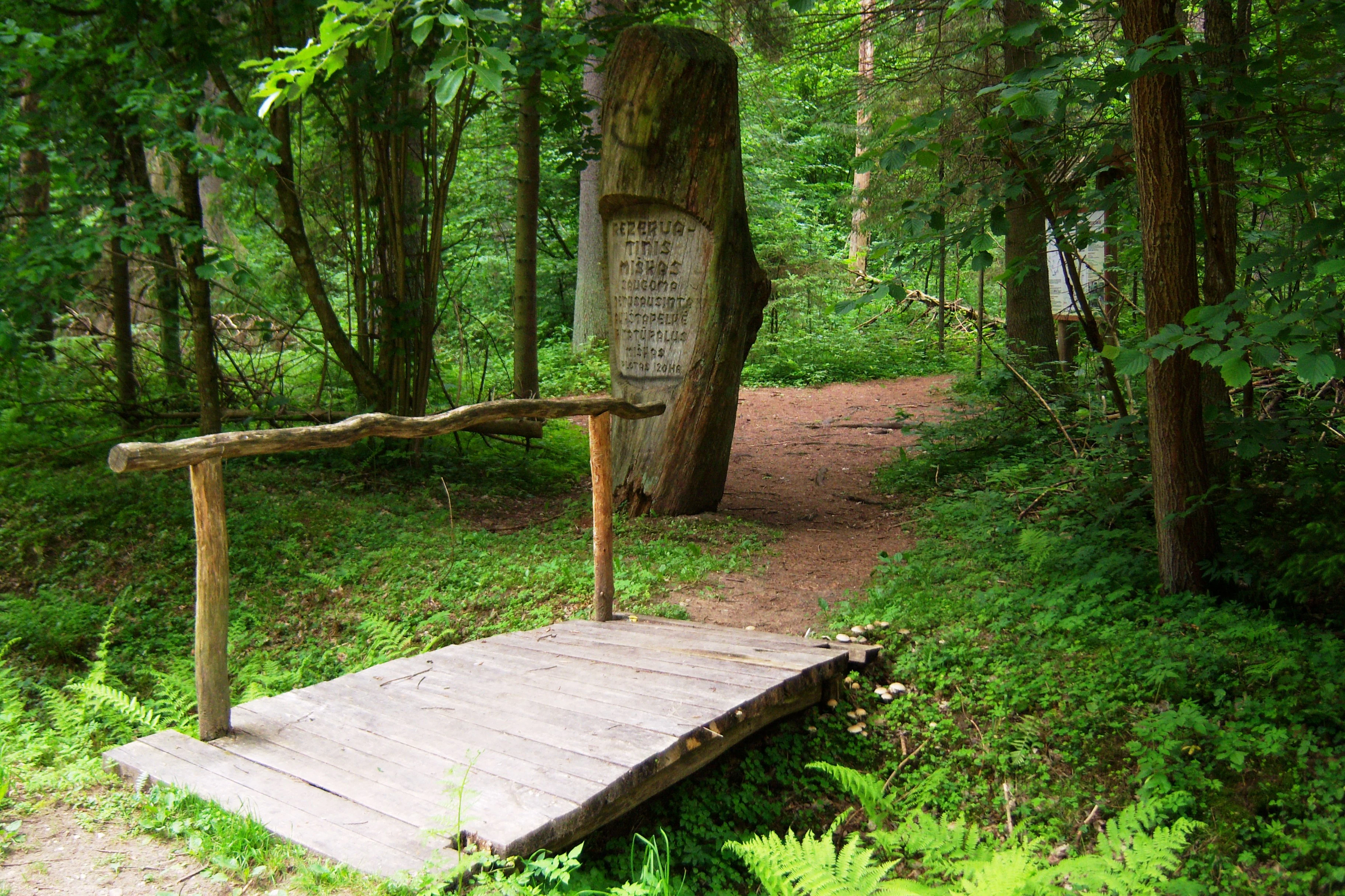
A small rustic wooden footbridge spans a minor crossing on a dirt forest path; a carved wooden signpost stands upright behind the bridge in a lush, green woodland setting.
A small wooden footbridge marking the beginning of the trail in the Dubravos rezervatinė apyrubė.

Dubravos Reserve (Dubrava Strict Nature Reserve) ecosystems, habitats, and plant life

Ecologically, Dubravos rezervatinė apyrubė represents a lowland forest-wetland mosaic characteristic of central Lithuania's sandy plains. The reserve's primary ecological value lies in protecting rare natural forest habitats, productive coniferous stands, and other plant communities that have become uncommon in the heavily managed Baltic forest landscape.

The forest core of the reserve is dominated by pine, which forms the bulk of the canopy and structural diversity. Because human disturbance has been minimized for decades, the site exhibits natural layering, age variation, and the kind of structural complexity typical of older, more natural pine forests in the region. Accumulating deadwood from windthrow and standing mortality supports decomposer communities and contributes to nutrient cycling within the reserve.

The raised bog that covers roughly a quarter of the reserve is the second major ecological feature. As a relatively unmodified aukštapelkė, it develops through peat accumulation, Sphagnum dominance, and moisture-driven succession. Bogs of this type are important for hydrological regulation, carbon storage, and the persistence of specialized peatland plant communities. The reserve's bog contributes to regional peatland representation within Lithuania's protected-area network.

The combination of mature pine forest and an active raised bog, integrated within a small but well-protected area, makes the reserve ecologically distinctive. The site functions as a small-scale reference ecosystem, where natural processes such as storm damage, tree mortality, and peat accumulation can be observed without active forestry intervention.
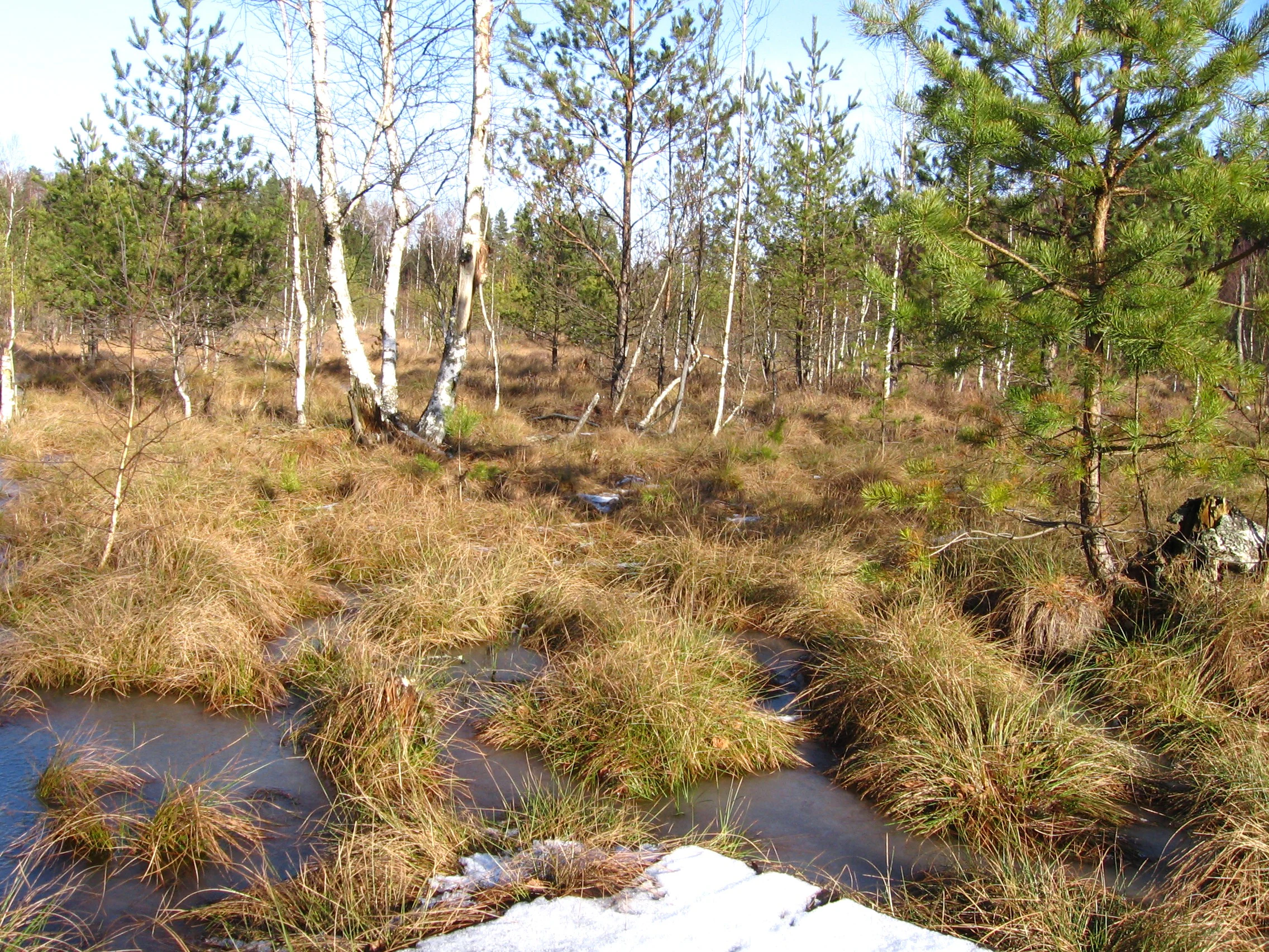
A wetland landscape with patches of brown grass, standing water, and scattered birch and pine trees under a clear sky.
A view of the landscape within Dubravos rezervatinė apyrubė nature reserve, featuring wetlands and sparse forest.

Dubravos Reserve (Dubrava Strict Nature Reserve) wildlife and species highlights

Wildlife in Dubravos rezervatinė apyrubė is closely tied to the structural and ecological condition of the forest and bog rather than to broadly charismatic species. Because the area has been left undisturbed for decades, it provides a relatively stable habitat for species associated with old-growth coniferous woodland, including wood-boring insects, fungi, and the communities that depend on them.

The accumulation of deadwood, windthrown trees, and storm-snapped stems in the forest creates habitat for saproxylic insects, including the bark beetles and other trunk pests that played a notable role in the 1993–1997 forest-health episode in the wider Dubrava Forest. While these species can cause visible damage to surrounding pine stands, they are also an integral part of natural forest disturbance cycles.

The reserve's bog supports peatland-adapted flora and fauna typical of Lithuanian aukštapelkės, including Sphagnum-dominated plant communities. Such open peatland habitats are also typically important for certain bird, invertebrate, and amphibian groups that rely on acidic, waterlogged conditions, although the source material does not allow detailed species-level claims.

The broader significance of the reserve for wildlife lies less in any single flagship species and more in the continuity of habitat conditions. By maintaining a long-term, low-disturbance reference area, the reserve preserves the ecological context in which specialized forest and bog organisms can persist at a regional scale.
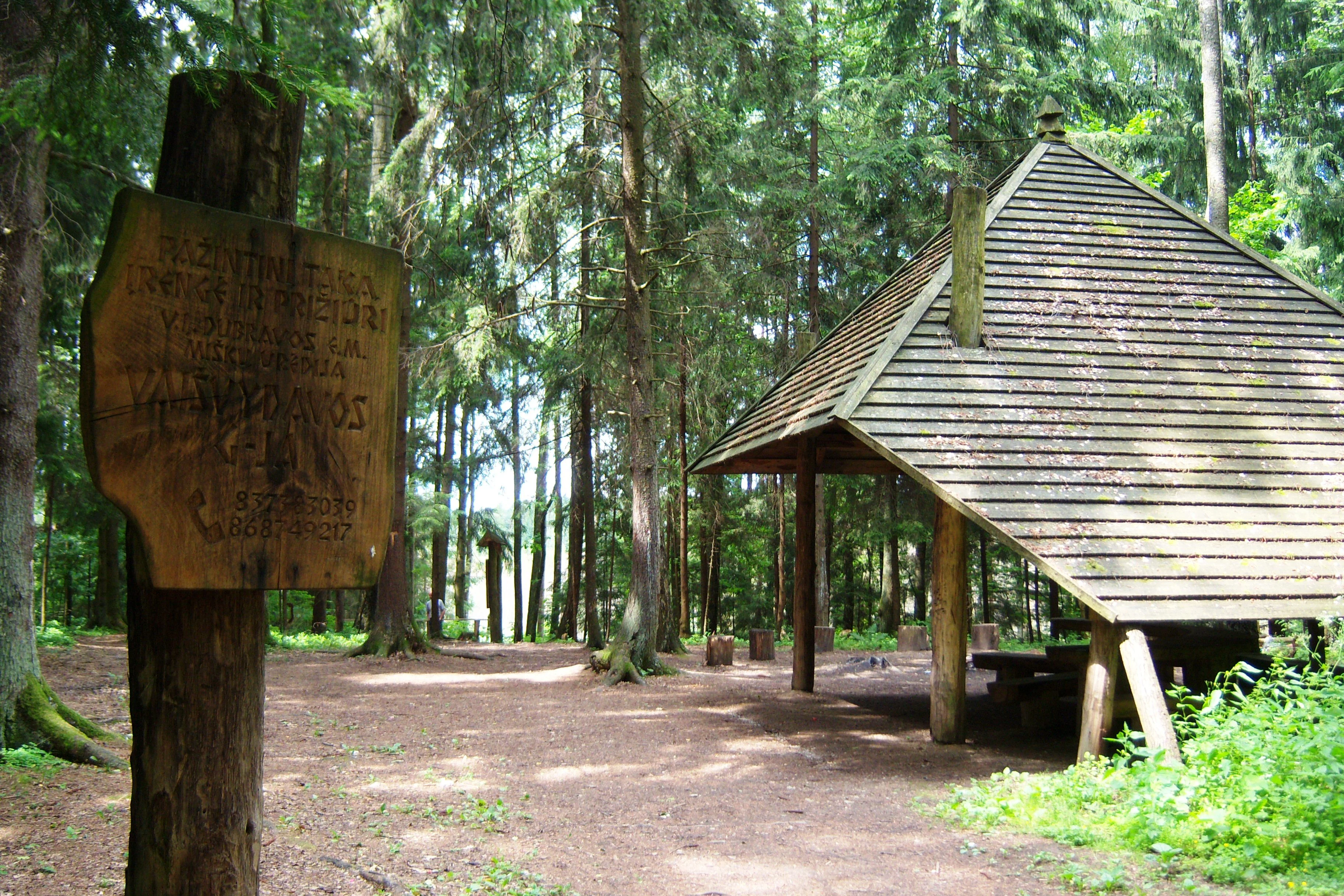
A rustic wooden gazebo shelter with a pyramidal roof sits in a dense forest, with a weathered wooden information sign on a post in the foreground.
A wooden gazebo and trail sign within the forest at Dubravos rezervatinė apyrubė.

Dubravos Reserve (Dubrava Strict Nature Reserve) conservation status and protection priorities

Dubravos rezervatinė apyrubė is classified as an IUCN Category Ia protected area, the highest protection category, and is administered as a strict nature reserve. Its central conservation purpose is to preserve rare forest habitats, productive coniferous stands, and other valuable plant communities in their natural state, while excluding the kind of active forestry that shaped much of the surrounding landscape.

Formally established in 1994 after a longer period of de facto protection since 1968, the reserve is part of Lithuania's network of small, strict reserves that together serve as reference ecosystems for natural forest dynamics. The designation recognizes that the site's mature pine stands and intact raised bog represent ecological conditions that have become rare in the intensively managed Baltic forest region.

The reserve's conservation interest extends beyond its own boundaries. Bark beetle outbreaks originating from within or near the reserve affected roughly a third of the surrounding pine forest in the broader Dubrava Forest between 1993 and 1997. This episode illustrates how strict reserves, while maintaining ecological integrity locally, can also influence the conservation and sanitary management of neighboring commercial forests.

Administrative responsibility lies with the State Service for Protected Areas, and the reserve operates without a dedicated directorate, in line with the "rezervatinė apyrubė" model focused on protection rather than intensive public use. The introduction of a short interpretive trail in 2005 reflects a measured balance between conservation and low-impact public engagement.

Dubravos Reserve (Dubrava Strict Nature Reserve) cultural meaning and human context

Dubravos rezervatinė apyrubė lies within the Dubrava Forest, a forest complex that has long been part of the cultural and economic landscape of central Lithuania. The forest historically supported timber production, local livelihoods, and traditional uses of woodland resources in the Kaunas district region.

The transition from productive forest use to strict nature conservation reflects broader shifts in Lithuanian environmental policy during the late twentieth century. Establishing the reserve in 1994, after a longer informal protection period, illustrates how some valued forest sites were gradually removed from active management to safeguard rarer habitats and community types.

As a small strict reserve without its own directorate, Dubravos rezervatinė apyrubė represents a distinct model within Lithuania's protected-area framework. The term "rezervatinė apyrubė" itself refers to a compact reserve focused on ecological preservation rather than on visitor infrastructure or administrative complexity, embedding the site within a particular Lithuanian approach to small-scale, high-protection conservation.

Top sights and standout views in Dubravos Reserve (Dubrava Strict Nature Reserve)

Dubravos rezervatinė apyrubė stands out for the combination of unusually tall, mature pine stands and a substantial, natural raised bog within a single small protected area. The tallest pines exceed 38 meters, marking the site as one of the better examples of structurally developed pine forest in central Lithuania. Roughly a quarter of the reserve is bog, giving visitors and researchers a rare chance to observe a lowland aukštapelkė closely tied to surrounding coniferous woodland.

A second highlight is the long continuity of protection. With a protective regime in place since 1968 and formal reserve designation in 1994, the site has accumulated decades of natural processes, including windthrow, deadwood buildup, and disturbance-driven turnover. These give the reserve value as a reference site for understanding unmanaged forest dynamics in the Baltic region.

Best time to visit Dubravos Reserve (Dubrava Strict Nature Reserve)

The reserve can be experienced meaningfully across much of the year, but the character of the visit shifts with the seasons. Late spring and summer bring active vegetation in the bog and forest, with greener foliage, warmer weather suitable for walking the 1.9-kilometer interpretive trail, and intensified insect and bird activity within the woodland.

Autumn offers a different appeal, as the surrounding forest takes on autumnal coloring and the bog surface changes in tone, while cooler temperatures reduce insect presence. Winter visits reveal the structure of the reserve most clearly: the tall pines stand out against snow, the open bog becomes more visible through the leafless landscape, and the patterns of windthrown trees and deadwood are most apparent without foliage cover.

Because the reserve is a strict nature reserve, visitors should expect quiet, low-impact conditions and should remain on designated paths, particularly when crossing the bog. Seasonal experiences will be richest for those interested in forest structure, peatland landscapes, and the long-term ecological character of Lithuanian lowland forests.
Monthly climate preview

Measured monthly temperature ranges and precipitation averages at a representative coordinate

Dubravos rezervatinė apyrubė climate normals and long term temperature patterns

Long term climate data for Dubravos rezervatinė apyrubė records steady shifts in average monthly temperatures alongside consistent precipitation rates across the year. Reviewing the complete twelve month profile provides detailed metrics for evaluating the regional climate baseline at this protected location.
Annual mean6 °C
-5 °C18 °C
Jan-5°
Feb-5°
Mar
Apr
May12°
Jun16°
Jul18°
Aug17°
Sep12°
Oct
Nov
Dec-3°
Warmest month
July

18.1 °C

Coolest month
January

-5.4 °C

Wettest month
July

3.1 mm/day

Driest month
March

1.6 mm/day

Park location guide

Geography guide, regional context, and park location map for Dubravos Reserve (Dubrava Strict Nature Reserve)

Dubravos Reserve (Dubrava Strict Nature Reserve) park geography, regions, and map view in Lithuania

Understand where Dubravos Reserve (Dubrava Strict Nature Reserve) sits in Lithuania through a broader geographic reading of the surrounding landscape, nearby location context, and its mapped position within the national park landscape.

How Dubravos Reserve (Dubrava Strict Nature Reserve) fits into Lithuania

Lithuania is a unitary semi-presidential republic and one of three Baltic states in Northern Europe. It lies on the eastern coast of the Baltic Sea, with Vilnius as its capital and largest city. The country regained independence in 1990 after Soviet occupation and joined the European Union in 2004. Lithuania has a population of about 2.9 million and covers an area of 65,300 km².

Wider geography shaping Dubravos Reserve (Dubrava Strict Nature Reserve) in Lithuania

Lithuania is situated on the eastern shore of the Baltic Sea in Northern Europe. It borders Latvia to the north, Belarus to the east and south, Poland to the south, and Russia's Kaliningrad Oblast to the southwest. The country also has a maritime border with Sweden to the west. The terrain is largely flat with rolling hills, numerous lakes, and rivers. The Nemunas River is the longest river in the country.

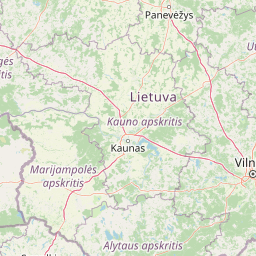
Map view of Dubravos Reserve (Dubrava Strict Nature Reserve)

Use this park location map to pinpoint Dubravos Reserve (Dubrava Strict Nature Reserve) in Lithuania, understand its exact geographic position, and read its mapped placement within the surrounding landscape more clearly.

Pigeon | © OpenStreetMap contributors

Location context for Dubravos Reserve (Dubrava Strict Nature Reserve)

Kauno rajono savivaldybė

Visual exploration of mature pine stands, raised bogs, and strict forest habitats

Dubravos rezervatinė apyrubė Photos and Protected Landscape Scenery

Photographic records capture the structural diversity of tall coniferous woodland and open peat-forming wetlands within Dubravos rezervatinė apyrubė. Visual documentation reveals the terrain, canopy characteristics, and undisturbed ground features that define this protected Baltic reserve.

A wooden boardwalk trail descends into a dense green forest, with a wooden handrail on the right side.

A raised wooden boardwalk trail curving through a sparse forest with swampy ground covered in grasses.

A small rustic wooden footbridge spans a minor crossing on a dirt forest path; a carved wooden signpost stands upright behind the bridge in a lush, green woodland setting.

A wetland landscape with patches of brown grass, standing water, and scattered birch and pine trees under a clear sky.

A rustic wooden gazebo shelter with a pyramidal roof sits in a dense forest, with a weathered wooden information sign on a post in the foreground.

A raised wooden boardwalk crosses through a grassy wetland area with young birch trees, featuring a wooden bench and an information sign.

Park atlas

Compare surrounding forest landscapes and regional Baltic nature reserves

Other Parks Like Dubravos Rezervatinė Apyrubė and Nearby Protected Areas

Continue exploring protected areas near Dubravos rezervatinė apyrubė by browsing adjacent lowland forests and wetland reserves. Regional comparisons reveal shared ecological traits across central Lithuanian conservation landscapes.
Biosphere reserveKauno rajonas
About 22 km away#1 closest

Northwest

Babtų-Varluvos miškų biosferos poligonas: Protected Forest Landscapes and Geographic Mapping

Essential woodland corridors in Kaunas district, Lithuania

Babtų-Varluvos miškų biosferos poligonas functions as a significant biosphere reserve focused on mature lowland forest conservation. This protected area offers a look at continuous woodland structures, research-focused biodiversity monitoring, and the spatial significance of forest corridors within central Lithuanian geography.

Area
44.19 km²
Established
2004
IUCN
VI
Relief
Lowland
Watercolor painting showing green hills, trees, a body of water, and grassy vegetation
National parkLithuania
About 32 km away#2 closest

Southeast

Trakai National Historic Park: Medieval Heritage and Lake District Protected Landscape

Explore Lithuania's historic park and its mapped geographic context.

Trakai National Historic Park offers a rich tapestry of medieval history intertwined with a captivating lake district landscape. As a protected area in southeastern Lithuania, it preserves significant architectural monuments, including the iconic Trakai Castle, set against a backdrop of interconnected lakes, forests, and wetlands. MoriAtlas provides a structured overview of its geographic boundaries and regional setting, facilitating atlas-style exploration of this historically significant protected landscape.

IUCN
V
Access
Moderate access
Scope
Mixed
Nature reserveTrakai District Municipality
About 39 km away#3 closest

Southeast

Mergiškių gamtinis rezervatas Protected Nature Reserve in Trakai District Municipality

Strictly protected hornbeam woodland and hilly glacial terrain

Mergiškių gamtinis rezervatas is a protected area in Lithuania dedicated to conserving mature hornbeam-dominated hill forest. Located within the Trakai District Municipality, the reserve provides a critical habitat for threatened species and maintains the natural integrity of hilly glacial landscapes typical of the Aukštadvaris region.

Area
1.57 km²
Established
1996
IUCN
Ia
Relief
Upland
Biosphere reserveUkmergė District Municipality
About 52 km away#4 closest

Northeast

Viliukų, Karpių miškai Biosphere Reserve: Regional Protected Area Geography and Maps

Broadleaved forests and wetland ecosystems in central Lithuania

Gain insights into the protected landscape of Viliukų, Karpių miškai in the Ukmergė District. This biosphere reserve provides a detailed view of lowland forest ecosystems, characterized by spruce and birch dominance within an undulating terrain that sustains rare insect and plant communities.

Area
7.772 km²
Established
2012
Relief
Lowland
Scope
Terrestrial
Watercolor illustration showing a landscape with forests, a river, and distant hills
National parkLithuania
About 66 km away#5 closest

South

Dzūkija National Park: Explore Lithuania's Largest Protected Forest and Inland Dune Landscapes

Mapped protected area geography and natural terrain of the Dainava region.

Delve into the protected landscape of Dzūkija National Park, Lithuania's expansive national park renowned for its vast primeval pine forests and extraordinary inland dune formations. This page provides a detailed atlas-style view of the park's mapped boundaries, diverse terrain, and significant natural features, offering insight into its protected territory and regional geographic importance. Examine the unique wetland systems and forest ecosystems that make this a crucial area for protected land discovery.

Area
584.53 km²
Established
1991
IUCN
II
Visitors
30K annual
Biosphere reserveLithuania
About 76 km away#6 closest

Northeast

Taujėnų, Užulėnio miškų biosferos poligonas: Protected Forest Landscapes of Lithuania

Central Baltic lowland conservation territory

Spanning central Lithuania, this biosphere reserve preserves a vast mosaic of deciduous, coniferous, and mixed forest lands. The territory supports high-quality bird habitats through disciplined forestry practices and the protection of complex wetland and peatland systems, making it a reference site for lowland forest conservation.

Area
44.19 km²
Established
2004
Relief
Lowland
Climate
Temperate
Watercolor illustration of a serene river landscape with green trees, grassy banks, and rolling hills in the background.
Nature reserveVarėna District Municipality
About 86 km away#7 closest

South

Skroblaus rezervatas: Protected Nature Reserve and Baltic Upland Geographic Reference Site

Natural hydrological basin and inland dune landscapes in Varėna District Municipality

Skroblaus rezervatas functions as a strict nature reserve protecting the natural hydrological regime of the Baltic uplands. Located in the Varėna District Municipality, the terrain features deep stream valleys, thermokarst depressions, and inland dune massifs. This mapped area offers a deep look into the geomorphology and forest ecology of southern Lithuania, providing essential context for understanding undisturbed upland water systems.

Area
8.107 km²
Established
1983
IUCN
Ia
Relief
Upland
A horizontal watercolor painting showing a soft, impressionistic landscape with trees on both sides and a gentle rolling hill in the background.
Nature reserveVarėna District Municipality
About 89 km away#8 closest

South

Povilnio Rezervatas: Protected Nature Reserve and Glacial Valley Geography in Varėna District

Glacial landscape study within the Dainava Forest massif

Located in the Varėna District, Povilnio Rezervatas is a protected nature reserve defined by its striking glacial spillway valley and diverse forest communities. This area encompasses a complex mosaic of lichen-rich pine heaths, spruce forests, and alder mires, making it a critical site for botanical conservation and regional geomorphology studies.

Area
1.832 km²
Established
1997
IUCN
Ia
Relief
Lowland

Common questions about visiting, size, designation, and location context for Dubravos Reserve (Dubrava Strict Nature Reserve)

Dubravos Reserve (Dubrava Strict Nature Reserve) FAQs for park facts, access, geography, and protected area context

Find quick answers about Dubravos Reserve (Dubrava Strict Nature Reserve), including protected-area facts, park geography, trail and visitor context, and how the park fits into its surrounding country and regional landscape.
MoriAtlas Explorer

Continue Your Protected Areas Search Across the Global Atlas

Deepen your exploration by continuing the structured search for national parks and protected areas worldwide. Utilize the comprehensive filtering capabilities to compare different conservation landscapes and refine your understanding of global park geography. Discover more about the distribution and characteristics of protected natural areas.

Global natural geography