

Mori Atlas logo
Nature reserveEagles Claw Nature Reserve

Mapping the distinctive sea gutters, rocky cliff formations, and coastal scrub habitat

Eagles Claw Nature Reserve and the Rugged Coastal Geography of New South Wales Australia

Eagles Claw Nature Reserve stands as a compact, ecologically significant protected area on the far south coast of New South Wales. Defined by a series of four narrow sea gutters and rugged cliff faces, the reserve preserves a specialized coastal habitat. This atlas entry examines the reserve's unique landform, which resembles a three-taloned bird's foot, and its essential role in safeguarding mainland seabird breeding grounds.

coastal nature reservelittle penguin breeding colonyrocky coastlinesea gutterslow cliffscoastal scrub

Eagles Claw Nature Reserve

Nature reserve

Park overview

Structured park overview, official facts, and landscape profile for Eagles Claw Nature Reserve

Eagles Claw Nature Reserve park facts, protected area profile, and essential visitor context

Review the core facts for Eagles Claw Nature Reserve, including designation, size, terrain, visitor scale, habitats, and operating context in one park-focused overview.

About Eagles Claw Nature Reserve

Eagles Claw Nature Reserve is one of the smallest protected areas managed by the NSW National Parks and Wildlife Service, yet it carries a focused and specific conservation purpose. It lies on the far south coast of New South Wales, within reach of the town of Eden, a region long associated with marine wildlife, whale watching, and rugged coastal scenery. Despite its compact footprint of around one hectare, the reserve holds enduring ecological value because it was established to address a very particular concern: the protection of a mainland little penguin breeding colony within the state.

The physical character of the reserve centers on a piece of rocky coastline marked by four narrow sea gutters and small bays. These features create a varied microhabitat of sheltered water, low cliffs, and boulder fields. The cliffs and rock debris are especially important, as their crevices and cavities provide nesting locations for little penguins, allowing the birds to breed on the mainland in conditions that otherwise resemble more typical offshore island colonies. Above this rocky shoreline, the vegetation shifts to dense coastal scrub dominated by bracelet honey myrtle, a hardy shrub characteristic of the NSW south coast, lending the site its own botanical identity.

Adjacent to a residential area of Eden, the reserve functions as a tightly defined natural patch embedded within a developed coastal landscape. The juxtaposition of housing and protected habitat is part of what makes Eagles Claw notable; it shows how small, strategically located reserves can play an outsized role in safeguarding vulnerable species at the very edge of human settlement. Its unusual name, drawn from the headland's resemblance to a three-taloned bird's foot, ties the visual geography of the place to its ecological mission, giving the reserve a distinctive identity that extends beyond its modest size.

Quick facts and research context for Eagles Claw Nature Reserve

Eagles Claw Nature Reserve is a state-level nature reserve on the south coast of New South Wales, near the coastal town of Eden. It is classified as an IUCN Category IV protected area, designated for habitat and species management. Established in March 1986 under the management of the NSW National Parks and Wildlife Service, the reserve covers approximately one hectare of rugged coastline. Its principal conservation purpose is the protection of a little penguin breeding colony, supported by coastal scrub vegetation, low cliffs, and four narrow sea gutters that create sheltered nesting crevices.

Protection and recognition

Terrestrial conservation framework, management scope, and recognition data

Eagles Claw Nature Reserve Protection Status and Designated Area Facts

Eagles Claw Nature Reserve maintains a documented terrestrial conservation framework outlining its official protected area status and management scope. Recorded records aggregate administrative boundaries, designation history, and international recognition sources to support ecological research.

Protection details

Protection scope
Terrestrial
Transboundary protection
No
Park context

Deeper park guide and search-rich context for Eagles Claw Nature Reserve

Eagles Claw Nature Reserve history, landscape, wildlife, and travel context

Explore Eagles Claw Nature Reserve through its history, landscape character, ecosystems, wildlife, conservation priorities, cultural context, and seasonal travel timing in a structured park guide built for atlas discovery and search intent.

Why Eagles Claw Nature Reserve stands out

Eagles Claw Nature Reserve is best known for protecting a mainland breeding colony of little penguins along the far south coast of New South Wales. Its identity centers on a narrow strip of rugged coastline near Eden, where four small bays, rocky cliffs, and boulder crevices provide natural nesting sites for the penguins. The distinctive outline of the headland when viewed from the north, resembling a three-taloned bird's foot, gives the reserve its evocative name and links its visual identity directly with the seabirds it was created to protect.

Eagles Claw Nature Reserve history and protected-area timeline

The Eagles Claw Nature Reserve was officially gazetted on 27 March 1986, becoming a formally protected area under the management of the NSW National Parks and Wildlife Service. The motivation for its creation was highly specific: at the time, the site was believed to host what was thought to be the only known mainland breeding colony of little penguins in New South Wales. Because mainland breeding sites for the species are rare and vulnerable to disturbance and predation, the decision to gazette the small coastal strip reflected a targeted conservation response rather than the protection of a broad natural landscape.

Over the years, the reserve has retained its focused identity as a penguin-protection site, even as understanding of little penguin breeding populations elsewhere along the NSW coast has developed. The original justification for protection has shaped the reserve's management priorities, visitor approach, and ecological framing ever since, marking it as an early example of habitat-specific conservation action in the state's network of small nature reserves.

Eagles Claw Nature Reserve landscape and geographic character

The landscape of Eagles Claw Nature Reserve is defined by a compact but visually striking stretch of rugged south coast terrain. The reserve sits along a section of coastline in the vicinity of Lookout Point at Eden, where the shore is broken into a series of four narrow sea gutters, or small bays, separated by rocky outcrops. These gutters create an irregular, indented shoreline pattern that contrasts with the smoother beaches typical of other stretches along the New South Wales far south coast.

Low cliffs rise above the gutters, shaped by ongoing coastal erosion and undercutting at the waterline. The cliff faces and the boulder debris scattered below them produce a chaotic but habitat-rich surface of crevices, ledges, and cavities. Above the cliffs, the terrain supports dense stands of coastal scrub, dominated visually and structurally by bracelet honey myrtle, a plant well adapted to salt spray and wind exposure. The overall impression is of a small, heavily textured coastal landform that fits the reserve's bird-derived name: viewed from the north, the headland resembles a three-taloned bird's foot, an unusual silhouette that reinforces the interplay between landscape form and wildlife identity at the site.

Eagles Claw Nature Reserve ecosystems, habitats, and plant life

Eagles Claw Nature Reserve represents an unusually focused ecological niche within the New South Wales protected-area network. Although only around one hectare in size, it concentrates on a single high-value habitat type: the rocky coastal fringe and cliff-top scrub ecosystem characteristic of the state's far south coast. The narrow sea gutters and boulder fields provide sheltered microhabitats that differ markedly from the more open sandy beaches typical of the region, creating conditions that suit seabird nesting and shelter rather than general beachfront wildlife.

The vegetation pattern at Eagles Claw reflects the demanding conditions of the coastal edge. Dense stands of coastal scrub, dominated by bracelet honey myrtle, occupy the cliff tops and the more stable slopes above the gutters. This shrub layer stabilizes the cliff edges, contributes organic matter to the rocky ground below, and frames the reserve visually in shades of grey-green foliage set against the darker tones of cliff rock and seawater. Together, the scrub, cliffs, gutters, and boulders create a layered ecological mosaic that is small in extent but rich in habitat variation.

Eagles Claw Nature Reserve wildlife and species highlights

The wildlife value of Eagles Claw Nature Reserve centers overwhelmingly on its role as a breeding location for little penguins along the New South Wales mainland. The boulder piles and cliff debris within the reserve are particularly important in this context, because the crevices and cavities among the rocks provide the kind of sheltered nesting sites that penguins typically rely upon for protection from predators and weather. The very reason the reserve was gazetted in 1986 was to formalize protection of what was then believed to be the only known mainland breeding colony of the species in the state.

Beyond its importance for little penguins, the reserve's coastal setting supports elements of broader south coast fauna associated with rocky shoreline habitats, cliff-top scrub, and sheltered inshore waters. The combination of scrub vegetation, sea gutters, and rocky outcrops creates habitat heterogeneity that, while small in scale, contributes to local biodiversity and ecological connectivity along the Eden coastline. The reserve's wildlife identity, however, remains firmly defined by its penguin-centered mission.

Eagles Claw Nature Reserve conservation status and protection priorities

The conservation significance of Eagles Claw Nature Reserve lies in its focused, habitat-specific role within New South Wales' protected-area system. Classified as an IUCN Category IV area, it is managed primarily for the conservation of a particular species and its associated habitat, rather than for broad-scale ecosystem protection. The reserve's existence reflects an early recognition that mainland little penguins in New South Wales were vulnerable to ongoing coastal development, human disturbance, and habitat degradation, and that targeted intervention at a known breeding site was necessary to safeguard them.

By protecting a small but ecologically critical stretch of coastline, including its cliff crevices and adjacent scrub, Eagles Claw provides a buffer against the loss or disturbance of nesting habitat at the very edge of a populated area. The reserve's management under the NSW National Parks and Wildlife Service reflects an institutional commitment to maintaining this habitat integrity even as Eden has grown around it. In conservation terms, the reserve demonstrates how small, site-specific protected areas can act as essential refuges for seabird populations that depend on particular coastal landforms.

Eagles Claw Nature Reserve cultural meaning and human context

The cultural context of Eagles Claw Nature Reserve is closely bound to the identity of Eden as a coastal community with a long relationship to marine wildlife. Eden, on the far south coast of New South Wales, is widely recognized for its whaling heritage and its enduring connection to the sea, and the reserve sits within this broader maritime cultural landscape. While the reserve itself is a small modern protected area rather than a historic site, its presence reflects a community-level awareness that coastal wildlife, including little penguins, is part of the local identity and worth protecting at close range.

Top sights and standout views in Eagles Claw Nature Reserve

Among the defining highlights of Eagles Claw Nature Reserve are its four narrow sea gutters and low rugged cliffs, which together form one of the more distinctive small coastal landforms on the NSW south coast. The cliff-top stands of bracelet honey myrtle provide a strong botanical signature, while the boulder crevices below them offer the penguin nesting habitat that gives the reserve its ecological purpose. The headland's resemblance to a three-taloned bird's foot, visible from the north, gives the site a memorable visual identity that ties its name, its landscape, and its protected wildlife together in a single image.

Best time to visit Eagles Claw Nature Reserve

Because Eagles Claw Nature Reserve revolves around its penguin breeding activity and its coastal setting, the experience of visiting is shaped by the calmer conditions typical of the warmer and drier months along the far south coast of New South Wales. Spring and early summer tend to coincide with the active breeding and chick-rearing period for little penguins in the region, which can make the reserve especially meaningful for those interested in seabird behavior, while autumn offers quieter conditions and softer coastal light. Winter brings cooler, often windier weather to this exposed coastline, which can make the cliff-top scrub and rocky shoreline feel more austere but also reinforces the rugged character of the reserve. Visitors should generally favor daylight hours for appreciating the coastal scrub and cliff scenery, and treat the site as a short, contemplative coastal walk rather than a destination requiring extensive planning.

Monthly climate preview

Long-term temperature ranges and monthly precipitation averages for New South Wales

Eagles Claw Nature Reserve Climate Normals and Annual Weather Patterns

Eagles Claw Nature Reserve tracks a measured annual temperature and precipitation rhythm across twelve recorded months at a representative elevation of 132 meters. Detailed monthly comparisons reveal the complete long-term climate normals for this protected area.
Annual mean16 °C
12 °C20 °C
Jan20°
Feb20°
Mar19°
Apr17°
May15°
Jun13°
Jul12°
Aug12°
Sep14°
Oct15°
Nov17°
Dec18°
Warmest month
February

20.2 °C

Coolest month
July

11.8 °C

Wettest month
February

3.5 mm/day

Driest month
May

1.6 mm/day

Park location guide

Geography guide, regional context, and park location map for Eagles Claw Nature Reserve

Eagles Claw Nature Reserve park geography, regions, and map view in Australia

Understand where Eagles Claw Nature Reserve sits in Australia through a broader geographic reading of the surrounding landscape, nearby location context, and its mapped position within the national park landscape.

How Eagles Claw Nature Reserve fits into Australia

Australia is a constitutional monarchy and federal parliamentary democracy comprising six states and ten territories. With a population of nearly 28 million, it is one of the world's most urbanised countries, with most people concentrated on the eastern seaboard. The country has a high Human Development Index and is known for its cultural diversity, ancient Aboriginal heritage, and unique wildlife.

Wider geography shaping Eagles Claw Nature Reserve in Australia

Australia occupies the entire Australian continent, the island of Tasmania, and numerous smaller islands. It is the world's flattest and driest inhabited continent, featuring vast deserts in the interior (the Outback), tropical rainforests along the eastern coast, and a coastline bordering the Indian and Pacific Oceans.

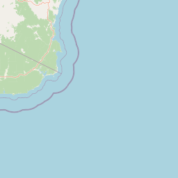
Map view of Eagles Claw Nature Reserve

Use this park location map to pinpoint Eagles Claw Nature Reserve in Australia, understand its exact geographic position, and read its mapped placement within the surrounding landscape more clearly.

Pigeon | © OpenStreetMap contributors

Location context for Eagles Claw Nature Reserve

New South Wales
Park atlas

Compare adjacent protected landscapes and discover regional coastal habitats along the New South Wales shore

Explore Other Parks Near Eagles Claw Nature Reserve and Surrounding Coastal Reserves

Continue geographic discovery by comparing Eagles Claw Nature Reserve with other protected coastal zones in the surrounding region. Browsing nearby national parks reveals broader patterns of rugged shoreline topography, native vegetation, and regional seabird habitats.
National parkNew South Wales
About 2.9 km away#1 closest

Southeast

Beowa National Park: Protected Landscape and Coastal Geography in New South Wales

Mapped terrain and unique erosion sites within this national park.

Delve into the protected landscape of Beowa National Park, situated in the coastal region of New South Wales. This national park showcases a varied terrain, from heathland headlands to eucalypt woodlands, with the visually dramatic Pinnacles erosion gully as a key highlight. Its geographic setting within Twofold Bay provides a compelling focus for atlas exploration of Australia's protected natural areas.

Area
104.86 km²
Established
1971
IUCN
II
Relief
Lowland
National parkNew South Wales
About 10 km away#2 closest

West

South East Forests National Park: New South Wales National Park Atlas Entry

Mapped landscape and protected area geography.

This canonical MoriAtlas entry for South East Forests National Park provides essential geographic context and details about its status as a national park. Understand the mapped boundaries of this protected landscape within New South Wales, supporting discovery through its regional setting and natural terrain. The focus remains on atlas-style exploration of its geographic identity and conservation significance, devoid of visitor logistics or travel advice.

Area
1,151.77 km²
Established
1997
IUCN
II
Relief
Highland
National parkNew South Wales
About 14 km away#3 closest

Southwest

Mount Imlay National Park: Protected Land Geography and Mapped Boundaries in New South Wales

Explore the geographic context of this Australian national park.

Mount Imlay National Park serves as a significant protected area within New South Wales, providing a focal point for understanding regional geography and mapped natural landscapes. As a national park, its boundaries and terrain offer valuable insights for atlas-based discovery, highlighting Australia's commitment to conserving diverse geographic entities and showcasing its role in the broader national landscape context.

Area
48 km²
Established
1972
IUCN
II
Relief
Mountain
Nature reserveNew South Wales
About 25 km away#4 closest

South

Nadgee Nature Reserve: Protected Wilderness and Coastal Geography in New South Wales

Coastal heath, eucalyptus forest, and regional bird habitat

Located at the southeastern edge of the Australian continent, Nadgee Nature Reserve offers a deep look at remote coastal landscapes. The area protects a mix of saltwater wetlands, dense eucalyptus forests, and significant Aboriginal cultural sites along the coast, creating a contiguous protected zone that stretches across state borders into Victorian territory.

Area
206.71 km²
Established
1957
IUCN
Ib
Relief
Lowland
Watercolor illustration showing a coastal landscape with green hills, blue water, and distant mountains
National parkNew South Wales
About 26 km away#5 closest

North

Bournda National Park: A Protected National Park in New South Wales

Explore mapped boundaries and regional geographic context.

Bournda National Park represents a key protected area within the state of New South Wales, Australia. This page offers focused discovery of its protected landscape identity, situated within the broader geographic framework of the region. Examine the park's mapped boundaries and understand its significance as a component of Australia's network of natural landscapes.

Area
26.55 km²
Established
1947
IUCN
II
Relief
Lowland
National parkAustralia
About 42 km away#6 closest

South

Croajingolong National Park: A UNESCO World Biosphere Reserve with Dramatic Coastal Geography

Explore Victoria's protected wilderness, mapped coastlines, and diverse ecosystems.

Croajingolong National Park is a key protected area in Victoria, Australia, recognized globally as a UNESCO World Biosphere Reserve. This vast national park offers a detailed look at coastal wilderness, characterized by its extensive sandy beaches, rugged rocky headlands, dynamic dunes, and rich heathland ecosystems. Its position along the Tasman Sea coastline provides significant geographic context, forming a vital part of southeastern Australia's protected landscapes and offering unique opportunities for atlas-driven exploration of its mapped terrain and biodiversity.

Area
883.55 km²
Established
1979
IUCN
II
Relief
Mixed relief
National parkNew South Wales
About 42 km away#7 closest

North

Mimosa Rocks National Park: Coastal Protected Area Atlas and Geographic Discovery

New South Wales National Park with Mapped Coastal Terrain

Mimosa Rocks National Park offers a compelling glimpse into Australia's protected coastal geography. This national park showcases a dynamic landscape where rocky outcrops and sweeping beaches define the Sapphire Coastline within New South Wales. Engage with its mapped boundaries and understand its role as a vital part of the regional protected area network, perfect for detailed atlas exploration and appreciating natural landscape context.

Area
57 km²
Established
1973
IUCN
II
Relief
Lowland
National parkAustralia
About 47 km away#8 closest

Southwest

Coopracambra National Park: Remote Mountainous Protected Landscape in Victoria

Explore its transboundary wilderness role and tall forest terrain.

Coopracambra National Park stands as a significant protected landscape in Victoria, Australia, renowned for its rugged mountainous terrain and extensive tall eucalypt forests. This remote national park serves as the crucial Victorian component of a vast transboundary wilderness corridor, linking protected areas across the state border into New South Wales. Its geographic identity is shaped by prominent peaks such as Mount Coopracambra and the unique Black-Allan Line boundary, offering users a detailed atlas view of its conservation significance and natural features within south-eastern Australia.

Area
388 km²
Established
1988
IUCN
II
Relief
Mountain

Common questions about visiting, size, designation, and location context for Eagles Claw Nature Reserve

Eagles Claw Nature Reserve FAQs for park facts, access, geography, and protected area context

Find quick answers about Eagles Claw Nature Reserve, including protected-area facts, park geography, trail and visitor context, and how the park fits into its surrounding country and regional landscape.
MoriAtlas Explorer

Continue Your Protected Areas Search Across the Global Atlas

Deepen your exploration by continuing the structured search for national parks and protected areas worldwide. Utilize the comprehensive filtering capabilities to compare different conservation landscapes and refine your understanding of global park geography. Discover more about the distribution and characteristics of protected natural areas.

Global natural geography