Mori Atlas logo
Wildlife reserveEl Jabalí Flora and Fauna Protection Area

A detailed look at the montane forests and natural lagoon systems spanning Colima mountain terrain

El Jabalí Flora and Fauna Protection Area: Mapping the Volcanic Landscapes of Western Mexico

(Área de Protección de Flora y Fauna El Jabalí)

El Jabalí Flora and Fauna Protection Area is a significant wildlife reserve located on the lower western slopes of the Colima volcanoes. This protected area safeguards a mosaic of pine-oak stands, remnant cloud forests, and permanent natural lagoons that descend toward the lowlands. By examining the geographic boundaries and terrain gradients, one can understand how this reserve forms a vital ecological corridor within the Trans-Mexican Volcanic Belt.

volcanic landscapepine-oak forestcloud forestmontane forestnatural lakesprotected area

El Jabalí Flora and Fauna Protection Area

Wildlife reserve

Park overview

Structured park overview, official facts, and landscape profile for El Jabalí Flora and Fauna Protection Area

El Jabalí Flora and Fauna Protection Area park facts, protected area profile, and essential visitor context

Review the core facts for El Jabalí Flora and Fauna Protection Area, including designation, size, terrain, visitor scale, habitats, and operating context in one park-focused overview.

About El Jabalí Flora and Fauna Protection Area

El Jabalí Flora and Fauna Protection Area occupies a strategically placed position in the transition zone between the Colima volcanic highlands and the surrounding lowlands of western Mexico. Its northern edge traces the Jalisco–Colima border, and it lies on the lower western slopes of the Colima volcanic complex, where Nevado de Colima and the still-active Volcán de Colima rise to the northeast. The protected area adjoins Volcán Nevado de Colima National Park, effectively forming part of a larger continuous corridor of protected terrain around one of Mexico's most prominent volcanic landmarks.

The terrain itself is dramatically varied. Elevations within El Jabalí range from about 1,200 to 2,300 meters, generally stepping downward from east to west. This gradient allows an unusually compressed sequence of vegetation types: montane oak forest and pine forest dominate much of the area, while remnant cloud forest persists in more sheltered, moisture-retaining pockets, and small fragments of dry forest cling to the warmer, lower elevations. Trees such as walnut, cedar, and ash contribute to a mixed canopy that reflects the transitional character of the site.

Water is another defining element of the landscape. A handful of natural lakes and lagoons, including La María, El Calabozo, El Jabalí, and La Escondida, are scattered through the reserve, while a network of permanent streams descends from the volcanic peaks and flows eastward to west. These aquatic habitats support wetland species and add a critical seasonal dimension to the otherwise forest-dominated environment. The annual mean temperature is moderate, generally ranging between about 12 and 18 degrees Celsius, which reinforces the area's montane, mist-influenced character.

The protection area's identity is therefore tied to several overlapping themes: a volcanic setting, a mosaic of pine, oak, and cloud forest, a string of high-elevation lakes, and an unusually rich fauna for its size. Together, these elements make El Jabalí a compact but ecologically significant refuge within the broader Trans-Mexican Volcanic Belt.

Quick facts and research context for El Jabalí Flora and Fauna Protection Area

El Jabalí Flora and Fauna Protection Area is located in northern Colima State in western Mexico, covering roughly 51.79 square kilometers of forested volcanic terrain along the Jalisco–Colima border. The reserve lies on the lower slopes of Volcán de Colima and Nevado de Colima and is directly adjacent to Volcán Nevado de Colima National Park.

Originally decreed a Forest Protection Area and Wildlife Refuge in 1981, the site was reclassified as a flora and fauna protection area in 2000. It encompasses pine, oak, and cloud forest as well as several natural lakes, and is administered through Mexico's National Commission of Natural Protected Areas.

Protection and recognition

Terrestrial conservation metrics, establishment year, and management framework details.

El Jabalí Flora and Fauna Protection Area Protection Status and Designation History

El Jabalí Flora and Fauna Protection Area maintains a documented terrestrial protection scope established in the year 2000. Structured conservation records provide historical context regarding management parameters and international recognition frameworks.

Protection details

Protection scope
Terrestrial
Designated year
2000
Transboundary protection
No
Park context

Deeper park guide and search-rich context for El Jabalí Flora and Fauna Protection Area

El Jabalí Flora and Fauna Protection Area history, landscape, wildlife, and travel context

Explore El Jabalí Flora and Fauna Protection Area through its history, landscape character, ecosystems, wildlife, conservation priorities, cultural context, and seasonal travel timing in a structured park guide built for atlas discovery and search intent.

Why El Jabalí Flora and Fauna Protection Area stands out

El Jabalí is best known for its combination of montane pine, oak and cloud forest set against the backdrop of the Colima volcanoes, and for the series of natural lakes or lagoons, including La María, El Calabozo, El Jabalí, and La Escondida, that punctuate its slopes. The protection area is also notable for the diversity concentrated in a relatively compact area: according to national biodiversity records, more than 1,540 plant and animal species have been documented here, with a meaningful share listed as at risk or requiring protection.

El Jabalí Flora and Fauna Protection Area history and protected-area timeline

El Jabalí was first placed under formal protection on August 14, 1981, when President José López Portillo decreed the site a Forest Protection Area and Wildlife Refuge. This early designation reflected growing recognition of the ecological value of the forests, lakes, and volcanic terrain on the lower slopes of the Colima volcanoes.

In 2000, the area was reclassified as a flora and fauna protection area under Mexico's evolving system of natural protected areas. This new designation broadened and clarified the legal framework for the site and aligned it with the country's modern flora and fauna protection area category, which emphasizes both biological conservation and the sustainable use of natural resources.

Since that reclassification, the reserve has continued to be administered through Mexico's National Commission of Natural Protected Areas, with management focused on habitat conservation, species reproduction, ecological balance, and the protection of wild plant and animal species that depend on the area as a refuge.

El Jabalí Flora and Fauna Protection Area landscape and geographic character

The landscape of El Jabalí is defined by its position on the lower slopes of two major volcanoes, Nevado de Colima and Volcán de Colima, which dominate the skyline to the northeast. Elevations within the protected area span roughly 1,200 to 2,300 meters, and the terrain generally steps downward from east to west, producing a clear gradient from the volcanic summits toward the lowlands.

A distinctive feature of the area is the series of natural lakes and lagoons, including La María, El Calabozo, El Jabalí, and La Escondida, which punctuate the forested slopes. These lakes, together with several permanent streams descending from the volcanic peaks and flowing east to west, add a significant aquatic dimension to an otherwise heavily wooded landscape and create localized conditions of higher humidity and fertility.

The combination of volcanic slopes, varied elevations, permanent surface water, and moderate temperatures gives El Jabalí a layered physical geography: montane pine and oak forest on the upper slopes, remnant cloud forest in sheltered pockets, dry forest at the lower elevations, and lake- and stream-associated habitats woven throughout. The result is a compact, layered landscape that mirrors many of the broader patterns of the Trans-Mexican Volcanic Belt.

El Jabalí Flora and Fauna Protection Area ecosystems, habitats, and plant life

El Jabalí sits within the Trans-Mexican Volcanic Belt pine–oak forests ecoregion, one of the most ecologically significant forest types in Mexico. Within its roughly 51 square kilometers, the reserve collects an unusually wide range of vegetation communities, including montane oak forest, pine forest, and remnant cloud forest, along with scattered walnut, cedar, and ash trees that contribute to a diverse canopy. Small patches of dry forest cover the lower, warmer elevations, often where the slope transitions into adjacent ecological zones.

Water shapes the ecology in important ways. The combination of natural lakes such as La María, El Calabozo, El Jabalí, and La Escondida, together with permanent streams fed by the volcanic highlands above, creates humid microhabitats that contrast with the drier forest types. These water bodies and their margins are particularly important for aquatic species, wetland vegetation, and the birds and mammals that depend on them.

According to data from Mexico's National Biodiversity Information System, more than 1,540 plant and animal species have been documented in El Jabalí. Of these, 63 are listed as being at risk, while 58 are classified as exotic. This concentration of species in a relatively small protected area underscores its value as a refuge and as a node within the larger protected landscape that includes Volcán Nevado de Colima National Park just to the northeast.

El Jabalí Flora and Fauna Protection Area wildlife and species highlights

El Jabalí supports a varied mammal community typical of the volcanic forests of western Mexico. White-tailed deer roam the forested slopes, accompanied by coyotes, gray foxes, raccoons, and nine-banded armadillos, among other native mammals that find food and shelter in the mix of pine, oak, cloud forest, and lakeside vegetation.

The area is also notable for its birdlife: around 100 bird species have been recorded here. Among the characteristic species are the long-tailed wood partridge and the banded quail, which inhabit the understory of the oak and pine woods. Woodpeckers are well represented, including the golden-cheeked woodpecker and the grey-crowned woodpecker, while the white-striped woodcreeper moves along trunks in cloud forest patches. Smaller forest birds are also common, such as the spotted wren, the white-bellied wren, and the brown-backed solitaire, whose song is often associated with montane forest in Mexico.

Other recorded species reflect the area's varied habitats, from the slaty vireo and golden vireo in the canopy to the fan-tailed warbler in the understory, and ground-dwelling species such as the rusty-crowned ground sparrow. The sparkling-tailed woodstar adds a hummingbird presence to forest edges and openings. Taken together, these species illustrate how a relatively compact protected area can support a surprisingly rich community of forest-dependent birds and mammals.

El Jabalí Flora and Fauna Protection Area conservation status and protection priorities

El Jabalí's conservation significance lies in its ability to protect a compressed but ecologically rich slice of the Trans-Mexican Volcanic Belt. It safeguards a sequence of forest types, from pine and oak woodland through cloud forest to dry forest, alongside a set of natural lakes and streams, in an area that would otherwise be exposed to logging, hunting, and land-use change. By connecting via its eastern boundary with Volcán Nevado de Colima National Park, it also contributes to a larger landscape-level system of protection around the Colima volcanoes.

The reserve's management objectives emphasize habitat conservation, natural reproduction of species, the maintenance of ecological balance, and the protection of wild plant and animal species that depend on the area as a refuge. The legal framework places particular emphasis on the lagoon habitats: within and around the lakes, fishing, hunting, capturing, chasing, or otherwise harassing wildlife is prohibited at all times, in recognition of the sensitivity of these wetland environments.

At the same time, the area is not managed under a strict wilderness-only model. Low-impact activities, such as camping, are permitted, reflecting the flora and fauna protection area category's balance between conservation and sustainable use. This hybrid approach allows the area to function simultaneously as a refuge for species at risk and as a managed natural landscape connected to the broader network of protected areas in western Mexico.

Top sights and standout views in El Jabalí Flora and Fauna Protection Area

El Jabalí's standout qualities lie in the way several distinct features converge within a small protected footprint: a volcanic setting on the lower slopes of Nevado de Colima and Volcán de Colima, a sequence of pine, oak, and cloud forest habitats, a network of lakes and permanent streams, and a wildlife community that includes dozens of forest-dependent mammals and roughly 100 bird species.

Its proximity to and functional connection with Volcán Nevado de Colima National Park enhance its significance, allowing El Jabalí to act as a complementary refuge rather than an isolated patch. At the same time, its strict protections around lagoon habitats and its flexible rules on low-impact activities give the reserve a particular balance of ecological sensitivity and access that influences how it is managed and experienced.

Best time to visit El Jabalí Flora and Fauna Protection Area

El Jabalí's montane character, with elevations between roughly 1,200 and 2,300 meters and annual mean temperatures of about 12 to 18 degrees Celsius, supports relatively mild conditions year-round compared with the hotter lowlands of Colima. Cooler, mistier periods are likely to bring out the area's cloud forest character and to make lakes, streams, and humid forest understory more visible, while drier intervals can clarify views across the slopes and toward the volcanic peaks to the northeast.

The wet season tends to feature greener vegetation, fuller streams, and more active wildlife in the forest understory, while the dry season may bring clearer skies and easier access on forested trails. Either period can offer meaningful experiences of the reserve's ecology, and the choice often depends on whether a visitor prioritizes lush forest atmosphere and water flow or panoramic views of the surrounding volcanic landscape.
Monthly climate preview

Long-term temperature and precipitation records across twelve recorded intervals

El Jabalí Flora and Fauna Protection Area Climate Normals and Weather by Month

El Jabalí Flora and Fauna Protection Area tracks measured monthly temperatures ranging from 18.04 degrees Celsius to 24.53 degrees Celsius alongside recorded precipitation variations from 0.03 to 6.69 millimeters per day. Reviewing the comprehensive monthly climate profile provides deeper context for long-term meteorological patterns at the representative park coordinate.
Annual mean21 °C
18 °C25 °C
Jan18°
Feb19°
Mar21°
Apr23°
May25°
Jun24°
Jul22°
Aug22°
Sep22°
Oct21°
Nov20°
Dec19°
Warmest month
May

24.5 °C

Coolest month
January

18 °C

Wettest month
September

6.7 mm/day

Driest month
April

0 mm/day

Park location guide

Geography guide, regional context, and park location map for El Jabalí Flora and Fauna Protection Area

El Jabalí Flora and Fauna Protection Area park geography, regions, and map view in Mexico

Understand where El Jabalí Flora and Fauna Protection Area sits in Mexico through a broader geographic reading of the surrounding landscape, nearby location context, and its mapped position within the national park landscape.

How El Jabalí Flora and Fauna Protection Area fits into Mexico

Mexico, officially the United Mexican States, is a country in North America spanning the Sierra Madre mountain ranges, coastal plains, and tropical regions. It borders the United States to the north, Guatemala and Belize to the southeast, and has coastlines along the Pacific Ocean, Gulf of Mexico, and Caribbean Sea. With a population exceeding 130 million, Mexico is home to one of the world's most significant concentrations of Indigenous languages alongside Spanish.

Wider geography shaping El Jabalí Flora and Fauna Protection Area in Mexico

Mexico occupies a land area of 1,972,550 km2, making it the thirteenth-largest country in the world. The terrain is highly diverse, featuring the Sierra Madre Occidental and Sierra Madre Oriental mountain ranges, the Mexican Plateau, coastal lowlands along the Pacific and Gulf/Caribbean margins, and the Yucatan Peninsula. The country spans multiple climate zones from desert in the north to tropical rainforest in the south.

Map view of El Jabalí Flora and Fauna Protection Area

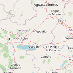
Use this park location map to pinpoint El Jabalí Flora and Fauna Protection Area in Mexico, understand its exact geographic position, and read its mapped placement within the surrounding landscape more clearly.

Pigeon | © OpenStreetMap contributors

Location context for El Jabalí Flora and Fauna Protection Area

Colima
Park atlas

Discover adjacent volcanic reserves, montane forests, and regional conservation areas.

Parks Near El Jabalí Flora and Fauna Protection Area: Compare Related Protected Landscapes

Compare El Jabalí Flora and Fauna Protection Area with adjacent protected reserves across the surrounding region. Analyzing connected volcanic terrain and forest habitats expands regional geographic context.
National parkJalisco
About 9.8 km away#1 closest

North

Volcán Nevado de Colima National Park: National Park Protected Landscape Exploration

Mapping the geographic context and protected boundaries.

Delve into the protected landscape identity of Volcán Nevado de Colima National Park, a designated national park in Jalisco, Mexico. This detailed view focuses on its geographic context, providing insights into mapped park boundaries and the natural terrain that defines this significant protected area for comprehensive atlas discovery.

Area
65.55 km²
Established
1936
IUCN
II
Relief
Mountain
State or regional parkJalisco
About 28 km away#2 closest

Northwest

Bosque Mesófilo Nevado de Colima State Park: Atlas and Geographic Landscape Overview

Protected montane ecosystems of the Jalisco volcanic complex

Bosque Mesófilo Nevado de Colima State Park serves as a crucial protected area on the volcanic slopes of western Mexico. The territory captures an entire elevational gradient, shielding rare cloud forest stands from disturbance while providing a detailed study of volcanic topography, ranging from deep barrancas to high-altitude subalpine zacatonal grassland.

Area
72.14 km²
Established
2009
Relief
Mountain
Scope
Terrestrial
A watercolor painting showing a stylized, soft-focus landscape with rolling green hills and tall grasses against a pale background.
Protected areaJalisco
About 72 km away#3 closest

North

Laguna de Sayula Protected Area: Exploring the Salt Lake Basins and Geography of Jalisco

Ramsar wetland habitat within the Neo-Volcanic Axis

Laguna de Sayula spans a shallow tectonic depression in central-western Mexico, defined by its endorheic lake system and saline margins. This protected area provides a critical flyway for migratory birds while preserving a unique landscape of volcanic mountains, tropical deciduous forest, and ancestral salt harvesting sites. Trace the boundaries and natural features of this significant wetland in the southern region of Jalisco.

Area
168 km²
Relief
Lowland
Climate
Subtropical
Access
Access unknown
Wildlife reserveJalisco
About 100 km away#4 closest

Northwest

Sierra de Quila: Protected Mountain Geography and Forested Wildlife Reserve in Western Jalisco

Mapped terrain, watershed boundaries, and high-altitude forest ecosystems

Sierra de Quila stands as a prominent protected mountain range in western Jalisco, offering a unique mosaic of pine, oak, and mesophilic cloud forests. This wildlife reserve serves as a essential natural anchor for regional biodiversity and watershed protection, with its rugged canyons and dramatic elevation changes providing a distinct geographical profile within the broader Mexican landscape.

Area
151.92 km²
Established
1982
Relief
Mountain
Climate
Temperate
Watercolor painting of a wide, calm lake surrounded by low, rolling hills and lush green vegetation under a soft, hazy sky.
Wildlife reserveJalisco
About 118 km away#5 closest

Northeast

Lake Chapala Wildlife Reserve: A Geographic Exploration of Mexico's Largest Freshwater Basin

Highland volcanic landscapes and protected wetland boundaries in Jalisco

Lake Chapala functions as the central hydrological anchor of the Lerma-Santiago watershed. Situated on a high volcanic plateau, this protected wildlife reserve spans a broad valley floor surrounded by dramatic sierras. Gain detailed perspective on its unique endemic fauna, including rare fish species and migratory waterbirds, while navigating the mapped geography of its shoreline, islands, and basin-wide ecological footprint.

Area
1,100 km²
Established
2009
Relief
Mixed relief
Climate
Temperate
A horizontal watercolor painting depicting a soft-focus landscape with rolling green hills, patches of forest, and light golden hues representing meadows or dry terrain.
Biosphere reserveJalisco
About 135 km away#6 closest

North

La Primavera Biosphere Reserve: Mapping Volcanic Landscapes and Protected Watersheds

Ecological geography and forest distribution in Jalisco, Mexico

Centering on the Sierra la Primavera volcanic complex, this biosphere reserve functions as an essential green corridor and water catchment zone. The terrain consists of a complex mosaic of vegetation types, including pine-oak forests and relict cloud forest patches across high-elevation ridges. Discover the structural role of these protected lands in moderating the climate and supporting biodiversity in the Guadalajara metropolitan region.

Area
305 km²
Established
2000
IUCN
VI
Relief
Mountain
Wildlife reserveMichoacán
About 140 km away#7 closest

East

Área de protección de flora y fauna Pico de Tancítaro: Geographic and Landscape Overview

Protected volcanic highlands in the state of Michoacán

Trace the ridges and forested valleys of this federal wildlife reserve. The area integrates sustainable land use with the protection of native highland ecosystems, marking a core point of interest for those tracking the volcanic geography of Mexico's Trans-Mexican Volcanic Belt.

Area
234.06 km²
Established
2009
Relief
Mountain
Scope
Terrestrial
A horizontal watercolor illustration depicting rolling green hills and distant muted mountain ranges.
Nature reserveJalisco
About 143 km away#8 closest

North

Barranca de Oblatos: Protected Canyon Nature Reserve and Geographical Landmark in Jalisco

Urban-adjacent nature reserve and protected river corridor

Barranca de Oblatos is a striking geological feature and nature reserve that anchors the biodiversity of the Guadalajara metropolitan region. Featuring a deep canyon system carved by the Rio Grande de Santiago, this protected area holds a complex mosaic of tropical deciduous forests and historical landmarks within its dramatic vertical walls. Explore the landscape context and natural boundaries that define this essential western Mexican wilderness area.

Area
11.37 km²
Established
1997
Relief
Highland
Climate
Subtropical

Common questions about visiting, size, designation, and location context for El Jabalí Flora and Fauna Protection Area

El Jabalí Flora and Fauna Protection Area FAQs for park facts, access, geography, and protected area context

Find quick answers about El Jabalí Flora and Fauna Protection Area, including protected-area facts, park geography, trail and visitor context, and how the park fits into its surrounding country and regional landscape.
MoriAtlas Explorer

Continue Your Protected Areas Search Across the Global Atlas

Deepen your exploration by continuing the structured search for national parks and protected areas worldwide. Utilize the comprehensive filtering capabilities to compare different conservation landscapes and refine your understanding of global park geography. Discover more about the distribution and characteristics of protected natural areas.

Global natural geography