Mori Atlas logo
National parkEl Potosí National Park

Discover the mapped boundaries and geographic identity of this national park.

El Potosí National Park: Protected Landscape and Regional Geography in San Luis Potosí

(Parque Nacional El Potosí)

El Potosí National Park represents a significant protected area within the state of San Luis Potosí, Mexico. This page serves as your gateway to understanding the park's specific geographic scope, its role as a national park, and its place within the regional landscape. Engage with the mapped boundaries and natural terrain to build your atlas understanding of this vital protected territory.

National ParksMexicoSierra Madre OrientalPine-Oak ForestsSan Luis PotosíMountain Ecosystems

El Potosí National Park

National park

Park overview

Structured park overview, official facts, and landscape profile for El Potosí National Park

El Potosí National Park park facts, protected area profile, and essential visitor context
Review the core facts for El Potosí National Park, including designation, size, terrain, visitor scale, habitats, and operating context in one park-focused overview.

About El Potosí National Park

El Potosí National Park represents a significant conservation area in the Sierra Madre Oriental mountain range of northeastern Mexico. Established in 1936 during the presidency of Lázaro Cárdenas, the park was one of Mexico's earlier protected areas, reflecting early 20th-century recognition of the importance of preserving representative ecosystems. The park's location in the Serrania de Rioverde places it within one of Mexico's most biologically diverse mountain regions, where the convergence of different climate zones and elevations supports varied plant communities. The park's forests are particularly important for their watershed function, helping to regulate water flow and protect water quality in the Río Verde basin, which ultimately feeds into the Panuco River system.

Quick facts and research context for El Potosí National Park

El Potosí National Park covers 20 square kilometers in the Sierra Madre Oriental of San Luis Potosí, Mexico. Established in 1936 by President Lázaro Cárdenas, it protects a montane landscape with elevations from 1,500 to 2,480 meters. The park features pine-oak forests and is situated within the Río Verde watershed, supporting regional water quality and hydrological function. The climate is montane and semi-arid with average temperatures between 12 and 22 degrees Celsius.

Park context

Deeper park guide and search-rich context for El Potosí National Park

El Potosí National Park history, landscape, wildlife, and travel context
Explore El Potosí National Park through its history, landscape character, ecosystems, wildlife, conservation priorities, cultural context, and seasonal travel timing in a structured park guide built for atlas discovery and search intent.

Why El Potosí National Park stands out

El Potosí National Park is best known for its preserved pine-oak forest ecosystems within the Sierra Madre Oriental. The park protects significant biodiversity including 285 species of wild plants across 207 genera and 84 families, with several species receiving special government protection. The rugged mountain terrain and the park's role in watershed protection make it an important conservation area in northeastern Mexico.

El Potosí National Park history and protected-area timeline

El Potosí National Park was established in 1936 by presidential decree, making it one of Mexico's older national parks. The park was created during a period when Mexico was developing its system of protected areas, with President Lázaro Cárdenas overseeing the designation. The establishment reflected early recognition of the ecological and watershed value of the Sierra Madre Oriental forests in the Rioverde region. The park has remained under the administration of Mexico's National Commission of Natural Protected Areas (CONANP) since its creation.

El Potosí National Park landscape and geographic character

The landscape of El Potosí National Park is characterized by rugged, often steep terrain within the Serrania de Rioverde region of the Sierra Madre Oriental. Elevations within the park range from 1,500 meters at the lower boundaries to 2,480 meters at El Cuatesoncito, the highest peak. The mountainous terrain features dramatic changes in slope and aspect, creating diverse microhabitats throughout the park. The park lies within the watershed of the Río Verde, a tributary of the larger Panuco River system, giving the area significant hydrological importance.

El Potosí National Park ecosystems, habitats, and plant life

The predominant ecological community in El Potosí National Park is pine-oak forest, characteristic of the Sierra Madre Oriental. The park supports remarkable plant diversity with 285 documented species of wild plants distributed across 207 genera and 84 families. Characteristic tree species include several oak species (Quercus resinosa, Quercus potosina, Quercus laeta), pines such as Pinus pseudostrobus and Pinus teocote, madroño (Arbutus xalapensis), lantrisco (Rhus virens), bodero (Dodonaea viscosa), and laurel (Litsea schaffneri). The understory includes plants such as yerbanís (Tagetes lucida), acedia (Ageratum corymbosum), carrestolianda (Senecio aschenbornianus), and calaguala (Polypodium aureum).

El Potosí National Park wildlife and species highlights

While the source material focuses primarily on plant diversity, the park's diverse habitats support varied wildlife. The Spanish-language source indicates that over 410 species of plants and animals inhabit the park, with 20 species classified within some category of risk under Mexican environmental regulations (NOM-059) and 13 exotic species documented. Three plant species receive special protection: the cactus Ferocactus histrix (locally known as borrachitas biznaga), the orchid Laelia speciosa (laelia de mayo or mayito), and the cycad Ceratozamia zaragozae (palmita). The pine-oak forest habitat supports birdlife and other fauna typical of Sierra Madre Oriental ecosystems.

El Potosí National Park conservation status and protection priorities

El Potosí National Park serves important conservation functions within the Sierra Madre Oriental region. The park protects vital watershed areas that feed into the Río Verde and ultimately the Panuco River, with its forests playing a critical role in moderating rainfall runoff and protecting water quality for downstream communities. The protected area preserves representative examples of Sierra Madre Oriental pine-oak forest ecosystems. Several species within the park receive special government protection, including the cactus Ferocactus histrix, the orchid Laelia speciosa, and the cycad Ceratozamia zaragozae. The park experienced significant environmental stress during a severe drought from 2010 to 2012, which weakened trees and made them vulnerable to pine bark beetle infestations, resulting in mortality particularly among young pines in the northern and southern portions of the park.

El Potosí National Park cultural meaning and human context

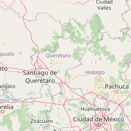
El Potosí National Park is situated in the state of San Luis Potosí in northeastern Mexico. The park lies west of the city of Rioverde, the nearest urban center. The region has historical significance as part of the Sierra Madre Oriental, a mountain range that has shaped local communities and land use patterns. The park's establishment in 1936 reflects Mexico's early efforts to designate protected areas for conservation and watershed protection.

Top sights and standout views in El Potosí National Park

El Potosí National Park offers visitors access to well-preserved Sierra Madre Oriental pine-oak forests in a rugged mountain setting. The park's elevation range from 1,500 to 2,480 meters creates diverse ecological zones within a relatively compact area. Hiking to El Cuatesoncito, the highest peak, provides views of the surrounding mountainous landscape. The park's watershed function and biodiversity make it significant beyond its modest 20-square-kilometer area. Protected plant species including orchids, cycads, and cacti add botanical interest to the park's natural offerings.

Best time to visit El Potosí National Park

The best time to visit El Potosí National Park considers the regional climate patterns. Summer months bring the heaviest rainfall, which can affect trail conditions and visibility but also bring the landscape to life with water features and lush vegetation. The montane climate keeps temperatures moderate, with averages between 12 and 22 degrees Celsius. Visitors should be aware that the park experienced a severe drought from 2010 to 2012, which impacted forest health, and that pine bark beetle infestations have affected some areas, particularly in the northern and southern portions of the park.

Park location guide

Geography guide, regional context, and park location map for El Potosí National Park

El Potosí National Park park geography, regions, and map view in Mexico
Understand where El Potosí National Park sits in Mexico through a broader geographic reading of the surrounding landscape, nearby location context, and its mapped position within the national park landscape.

How El Potosí National Park fits into Mexico

Mexico, officially the United Mexican States, is a country in North America spanning the Sierra Madre mountain ranges, coastal plains, and tropical regions. It borders the United States to the north, Guatemala and Belize to the southeast, and has coastlines along the Pacific Ocean, Gulf of Mexico, and Caribbean Sea. With a population exceeding 130 million, Mexico is home to one of the world's most significant concentrations of Indigenous languages alongside Spanish.

Wider geography shaping El Potosí National Park in Mexico

Mexico occupies a land area of 1,972,550 km2, making it the thirteenth-largest country in the world. The terrain is highly diverse, featuring the Sierra Madre Occidental and Sierra Madre Oriental mountain ranges, the Mexican Plateau, coastal lowlands along the Pacific and Gulf/Caribbean margins, and the Yucatan Peninsula. The country spans multiple climate zones from desert in the north to tropical rainforest in the south.

Map view of El Potosí National Park

Use this park location map to pinpoint El Potosí National Park in Mexico, understand its exact geographic position, and read its mapped placement within the surrounding landscape more clearly.

Pigeon | © OpenStreetMap contributors

Location context for El Potosí National Park

San Luis Potosí
Park atlas

Trace the regional spread of protected landscapes within Mexico's Sierra Madre Oriental.

Explore Related National Parks and Protected Areas Near El Potosí National Park, Mexico
Discover additional national parks and protected areas near El Potosí National Park, exploring their mapped geography and unique conservation profiles within Mexico. Compare diverse mountain ecosystems, pine-oak forest habitats, and significant watershed protection landscapes across the regional context.
National parkQuerétaro

El Cimatario National Park: National Park Protected Landscape in Querétaro Region

Explore mapped boundaries and regional geography.

Investigate El Cimatario National Park, a protected national park located in Querétaro, Mexico. This entry offers detailed atlas-style insights into the park's protected landscape, its geographic setting within the region, and its clearly mapped boundaries. It serves as a focused point for understanding this specific natural area's place in broader geographic and conservation mapping.

Area
24.48 km²
Established
1982
IUCN
II
Relief
Mountain
National parkMichoacán

Cerro de Garnica National Park: Its Geography and Protected Landscape Identity

Explore mapped boundaries within Michoacán's natural terrain.

Cerro de Garnica National Park serves as a distinct protected area contributing to the geographic understanding of Michoacán. This page offers a focused view on its mapped boundaries and natural landscape characteristics, providing essential context for atlas exploration. Discover the park's specific identity as a national park and its place within the regional geography, highlighting its value for structured discovery.

Area
19.36 km²
Established
1936
IUCN
II
Relief
Mountain
National parkHidalgo

El Chico National Park: National Park Boundaries and Regional Geography in Hidalgo

Explore the mapped protected landscape and terrain of this national park.

El Chico National Park is a distinct protected area offering insight into Mexico's regional geography and conservation landscapes. This page details its specific geographic footprint, the character of its natural terrain, and its place within Hidalgo's broader protected areas atlas. Users can examine mapped boundaries and understand the park's unique environmental context.

Area
27.39 km²
Established
1982
IUCN
II
Relief
Mountain
National parkMichoacán

Insurgente José María Morelos y Pavón National Park: Mapped Protected Landscape in Michoacán

Discover its geographic context and protected area boundaries.

Explore Insurgente José María Morelos y Pavón National Park, a designated national park in Michoacán, Mexico. This page provides detailed insights into its protected status, mapped geographic features, and its role as a significant natural landscape within the regional atlas. Understand the park's protected boundaries and its contribution to the geographic understanding of Michoacán.

Area
71.92 km²
Established
1939
IUCN
II
Relief
Mountain
National parkMexico State

Los Remedios National Park: Protected Landscape and Historical Geography of Mexico State

Mapped terrain and cultural heritage within this unique national park.

Delve into the protected landscape of Los Remedios National Park, a national park situated in Mexico State. This page provides detailed geographic context, focusing on its volcanic terrain, mapped boundaries, and the convergence of pre-Hispanic and colonial heritage. Understand its role as a protected area within the western Valley of Mexico and explore the mapped elements that define its cultural and natural identity.

Area
4 km²
Established
1938
IUCN
II
Relief
Mountain
National parkMichoacán

Lago de Camécuaro National Park: National Park Protected Landscape and Geographic Atlas

Mapped boundaries and regional natural landscape context for Michoacán.

Lago de Camécuaro National Park offers a focused exploration of a distinct protected area within Michoacán, Mexico. Understand its specific geographic identity through mapped boundaries and regional terrain context, suitable for atlas-based discovery of natural landscapes and conservation areas. This entry provides a factual overview of the park's protected status and its placement within the broader geography of the region.

Area
0.097 km²
Established
1941
IUCN
II
Relief
Upland
National parkMexico City

Desierto de los Leones National Park: Protected National Park and its Geographic Setting

Explore mapped boundaries and regional landscape context near Mexico City.

Delve into the specifics of Desierto de los Leones National Park, a designated national park recognized for its protected landscape. This MoriAtlas entry focuses on its geographic presence within the Mexico City region, providing clear insights into its mapped boundaries and the surrounding natural terrain. Understand the park's importance as a conservation area and its contribution to the regional geography through dedicated atlas data.

Area
18.67 km²
Established
1917
IUCN
II
Visitors
205K annual
National parkMexico

Fuentes Brotantes de Tlalpan National Park: National Park Geographic Atlas and Terrain Exploration

Explore protected land boundaries and mapped natural landscapes.

Delve into the geographic specifics of Fuentes Brotantes de Tlalpan National Park, a protected national park situated within Mexico. This detailed view highlights the park's mapped terrain and its significance as a distinct natural landscape. Understand its role in the country's protected area network and its contribution to the broader atlas of natural geography.

Area
0.08 km²
Established
1936
IUCN
II
Relief
Upland

Common questions about visiting, size, designation, and location context for El Potosí National Park

El Potosí National Park FAQs for park facts, access, geography, and protected area context
Find quick answers about El Potosí National Park, including protected-area facts, park geography, trail and visitor context, and how the park fits into its surrounding country and regional landscape.
MoriAtlas Explorer

Continue Your Protected Areas Search Across the Global Atlas

Deepen your exploration by continuing the structured search for national parks and protected areas worldwide. Utilize the comprehensive filtering capabilities to compare different conservation landscapes and refine your understanding of global park geography. Discover more about the distribution and characteristics of protected natural areas.

Global natural geography