
Why UNESCO Biosphere Entlebuch stands out
Entlebuch is best known for its extraordinary concentration of peatlands, including raised bogs and flat bogs, set in close proximity to dry habitats that produce highly varied flora and fauna within small areas. It also stands out for the Schrattenfluh karst landscape, one of the most prominent karst massifs in the Swiss Alps and a defining visual landmark of the biosphere reserve. Equally important is the participatory model behind the reserve itself. Entlebuch was the first biosphere reserve anywhere in the world to be founded through a popular vote and through cooperative engagement with the local population, setting an early precedent for community-driven conservation in Europe.
UNESCO Biosphere Entlebuch history and protected-area timeline
The name Entlebuch is documented as early as 1139, derived from the river Entle, itself a name with pre-Germanic, likely Celtic, roots. The region was originally part of the lordship of the Herren von Wolhusen, becoming an Austrian fief in 1313. In 1370, the Entlebuch people expelled their imperial governor and entered into a Burgrecht alliance with the city of Lucerne, an event that became foundational to regional identity.
The medieval period brought the legendary conflict with Obwalden around 1380 and the associated legend of the local hero Windtrüeb, as well as a formal 1395 settlement of relations with Lucern that allowed Entlebuch to retain its own banner, seal, and court. By 1405, however, Entlebuch had become a major Vogtei of Lucerne, eventually giving up its original banner and seal, though it retained distinctive militia pennants under the older designation Vennly. A 1472 militia flag with a Passion cross granted by Pope Sixtus IV is one of the region's oldest surviving heraldic objects.
In 1580 the Amt was divided into an upper Amt (Escholzmatt and Marbach), a middle Amt (Schüpfheim and Flühli), and a lower Amt (Entlebuch, Hasle, Romoos, and Doppleschwand). During the Napoleonic Helvetic era the region was reorganized into individual political municipalities. The boundary between Entlebuch and the neighboring Emmental, along the Ilfis river, was set by the 1470 Völlige Richtung between Lucerne and Bern and later also became the confessional border between Catholic Lucerne and Reformed Bern.
In the twentieth century, post-1990 land use restrictions following the Rothenthurm Initiative, which protected Switzerland's remaining moors, made large parts of the valley difficult to farm under traditional rules. This was the direct background for the biosphere idea, which aimed to repurpose conservation constraints as a tourism and regional economic asset. The effort culminated in 2001 when the region became a UNESCO Biosphere Reserve under the Seville criteria, the first such reserve anywhere in the world to be established through popular vote and participatory citizen involvement. Since 2008, the reserve has also been a Regional Nature Park of national importance under Swiss park law. Theo Schnider co-founded and directed the biosphere reserve until 2022, when he was succeeded by the former director of the Natur- und Tierpark Goldau.
UNESCO Biosphere Entlebuch landscape and geographic character
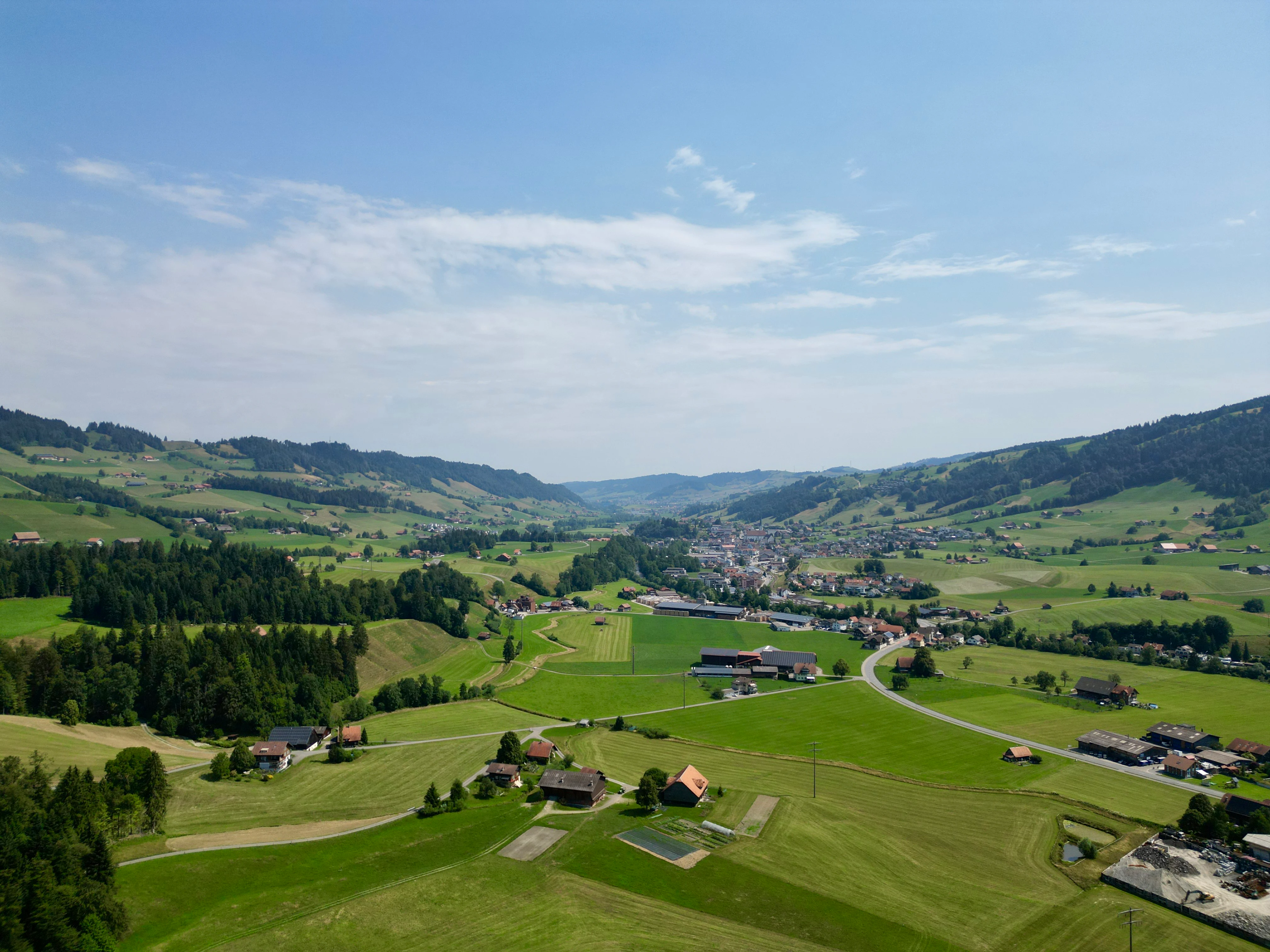
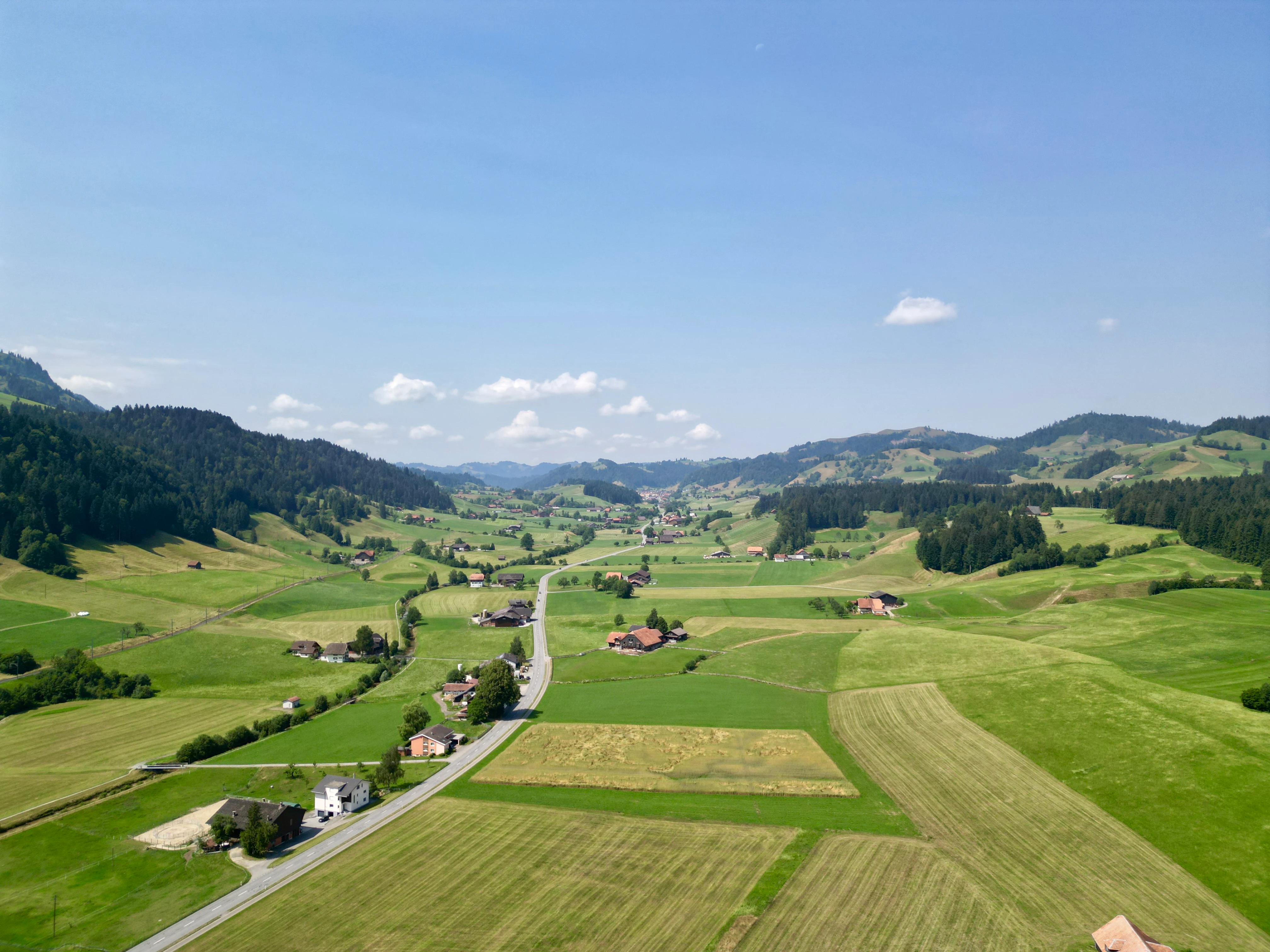
Entlebuch's landscape is shaped by its position in the upper valley of the Kleine Emme and the surrounding pre-Alpine relief. The terrain combines deeply forested slopes, open agricultural valley floors, high alpine pastures, peatlands, and rocky ridges, producing a varied topography in a relatively small area.
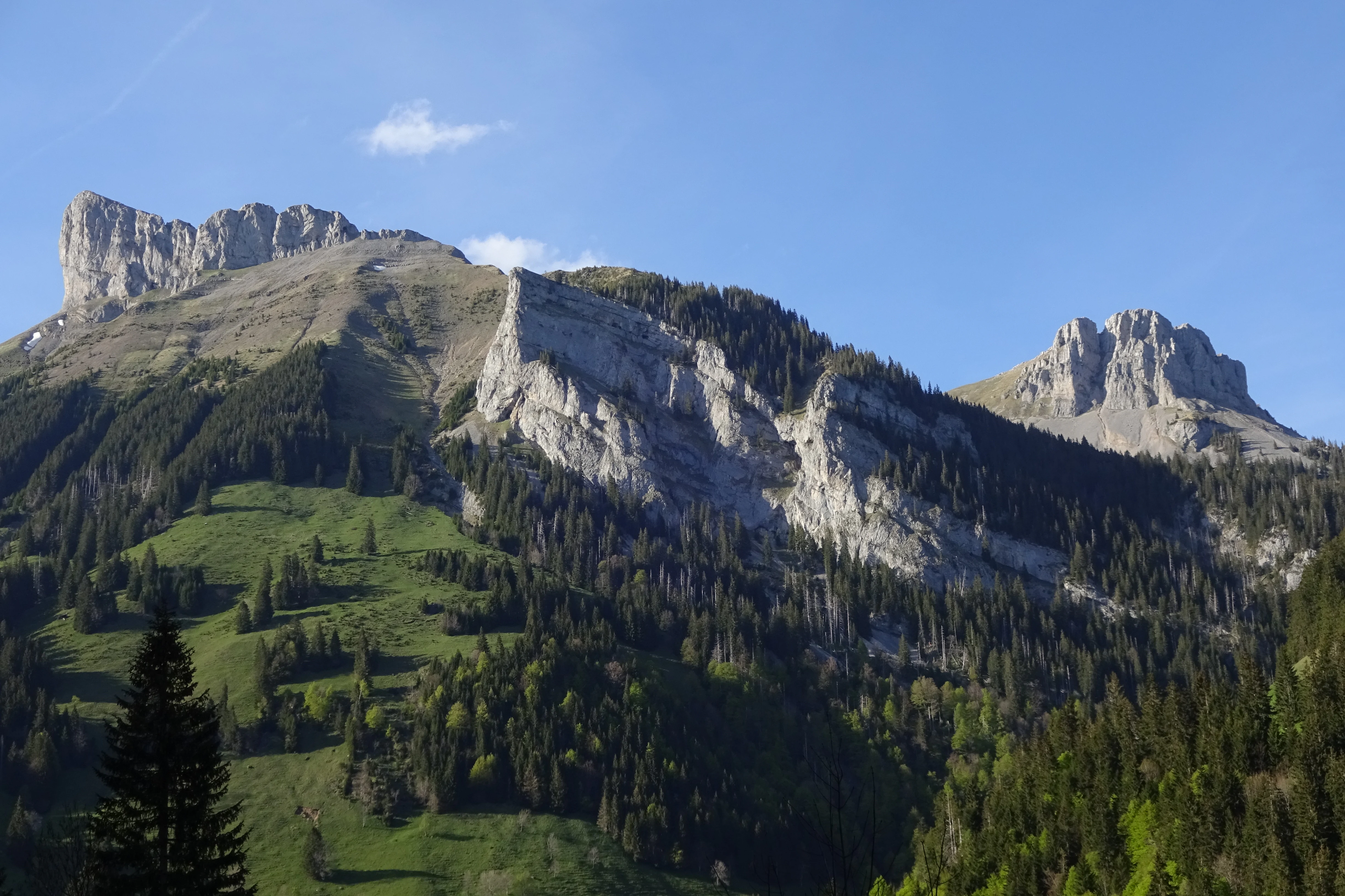
The most visually striking feature is the Schrattenfluh, a prominent karst massif with characteristic limestone formations including exposed rock faces, dolines, and extensive karrenfeld or exposed limestone pavement. Photos from the region highlight dramatic southern flanks such as those around the Schibengütsch, Hängst, Achs, and Böli, which display the characteristic folded and weathered limestone profiles that make karst landscapes visually distinctive.
Outside the karst areas, the region is dominated by forested hills and moors. Forests of beech with fir, silver fir with spruce, and pure spruce blanket much of the area, while the valley bottoms carry wet meadows, lowland bogs, and the moated agricultural landscape that has long supported small-scale farming. Above the treeline, alpine grasslands and rocky mountain pastures extend toward summits such as those of the Schrattenfluh range, giving the biosphere reserve an unusually complete vertical structure from valley to high mountain.
UNESCO Biosphere Entlebuch ecosystems, habitats, and plant life
Entlebuch's ecological identity is defined by two overlapping natural features: an unusually rich mosaic of peatland habitats and a significant karst landscape. Together they create microhabitat diversity that supports many species in a compact area.
The peatlands are among the most important in Switzerland. More than twenty percent of the country's intact raised bogs lie within the biosphere reserve, and the reserve overall lists 135 flat bogs and raised bogs as well as four nationally important moor landscapes of national significance. Adding to this are four floodplain landscapes, several amphibian spawning sites, dry meadows of national importance, and three nationally important landscapes, all of which are integrated into the broader biosphere concept.
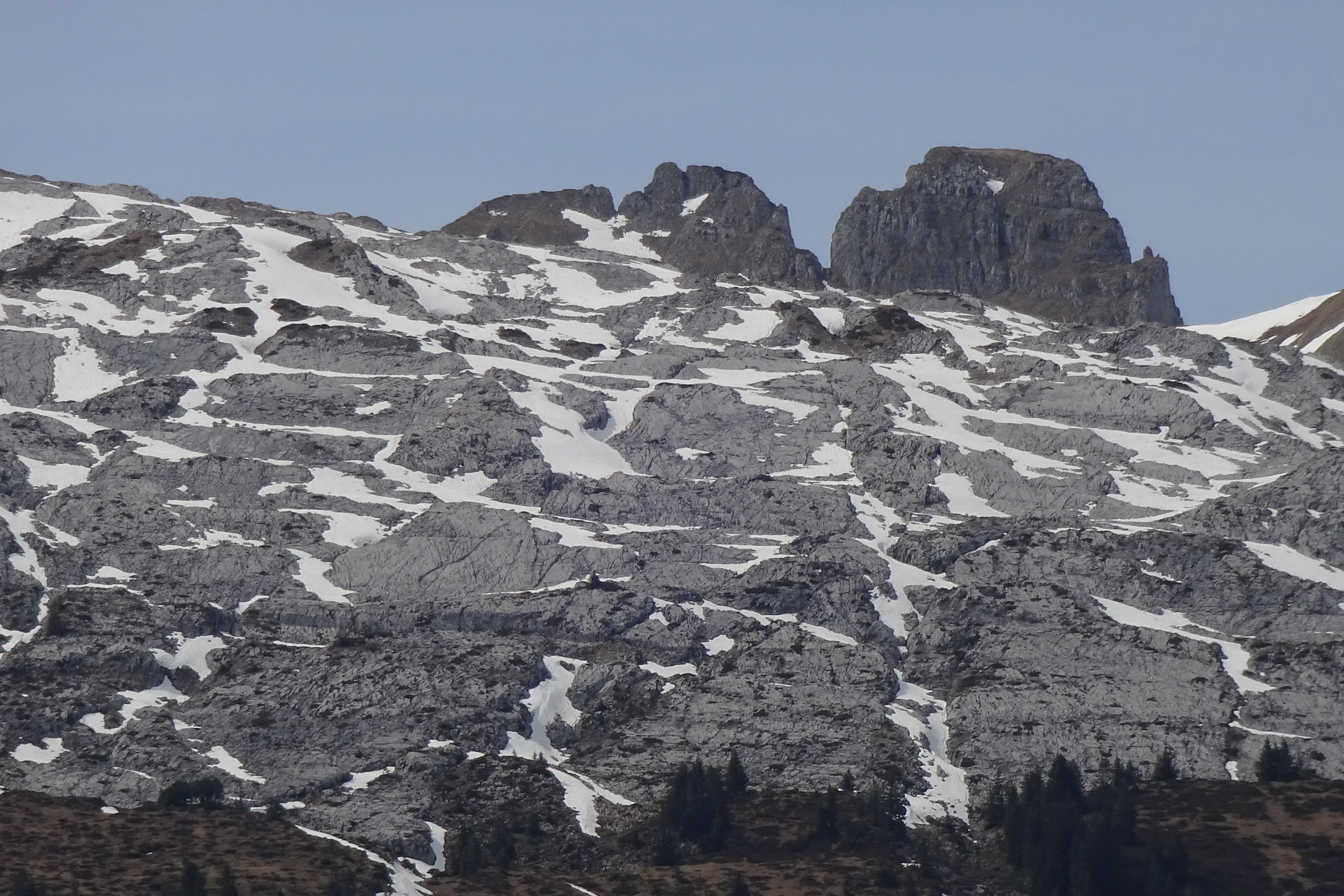
Ecologically, the proximity of wet bog habitats to dry rocky and grassland habitats produces what conservation literature describes as a remarkable concentration of species-rich environments within a small area. Forests in the reserve include beech-fir, fir-spruce, and spruce communities, as well as relict mountain pine and spruce raised bog forests associated with peatland edges. Above the forests, the karst landscape hosts its own specialized flora, with high-altitude species such as alpine asters (Alpenastern) found near exposed rock in the Schrattenfluh area.
UNESCO Biosphere Entlebuch wildlife and species highlights
Although the regional source material is more focused on habitats than on individual species, the mosaic character of Entlebuch's landscape supports a rich fauna in a compact area. The combination of bogs, dry meadows, floodplains, karst, and mixed montane forests provides habitat for amphibians in the documented amphibian spawning sites, as well as for wetland birds tied to the peatland networks and forest species associated with the extensive beech-fir and spruce stands.
The biodiversity argument in the context of the biosphere reserve emphasizes not single flagship species but the coincidence of bog fauna, dry-ground species in karst and meadow habitats, and forest species in a single landscape. This ecological density, rather than a single charismatic animal, is what defines the wildlife profile of the region.
UNESCO Biosphere Entlebuch conservation status and protection priorities
Entlebuch's conservation significance is rooted in its exceptional density of protected habitats. More than half of the biosphere reserve's total area is under formal protection, including nationally important flat bogs, raised bogs, moor landscapes, floodplains, dry meadows, and a nationally important landscape. The reserve contains more than twenty percent of Switzerland's intact raised bogs, making it disproportionately important for the country's peatland heritage.
The Rothenthurm-Initiative of the early 1990s imposed legal restrictions on farming and forestry across roughly half of the region's surface, primarily within flat and raised bogs. Rather than treating these restrictions purely as a burden, the region reframed them as a basis for sustainable regional development, leading to the participatory creation of the biosphere reserve.
In line with UNESCO biosphere reserve principles, Entlebuch combines strict core conservation zones with a broader landscape where sustainable economic activity continues. The reserve also operates an education for sustainable development program aligned with the UN Decade of Education for Sustainable Development between 2005 and 2014, including the multi-day Biosphärenschule program for visiting children and the local Äntlibuecher Schuelschätz initiative for in-region schoolchildren. Sustainable regional economic development is supported through the Echt Entlebuch quality and origin brand, under which more than fifty businesses and over two hundred products are currently certified.
UNESCO Biosphere Entlebuch cultural meaning and human context
Entlebuch has roughly 17,000 inhabitants and remains strongly rural, with a historically grown sense of regional and cultural identity. The region has an active and intact associative life, and local awareness of the Entlebuch valley as a distinct cultural landscape has long predated the biosphere reserve designation.
Historical symbols still shape local identity: the older cantonal banner of around 1382 features a beech tree with three roots and seven branches on a red field, the same motif later chosen as the modern municipal coat of arms of the municipality of Entlebuch. After periods of unrest, most notably in 1514, Entlebuch regained greater self-rule and restored its seal, banner, and coat of arms. Since 2004, regional planning discussions under the Vogelschau project have explored different governance models, including the G4 fusion negotiations among Entlebuch, Hasle, Schüpfheim, and Flühli, and the 2013 merger of Marbach and Escholzmatt into Escholzmatt-Marbach. The local dialect is Swiss German, which is reflected even in educational programs such as the Schuelschätz initiative.
Top sights and standout views in UNESCO Biosphere Entlebuch
Entlebuch's standout features include its extraordinary peatland density, its dramatic Schrattenfluh karst landscape, and its pioneering status as the world's first UNESCO biosphere reserve to be established through a popular vote. The region is also notable for combining a working rural economy with high-level conservation, as more than fifty percent of its surface is under protection while agriculture, forestry, and tourism continue to operate within the same landscape.
Best time to visit UNESCO Biosphere Entlebuch
As a predominantly rural Alpine valley with extensive forests, mires, and karst highlands, Entlebuch's seasonal character shifts with the snowline, the alpine farming calendar, and the visibility of its mires and high pastures. Late spring and early summer tend to bring the fresh green of alpine meadows, grazing livestock on high pastures, and comfortable temperatures for walking between bog areas and villages. Summer offers the widest range of conditions for exploring high-altitude karst areas such as the Schrattenfluh, while autumn brings traditional agricultural activity in the valley and the start of quieter conditions for landscape observation. Winter conditions can limit access to higher altitudes and emphasize the valleys, villages, and lower wooded slopes. Seasonal conditions are broad and visitor experience will depend mainly on whether one seeks the active agricultural landscape or the quieter, more contemplative winter character.