
Mori Atlas logo
Nature reserveErtis Ormany

Tracing the geographic extent of sandy soil forests within the expansive Kulunda Plain.

Ertis Ormany Nature Reserve: Analyzing the Pine Belt Landscapes and Protected Steppe Geography

(Yertis Ormany State Forest Natural Reserve)

Ertis Ormany serves as a significant protected landscape in northeastern Kazakhstan, preserving the iconic Irtysh pine belts across the Pavlodar Region. This nature reserve maintains extensive forest corridors that contrast sharply with the surrounding dry steppe, offering a unique study in desertification control and forest-steppe ecology. The mapped territory reveals a flat, sandy landscape where coniferous woodlands provide a vital refuge for regional wildlife despite the absence of permanent rivers.

pine foreststeppeforest-steppeIrtysh River regionPavlodar Oblaststate forest reserve
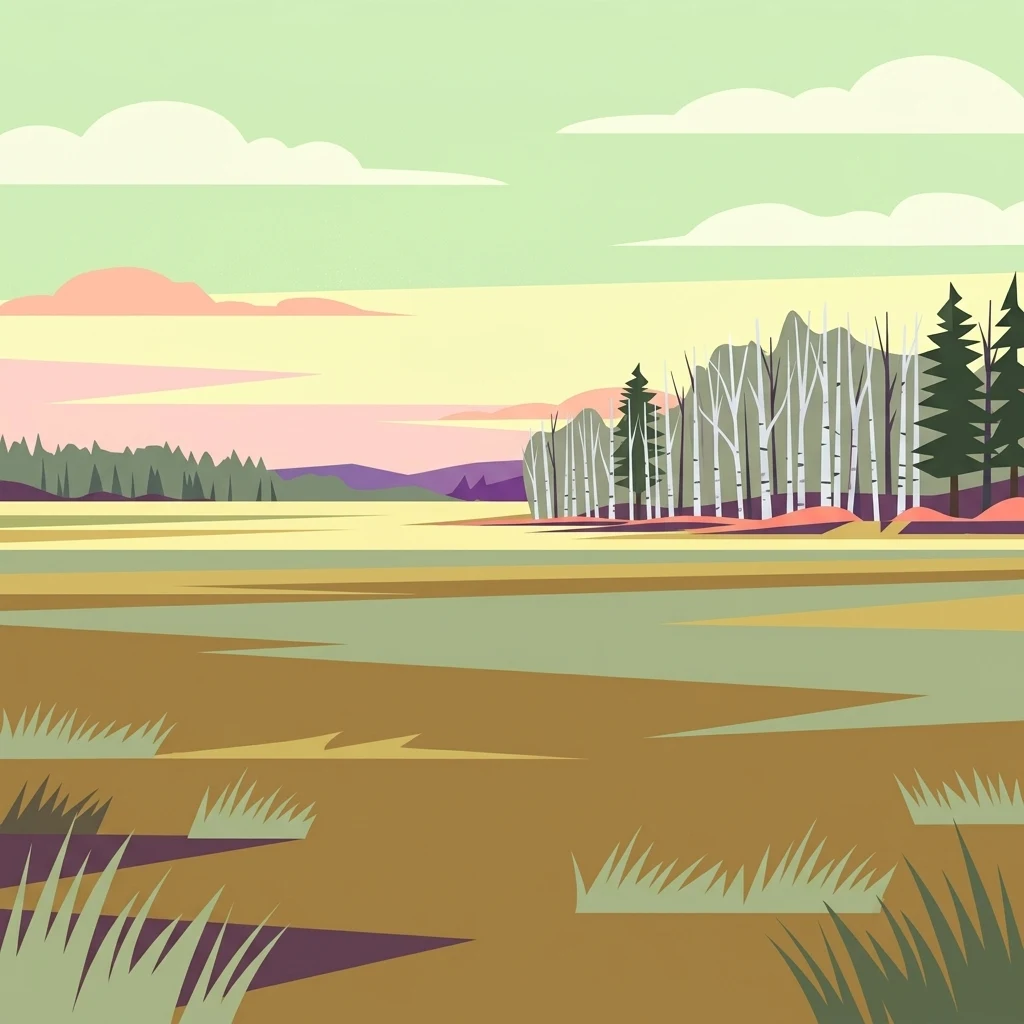
A flat-style digital illustration showing a flat landscape with patches of grass, a distant forest with pine and white-barked trees, and a pale yellow sky with soft clouds.

Ertis Ormany

Nature reserve

Park overview

Structured park overview, official facts, and landscape profile for Yertis Ormany State Forest Natural Reserve

Yertis Ormany State Forest Natural Reserve park facts, protected area profile, and essential visitor context

Review the core facts for Yertis Ormany State Forest Natural Reserve, including designation, size, terrain, visitor scale, habitats, and operating context in one park-focused overview.

About Yertis Ormany State Forest Natural Reserve

Yertis Ormany is among the largest state forest reserves in Kazakhstan and the principal protected site for the country's famous Irtysh pine belts. It lies in the northeastern part of the country, in Pavlodar Oblast, crossing the administrative boundaries of Shcherbakty and Lebyazhye districts. The reserve's territory extends roughly 133 kilometers from north to south and 130 kilometers from west to east, occupying a substantial swath of the southwestern part of the Kulunda Plain, where sandy deposits support pine growth in a region otherwise dominated by open dry steppe.

The reserve was created on 22 January 2003 through a governmental reorganization that combined two existing state forest institutions, the Shaldai and Beskaragai forest estates, into a single unified body. This restructuring was driven by a clear conservation goal: to ensure the long-term preservation and restoration of the ecologically, scientifically, culturally, and recreationally valuable pine forests of the Irtysh region, in both Pavlodar and the neighboring Abay region. The founding of the reserve consolidated fragmented forest management and gave the pine belts formal protection status under a single management mandate administered today by the Forestry and Animal World Committee of the Ministry of Agriculture of Kazakhstan.

What makes Yertis Ormany distinctive is the contrast between forest and steppe that defines nearly every landscape within its borders. The sandy soils sustain dense pine stands, while the surrounding terrain opens into classic Central Asian dry steppe, dominated by feather grass and fescue formations, with scattered patches of aspen and birch groves. The reserve is also notable for being a forested refuge inside an otherwise largely treeless region. Within a continental climate of hot dry summers, severe winters with little snow, and frequent droughts and dust storms, the pine forests act both as habitat for wildlife and as a barrier against desertification and soil erosion on the surrounding sandy terrain.

Quick facts and research context for Yertis Ormany State Forest Natural Reserve

Yertis Ormany is a state forest natural reserve located in Pavlodar Oblast in northeastern Kazakhstan, divided between the Shcherbakty and Lebyazhye districts. Established on 22 January 2003, it now encompasses roughly 278,000 hectares, making it one of the largest forest protected areas in the country. It was formed to preserve and restore the Irtysh pine belts, narrow ribbons of pine forest that grow on sandy soils within the broader steppe landscape.

The reserve is administered by the Forestry and Animal World Committee of the Ministry of Agriculture of Kazakhstan and is classified by IUCN as a Category VI protected area, indicating sustainable use of natural resources. Pine is overwhelmingly the dominant tree species, with smaller shares of aspen and birch, while the reserve supports populations of moose, roe deer, lynx, wolves, foxes, marmots, and around two hundred bird species.

Protection and recognition

Examine the official terrestrial protection framework and designation records for Ertis Ormany.

Ertis Ormany Protection Status and Documented Conservation Scope

Ertis Ormany maintains a documented terrestrial protection scope within its primary conservation boundaries. Systematic records aggregate available management frameworks and designation data without external international recognitions.

Protection details

Protection scope
Terrestrial
Transboundary protection
No
Park context

Deeper park guide and search-rich context for Yertis Ormany State Forest Natural Reserve

Yertis Ormany State Forest Natural Reserve history, landscape, wildlife, and travel context

Explore Yertis Ormany State Forest Natural Reserve through its history, landscape character, ecosystems, wildlife, conservation priorities, cultural context, and seasonal travel timing in a structured park guide built for atlas discovery and search intent.

Why Yertis Ormany State Forest Natural Reserve stands out

The reserve's identity is defined by its Irtysh pine belts, narrow ribbons of Scots pine forest growing on sandy soils within a dry steppe environment that would otherwise support only grassland. These pine belts are ecologically unusual in this part of Kazakhstan and give the reserve its distinctive character as a forested island amid the steppe. Yertis Ormany is also widely recognized for combining managed forestry with protected-area status, ensuring long-term conservation of a regionally important pine ecosystem while maintaining the surrounding open landscapes that support steppe wildlife and migratory bird life.
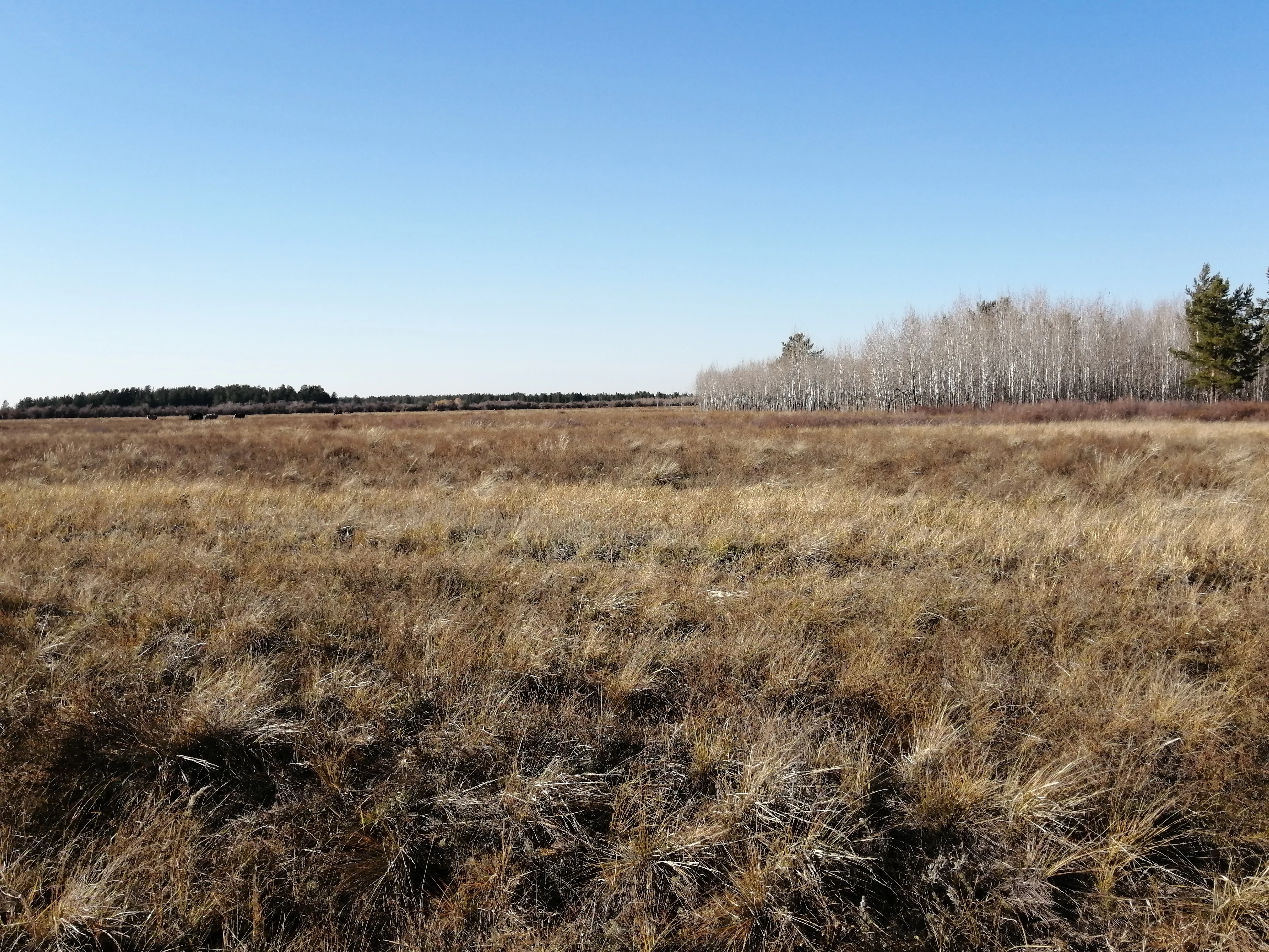
A vast, dry golden grassy field under a clear blue sky, with a forest of bare birch trees visible in the mid-ground on the right side.
A wide view of the dry steppe grasslands and deciduous forest stands within the Ertis Ormany nature reserve.

Yertis Ormany State Forest Natural Reserve history and protected-area timeline

The reserve's history is rooted in the long-standing ecological, economic, and cultural importance of the Irtysh pine belts, which for centuries defined the natural character of the Irtysh River region in northeastern Kazakhstan. These pine stands were historically managed through dedicated forest institutions, including the Beskaragai and Shaldai forest estates, each responsible for a different portion of the pine belt landscape.

In the early 2000s, the Government of Kazakhstan chose to consolidate these and similar institutions into a more unified forest management framework. Resolution No. 75, dated 22 January 2003, formally reorganized these state forest institutions under the Committee of Forestry and Hunting within the Ministry of Agriculture. This reorganization resulted in the creation of the Yertis Ormany State Forest Natural Reserve as a single integrated entity tasked with the protection and restoration of the Irtysh pine belts spanning both Pavlodar and Abay regions.

Since its establishment, the reserve has functioned as a dedicated conservation and sustainable-use site, ensuring that the unique pine-belt forests of the Irtysh region are managed within a coherent ecological framework rather than through fragmented local authorities. It has gradually taken on additional recognition as one of the most significant forested protected areas in the Kazakh steppe zone.

Yertis Ormany State Forest Natural Reserve landscape and geographic character

The landscape of Yertis Ormany is defined by the meeting of two starkly different but interlinked environments: pine forest and dry steppe. The reserve sits within the southwestern reaches of the Kulunda Plain, where ancient sandy deposits have created conditions favorable to pine growth in a region otherwise too dry to support large tracts of woodland. The pine stands form narrow, elongated belts that run through the steppe, often appearing as dark green corridors against lighter, grassy plains. These are the Irtysh pine belts that give the reserve its identity.

The relief is generally flat to gently undulating, with sandy soils supporting coniferous stands and the harder soils between them covered by feather grass and fescue-dominated steppe formations, including stiff grass, Koeleria, low sedge, and field sagebrush. Open meadows, agricultural fields, and small birch groves add further variety to the scene. The reserve stretches widely across this mosaic, with the forest itself covering roughly 148,000 hectares of the total territory, while plantations, often of pine, account for an additional several thousand hectares.

The hydrological character of the reserve is unusual for a place of its size: there are no permanent rivers, streams, or springs within its borders. Instead, water is limited to a few small, shallow, often saline lakes, some of which dry out entirely in drought years and turn into salt flats and saline pans, as well as a small number of artificial reservoirs and wells built to supply water for technical purposes, firefighting, and wildlife watering. Combined with extreme temperature swings and frequent winds that can become dust storms, this hydrological scarcity strongly shapes both the ecology and the management of the reserve.

Yertis Ormany State Forest Natural Reserve ecosystems, habitats, and plant life

Vegetation in Yertis Ormany follows a classic pattern of forest-steppe contrast. Pine overwhelmingly dominates the forested areas, with Scots pine covering roughly 141,000 hectares, more than 94 percent of the forested land. Aspen and birch form smaller secondary components, and small planted stands and young forest plantations add a managed dimension to the wooded landscape. The herbaceous layer of the open areas is dominated by feather grass, fescue, and other drought-tolerant steppe species, with sagebrush and low sedge adding to the characteristic dry-steppe flora.

The reserve's plant diversity is broader than its forest-sand emphasis might suggest. Recorded flora includes higher plants spanning six divisions and four subdivisions, encompassing around 50 families, 148 genera, and approximately 215 species. Angiosperms dominate this list, making up over 96 percent of recorded higher plants, with dicotyledons particularly well represented. The leading plant families reflect a typical steppe-forest mosaic: Asteraceae around 34 species, Poaceae around 30 species, and Fabaceae and Rosaceae each contributing around 17 species. Perennial herbs form the dominant life form, accounting for over 60 percent of species, with annual and biennial herbs, shrubs, and trees making up smaller shares.

This combination of forest and steppe flora on sandy and loamy soils has created a habitat mosaic that is uncommon elsewhere in this part of Kazakhstan. The reserve's ecological value lies not only in its forests but also in maintaining landscape connectivity between dry steppe, meadow, and woodland patches.

Yertis Ormany State Forest Natural Reserve wildlife and species highlights

The wildlife of Yertis Ormany is shaped by the forest-steppe mosaic and benefits from the reserve's protected status. Around 40 mammal species have been recorded across the territory, and the bird community is rich, with approximately 200 species present overall. More recent assessments place the combined vertebrate fauna at 63 species across amphibians, reptiles, birds, and mammals.

Among mammals, the larger ungulates and predators typical of Eurasian forest-steppe habitats are present, including moose, Siberian roe deer, lynx, and wolves, alongside widespread smaller carnivores such as red fox and corsac fox. Steppe species such as bobak marmot and both mountain hare and European hare are recorded, as are smaller mammals including Eurasian red squirrel, polecat, various jerboas, hedgehogs, bats, and several rodent species. The combination of forest cover and open steppe within a single contiguous landscape supports both forest-dwelling and steppe-dwelling mammal communities.

The bird fauna is notable for the presence of several species listed in the Red Book of Kazakhstan, including golden eagle, saker falcon, eagle owl, and lesser kestrel. Raptors, ground-nesting steppe birds, and waterfowl are all part of the reserve's avian diversity. Reptile presence is more limited, with only a few species such as the common green lizard and common rat snake documented. The reserve is thus best understood as a stronghold for typical Central Asian forest-steppe wildlife, including both resident and migratory species.

Yertis Ormany State Forest Natural Reserve conservation status and protection priorities

Yertis Ormany holds substantial conservation significance as the principal formal protection site for the Irtysh pine belts, an ecologically distinctive forest type in northeastern Kazakhstan. Designated by IUCN as a Category VI protected area, the reserve is oriented around sustainable use of natural resources while maintaining the long-term integrity of the pine forest and the associated forest-steppe landscapes. The reserve's legal creation in 2003 specifically aimed at the preservation and restoration of these forests, including those extending into neighboring Abay Region.

From a broader environmental perspective, the reserve plays a key role in protecting the sandy-soil pine forests from degradation, illegal logging, and uncontrolled land use, while also serving as a buffer against desertification and soil erosion across the southwestern Kulunda Plain. The artificial reservoirs and wells scattered across its territory function in part as firefighting infrastructure and wildlife watering points, illustrating that active management is integral to the reserve's conservation strategy. Protecting populations of Red Book species such as golden eagle, saker falcon, eagle owl, and lesser kestrel adds further conservation weight.

Yertis Ormany State Forest Natural Reserve cultural meaning and human context

The Irtysh pine belts of northeastern Kazakhstan have long been an integral part of regional identity and local heritage in the Pavlodar and Abay regions, where forested landscapes stand out against the predominantly open steppe that surrounds them. The pine forests of the Irtysh region are recognized for their ecological, scientific, cultural, and recreational significance, and that broader valuation of the landscape is reflected in the formal mandate of the reserve.

Communities in the reserve's surrounding districts have historical ties to these pine forests, which have traditionally supported both local livelihoods and regional forestry activity. The reorganization of forest management that created Yertis Ormany in 2003 reflected both modern conservation priorities and continuity in the cultural relationship between the region and its unusual forested landscapes.

Top sights and standout views in Yertis Ormany State Forest Natural Reserve

Yertis Ormany's most distinguishing quality is its role as the foremost protected site for the Irtysh pine belts, narrow pine corridors that grow on sandy soils embedded deep in the dry steppe of northeastern Kazakhstan. The reserve's sheer scale, covering roughly 278,000 hectares across two districts, makes it one of the country's most important forest reserves.

The reserve also stands out for combining internationally recognized protected-area status with active forestry management, ensuring that pine, aspen, and birch woodlands continue to function as habitat alongside cultivated stands. Its IUCN Category VI designation, combined with its role in protecting endangered bird species and controlling desertification in the Kulunda Plain, gives Yertis Ormany a unique position as a forested refuge in the Kazakh steppe.

Best time to visit Yertis Ormany State Forest Natural Reserve

Yertis Ormany's sharply continental climate strongly shapes the experience of visiting the region. Summers are hot and dry, with daytime temperatures reaching extreme highs, while winters are cold and relatively snow-poor, characterized by very low minimum temperatures and wide annual swings. Late spring and early autumn carry the risk of frost, and drought-period winds frequently turn into dust storms.

The most rewarding periods for landscape and wildlife viewing tend to be the shoulders of summer and early autumn, when steppe vegetation remains visible, temperatures are less extreme, and migratory and resident birdlife is most active. Winter visits, though visually striking with snow-dusted pine stands, involve severe cold and should be planned with that in mind. Visitors should be aware that the reserve's hydrological scarcity means that wildlife tends to concentrate around the few water sources, which can shape the timing and location of wildlife sightings.
Monthly climate preview

Long-term representative point measurements tracking monthly climate patterns in Pavlodar Region

Ertis Ormany Climate Normals, Annual Temperature and Precipitation Rhythm

Ertis Ormany records a wide annual temperature spread ranging from severe winter minimums to warm summer maximums alongside measured monthly precipitation. Reviewing the complete twelve-month climatology profile provides deeper analytical insight into long-term environmental patterns.
Annual mean4 °C
-18 °C22 °C
Jan-18°
Feb-14°
Mar-6°
Apr
May14°
Jun21°
Jul22°
Aug20°
Sep12°
Oct
Nov-6°
Dec-14°
Warmest month
July

22.5 °C

Coolest month
January

-17.6 °C

Wettest month
July

1.6 mm/day

Driest month
January

0.5 mm/day

Park location guide

Geography guide, regional context, and park location map for Yertis Ormany State Forest Natural Reserve

Yertis Ormany State Forest Natural Reserve park geography, regions, and map view in Kazakhstan

Understand where Yertis Ormany State Forest Natural Reserve sits in Kazakhstan through a broader geographic reading of the surrounding landscape, nearby location context, and its mapped position within the national park landscape.

How Yertis Ormany State Forest Natural Reserve fits into Kazakhstan

Kazakhstan is a Central Asian country spanning vast steppes and plains, bordered by Russia, China, Kyrgyzstan, Uzbekistan, and Turkmenistan, with a coastline along the Caspian Sea. It gained independence from the Soviet Union in 1991 and has a population of approximately 20.5 million people. The country is officially secular but predominantly Muslim, with Kazakh and Russian as official languages.

Wider geography shaping Yertis Ormany State Forest Natural Reserve in Kazakhstan

Kazakhstan occupies a vast territory in Central Asia, extending into Eastern Europe. Its terrain consists largely of hilly plateaus and plains, with lowlands covering about a third of the area. The southern and eastern regions are mountainous. The country borders Russia to the north and west, China to the east, Kyrgyzstan to the southeast, Uzbekistan to the south, and Turkmenistan to the southwest. It has a coastline along the Caspian Sea.

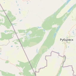
Map view of Yertis Ormany State Forest Natural Reserve

Use this park location map to pinpoint Yertis Ormany State Forest Natural Reserve in Kazakhstan, understand its exact geographic position, and read its mapped placement within the surrounding landscape more clearly.

Pigeon | © OpenStreetMap contributors

Location context for Yertis Ormany State Forest Natural Reserve

Pavlodar Region

Explore protected area photography, forest habitats, and terrain across northeastern Kazakhstan.

Ertis Ormany Photos and Landscapes: Visualizing the Pine Belts and Steppe

Visual documentation captures the striking contrast between sandy pine forests and open dry steppe environments within Ertis Ormany. Detailed imagery reveals the ecological character of the Irtysh pine belts and surrounding protected landscapes.

A vast, dry golden grassy field under a clear blue sky, with a forest of bare birch trees visible in the mid-ground on the right side.

A close-up of a pine tree branch with a cluster of needles and moss in a forest setting.

Park atlas

Compare regional forest reserves and steppe landscapes across northeastern Kazakhstan

Parks Near Ertis Ormany and Surrounding Protected Areas

Browsing protected areas near Ertis Ormany reveals broader ecological patterns across the Kulunda Plain and surrounding dry steppe environments. Comparing these neighboring forest reserves provides deeper geographic context for the unique pine belts of northeastern Kazakhstan.
Natural monumentPavlodar Region
About 141 km away#1 closest

West

Gusiny Perelet Natural Monument: Geological Geography and Fossil Site Mapping in Pavlodar Region

An iconic Irtysh River protected area and Neogene research locality

Situated along the Irtysh River bank, Gusiny Perelet functions as a vital reference point for Neogene mammal evolution in Central Asia. The protected site showcases an exposed geological face, providing scientific insight into ancient ecosystems once dominated by Hipparion fauna. Its preserved fossil assemblage and riverside location offer a tangible connection to the region's deep natural history.

Established
1971
Relief
Lowland
Climate
Temperate
Access
Easy access
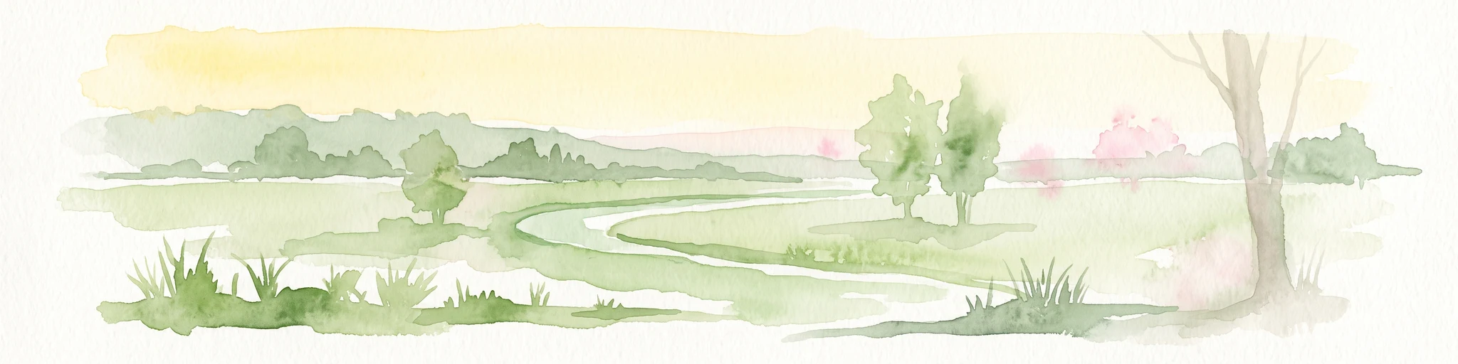
A pale, soft-toned watercolor illustration of a winding stream moving through a grassy meadow with scattered trees and distant hills.
Nature reserveAbai Region
About 150 km away#2 closest

Southeast

Semey Ormany Nature Reserve: Protected Ribbon Pine Forests in Abai Region

Mapped forest corridors and steppe ecological boundaries.

Semey Ormany protects extensive ribbon pine forests that stretch through the sandy plains of the Abai Region. This reserve serves as a vital ecological buffer, bridging the gap between desert-like semi-steppes and dense woodland strips, home to diverse wildlife and rare plant communities across the Irtysh river basin.

Area
6,541.8 km²
Established
2003
IUCN
VI
Relief
Mixed relief
National parkKazakhstan
About 237 km away#3 closest

Southwest

Bayanaul National Park: Kazakhstan's First National Park Mapped Landscape

Explore granite mountains, unique lakes, and striking rock formations.

Bayanaul National Park, situated in Kazakhstan's Pavlodar Province, represents a significant protected area renowned for its extraordinary granite mountain landscape. Established as the country's first national park, it showcases unique erosion-shaped rock formations, diverse vegetation including rare pines, and four significant freshwater lakes. This park offers a distinct visual tapestry of mountainous terrain and geological wonders within the broader Central Asian geography, making it a key destination for atlas-based discovery.

Area
684.53 km²
Established
1985
IUCN
II
Relief
Mountain
Watercolor illustration of a mountainous landscape with green hills, trees, and a river in the foreground
National parkKazakhstan
About 333 km away#4 closest

Southwest

Karkaraly State National Nature Park: Kazakhstan's Mountain-Forest Protected Area

Discover unique geology, archaeology, and regional landscape context.

Delve into the distinctive protected landscape of Karkaraly State National Nature Park, situated in Kazakhstan's Karaganda Region. This park preserves a rare mountain-forest ecosystem with dramatic granite formations, ancient archaeological sites, and lakes, presenting a rich geographic contrast to the surrounding Kazakh Steppe. MoriAtlas provides structured insights into Karkaraly State National Nature Park's unique terrain, its conservation value, and its position within the broader regional geography of Central Asia.

Area
1,121.2 km²
Established
1998
IUCN
II
Relief
Mountain
Watercolor illustration of a landscape with green forests, rolling hills, and distant mountains under a soft sky
National parkAkmola Region
About 385 km away#5 closest

West

Buiratau State National Nature Park: Kazakhstan National Park within Akmola Region

Explore unique steppe-forest transition ecosystems and geography.

Buiratau State National Nature Park in Kazakhstan's Akmola Region protects a significant transitional zone between dry steppe and semi-arid forest. This national park showcases a diverse landscape of low ridges, plains, and salt lakes, contributing to its rich biodiversity. Discover the mapped boundaries and the unique ecological character of this protected area within the context of the Kazakh Uplands atlas and its regional geography.

Area
890 km²
Established
2011
IUCN
II
Relief
Upland
A wide, panoramic watercolor illustration showing a mountain range with purple and yellow hues in the background, a green grassy meadow in the middle ground, and small pine trees and wildflowers in the foreground against a white background.
Nature reserveKazakhstan
About 405 km away#6 closest

East

West Altai State Nature Reserve: Protected Mountain Taiga and Alpine Geography in Kazakhstan

An ecological atlas of the Western Altai mountain system

Spanning the Ivanovsky and Uba ranges, this nature reserve protects a diverse terrain of mountain taiga, glacial cirques, and high-mountain bogs. It remains a key conservation landscape for Central Asian biodiversity, anchoring the headwaters of the Uba River within a striking environment of granite pillars and alpine meadows.

Area
861.22 km²
Established
1992
Relief
Mountain
Climate
Boreal
Watercolor painting of a river flowing through forested hills with mountains in the background under a sunset sky
National parkEast Kazakhstan Region
About 495 km away#7 closest

Southeast

Katon-Karagay National Park: Discover Kazakhstan's Largest Protected Mountain Landscape

Explore the geography and park boundaries of East Kazakhstan's premier national park.

Katon-Karagay National Park, the largest national park in Kazakhstan, offers a deep dive into the protected landscapes of the Southern Altai Mountains. This page provides essential geographic context, detailing the park's terrain, its significance as a protected area within East Kazakhstan Region, and its role in mapping the natural contours of this ecologically diverse mountain system. Understand the park's boundaries and its contribution to regional conservation.

Area
6,435 km²
Established
2001
IUCN
II
Relief
Mountain
National parkEast Kazakhstan Region
About 513 km away#8 closest

Southeast

Tarbagatai National Park: Protected Landscape and Wild Fruit Tree Forests in East Kazakhstan Region

Explore the mapped boundaries and ecosystem of this national park.

Tarbagatai National Park is a protected area in East Kazakhstan recognized for its unique role in conserving wild fruit tree forests that have maintained genetic isolation. This national park provides a detailed view of a mountain-steppe ecosystem across the Tarbagatai mountain range, Karabas Mountains, and Arkaly Mountains, along with the Urzhar and Emel river valleys. Its establishment in 2018 highlights its importance for biodiversity and the study of natural forest genetics, offering significant geographic context for regional protected land exploration.

Area
1,364 km²
Established
2018
IUCN
II
Relief
Mountain

Common questions about visiting, size, designation, and location context for Yertis Ormany State Forest Natural Reserve

Yertis Ormany State Forest Natural Reserve FAQs for park facts, access, geography, and protected area context

Find quick answers about Yertis Ormany State Forest Natural Reserve, including protected-area facts, park geography, trail and visitor context, and how the park fits into its surrounding country and regional landscape.
MoriAtlas Explorer

Continue Your Protected Areas Search Across the Global Atlas

Deepen your exploration by continuing the structured search for national parks and protected areas worldwide. Utilize the comprehensive filtering capabilities to compare different conservation landscapes and refine your understanding of global park geography. Discover more about the distribution and characteristics of protected natural areas.

Global natural geography