Mori Atlas logo
Marine protected areaFirth of Forth Banks Complex

A dynamic chain of submarine sand and gravel banks shaping the eastern coastal seabed

Firth of Forth Banks Complex: Mapping the Offshore Marine Protected Area Landscape in Scotland

(Firth of Forth Banks Complex Nature Conservation Marine Protected Area)

The Firth of Forth Banks Complex represents a critical marine protected area located at the eastern entrance to the Firth of Forth in Scotland. This offshore region encompasses a distinct series of seabed features, including the Berwick, Scalp, Wee Bankie, and Montrose banks. These elevated sediment ridges, formed by powerful tidal currents and North Sea hydrodynamic interactions, create a diverse mosaic of benthic habitats that sustain productive spawning grounds and vital marine life.

marine protected areaoffshore sand banksNorth SeaFirth of Forthsubtidal habitatsspawning grounds

Firth of Forth Banks Complex

Marine protected area

Park overview

Structured park overview, official facts, and landscape profile for Firth of Forth Banks Complex

Firth of Forth Banks Complex park facts, protected area profile, and essential visitor context

Review the core facts for Firth of Forth Banks Complex, including designation, size, terrain, visitor scale, habitats, and operating context in one park-focused overview.

About Firth of Forth Banks Complex

The Firth of Forth Banks Complex is an offshore marine protected area defined by a series of sand and gravel banks that rise from the seabed at the mouth of the Firth of Forth on the eastern coast of Scotland. From south to north, the complex includes the Berwick Bank, the Scalp Bank, the Wee Bankie, and the Montrose Bank. Although the banks are physically separate, they share a common geological character, each representing an accumulation of coarse sediments shaped by powerful tidal movement where the confined waters of the Forth meet the open North Sea.

The complex is protected as a Nature Conservation Marine Protected Area, a designation introduced under Scottish law to safeguard marine biodiversity and seafloor habitats. Established in 2014 and managed by Marine Scotland on behalf of the Scottish Government, the complex is composed of three discrete zones that together span a vast area of Scottish Offshore Waters. The total protected extent reflects the scale of the banks themselves and the surrounding buffer of seabed ecosystems that depend on them.

Ecologically, the area stands out because of the interaction between substrate, depth, and hydrodynamic energy. The strong tidal currents sweeping through the mouth of the Firth move fine particles away, leaving behind deposits of sand and gravel that vary across each bank. This mosaic of sediment types supports different communities of benthic organisms, from burrowing worms and bivalves to more mobile species such as crabs, starfish, and flatfish. Because the banks rise above the surrounding seabed, they also create localized upwelling and turbulence that increases biological productivity in the area.

The complex is recognized for its broader ecological role in supporting populations beyond its own boundaries. Seals, dolphins, and seasonal visitors such as migratory fish and seabirds rely on the productive waters around the banks. Eastern Scottish seabird colonies feed in these offshore waters, linking the protected area to inshore coastal ecosystems. As a result, the Firth of Forth Banks Complex is considered an important node in the wider marine environment of the western North Sea.

Quick facts and research context for Firth of Forth Banks Complex

The Firth of Forth Banks Complex is a Nature Conservation Marine Protected Area located in Scottish Offshore Waters at the mouth of the Firth of Forth, in the outer section of the Firth where it opens into the North Sea. It was established in 2014 under the Scottish Government and is managed by Marine Scotland. The complex consists of three separate designated zones encompassing a combined area of around 213,000 hectares, making it one of the larger offshore marine protected areas in this part of the United Kingdom. It is composed of the Berwick Bank, Scalp Bank, Wee Bankie, and Montrose Bank, which together form a chain of sand and gravel sea banks that are biologically productive and ecologically distinct from the surrounding seabed.

Protection and recognition

Examine documented marine protection status and official designation records for this site.

Firth of Forth Banks Complex Protection Status and Marine Area Recognition

Firth of Forth Banks Complex holds a documented marine protection scope within regional waters. Official records detail the designated management framework and conservation status for this protected marine area.

Protection details

Protection scope
Marine
Transboundary protection
No
Park context

Deeper park guide and search-rich context for Firth of Forth Banks Complex

Firth of Forth Banks Complex history, landscape, wildlife, and travel context

Explore Firth of Forth Banks Complex through its history, landscape character, ecosystems, wildlife, conservation priorities, cultural context, and seasonal travel timing in a structured park guide built for atlas discovery and search intent.

Why Firth of Forth Banks Complex stands out

The Firth of Forth Banks Complex is best known for its offshore sand and gravel banks, which form a chain of raised seabed features at the mouth of the Firth of Forth. These banks are recognized for their rich benthic habitats, which support diverse invertebrates, fish, and marine mammals, and for their role as an important spawning ground for commercially significant fish species such as plaice. The area is also notable for hosting ocean quahog, an exceptionally long-lived clam considered among the oldest living animals on Earth. Together, these qualities make the complex a defining example of Scotland's offshore marine conservation estate.

Firth of Forth Banks Complex history and protected-area timeline

The Firth of Forth Banks Complex was formally established in 2014 as a Nature Conservation Marine Protected Area by the Scottish Government, following an assessment of the ecological importance of the sand and gravel banks at the mouth of the Firth of Forth. The designation brought together the Berwick Bank, the Scalp Bank, and additional offshore areas under a single protection framework, recognizing the geological and biological coherence of the bank system as a distinct marine feature.

The protected area is managed by Marine Scotland, which oversees monitoring, regulation, and conservation planning within the three designated zones. The establishment of the complex was part of a broader expansion of Scotland's network of marine protected areas, aimed at preserving representative examples of offshore habitats in waters under Scottish jurisdiction. In the years since designation, the area has become a focal point for discussions about the balance between marine conservation and offshore renewable energy development, particularly with the proposed Berwick Bank Wind Farm project to the north of the complex.

Firth of Forth Banks Complex landscape and geographic character

The defining physical feature of the Firth of Forth Banks Complex is its sea banks, which are elongated accumulations of coarse sediment rising above the surrounding seabed. These banks are the result of long-term interactions between tidal currents, sediment supply from the Firth of Forth, and the offshore hydrodynamic conditions of the North Sea. As currents accelerate through the narrow opening of the Forth, they sort and deposit sediments, forming elevated ridges that contrast with the deeper, finer substrates flanking them.

From south to north, the chain includes the Berwick Bank, the Scalp Bank, the Wee Bankie, and the Montrose Bank. Each bank has a distinct shape and orientation, reflecting the influence of local currents and historical sediment movement. The flanks of the banks are generally gentler than their crests, creating transitional zones where gravelly material gradually gives way to sandy or muddy sediments. This variation in substrate across relatively short distances is one of the most distinctive characteristics of the area's marine landscape.

Firth of Forth Banks Complex ecosystems, habitats, and plant life

The seabed habitats of the Firth of Forth Banks Complex are defined by the varied composition of sand and gravel across the different banks and their flanks. Coarse, well-oxygenated gravels support communities of sessile invertebrates, while mixed sands and finer sediments provide habitat for burrowing organisms. This mosaic of substrates contributes to a high overall diversity of benthic life compared with surrounding, more uniform seabed areas.

The interaction between the banks and the strong tidal regime at the mouth of the Firth produces conditions favorable to biological productivity. Nutrient mixing and sediment turnover support dense populations of invertebrates, which in turn provide food for fish, marine mammals, and seabirds. Because the banks extend from deeper water up toward the photic zone, they also create gradients in light, temperature, and exposure that further diversify the ecological conditions across the complex. Overall, the area represents a productive and structurally complex offshore habitat within the western North Sea.

Firth of Forth Banks Complex wildlife and species highlights

The wildlife of the Firth of Forth Banks Complex reflects the productivity of its sand and gravel habitats. The seabed supports a rich community of marine invertebrates, including crabs, starfish, and a variety of bivalves. Among the most ecologically significant species is the ocean quahog, a large, slow-growing clam known for its exceptional longevity. Individual ocean quahogs in these waters can live for several centuries, making them some of the oldest living animals on Earth and giving the banks particular conservation interest.

Fish populations are an important component of the area's wildlife. Flatfish, including plaice, are notably associated with the banks, and the Berwick Bank in particular is recognized as an important spawning ground for plaice. The waters around the complex also support seals, dolphins, and other marine mammals that take advantage of the productive conditions. Seabirds from colonies along the eastern Scottish coast feed regularly in the area, linking the offshore banks to coastal breeding populations.

Firth of Forth Banks Complex conservation status and protection priorities

The Firth of Forth Banks Complex was designated specifically to protect a representative example of offshore sand and gravel bank ecosystems in Scottish waters. Its conservation value lies in the unusual combination of habitat diversity, biological productivity, and long-lived species such as the ocean quahog, which can only be sustained where seabed conditions remain undisturbed. Protecting the banks helps preserve genetic resources, ecological processes, and habitat structure that would be difficult to restore if lost.

Within the Scottish marine protection framework, the complex contributes to broader network goals by safeguarding offshore features that complement inshore protected areas. Because the banks support spawning grounds for commercially important fish and feeding areas for seabirds, their conservation has implications beyond the marine environment, extending to fisheries management and the protection of internationally important bird populations.

The area has also become a prominent case study in marine spatial planning. Proposals for large-scale offshore wind development, including the Berwick Bank Wind Farm, intersect with the complex and have raised concerns from conservation organizations about cumulative impacts on seabirds and benthic habitats. These debates highlight the ongoing challenge of balancing renewable energy expansion with the preservation of ecologically sensitive offshore environments.

Top sights and standout views in Firth of Forth Banks Complex

The Firth of Forth Banks Complex protects four major offshore sand and gravel banks: Berwick Bank, Scalp Bank, Wee Bankie, and Montrose Bank, which together form one of the most distinctive seabed features at the mouth of the Firth of Forth. The area is celebrated for its high marine productivity, its importance as a spawning ground for plaice, and its population of ocean quahogs, an extraordinarily long-lived bivalve considered among the oldest animals in the world. The complex occupies a central place in Scotland's marine protected area network and has become a notable reference point in discussions about the future of offshore renewable energy.

Monthly climate preview

Examine long-term monthly temperature averages and precipitation patterns across the protected marine geography.

Firth of Forth Banks Complex Climate Normals and Annual Temperature Rhythm

Long-term representative records reveal measured monthly temperature and precipitation variations across Firth of Forth Banks Complex. Detailed weather by month breakdowns provide complete historical data for comprehensive environmental analysis.
Annual mean10 °C
6 °C14 °C
Jan
Feb
Mar
Apr
May
Jun12°
Jul14°
Aug14°
Sep13°
Oct11°
Nov
Dec
Warmest month
August

14.2 °C

Coolest month
February

5.7 °C

Wettest month
October

3 mm/day

Driest month
May

1.6 mm/day

Park location guide

Geography guide, regional context, and park location map for Firth of Forth Banks Complex

Firth of Forth Banks Complex park geography, regions, and map view in United Kingdom

Understand where Firth of Forth Banks Complex sits in United Kingdom through a broader geographic reading of the surrounding landscape, nearby location context, and its mapped position within the national park landscape.

How Firth of Forth Banks Complex fits into United Kingdom

The United Kingdom is a parliamentary constitutional monarchy located in northwestern Europe, consisting of four constituent countries: England, Scotland, Wales, and Northern Ireland. As a major global power with over 69 million residents, it maintains significant international influence in politics, economics, and culture.

Wider geography shaping Firth of Forth Banks Complex in United Kingdom

The United Kingdom is an island nation located in northwestern Europe, surrounded by the Atlantic Ocean, North Sea, English Channel, Celtic Sea, and Irish Sea. It shares a land border with the Republic of Ireland to the west. The territory includes the island of Great Britain, the northeastern portion of Ireland, and most of the smaller British Isles islands.

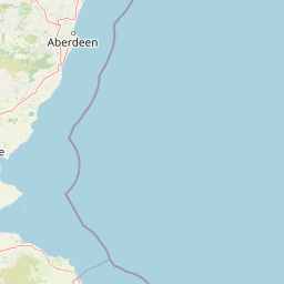
Map view of Firth of Forth Banks Complex

Use this park location map to pinpoint Firth of Forth Banks Complex in United Kingdom, understand its exact geographic position, and read its mapped placement within the surrounding landscape more clearly.

Pigeon | © OpenStreetMap contributors

Location context for Firth of Forth Banks Complex

Scotland
Park atlas

Compare surrounding coastal waters, seabed habitats, and regional conservation zones.

Explore Protected Areas and Marine Reserves Near Firth of Forth Banks Complex

Browse marine protected areas and coastal reserves situated near Firth of Forth Banks Complex to examine broader regional seabed habitats. Regional park comparisons reveal shared hydrographic features and connected conservation landscapes across adjacent waters.
Watercolor painting depicting mountains, forested hills, and a river in a scenic landscape
National parkScotland
About 95 km away#1 closest

Northwest

Cairngorms National Park: Explore Scotland's Largest Protected Mountain Landscape

Mapped boundaries and arctic-alpine geography.

As the United Kingdom's largest national park, Cairngorms National Park in Scotland presents a vast expanse of distinctive arctic-alpine terrain and ancient Caledonian forests. This protected landscape offers a unique opportunity to explore mapped geographic features, from its extensive mountain plateaus to its vital river systems. Discover the contours and context of this significant natural area within the broader atlas of Scotland's protected lands.

Area
4,528 km²
Established
2003
IUCN
V
Visitors
1.9M annual
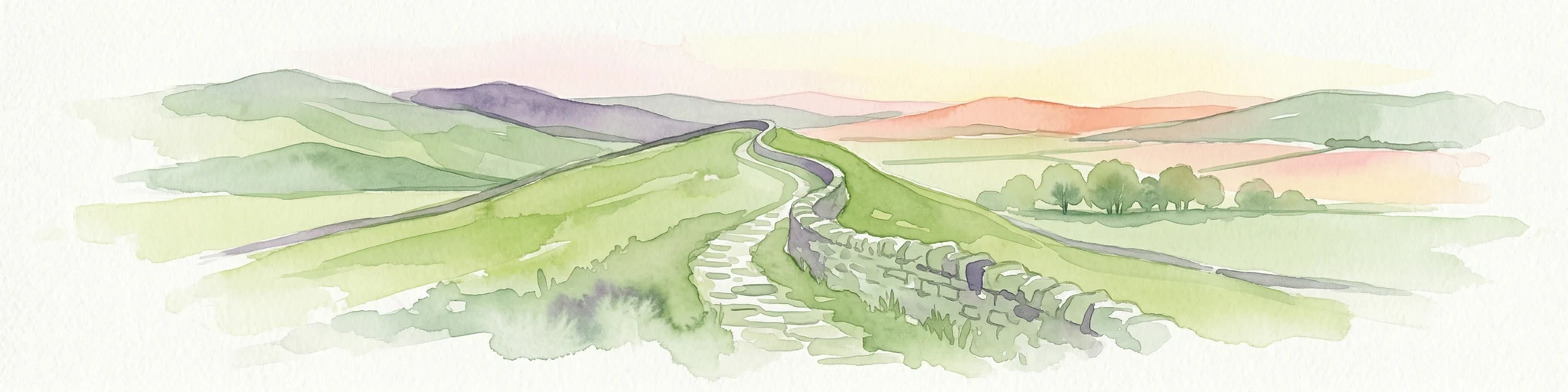
Watercolor illustration of Hadrian's Wall stretching across rolling green hills with distant mountains and trees under a sunset sky
National parkNorthumberland
About 95 km away#2 closest

South

Northumberland National Park: England's Northernmost Protected Landscape and Dark Sky Wilderness

Explore its mapped boundaries, Roman heritage, and remote moorland terrain.

Northumberland National Park protects over 1,050 square kilometers of remote and stunning natural beauty in northern England, bordering Scotland. This page provides a structured overview of its protected landscape, focusing on its geographic context within the county of Northumberland, its designation as a National Park, and its renowned status as Europe's largest Dark Sky Park. Users can discover the park's characteristic moorland terrain, the archaeological significance of Hadrian's Wall, and the vast expanses of Kielder Forest, offering an atlas-level understanding of this unique frontier landscape.

Area
1,050 km²
Established
1956
IUCN
V
Relief
Highland
Protected areaPerth and Kinross
About 103 km away#3 closest

West

Coupar Angus Protected Area: Geographic Boundaries and Regional Landscape Mapping

Located in the Perth and Kinross council area of Scotland

Coupar Angus is a key protected area providing essential insights into the geography and terrain of the Perth and Kinross council area. This detailed mapping overview captures the unique landscape features and boundary distributions characteristic of this Scottish region. Perfect for understanding the spatial configuration and natural setting of the site within its broader local government context.

Area
3.76 km²
Established
1976
Relief
Lowland
Climate
Temperate
Protected landscapeScottish Borders
About 136 km away#4 closest

Southwest

Upper Tweeddale National Scenic Area: Geography and Protected Landscape Atlas Map

Regional landscape profile in the Scottish Borders

Upper Tweeddale National Scenic Area encompasses 12,770 hectares of refined southern Scottish countryside. This atlas entry provides an overview of the area landscape, defined by its narrow river valley, tributary glens, and the significant upland plateau of the Tweedsmuir Hills. Examine the geographic intersection of protected habitats, historic estates, and the winding course of the River Tweed.

Area
128 km²
Established
1981
Relief
Upland
Climate
Temperate
A horizontal watercolor painting showing a soft, impressionistic view of green hills, trees, and a lake, set against a light background.
Protected landscapePerth and Kinross
About 147 km away#5 closest

West

Loch Tummel National Scenic Area: Geography and Mapped Protected Landscape Features

Highland landscape corridor in Perth and Kinross

Loch Tummel National Scenic Area encompasses a vital Highland corridor where freshwater lochs, river gorges, and managed woodlands intersect. This overview focuses on the physical geography of the Tummel valley, providing a detailed look at the protected land, elevation changes, and the hydro-electric history that shaped the current terrain of this scenic region.

Area
90.1 km²
Established
1981
Relief
Upland
Climate
Temperate
Watercolor illustration showing mountains, green forests, a loch, and a river in a landscape
National parkScotland
About 152 km away#6 closest

West

Loch Lomond and The Trossachs National Park: Mapped Landscapes and Terrain

Regional geography and protected Highland boundaries in Scotland

Loch Lomond and The Trossachs National Park covers a vast array of protected habitats, from coastal sea lochs to high-altitude Munros. This geographic profile outlines the park's position across the Highland Boundary Fault, highlighting its role as a core protected area for Caledonian forests and freshwater lake ecosystems within Scotland.

Area
1,865 km²
Established
2002
IUCN
V
Visitors
2.9M annual
A soft watercolor painting of a landscape featuring green rolling hills, a suggestion of a reflective body of water, and layers of purple distant mountains against a light sky.
National parkScotland
About 187 km away#7 closest

West

Loch Lomond and The Trossachs National Park: Geographic and Protected Area Overview

Tracing Highland and Lowland transition zones in Scotland

This protected area captures the contrast between the rugged mountainous terrain of the northern Trossachs and the gentler southern loch basins. By examining the Highland Boundary Fault, users can analyze how glaciers carved the landscape, creating the deep fjord-like trenches and islands that define the region's unique natural geography.

Area
71 km²
Established
2002
Relief
Mountain
Climate
Temperate
Watercolor painting showing a lake, green hills, and sky
National parkCumbria
About 202 km away#8 closest

Southwest

Lake District National Park: Protected Landscape Atlas and Geographic Exploration

Mapped mountain terrain and glacial valleys in Cumbria

Delve into the geography of Lake District National Park, a protected area renowned for its dramatic mountainous terrain, U-shaped glacial valleys, and stunning natural lakes. This atlas perspective highlights the park's unique landscape features, mapped boundaries, and its significance within Cumbria, offering a comprehensive view for geographic discovery.

Area
2,292 km²
Established
1951
IUCN
V
Relief
Mountain

Common questions about visiting, size, designation, and location context for Firth of Forth Banks Complex

Firth of Forth Banks Complex FAQs for park facts, access, geography, and protected area context

Find quick answers about Firth of Forth Banks Complex, including protected-area facts, park geography, trail and visitor context, and how the park fits into its surrounding country and regional landscape.
MoriAtlas Explorer

Continue Your Protected Areas Search Across the Global Atlas

Deepen your exploration by continuing the structured search for national parks and protected areas worldwide. Utilize the comprehensive filtering capabilities to compare different conservation landscapes and refine your understanding of global park geography. Discover more about the distribution and characteristics of protected natural areas.

Global natural geography