

Mori Atlas logo
Wildlife reserveFortuna Forest Reserve

Mapping the high elevation cloud forest and watershed terrain of this endemic-rich wildlife reserve

Fortuna Forest Reserve: Analyzing Protected Mountain Landscapes and Regional Geography in Panama

Fortuna Forest Reserve represents a vital protected landscape within the mountains of Chiriqui Province, where the Cordillera de Talamanca terrain transitions toward the Cordillera Central. This wildlife reserve functions as a high-biodiversity sanctuary characterized by steep volcanic slopes, consistent cloud forest cover, and heavy annual precipitation. Its mapped boundaries encompass both critical ecological habitats and integrated hydroelectric infrastructure, illustrating a complex convergence of tropical mountain conservation and renewable energy land use.

cloud forestmountain rainforestvolcanic soilshigh biodiversityendemic speciesImportant Bird Area
A flat-style digital illustration showing a valley with tiered waterfalls, pine forests, and steep mountain peaks under a light sky.

Fortuna Forest Reserve

Wildlife reserve

Park overview

Structured park overview, official facts, and landscape profile for Fortuna Forest Reserve

Fortuna Forest Reserve park facts, protected area profile, and essential visitor context

Review the core facts for Fortuna Forest Reserve, including designation, size, terrain, visitor scale, habitats, and operating context in one park-focused overview.

About Fortuna Forest Reserve

Fortuna Forest Reserve is one of Panama's most ecologically significant protected areas, set in the country's western highland region within Chiriquí Province. Surrounded by the forested ridges of the Cordillera de Talamanca, the reserve sits at the ecological transition between Central America's two major mountain systems and captures some of the highest rainfall in the region. The combination of elevation, persistent moisture, and volcanic geology has produced a landscape of dense cloud forest and tropical rainforest that stands out within Panama's protected-area system.

The reserve covers roughly 206 square kilometers, anchored by Cerro Chorcha as its highest point. The terrain is dominated by steep ridges, deep valleys, and year-round humidity that sustains multiple layers of forest vegetation. Within this setting, the reserve protects an exceptional concentration of endemic species, more than any other protected area in Panama, including a particularly rich amphibian fauna and a notable diversity of birds. BirdLife International has formally recognized the reserve as an Important Bird Area, citing its importance for species such as the resplendent quetzal and the military macaw.

Fortuna also illustrates a distinctive approach to conservation in Central America, one in which environmental protection and energy generation have been combined. A hydroelectric dam operates within the reserve, using the abundant rainfall and steep terrain to generate renewable power while the surrounding ecosystem remains under protection. Since 2001, a research partnership with the Smithsonian Tropical Research Institute has added a strong scientific dimension to the reserve, supporting studies on topics ranging from disappearing amphibian populations to the influence of climate change on cloud-forest epiphytes. Together, these features make Fortuna Forest Reserve a key reference point for understanding highland biodiversity, sustainable infrastructure, and long-term ecological research in Panama.

Quick facts and research context for Fortuna Forest Reserve

Fortuna Forest Reserve is located in Chiriquí Province, in the western highlands of Panama near the border with Costa Rica. Established on 21 September 1976, it covers roughly 206 square kilometers of mountainous terrain dominated by cloud forest and rainforest on volcanic soils.

The reserve lies in the eastern foothills of the Cordillera de Talamanca, an area of exceptionally high rainfall exceeding 4,000 millimeters per year. It is internationally recognized as an Important Bird Area and hosts more endemic species than any other protected area in Panama. A hydroelectric dam operates within the reserve, producing renewable energy while the surrounding ecosystem is preserved for science and biodiversity.

Protection and recognition

Examine terrestrial protection metrics and management scope for Fortuna Forest Reserve.

Fortuna Forest Reserve Protection Status and International Recognition Record

Terrestrial protection status and documented conservation boundaries define the management scope for Fortuna Forest Reserve. Structured records assemble verified designation details and international recognition parameters for analytical review.

Protection details

Protection scope
Terrestrial
Transboundary protection
No
Park context

Deeper park guide and search-rich context for Fortuna Forest Reserve

Fortuna Forest Reserve history, landscape, wildlife, and travel context

Explore Fortuna Forest Reserve through its history, landscape character, ecosystems, wildlife, conservation priorities, cultural context, and seasonal travel timing in a structured park guide built for atlas discovery and search intent.

Why Fortuna Forest Reserve stands out

Fortuna Forest Reserve is best known for its exceptionally high concentration of endemic species, making it the most endemic-rich protected area in Panama. Its cloud forest habitats, sustained by heavy rainfall and volcanic soils, support an unusual concentration of amphibian, reptile, and bird life that has drawn sustained scientific attention. The reserve is also recognized as an Important Bird Area for populations of notable tropical bird species, including the resplendent quetzal and the military macaw. Combined with its long-running research partnership with the Smithsonian Tropical Research Institute and its integrated hydroelectric operation, Fortuna stands out as a rare example of a tropical mountain reserve where biodiversity, science, and sustainable infrastructure converge.
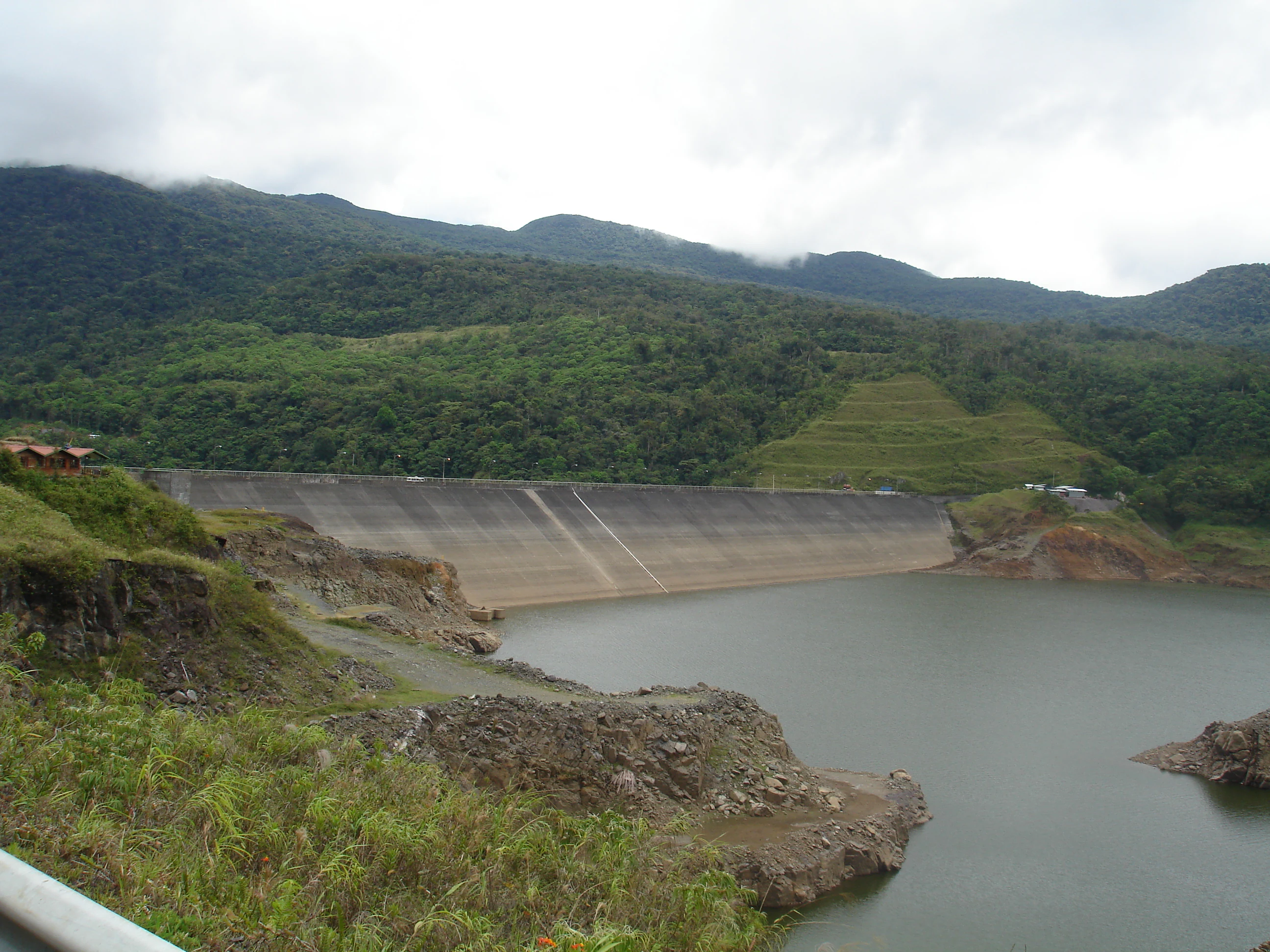
A wide shot of a large concrete dam wall holding back a reservoir of water, surrounded by lush green hills and a forested mountain range under a cloudy sky.
The Fortuna Dam set against the mountainous backdrop of the Fortuna Forest Reserve in Panama.

Fortuna Forest Reserve history and protected-area timeline

Fortuna Forest Reserve was formally established on 21 September 1976, when the area was declared a forest reserve under Panama's national protected-area framework. Its creation reflected recognition of the high ecological value of the Cordillera de Talamanca foothills and their exceptionally wet cloud-forest environment.

A defining development came with the construction and operation of a hydroelectric dam inside the reserve, marking an early and prominent example of integrating renewable energy infrastructure within a tropical protected area. In 2001, the reserve entered into a research agreement with the Smithsonian Tropical Research Institute, a partnership that has since supported a sustained scientific presence inside the park. Research efforts have included investigations into the decline of amphibian populations and studies of how climate change affects epiphyte communities in the cloud forest. Over time, this combination of legal protection, renewable energy use, and long-term science has shaped Fortuna's identity as a working, multi-purpose forest reserve.

Fortuna Forest Reserve landscape and geographic character

Fortuna Forest Reserve occupies a rugged stretch of mountain terrain in the eastern foothills of the Cordillera de Talamanca, near the transition toward the Cordillera Central of Panama. The topography is steep and heavily forested, shaped by volcanic geology and shaped over time by extremely high rainfall. Cerro Chorcha, the reserve's highest point, rises to 2,213 meters above sea level, giving the area a strong vertical gradient that influences forest composition and climate.

The climate is consistently cool and wet for a tropical location, with average temperatures around 20 degrees Celsius, daily lows near 10 degrees, and highs reaching roughly 27 degrees. Annual rainfall regularly exceeds 4,000 millimeters, feeding dense forest cover, persistent cloud cover, and the streams that pass through the reserve. The combination of high elevation, volcanic soils, and abundant moisture produces a landscape defined by moss-laden slopes, shaded ravines, and a continuous mosaic of cloud forest and rainforest.

Within this setting sits the Fortuna hydroelectric dam, an infrastructural landmark that uses the reserve's steep watersheds and high precipitation to generate renewable energy. The presence of the dam is a notable feature of the physical landscape, integrating human engineering into an otherwise deeply forested mountain environment.

Fortuna Forest Reserve ecosystems, habitats, and plant life

The ecological character of Fortuna Forest Reserve is defined by its cloud forest and mountain rainforest ecosystems. These habitats develop on volcanic soils under consistently high humidity, producing a multi-layered forest structure with abundant epiphytes, mosses, ferns, and understory plants that thrive in the misty conditions of the highland slopes. The reserve's plant record reflects this richness, with around 1,136 plant species documented across the area.

The reserve's position along the Caribbean and Pacific watershed divide gives it a transitional ecological character, drawing species from both sides of the Panamanian isthmus. This combination of elevation, moisture, and geographic position creates a gradient of habitats from lower montane rainforest up into true cloud forest near the higher ridges. The result is a relatively compact but ecologically varied protected landscape, where elevation-driven microclimates support a wide range of plant communities and the animal species depending on them.

Because of this habitat complexity, Fortuna functions as a stronghold for species that depend on intact, humid highland forest conditions, including amphibians, epiphyte-rich vegetation, and forest-interior birds. Its continuous forest cover makes it an important refugium within central Panama's broader landscape of fragmented forests and agricultural valleys.

Fortuna Forest Reserve wildlife and species highlights

Fortuna Forest Reserve hosts the highest concentration of endemic species of any protected area in Panama, a distinction shaped largely by its cloud-forest environment and its position along the Talamanca mountain system. The reserve is especially rich in amphibians and reptiles, with around 70 species recorded, a diversity that has attracted sustained scientific study, including research on amphibian population declines.

Birdlife is another major component of the reserve's fauna. BirdLife International has designated Fortuna as an Important Bird Area because of its significant populations of multiple bird species. Among the most notable bird species recorded in the reserve are the resplendent quetzal, a species strongly associated with highland cloud forests in Central America, and the military macaw, a large parrot dependent on intact forested landscapes.

Mammal fauna in the reserve includes a range of smaller forest mammals typical of Central American cloud forests and rainforest, alongside larger species such as the jaguar, which depends on extensive, well-connected forest cover. The presence of apex predators like the jaguar signals that the reserve retains ecologically functional forest habitat at a landscape scale, supporting both wide-ranging and more localized wildlife communities.

Fortuna Forest Reserve conservation status and protection priorities

Fortuna Forest Reserve is a protected area of considerable conservation importance in Panama, both nationally and within the Central American context. It is classified under IUCN Category VI, recognizing it as a protected area with sustainable use of natural resources, a designation that reflects its combination of strict ecological protection with managed activities such as hydroelectric generation.

The reserve's conservation value rests on its exceptionally high endemism, its importance for migratory and resident bird populations, and its role as a stronghold for cloud forest and mountain rainforest ecosystems. Its recognition as an Important Bird Area by BirdLife International underscores its significance for bird conservation in the region, while its high amphibian diversity has made it a focal site for research into global amphibian declines.

The reserve has also become an important site for long-term ecological research through its partnership with the Smithsonian Tropical Research Institute. Studies conducted since 2001 on topics such as amphibian disappearances and climate-change effects on epiphytes have helped position Fortuna as a reference site for understanding how tropical highland ecosystems respond to environmental change. Together, these factors give the reserve a strong role in Panama's biodiversity conservation, scientific monitoring, and sustainable land-use planning.

Fortuna Forest Reserve cultural meaning and human context

Fortuna Forest Reserve is situated in Chiriquí Province, a region of Panama known for its highland landscapes, agricultural traditions, and proximity to the country's mountainous western frontier. While the reserve itself is primarily framed around its ecological and hydroelectric functions, its location places it within a broader regional context where mountain forests have long shaped local livelihoods, water resources, and identity.

The integration of a hydroelectric dam within a protected forest reserve also reflects a particular chapter in Panama's modern environmental and energy history, illustrating how national priorities around renewable energy and biodiversity protection have been negotiated within the same landscape. The presence of long-term international scientific collaboration, including with the Smithsonian Tropical Research Institute, adds another cultural layer to the reserve, embedding it into global networks of tropical research.

Top sights and standout views in Fortuna Forest Reserve

Fortuna Forest Reserve stands out for holding the highest number of endemic species of any protected area in Panama, particularly within its amphibian fauna and cloud-forest bird communities. Its recognition as an Important Bird Area, the presence of iconic species such as the resplendent quetzal and the military macaw, and confirmed records of jaguar give it a distinctive profile within Central America's network of highland reserves.

Equally notable is the reserve's combination of strict ecological protection, a working hydroelectric dam, and a long-running scientific partnership with the Smithsonian Tropical Research Institute. This unusual blend of biodiversity, renewable energy, and ongoing research makes Fortuna a uniquely informative case study of how tropical mountain ecosystems can be conserved, studied, and used at the same time.

Best time to visit Fortuna Forest Reserve

The climate of Fortuna Forest Reserve is consistently cool, wet, and humid, with average temperatures around 20 degrees Celsius and very high rainfall throughout the year. There is no strongly pronounced dry season, so visitors should generally expect mist, cloud cover, and frequent rain regardless of when they arrive.

Because the reserve's cloud-forest character and biodiversity are not strongly seasonal, any visit is likely to offer a similar experience of dense, mossy forest, active streams, and rich birdlife. Travelers prioritizing clearer views from higher elevations may find relatively drier interludes more rewarding, while those interested in frog, amphibian, and general rainforest activity will find the persistently humid conditions favorable much of the year.

Monthly climate preview

Long-term representative monthly averages and temperature ranges for Fortuna Forest Reserve

Fortuna Forest Reserve Climate Normals, Annual Temperature and Precipitation Rhythm

Representative coordinate records show measured monthly temperature variations and precipitation totals spanning twelve distinct periods across Fortuna Forest Reserve. Detailed long-term climate normals offer deeper insight into historical atmospheric patterns without relying on short-term weather forecasts.
Annual mean24 °C
23 °C25 °C
Jan23°
Feb24°
Mar24°
Apr25°
May25°
Jun24°
Jul24°
Aug24°
Sep24°
Oct23°
Nov23°
Dec23°
Warmest month
April

25 °C

Coolest month
January

23 °C

Wettest month
September

9 mm/day

Driest month
February

0.6 mm/day

Park location guide

Geography guide, regional context, and park location map for Fortuna Forest Reserve

Fortuna Forest Reserve park geography, regions, and map view in Panama

Understand where Fortuna Forest Reserve sits in Panama through a broader geographic reading of the surrounding landscape, nearby location context, and its mapped position within the national park landscape.

How Fortuna Forest Reserve fits into Panama

Panama is a presidential republic located at the southern end of Central America in North America. It gained independence from Spain in 1821 and from Colombia in 1903, the latter enabling the construction of the Panama Canal under U.S. supervision between 1904 and 1914. The canal was transferred to Panamanian control in 1999 following the Torrijos-Carter Treaties. With a population of approximately 4.3 million and an area of about 75,400 km², Panama has a high-income economy driven primarily by canal tolls, banking, commerce, and tourism.

Wider geography shaping Fortuna Forest Reserve in Panama

Panama is located at the southern end of the Central American isthmus, stretching from the Caribbean coast in the north to the Pacific coast in the south. The country shares land borders with Costa Rica to the west and Colombia to the southeast. The terrain consists of coastal plains, mountain ranges including the Cordillera Central and Cordillera de Talamanca, and river valleys. The Panama Canal bisects the country, connecting the Atlantic and Pacific Oceans.

Map view of Fortuna Forest Reserve

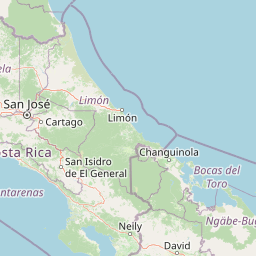
Use this park location map to pinpoint Fortuna Forest Reserve in Panama, understand its exact geographic position, and read its mapped placement within the surrounding landscape more clearly.

Pigeon | © OpenStreetMap contributors

Location context for Fortuna Forest Reserve

Chiriquí Province

Explore protected area imagery, mountain scenery, and high-elevation habitats.

Fortuna Forest Reserve Photos and Landscapes: Visualizing the Cloud Forest Terrain

Photographic collections reveal the steep volcanic terrain, dense cloud forest canopies, and aquatic networks defining Fortuna Forest Reserve. Visual exploration provides critical context for understanding how remote tropical highlands, endemic wildlife habitats, and renewable energy infrastructure intersect.

A wide shot of a large concrete dam wall holding back a reservoir of water, surrounded by lush green hills and a forested mountain range under a cloudy sky.

Park atlas

Compare regional mountain reserves and protected areas across western Panama

Parks Near Fortuna Forest Reserve and Related Protected Landscapes to Explore

Browse nearby national parks and protected areas sharing the rugged highland terrain of the surrounding region. Extending your geographic comparison helps trace the wider distribution of tropical mountain ecosystems and cloud forest habitats.
Marine protected areaBocas del Toro Province
About 63 km away#1 closest

North

Isla Bastimentos National Marine Park: Marine Protected Area Geography and Atlas Context

Explore the protected landscape within Bocas del Toro Province.

Isla Bastimentos National Marine Park represents a critical marine protected area offering essential geographic data for atlas-based research. Situated in Panama's Bocas del Toro Province, this entity provides a focal point for understanding protected marine territories and their mapped extent. Discover the park's specific location within the province, contributing to a detailed regional geography and a broader understanding of conservation landscapes.

Area
132.26 km²
Established
1988
IUCN
II
Relief
Lowland
Marine protected areaPanama
About 68 km away#2 closest

South

Gulf of Chiriquí National Marine Park: Panama's Protected Marine Landscape

Discover its mapped boundaries and regional geographic context.

The Gulf of Chiriquí National Marine Park is a crucial marine protected area located in Panama, offering unique insights into coastal and marine geography. This page provides detailed atlas-level information on its protected landscape, mapped extent, and conservation significance, essential for understanding its place within the region's natural geography and protected areas.

IUCN
II
National parkPuntarenas Province
About 110 km away#3 closest

West

Piedras Blancas National Park: Costa Rica National Park Protected Landscape

Explore Puntarenas Province's mapped protected areas and terrain.

Piedras Blancas National Park is a key protected area within Puntarenas Province, Costa Rica, identified for its national park status. This entry serves as a geographic anchor, detailing the park's mapped landscape and its contribution to the regional protected areas atlas. Understand its specific geographic setting and the importance of its protected boundaries for natural landscape exploration and research, contributing vital context to Costa Rica's conservation geography.

Area
140.19 km²
Established
1991
IUCN
II
Relief
Mountain
National parkCosta Rica
About 114 km away#4 closest

Northwest

La Amistad International Park National Park: Mapped Protected Area in Costa Rica

Explore its geographic boundaries and landscape context.

La Amistad International Park represents a vital component of Costa Rica's protected land network. This detail provides an atlas-centric view, highlighting the park's mapped boundaries and its contribution to the regional geography. Understand the park's identity as a national park and explore its natural terrain context, crucial for any structured geographic discovery of protected areas within Central America.

Area
1,992 km²
Established
1988
IUCN
II
Relief
Mountain
National parkLimón Province
About 126 km away#5 closest

Northwest

Cahuita National Park National Park: Geographic Atlas and Protected Landscape Identity

Explore mapped boundaries and regional context within Limón Province.

Gain an atlas perspective on Cahuita National Park, a designated national park situated in Limón Province, Costa Rica. This detailed entry focuses on its protected landscape character and geographic setting, offering insights into its mapped boundaries and its role within the region's natural geography. Understand the park's specific contribution to the protected area network through detailed geographic data.

Area
234.679 km²
Established
1982
IUCN
II
Relief
Lowland
National parkCosta Rica
About 138 km away#6 closest

West

Corcovado National Park: Geographic Boundaries and Rainforest Ecosystems in Costa Rica

Mapping primary forest corridors and coastal protected landscapes.

Corcovado National Park covers much of the Osa Peninsula, protecting the largest primary rainforest stand on the American Pacific coast. The park's rugged terrain includes inland mountainous ridges, extensive river networks, and vital coastal lagoons. This protected area functions as a biological corridor, sustaining diverse habitats that range from lowland tropical forests to elevated montane ecosystems.

Area
424 km²
Established
1975
IUCN
II
Relief
Mixed relief
National parkPanama
About 142 km away#7 closest

South

Coiba National Park: Mapped Geography and Protected Landscapes in Panama

Tropical forest interiors and expansive marine boundaries

Coiba National Park protects a significant expanse of tropical forest and marine habitat off the coast of Panama. Its landscape, characterized by mountainous terrain and surrounding reef systems, provides a critical environment for endemic subspecies and diverse marine life within the Pacific gulf.

IUCN
II
Watercolor painting of a tropical island beach with a sandy shore, palm trees, and a distant coastline, rendered in a minimalist, light-washed style.
National parkVeraguas Province
About 142 km away#8 closest

South

Coiba National Park: Geographic and Protected Landscape Atlas of the Gulf of Chiriquí

Extensive marine and tropical island terrain in Veraguas Province

Coiba National Park spans a significant portion of the Pacific Ocean and islands, representing one of the most important conservation landscapes in Panama. Its geography features the vast main island, forested hills, sandy beaches, and complex submerged reef structures. This detailed record provides insight into the park's terrestrial and marine boundaries, illustrating the ecological significance of this largely isolated archipelago.

Area
2,698.78 km²
Established
1992
IUCN
II
Relief
Lowland

Common questions about visiting, size, designation, and location context for Fortuna Forest Reserve

Fortuna Forest Reserve FAQs for park facts, access, geography, and protected area context

Find quick answers about Fortuna Forest Reserve, including protected-area facts, park geography, trail and visitor context, and how the park fits into its surrounding country and regional landscape.
MoriAtlas Explorer

Continue Your Protected Areas Search Across the Global Atlas

Deepen your exploration by continuing the structured search for national parks and protected areas worldwide. Utilize the comprehensive filtering capabilities to compare different conservation landscapes and refine your understanding of global park geography. Discover more about the distribution and characteristics of protected natural areas.

Global natural geography