

Mori Atlas logo
Marine protected areaFranklin Commonwealth Marine Reserve

Tracing protected shelf waters and offshore oceanic ecosystems within the South-east Marine Reserve Network

Franklin Commonwealth Marine Reserve: Mapping the Marine Protected Landscapes of Northern Tasmania

Franklin Commonwealth Marine Reserve covers 671 square kilometers of ocean off the north-western coast of Tasmania. This marine protected area functions as a critical junction where the western Bass Strait and the Tasmanian shelf converge. The reserve provides essential habitat for seabird breeding colonies on Black Pyramid Rock while managing ecological conservation through a balanced multiple use framework.

marine protected areaoceancontinental shelfBass StraitTasmaniaAustralasian gannet

Franklin Commonwealth Marine Reserve

Marine protected area

Park overview

Structured park overview, official facts, and landscape profile for Franklin Commonwealth Marine Reserve

Franklin Commonwealth Marine Reserve park facts, protected area profile, and essential visitor context

Review the core facts for Franklin Commonwealth Marine Reserve, including designation, size, terrain, visitor scale, habitats, and operating context in one park-focused overview.

About Franklin Commonwealth Marine Reserve

Franklin Commonwealth Marine Reserve represents Australia's shift toward managing its offshore waters as integral parts of the national conservation estate, complementing the country's more familiar terrestrial national parks. Sitting off the rugged western coast of north-western Tasmania, the reserve marks a distinctive section of Australia's southern marine frontier, where cool temperate waters of the Bass Strait meet the broader Tasmanian shelf bioregion.

The reserve covers 671 square kilometers and is zoned entirely as 'Multiple Use', a designation that acknowledges both the ecological importance of the area and the continuing, regulated human activity within it. Recreational fishing is permitted throughout the reserve, while commercial fishing and seabed mining are allowed only with formal approval. This management approach places the reserve within the IUCN framework as a Category VI protected area with sustainable use of natural resources.

The broader context of Franklin Commonwealth Marine Reserve is the South-east Commonwealth Marine Reserve Network, a Commonwealth initiative designed to safeguard representative examples of Australia's south-eastern marine environments. Within this network, Franklin contributes a relatively compact but strategically placed component, knitted together with neighbouring Commonwealth marine reserves that together provide regional coverage of shelf and slope habitats.

On a geographic scale, the reserve is dwarfed by Tasmania's iconic land-based national parks, but its ecological significance is meaningful and different in character. Where the island's terrestrial parks protect forests, mountains and wild rivers, Franklin looks after ocean waters and the wildlife that depends on them, including the seabirds nesting on rugged offshore rock outcrops. Together, marine and terrestrial reserves form a more complete conservation picture for the Tasmanian region and for southern Australia as a whole.

Quick facts and research context for Franklin Commonwealth Marine Reserve

Franklin Commonwealth Marine Reserve is a Commonwealth of Australia marine protected area located west of north-west Tasmania, covering approximately 671 square kilometers in waters of the Indian Ocean. The reserve lies across portions of the western Bass Strait and Tasmanian shelf marine bioregions, and is part of the larger South-east Commonwealth Marine Reserve Network managed by Parks Australia.

Protection and recognition

Examine the documented marine protection scope and official designation records.

Franklin Commonwealth Marine Reserve Protection Status and Governance Data

Marine protection status and management scope details define the conservation framework for Franklin Commonwealth Marine Reserve. Official records compile documented designation parameters and international recognition data for comprehensive atlas analysis.

Protection details

Protection scope
Marine
Transboundary protection
No
Park context

Deeper park guide and search-rich context for Franklin Commonwealth Marine Reserve

Franklin Commonwealth Marine Reserve history, landscape, wildlife, and travel context

Explore Franklin Commonwealth Marine Reserve through its history, landscape character, ecosystems, wildlife, conservation priorities, cultural context, and seasonal travel timing in a structured park guide built for atlas discovery and search intent.

Why Franklin Commonwealth Marine Reserve stands out

Franklin Commonwealth Marine Reserve is best known for protecting a transitional zone between the western Bass Strait and the Tasmanian continental shelf at the southern extremity of Australia's south-east marine reserve network. Its waters and adjacent offshore rocks are valued for their ecological diversity, including major seabird breeding habitat. The reserve's strongest biological signature is its connection to Black Pyramid Rock. This isolated oceanic feature supports the largest breeding colony of Australasian gannets in Tasmania, making the surrounding marine reserve area internationally relevant for seabird conservation as well as for the broader marine ecosystem.

Franklin Commonwealth Marine Reserve history and protected-area timeline

Franklin Commonwealth Marine Reserve was formally established on 31 August 2007 as part of the Commonwealth of Australia's effort to build a network of large marine protected areas in the country's south-eastern waters. Its creation coincided with the development of the South-east Commonwealth Marine Reserve Network, which grouped several individual reserves into a coordinated system under the management of Parks Australia.

The reserve's establishment reflected growing recognition, both within Australia and internationally, that effective biodiversity conservation requires protecting marine environments, not just terrestrial landscapes. By placing the waters off north-west Tasmania under formal Commonwealth protection and zoning them as 'Multiple Use', the Australian government created a framework in which ecological values and continuing human activity could be balanced through regulation rather than exclusion.

Over time, the Franklin reserve has continued to be administered alongside other Commonwealth marine reserves in the south-east network, with management plans reviewed and adjusted to reflect evolving scientific understanding and policy priorities. The reserve's establishment date of August 2007 remains its foundational milestone, anchoring its identity within Australia's broader marine conservation history.

Franklin Commonwealth Marine Reserve landscape and geographic character

Although Franklin Commonwealth Marine Reserve is a marine rather than terrestrial protected area, it possesses a distinct physical landscape defined by water depth, seafloor topography, and the underlying influence of the surrounding continental shelf. Its 671 square kilometers encompass submerged terrain shaped by the meeting of two regional marine systems: the western Bass Strait and the Tasmanian shelf. These waters are not a flat expanse but a structured environment of channels, banks, slopes, and sediment plains typical of southern Australian shelf seas.

Above the surface, the reserve's most visually prominent landscape feature is Black Pyramid Rock, a steep offshore rock formation to the north of the protected area. This rocky outcrop rises abruptly from the surrounding ocean and creates a dramatic interface between sea and sky, distinguishing the seascape from the long, low horizons that dominate most of the reserve's waters.

The wider setting, viewed from the Tasmanian mainland, is characterized by the remote and exposed western coast of north-western Tasmania, an area defined by powerful Southern Ocean swells, frequent storm activity, and a sparsely populated coastline. The small town of Marrawah serves as the nearest settlement, anchoring the reserve's geography to a rugged human landscape of farming communities, rough harbors, and windswept headlands.

Franklin Commonwealth Marine Reserve ecosystems, habitats, and plant life

The ecological identity of Franklin Commonwealth Marine Reserve is shaped by its position across two overlapping marine bioregions. This overlap creates a transition zone where species and habitats typical of western Bass Strait blend with those of the broader Tasmanian shelf, supporting a variety of marine life adapted to cool temperate southern Australian waters.

The reserve's waters and seafloor contain habitats typical of south-eastern Australian shelf environments, including soft sediment plains, rocky reef patches, and channels that influence the movement of nutrients, sediments, and marine organisms. Such structural diversity in the seabed supports corresponding variety in the organisms that depend on the seafloor, the water column above it, and the sea surface further still.

By protecting a representative section of these two bioregions under formal Commonwealth status, Franklin contributes to the maintenance of ecological processes such as nutrient cycling, predator-prey relationships, and the broader productivity of the south-eastern Australian marine environment. Although only a small piece of the regional seascape, it functions as a connected ecological node within the larger South-east Commonwealth Marine Reserve Network.

Franklin Commonwealth Marine Reserve wildlife and species highlights

Wildlife in and around Franklin Commonwealth Marine Reserve is shaped by the richness of the underlying marine ecosystems and the dramatic offshore geological features that pierce the sea surface. The reserve's most prominent and best-documented wildlife value is its association with Black Pyramid Rock, which hosts Tasmania's largest breeding colony of Australasian gannets. These seabirds gather in dense, noisy colonies during the breeding season, with adults plunge-diving into surrounding waters to feed and returning to the rock to rear their chicks.

Beyond gannets, the reserve's productive shelf waters provide feeding grounds for a range of marine species characteristic of southern Australian seas. Pelagic seabirds, marine mammals, sharks, rays, and a variety of finfish are part of the broader biological community supported by the intersection of the Bass Strait and Tasmanian shelf ecosystems. Soft sediment and reef patches on the seafloor host invertebrates and demersal species that in turn underpin the food web.

The result is a wildlife profile dominated less by charismatic single species and more by ecological relationships across trophic levels, from seafloor invertebrates and small forage fish up to large predatory seabirds and marine mammals that move through the wider south-eastern Australian ocean.

Franklin Commonwealth Marine Reserve conservation status and protection priorities

Conservation significance in Franklin Commonwealth Marine Reserve stems from its formal role within the South-east Commonwealth Marine Reserve Network and from its coverage of two recognized marine bioregions. By protecting a representative area where the western Bass Strait meets the Tasmanian shelf, the reserve helps maintain the ecological character of a transition zone that would otherwise be vulnerable to cumulative pressures from fishing, shipping, and potential resource extraction.

The reserve's IUCN Category VI 'Multiple Use' zoning reflects a conservation philosophy that emphasizes sustainable use alongside protection, rather than strict exclusion. Recreational fishing is allowed throughout the reserve, while commercial fishing and mining are permitted only with formal approval, allowing regulators to control the intensity and location of potentially impactful activities.

A particular conservation highlight is the regional importance of Black Pyramid Rock and its Australasian gannet colony. While the rock itself lies just outside the reserve's boundary to the north, the surrounding waters are part of the protected area, helping to buffer a nationally significant seabird breeding site from additional pressures. In this way, Franklin contributes to both marine ecosystem conservation and seabird protection in a single coordinated management framework.

Franklin Commonwealth Marine Reserve cultural meaning and human context

Franklin Commonwealth Marine Reserve carries a more subtle cultural dimension than many terrestrial national parks, but it still reflects strong regional identity along Tasmania's remote western coast. The nearby community of Marrawah, the closest town to the reserve, lies within a landscape long characterized by small-scale farming, fishing, and a deep connection to the often-tempestuous Southern Ocean.

The waters off north-west Tasmania have historically supported local fishing economies and small maritime traditions, and the reserve's 'Multiple Use' zoning accommodates the continuation of recreational fishing activity while placing the broader marine environment under formal Commonwealth care. This balance recognizes both the lifestyle and cultural ties of coastal Tasmanians to the sea and the national interest in conserving these waters for future generations.

By incorporating these waters into a national-level marine reserve, Australia has added a new layer of identity to a region already famous for its wild land-based parks, framing north-west Tasmania as a place where terrestrial wilderness and offshore marine conservation are increasingly recognized as parts of a single cultural and ecological heritage.

Top sights and standout views in Franklin Commonwealth Marine Reserve

Franklin Commonwealth Marine Reserve's strongest highlights are its geographic position spanning two major marine bioregions, its formal role within the South-east Commonwealth Marine Reserve Network, and its association with the Australasian gannet breeding colony on Black Pyramid Rock. Its 'Multiple Use' zoning also makes it a notable example of how Australia integrates conservation with regulated human activity in offshore waters.

Together, these features give the reserve an identity that is compact in size but distinctive in function, complementing Tasmania's larger land-based national parks with an offshore counterpart that protects productive shelf waters and globally relevant seabird habitat.

Best time to visit Franklin Commonwealth Marine Reserve

As an offshore marine reserve, Franklin Commonwealth Marine Reserve is best appreciated through boat-based excursions from the north-western Tasmanian coast, conditions for which are strongly seasonal. The calmer months of late spring through autumn tend to offer more settled weather and clearer seas, making them generally more favorable for visiting the reserve's waters and observing seabird colonies on offshore rocks such as Black Pyramid Rock.

In contrast, the winter months bring stronger swells, more frequent storms, and rougher conditions along the exposed western Tasmanian coastline, which can limit access and comfort on the water, even though this is a period of heightened ecological dynamism in the Southern Ocean. Planning any visit around the gentler shoulder and summer seasons is likely to provide the most rewarding experience of the reserve's seascapes and wildlife.
Monthly climate preview

Long-term temperature ranges and monthly precipitation averages across representative coordinates

Franklin Commonwealth Marine Reserve Climate Normals and Annual Weather Patterns

Measured NASA climate records for Franklin Commonwealth Marine Reserve outline a distinct annual temperature and precipitation rhythm across twelve months of recorded baseline data. Reviewing the complete monthly climate profile provides deeper context for long-term meteorological trends within this protected marine area.
Annual mean13 °C
11 °C16 °C
Jan15°
Feb16°
Mar16°
Apr14°
May13°
Jun12°
Jul12°
Aug11°
Sep11°
Oct12°
Nov13°
Dec14°
Warmest month
February

16.1 °C

Coolest month
August

11.3 °C

Wettest month
July

5.6 mm/day

Driest month
February

1.9 mm/day

Park location guide

Geography guide, regional context, and park location map for Franklin Commonwealth Marine Reserve

Franklin Commonwealth Marine Reserve park geography, regions, and map view in Australia

Understand where Franklin Commonwealth Marine Reserve sits in Australia through a broader geographic reading of the surrounding landscape, nearby location context, and its mapped position within the national park landscape.

How Franklin Commonwealth Marine Reserve fits into Australia

Australia is a constitutional monarchy and federal parliamentary democracy comprising six states and ten territories. With a population of nearly 28 million, it is one of the world's most urbanised countries, with most people concentrated on the eastern seaboard. The country has a high Human Development Index and is known for its cultural diversity, ancient Aboriginal heritage, and unique wildlife.

Wider geography shaping Franklin Commonwealth Marine Reserve in Australia

Australia occupies the entire Australian continent, the island of Tasmania, and numerous smaller islands. It is the world's flattest and driest inhabited continent, featuring vast deserts in the interior (the Outback), tropical rainforests along the eastern coast, and a coastline bordering the Indian and Pacific Oceans.

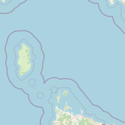
Map view of Franklin Commonwealth Marine Reserve

Use this park location map to pinpoint Franklin Commonwealth Marine Reserve in Australia, understand its exact geographic position, and read its mapped placement within the surrounding landscape more clearly.

Pigeon | © OpenStreetMap contributors

Location context for Franklin Commonwealth Marine Reserve

Tasmania
Recorded earthquake history

Examine the Seismic Record of Franklin Commonwealth Marine Reserve

Review the historical collection of recorded earthquakes associated with the waters of Franklin Commonwealth Marine Reserve. This structured catalogue helps identify past seismic occurrences near this Tasmanian marine environment, offering valuable geographic insight into the region's recorded history without assessment of future risk.

Franklin Commonwealth Marine Reserve Earthquake Records

Catalogued events

4 events

Strongest magnitude

Magnitude 4

Most recent event

Sep 8, 2007

This history includes earthquakes recorded inside the park or within 50 km of its borders

Park atlas

Compare adjacent marine reserves and connected regional conservation areas

Parks Near Franklin Commonwealth Marine Reserve and Surrounding Protected Landscapes

Browse other marine protected areas and continental shelf reserves situated near Franklin Commonwealth Marine Reserve. Comparing these surrounding waters reveals broader regional conservation networks across the Tasmanian coastline.
Marine protected areaTasmania
43 km away#1 closest

Northeast

Boags Commonwealth Marine Reserve: Marine Protected Area and Bass Strait Geography

A protected marine seascape off the north-west coast of Tasmania.

Boags Commonwealth Marine Reserve captures a unique niche of soft-sediment seafloor habitat in the Bass Strait. This marine protected area is defined by its muddy and sandy benthic communities and its function as a vital feeding corridor for seabirds from the Hunter Island Group, anchoring it firmly in the regional marine geography of Tasmania.

Area
537 km²
Established
2007
IUCN
VI
Relief
Lowland
Marine protected areaTasmania
82 km away#2 closest

West

Zeehan Commonwealth Marine Reserve: Geographic Map and Protected Marine Landscape Overview

Deep-sea habitats and shelf bathymetry off the Tasmanian coast

Spanning from fifty meters to over three thousand meters deep, the Zeehan Commonwealth Marine Reserve represents a massive, bathymetrically diverse protected area in the southern Indian Ocean. This geographic overview highlights the reserve's role in conserving limestone seabed features and deep-sea corridors west of Tasmania, offering a clear perspective on its location and scale within the broader regional marine network.

Area
19,897 km²
Established
2007
IUCN
VI
Relief
Lowland
National parkTasmania
95 km away#3 closest

Southeast

Savage River National Park: Discover Tasmania's Protected Landscape Geography

Explore mapped boundaries and regional park context.

Savage River National Park represents a distinct protected area within Tasmania, Australia, offering valuable insights into the island's natural geography and conservation landscape. As a designated national park, its mapped territory contributes to the understanding of regional protected areas and their distribution across Tasmania. This entity serves as a crucial point for atlas-based exploration, allowing users to grasp its geographic identity and its place within a broader map of Australian natural territories.

Area
179.8 km²
Established
1999
IUCN
II
Climate
Temperate
National parkTasmania
96 km away#4 closest

East

Rocky Cape National Park: Tasmania's Coastal National Park with Ancient Aboriginal Heritage

Explore the dramatic headland, heath ecosystems, and mapped park boundaries.

Rocky Cape National Park on Tasmania's North West Coast is a nationally significant protected area recognized for its ancient Aboriginal archaeological heritage, representing at least 8,000 years of continuous occupation. The park's landscape unfolds across a dramatic coastal headland, featuring rugged rocky shores, expansive heathlands, and coastal woodlands that define this wild section of Tasmania. Its protected status underscores its importance for both cultural discovery and the preservation of unique Australian coastal ecosystems. Understanding Rocky Cape National Park offers direct insight into the region's geography and the enduring legacy of its first peoples.

Area
30.64 km²
Established
1967
IUCN
II
Relief
Lowland
Marine protected areaVictoria
133 km away#5 closest

North

Apollo Marine Park: A Submarine Atlas of the Bass Strait Basin and Otway Depression

Examining underwater topography and maritime heritage off Victoria

Apollo Marine Park represents a critical offshore protected area, spanning over 1,180 square kilometres of seabed. Its primary feature, the Otway Depression, offers a window into ice age geology through drowned river valleys and fossil drainage channels that once defined the Bassian Plain. The reserve functions as an underwater archive of southeastern Australian environmental history, integrating deep-time geomorphology with significant twentieth-century maritime shipwreck remnants.

Area
1,184 km²
Established
2007
IUCN
VI
Relief
Lowland
National parkTasmania
142 km away#6 closest

Southeast

Cradle Mountain, Lake St Clair National Park: Tasmania's Mapped Protected Landscape and Geography

Explore national park boundaries and regional natural terrain.

Gain insight into Cradle Mountain, Lake St Clair National Park, a protected national park in Tasmania, Australia. This entry provides a foundational understanding of its mapped terrain, geographic setting, and protected area status. Delve into the specific landscape characteristics that define this significant conservation zone and its place within the national atlas.

Area
1,614.43 km²
Established
1922
IUCN
II
Visitors
209K annual
National parkTasmania
173 km away#7 closest

Southeast

Mole Creek Karst National Park: Mapped Protected Area and Tasmanian Landscape Atlas

Explore the geography and park boundaries within Tasmania's protected lands.

Mole Creek Karst National Park stands as a key protected area within Tasmania, offering a unique glimpse into the island state's natural geography. This resource facilitates an atlas-style discovery of the park's mapped landscape, its protected boundaries, and its significance within the broader context of Australian protected lands. Understand the park's terrain and its role in the region's conservation heritage.

Area
13.45 km²
Established
1996
IUCN
II
Relief
Mountain
National parkTasmania
180 km away#8 closest

Southeast

Walls of Jerusalem National Park: A Mapped Alpine Wilderness in Tasmania

Explore protected landscapes with biblical place names.

Walls of Jerusalem National Park in Tasmania is a distinguished national park characterized by its rugged alpine terrain and dramatic quartzite formations, most notably King Davids Peak. The park's landscape is further distinguished by a unique series of features named after biblical locations, offering an evocative exploration for those interested in geographic discovery. As a protected wilderness area within the Tasmanian Wilderness World Heritage Area, it provides valuable insight into Australia's significant natural landscapes and their mapped representation.

Area
518 km²
Established
1978
IUCN
II
Relief
Mountain

Common questions about visiting, size, designation, and location context for Franklin Commonwealth Marine Reserve

Franklin Commonwealth Marine Reserve FAQs for park facts, access, geography, and protected area context

Find quick answers about Franklin Commonwealth Marine Reserve, including protected-area facts, park geography, trail and visitor context, and how the park fits into its surrounding country and regional landscape.
MoriAtlas Explorer

Continue Your Protected Areas Search Across the Global Atlas

Deepen your exploration by continuing the structured search for national parks and protected areas worldwide. Utilize the comprehensive filtering capabilities to compare different conservation landscapes and refine your understanding of global park geography. Discover more about the distribution and characteristics of protected natural areas.

Global natural geography