
Mori Atlas logo
Wildlife reserveGaliuro Wilderness

Mapping the dramatic ridgelines and riparian corridors of this protected Arizona mountain range

Galiuro Wilderness: Exploring the Rugged Block-Fault Mountains of Southeastern Arizona

Galiuro Wilderness represents a quintessential example of block-fault geology in southeastern Arizona. Rising sharply from the surrounding desert, this protected landscape features deeply incised canyons and double-crested ridgelines that transition from semi-desert grasslands to dense mixed-conifer forests. The area offers a significant opportunity to study vertical habitat layering and classic Arizona mountain terrain within an expansive, roadless environment.

wilderness areasky islandblock-fault mountainsMadrean woodlandmixed conifer forestriparian canyons
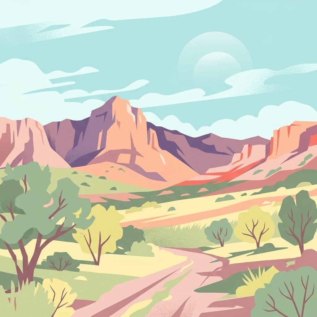
A stylized vector illustration of a rugged desert landscape with a dirt path winding through sparse vegetation toward distant rocky peaks under a pale sky.

Galiuro Wilderness

Wildlife reserve

Park overview

Structured park overview, official facts, and landscape profile for Galiuro Wilderness

Galiuro Wilderness park facts, protected area profile, and essential visitor context

Review the core facts for Galiuro Wilderness, including designation, size, terrain, visitor scale, habitats, and operating context in one park-focused overview.

About Galiuro Wilderness

Galiuro Wilderness occupies a central place in the sky island and basin-and-range geography of southeastern Arizona. The wilderness is defined by the mid and upper slopes of the Galiuro Mountains, a fault-bounded range that separates the upper San Pedro watershed from the Gila drainage. Its terrain is markedly abrupt: the mountains rise in a near-vertical wall from surrounding plains and bajadas, and within only a few miles the elevation changes from low desert scrub to montane conifer forest. This steep gradient is one of the defining qualities of the area and explains why a relatively compact wilderness can contain such varied habitat.

Administratively, Galiuro Wilderness is part of the Safford Ranger District of the Coronado National Forest, and it borders the Redfield Canyon Wilderness to the south, extending a continuous corridor of protected wildlands across the southern flank of the range. The wilderness follows roughly the western forest boundary on its west side and runs about one mile east of Trail 287 along its eastern edge, creating a long, narrow protected footprint oriented along the spine of the mountains.

From an ecological standpoint, the wilderness sits at the meeting point of the Sonoran and Chihuahuan biotic influences, layered over a Madrean woodland base. South- and west-facing slopes are dominated by dense brush fields of manzanita, live oak, and mahogany, while higher elevations support juniper, pinon, oak, and eventually mixed conifer stands. The numerous spring-fed canyons cutting through the range provide the moisture needed for sycamore, alder, maple, walnut, and even aspen to persist in an otherwise arid mountain setting.

The wilderness has also acquired a strong historical character. From the early Apache-era inhabitants loosely identified with the Jacome people to 19th-century homesteaders, miners, and ranchers, the Galiuros have long been a landscape of human endurance and occasional violence. The Power family's cabin and mine in Rattlesnake Canyon, the B-24 bomber crash site near Bassett Peak, and the broader ranching legacy of the range all contribute to a wilderness that feels historically layered as well as ecologically rich.

Quick facts and research context for Galiuro Wilderness

Galiuro Wilderness covers about 76,317 acres in Graham County, Arizona, and lies within the Safford Ranger District of the Coronado National Forest. It was originally protected in 1932 as the Galiuro Primitive Area, was renamed the Galiuro Wild Area in 1940, and received its current wilderness designation under the Wilderness Act of 1964, with a final boundary addition in 1983.

The wilderness is a block-fault mountain range bisected by Rattlesnake and Redfield Canyons, with elevations rising from around 4,000 feet to 7,671 feet at Bassett Peak. Habitat ranges from semi-desert grassland and dense manzanita-oak brush on south-facing slopes to mixed conifer forest of ponderosa, Chihuahua, Douglas fir, and Arizona cypress on higher elevations, with riparian deciduous growth along its spring-fed canyons. The area is home to desert mule deer, pronghorn, bighorn sheep, black bear, cougar, and a wide range of smaller mammals and upland birds.

Protection and recognition

Documented terrestrial preservation scope and establishment records

Galiuro Wilderness Protection Status and Official Designation History

Galiuro Wilderness maintains a documented terrestrial protection status established in 1964 without international recognition listings. Certified records outline the conservation scope and designation history for this protected area.

Protection details

Protection scope
Terrestrial
Designated year
1964
Transboundary protection
No
Park context

Deeper park guide and search-rich context for Galiuro Wilderness

Galiuro Wilderness history, landscape, wildlife, and travel context

Explore Galiuro Wilderness through its history, landscape character, ecosystems, wildlife, conservation priorities, cultural context, and seasonal travel timing in a structured park guide built for atlas discovery and search intent.

Why Galiuro Wilderness stands out

Galiuro Wilderness is best known for being a textbook example of a southeastern Arizona block-fault range, in which mountain uplift rises abruptly from surrounding desert plains to form a deeply eroded, double-crested system. The wilderness is recognized for its dramatic topographic diversity within a relatively compact footprint: semi-desert slopes, brushy chaparral-like ridges, and cool mixed-conifer canyons all occur within a single protected unit. It is also distinguished by its deep canyons, particularly Rattlesnake and Redfield, which split the range into two parallel ridgelines and host the riparian springs that anchor wildlife movement through the wilderness. The area carries a strong cultural identity tied to early Arizona homesteading, the Power family shootout of 1918, and the mountain wilderness tradition codified by the 1964 Wilderness Act.
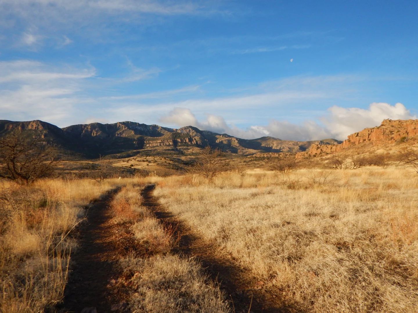
A dirt track leads through dry golden grasses toward a range of rugged mountains under a blue sky with light clouds.
A view of the Galiuro Mountains from the Deer Creek area.

Galiuro Wilderness history and protected-area timeline

Galiuro Wilderness has a layered human history that long predates its formal protection. The earliest documented inhabitants of the area are believed to have been the Jacome Indians, a relatively obscure group possibly connected to Apache cultural spheres in southeastern Arizona. Their presence set the stage for centuries of indigenous land use before European-American settlement transformed the range.

White settlers began arriving in the mid-19th century, initially drawn by prospecting and later by mining and ranching opportunities. By the 1890s, cattle operations and small-scale hard-rock mining had become established in the range. The most famous episode of this era began in 1909, when Jeff Power and his family homesteaded in Rattlesnake Canyon and began mining nearby. The Power family's refusal to comply with World War I draft notices led, on the night of February 9, 1918, to a confrontation at their cabin in which Sheriff Robert F. McBride, two deputies, and Jeff Power were all killed. The surviving Power brothers and their hired man Tom Sisson fled south into Mexico, were captured by the U.S. Army, and were convicted of first-degree murder, ultimately serving long prison terms before being paroled in 1960 and pardoned by Governor Jack Richard Williams. The Power Cabin was placed on the National Register of Historic Places in 1975, preserving this dramatic chapter of the range's story within the wilderness itself.

The formal protection of the Galiuros began in 1932, when Congress set aside 52,717 acres as the Galiuro Primitive Area within the Crook National Forest. In 1940 the area was renamed the Galiuro Wild Area, and administrative responsibility shifted to the Coronado National Forest in 1953. With the passage of the Wilderness Act in 1964, the region was redesignated as the Galiuro Wilderness. A final boundary addition in 1983 incorporated the floor of Rattlesnake Valley, bringing the total to its current size of about 76,317 acres.

A second defining historical marker is a World War II training accident. In January 1943, a B-24 bomber on a training run crashed near the summit of Bassett Peak, killing all eleven men aboard. A plaque mounted on one of the aircraft's wings now marks the site as a memorial within the wilderness, linking the Galiuros to the broader wartime history of southern Arizona's training corridors.

Galiuro Wilderness landscape and geographic character

The landscape of Galiuro Wilderness is defined by the classic basin-and-range geology of southeastern Arizona. The Galiuro Mountains are a block-fault range, meaning they are essentially a single uplifted slab of crust that has risen sharply along faults relative to the surrounding plains. This produces the wilderness's signature character: abrupt escarpments, deep linear canyons, and ridgelines that feel like walls rather than gradual ascents.

The range is a double mountain system, bisected lengthwise by two principal canyons, Rattlesnake Canyon on the north side and Redfield Canyon on the south side. These two canyons effectively divide the wilderness into an east divide and a west divide, each topped by a series of prominent peaks. Along the east divide, the high points include Bassett Peak at 7,671 feet, Kennedy Peak at 7,540 feet, and Sunset Peak at 7,094 feet. Along the west divide, the notable summits include Rhodes Peak at 7,116 feet, Maverick Mountain at 6,990 feet, and Kielberg Peak at 6,880 feet. Elevations overall span from roughly 4,000 feet along the lower flanks to over 7,600 feet at the top of Bassett Peak.

Erosion has heavily sculpted this uplifted terrain. Long-term weathering has carved the mountains into rugged cliffs, steep slopes, and deeply shaded ravines, and has exposed brightly colored soils and rocks that give the Galiuros their name, which is associated with rust-toned, reddish earth. The lower flanks transition sharply into the surrounding semi-desert plains, making the wilderness feel like a wild island of forested ridges rising out of open country. This abrupt edge is one of the defining visual impressions of the area.

Galiuro Wilderness ecosystems, habitats, and plant life

Vegetation in Galiuro Wilderness is unusually diverse for a range of its size because of the steep elevation gradient and the strong north-south contrast between sun-baked slopes and shaded, spring-fed canyons. The vegetation transitions, in places within only a few miles, from semi-desert grassland up through Madrean oak woodland to mixed conifer forest.

The majority of the south- and west-facing slopes are covered in dense brush fields dominated by manzanita, live oak, mahogany, and associated scrub species that thrive on dry, sunny terrain. These brushy slopes give the Galiuros their famously rough and dense character and help protect soils on otherwise steep ground. Higher up the ridges and along ridgetops, the vegetation shifts to moderate to dense stands of juniper, pinon pine, and oak, forming a classic woodland transition zone.

In cooler and more sheltered positions, particularly on north-facing slopes and along canyon bottoms, the flora becomes distinctly montane. Arizona cypress, ponderosa pine, Chihuahua pine, Mexican white pine, Douglas fir, and small stands of white fir create the mixed conifer communities that are the ecological signature of the highest parts of the wilderness. In the riparian corridors threaded through these canyons, where springs such as Power's Garden, Mud Spring, Corral Spring, Juniper Spring, South Field Spring, and Walnut Spring supply water across much of the year, deciduous trees including sycamore, alder, maple, ash, walnut, and aspen form narrow but ecologically rich bands of habitat.

Galiuro Wilderness wildlife and species highlights

The mix of habitats within Galiuro Wilderness supports fauna typical of both the arid basins and forested sky islands of southeastern Arizona. Large mammals are a major part of the wilderness's wildlife profile, including desert mule deer, pronghorn, desert bighorn sheep, and the smaller, forest-adapted Coues' white-tailed deer on the higher terrain. Other significant mammal species include collared peccary, the Mearns coyote, the New Mexico black bear, and the North American cougar, the last of which is an important apex predator across the range.

Smaller mammals add to the diversity of the wilderness. Desert cottontails, ground squirrels, raccoons, white-nosed coatis, foxes, skunks, and bobcats all inhabit the lower canyons and brushy slopes, while coatis and raccoons in particular benefit from the riparian corridors where food and water are more reliable. The presence of these species reflects the strong edge-and-interior habitat mosaic typical of the Coronado National Forest.

Birdlife in the wilderness includes upland game species and dry-country specialists typical of southeastern Arizona. Quail, doves, and the band-tailed pigeon are among the characteristic species, with the pigeon often associated with oak-dominated slopes. The combination of forest, brush, riparian, and grassland habitats makes the Galiuros a productive area for birdwatchers, even though the rugged terrain keeps wildlife relatively undisturbed.

Galiuro Wilderness conservation status and protection priorities

Galiuro Wilderness is significant from a conservation standpoint because it preserves a large, contiguous block of mid- to high-elevation habitat in a part of Arizona where most lower-elevation land has been heavily grazed, developed, or fragmented by ranching, mining, and road-building. By protecting approximately 76,000 acres from mechanized use and road construction, the wilderness maintains a functional core of Madrean woodland and mixed conifer habitat that supports wide-ranging species such as black bear, cougar, and bighorn sheep.

The wilderness also helps maintain watershed integrity on the Galiuro Mountains. By keeping the canyons, springs, and riparian corridors in a relatively undisturbed state, the area supports groundwater recharge and base flow in streams that ultimately leave the range and are important for downstream ecosystems, including parts of the San Pedro and Gila systems. The dense brush and forest cover on steep slopes also reduces erosion and helps protect the exposed, vividly colored soils for which the range is named.

Designated under the Wilderness Act of 1964 and expanded in 1983, Galiuro Wilderness is part of a broader conservation network in southeastern Arizona that includes adjacent protected areas such as Redfield Canyon Wilderness. Together, these lands form a substantial wildland corridor for species that depend on quiet, roadless terrain, and they preserve the ecological transitions between Sonoran desert grassland and montane conifer forest that characterize the region's sky island character.

Galiuro Wilderness cultural meaning and human context

Culturally, the Galiuro Mountains sit within a long and complex human landscape. The earliest known inhabitants are believed to have been the Jacome Indians, a group whose identity is uncertain but who appear to be connected to the Apachean peoples of the region. Their presence reflects the broader indigenous history of southeastern Arizona, in which Apache and related cultures shaped land use across the mountains and basins for centuries before sustained European-American contact.

The 19th and early 20th centuries brought a wave of Euro-American settlement focused on prospecting, mining, and ranching. Mining families like the Powers, and ranching operations across the range, left a lasting imprint on the cultural landscape, including the Power Cabin in Rattlesnake Canyon and the broader trail and cabin network used by early homesteaders. The Power Brothers Shootout of 1918, in which a sheriff, two deputies, and Jeff Power were killed, became one of the most dramatic episodes in Arizona frontier history and is preserved through the Power Cabin listing on the National Register of Historic Places.

The wilderness also carries more modern cultural memory. The B-24 bomber crash near Bassett Peak in 1943, commemorated by a plaque on one of the aircraft's wings, ties the area to Arizona's role as a major training ground during World War II. Together, these layers give the Galiuros a cultural identity that mixes Apache-era land use, frontier-era ranching and mining, and mid-20th-century wartime history within a single protected landscape.

Top sights and standout views in Galiuro Wilderness

Galiuro Wilderness stands out for the abruptness of its block-fault topography, with the mountains rising sharply from surrounding plains and sweeping from roughly 4,000-foot foothills to the 7,671-foot summit of Bassett Peak. The double-ridge structure created by Rattlesnake and Redfield Canyons gives the wilderness a rare linear, spine-like geography, and the bright, rust-toned exposures of rock and soil give the range its visual identity.

Ecologically, the wilderness is unusually layered for its size, ranging from dense manzanita-oak brush and semi-desert grassland up to mixed conifer forests of ponderosa, Chihuahua, Douglas fir, and Arizona cypress, with riparian zones of sycamore, walnut, and even aspen along spring-fed canyons. Historically, the area preserves the Power Cabin, the Power Brothers Shootout site, and the B-24 crash memorial near Bassett Peak, all within a roadless landscape that retains much of its frontier-era character.

Best time to visit Galiuro Wilderness

Galiuro Wilderness is best experienced in fall and spring, when temperatures in southeastern Arizona are most moderate and the wide elevation range of the wilderness becomes fully accessible without extreme summer heat. Spring brings wildflower displays in the lower brushy slopes and cooler conditions for crossing the range on foot, while fall offers crisp air in the high country, clear views from the ridge tops, and active wildlife movement as deer and other animals shift into different elevations.

Summer visits are possible but can be physically demanding because the steeper, exposed slopes heat up quickly, and monsoon thunderstorms occasionally complicate travel along the canyons. Winter brings cooler temperatures and occasional snow on the highest elevations, particularly around Bassett Peak, but is generally mild in the lower parts of the wilderness. Across all seasons, rugged terrain and limited water sources away from named springs mean that conditions in the range can shift quickly, and timing a visit to the milder shoulder seasons typically provides the most balanced experience.
Monthly climate preview

Long-term representative temperature ranges and monthly precipitation distributions

Galiuro Wilderness Climate Normals and Monthly Weather Patterns

Historical data records monthly temperature fluctuations and precipitation totals across the Galiuro Wilderness coordinate. Examining complete twelve-month normals provides detailed baseline context for regional climate variations.
Annual mean18 °C
7 °C28 °C
Jan
Feb
Mar13°
Apr17°
May22°
Jun28°
Jul28°
Aug27°
Sep25°
Oct19°
Nov12°
Dec
Warmest month
July

28.2 °C

Coolest month
December

7.4 °C

Wettest month
August

1.9 mm/day

Driest month
May

0.2 mm/day

Park location guide

Geography guide, regional context, and park location map for Galiuro Wilderness

Galiuro Wilderness park geography, regions, and map view in United States of America

Understand where Galiuro Wilderness sits in United States of America through a broader geographic reading of the surrounding landscape, nearby location context, and its mapped position within the national park landscape.

How Galiuro Wilderness fits into United States of America

The United States of America is a federal presidential republic and one of the world's largest countries by area and population. It consists of 50 states across a vast territory spanning multiple time zones, with its capital in Washington, D.C. and largest city in New York City. The nation has a diverse economy, influential political system, and significant cultural and military presence globally.

Wider geography shaping Galiuro Wilderness in United States of America

The United States occupies a vast territory in North America, bordered by Canada to the north and Mexico to the south. The 48 contiguous states stretch from the Atlantic to the Pacific Ocean, while Alaska occupies the northwestern region and Hawaii is an archipelago in the Pacific. The country encompasses diverse terrain including the Rocky Mountains, Appalachian Mountains, Great Plains, and extensive river systems.

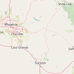
Map view of Galiuro Wilderness

Use this park location map to pinpoint Galiuro Wilderness in United States of America, understand its exact geographic position, and read its mapped placement within the surrounding landscape more clearly.

Pigeon | © OpenStreetMap contributors

Location context for Galiuro Wilderness

ArizonaGraham County
Recorded earthquake history

Explore the Historical Earthquake Catalogue for Galiuro Wilderness

Review recorded seismic events associated with the geography of Galiuro Wilderness. This MoriAtlas collection offers an accessible way to examine historical earthquake records, including magnitude and location data, for better understanding regional seismic activity.

Galiuro Wilderness Earthquake History

Catalogued events

1 event

Strongest magnitude

Magnitude 3.1

Most recent event

Sep 28, 2023

This history includes earthquakes recorded inside the park or within 50 km of its borders

Visual reference guide for block-fault ridges, canyon habitats, and rugged desert mountain terrain

Galiuro Wilderness Photos and Landscape Scenery Explorer

Examine detailed Galiuro Wilderness photography to understand the striking topography of southeastern Arizona mountain ranges. Visual records reveal the steep canyons, rust-toned rock exposures, and layered ecological zones defining the protected landscape.

A dirt track leads through dry golden grasses toward a range of rugged mountains under a blue sky with light clouds.

A black and white photograph of a historic, rustic log cabin with a stone chimney, situated in a dry, wooded area.

Park atlas

Compare surrounding regional terrain and connected protected landscapes

Explore Protected Areas and Parks Near Galiuro Wilderness

Continue browsing adjacent wilderness areas and nearby protected landscapes to compare regional block-fault geology and diverse elevation zones. Expanding the geographic scope reveals how similar sky island habitats connect across southeastern Arizona.
National parkPima County
29 km away#1 closest

Southwest

Saguaro National Park: Discover Its Protected Landscape Geography and Mapped Boundaries

Explore the natural terrain and regional context of this national park.

Saguaro National Park offers a focused exploration of a specific protected landscape, highlighting its unique geographic features and mapped boundaries within Pima County. This detail page provides an atlas perspective, allowing for a deep dive into the park's natural terrain and its regional significance. Understand the protected area's identity and its place within the wider geographical context.

Area
371.16 km²
Established
1994
IUCN
II
Visitors
946.4K annual
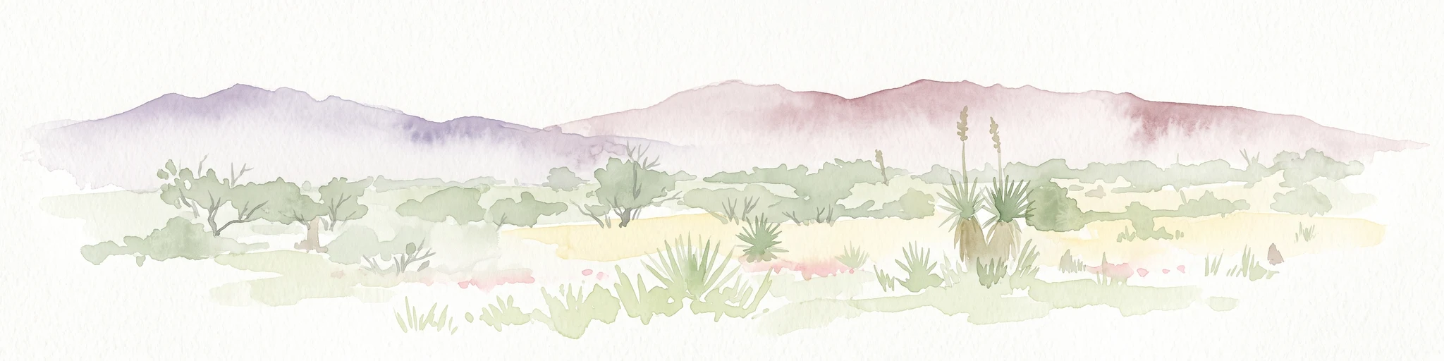
A horizontal watercolor painting depicting a desert landscape with mountains in the distance, soft green and yellow foreground vegetation, and several yucca plants.
Protected landscapeUnited States of America
About 36 km away#2 closest

South

Rincon Mountain Wilderness: Geographic Atlas and Protected Landscape Overview

Sky island ecosystems and mountainous desert terrain in Arizona

This protected landscape encompasses the core of the Rincon Mountains, defining a classic triangular range oriented southwest to northeast. The wilderness serves as a vital ecological bridge, rising from arid Sonoran lowlands to cool, high-elevation montane forests. Its boundaries protect an intricate system of ridges and canyons that support isolated relict plant communities, offering a distinct study in regional desert mountain geography.

Relief
Mountain
Access
Moderate access
Scope
Terrestrial
Water
Minor water
A watercolor illustration of a wide desert landscape with soft, pastel-colored mountains, arid terrain, and sparse desert vegetation against a bright sky.
Wildlife reserveUnited States of America
About 44 km away#3 closest

Southwest

Pusch Ridge Wilderness: Wildlife Reserve and Sky Island Geography in Arizona

Protecting diverse habitats from Sonoran desert lowlands to high mountain forests.

Located in the Santa Catalina Mountains, Pusch Ridge Wilderness preserves a significant vertical gradient of ecosystems. This wildlife reserve features steep canyons and granite uplifts, providing an essential habitat for Desert Bighorn Sheep while illustrating the distinct Sky Island geography found across the southern Arizona region.

Area
228.36 km²
Established
1978
Relief
Mountain
Climate
Arid
Wildlife reserveArizona
About 53 km away#4 closest

Northwest

Needle's Eye Wilderness: Protected Desert Geography and Mescal Mountain Topography

Gila River canyons and limestone desert landscapes in Arizona

Needle's Eye Wilderness encompasses a rugged segment of the Mescal Mountains where the Gila River has incised deep limestone gorges. This protected area features a striking shift between harsh arid uplands and a dense riparian corridor, offering a study in concentrated desert canyon topography and dramatic geological formations within southern Arizona.

Area
35.5 km²
Established
1990
IUCN
Ib
Relief
Mountain
Wildlife reserveArizona
About 67 km away#5 closest

Northeast

Fishhooks Wilderness: An Arizona Desert Wildlife Reserve and Protected Landscape Atlas

Mapped terrain and arid geography in Graham County

Fishhooks Wilderness represents an intact, undeveloped stretch of southeastern Arizona desert managed by the Bureau of Land Management. The area provides a critical example of basin-and-range topography, where volcanic ridges and desert flats border the San Carlos Apache Indian Reservation. This record offers a clear perspective on the wilderness boundaries, ecological transition zones, and remote backcountry character of this distinctive regional landscape.

Area
42 km²
IUCN
Ib
Relief
Upland
Climate
Arid
Protected landscapeArizona
67 km away#6 closest

Northwest

Tonto National Forest: Understanding the Geography of an Expansive Protected Landscape

Exploring the vertical ecosystem gradients in Central Arizona

Spanning from arid Sonoran basins to the towering Mogollon Rim, Tonto National Forest offers a unique study in vertical geography and protected land management. This expansive territory provides a vital map of Southwest life zones, encompassing reservoir systems, rugged river canyons, and critical wilderness habitat that define the environmental identity of the region.

Area
11,627 km²
Established
1905
Visitors
5.9M annual
Relief
Mountain
A horizontal watercolor painting showing distant mountains in shades of purple, soft green rolling hills, a central winding river or stream, and grassy foreground elements on a white background.
Protected landscapeNew Mexico
119 km away#7 closest

Northeast

Gila National Forest: A Geographic Overview of New Mexico's Protected Wilderness Core

Mapped terrain, forest boundaries, and regional wilderness character

Gila National Forest stands as a critical protected landscape in New Mexico, encompassing immense mountain ranges, narrow river gorges, and extensive backcountry basins. This atlas entry details the forest's topographic transition from high-altitude ponderosa stands to desert lowlands, highlighting its status as the foundational site for the global wilderness movement and a stronghold for regional ecological diversity.

Area
10,969.7 km²
Established
1905
Relief
Mountain
Climate
Temperate
A horizontal watercolor illustration showing green foreground vegetation, rolling light green hills in the midground, and purple hazy mountains in the background against a white sky.
Wildlife reserveNew Mexico
151 km away#8 closest

East

Gila Wilderness: An In-Depth Look at the Protected Landscape and Geography of New Mexico

Mapped terrain, alpine peaks, and diverse forest ecosystems within the American Southwest

The Gila Wilderness stands as a primary case study in landscape conservation, protecting a massive network of unroaded river canyons and forest-covered mountains in New Mexico. This region serves as a bridge between temperate montane zones and arid desert environments, creating a unique ecological atlas defined by significant altitudinal gradients, volcanic features, and extensive watershed networks across the Mogollon range.

Area
225,820 km²
Established
1924
IUCN
Ib
Relief
Mountain

Common questions about visiting, size, designation, and location context for Galiuro Wilderness

Galiuro Wilderness FAQs for park facts, access, geography, and protected area context

Find quick answers about Galiuro Wilderness, including protected-area facts, park geography, trail and visitor context, and how the park fits into its surrounding country and regional landscape.
MoriAtlas Explorer

Continue Your Protected Areas Search Across the Global Atlas

Deepen your exploration by continuing the structured search for national parks and protected areas worldwide. Utilize the comprehensive filtering capabilities to compare different conservation landscapes and refine your understanding of global park geography. Discover more about the distribution and characteristics of protected natural areas.

Global natural geography